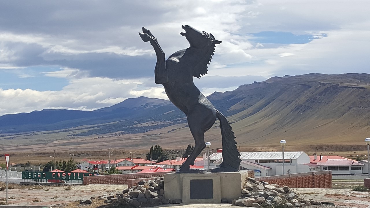
On Monday morning, January 21st, after a wonderful buffet breakfast, we left Puerto Natales on our bus to continue our trip north to Torres del Paine National Park in Chile. In 2-hours, we reach a small town at a crossroads called Cerro dos Castillo’s. This little town has a nice cafeteria and store, and sits right at the border with Argentina, but today, we are continuing north in Chile. After a quick bathroom break and a bit of souvenir shopping, we continue our trip north. The countryside is dry and wind-swept, consisting only of dry, small grasses and small hardy bushes. Here, the principal industry is ranching with lamb for wool and food, and cattle. Sheep herds are plentiful in the countryside, as is beef, but everything else that the people here need – fruit, vegetables, medicine, etc. must be brought in via ships and ferries that make their way up the fiords from the north. These same ships then take the beef, lamb and wool from the processing plants back to the coast to be shipped around South America and the world. We pass a small village near the “Waters of Last Hope” Fiord where our local guide, Kris, lives with her boyfriend and dog in a very modest house with no running water, and with propane to cook, wood to heat and rationed electricity. She moved here because she enjoys the outdoors, and the government paid her to build a house as part of a program to get people to move to this sparsely populated area. Her 1-acre property cost $10,000 USD 8-years ago, but now is worth nearly 8-times that because of a huge land-grab being driven by tourism. The “Waters of Last Hope” Fiord was named so because it was “the last hope” (unsuccessfully) during the area’s early exploration to find another waterway across Patagonia. Today, the town is growing, and things are changing rapidly. Before this past year, the nearest hospital was in Punta Arenas – over 3-hours away by car! This drove the locals to cross the border and use the Argentinean hospital instead – less than 1-hour away! Today, they have a new hospital in Puerto Natales which is much closer.
Since the primary industry of the area is ranching (and now, tourism), the region is dominated by very large Estancias (ranches) raising either sheep, or Hereford or Angus cattle – no milk cows. Small ranches are ~8000-10,000 acres, and large ranches can be over 200,000 acres. The sheep are Corridales from the Falkland Islands, and are of Scottish origin. Alpaca were once tried to be raised in the area, but those efforts were unsuccessful. The region also hosts a large number of rhea’s (smaller ostrich-like flightless birds), guanaco’s (a llama-like animal), and herds of wild horses and wild pigs that still roam the countryside. Watching over all of these animals are a significant number of pumas roaming the range, and, in the higher altitudes, a large number of condors that soar overhead watching and waiting for an easy meal.
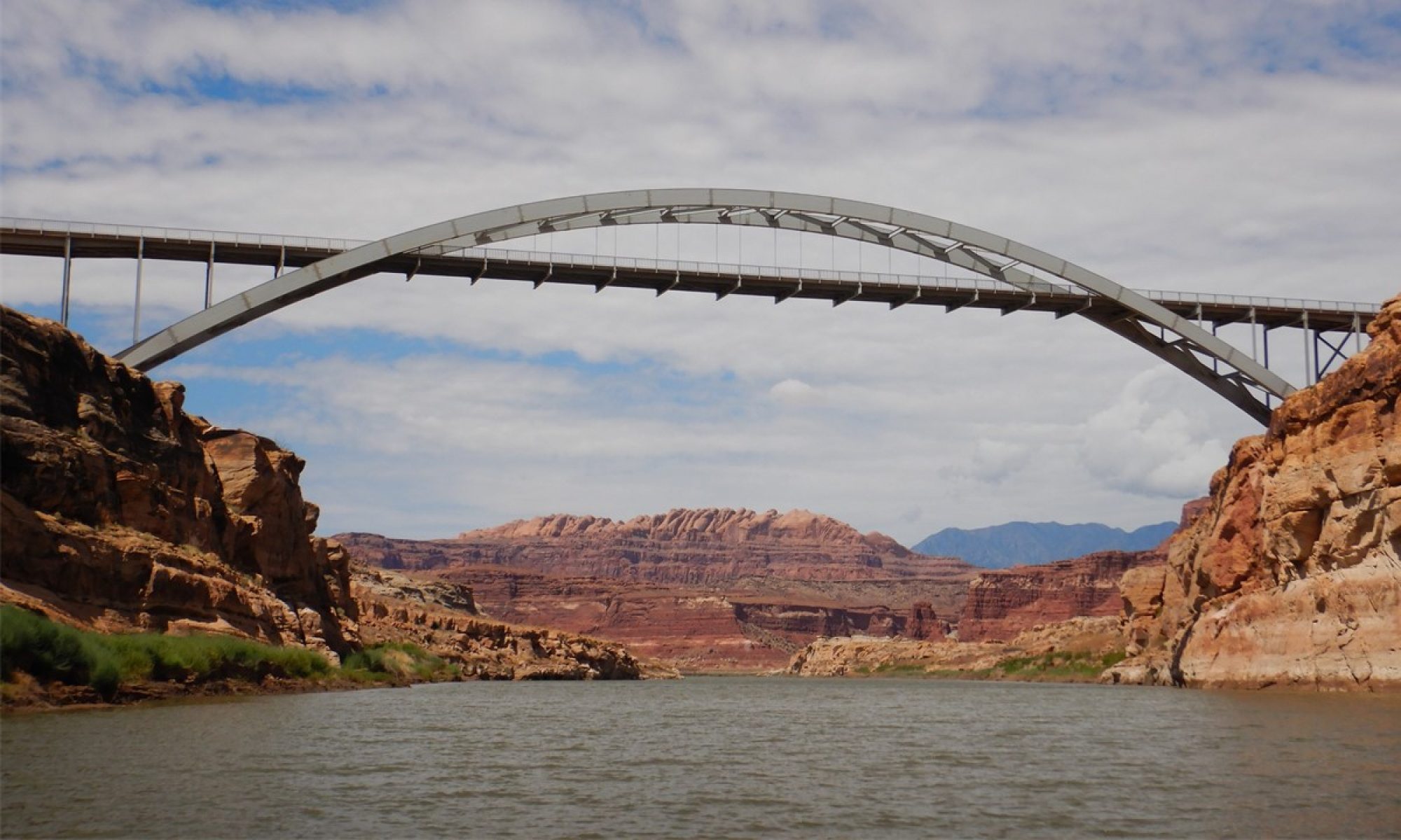
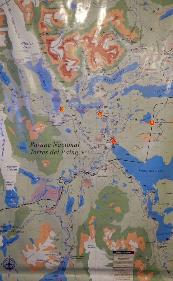
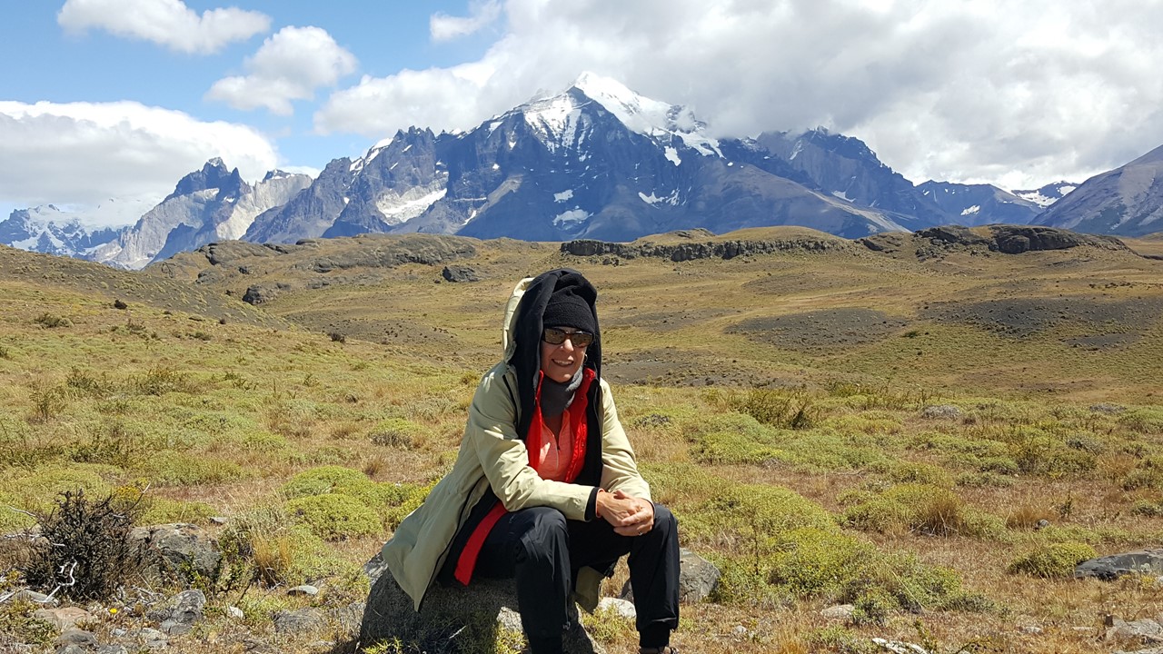
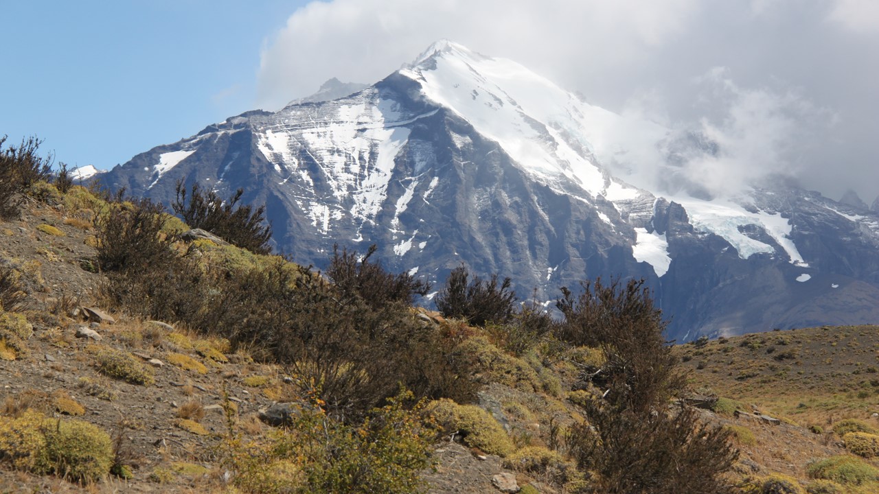
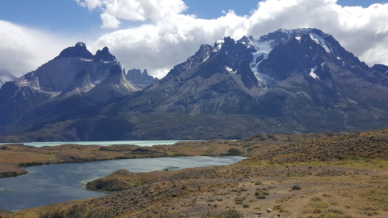
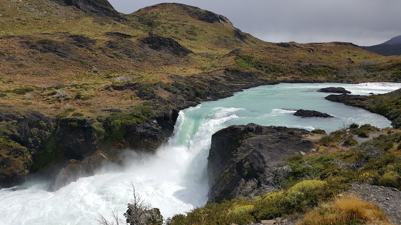
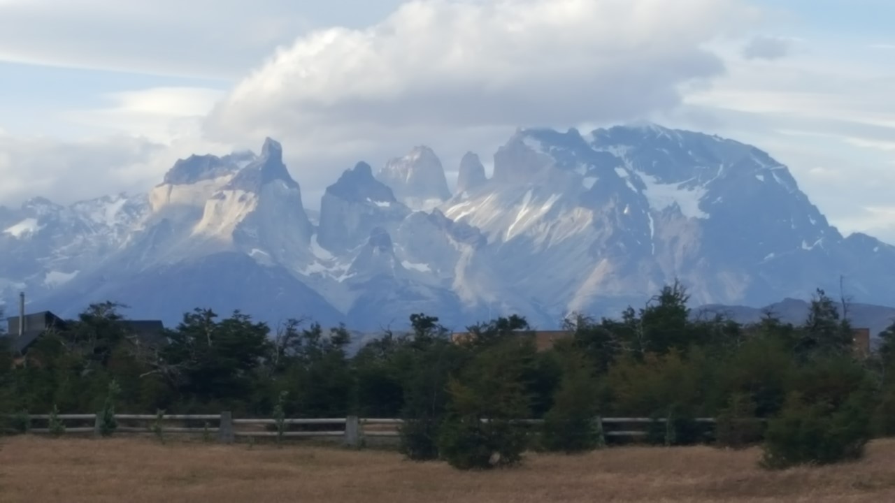
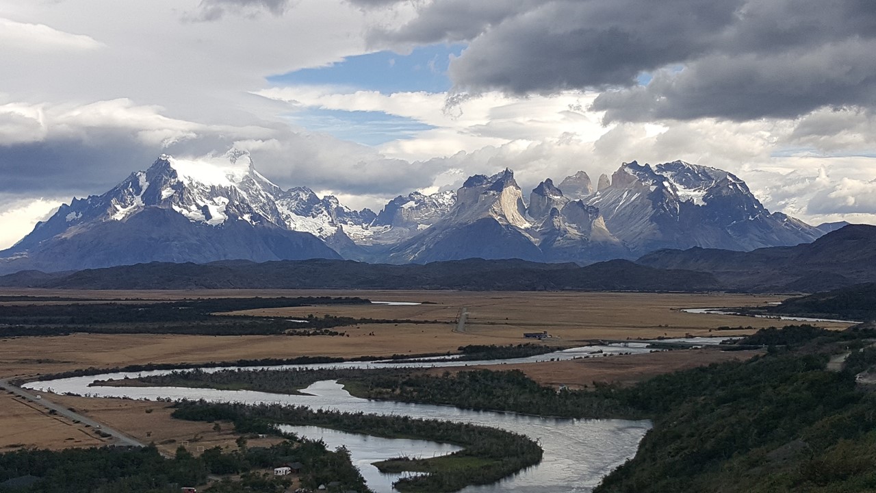
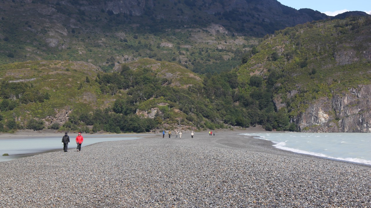
We finally arrive at the Lake Sarmiento Entrance to the Torres del Paine Park, where we check in and pay our park fees, and immediately begin our first hike. We hike ~4-miles from the ranger’s station, up a hill to a number of lookout views of the Paine Massif and of the “Towers”, and to the lookout at Laguna Amarga, passing along the way various guanaco’s who paid little attention to us, However, we were warned not to get too close, as they spit much like their distant-relatives – the camel. All along the hike, we faced 35 mph headwinds and occasional rain, but the brief periods of sunshine and the views made the hike so worthwhile. After our hike, we took a short drive to Nordenskjold Lookout where we ate lunch in the bus while facing growing winds outdoors, before exiting to take in the view. Then, we traveled north to Salto Grande Lookout to look at one of the more famous waterfalls in the park. Once arriving, we took a short, 15-minute walk into 60-65 mph wind gusts that made any walking difficult, but finally made it to the small boardwalk for pictures and the view. Finally, we traveled south a bit to Pehoe Lookout to look over Lake Pehoe. By now, the winds had abated, somewhat, and from here we had a good view of the local hostel which was located on an island in the lake accessible by pedestrian bridge only. Some of the area had been devastated by forest fires – nearly all of them started by man – and there were large areas with whitened, lifeless tree trunks and only small shrubs. In response, all along the lake, over 200,000 beech trees were planted two years ago and hopefully they will form the basis of a future forest. We then traveled to our hotel, the Rio Serrano – one of the few hotels within the park – where the rooms and the lobby were lined with glass allowing an overlook of the nearby plain and “the Three Horns”and “Towers” Mountains that rose into the clouds not far away. After checking in, we take a swim and sauna in the spectacular indoor pool, before meeting as a group for a buffet dinner.

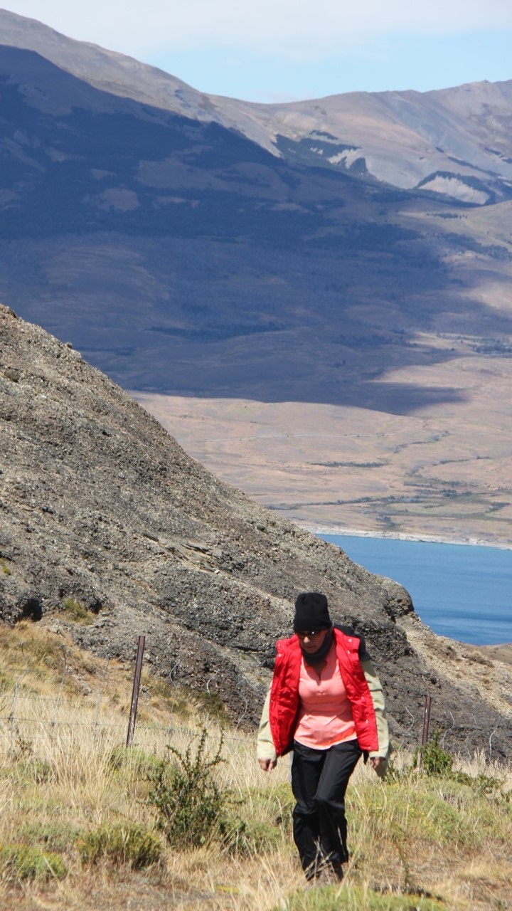
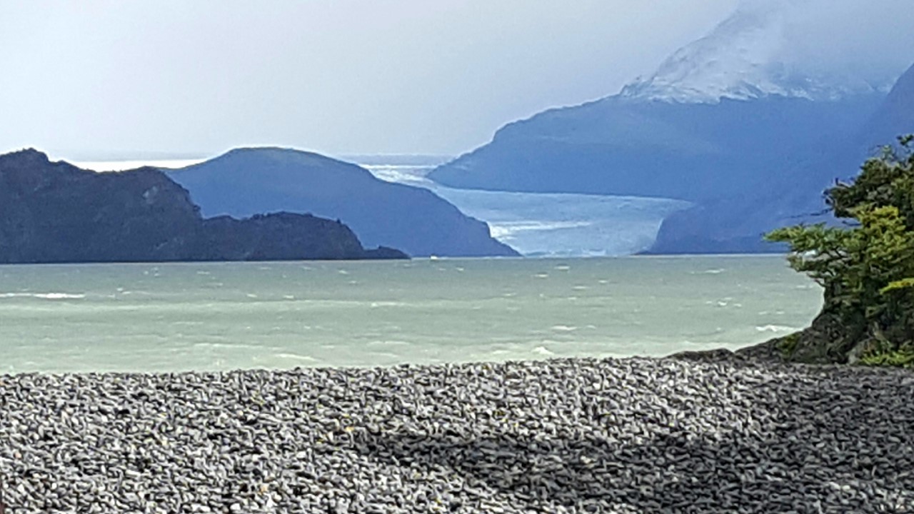
The next morning, we are greeted with a beautiful rainbow at breakfast before we set off to hike to a view of Grey Glacier. The park’s glaciers are in significant retreat, and Grey Glacier is disappearing at a rate of 56’ per year for the last 70 years! Grey Glacier and Grey River were named for an early Swedish explorer that spend time describing the area. We drove to the southern end of the Glacier’s lake where we began our hike through arctic forests, across the Grey River on a rope bridge, and then 1-mile across the glacier’s 400-year-old terminal moraine which stretches to an island lookout point. After climbing up a rocky trail to the island’s viewpoint, one could watch the icebergs float by and catch a glimpse of the mile-long dual faces of the Grey Glacier. Although our hike began in the rain, and we crossed the moraine in gusting winds, when we arrived at the lookout the skies cleared, and we were greeted with gracious sunshine. Because of the weather, we encountered no one else on our journey there, but passed a huge number of tourists beginning their hike on our way back.

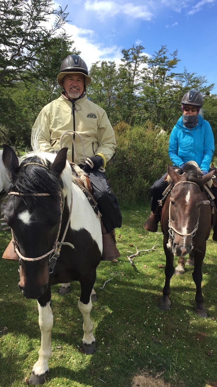
We arrive back at the hotel in time for lunch, and then it was time to go horseback riding. Only 8 of decided to participate, and we met our guides at the stables, got introduced to our horses, and began our ride. Unfortunately, about 40 minutes into our ride across the plains and into the woods, the winds again picked up significantly, and we needed to head back. If the winds get too high, it can spook the horses, and can make sitting up on horseback unstable. Since we returned early, we decided to take a traditional “tea time”. Apparently, a very independent woman, Lady Florence Dixie, came to the area and began the tourism industry back in 1879. She was an accomplished hunter and developed a number of recipes for the widely available rhea of the time. While in the area and guiding others, she instituted tea time and it has remained a local area tradition ever since. Lady Florence Dixie eventually returned to England and while there wrote a hugely popular book called, “Across Patagonia“, that documents many of the details of living in the wilderness at that time. That night we have a dinner of fish with mushroom stuffing.
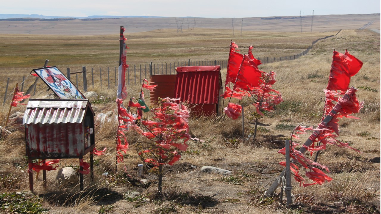
On Wednesday morning, we meet to quickly review our time from Puenta Arenas through Torres del Paine before returning to our bus to leave Chile. From here, we take the 2-hour bus ride back to the Cerro dos Castillo’s crossroads for the border crossing to Argentina. Along the way we pass Torres Lake, an area that looks green and lush with beech and cypress trees and populated with private estancias raising beef cattle. We arrive at the crossing at ~11:30am, in time for lunch taken upstairs above the gift shop. After lunch, we walked to the Chilean Border Crossing for passport control before reboarding the bus, crossing the border fence at the top of the hill, and then stopping at the Argentinean Passport Control & Customs Office on the other side. Here, we switch from a Chilean bus and driver to an Argentinean bus and driver and continued our journey. In Argentina, out in these desolate and open spaces, the side of the road will occasionally have red-decorated “shrines” dedicated to Gaucho Antonio Gil. Legend has it that if you stop at one of these shrines and leave something of high importance to you there, and fulfill a promise to Gaucho Antonio, that good “karma” will watch over you. This is very popular with many of the long-distance truck drivers in Argentina, and so we stopped and left various items, including a can of beer over the ground in front of the shrine. Apparently, our sacrifice worked, because we were immediately greeted with a Southern Crested Caracara falcon and had a smooth journey the rest of the way to El Calafate.

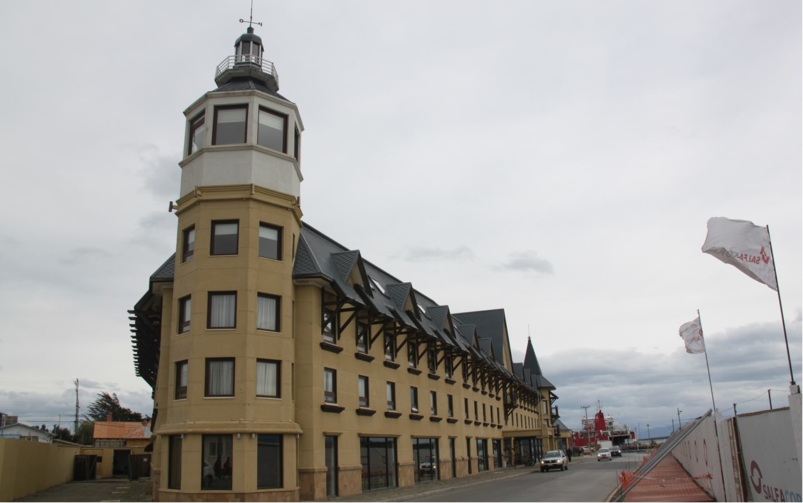
We arrived in El Calafate around 6:00pm and checked into our hotel, the Kosten Aike, which was located only 4 blocks from the local bay, and only 2 blocks from the town’s Main Street. After an early dinner of Trout with Vegetables or Lamb Stew, we explored Main Street and the shops and brewhouses located there.
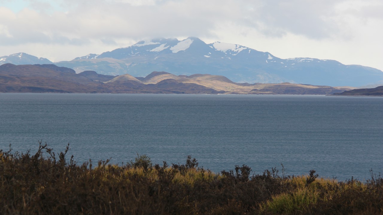
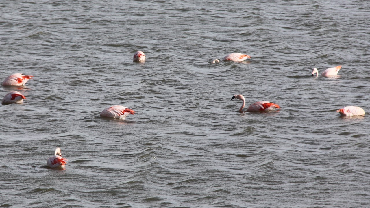
Thursday morning, we began our adventures driving along the bay-front, stopping to take pictures of the pink flamingoes and black- and white-headed swans that clustered in the area. The bay is a part of Lake Argentino, (first described & extensively explored by Fransisco Murino) a lake formed by the glacier waters coming from an enormous ice cap (the second largest continental ice field in the world – after Antarctica) and the heart of Los Glaciares National Park (over 50 glaciers). Unlike most glacier fields which typically form at altitudes above about 8200’, most of the glaciers of Los Glaciares form at around 5000’. Fransisco Murino was the country’s first recognized naturalist who was instrumental in preserving the local environment and is widely regarded as Argentina’s “Teddy Roosevelt”.
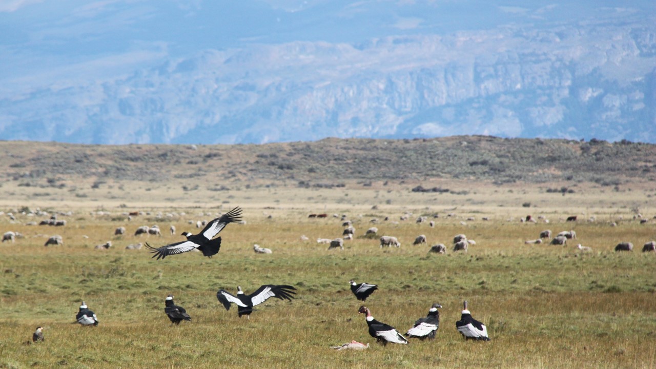
As we leave the town and lake behind, the air chills and dries, and the landscape is again brown, short grasses, and the vistas are endless. Local ridges are stained from the residence of numerous condors, and sheep, rheas and guanacos populate the landscape, along with skunks, moles and armadillos. This area is shielded from most rainfall by the Andes Mountain Range, and only receives 15” of precipitation per year. The only trees here are poplars that have planted by local ranchers as wind blocks, as they do well near water and creeks. With 100 miles to go, we can already see the higher reaches of the famous Perito Moreno Glacier which dominates this area and forms the basis for most of the town and region’s tourism. Along the way, we spotted eagles and condors overhead, but then we come upon a dozen condors on the ground feasting on a deceased lamb. Condors can live over 30 years old, and they raise their young in the nest for 2-3 years before they fledge and go on their own.
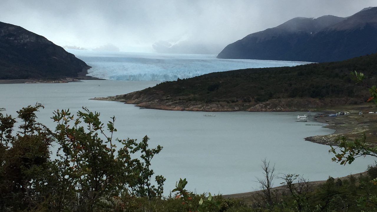
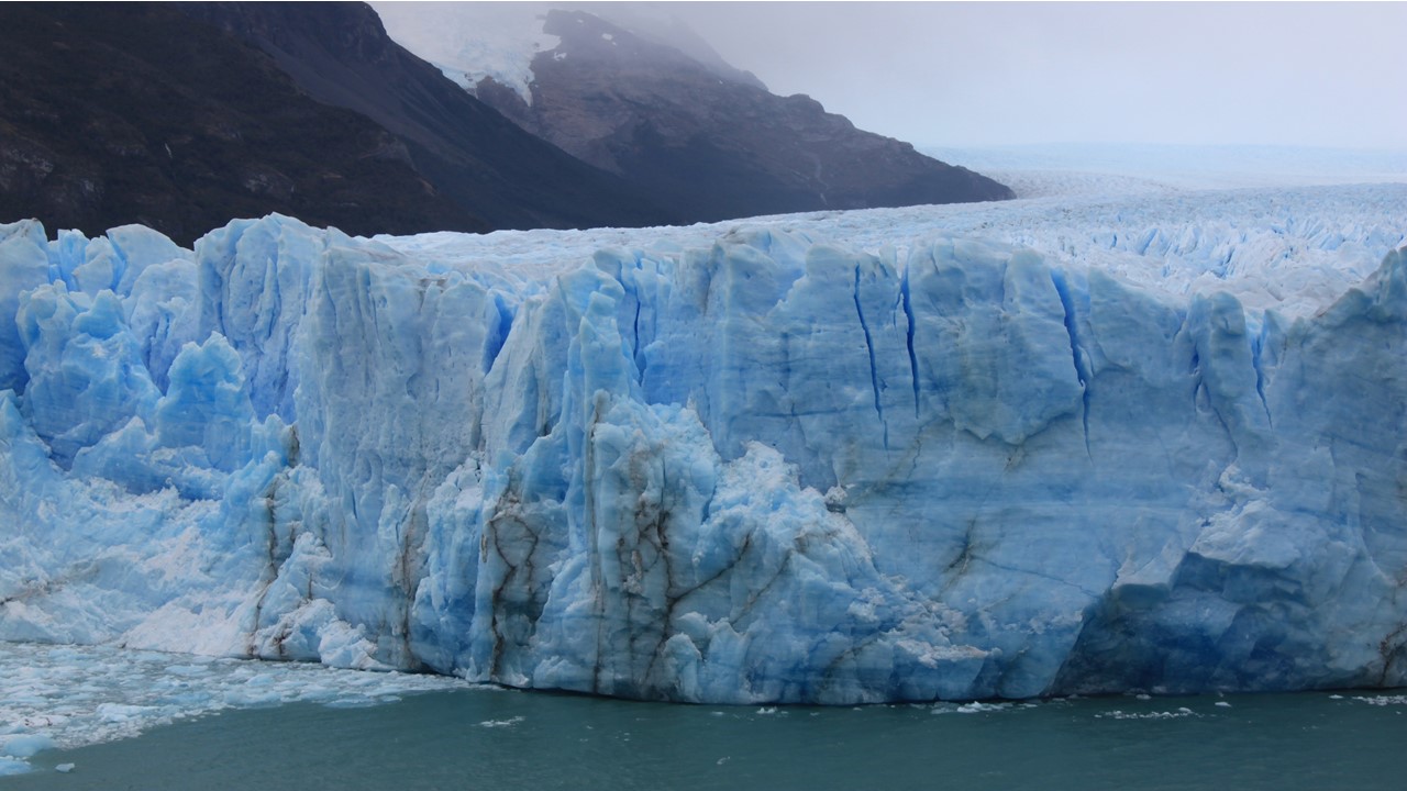
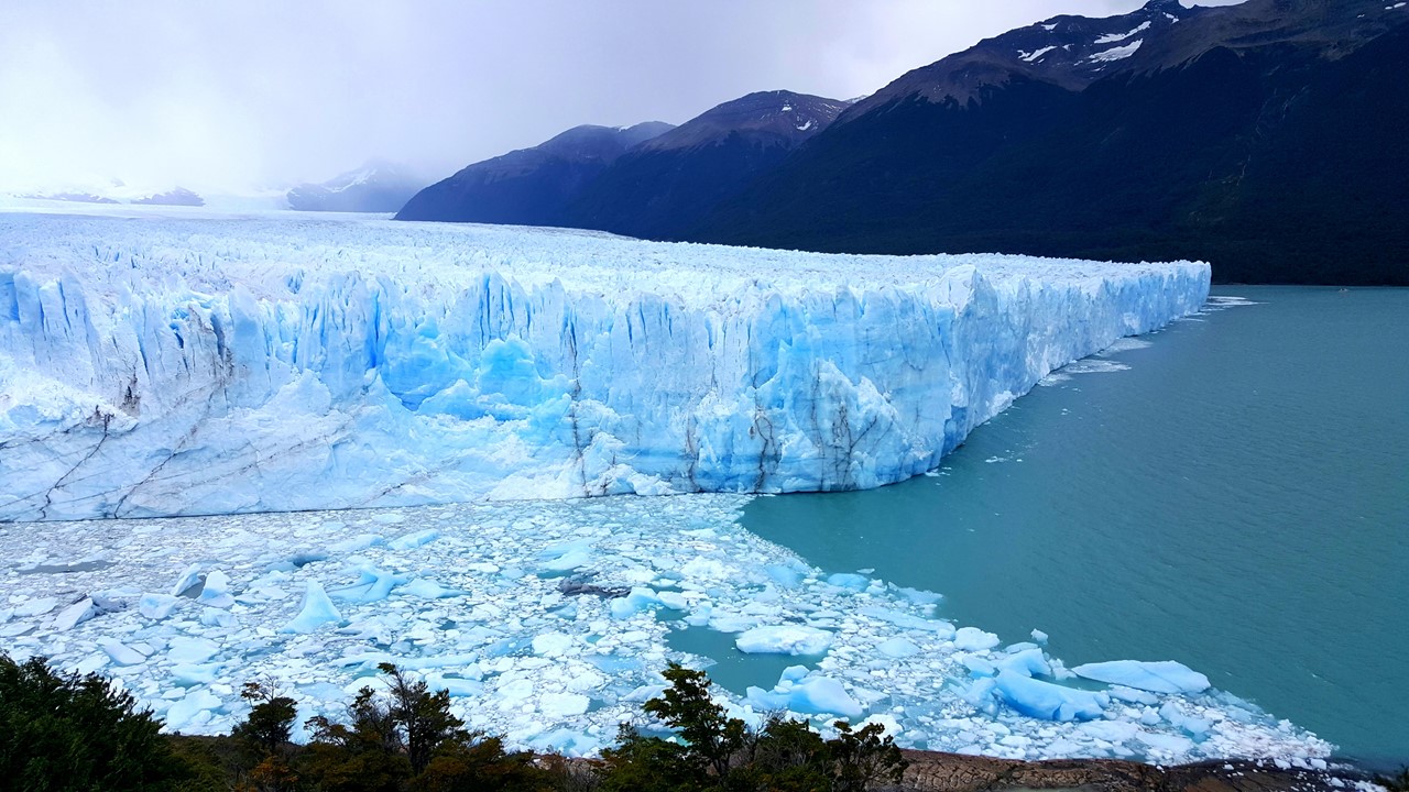
Soon we enter Los Glaciares National Park which was created in 1937 and is the second largest National Park in Argentina. Here is located Perito Moreno Glacier, towering over 200 feet above the Lake Argentino, and moving at 3-6 feet/day towards and into the lake. The glacier has been stably doing this since recorded times in the 1800’s, but no one knows if it is getting thinner, thicker and remaining stable upslope. The glacier’s face comes very close to a point of land that the park has used to install an extensive network of catwalk loops that are clearly labeled by color and that circle back and forth in front of the falling and extensive ice face, allowing one to view all aspects on the glacier. In fact, every few years, the glacier moves far enough to join the point of land, blocking the water flow from upstream into Lake Argentino. This causes the dammed water upstream to rise over 50’ higher before the dam breaks and a balance in restored. After exploring all the walkways, we grab a quick hot chocolate at the gift shop before returning to town for shopping and dinner on our own. We decided to “bar hop” and started at a local brewery pub listening to a hand-drummer before moving on to a lamb burger pub and finishing with nightcaps and then returning to the hotel.

On Friday morning (January 25th) we arose early and went for a long, early morning walk along the bay front looking at the flamingoes and swans before returning for showers, breakfast, and a final meeting to share our favorite highlights of the trip. Then, it was off to the airport for the flight back to Buenos Aires. The El Calafate airport is new (2005) and has significantly raised the tourism of the region. We board for our trip east, but our adventures were not over, yet! During the flight, one passenger had a medical emergency which required intervention and monitoring and medical evacuation upon our arrival. Luckily, she recovered fine, and the trip ended on a “high note”!