Summer 2026 — Royal Caribbean Ovation of the Seas & Alaska Cruisetour
Traveling through Alaska is never just a vacation — it is an immersion into deep time. Glaciers shaped over millennia, Indigenous cultures whose traditions predate written history, frontier towns born from gold fever, and wilderness that remains largely unchanged since the first humans crossed the Bering land bridge. For our family of ten, this northbound voyage became a shared exploration of one of the last great wild regions of North America.
June 26 — Vancouver: Gateway to the North
Our adventure began at Vancouver’s Canada Place, a modern cruise terminal built atop the city’s historic piers. Vancouver has long been a maritime crossroads — first for Coast Salish peoples, then for fur traders, and now for travelers heading toward Alaska’s Inside Passage.
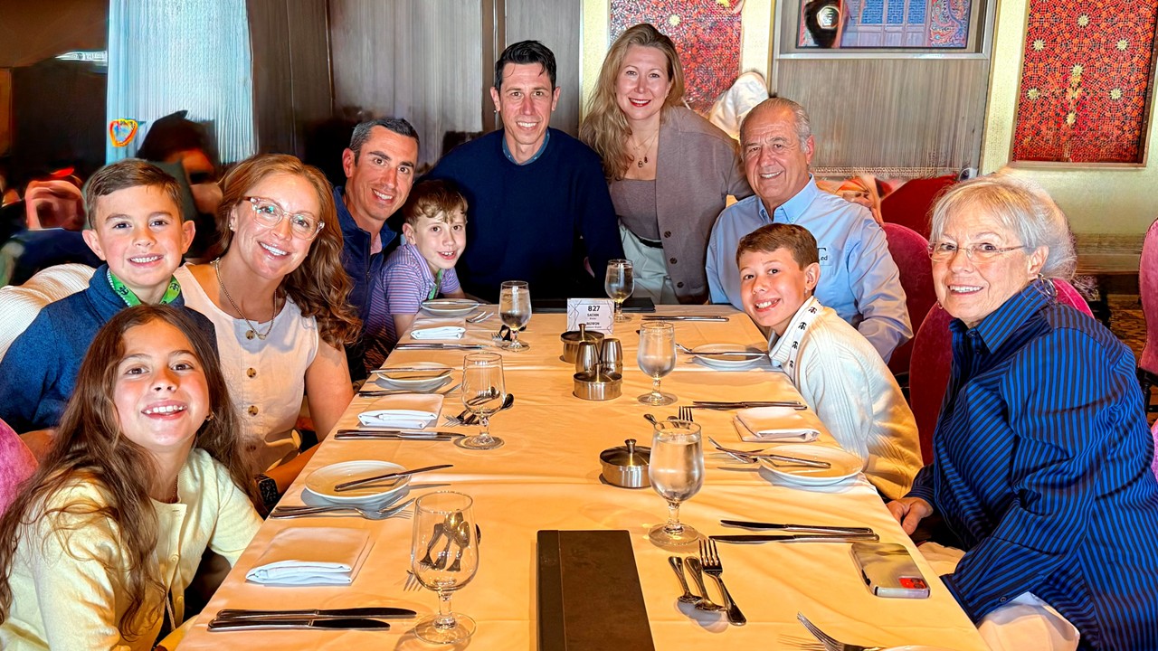
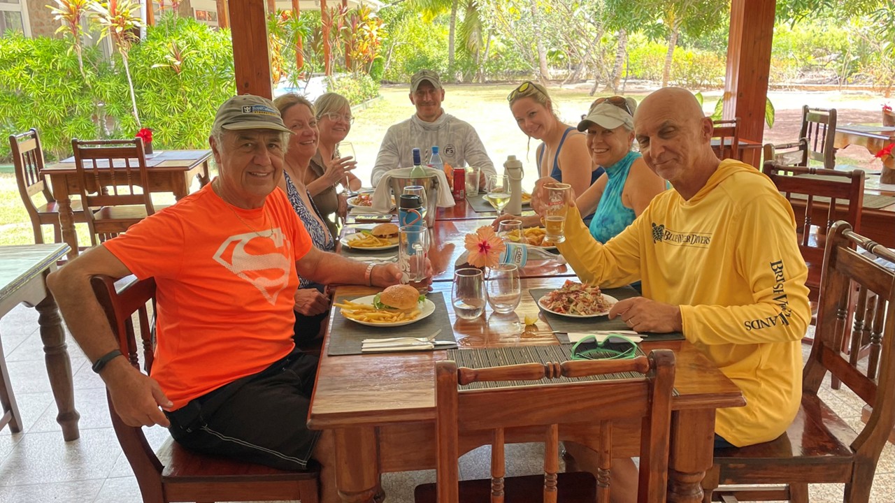
As flights converged from Baltimore, Washington, and Orlando, we gathered aboard Ovation of the Seas. That first dinner felt like a reunion and a launch point — a long table, lively conversation, and the anticipation of the week ahead.
When the ship slipped away at 9:45 PM, it followed a route once used by Indigenous canoes and later by steamships carrying prospectors north during the Klondike Gold Rush. We were sailing in the wake of history.
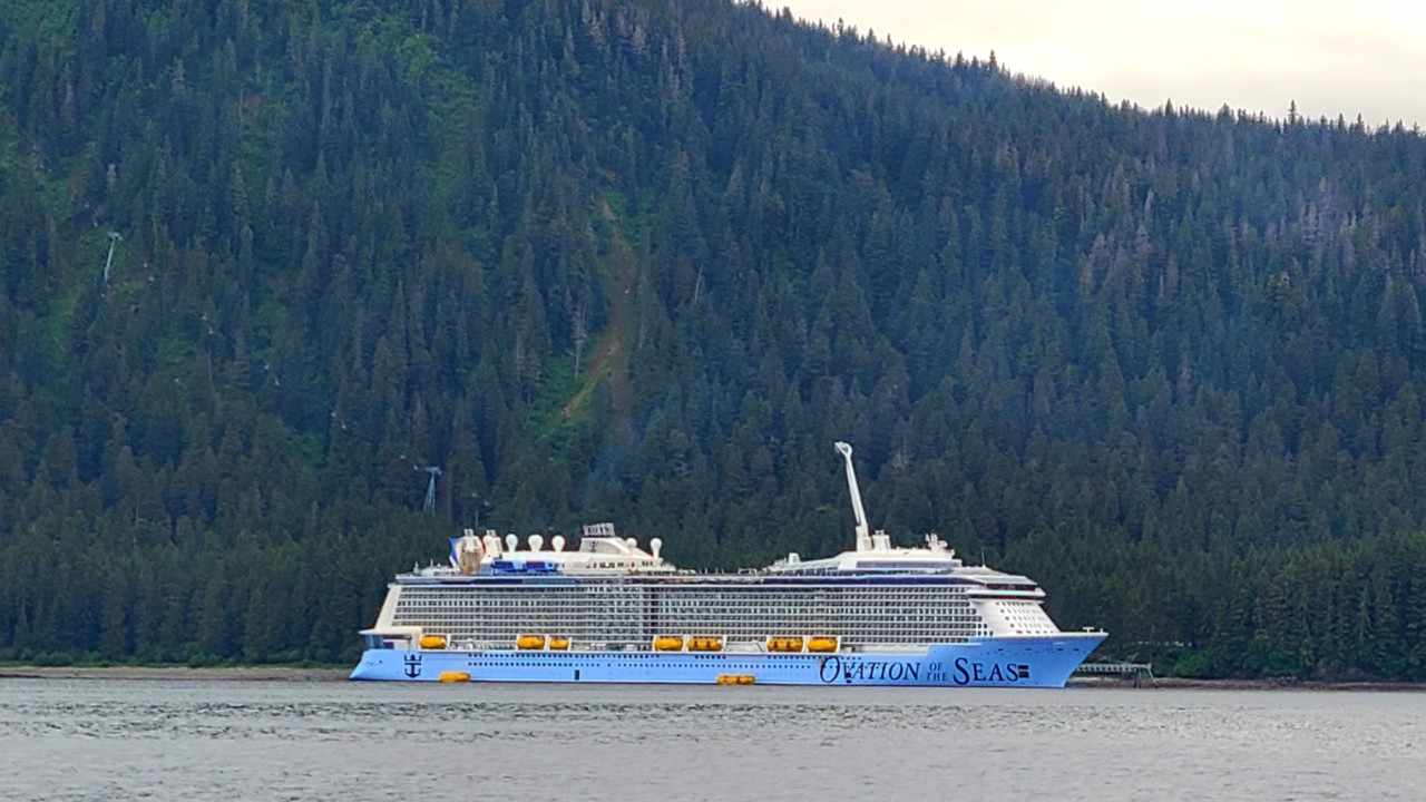
Detomo Family Aboard at DinnerThe Ovation of the Seas
June 27 — At Sea: Life Along the Inside Passage
The Inside Passage is one of the calmest and most scenic coastal routes in the world — a 500mile corridor shielded by islands that protect ships from the open Pacific. Its sheltered waters have supported Indigenous travel, trade, and communication for thousands of years. Today, travelers glide past forested islands, granite peaks, waterfalls, and wildlife-rich straits.
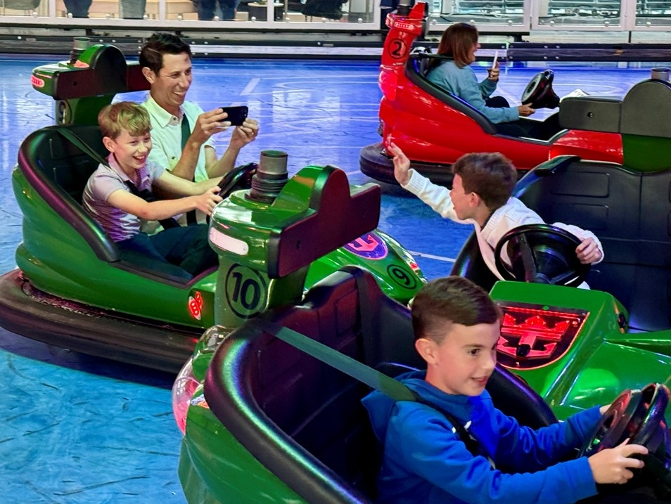
Aboard the ship, the day unfolded in easy rhythm. The kids discovered bumper cars, ping pong, foosball, archery, and trivia — a modern echo of the carefree joy that travel often brings — while adults explored lounges and panoramic decks.. Our sons taught our grandsons napkin folding, passing down a small tradition from their own childhood adventures at sea.
Outside, the ocean was a deep, nutrient-rich blue — part of a marine ecosystem that draws humpback whales each summer to feed along this protected corridor.
Family Bumper Cars on Board the Ship
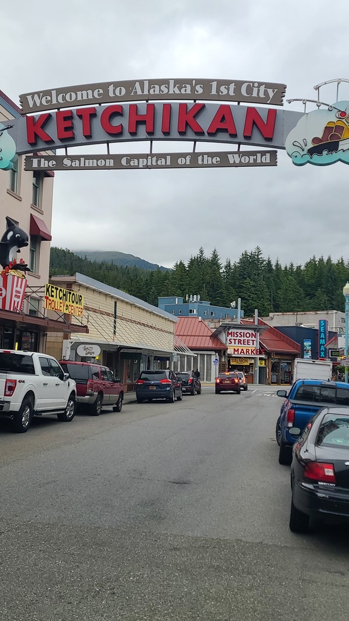
June 28 — Ketchikan: Totem Poles, Rainforest, and Alaska’s First City
Ketchikan, often called Alaska’s “First City,” sits within the Tongass National Forest — the largest temperate rainforest on Earth. Towering cedar and hemlock thrive in its misty climate.
Totem poles are everywhere, carved by Tlingit and Haida artists whose traditions stretch back millennia. These poles were never objects of worship; they were storytelling devices, historical markers, and expressions of clan identity.
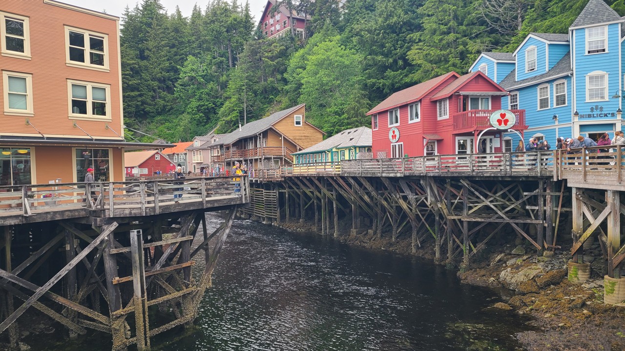
Ward Cove’s rustic waterfront buildings recall early 20thcentury canneries that once lined Alaska’s coast, processing salmon for markets around the world.
Ketchikan – Alaska’s First CityWard Cove in Ketchikan
June 29 — Icy Strait Point: Orcas and Indigenous Stewardship
Icy Strait Point is owned and operated by the Huna Tlingit — one of the few cruise destinations in Alaska managed by Indigenous people. The region is known for exceptional wildlife viewing, especially orcas and humpbacks that feed in the deep waters of Icy Strait.
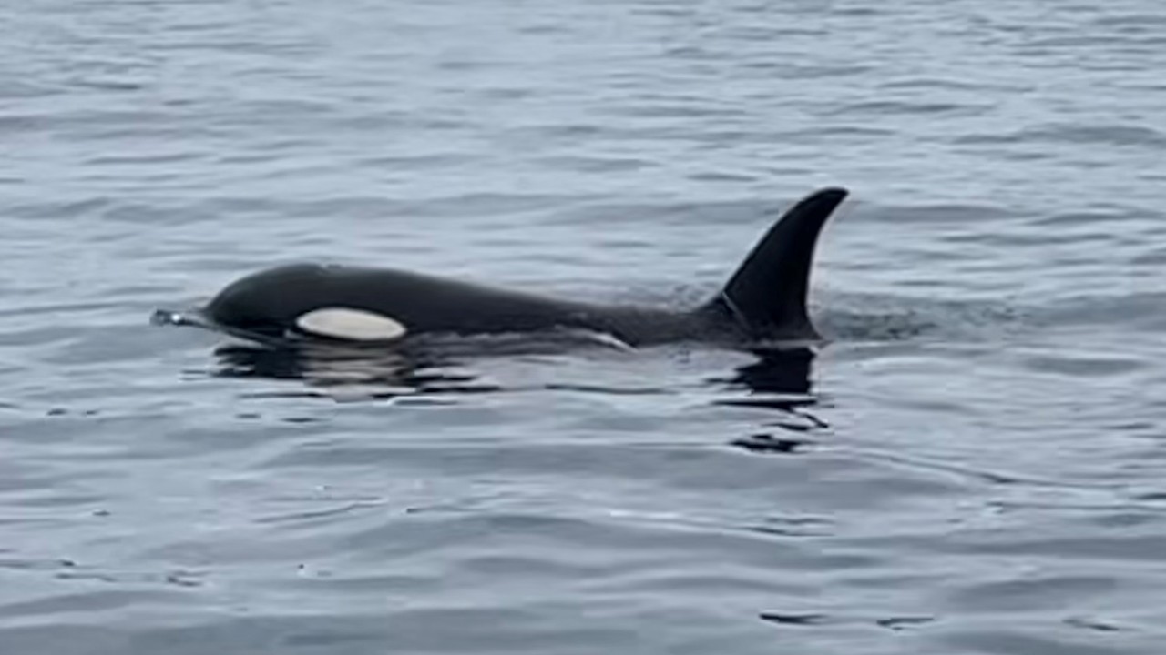
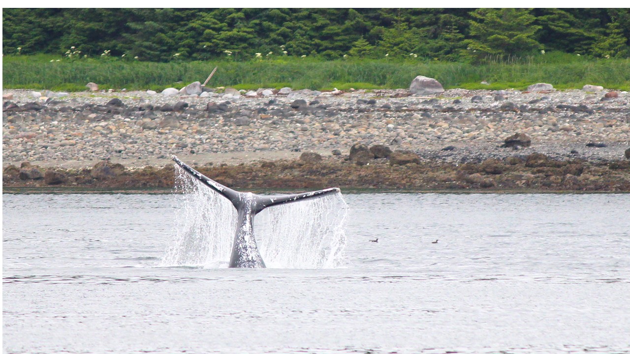
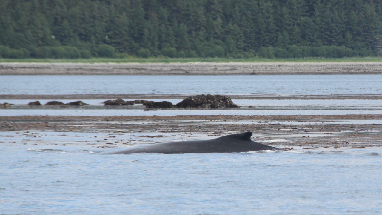
Seeing orcas in the wild is a profound experience. These animals are apex predators with complex social structures, dialects, and hunting strategies passed down through generations. The mountains rising behind the strait — streaked with snow even in June — are part of the Fairweather Range, some of the tallest coastal mountains in the world. The quiet of the water, the rhythm of the whales (Humpback and Orcas – tales flips and blows and breeching dives) and sea otters with babies on their chest , and the vastness of the landscape created a moment that felt suspended in time. We visited the fishery museum and rode the mountaintop gondola back to town. That evening, all ten of us celebrated our 50 years of marriage with lobster, Baked Alaska, and group photos — a milestone set against one of the world’s most dramatic landscapes.
Orcas in Icy Strait PointHumpback Whale Tail in Icy Strait PointHumpback among Sea Otters in Icy Strait Point
June 30 — Sitka: Russia’s Former Capital and Tlingit Homeland
Sitka is one of Alaska’s most historically layered communities. Long before Russian traders arrived, it was the heart of the Kiks.ádi clan of the Tlingit people. The 1804 Battle of Sitka between the Tlingit and Russian colonizers shaped the region’s future.
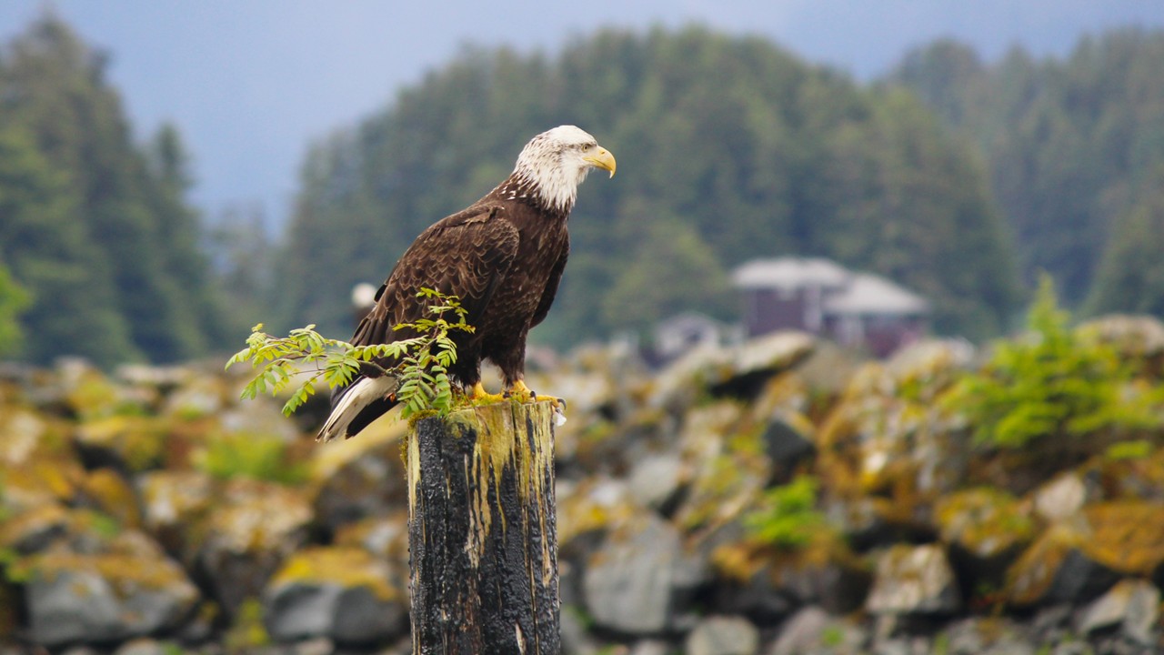
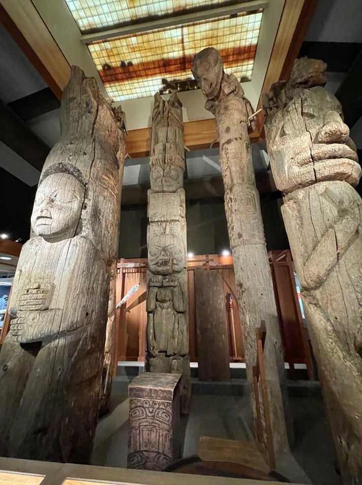
The Russian influence remains visible in onion-domed architecture and Orthodox traditions, but the deeper story lies in the rainforest trails and carved poles of Sitka National Historical Park. The park commemorates the 1804 battle and preserves the artistry of Indigenous carvers whose work reflects clan identity and ancestral memory. Sitka is also one of Alaska’s best wildlife ports, known for eagles, bears, and marine life.
Walking among 500yearold trees, spotting bald and golden eagles, and enjoying our first lunch of fresh crab made the day unforgettable. That night, bumper car races kept the celebration going.
The Alaska Town of SitkaBald Eagle along Sitka National Historical ParkTlingit Totem Poles in Sitka
July 1 — Skagway: Gold Rush Dreams and Sled Dog Heritage
Skagway was once the gateway to the Klondike Gold Rush. In 1897–98, more than 100,000 stampeders passed through this narrow valley hoping to strike it rich — though only a fraction made it, and fewer still found gold.
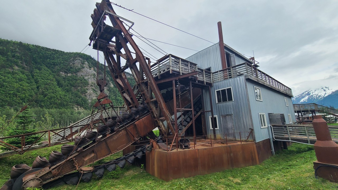
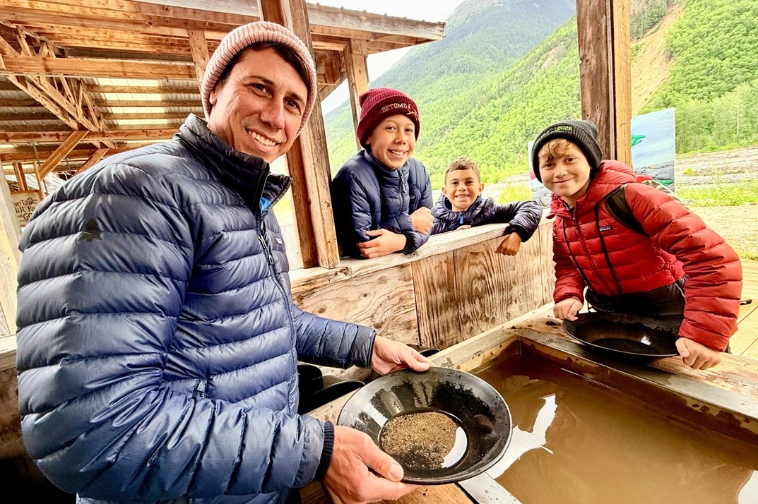
Gold panning today is a playful echo of that era, but the history remains sobering: many stampeders died on the Chilkoot Trail, and the boomtown was notorious for crime, corruption, and hardship. We explored a gold dredge, learned to maneuver its control levers, and then practiced panning for gold ourselves.
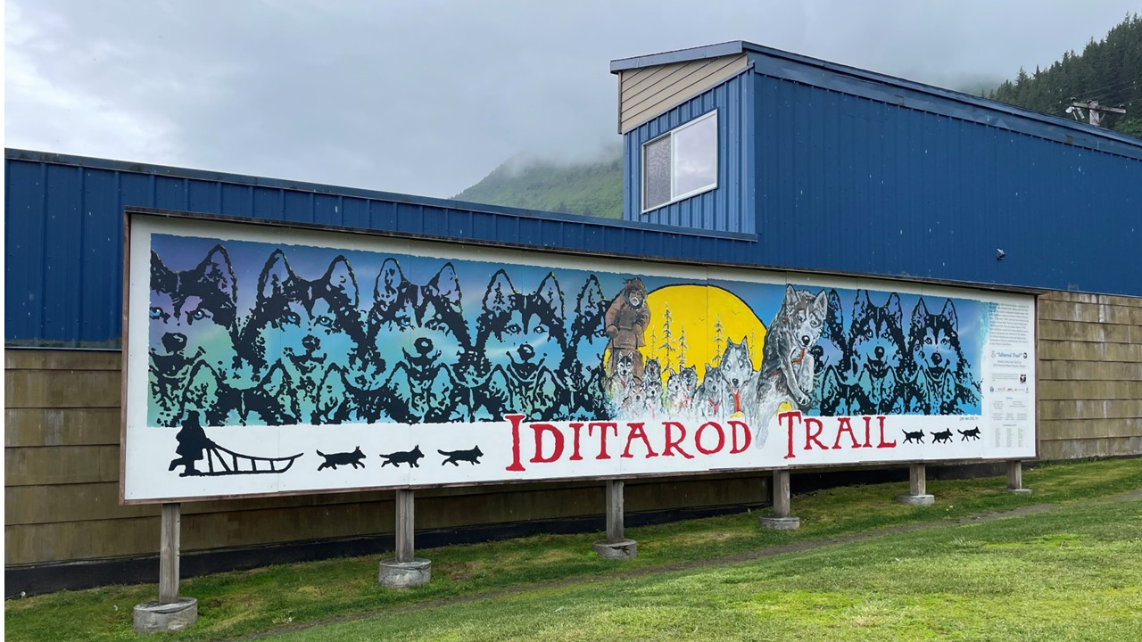
Skagway is also famous for sled dog culture. Long before snow machines, sled dogs were essential for winter travel and mail delivery across Alaska’s interior. The Iditarod Trail itself was originally a mail and supply route linking remote communities. Meeting the dogs, learning about training, and holding a young pup offered a glimpse into a tradition still central to many rural communities. These dogs are athletes, workers, and companions — central to the identity of many Alaskans.
The day ended with World Cup excitement aboard the ship — frontier history blending with global celebration.
Gold Dredge in SkagwayFamily Gold Panning in Skagway
July 2 — Hubbard Glacier: The Living Ice
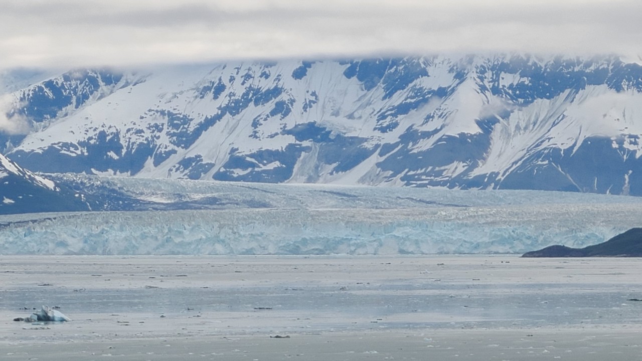
Hubbard Glacier is Alaska’s largest tidewater glacier — a massive river of ice, stretching between the mountains down to the sea. Unlike most glaciers worldwide, Hubbard is still advancing, driven by heavy snowfall in the Saint Elias Mountains — a range that includes some of the tallest peaks in North America.
The glacier’s face is 6 miles wide and 76 miles long, and its ice can be over 400 years old. When the glacier calves, the sound is like thunder — a deep, resonant crack that echoes across the bay. The floating ice around the ship is part of a natural cycle that has shaped the coastline for millennia. Clouds hung low over the mountains, creating a dramatic backdrop that made the glacier’s blue ice glow even brighter.
The rest of the day aboard ship was filled with foosball, Nintendo games, World Cup soccer, horse racing, and more napkin folding — capped by a lively New Orleans second line parade at dinner and a chance to meet the chef.
Hubbard Glacier – The Living Ice
July 3 — Seward→Anchorage→Talkeetna: Marine Science and Mountain Country
We disembarked the ship at Seward to experience Alaskan life.
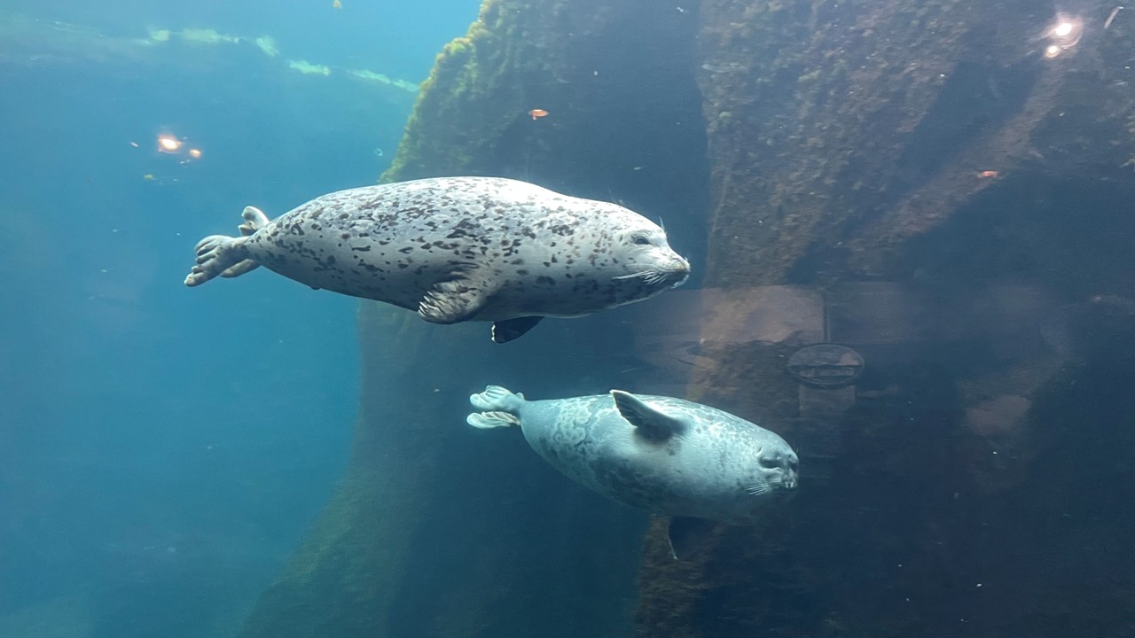
Seward sits at the head of Resurrection Bay, a deep fjord carved by glaciers. The Alaska SeaLife Center plays a crucial role in marine research, rehabilitation, and conservation. Learning about endangered Cook Inlet belugas — a genetically distinct population that remains isolated year round — added depth to the wildlife we had seen earlier in the trip.
Anchorage, Alaska’s largest city, is built on Dena’ina Athabascan land. The Anchorage Museum blends Indigenous art, Arctic science, and hands-on learning, offering a window into Alaska’s cultural and ecological complexity.
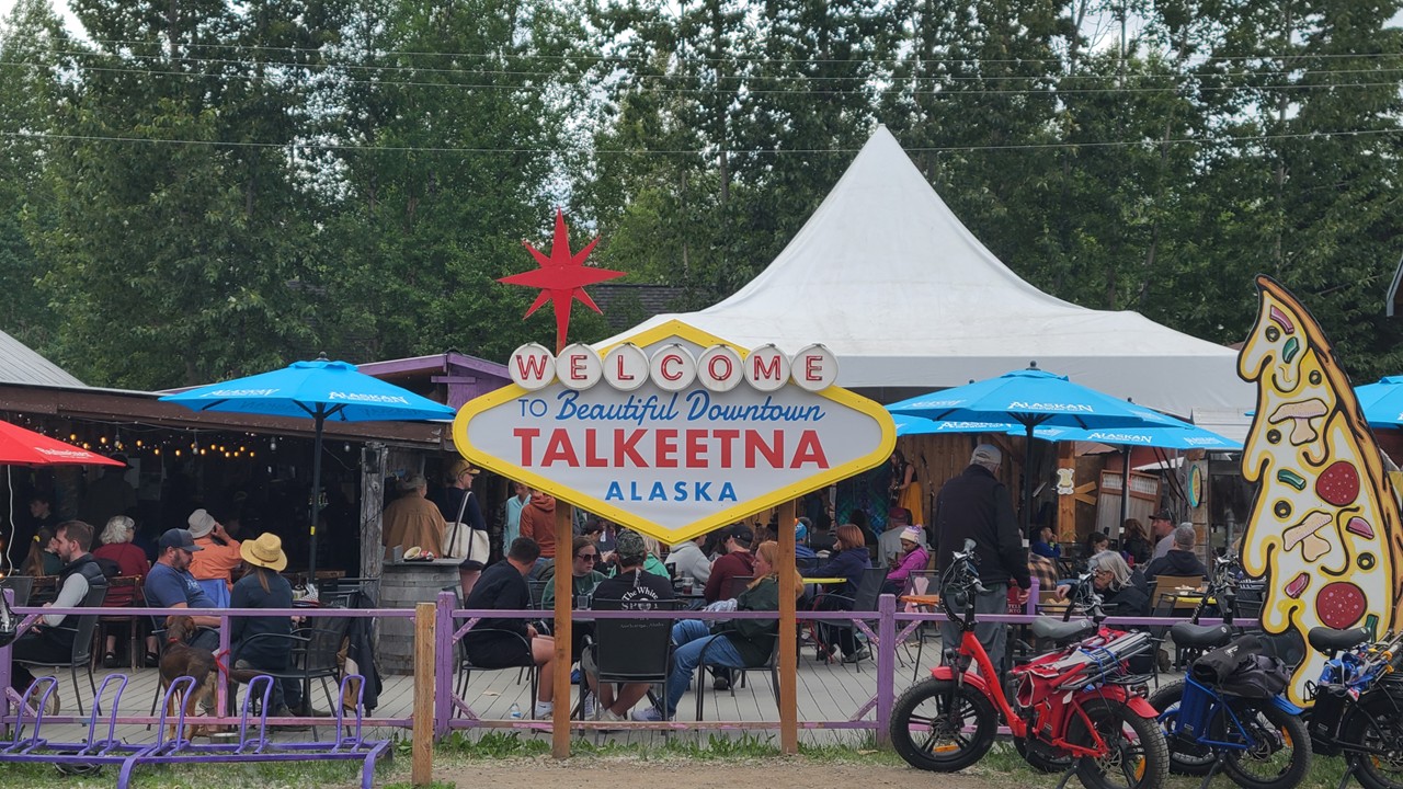
The drive to Talkeetna followed the Susitna River valley, long used by Indigenous travelers. Talkeetna began as a railroad town in 1916 and is now famous for its views of Denali — North America’s tallest peak at 20,310 feet. On clear days, the mountain appears impossibly large, rising above the Alaska Range like a white monolith.
The town was lively that evening with music, museums, restaurants, and ice cream treats.
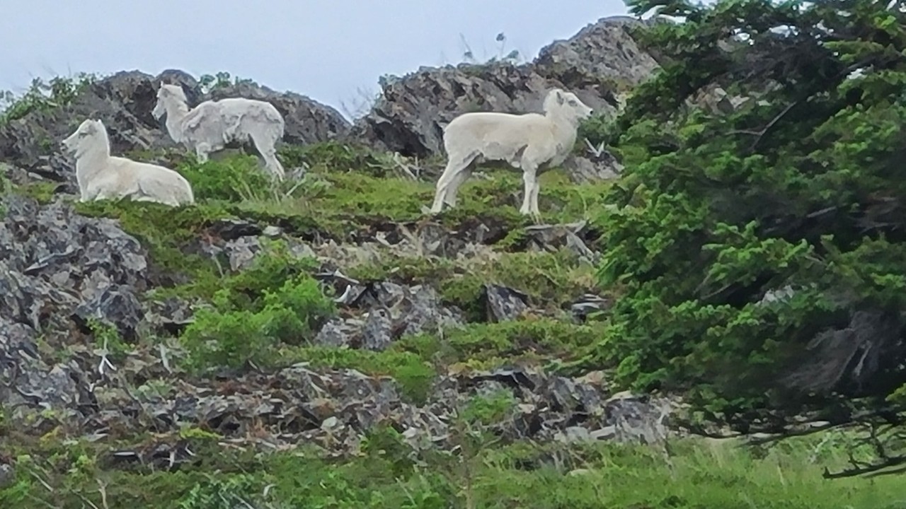
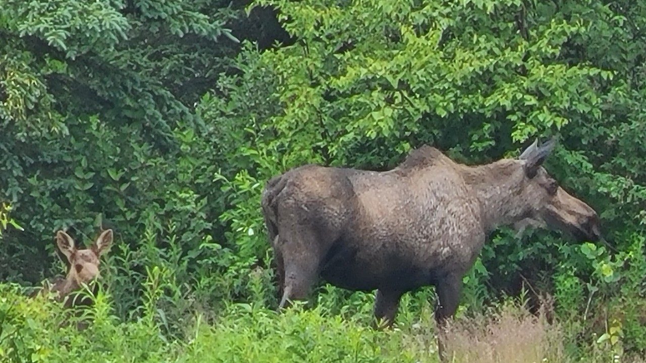
Alaska sea Life Center in SewardAnchorage – The Start of the Iditarod Trail RaceWild mountain Goats of Alaska on our way to TalkeetnaThe Town of Talkeetna and the Boarding of the Alaskan RailroadMoose and Her Baby Outside our Hotel in Talkeetna
July 4 — Talkeetna→Denali: Rail Through the Interior
The Wilderness Express railcar carried us north through boreal forest — the largest land biome on Earth. Spruce, birch, and willow lined the tracks, while rivers braided their way through gravel bars shaped by glacial melt.
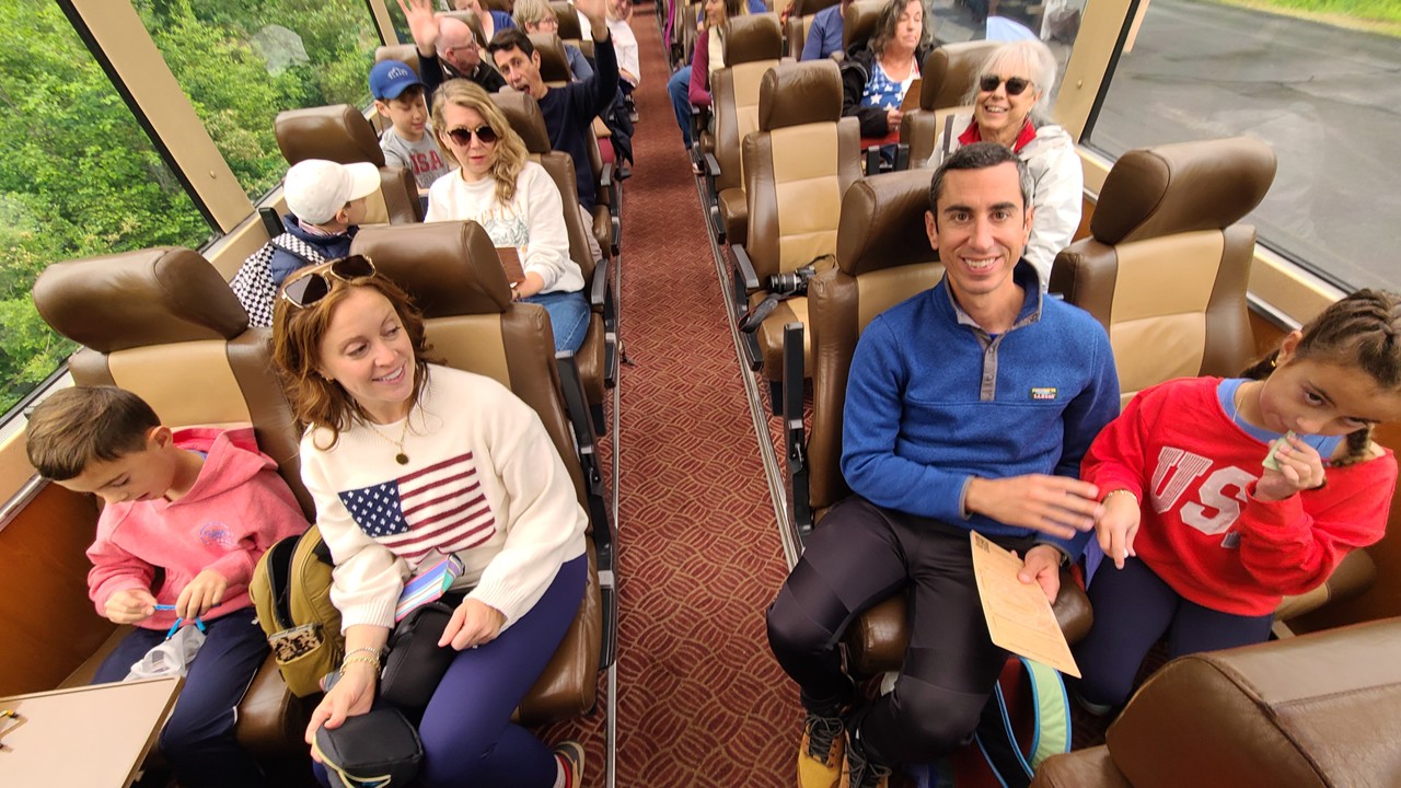
Rail travel in Alaska has a storied history. The Alaska Railroad was built between 1914 and 1923, connecting Seward to Fairbanks and opening the interior to commerce and settlement. Today, it remains one of the most scenic rail routes in the world. Spotting our first moose from the glass topped observation seats, to mocktails and cocktails while we had a lively guided tour of the countryside followed by a delicious lunch made to order in the dining car.
Arriving in Denali, the wilderness felt immediate. Moose moved quietly through tall grass, their presence a reminder that this landscape belongs first to wildlife. The evening’s s’mores gathering added warmth and simplicity to a day filled with grandeur.
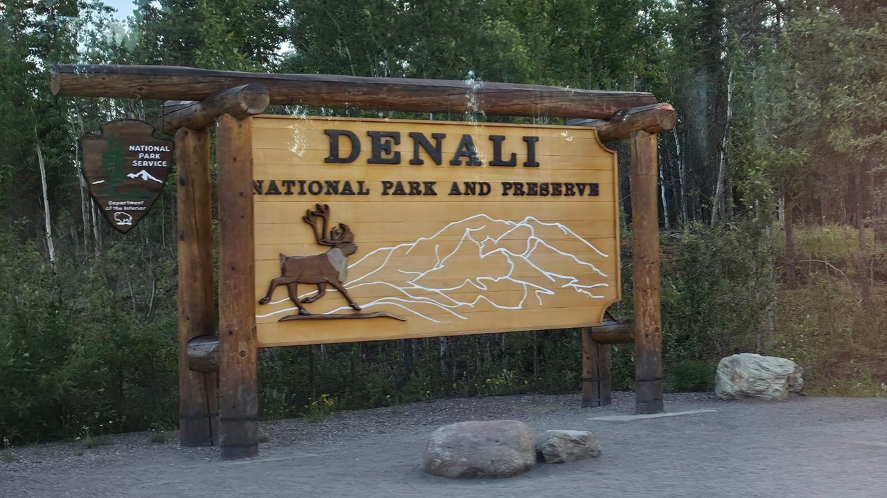
Riding in Glass Top Train Car on the Alaskan RailroadWelcome to Denali National Park
July 5 — Denali→Anchorage: Trails, Dogs, and the Long Road South
Denali National Park is larger than the state of New Hampshire, yet it has only one road — a design that protects the ecosystem and keeps human impact minimal. The guided hike offered insight into geology, flora, and wildlife, from glacially carved valleys to tundra plants adapted to extreme cold.
The visit to a working dog kennel highlighted the role of sled dogs in Alaska’s interior. The Iditarod Trail, now famous for racing, was once a lifeline for remote communities. Learning about training, endurance, and the bond between mushers and dogs added depth to the cultural significance of sled dog traditions.
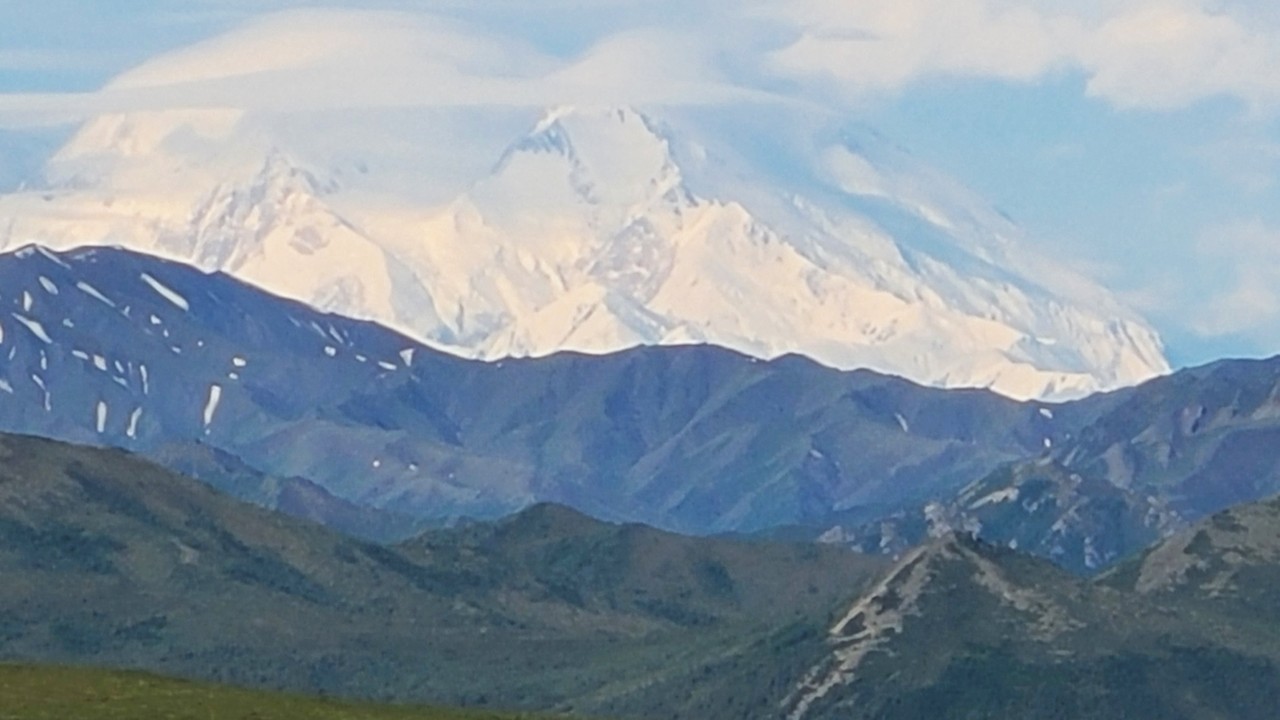
Mount Denali – The Tallest Peak in North America
Anchorage welcomed us back with coastal trails and mountain views — a gentle transition from wilderness to city.
July 6 — Homeward Bound
Flights departed throughout the day, carrying the family back across the continent. The journey ended, but the stories — of glaciers, wildlife, culture, and shared discovery — remained.
Early June in Scotland carries a particular kind of magic — long northern light stretching late into the evening, green hills newly awakened from spring, and a sense of timelessness woven through every loch, glen, and stone. For our journey from Edinburgh to Aberdeen, we chose the scenic, whisky rich route through the Highlands and Speyside, blending history, landscape, and the quiet rhythm of Scottish culture. What follows is our travel weblog – a personal view of experiences and learning.
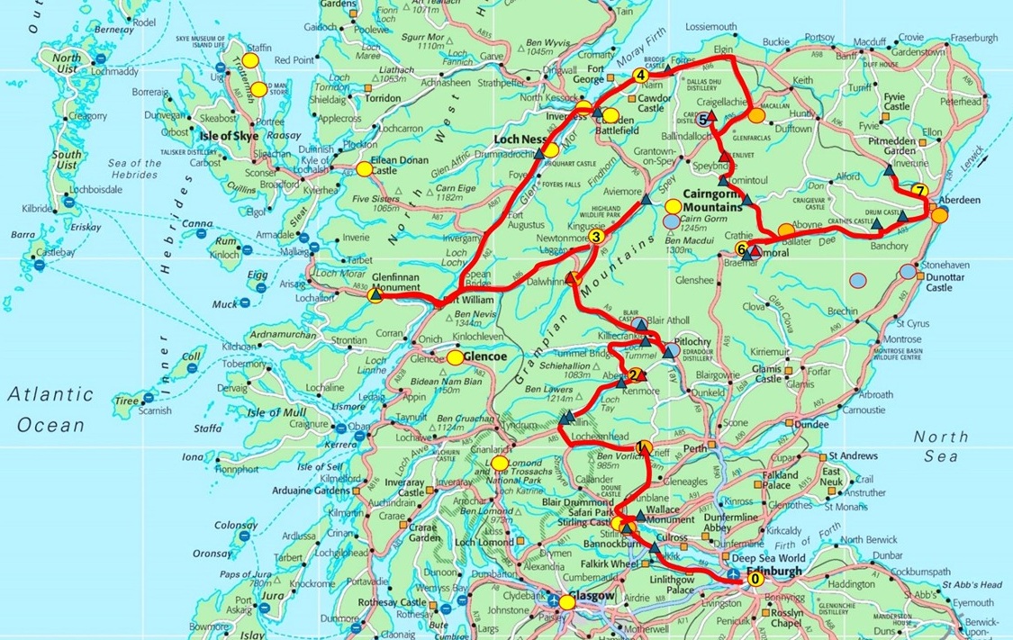
Scotland Tour Map
Day 1 — Edinburgh to Crieff: Castles, Kelpies, and Scotland’s Oldest Working Distillery
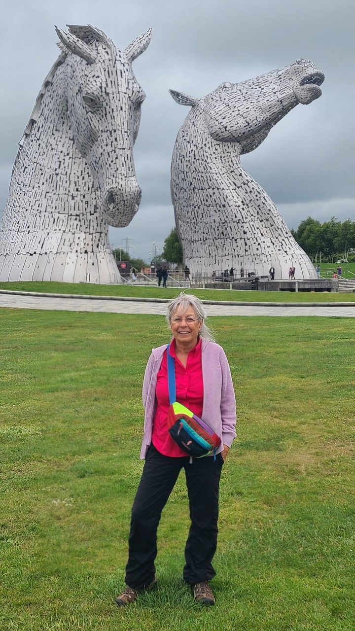
Leaving Edinburgh under a soft morning sky, we traveled toward Stirling, one of Scotland’s most storied towns where that story has pivoted for centuries. A short detour brought us to The Kelpies, the 100 foot steel horse heads that honor Scotland’s heavy horse heritage. Modern Scotland expresses its heritage through monumental public art celebrating the working horses that once powered agriculture and industry. Their gleaming steel forms capture both strength and grace, echoing the country’s blend of tradition and innovation, and they shimmered in the early light — modern art set against ancient land.
The Kelpies near Falkirk not only serve as a modern tribute to Scotland’s working‑horse heritage — but the name they bear reaches back into one of Scotland’s oldest and most haunting bodies of folklore. Kelpies appear throughout Scottish folklore as shape‑shifting water spirits inhabiting rivers, lochs, and fast‑moving streams. They are most commonly described as powerful horses, usually dark or grey‑white, with unnaturally wet, gleaming hides and the ability to transform into human form. Their origins are murky, but scholars widely agree that kelpie tales served as cautionary stories — warning children away from dangerous waters and reminding adults to be wary of charming strangers.
Julie at the Kelpies
Nearby Stirling Castle rises above the valley on a volcanic crag, a fortress that once controlled the gateway between the Highlands and Lowlands which has seen coronations, sieges, and has helped shape the national identity. Kings were crowned here; battles were shaped here. Seeing it from the road, you understand why it mattered. Its pale stone walls and battlements glow differently with each shift of Highland light, giving the fortress an almost living presence. The 1297 Siege of Stirling Castle set the stage for William Wallace’s victory at the Battle of Stirling Bridge. That siege, and the battle that followed, became a defining moment in the First War of Scottish Independence. In 1297, Stirling Castle stood as the last major English-held fortress blocking Scottish resistance. Its position controlled movement between Highlands and Lowlands, supply routes, and the political heart of Scotland. After the death of Alexander III and the ensuing succession crisis, Edward I of England sought to dominate Scotland. His forces occupied key strongholds, but Stirling remained the most symbolically and strategically important. The siege that unfolded there became a test of wills between English authority and the rising Scottish resistance led by William Wallace. The castle ultimately fell to the English, but the struggle around it ignited the momentum that led directly to Wallace’s counterstrike at Stirling Bridge, where Scottish forces achieved a stunning victory that reshaped the war and national identity.
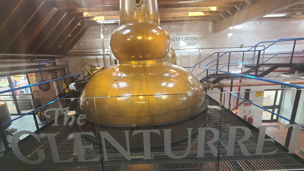
From there, we climbed toward the Dumyat Hill viewpoint for a panoramic sweep of the Forth Valley, and then continued into Perthshire’s rolling countryside. The country road led us to Glenturret, founded in 1763 and widely recognized as Scotland’s oldest working distillery. Its history is tangible — traditional mash tuns, copper stills, dark timber washbacks, and centuries-old stone buildings create an atmosphere where time feels layered and unchanged for centuries. Here, each dram carrying whispers of generations who crafted whisky long before it became a global icon. We enjoyed a relaxed tasting and wandered the grounds, easing into the slower pace we wanted for the week.
The Glenturret Distillery Pot
After the Distillery Tour, we headed to the village of Crieff for our overnight stay at the Gastro Pub & Apartments. Our room was an apartment located over the pub where we had dinner and local beer before settling in for the night.
Day 2 — Crieff to Aberfeldy: Loch Tay, Falls of Dochart, Kenmore and Dewar’s Legacy
The morning drive toward Loch Tay was serene — mirror calm water still beneath early summer light, its surface reflecting the surrounding hills like polished glass. Loch Tay has deep roots in Scottish history, with evidence of ancient Iron Age dwellings built on wooden platforms still visible in places — reminders that people have lived and thrived here for thousands of years.
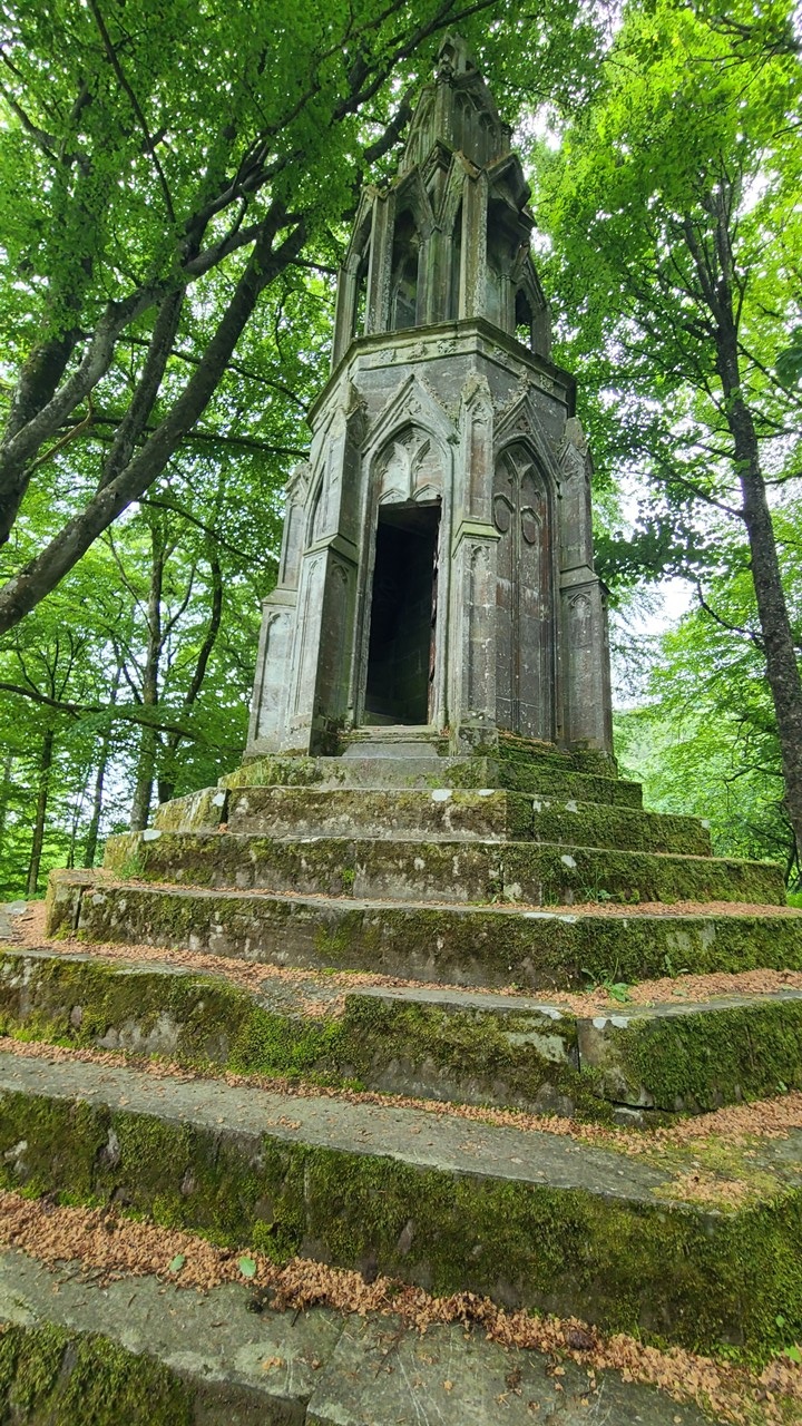
In Killin, the Falls of Dochart thunder through the village, historically tied to Clan MacNab. The river’s white spray and dark rocks create a dramatic natural stage that has witnessed clan gatherings, local trade, and centuries of Highland life. We paused to watch the water rush over the rocks, shop the local souvenir store, before continuing to Kenmore, a lochside village dating back to the 16th century. Kenmore’s 16th century origins show in its orderly layout and estate architecture. Here we hiked along side of the River Tay and come upon “Eleanor Cross” – a 30-foot-tall gothic folly known as Maxwell’s Temple. Located in Kenmore, Perthshire, it was built in 1831 by the Marquess of Breadalbane as a tribute to his wife Mary, Countess of Breadalbane. It is modeled after the medieval English Eleanor Crosses. This romantic gesture characterized a period when aristocrats embraced medieval nostalgia and reshaped their landscapes accordingly.
Rocky at the Top of Eleanor’s Cross
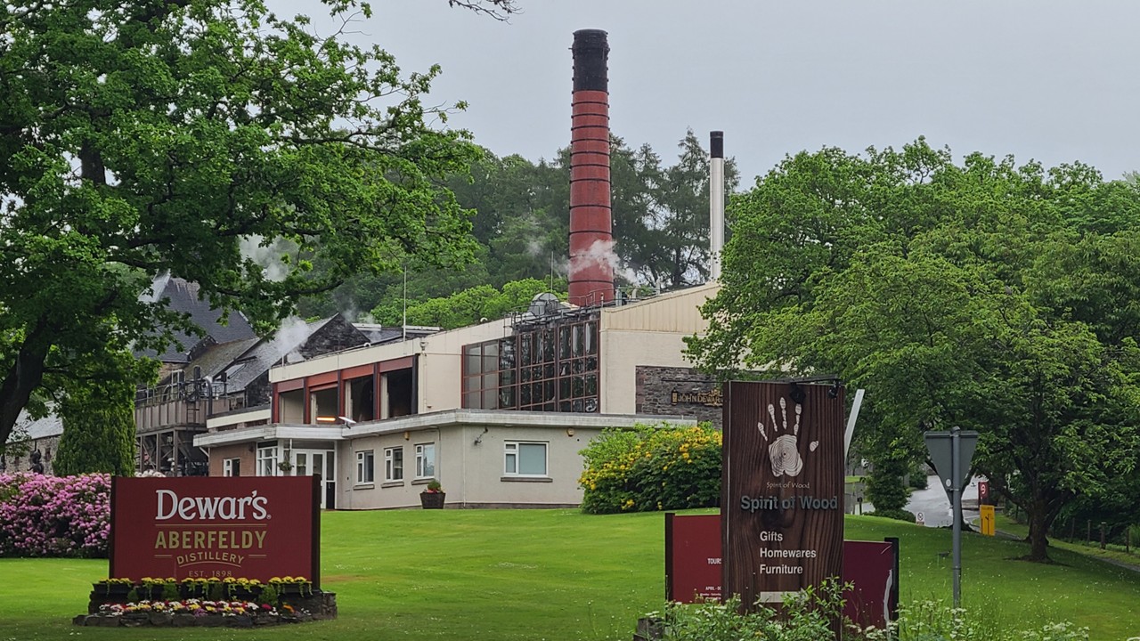
Following the River Tay into Aberfeldy, we arrived at The Townhouse Hotel then walked to Dewar’s Aberfeldy Distillery, founded in 1898 by the Dewar family. Aberfeldy’s riverside charm and Dewar’s Distillery, tells the story of blended Scotch’s rise during the Victorian era, when whisky shifted from local spirit to global export. Their museum’s exhibits highlight how industrialization, railways, and international trade transformed Scotch into a worldwide symbol of Scotland.
Dewar’s Aberfeldy Distillery
Day 3 — Aberfeldy to Dalwhinnie: Queen’s View, Blair Castle, Highland Estates, and Mountain Whisky
This day was built around iconic Highland scenery. Queen’s View, overlooking Loch Tummel, has been a celebrated viewpoint since Queen Victoria’s 19th century toured of the area. The panorama — shimmering water, dense forest, distant peaks — feels unchanged since her era and helped popularize Highland romanticism
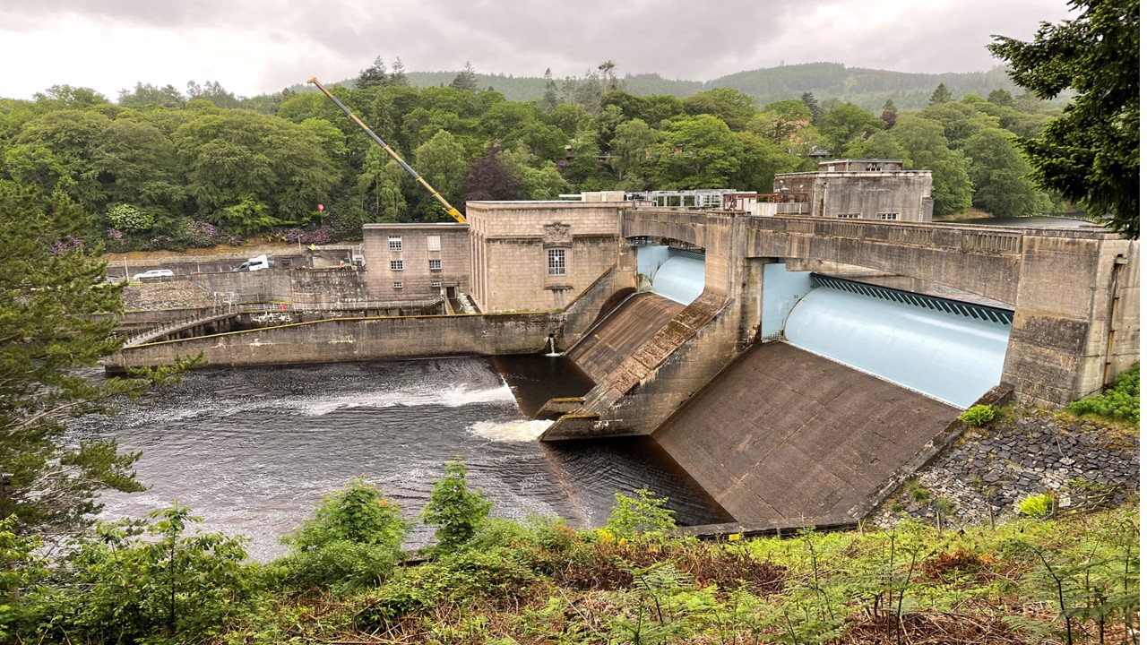
In Pitlochry, we walked along the Pitlochry’s dam and fish ladder, which reflects Scotland’s early hydroelectric innovation, blending engineering with natural landscape. Here we saw the active salmon count change as we the set of salmon pools. Nearby, Blair Castle stands as a white-walled Highland stronghold with roots stretching back to the 13th century. Its halls lined with weapons and antlers speak to centuries of clan power, Jacobite uprisings, royal visits, and aristocratic tradition.
The Pitlochry Dam
Driving north into the Cairngorm foothills, the mountains grew larger and the air cooler. Along the way, we visited the Dalwhinnie Distillery, founded in 1897. It sits at one of the highest elevations of any Scottish distillery. Its whisky has long been shaped by altitude, cold air, and the pure water of the surrounding hills. The distillery was closed for maintenance but we did partake of a tasing.
That evening we stayed at the Dalwhinnie / Newtonmore / Kingussie Crossing and had dinner at the local hotel pub, which served us the largest fish & chips we had ever seen!
Day 4 — Onto Newtonmore, Spean Bridge, to Fort William, Glenfinnan, Loch Ness, Inverness & Nairn
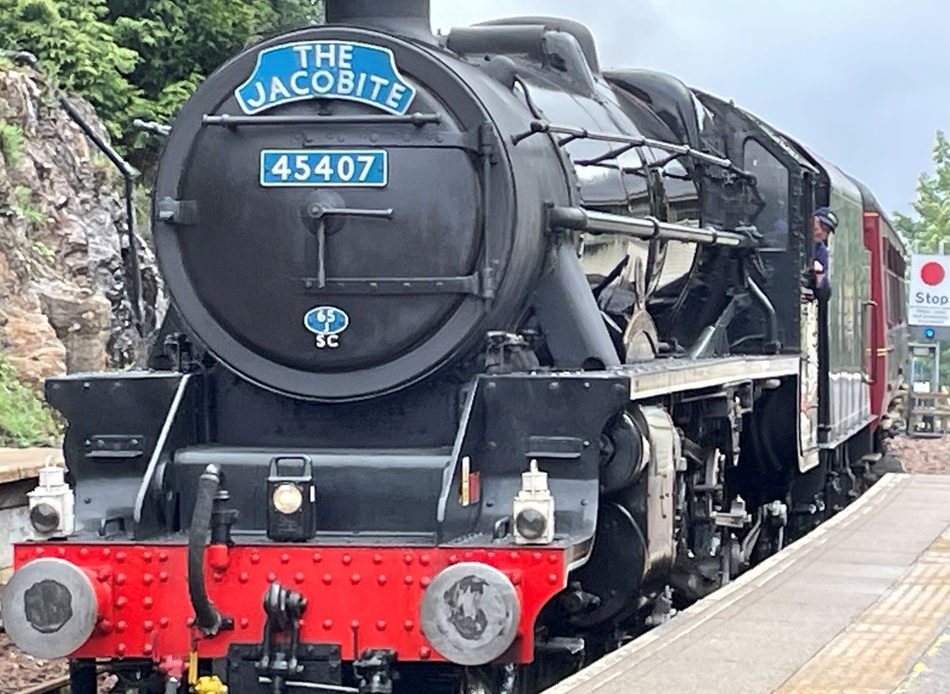
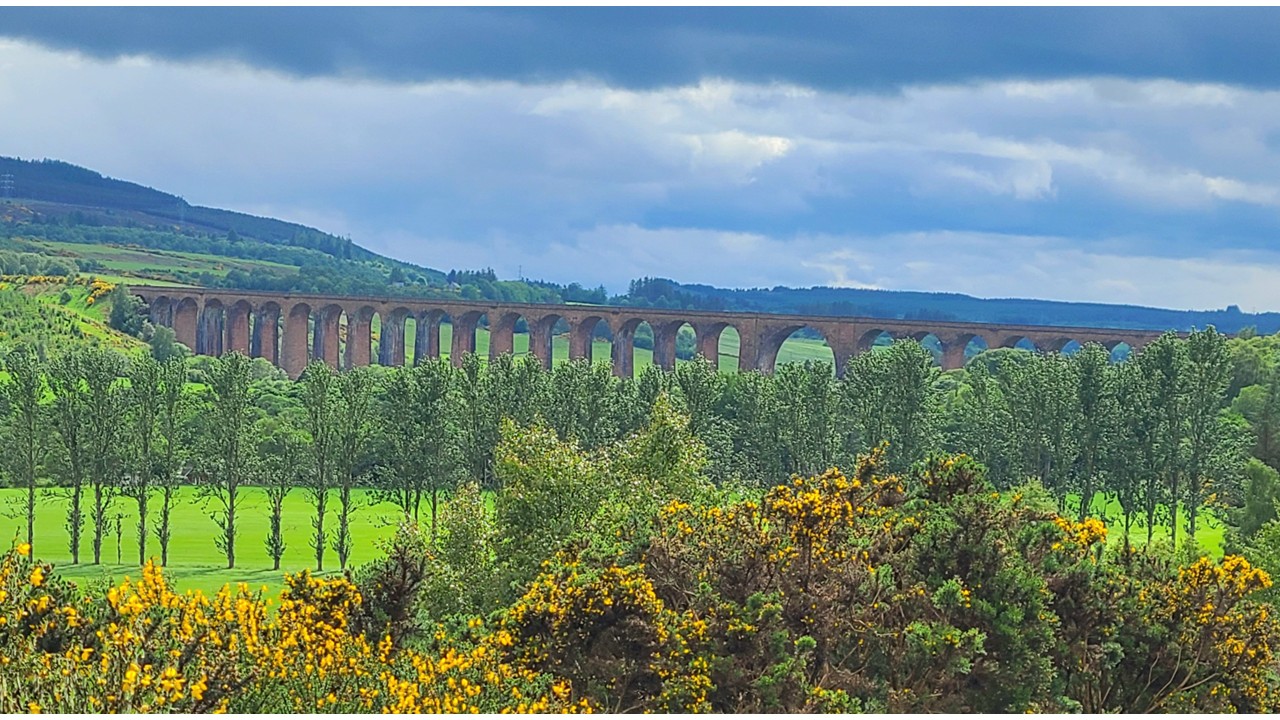
Driving the wooded highway west towards Fort William, we passed the shadow of Ben Nevis — Britain’s highest peak. Fort William has long been a gateway to Highland adventure, from mountaineering to wartime history, and the Ben Nevis mountain and ski resort chair lift was running for those who had time to seek the mountain view. Instead, we traveled onto Glenfinnan where the Harry Potter train scenes were filmed. While at the station, we watched the steam train pulling into the station and visited their museum. Glenfinnan’s railway heritage is steeped in Victorian engineering ambition. The classic steam locomotive that runs through this region evokes a bygone era of travel, when iron rails first connected remote Highland communities. Its route through sweeping glens and over iconic viaducts has become one of the most celebrated scenic rail journeys in the world.
The Hary Potter Train at GlenfinnanGlenfinnan Railroad Viaducts
Next, we drove along the loch to Loch Ness and the Loch Ness Experience and shops. Loch Ness, deep and mysterious, has inspired centuries of folklore. Its vast, dark waters and steep banks create an atmosphere where legend feels almost plausible. Urquhart Castle’s ruins, perched above the loch, recall medieval conflict and clan rivalry. While there, we also came across the world’s smallest gin distillery – barely 10ft by 20ft. making only a gin batch every week or so with a still that would fit in our closet.
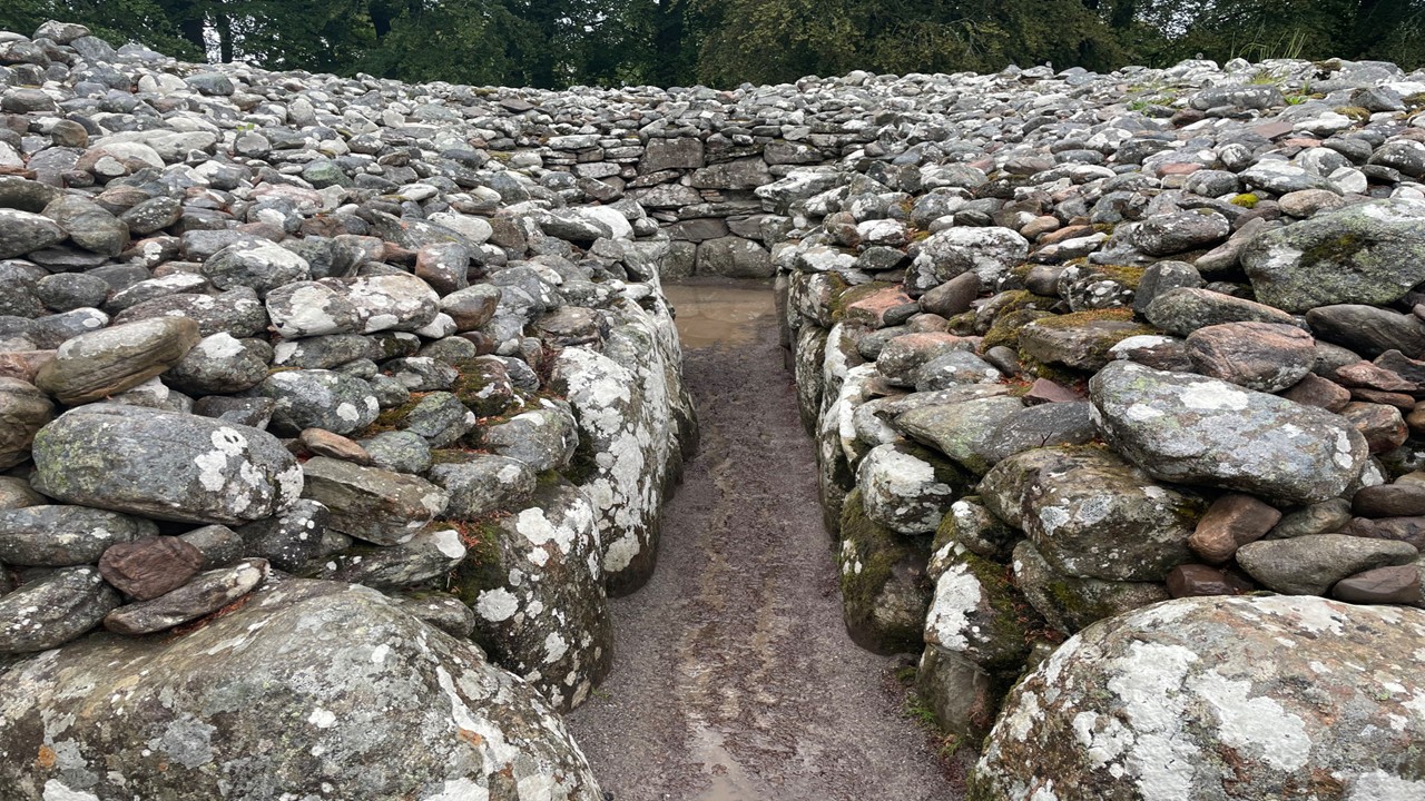
Near Inverness, we took a small country road to find the Clava Cairn stones near Cawdor Castle. The ancient Clava Cairns — Bronze Age burial sites — connect visitors to Scotland’s prehistoric past. Their standing stones and ring cairns have endured for over 4,000 years.
One of the Clava cairns Burial Circles near Cawder Castle
Then we drove north to the ocean beach at Nairn, which was once a Victorian seaside resort, offering a peaceful coastal evening. We walked the coast to a beachside restaurant for drinks & nibbles and then spent the night in Nairn at the Bandstand Hotel which offered a wonderful view of the beach and had dinner at their pub.
Day 5 —Into Speyside: MacCallan, Cardhu, and the River That Built Whisky
The next morning, we traveled south and crossed deeper into the Cairngorms, pausing at the Tomintoul viewpoint where sweeping Highland panoramas stretch toward Speyside. Speyside’s identity is inseparable from the River Spey. Its clean, fast-flowing, mineral-rich waters and nearby barley fields made the region ideal for distilling and the natural cradle of Scotch production.. By the 19th century, Speyside had become the epicenter of Scotch whisky.
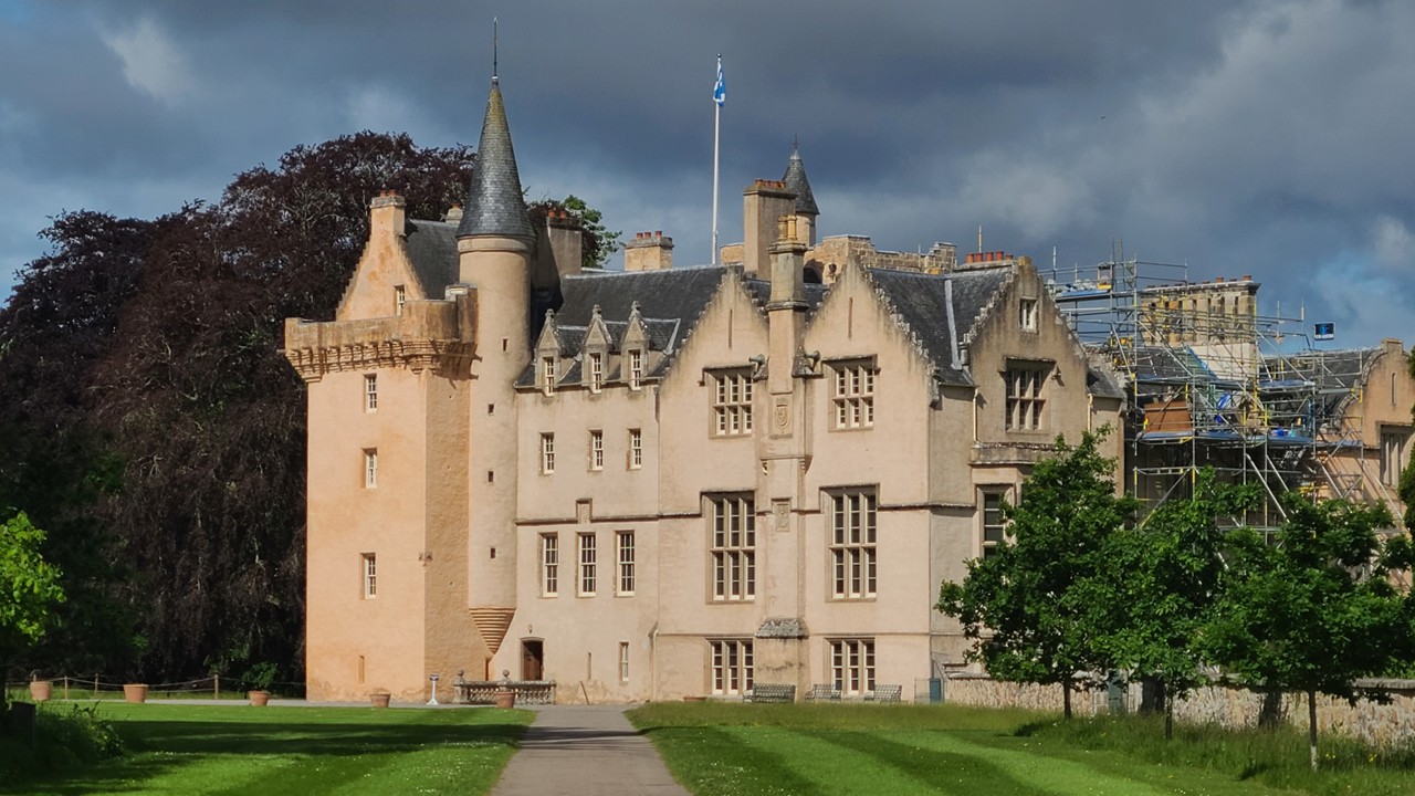
Nearby is located Brodie Castle, with its warm stone and turreted silhouette, it reflects centuries of clan history and architectural evolution. Its grounds blend formal gardens with whimsical modern touches. While there we took a tour of the castle, walked the grounds, and visited The Play Garden (for lunch) that has a Massive white rabbit and play areas for children.
Brodie Castle
From here, we chose two distilleries that capture Speyside’s range. First we briefly visited MacCallan – a massive complex befitting of their well known brand. However, we next visited Cardhu – a less well known distillery, but one of significant historical and present day importance.
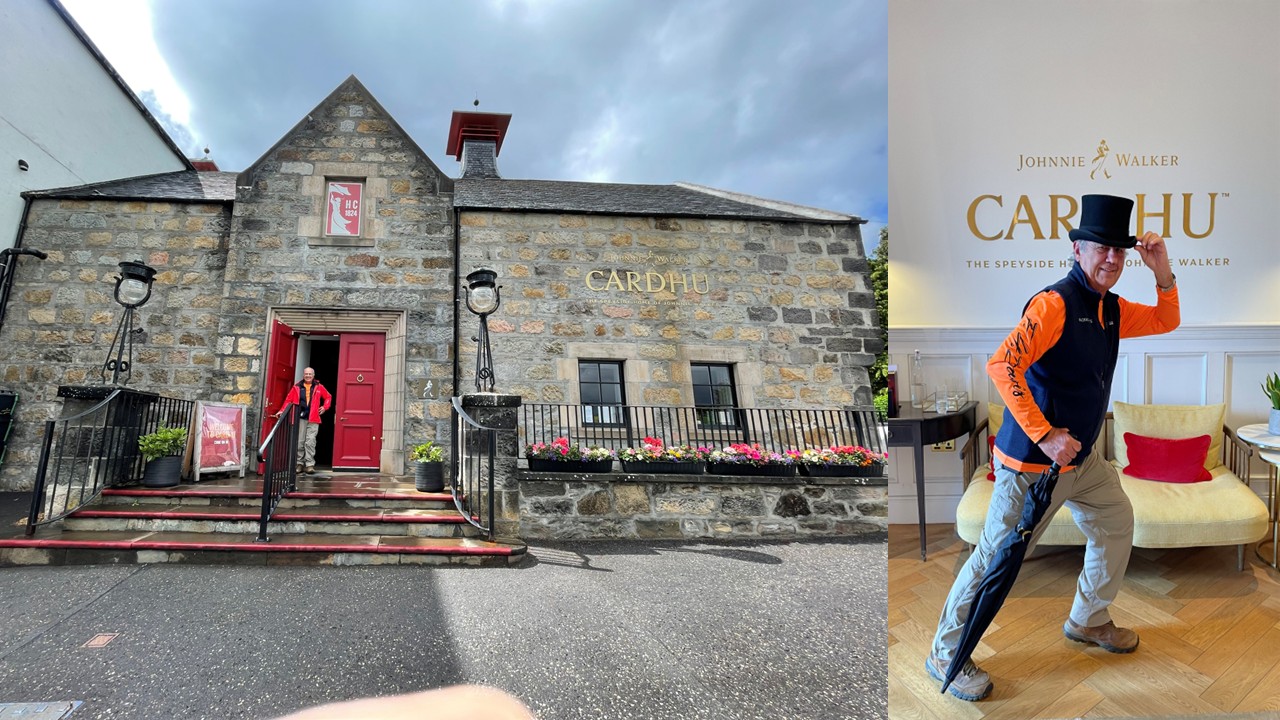
From the rolling fields above the River Spey, our route carried us to Cardhu, a distillery that at first glance seems modest compared to its more famous neighbors. Yet Cardhu’s quiet presence belies a history that is unusually influential—one shaped not by industrial barons or merchant families, but by the remarkable leadership of two women whose decisions helped define modern Scotch whisky.
Cardhu began not as a commercial enterprise but as a farmhouse operation run by Helen Cumming, who distilled spirit long before the Excise Act made such work legal. The stories of her ingenuity still circulate in Speyside: Helen spotting excise officers from the kitchen window, throwing flour on her apron to appear mid‑baking, serving the officials tea while discreetly raising a red flag to warn nearby illicit distillers. When the law changed in 1823, she stepped forward and registered Cardhu as a legal distillery—one of the very first in the region. In an era when women rarely appeared in business records, Helen’s name and handwriting fill the early ledgers.
Her legacy did not fade with time. In 1872, Elizabeth Cumming, Helen’s daughter‑in‑law, assumed control and transformed Cardhu from a farm still into a modern Speyside producer. She rebuilt the distillery on higher ground, tripled its capacity, and—most famously—sold the old stills to a young William Grant, who used them to launch Glenfiddich. Elizabeth also insisted that Cardhu be bottled and sold as a single malt, making it one of the earliest Speyside whiskies available directly to consumers. Her stewardship was firm, strategic, and ahead of its time.
Cardhu’s next chapter began in 1893, when Elizabeth agreed to sell the distillery to John Walker & Sons. Her condition was unusual: the Cumming family would continue running it. The Walkers agreed, and Cardhu became the signature malt in the emerging Johnnie Walker blends. Its light, honeyed, orchard‑fruit character proved essential to the consistency and elegance of Black Label, and it remains a core component of the Walker flavor profile today. In this way, the quiet distillery on the hill helped shape one of the world’s most recognizable spirits.
Walking through Cardhu today, that layered history feels present. The tasting rooms are warm and understated, filled with displays that honor Helen and Elizabeth’s leadership. Outside, the breeze carries the scent of barley and the faint sweetness of the washbacks. Inside, the copper stills gleam with the same gentle curves that have defined Cardhu’s spirit for generations. It is not a distillery that shouts for attention; instead, it rewards those who seek out its story.
The Cardhu Distillery providing the base if Johnny Walker Whisky
For us, Cardhu became one of the most memorable stops of the journey—not because of scale or spectacle, but because of the sense of continuity. Here, in a place shaped by two determined women, the traditions of Speyside feel both intimate and enduring. Cardhu may be less well known than some of its neighbors, but its influence runs deep, and its charm is unmistakable.
That evening, we stayed in Speyside at the Cardhu Country House – a former Church pastor residence. While there, we visited the town of Speyside for some local Chinese Take-out and then met fellow travelers in the Country House drawing room for an evening of scotch sipping.
Day 6 — Speyside to Royal Deeside: Corgarff Castle and Balmoral Country
The next morning, it was a quick drive to Glenlivet, founded in 1824, and another of the first distilleries to obtain a legal license after the Excise Act. Its valley setting is dramatic, and its history is tied to the end of the illicit distilling era.
After Glenlivet’s, we stopped in the village of Tomintoul to see the local shops, including the “Whiskey Castle.” Tomintoul, one of the highest villages in the Highlands, has long served travelers crossing remote mountain passes. Its shops reflect the region’s whisky culture and Highland traditions.
Leaving Speyside, we traveled the Lecht Road, one of Scotland’s most scenic mountain drives. The road passes near Corgarff Castle — a lonely white fortress with a turbulent past. Once tied to clan feuds and Jacobite conflict, it later became a government barracks. Its star-shaped perimeter walls, added during its military era, remain one of the most distinctive defensive designs in Scotland.
Royal Deeside carries the imprint of Queen Victoria, whose affection for the Highlands helped define the Victorian romantic vision of Scotland. The landscape around Balmoral still feels touched by that era—quiet pine forests, wide glens, and the reflective stillness of Loch Muick, a glacial basin whose calm surface mirrors the muted grandeur of the royal estate. Walking along its shoreline, we felt the same solitude and clarity that drew Victoria and Albert to this part of Scotland nearly two centuries ago.
From there we continued to Royal Lochnagar Distillery, a small but storied producer tucked just above the River Dee. Founded in 1845 by John Begg, the distillery’s fortunes changed dramatically in 1848, when Begg invited Queen Victoria, Prince Albert, and their entourage to visit. The royal party arrived unannounced the next day, toured the stillhouse, and—according to local accounts—enjoyed a dram of the new spirit. Impressed, Victoria granted Lochnagar a Royal Warrant, a distinction that instantly elevated the distillery’s reputation and tied its identity to the monarchy.
That royal connection remains central to Lochnagar’s character even today. The distillery continued supplying whisky to Balmoral Castle for decades, and its spirit was used in commemorative bottling for royal events throughout the 20th century. Inside the visitor center, displays trace this lineage: early warrant documents, Victorian-era equipment, and photographs of the distillery’s role in royal celebrations. Despite its modest scale, Royal Lochnagar stands as one of the few distilleries in Scotland whose history is inseparable from the Crown.
Visiting felt like stepping into a preserved chapter of Highland heritage—an intimate distillery shaped not by industrial expansion, but by proximity to the royal family and the traditions of Deeside. It was a fitting complement to the quiet majesty of Loch Muick and the enduring presence of Balmoral in the surrounding hills.
That evening, we stayed nearby in the town of Ballater at the Hotel Balmoral Arms. That evening we had dinner nearby at the very busy Balmoral Pub.
Day 7— Royal Deeside to Aberdeen: Balmoral Castle & Crathes Castle
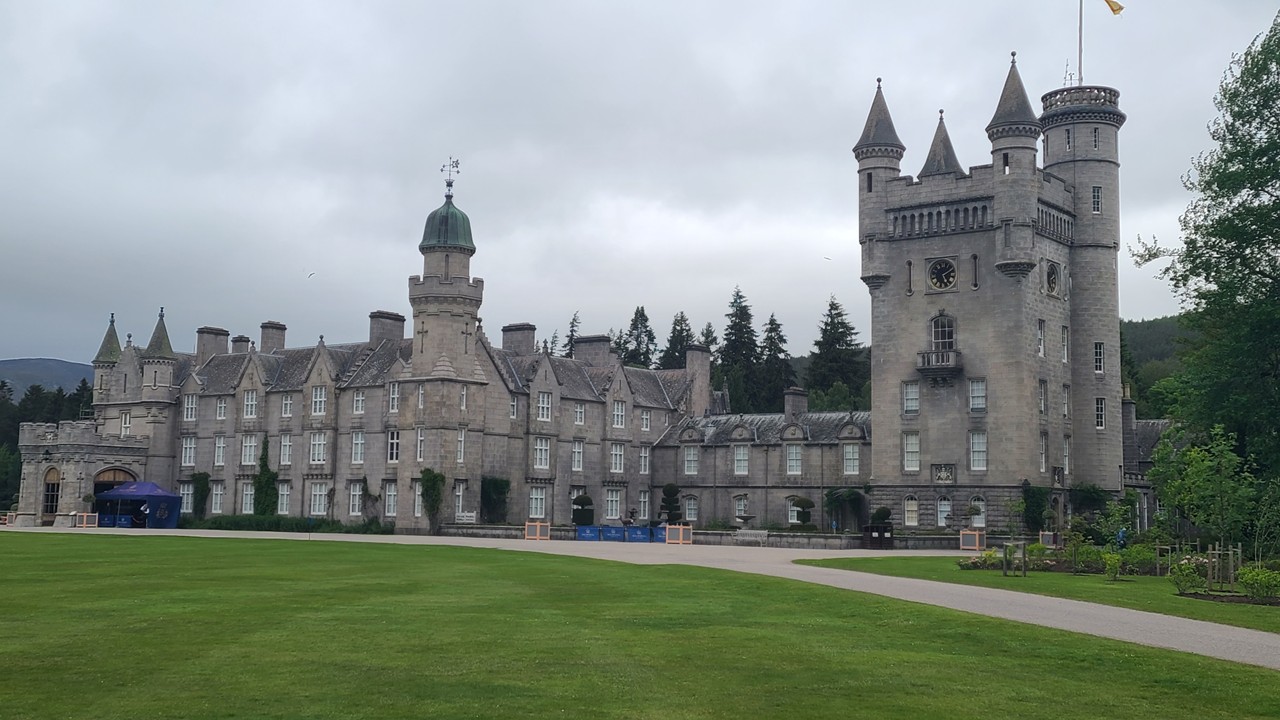
Royal Deeside carries a different tone: pine forests, rivers, and the cultural weight of the Balmoral Estate, purchased by Victoria and Albert in 1852, it is a masterpiece of Scots Baronial architecture — turrets, battlements, crow-stepped gables, and steep slate roofs. Its ornate gates, decorated with royal initials and commemorative dates, mark transitions between monarchs and celebrate the estate’s long royal lineage. The estate helped shape Victorian romanticism about the Highlands, influencing art, literature, and tourism. We walked the gardens and visited the display in the Castle Ballroom.
The Royal Balmoral Estate
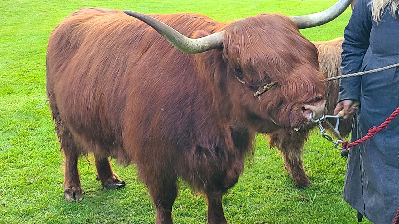
Crathes Castle, with its painted ceilings and ancient yew hedges, embodies centuries of Scottish domestic architecture. The surrounding farmland is home to Highland cattle, “Hairy Coos”, whose shaggy coats and sweeping horns have become symbols of rural Scotland.
A Hairy Coo – the Shaggy Cows Suited to the Cold
And then it was on to Aberdeen — the Granite City — which welcomed us with medieval lanes, riverside paths, and maritime heritage shaped by centuries of North Sea trade. Its grand civic buildings, carved from locally quarried stone, shimmer silver in sunlight. Since Rocky would be attending a conference there, we settled in early for a stay lasting for nearly a week. While the conference would fill our days with geophysics, colleagues, and international discussions, evenings would give us time to explore Old Aberdeen’s medieval streets, riverside paths, and the city’s maritime heritage
Dunnottar’s Clifftop Drama and the Granite City
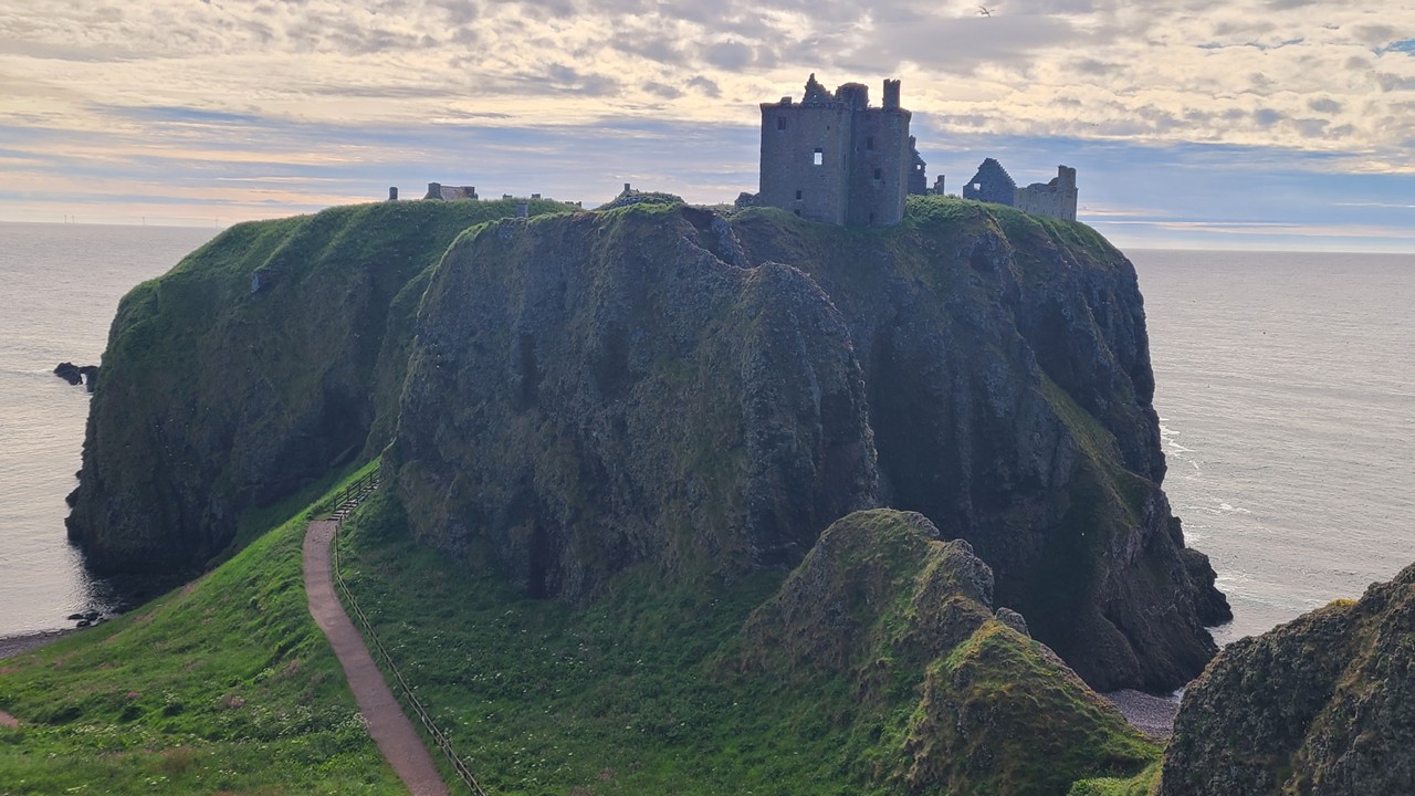
The next morning was pre-conference, so we traveled north to explore Dunnottar Castle. Perched on a sheer cliff above the North Sea, it is one of Scotland’s most dramatic ruins. Its windswept towers and stone halls have witnessed royal refuge, siege, and the hiding of the Scottish Crown Jewels from Cromwell’s forces in the 1650s — a story that gives the site an almost mythic aura.
Dunnottar Castle Perched in Shear Cliffs
Next, we traveled to Stonehaven Harbour – a quiet seaside pause before returning to Aberdeen’s granite architecture, where spires, turrets, and clock towers rise above bustling streets — a blend of medieval roots and Victorian ambition.
Day 9& 10 – Explore Aberdeen
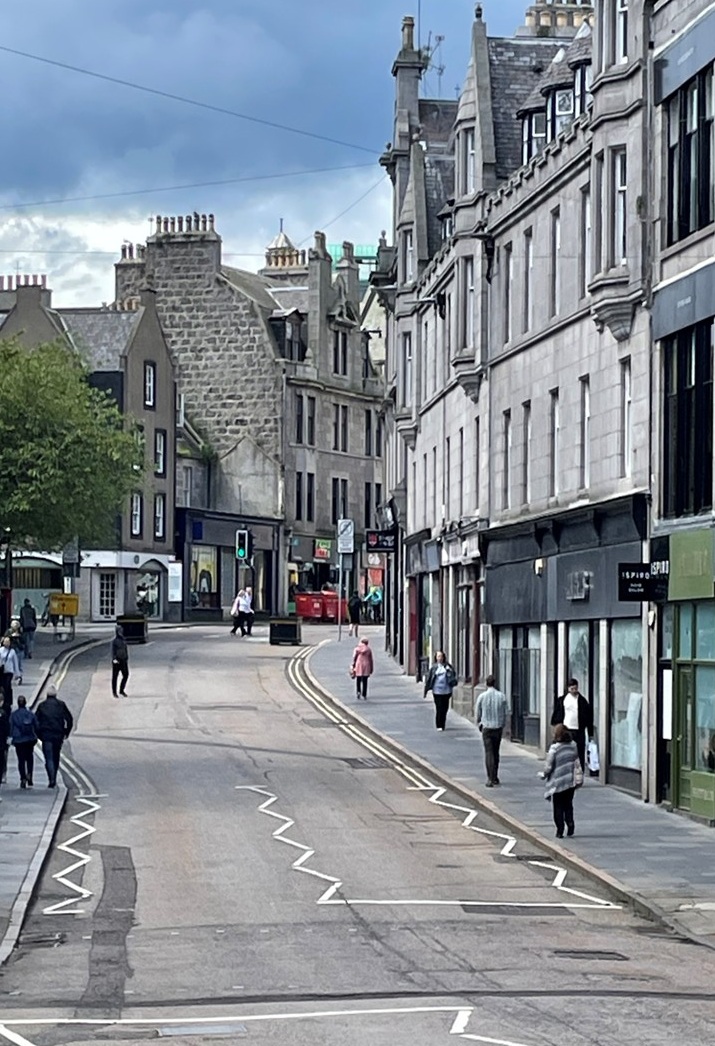
Aberdeen’s streets blend medieval foundations with Victorian expansion. Marischal College, one of the largest granite buildings in the world, reflects civic pride and architectural ambition.
Union Street and Castlegate trace the city’s growth from medieval burgh to modern port. The Maritime Museum highlights Aberdeen’s centuries-long relationship with the North Sea, from fishing to the rise of offshore energy.
A Typical Street View the Granite City of Aberdeen
Footdee (Fittie), a quirky 19th century fishing village, preserves the charm of tightly packed cottages and communal courtyards — a living reminder of Aberdeen’s maritime roots.
Day 11 — Aberdeenshire Coast: Sea Cliffs, Harbours, Wildlife, and a Final Dram
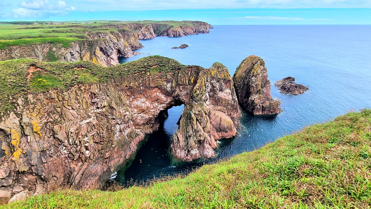
Our final day was a coastal wander. The Aberdeenshire coast is shaped by wind, waves, and dramatic geology. We drove north to Cruden Bay and the Bullers of Buchan – a spectacular collapsed sea cave that drops 30 meters down, connecting to the North Sea and forming a natural amphitheater. We walked bits of the coastal footpath encountering herds of sheep and enjoying the cliffside views.
A View Down the Aberdeenshire Coast
Nearby, the historic fishing community of Port Erroll tells a story stretching back to the 1600s. Once home to dozens of boats and generations of fishermen, the harbor’s fortunes rose and fell with the herring trade, steam-era fishing, and later economic shifts. Today, heritage groups work to preserve its legacy as the sea continues to reshape the coastline.
Along the coast, Balmedie Beach stretches for miles, its dunes shaped by shifting winds and home to seals resting along the shore. The area’s wildlife — seabirds, marine mammals, and coastal flora — thrives in this meeting place of land and sea. We walked along the dunes taking pictures of seals and puffins, and then drove north to Slains Castle, a ruin said to have inspired Bram Stoker’s Dracula after he visited there in the 1890s. Slains Castle, perched high above the waves, offers dramatic clifftop ruins and windswept corridors make it easy to imagine Victorian writers finding gothic inspiration there.
For a final whisky flourish, we visited Glen Garioch, founded in 1797 and one of Scotland’s oldest distilleries. It was a fitting closing note — a blend of sea air, history, and one last dram. It seamlessly blended Highland tradition with maritime influence.
Reflections on the Road
This journey wasn’t just about whisky — though each tasting carried its own story. It was about landscapes that feel ancient, castles that hold centuries of memory, coastal villages shaped by generations of fishermen, and wildlife thriving along windswept shores. Our extended stay in Aberdeen added a professional dimension, tying SEG’s presence at the EAGE Annual Meeting to Scotland’s broader heritage of science, engineering, and exploration.
Driving from Edinburgh to Aberdeen over a week gave us time to savor each region. The pace was gentle, the scenery unforgettable, and the shared experience — with just the two of us — made it a trip we’ll remember for years. Early June in Scotland has a personality: generous, luminous, and steeped in history. We felt that generosity every day.
As we made our way south from a wonderful Christmas with family in northern Virginia, we decided to stretch our legs—and our spirits—at Congaree National Park. It felt like the perfect pause between holiday gatherings and the long road home to Florida.
Congaree National Park
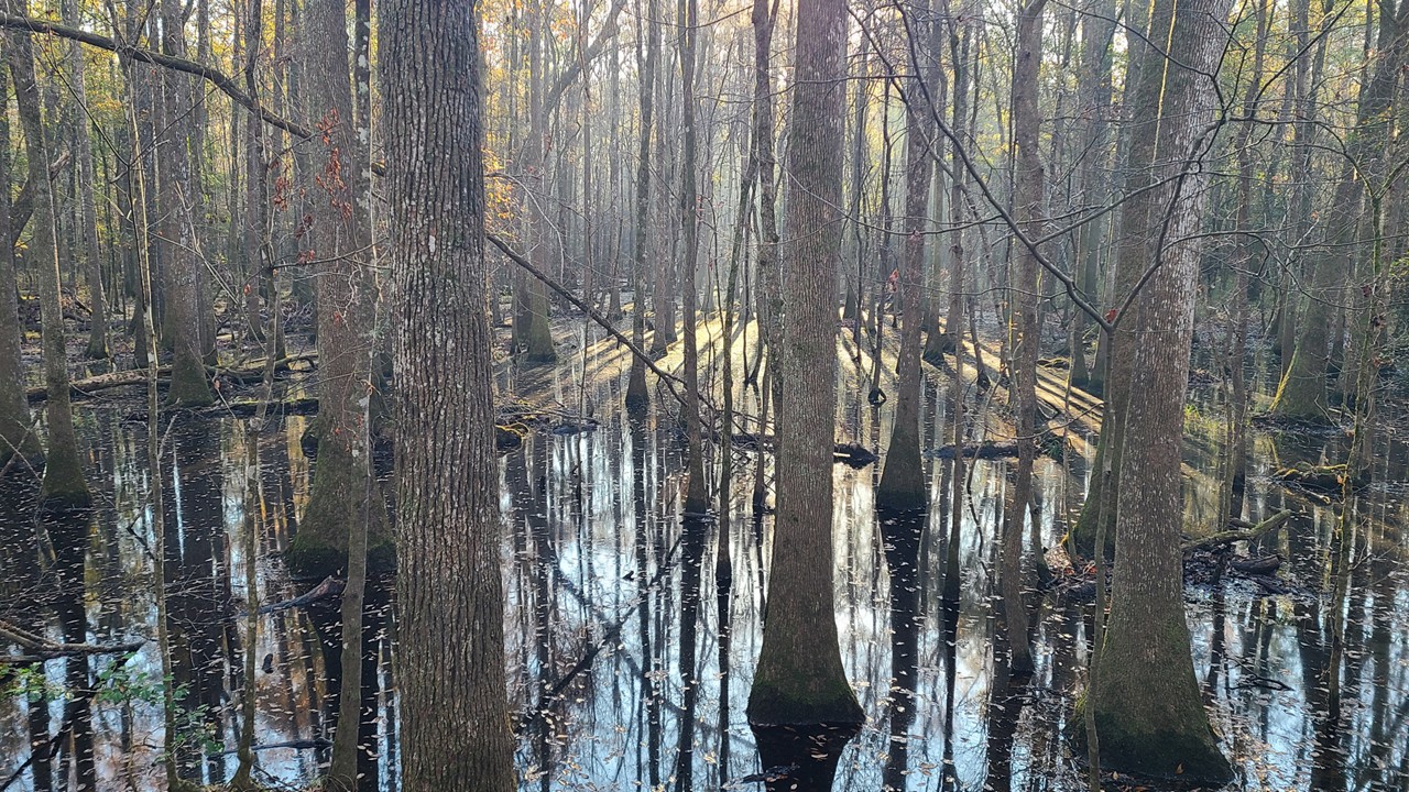
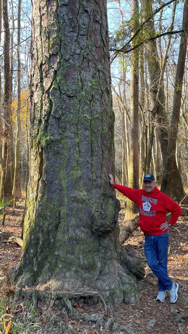
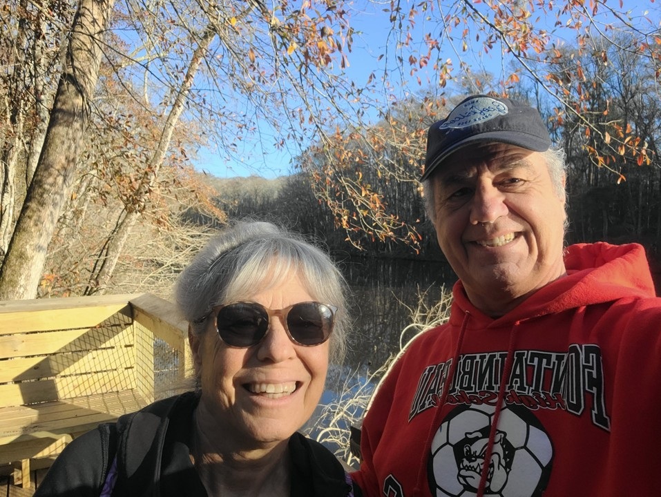
At Congaree, we started on the upper section of the Boardwalk Loop, following its gentle rise through the quiet winter forest toward Weston Lake. The air was cool and still, and the towering Loblolly Pines along the route stood like an old friends welcoming us back. From there, we left the boardwalk and wandered a forest trail that carried us beneath a canopy so tall it felt like a vaulted ceiling of living wood. Eventually, the path led us back to the Visitor Center, where the warmth of the building contrasted beautifully with the wildness outside.
Rocky with Old Loblolly Pine
The lower boardwalk was closed for reconstruction—no surprise, since Congaree floods about ten times a year. When the river swells, the entire lower section disappears underwater. The new design will raise the walkway above historic flood levels, a thoughtful adaptation to a landscape that has always been shaped by water. Flooding isn’t an inconvenience here; it’s part of the park’s rhythm, the force that feeds the soil and sustains this extraordinary forest.
Morning Hike in Congaree
Even in winter, Congaree feels alive. We didn’t see fox squirrels this time, but knowing they roam these woods—bigger, bolder, and more colorful than their gray cousins—always makes us smile. And we couldn’t help thinking about the synchronous fireflies that light up the forest in summer, turning these same trees into a shimmering galaxy.
What makes Congaree truly unforgettable, though, is its scale. This 22,000‑acre park protects the largest remaining tract of old‑growth bottomland hardwood forest in the United States. It holds more record‑breaking trees than anywhere else in the country. Nowhere in eastern North America will you find a larger unbroken expanse of giants reaching 130 to over 160 feet into the sky. These broadleaf forests are among the tallest of their kind on Earth—taller than old‑growth stands in Japan, the Himalayas, and nearly all of Europe, and rivaling the great temperate forests of South America.
Thousands of Congaree’s giants still haven’t been formally measured. They simply stand, century after century, quietly keeping their own counsel.
Walking here together felt like stepping into a living time capsule—a place that endures, flood after flood, season after season. As we continued our journey back to Florida, we carried with us that sense of calm, that reminder of how rare and resilient this forest truly is.
Sesquicentennial State Park
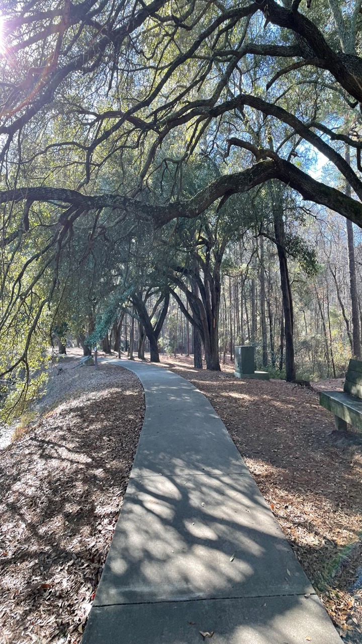
From Congaree, we drove on to Sesquicentennial State Park—“Sesqui” to the locals—a place we’d heard about but never explored. It turned out to be one of those unexpected gems that make road trips feel like small adventures stitched together.
Sesquicentennial Park
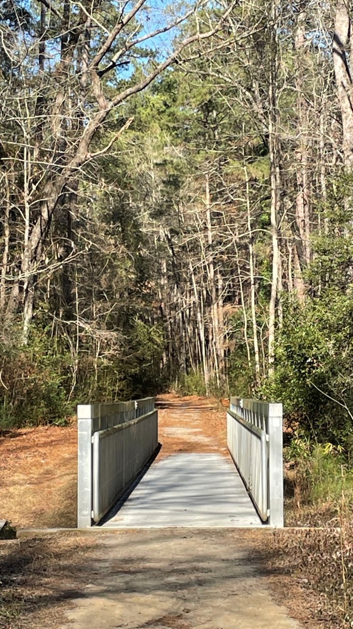
Our main goal was to see the FEMA bridge, a sleek 100‑foot aluminum span tucked deep in the woods. It was built after the devastating 2015 floods wiped out the old bridge over Jackson Creek, and knowing that history gave the hike a sense of purpose. But Sesqui had more stories waiting for us.
The FEMA Aluminum Bridge
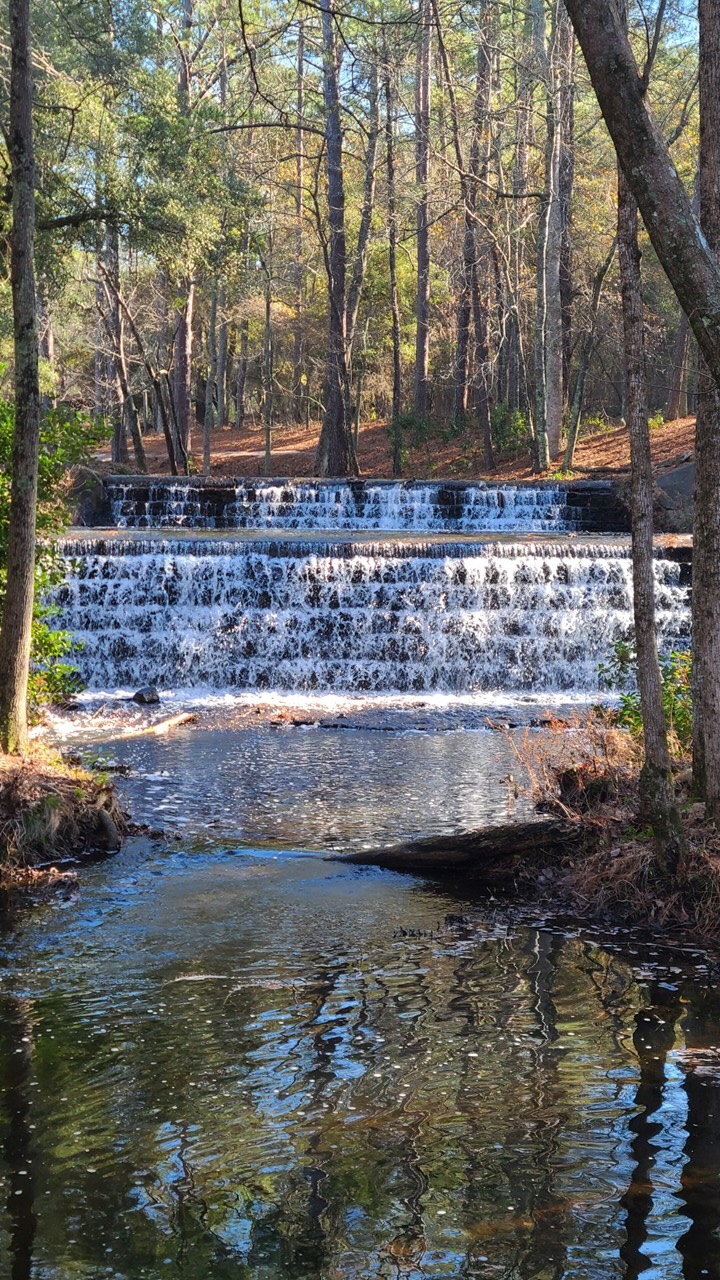
The moment we stepped out of the car, we realized we’d wandered into a living chapter of 1930s history. The entire 1,400‑acre park was shaped by the Civilian Conservation Corps, one of those New Deal programs that left a quiet but lasting legacy across the country. Here, the CCC built a man‑made lake, carved trails through the Sandhills, and engineered a beautiful stepped spillway that still sends water cascading from the lake into Jackson Creek. Standing there, watching the water tumble down the stonework, it was easy to imagine the young men who built it—many far from home, earning a dollar a day, shaping a park that would outlast them by generations.
CCC Weirs on Jackson Creek
We set off on the Sandhills Hiking Trail, winding through longleaf pines and sandy soil that felt worlds away from the flooded forests of Congaree. The trail linked seamlessly into the Jackson Creek Nature Trail, where the sound of running water grew louder with each step. From there, we followed the Loop Trail deeper into the woods until the aluminum bridge appeared—bright, modern, and almost futuristic against the backdrop of old forest and CCC craftsmanship.
Crossing it felt symbolic in a small way: a bridge built from necessity, resilience, and adaptation, standing in a park born from hard work during another difficult era. We paused in the middle, listening to Jackson Creek rushing below, grateful for the quiet and for the chance to share these places together on our slow journey back to Florida.
It was one of those stops that wasn’t planned as a highlight but became one anyway—the kind of discovery that makes the road feel a little wider and the trip feel a little richer.
Charleston
From Sesqui, we continued our drive toward Charleston, watching the landscape slowly shift from pine forests to marsh‑lined low country as we approached the coast. By the time we reached downtown, the late‑day light was settling beautifully over the historic district. We parked in the College of Charleston campus garage—an easy jumping‑off point—and set out on foot to explore this renown Southern city.
King Street greeted us with its usual energy. Even after the holidays, it felt festive, lined with high‑end boutiques, familiar national shops, and the kind of local storefronts that make you slow down and peek inside. Walking there felt like slipping into a blend of old Charleston charm and modern bustle, characteristics of old southern-style magic.
We followed King Street down to Market Street and wandered through the North, Central, and South Markets—rows of open‑air stalls that reminded us of the French Market back home in New Orleans. Sweetgrass basket weavers, local artisans, food vendors, and tourists all mingled under the long, breezy sheds. It’s one of those places where you can feel the layers of Charleston’s history in the air, from the city’s earliest trading days to the vibrant cultural crossroads it is now.
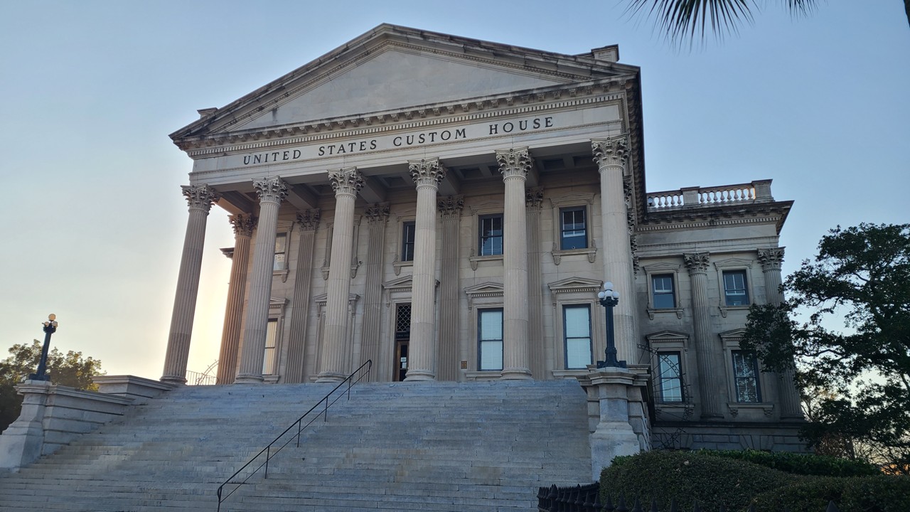
US Customs House in Charleston
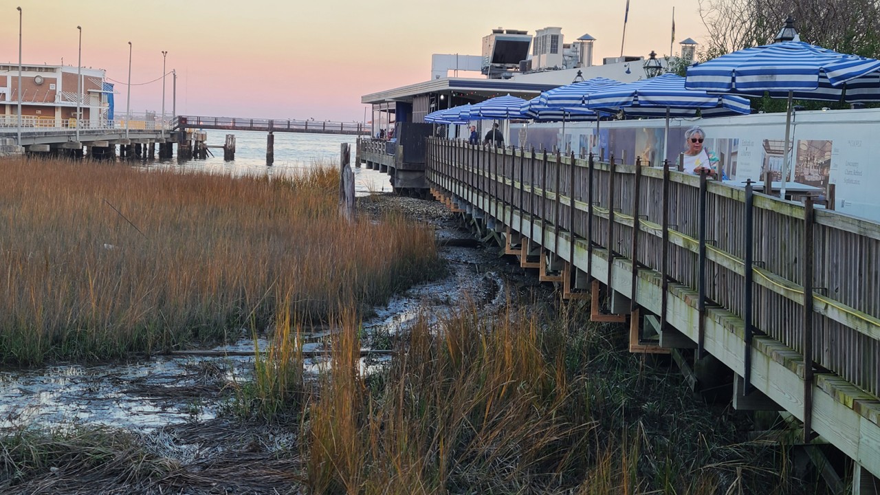
From the markets, we continued toward the waterfront until the grand white columns of the U.S. Customs House came into view, standing proudly above the harbor. Just beyond it was our destination for the evening: Fleet Landing, a waterfront bar and restaurant perched right over the water.
Walkway to Fleet’s Landing Bar & Restaurant
Instead of a full dinner, we decided to make a meal out of appetizers—something we love doing when a place has dishes too interesting to pass up. We shared the Fried Green Tomato Stack, layered with crab salad in a way that felt both indulgent and perfectly coastal. Then came the Stuffed Hush Puppies: oversized, golden, and filled with shrimp in a lemon meunière sauce, topped with crab and crispy sweet onion strips. These were unlike anything we’d ever had—rich, bright, and absolutely delicious. One of those dishes that makes you look at each other mid‑bite because you know you’ve stumbled onto something special.
It’s no wonder people say ithat the Stuffed Hush Puppies there are one of the “50 things you should do in Charleston.” Sitting there together, watching the harbor shift from daylight to evening while sharing plates that tasted like the Lowcountry itself, it felt like the perfect way to end the day before continuing our journey south.
Sunday, 12/28
Folly Beaches
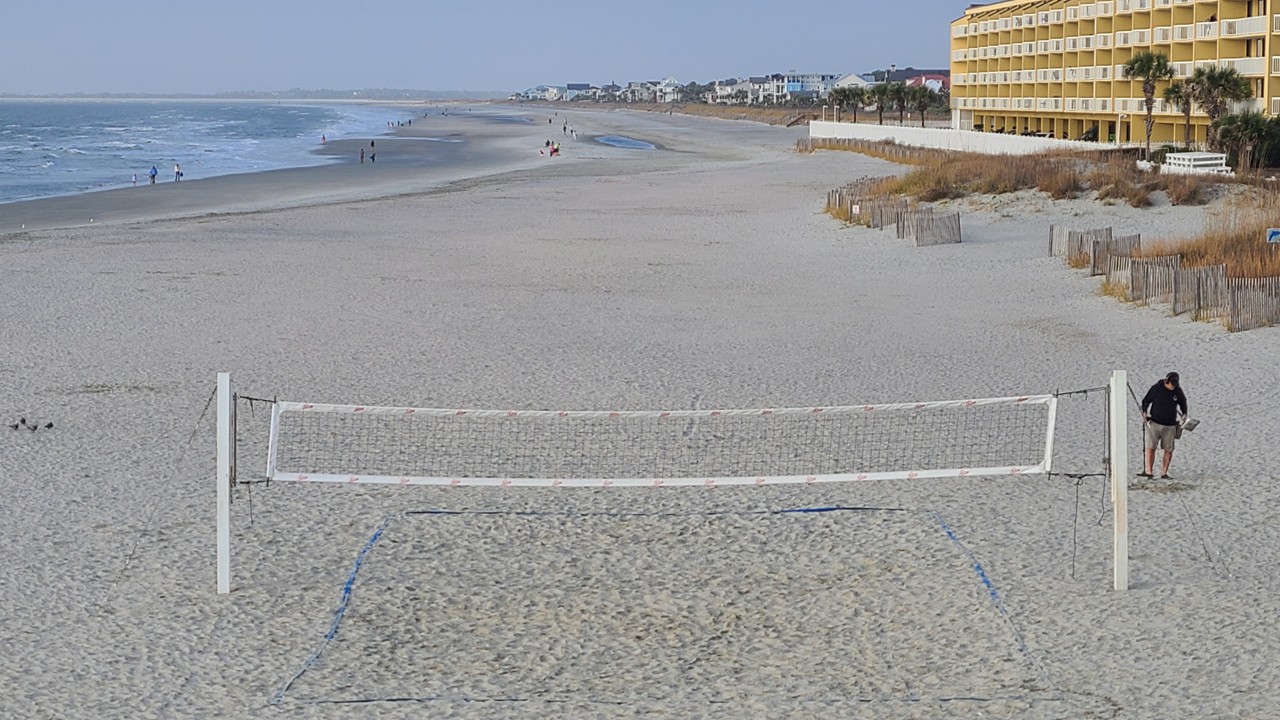
We left Charleston that morning and drove through the lowlands toward Folly Beach, watching the marsh grasses ripple in the winter breeze. Folly always calls itself “the edge of America,” and standing on the pier, it really did feel that way. The county‑run fishing and sightseeing pier stretches an impressive 1,049 feet into the Atlantic—25 feet wide, 26 feet above the water, and long enough that the shoreline slowly fades behind you as you walk.
View from the Folly Beach Pier
Out at the end, the ocean was alive. We watched porpoises glide just beyond the breakers, fish leaping in quick silver flashes, and fishermen lined along the railings with the easy patience of people who know the tides better than clocks. A few folks wandered the beach with metal detectors, sweeping the sand for lost treasures, while others stood at the railing with us capturing panoramic photos of the horizon. There was something peaceful about it — everyone doing their own thing, all drawn to the same stretch of ocean.
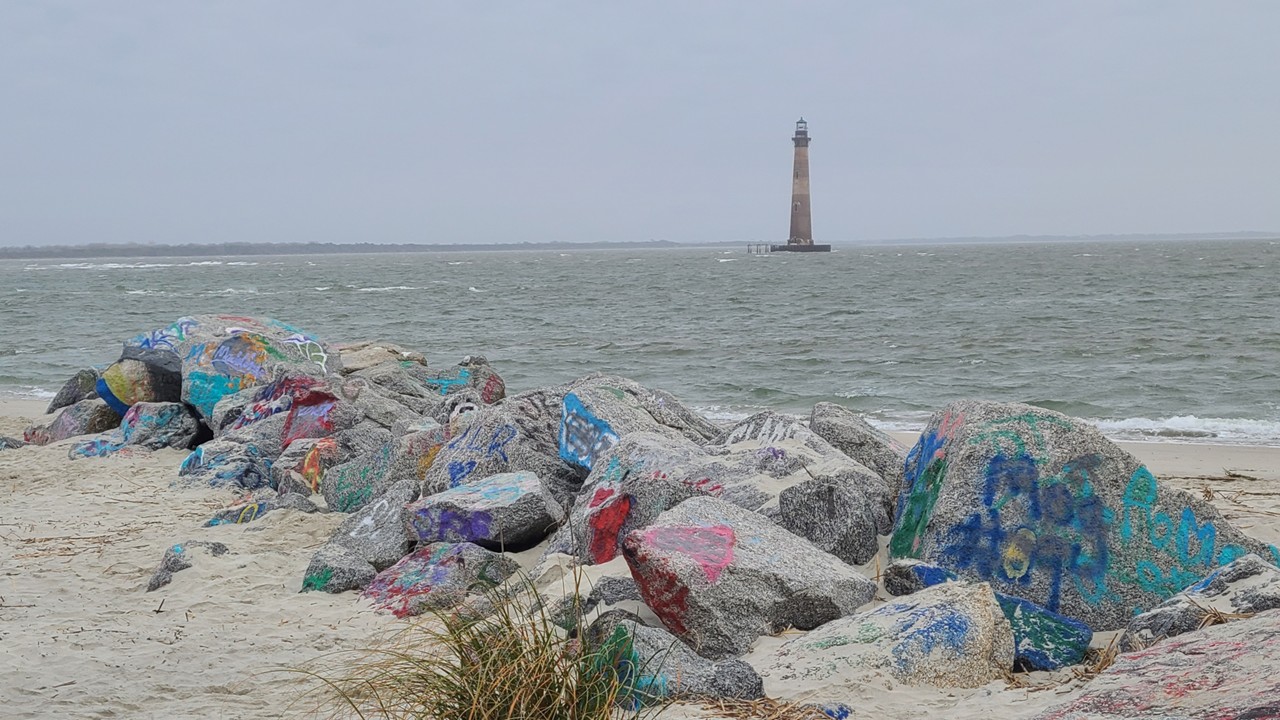
From there, we drove up Ashley Road to the county park overlooking the Morris Island Lighthouse. A leisurely half mile walk along a closed and graffiti decorated road led us to the remote beach. Once there, seeing the lighthouse standing alone in the water felt almost surreal. Built in 1876, automated in 1938, and decommissioned in 1962, the lighthouse now rises 161 feet above the waves—the tallest in South Carolina. Time and erosion have pushed the shoreline back, leaving the tower marooned offshore, a solitary sentinel still holding its place in history. We lingered there for a while, imagining the keepers who once climbed its spiral stairs.
The Morris Island Lighthouse
We returned to the car and continued the opposite direction to the southern tip of Folly Island, passing neighborhoods with a mix of architectural styles—classic beach cottages, modern coastal homes, and everything in between. Each seemed to tell its own story about storms weathered and summers enjoyed.
Kiawah Island
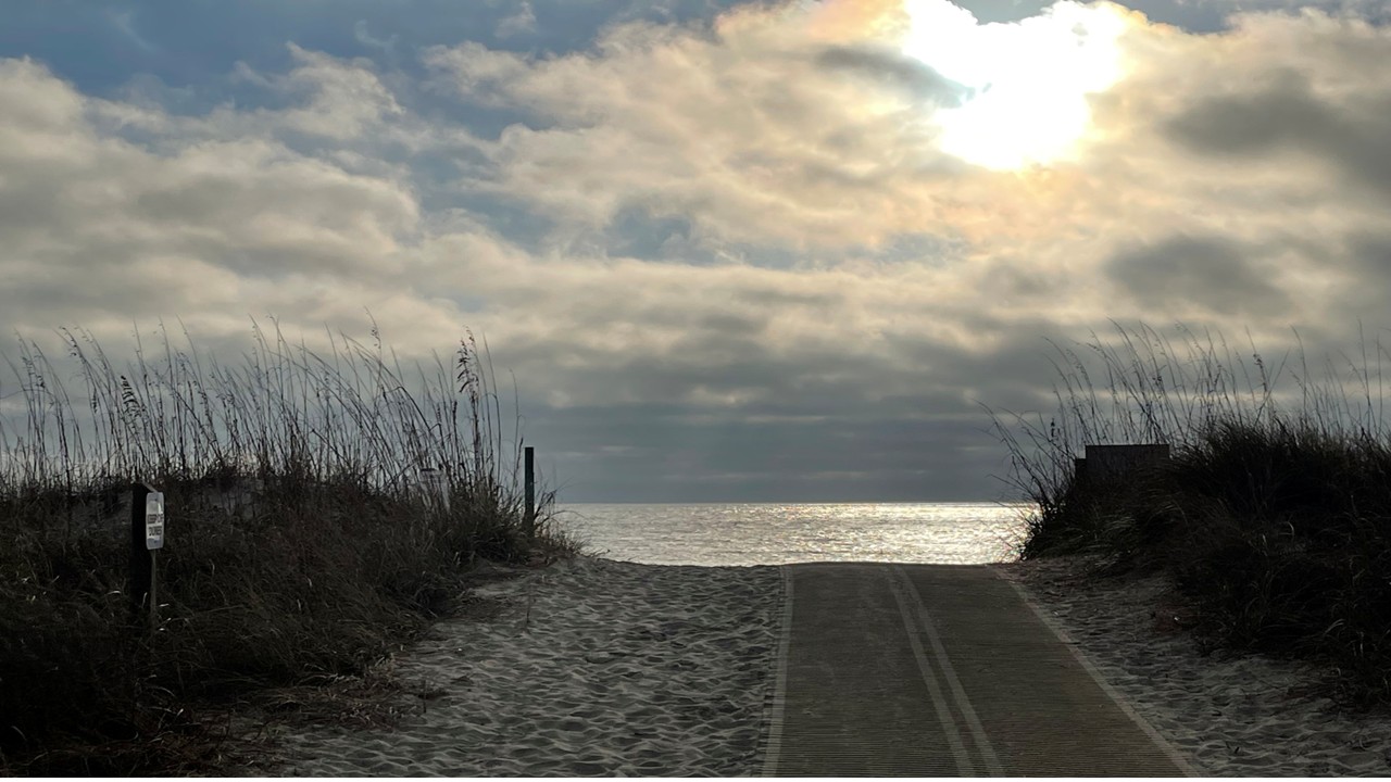
From Folly, we drove through the quiet beauty of the low country toward Kiawah Island. Our destination was Kiawah Beachwalker Park—the only public access point on an island otherwise privately held. The park’s long boardwalk carried us over the dunes, carefully designed to protect the fragile habitat beneath. Out on the beach, the world felt wide and open.
Kiawah is known for its dune‑nesting birds—oystercatchers, plovers, terns—and even in winter, the shoreline felt like a sanctuary. But what fascinated us most was the thought of the Atlantic bottlenose dolphins that strand‑feed here. For fifty years, these dolphins have been working together to herd fish onto sandbars and mudbanks, launching themselves partly out of the water to feed. We didn’t catch them in the act this time, but just knowing this rare behavior happens here made the place feel even more special.
After soaking in the views, we continued our drive south toward Hilton Head, the late‑afternoon light settling softly over the marshes. It was one of those days that felt full but unhurried—each stop offering its own small wonder as we made our way closer to home.
Monday, 12/29
Hilton Head
The next morning, we woke to a cool, quiet Hilton Head morning and decided to spend the day exploring the island’s beaches and preserves before continuing home to Florida the next day. There’s something about Hilton Head in winter—calm, unhurried, and spacious—that makes it perfect for wandering.
Our first stop was Folly Field Beach Park, mid‑island on the Atlantic. Low tide had pulled the water far back, revealing a beach that felt impossibly wide and flat—one of the broadest stretches of sand on Hilton Head. Only a handful of people were out walking their dogs, leaving long footprints in the damp sand. The condos and apartments sat well behind the dunes, giving the shoreline a peaceful, open feel. It was the kind of beach where you breathe a little deeper without even realizing it.
Sunrise at Folly Field Beach in Hilton Head
Just a short drive away—barely three‑tenths of a mile—was Burkes Beach, tucked beside a large community park. To reach the sand, we crossed a small swampy area dotted with oysters and watched cormorants drying their wings on exposed branches. The beach itself was even quieter than Folly Field, known for its calm waters and wide, flat shoreline. No shells here, just smooth sand stretching toward the horizon. Again, the homes were set far back from the dunes, giving the whole place a sense of space and respect for the landscape.
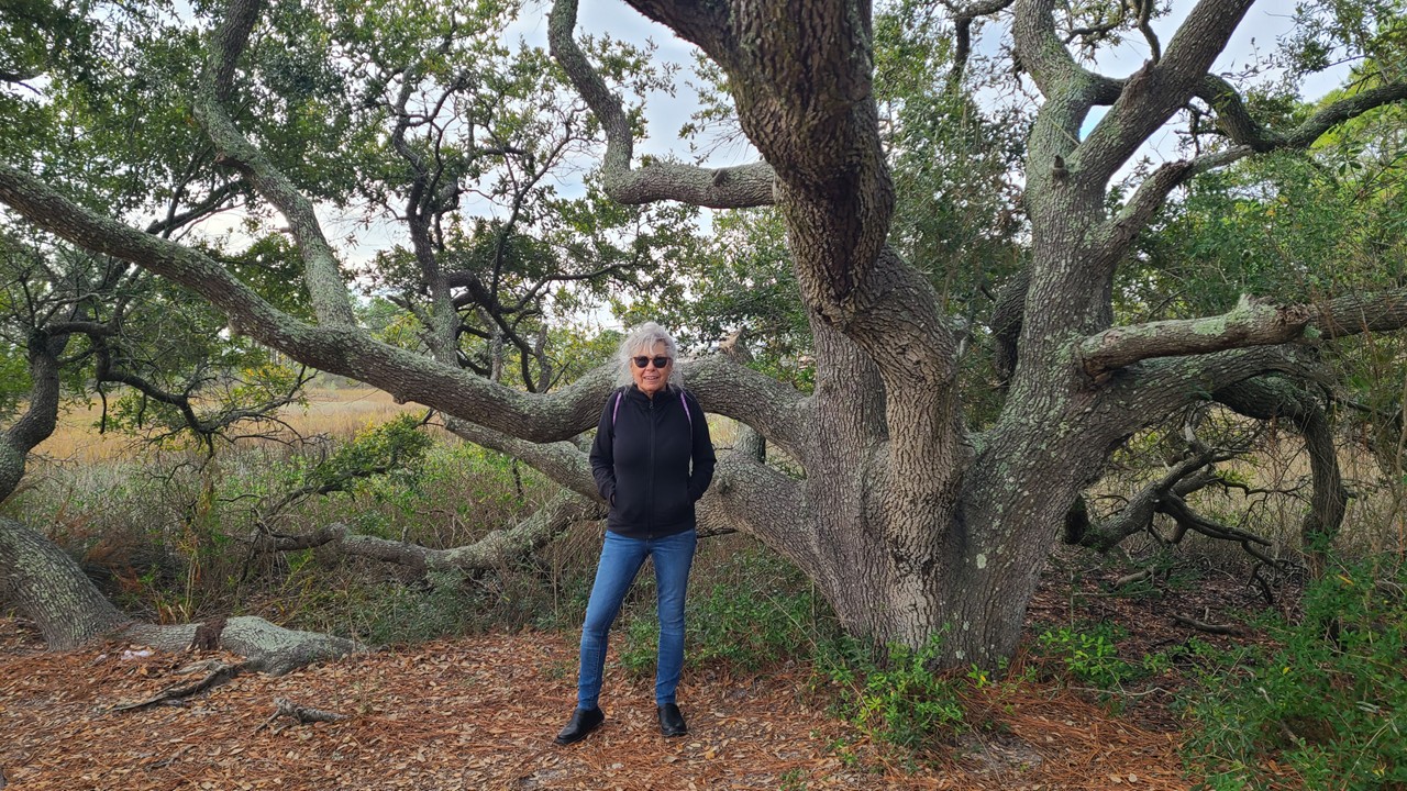
Julie under an Oak at Burkes Beach in Hilton Head
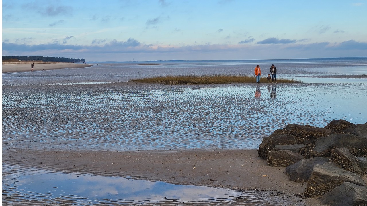
From there we headed about five miles north to Fish Haul Beach, near Port Royal Sound. Low tide had transformed the shoreline into a vast expanse of mudflats and rocky patches where mussels clung in clusters. With waders, you could walk far out across the flats, and we watched locals setting up chairs and little play areas for their kids, turning the exposed landscape into an impromptu playground. It felt like a different world from the Atlantic-facing beaches—quieter, more elemental.
Low Tide at Fish Haul Beach in Hilton Head
After exploring the shoreline, we drove inland to Pinckney Island National Wildlife Refuge, a place steeped in history. Commander Charles Pinckney—Revolutionary War officer and signer of the U.S. Constitution—once spent time here, and the island passed into his family’s hands in 1779. In the 1930s, it became a private game preserve, and in 1975, the family donated it to the United States as a wildlife refuge. Archaeological evidence shows people lived here over 10,000 years ago, long before any of its more recent chapters. Today, miles of trails wind through salt marsh, forest, and ponds, making it a haven for hikers, birders, and anyone who loves quiet places. We walked a bit of the trail system, feeling the weight of history in the stillness.
Our last stop of the day was the Sea Pines Forest Preserve, a remarkable 605‑acre sanctuary tucked inside the Sea Pines development. When the resort community was planned over 50 years ago, a quarter of the land was intentionally set aside as green space, preserving this already‑existing wildlife refuge. The land once grew rice, indigo, and cotton, and although Hurricane Matthew damaged thousands of trees in 2016, the restoration efforts have only strengthened the habitat and increased wildlife diversity. It remains the largest undeveloped tract on Hilton Head Island.
Canopy at Sea Pines Forest Preserve
Driving and hiking under its canopy of pines and hardwoods felt like slipping into a pocket of tranquility hidden inside an otherwise bustling island. Birdwatchers dotted the trails, and signs warned of American alligators—quiet reminders that this is still wild land at heart. We wandered slowly, taking in the still ponds, the filtered light, and the sense of calm that settled over everything.
By the time we left the preserve, the sun was dipping low, casting long shadows across the road. It was the perfect final chapter to our Hilton Head day—a blend of beaches, history, wildlife, and quiet moments shared together before the last leg of our journey home to Florida the next morning.
Our odyssey began with a metro ride to Dulles Airport, the gateway to distant horizons. Qatar Airways carried us eastward, but not before we indulged in the Etihad Lounge’s gourmet offerings—cocktails and delicacies fit for explorers about to cross oceans. After a brief delay, the engines roared, and we lifted off toward the Indian Ocean, chasing the same trade winds that once guided spice merchants and explorers centuries ago.
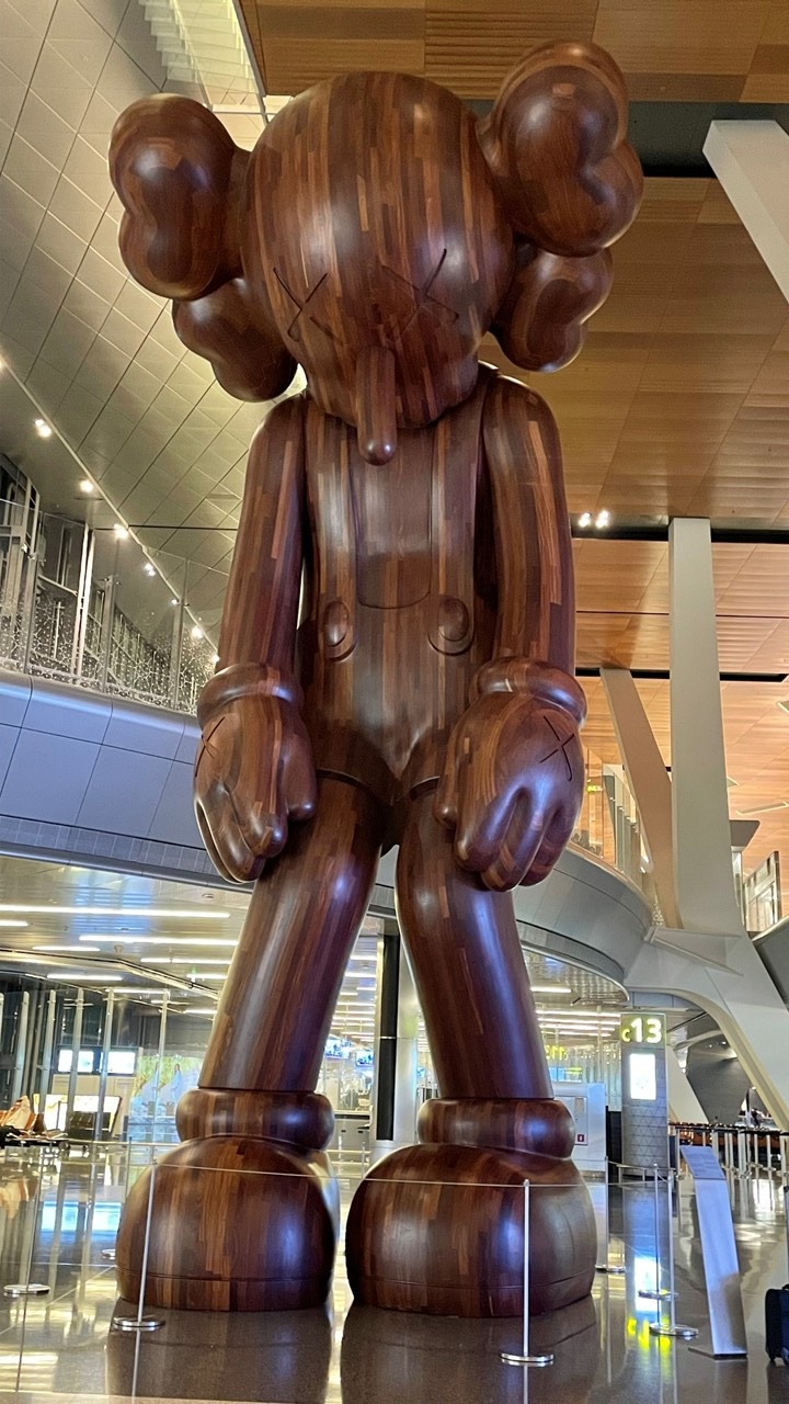
Fischer’s Teddy Bear in Doha Terminal
September 5 – Doha: Pearls, Bears, and Midnight Wandering
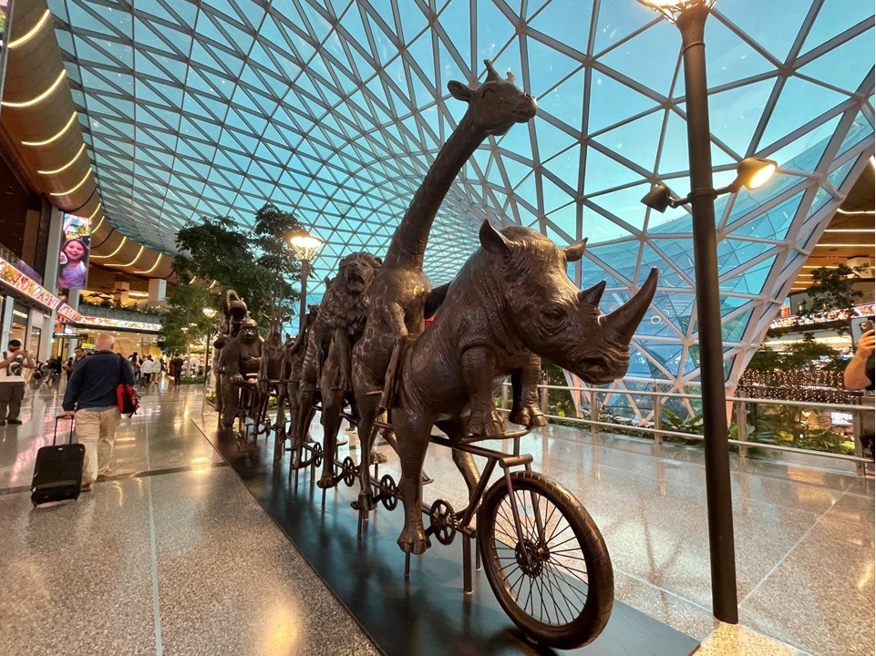
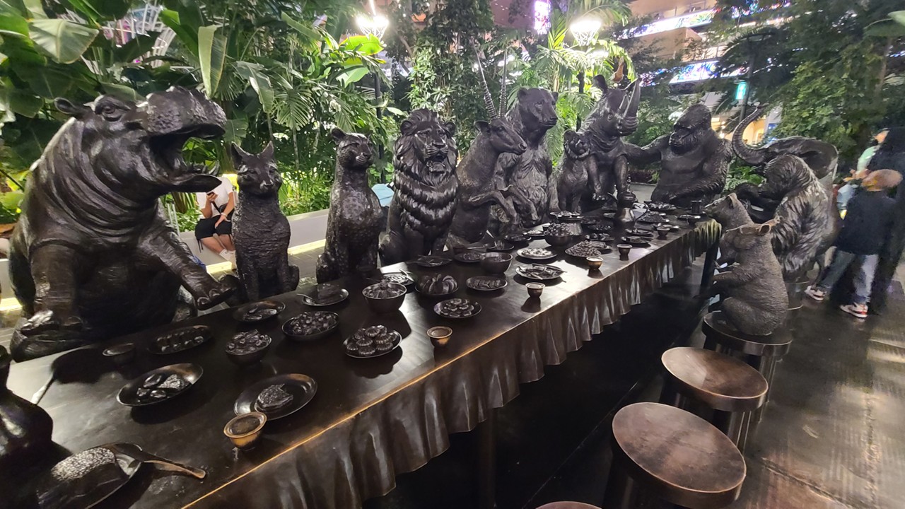
Touching down in Doha, we reunited with Mary Jane, our steadfast companion in adventure. Hamad International Airport unfolded like a modern bazaar of wonders: Urs Fischer’s surreal $6.8 million teddy bear sculpture loomed like a guardian of dreams, while shimmering pearl installations paid homage to Qatar’s pearl-diving heritage—a trade that sustained the Gulf long before oil reshaped its destiny. We wandered past lush indoor gardens and whimsical sculptures, refreshed in the Al Maha Lounge, before strolling through boutiques that echoed the grandeur of caravans past.
The Animals Biking in Doha TerminalAfrica at Dinner in Doha Terminal
September 6 – Arrival in Seychelles: Island Hopping Begins
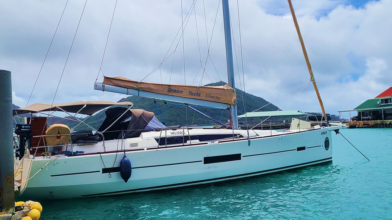
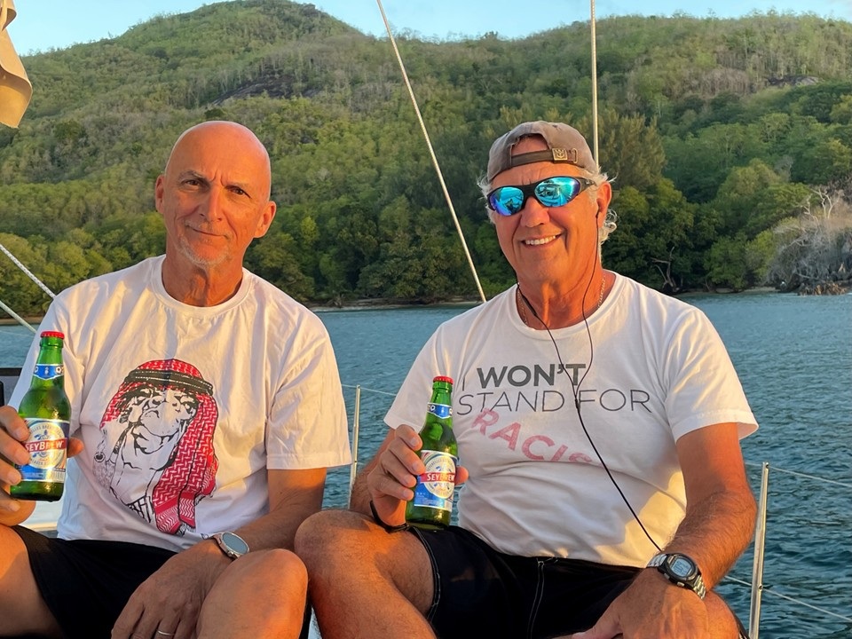
Mahé welcomed us with granite peaks rising from emerald rainforests. Once a French colony, later British, the island still bears traces of its colonial past—Victoria, its capital, remains one of the smallest in the world, and cars keep to the left in memory of British rule. A short hop on a twin-prop plane carried us to Praslin, where coral reefs shimmered beneath us like jeweled necklaces. At Baie St Anne Marina, we met our 52” Dufor monohull sailing vessel, the Vanga. But first, a Creole feast at Côte d’Or—grilled fish, prawns, chicken, and lamb overlooking Anse Volbert’s turquoise waters. Provisioned and eager, we claimed our cabins and prepared for the voyage ahead.
The Vanga – our 52ft Dufor
September 7 – La Digue: Jib Troubles and Ox Cart Nostalgia
The sea tested us early. At Grande Soeur, our jib furler line snapped, forcing us onward to La Digue for repairs. Mechanics hand-sewed the line back together—a reminder that sailing, like history, often demands patience and resilience. La Digue itself felt like a time capsule: named after an 18th-century French ship, the island still honors its ox carts, once the lifeblood of transport. With no cars, only bicycles and carts, La Passe village offered colonial-era charm beneath coconut palms. We dined at the Fish Trap, feasting on seafood before returning to the Vanga for a game of playing cards and camaraderie.
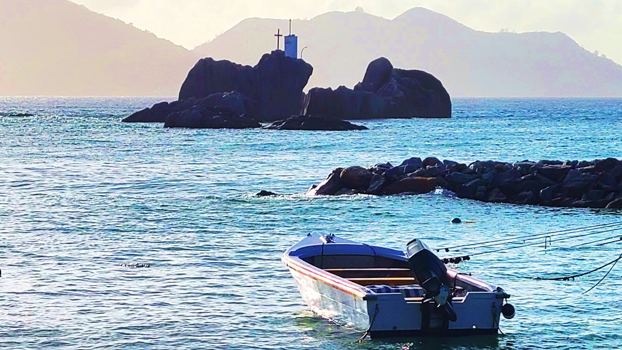
Evening Falling from La Passe
September 8 – Curieuse Island: Tortoises and Coco de Mer
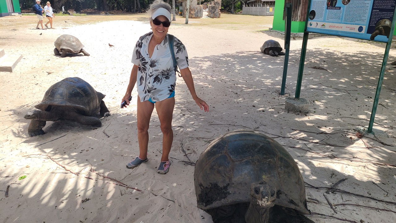
Curieuse Island rose from the sea, its red soil and granite outcrops glowing in the sun. Once a leper colony in the early 1900s, it is now a sanctuary for Aldabra giant tortoises—living relics of deep time. We walked among them, feeding bananas and scratching chins, marveling at their slow majesty. Here too grows the legendary Coco de Mer, whose double coconut—the largest seed in the world—was once believed to hold mystical powers. Declared a Marine National Park in 1979, Curieuse preserves both nature and history. That night, anchored at Anse Lazio, we grilled chicken over our stern-mounted charcoal grill, the stars above as our canopy.
Aldabra Tortoises at Curieuse Island
September 9 – Anse Lazio: Snorkeling and Aussie Hospitality
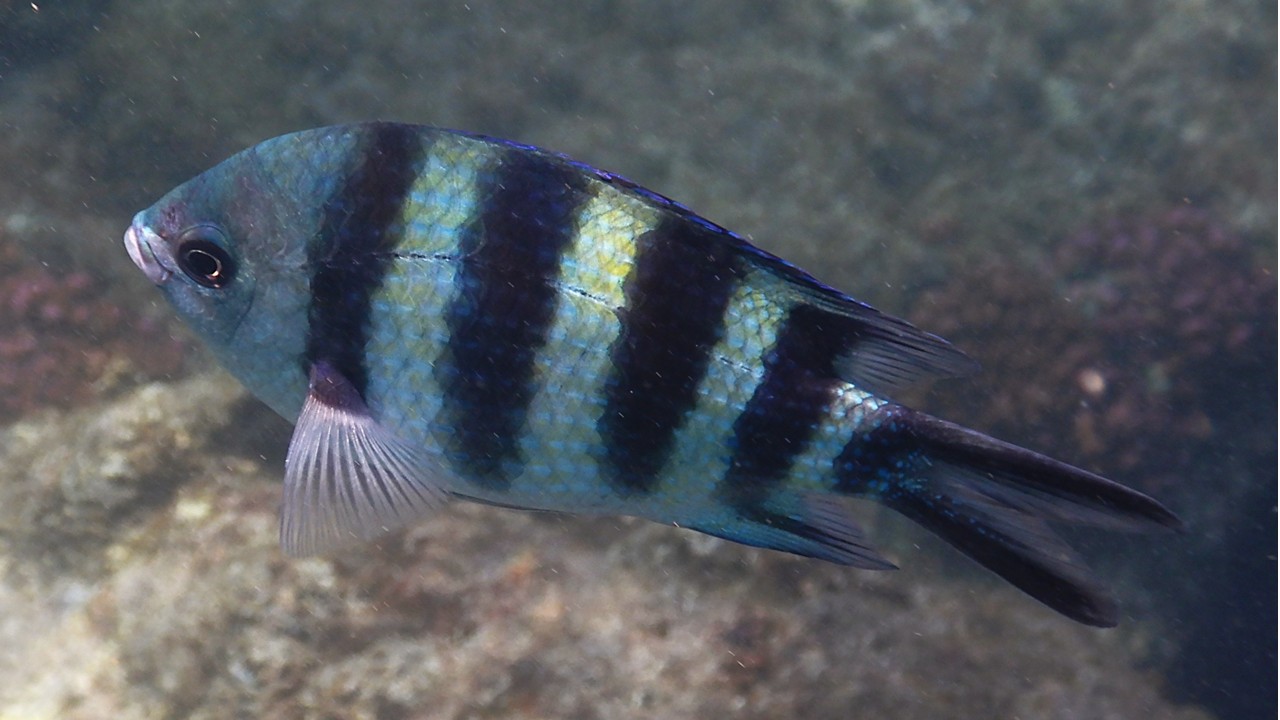
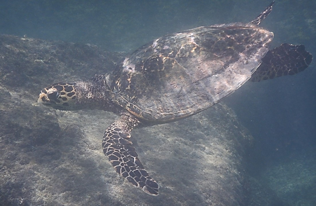
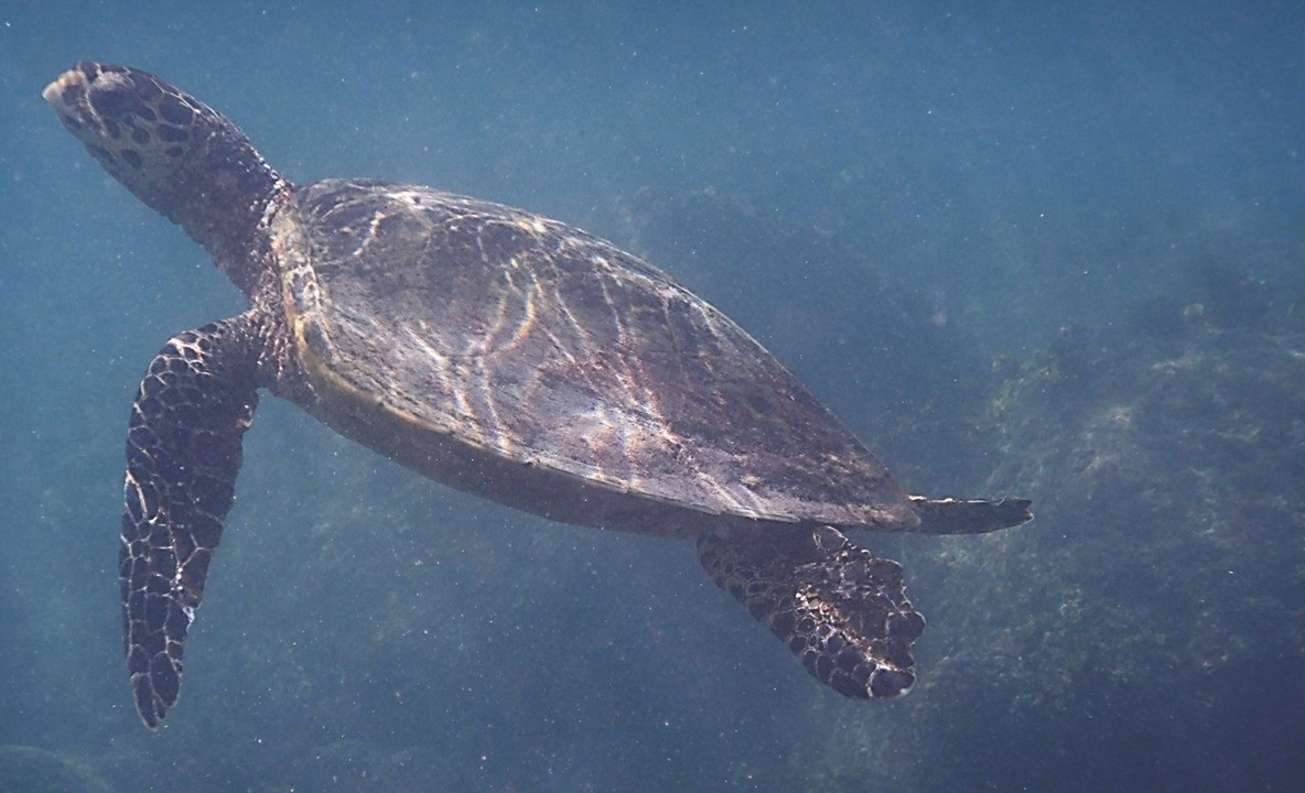
Anse Lazio, often hailed as one of Earth’s most beautiful beaches, dazzled with white sands and granite boulders. Named after Italy’s Lazio region, it whispered of early settlers. We swam and snorkeled among damselfish, moray eels, rays, and sea turtles gliding through seagrass meadows. Later, we lunched at Chevalier Bay Restaurant, run by an Aussie whose menu celebrated the sea—fish, octopus, prawns, and even a rare apple imported from Australia. That evening, anchored at Grande Volbert, we grilled burgers and played Uno-Flip, laughter echoing across the bay.
Wary Fish at Beach Anse LazioWelcome Ashore at Anse LazioDinner Ashore
September 10 – St Anne Island: Marine Park Wonders
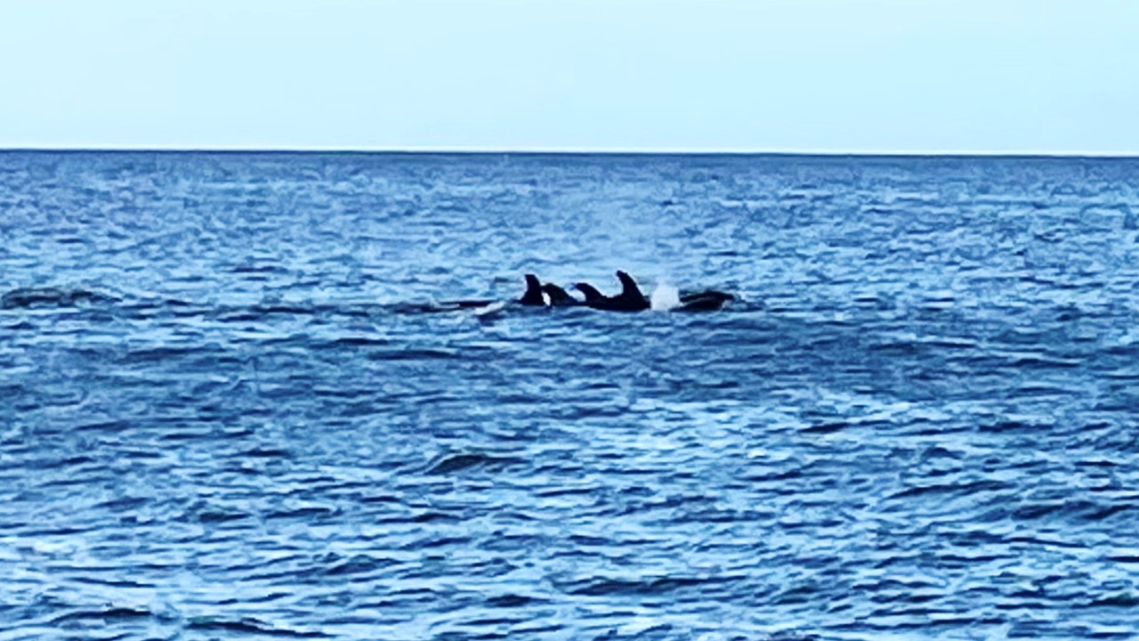
After a six-hour sail, we reached St Anne Marine National Park, the first of its kind in the Indian Ocean (est. 1973). Once a quarantine station for ships, the island now protects coral reefs and marine life. Snorkeling among coral heads, we were astonished by a pod of 50+ false killer whales leaping beyond our stern—sleek, black giants of the sea, heirs to the ocean’s mysteries.
A Pod of False Killer Whales off the SternSea Turtle Diving for SeagrassSea Turtle Coming Up for a Breath
September 11 – Félicité Island: Flying Foxes at Dusk
We passed Ile aux Cocos, famed for turtles and rays, before anchoring at Félicité. Once a coconut plantation, today it is a luxury eco-resort with a heliport and aerial arrivals. At dusk, giant fruit bats—the Seychelles flying foxes—swooped overhead, their 4-foot wingspans silhouetted against the fading sky. Vital pollinators, they are both revered and hunted, a reminder of the fragile balance between tradition and conservation. Dinner was grilled chicken and pasta, followed by cards beneath the stars.
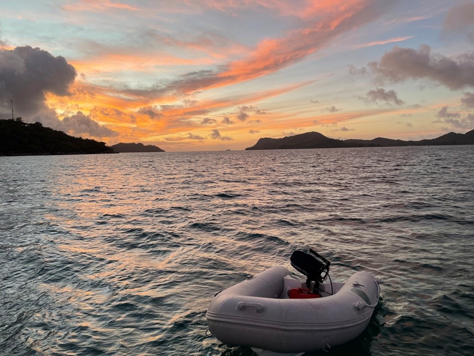
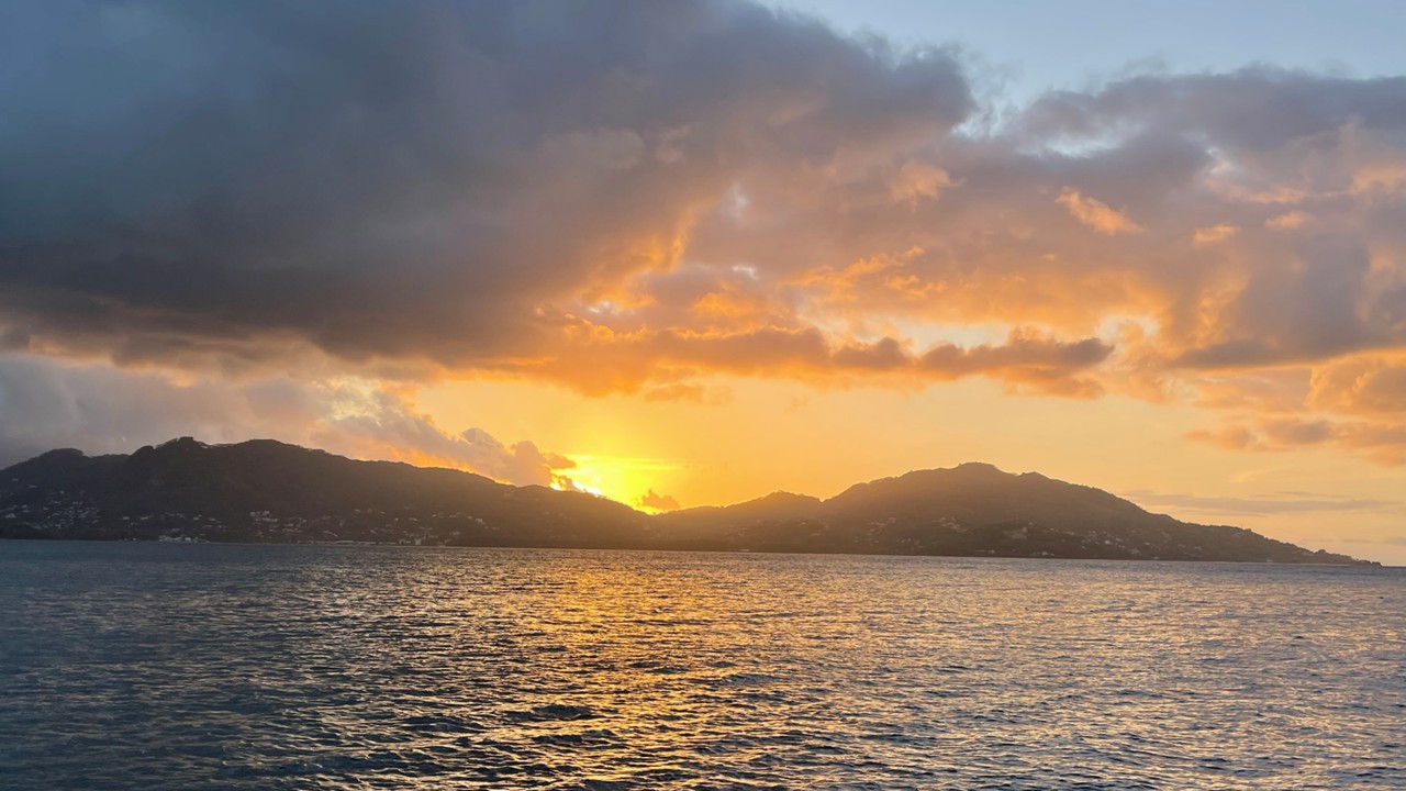
Recreation of Classic PictureEvening Sky in the Seychelles
September 12 – Grande Soeur: Private Paradise
Grande Soeur, or Big Sister Island, offered pristine beaches and coral reefs. Once a plantation, now a private resort, it felt like paradise preserved. We swam among reef fish before returning to Anse Lazio, where dinghy beach landings proved challenging and splashy—Nikki especially took a soaking, but we all survived. The Mabuya Beach Bar welcomed us with Creole fare and cold drinks, a fitting finale to our island-hopping.
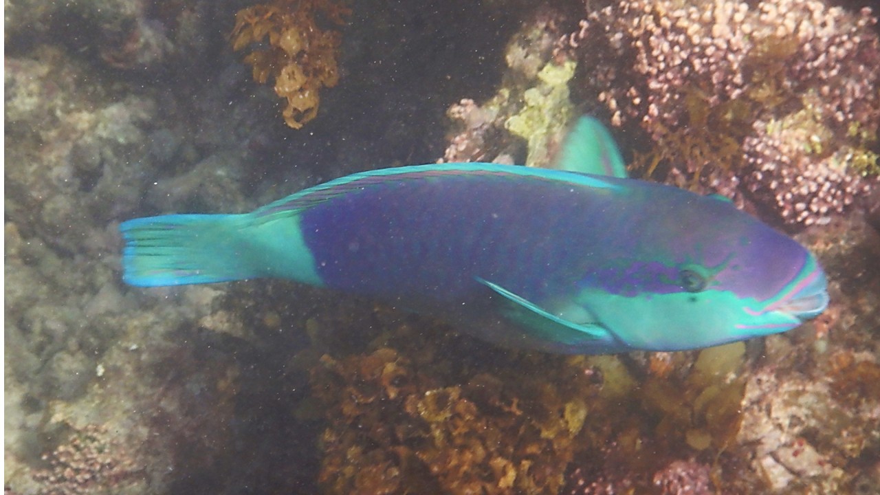
Reef Fish at St. Anne Marine Park
September 13 – Farewell to the Seychelles
Back at Paie Ste Anne Marina, we packed and savored a final lunch at Le Doc Café des Art. Air Seychelles shifted our flights earlier, granting us more time to connect in Mahé. The islands receded behind us, but their memory lingered—granite peaks, tortoises, and turquoise seas etched into our souls.
Our Final Sunset back at Anse Lazio
September 14 – Homeward Bound
A 5.5-hour flight to Doha marked our farewell to the Indian Ocean. After hugs and goodbyes, we boarded the long 15-hour journey to Dulles International Airport. By noon, we were home—sun-kissed, salt-sprayed, and forever changed by the timeless islands of the Seychelles.
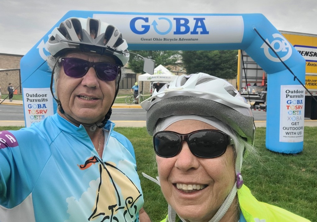
When we set out for GOBA 2025, the promise of adventure and spectacular sights and vistas hummed in the early summer air. On Saturday, June 14, we left our in-laws farm in Dayton, Ohio behind, and the miles slipping past as we drove north toward Bowling Green, Ohio. Fields flanked the highway, shimmering with recent rainfall—some so deeply flooded that they mirrored the sky.
Upon arriving at the Wood County Fairgrounds, we learned that the land had soaked up 3.5 inches of rain just the night before. Many campsites were submerged, but fortune favored us: the tent assigned to us from the Knights Kingdom was dry, though the ground itself felt more like a sponge than soil. Not wanting to take chances, we headed to Home Depot and returned equipped with a tarp to line the inside of the floor, ready to make our tent a haven for the next two days.
Relaxing at Knight’s Kingdom tent at GOBA in Bowling Green
That evening, our registration included GOBA Dollars, a currency meant for downtown Bowling Green. We hopped on a shuttle and soon found ourselves savoring incredible hamburgers at Becketts Bar & Restaurant. It felt good to escape the soggy fairgrounds for a bit. With our bellies full, we returned to camp, organized our gear for the next day’s ride, and let the gentle dusk coax us into an early sleep.
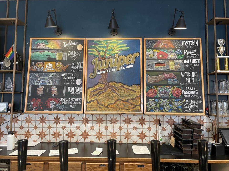
Sunday greeted us with a soft glow. We rose at six, slipping into our cycling gear and grabbed a coffee before prepping our bikes. By 6:45, we were pedaling into the countryside, the road flat and familiar, though fields on either side remained flooded and silent beneath the morning sun. Near a wooded stretch, a deer darted into view—a fleeting but magical moment, but not one uncommon for this part of the country. A coffee break in Weston was a welcome pause, though we accidentally veered off course for two miles before finding our proper way again. After ten more miles, we rolled into Grand Rapids, admiring the historic Ludwig mill. The lunch stop had not opened yet, so we pressed on, bouncing over nine bumpy miles along the old Erie Canal towpath – not an optimum surface for narrow-tired road bikes. By mile 39, we had reached Tontogany Centennial Park and enjoyed slices of pecan pie under the shade trees. Eight more miles and we were back at camp, having clocked 47 miles for the day. The afternoon brought showers and a trip back to downtown Bowling Green. We visited a charming quilt store and lunched at the Juniper Brewery, sampling a Tall Boy, a Sugar Magnolia, and pulled pork nachos. Later, at the Aryln Brewery, with Raspberry Wheat beers in hand, we chatted with locals, retired University Professionals, before heading back for ice cream near the fairgrounds. After the long day, the evening faded into a peaceful sleep.
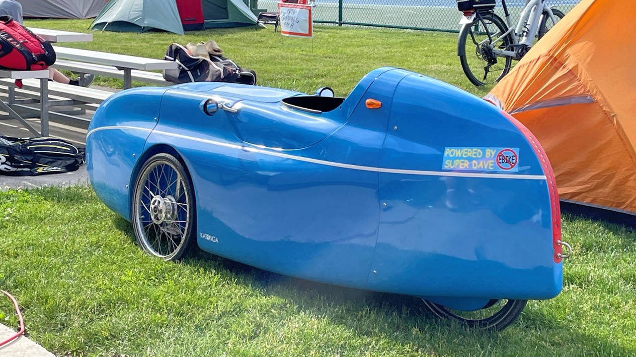
Pedal Power Tricycle with racing car bodyBeer Selection at Juniper Brewing Co
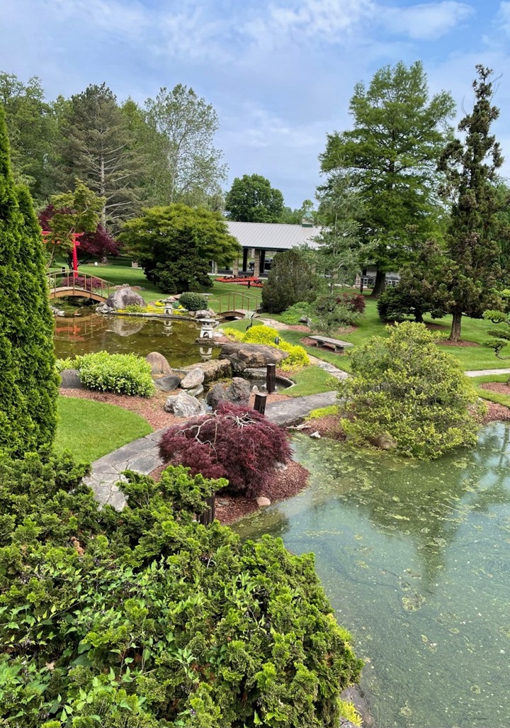
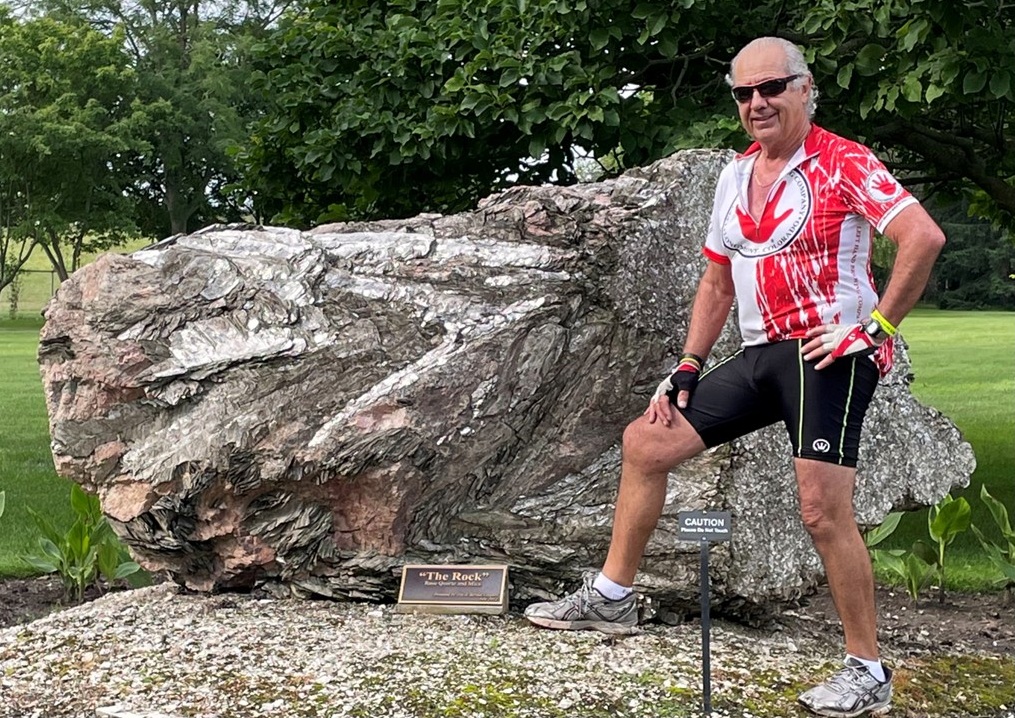
Monday, dawned early, as today would be a relocation day. After coffee, we packed our belongings, deflated our mattresses, and left everything in the tent vestibule. The day’s ride took us out of Bowling Green toward Port Clinton. Seventeen miles in, we stopped for breakfast—hot coffee, bacon, egg and cheese sandwiches, and the camaraderie of fellow cyclists. After another 11 miles, we discovered the beauty of Schedel Arboretum and Gardens—a idyllic tapestry of bonsai, pools, and swans gliding across the water. Lunch was a quiet affair among the rows of blooming flowers. Still ahead were miles to go and a popsicle stop for a sugary pick-me-up. By day’s end, we had covered 55 miles, the last stretch of which was straight into a brisk headwind. Arriving at Port Clinton High School, our camp’s host location for the next three days, we learned an on-site water main break had delayed showers and created drinking water woes. While our tents were being erected, we shuttled to the Brickhouse downtown for a much-needed cold beer. Later, we explored The Art Garage, where 20 artists displayed their work and free dessert, wine, and beer flowed in celebration while a local band played. We finally returned to camp for BBQ chicken sandwiches and a night of well-earned rest.
The Schedel Arboretum and GardensRoc at The Rock at Schedel Arboretum
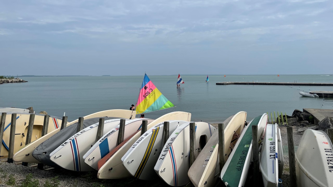
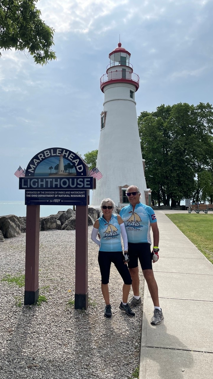
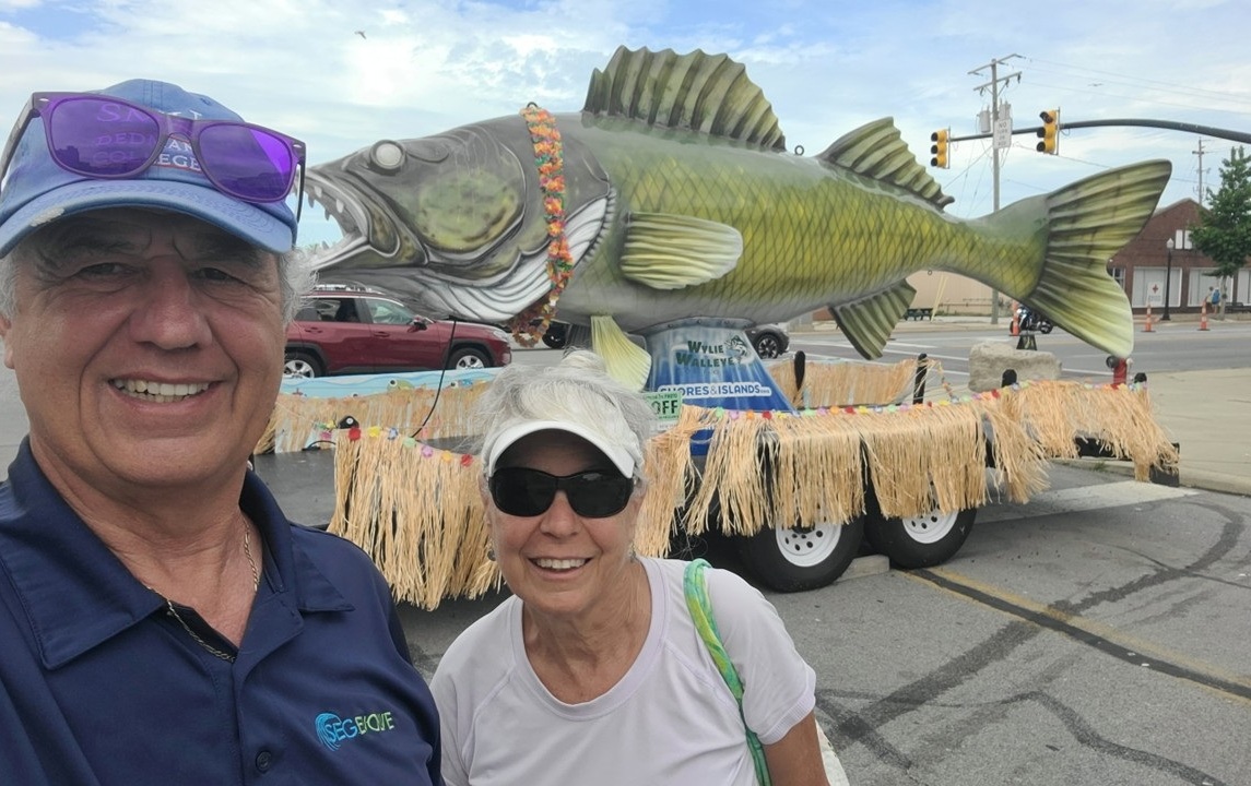
Tuesday was the day of the Marblehead loop—a somewhat “customized” and shortened 37-mile ride. Fueling up at the high school media room with coffee, we pedaled to Hotel Lakeside and Bettinger Park. Lunch was by the marina, bust with sailboats drifting and fishermen casting their lines. At a local farmers market, we bought smoked coffee, before arriving for lunch, the air being thick with the scent of grilling hot dogs and brats slathered in sauerkraut. After lunch, we continued to the famous Marblehead Lighthouse, then looped along Lake Erie, stopping for water breaks and returning to camp just ahead of a rainstorm. Clean and content, we enjoyed puzzles in the media center as the thunder rolled outside. When the skies cleared, we returned to the Port Clinton downtown, and the Brickhouse bustling with GOBA riders. Over meatball subs, we chatted with a high school football coach, and then wandered to Madison Ave, where a local band played for crowds in the closed-off pedestrian-only street. Back at camp, the night was peaceful.
Lake Erie from Hotel Lakeside and Bettinger ParkThe Famous Marblehead Lighthouse Posing with Wylie the Walleye in Port Clinton
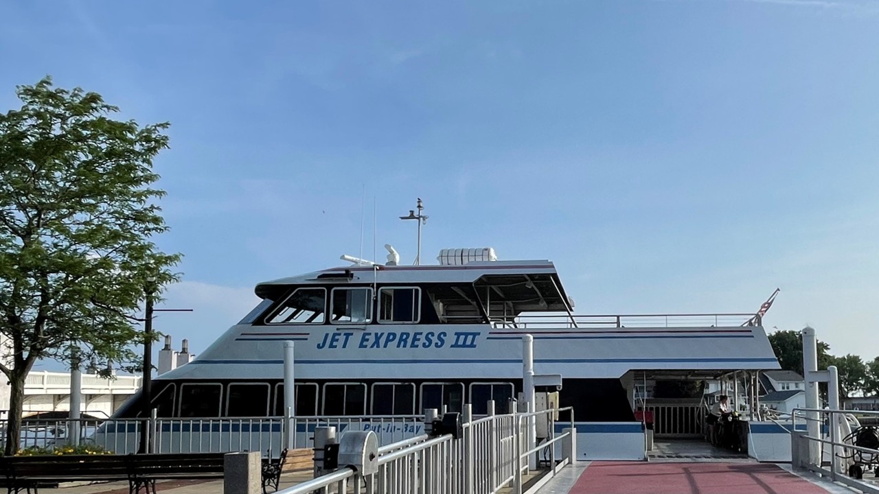
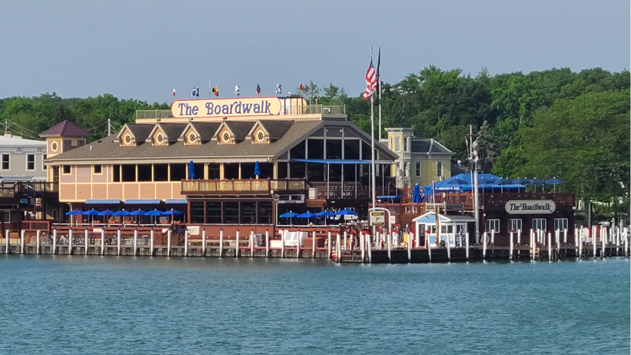
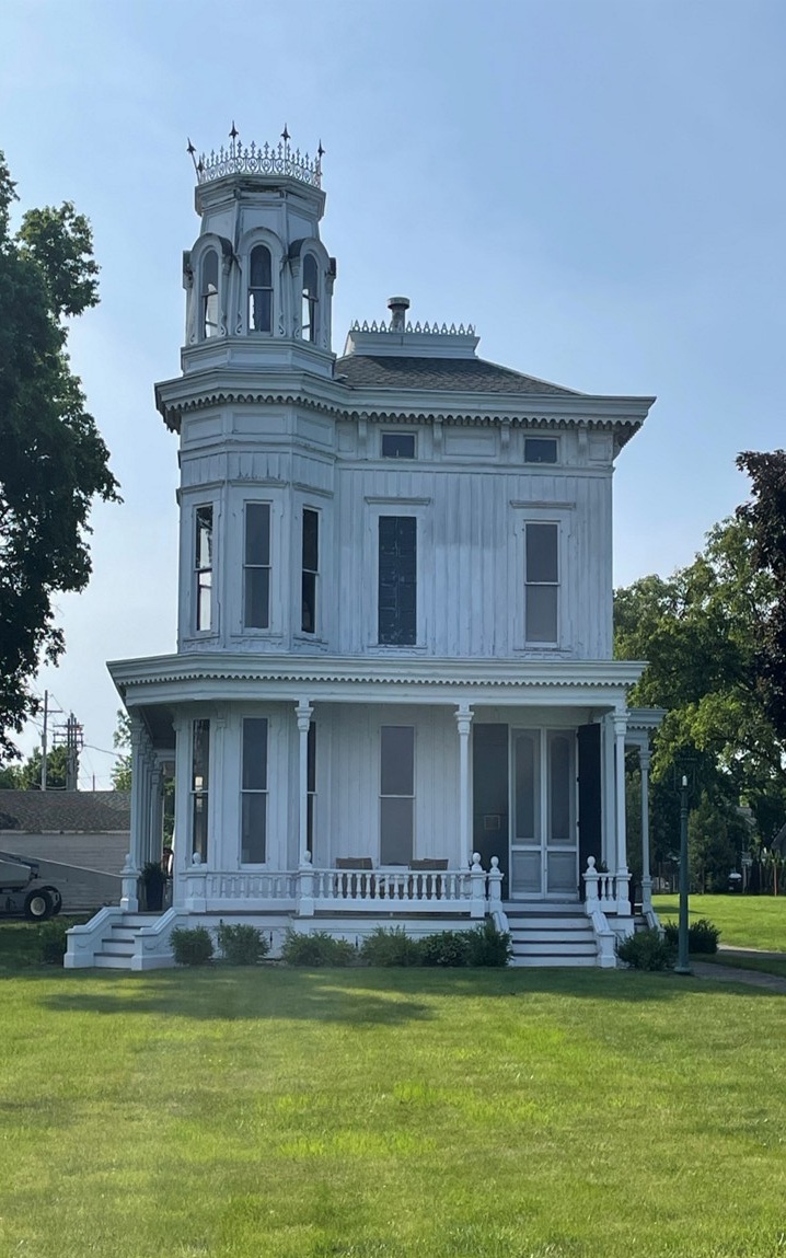
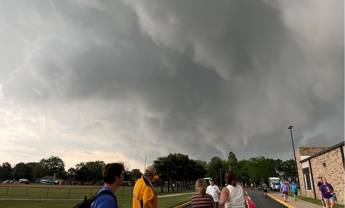
Wednesday we decided to skip the designated route and go off on our own for sightseeing. After a delightful breakfast sandwich from the OTR food truck, we pedaled to the Jet Express ferry and boarded with our bikes in tow for the half-hour journey. By 9 a.m., we had landed on South Bass Island, a lively summer retreat. We circled the island, visited preserves, parks, and the Ohio State University operated lighthouse—open for tours that day. With gifts and postcards acquired, we meandered to a local distillery for a tasting of salted caramel vodka and admired their liquor-holding ship-shaped bottle. Lunch was BBQ chicken in town on the patio, but, as storm warnings sounded, we raced on our bikes to the ferry. The boat launched among lightening and the onset of rain, but had to pause mid-lake until the worst of the weather passed and visibility was restored. However, by the time we reached the mainland shore, the sun was shining again and we and our bikes were dry. That night was the Golden GOBA dinner, honoring riders of five, ten, and up to thirty-six years. Fish, shrimp, clams, and hush puppies graced our plates. There were speeches, photographs, and a return to camp to prepare for the threatening weather. At the school’s grounds when the sirens blared at 8:02 p.m.—there was a sudden rush to the high school gym as a funnel cloud threatened. Miraculously, our tent survived the storm, though five nearby tents collapsed and had to be replaced.
The Jet Express Ferry to South Bass Island The Boardwalk at Put-in-Bay on South Bass IslandOne of many Stately Manors on South Bass IslandThe Ohio State University Research Center at the Island LighthouseTornado Warnings and imp[ending Storm
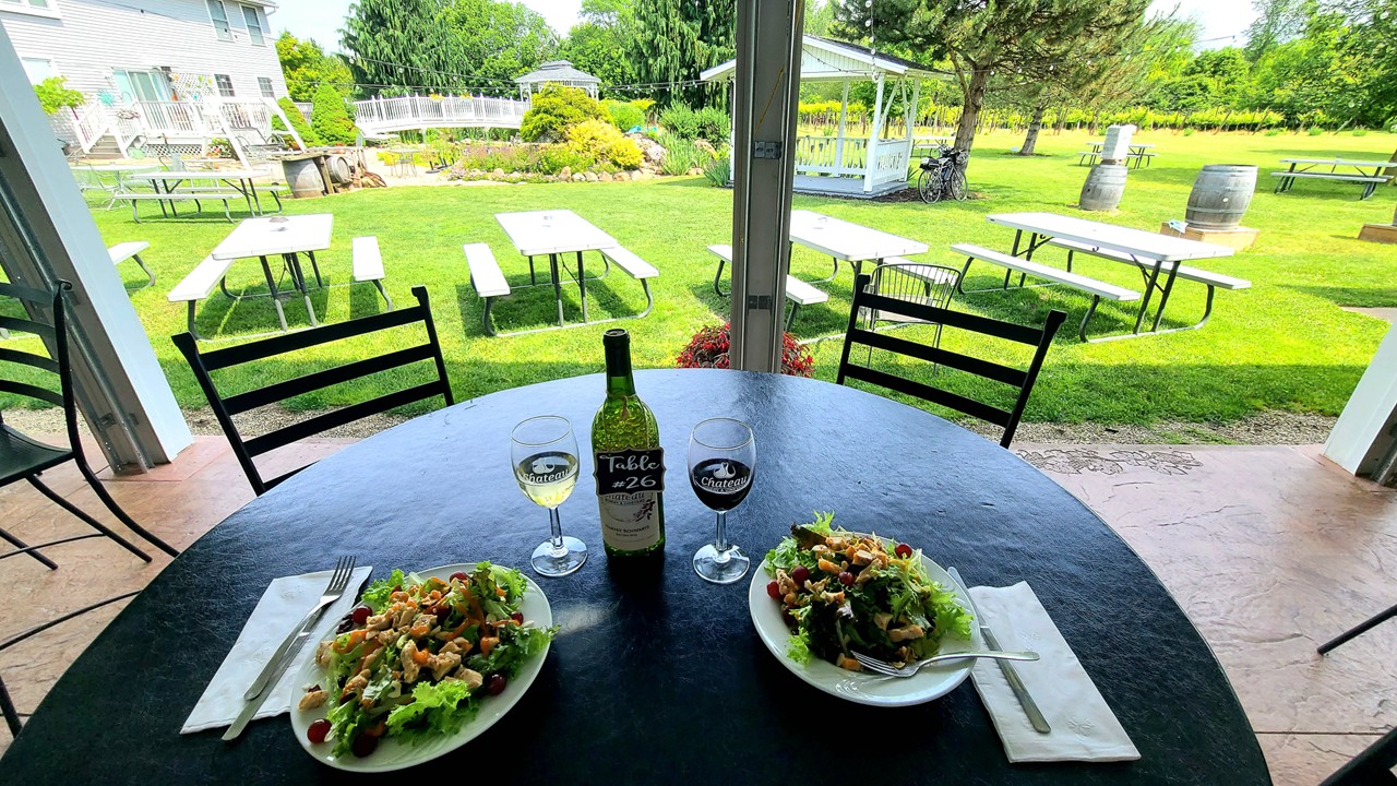
Thursday dawned brightly and we prepared for another relocation day. We packed our things and set off on our bicycles for Fremont with the sky overcast. Fourteen miles in, the Rising Sun coffee truck greeted us with warmth and caffeine. Lunch came seven miles later in Lindsay, courtesy of three food trucks—pizza bites for the win. We rode through a light drizzle to the town of Gibsonburg, where hot shredded chicken sandwiches revived us, and we pressed on. A stop at Chateau Winery—mile 49—brought a cheese plate and a flight of red wines. The skies had appeared to have cleared, but the last miles saw us caught in a sudden downpour causing us to temporarily shelter under a massive oak tree in an unsuspecting farmer’s front yard, before making a mad dash, utterly soaked, the last few miles to camp. After hot showers, we visited the Rutherford B. Hayes presidential home and library, GOBA’s BBQ dinner awaiting us on the estate’s grand lawn. The museum, home, and burial site told stories of the bygone president, while a band played us into a gentle evening.
Friday allowed for a slower start to the day, and we decided that the Winery that we had visited deserved our return for lunch. After riding to breakfast in Fremont then back to camp, we pedaled 10 miles to the winery for lunch and conversation, then another 10 back—24 miles in all that day. Camp showers and a BBQ chicken dinner at GOBA Camp capped the day, the band’s music filling the air as we organized for our final ride the next day.
Enjoying Lunch with Wine at Chateau Winery
Saturday morning came at last. Up early, we packed quickly, sipped coffee, and hit the road. The route was wet but manageable, the breakfast stop at Rising Sun fire station offering both food and local hospitality. Most of the way, a headwind pushed against us, but we pressed on, stopping for water and to shed layers of clothes as the day’s temperature rose. At mile 49, we rolled into Bowling Green, our journey full circle. We packed our bags, loaded our bikes, changed from our cycling gear into street clothes, and set out on the two-hour drive back to our in-laws home in Dayton, our hearts full of memories and the spirit of GOBA 2025.
Part 2: Navigating Houseboats along the Saone River
Monday came early as we got up before dawn to catch a taxi to the train station. A quick stop at Starbucks ensured that we had our caffeine fix for the four-hour train ride ahead. At the train station, we met up with out boating friends – 9 other people – who we would be spending the next week with. The train journey started underground, but soon transitioned to scenic countryside views as we traveled above ground to the town of Vesoul.
Upon arriving in Vesoul, we needed to wait a few hours for the bus ride to the town of Saône. Here, we wandered into a local bar for snacks and drinks. The bar owner, an intriguing character who doubled as a boxing referee, shared tales of his upcoming trip to Atlantic City to officiate a match. His pride was evident as he showcased photographs of himself refereeing legends like Joe Frazier.
Lunch with Boxing Referee
After lunch, the very short bus ride took us to the town of Saône, where we needed to walk about ~1-mile with luggage to the Locaboat office in Port Plaisance. With the two boats not yet scheduled to be ready, (5 people – 2 couples and a single – on one boat and 6 people – 3 couples – on the other), we stopped in town at a nearby grocery store to stock up on supplies, which were conveniently delivered to the marina later. Following a detailed briefing, we discovered that no restaurants were open in the town, and so, Take0out pizza became the obvious choice. Using the bicycles provided with the boat, we rode back into town and picked up our dinner.
As evening set in, conversations flowed, memories were shared, and toasts were raised to our recently departed close friends – Rick and Cliff—friends whose presence was dearly missed. The night ended on a comfortable note, thanks to the heated boat connected to shore power, ensuring we stayed warm despite the chill outside.
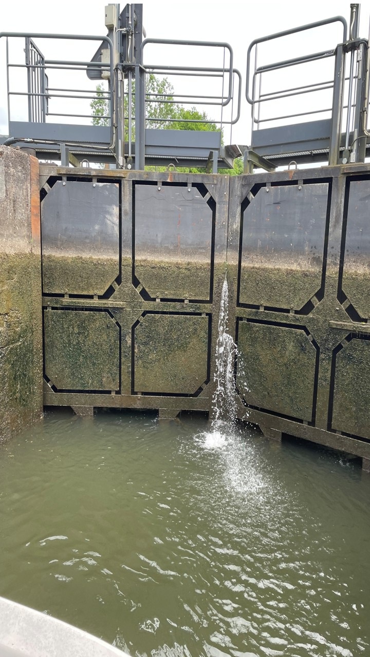
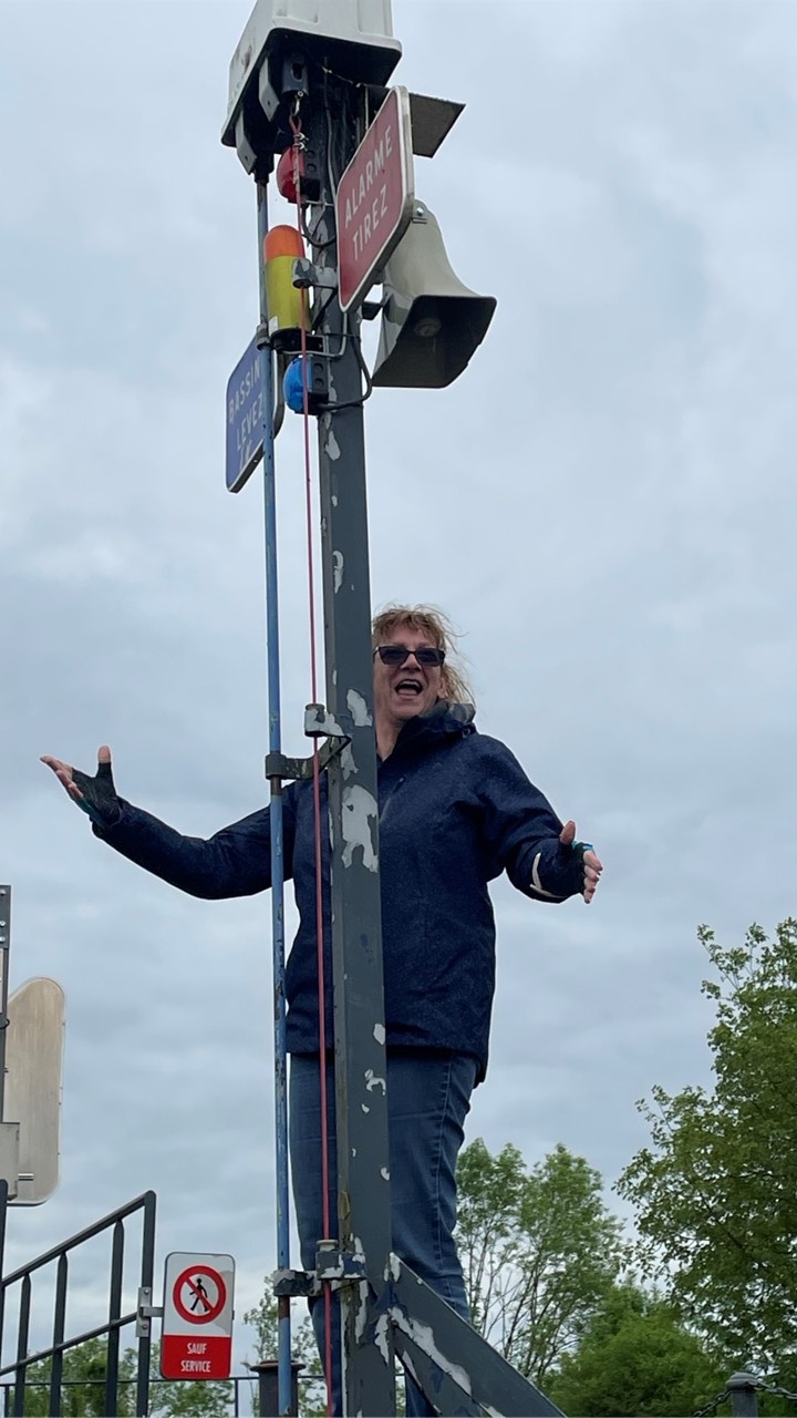
On Tuesday, our adventures began with a delightful breakfast of coffee and baguettes. We organized our day and set off from our base, ready to tackle our first lock. Navigating the lock was quite the procedure: turn a pole hanging by cable over the water, wait for the green light indicating that the lock was ready for your boat to proceed in, motor in, secure the boat with ropes around the bollards, lift a pole ringing a bell, and then watch as the locks close and the water levels adjust. Once the gate open and we receive the “proceed” green light, we retrieved our ropes and continued. Luckily, the locks are all long enough to accommodate our two boats nose-to-tail at the same time.
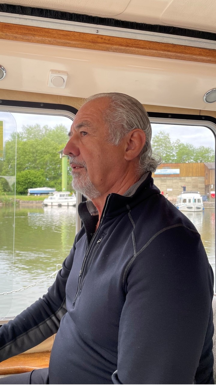
Rocky at the Helm of the SuerreLocks Closed on High Water SideWhen Ready Raise the Pole and Ring the Bell
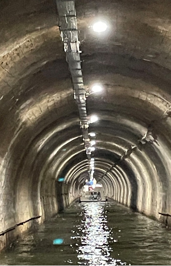
Soon, we encountered an impressive tunnel cutting through a mountain, stretching 630 meters long and just big enough for our boats traveling one-way.. Emerging from it felt like stepping into another world. After a few more locks, we saw sheep, chickens, and a donkey before stopping at a nature reserve near the town of Soing for lunch on the boats. Roc and Terry biked into the local town searching for restaurants, but unfortunately came back with no candidates. Therefore, we ventured further, through another tunnel and several locks, until we reached a campground past the town of Savonyeaux. Terry and his wife, Elaine, biked into town (population 206) for a bit of grocery shopping, and we wrapped up the evening with a lovely home-made spaghetti dinner and some socializing.
Passing Through a Tunnel
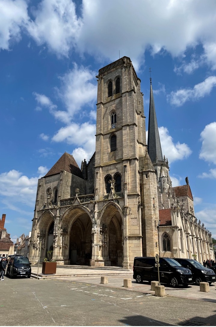
On Wednesday, the morning started with a hearty breakfast of eggs, potatoes, and bacon. This time, our boat led the group downriver, navigating locks and floodgates, passing picturesque riverside homes and other boats. We stopped at a summer beach, finding a restaurant willing to seat all eleven of us. Lunch at Restaurant de la Place was leisurely and excellent. After returning to the boat, we took the lock to the other side of the weir (with a set of turbines to generate the town’s electricity) and relocated onto the main quay in the large town (population 6,000) of Gray, France. Here they are set up for boat hookup to electricity and water for a nominal charge. We explored the town’s church (also called Notre Dame) and old medical castle of which only the crenellated tower and ramparts remain until we got dinner at a local restaurant.
Sunset along the Saône
Thursday, May 8 is Victory Europe Day and a holiday in France! We leave the town of Gray after a brief breakfast ashore and set off south, downriver again today. With fewer locks today, but deeper drops as we move down river, we traveled to the big town of Pontallier (population 18,600 and known to the world for its production of absinthe) and docked at a pontoon amidst the Victory Europe celebrations. We arranged dinner in a local restaurant’s private room that was simply outstanding.
Houseboats Moored for the Night
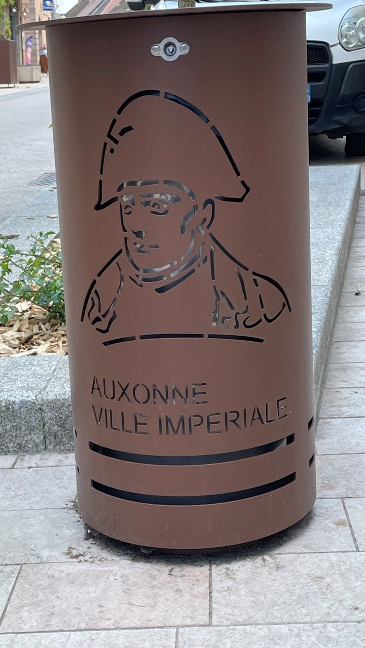
On Friday, we awoke and assembled a big breakfast on board, which set the mood for sailing to Auxonne (river marker 233). This ancient town featured a statue of Napoleon Bonaparte since he schooled at the Artillery School there, a castle with a moat, and the local Notre Dame church from the 13th century. Lunchtime was at a food truck on the river’s steps and dinner on the boat was capped by hors d’oeuvres of liver pate and a round of card games.
Napoleon Trash Cans in AuxonneCathedral in Auxonne
Saturday morning, we kicked off the day with first coffee on the boat followed by second coffee in town and a bakery visit for croissants. Sailing to Saint Jean de Losne, a commune and small town at the confluence of the Stone River and the Burgundy Canal. We docked at the town quay and enjoyed lunch at a dock restaurant, indulging in sole meunière, filet albettes, ice cream, and crème brûlée. The afternoon included exploring the town, buying postcards, visiting the local Barge Museum (Musee de la Batedllerie), and finishing the day with charcuterie and more card games.
Sunday began with a quiet breakfast on the boat and marked the beginning of our return trip upriver, beginning at river marker 214. Going upriver through the locks is a bit more difficult since the boat enters at the lower level and reaching the bollards in the lock with the ropes is a challenge. We chose to negotiate this by dropping off 1 person just before the lock and positioning then above us on the lock to secure our ropes. MJ skillfully executed this for the first time and secured our ropes and managing our first lock operation as the water rose. Drinks that night were at Les Mariners in Laq Pontellier and were delightful. This was followed by dinner at La Guinguette de Pontellier under river-side trees featuring beef ribeye steak.
Monday’s start was uneventful until we came upon a boat stranded aground in the shallows. We made an hour-long attempt to assist the stranded couple, although ultimately unsuccessful. We then traveled to Lamarche but could not find a suitable docking spot, so we moved to Mantoche a town of 451 people. There, we made lunch reservations at La Capitainerie, and enjoyed exploring the small town. Surprisingly, the stranded couple finally showed-up getting out of the shallows by reducing their boat’s weight by pumping all of their stored fresh water overboard! That night we had dinner on the boat followed by drinks and competitive games of backgammon.
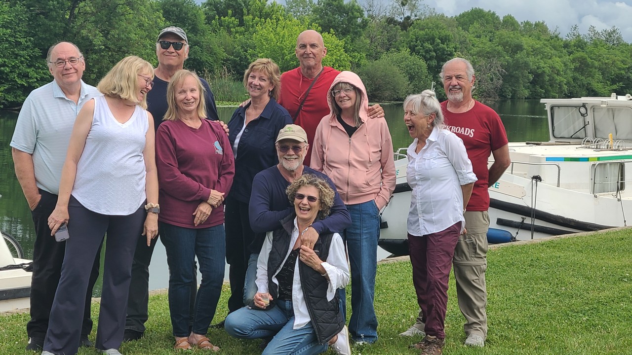
Our Traveling Group in front of our Houseboat
Tuesday morning we had arranged an early breakfast back at La Capitainerie by Chef Christoff before leaving to travel to Gray and securing an empty spot on the quay. Shopping for final groceries, getting drinks at La Gringos Bar, buying postage stamps, and making dinner reservations made for a productive day. That night we had a very French dinner at Au Mastroquet which was exquisite, and closed out the day with nightcaps back on the boats.
Wednesday morning started with bacon and French toast, and marked our last breakfast with our friends, Peter and Nikki, who had to leave 2-days early for a planned family obligation. We dropped them off near the bus station in Gray and continued our journey upriver. After navigating the first lock, intense fog engulfed us briefly, but we continued along slowly and safely. Since we made record time, we took a detour to a dead-end branch of the river to the docks of Soing (population 565), docking there on the town’s park and enjoying local lunch time treats, (the restaurant was open this time). That evening, a food trailer selling homemade pizzas showed up meaning that no cooking required that night.
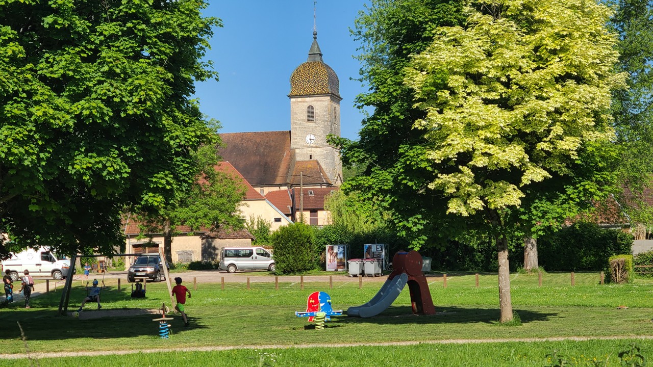
View of the Park & Town of Soing from a docked Houseboat
Thursday morning began with a leisurely breakfast of bacon and eggs before preceded along our final day’s journey to Pont Scey Sur Saone. Herons, wheat fields, maize, sugar beets, lily pads, and birds all accompanied our beautiful last-day voyage. We arrived at the base by noon, prepared a meal of sausages, green beans, and ratatouille, and initiated packing. Dinner that night was at La Deux Ports, a local restaurant that opened for us and which was a culinary delight. That night, champagne toasts were made celebrating each other and our trip.
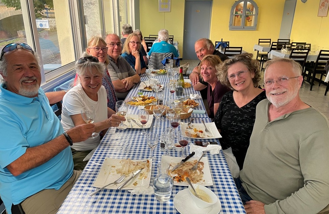
Our Last Nights Dinner TogetherSunset over our Home Marina
Friday was hectic as we officially checked in the boats and departing at 9 am for trains and cars to Paris. We took a taxi to Vesoul, and from there, negotiated four different trains to reach the Paris Charles de Gaulle Airport. Despite a slight delay, we reached the Airport Hilton and confirmed bookings with Air France on the next day, before relaxing for the evening.
Saturday morning, we had a quick breakfast before repacking and taking the CDGVAL airport train to the terminal for our flight back to Atlanta. After a brief layover in Atlanta, we flew home to Melbourne, Florida before taking an Uber home and ending our houseboating in France adventure.
Largely based upon our wonderful adventures last year exploring the Venice Lagoon via a rented houseboat, we decided to expand our trials of this mode of relaxing and exploring Europe with friends and rented two Locaboat Houseboats for exploring the Saone River in western France. We chartered two boats of 3-bedrooms each, (one with two heads – bathrooms – and one with three heads), and planned our travel with 4 other couples and another great friend. We had previously sailed with all of these people, and were confident that the trip would be wonderful and adventurous!
For us, our adventure began back in the USA, when, on Wednesday, the day before our international flight, Delta notified us that our Air France operated flight to France was cancelled with no rebooking! After frantic calls to Delta, we were able to get rescheduled for a flight later in the day but with no seat assignments, as the flight was “full.” The next day, at airport check-in, we were assured we were on the flight, but again, no seats could be assigned until just before boarding would commence. We waited patiently in our Priority Lounge until boarding commenced. In Atlanta, when we inquired at the gate before the flight, we were asked why we “changed flights,” as the original flight we were on was, in fact, NOT cancelled. Confusion ensued between Delta and Air France, but we were finally assigned the last two seats together on the plane and began our journey.
After arriving on Friday, our bad luck continued with the French Immigration computers all being down, and our passports needing to be validated manually. We finally collected luggage and proceeded to take the train and metro to the Hotel Balmoral, arriving at 3:30pm. We had stayed here before and the hotel warmly greeted us with a room upgrade and a free bottle of French wine. After settling in, we walked to a local grocery and grabbed a quick snack at a MacDonalds nearby the Arc de Triumph. That evening, we relaxed for Happy Hour drinks sitting at an outdoor cafe (beer and Apéral spritz) and followed up with a dinner of Chicken Caesar Salad and Leek Quiche at Cafe Mahon.
Arc de Triumph
The next morning was Saturday and we were up early for cheese & bacon toasties. We then caught the metro to the very recently opened Notre Dame Cathedral. Our entry tickets were for 9:30am and we were early, so we stopped at a little café table along the river for a cappuccino and people watching. There were already long lines for those with no reservations. However, there was no wait if you had reservations which could only be made a couple of days in advance. After coffees, we returned to the cathedral where crowds had now doubled, but there was still no line for those with free ticket reservations. Inside the cathedral, the crowds spread out and traveled in a one-way track clockwise throughout. The restoration has truly brighten the interior everywhere; tapestries, sculptures, walls, woodwork, and stained glass. A really magnificent tour. Afterwards we walked through the nearby Gardens of Luxembourg which are massive. There was a free concert going on under the trees, yoga happening in another section, Renaissance fighting in another, a playground, and a huge lake full of sailboats that the children pushed from shore with sticks as the wind blows them along. It was great weather to spend the day in the park. We then walked to the Latin Quarter of Paris before heading back to the metro. Once near our hotel we found an outdoor cafe for drinks and a light lunch. We then did a stroll down Avenue des Champs Élysées looking for gifts for friends and relatives. While out and about shopping, the rain started pouring, and then it hailed as we window-shopped inside! After shopping and the storm passed, we returned to the hotel for a hot tea before enjoying afternoon cocktails consisting of our complimentary bottle of red wine. Dinner was on the Champs Élysées with mussels and pepper steak. The food was great and the people watching was even better as we sat just across from the Louis Vuitton building, which is designed as a huge piece of LV luggage!
In Front of Renovated Notre Dame Cathedral Inside Notre Dame CathedralNotre Dames Pipe OrganThe Sailing Pond in the ParkQuiet Grotto in the ParkLouis Vuitton Stone in Paris
Sunday began with breakfast at McDonald’s, setting a relaxed tone for the morning. After enjoying a leisurely start, we hopped on a train headed towards Notre Dame for some additional shopping. The bustling streets offered a perfect blend of modern stores and historic charm. By afternoon, we were on another train, this time to Saint Maur, to visit friends who had previously lived in Washington, DC, but now called France their home. Their child’s laughter filled the air, adding warmth to the gathering, and offering plenty of opportunity to play like a kid. We shared stories over delicious food before we made our way back to Paris. Before retiring for the night, we grabbed some groceries to prepare for the next day’s journey.
The next morning we had an early breakfast so that we could begin our long van ride back to the east coast of Tasmania. The morning was characterized by raining buckets, and all of the luggage had to be moved from our rooms on the pier to the vans via covered golf carts. We departed Pumphouse Point and drove 1-hour before stopping at a fuel station for a bathroom break. Then, 2-hours later we stopped again – this time in the town of Campbell – the cross roads of Tasmanian highways, and a place where the convicts were originally sent to work in the Australian penal colony. Those that were interred and that died here are memorialized by bricks with their names, crimes and sentences etched in the sidewalks located around the town. After a quick local coffee, we are back in the vans until we stop at the Craigie Knowe Vineyard in Cranbrook for a delicious lunch and a wine tasting. Craigie Knowe is the oldest vineyard ion the East Coast of Tasmania, and was started in 1979 by John Austwick, a dentist. In 2013, father and son Glenn & Alex Travers were in the area and decided to bring new life to this now broken-down vineyard. It took 3 years to produce the first grapes – 12 tons but they were on their way and, in 2016, they produced 22 tons of grapes and 25 tons the year after. Next they bought the vineyard next door and today they operate the restaurant, Flora’s, which was where we were having lunch and tasting wine. For lunch, we ate scallops and calamari followed by duck and flat iron steak, all while tasting 6 different wines and then taking a walking tour of the 12-acre vineyard.
Sisters at Craigie Knowe VineyardsCgaigie Knowe vines in Eastern TasmaniaHiking Cole’s Bay beach to Freycinet Lodge
After lunch, we boarded the vans for a 45-minute drive Cole’s Bay at Freycinet National Park. After arriving at the Bay, we hiked a mile on the beach to the spectacular Freycinet Lodge overlooking the bay where we would stay for the next 2 days. After showering we headed to The Bay Restaurant for a family style meal of pork and fish. Tomorrow will be a hiking day.
We began Saturday morning with a leisurely breakfast before receiving a talk about the day’s activities and options, and each receiving a box lunch. The day’s plan is to hike to Coles Bay Lookout and the on to the Wine Glass Bay Lookout in the very popular Freycinet National Park. The hike begins at the hotel where we leave on the trail at 8:30am. The 4 of us leave before the rest of the group to beat the heat of the day, leaving our boxed lunches in our room as we should be back before noon.
The trail to Wineglass Bay and LookoutA view of Wineglass Bay
The hike is a five-mile round-trip walk along trails and boardwalks to and from the lookouts. Along the way, we saw a wallaby and a few geckos. It was a sunny and breezy morning, and the hike was uneventful, although there were a lot of steps to climb, (700 ft climb in altitude). The scenic overlooks were fantastic with views of beautiful blue water harbors and extensive beaches. After returning and eating our lunches, we played a few rounds of the card game “Euchre”, before heading back down to Coles Bay Beach to look for sea glass and shells. Rocky jumped in the water and found it was not as cold as it looked. Then we returned to the hotel for snacks, wine, and cards. Dinner that night was at Richardson’s Bistro and consisted of oysters and grilled mushroom appetizers with salmon and pumpkin ravioli.
Exploring Cole’s Bay BeachRocky swimming in the cold waters of Cole’s BayA Sea Anemonae on the Beach at Cole’s Bay
Sunday morning was met with a leisurely breakfast and packing. Today, we dressed in swimsuits under our clothes with a change of dry clothes carried in our backpacks. After a short 10-minute drive to Swan River, we were instructed in how to put on our fleece and foul-weather tops and our kayak skirts, before we moved our 2-person kayaks into the water and set off up-river. The tide was out so we had to avoid running aground in the shallows. Once on the water, we observed manta rays, eagle rays, egrets, pelicans, and numerous other birds in the river channel. Further up the river was a large oyster farm from which the oysters we ate yesterday had sourced from. After paddling up-river near the right bank, we turned the kayaks and paddled across the channel’s rising tide towards the opposite bank. Once we were again in the shallows, we took a break to enjoy the view and munch on some chocolate chip cookies. We then made a large circle around and returned to the dock with no mishaps. When we had dried off we were treated to hot tea and hot chocolate.
Rocky in a two man kayakKayaking at the mouth of Swan River
After reboarding the van, we traveled a short distance before stopping at the community garden for a bathroom break and to dress in our street clothes for the 1-hour trip to Mayfield Estate Wine Cellar and Tasman Sea Salt producers for lunch. Two brothers there farmed sheep until a drought came and nearly decimated the estate from 10,000 sheep to only 2,000 sheep. In response, the brothers set about growing grapes in 2010. Now they send the grapes to local wineries and their brands of wine are returned to their restaurant/estate, which is located on a wonderful hilltop venue overlooking the scenery around it. All of their grapes are hand-picked. While we each ordered a pizza from their stone oven, we enjoyed a wine tasting consisting of a sparkling wine, a Chardonnay, a Pinot Gris, a Rose, and a Pinot Noir. The brothers have also continued to raise sheep for their Merino wool, of which 80% is exported to China.
We then shuttled 1.5-hours to Hobart to famous “MACq 01 Hotel” located on the Harbor Waterfront. Our room has a beautiful view overlooking the harbor with a brand new tug boat parked just outside of our balcony. The MACq 01 is a “Story Hotel” with every room and lounge dedicated to the personal story of a Tasmanian individual: see the link: https://www.macq01.com.au/our-story/ . Cocktails that evening were in the “Story Bar” with a selection of hors d’oeuvres, and followed by a 3-course meal in the Old Wharf Restaurant. This was the last dinner we had as a group.
Statues & View of MACq 01 Hotel in Hobart
Monday morning we were up for breakfast with Julie’s sister and brother-in-law, as they were departing early to return to the U.S. After breakfast, we met with the remainder of our group for a “story telling” walking tour of the area beginning in the “Evolve Bar.” The “Evolve Bar” is decorated with a unique and valuable collection of fossils that is the private collection of the hotel owner. Once the introduction ended, we took an initial walk around the square surrounding the hotel, learning the history of various buildings and parks and how they became part of Tasmania’ history.
In 1642, the first white man who came to Tasmania was Abel Tasmania, the captain of a Dutch ship working under the sponsorship of Anthony van Diemen, the Governor-General of the Dutch East Indies. Later, 150 visitors and scientists came from France to study the strange and previously unknown animals and flora. When the British established a settlement there in 1803, they retained the name, “van Diemen’s Land”. Then, in 1825 it became a separate penal colony when John Bowman brought 50 convicts there. It soon became notorious for its harsh treatment of prisoners and for its reputation for being inescapable. Then, in 1856, the name was changed from Van Damien’s Land to Tasmania to distance it from its brutal reputation.
Today, Hobart is the second deepest port in the world and has traditionally been a breeding ground for Southern Right Whales, (so called because during the whaling industry times, they were the “right” whales to hunt!) It was said that at one time, there were so many whales in Hobart’s harbor that you could walk on their backs across the water. Today, there are few whales left that visit the harbor as most are up closer to Melbourne. We walked to Battery point – the oldest residential neighborhood in Tasmania where today over 60% of its citizens have convict heritage. Much of the port today is surrounded by reclaimed land that once held valuable warehouses and factories. We walked by the Henry James IXL Building – a company established in 1891 as a manufacturer of jams, conserves. However, by the 1970-1980’s the port area had become an area of slums and poverty. Then, in 1990, the area was restored and is a bustling shopping area today. The population of Hobart is only ~250,000 people – nearly half the population of Tasmania.
We then visited Franklin Square named for British explorer Sir John Franklin; a British Royal Navy officer, explorer and colonial administrator who was knighted in 1829 and who served as governor of Van Diemen’s Land from 1836 to 1843. He later took 128 men in 1845 to search for the North West passage. However, his ships got stuck in the ice and their fate was never discovered for 12 more years when a written account in a diary was discovered detailing their journey, starvation, and deaths. Their ships were never found until 2014 & 2016.
We then toured St. David’s Park – the largest park in Hobart and one that was once a cemetery. After the cemetery fell into disrepair, it was redesigned in 1925 as a classic Victorian garden, with lawns, flower beds, and a variety of native and exotic trees. The gravestones and burials of the cemetery’s inhabitants are still there.
Hobart HarborFranklin Square and Cemetery in HobartTasmanian Navy in the port of Hobart
After the tour and back at the hotel we checked out and left our bags in storage there while we did some shopping. We bought souvenirs and stopped at Mures for a lunch or fish and chips with a beer. Then, it was time to leave Tasmania and we returned to our hotel, picked up our luggage, and took an Uber to the airport for our 2-hour flight to Sydney, Australia where we stayed overnight in the airport hotel. The next morning we boarded a 16-hour flight back to Houston and connected to a 2.5 hour flight back home to Florida. A wonderfully adventurous trip, indeed.
Sunday morning we were up and checked-out of the airport hotel by 7am. After walking across the sky-bridge to the Check-in Counters, we checked our bags, got breakfast at McDonald’s, and then window shopped until boarding time. It was an hour flight from Melbourne south to Launceston, Tasmania. Launceston is the second largest city in Tasmania, (Hobart is the largest), and it was the first Australian city to have underground sewers and to be illuminated by hydro-electric power. Launceston is also known for its vibrant food culture and has been made a UNESCO city of gastronomy, one of only 49 in the world. From the airport, we caught a taxi to Peppers Silo Hotel, where we would meet our Backroads group to begin bicycling the next morning. Peppers Silo is a hotel made out of old grain silos and is very unique. We dropped our bags there and walked to Cataract Gorge, a National Reserve site. The site has been a Reserve since the 1800’s, and is characterized by a “hanging walkway” along its side that was built in the 1890’s and which is still used today. The walk starts in King’s Park across King’s Bridge and then down the path along the gorge. We saw numerous birds, massive Sequoyah trees (planted in 1894), and a number of peacocks. After sightseeing, we returned to the waterfront near the hotel to eat lunch at “The Rupert & Hound.” We then walked into the downtown area looking for some pastries for tomorrow’s breakfast, and for a bottle of wine for the evening. On return to our hotel we checked into our rooms and then played cards in the lobby. We had a light snack at the bar before calling it a day.
Map of Tasmania and the route takenCataract Canyon in Launceston
On Monday morning, we met our Backroads group, turned over our luggage, and loaded up into their vans for a short trip to The Truffle Farm – Australia’s First Black Truffle Farm. There the family run business showed us how they “pollinate” spores on fledgling tree roots and wait over 10-years to speculatively gather truffles with the help of their truffle-sniffing dogs. We sampled a variety of truffle products before getting fit for our bicycles and heading off for an 18-mile ride across the pastoral countryside.
Tasting table at The Truffle Farm
At the end of the 18-miles, we stopped at Sherlock Farms where we had lunch at a local farm run by Bob &Sally Sherlock. We dined family style on quinoa salad, tofu salad, edamame salad, topped with fresh beef from their ranch.
After lunch, we shuttled to Cradle Mountain Lodge located on the border of Cradle Mountain National Park. Along the way we saw echidnas foraging along the side of the road. On arrival at the Lodge, we saw pademelons, wallabies, and wombats. Our accommodation was in a private cabin a good walk out in the bush. Once we settled in and unpacked our luggage, we walked back to the lodge for dinner, seeing a wallaby with a Joey in her pouch and a platypus swimming in the pond along the way. In the lodge, we had a private dinner with wine and hors d’oeuvres of salmon ceviche, pork belly, and tortellini. The main course of lamb and beef, with desserts of lemon sorbet , chocolate raspberry compote, and vanilla almond ice cream with short breads. After dinner, we returned to our room to prepare for tomorrow’s hike.
Wallaby with joey in her pouchPadymelon foragingWombat grazing in camp
The next morning, we were up at the lodge for a quick breakfast at 7am so that we could leave for Cradle Mountain National Park for a day of hiking. It was 37F degrees this morning and somewhat windy. The park is biodiverse with ancient rainforest, alpine heaths, and grasslands. We drove to the Ronny Circle parking lot before dividing into groups that would take the shorter, easier route or the longer, challenging route. We decided to do the challenging route, and after crossing the road, we started our hike on part of the Overland Track Trail (a 65 kilometer long trail) until we reached the Scout Hut, and then we joined the Horse Track Trail which would take us around Crater Lake. We climbed up 1621 ft in altitude over wet boggy land and large granite boulders until we reached the Kitchen Hut. Here we broke for snacks and hot chocolate. We then walked on to Marion’s Lookout before rejoining the Overland Track via a path of steep downhill boulders while holding onto a chain rope. We continued on until we reached Crater Lake lookout then moved onto the Wombat Pool Track. Finally, the hike took us toward Lila Lake and the Park’s boathouse, ending at the shuttle bus stop. We rode the park shuttle bus to the Park’s Interpretive Center which was very near the Park’s entrance and our hotel. We strolled back to the hotel.
Hiking the Overland Track trail in Cradle Mountain National Park The Kitchen Hut along the Overland Track trailRocky at Marion’s Lookout over Dove LakeJulie at Marion’s Lookout over Dove LakeA view of Crater LakeScramble down the Rocks
Exhausted we hit the showers before joining friends in the lodge lobby for celebratory drinks and game of cards. At 6pm we had reservations in the Highland Restaurant for a 2-course dinner. Roc had smoked salmon and lamb rump roast and Julie had Tasmanian oysters and duck confit. Desert was vanilla ice cream with mango sauce and meringue. We watched the platypus frolic in the lake from our dining table. Then, it was back to our cabin to pack for our morning check-out.
Wallaby with joey
Breakfast the next morning was followed by a 1-mile hike to King Billie overlook to see The King Billie – a 1000+ year old pine tree. The morning was cool but the hike was warming and the wombats were out and about. We checked out of the lodge and drove 1.5-hours to Queenstown. The town of Queenstown is an old gold and copper mining town. Unfortunately, after no longer economic, the old mining companies left the town decimated and polluted with a sulfuric acid creek running through the middle. However, the surrounding mountains are now a popular mountain biking area which accounts for the meager income that supports the town beyond government assistance. We had a private lunch at the historic Paragon Theater while watching a movie about the theater’s history. After lunch, we changed into biking gear, drove 30 minutes to Burberry Lake Campground, and began our bike ride on the Lile Highway riding 25 miles while climbing 1/2 mile in altitude. When we arrived at the Lake St. Clair Ranger’s Headquarters, we took a short shuttle to a thoroughly unique hotel at Pumphouse Point. Our room was in the original planned hydroelectric dam’s pumphouse at the end of a long pier that extended out into Lake St. Clair. The pumphouse was deserted when the project to divert water and generate hydroelectric power was cancelled. We checked in, showered and changed, and then joined the other guests for a complementary cocktail hour and a convivial meal.
Our rooms out at the Pier at Pumphouse Point
Thursday morning we were up early for breakfast, after which we received a loaf of bread to use with the larder of food that was in our room to prepare ourselves a lunch to take with us while we hike the Lake St, Clair National Park. We drove back to the Park’s Headquarters and walked to the Ferry terminal and took the ferry across the lake to Echo Point. Here we rejoin the Overland Track Trail and hiked through the forest alongside the lake for the next 11 kilometers. The ground is wet, soft, and mossy, and is covered with large tree roots and the occasional babbling brook. The footing is challenging as we ford creeks, climb over logs and branches, and avoid the mud. Three-quarters way through the hike we stopped and made our way to the lake’s edge to eat our packed lunches, utilizing the larger trees and rocks as benches and tables. When we finished the hike back at the headquarters/Visitors center, we celebrated with drinks and a beer.
Boar across Lake St Clair to the Overland Track trailJulie and Rocky lakeside at lunch
Once back at the hotel, we decided to take a hike along the nearby beach looking for signs of platypus and any available beach glass. After collecting a bit of beach glass, we hiked over to the local weir bridge, and looked for wildlife. However, all we found was a sign warning of deadly snakes! Back at our hotel rooms, we took showers and prepared for dinner. Cocktails were again at 6pm and the night was a sloe gin special. Dinner was parsnip soup or pumpkin burratina (baby burrata), followed by lamb or chicken, and finished with a faux rock chocolate coffee desert. That night, we walked back to our room down the pier to see a stunning sunset.
View across Lake St. Clair with the Pumphouse in the circle
Thursday morning we were up early to train back to the airport to catch our flights – first to Sydney, and then onto Ayer’s Rock. We enjoyed a breakfast of corn fritters on board the first flight, and then samosas for a second breakfast on second leg of flight. We arrived at Ayer’s Rock at noon, picked up our rental SUV, and drove to our hotel – “The Lost Camel.” We checked-in and picked-up our welcome bag before visiting the local (only) grocery store to get some breakfast muffins for sunrise tomorrow. We then drove to Ayer’s Rock for pictures and a visit to the cultural center to understand the stories of the Indigenous tribes and see them actively painting their unique art designs. Then we drove around the entire rock, marveling at our closeup views of the erosional holes in the rock and the striation of the layering – all while noting that it was a dry 98-degrees outside. We then returned to the resort for much needed cold beers & ciders and began planning the rest of our day. We did some shopping at the Town Square waiting for the temperature to drop before stopping to pick up some pizzas and drinks and heading to the Sunset Overlook to watch the sunset on the rock. This time our foray into the park was a line of cars, all with the same idea- sunset at Uluru Rock. Once we assumed a prime spot, we met strangers, did selfies, ate pizza, and awaited the sunset And – when sunset did come – it was beautiful. A perfect ending to a long day.
Welcome to Uluru – Ayers RockDaytime view of Uluru – Ayers Rock from Pard Road
Uluru – Ayers Rock At DuskUluru – Ayers Rock at Sunset
On Friday, we were up early to head back to Uluru to do the base walk. We started walking the 10 kilometer trail the goes all the way around the rock at 6:45 am hoping to avoid the hottest part of the day. We started at Kuniya car park where we were still in shade and with a nice breeze. By the time we were a quarter of the way along the trail, it had moved away from the base and the breeze lessened. The trail is composed of red dirt & grit with only occasional restrooms, water, and first aid at the 1/4 and 3/4 way stopping points, and with only first aid stations at the 1/2 and end stopping points. Over half the route is considered sacred grounds which means no picture-taking is allowed. No climbing of any of the rocks is allowed any longer since the rock is sacred, but in the past this was not true. At the 3/4 point of the walk is the Kantju Gorge which contains precious water, but can catastrophically flood. We finished the walk in 2 ½ hours.
Overhang cave hiking around Uluru – Ayers RockKantju Gorge and watering holeErosional holes in the clay rich sandstone rockAboriginal wall paintings in Uluru caveSpectacular Erion features on Uluru – Ayers RockJulie on the 11kilometer Uluru base hikeUluru – Ayers Rock at duskUluru – Ayers Rock at Sunset
We then drove to Kata Tjuṯa Dune for a view of the Kata Tjuṯa rocks which are not at high as Uluru. This formation is not one rock but many rocks, and of a different composition. Along the way, we also saw a herd of wild camels.
The Kata Tjula RocksWild camel herds wandering the desert
Next we returned to the resort for a late breakfast but as it was already 11am, we settled for an early lunch followed by showers and some swimming pool time. Later in the day, we played cards in the hotel lobby, as it was another 98-degree day. For dinner, we walked to nearby Desert Garden Hotel and enjoyed their service at the Managua Bistro and Bar. Dinner consisted of kangaroo kebabs, pumpkin salad, mushroom rigatoni, and chicken wings. After walking back to our hotel, we called it early night as we are planning to rise early and see Uluru at the Sunrise Overlook.
Hotel center at Uluru – Ayers Rock
Saturday morning we were up very early to arrive before sunrise at Uluru at the Talinguru Nyakunytjaku, a series of boardwalks and platforms built to view the rock at sunrise. It was a quiet beautiful sight. Afterwards we drove back to the Sunset viewing area for a different morning view.
Uluru – Ayers Rock at dawnUluru – Ayers Rock at sunrise
When we returned to the resort, we had breakfast at the Academy Cafe, a training facility for the local tribes-people to be trained in the hospitality industry. After packing, we played a quick round of cards prior to checking out of the hotel. On the way to the airport, we drove to the local camel farm and self-toured their farm and small museum. Here, we learned that the Afghan people brought the camels to Australia in the 1800’s. At that time, this was the only way that people were able to traverse the desert and move supplies and mail about. Eventually, trains, and then roads took over the transport system, and by the 1950s the camels were too expensive to keep and no longer of any use, and so, were abandoned to roam free. About 10 years ago after the camel population had ballooned to over a million camels, a desert catastrophe was in the making as the wild camel herds were consuming huge amounts of the scarce desert water, depriving native animals of water to survive. In response, the government began annual culling of the wild camels. Today the camels are only used for desert tourism. The camel farm museum had lots of old pictures, saddles and carts, a gift shop, a children’s petting area, cows, and water buffalo.
Camel caravan at camel farm
After that, it was on to the petrol station, car return, and the airport. There, we checked-in for flights to Melbourne where we spent the night at the airport hotel.