January 2021
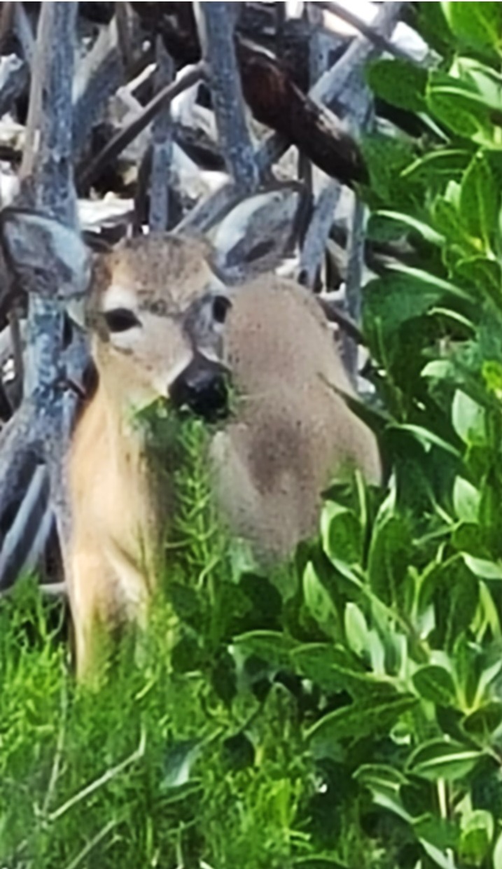
Tuesday morning, we were up for a hotel bag breakfast in the Hampton’s empty dining area before checking out and continuing our journey south by car to the southern end of Scout Key at Mile Marker 35 where we parked our cars to begin our next biking journey to the southwest. Unfortunately, it was quickly apparent that Julie’s rear bike tire was flat, so we pumped it up, saw that the leak was “slow” and began our journey anyways. The wind was still 17-20 mph in our faces as we rode over the bridge into Big Pine Key. Immediately we saw signs saying to “watch for Key Deer” as Big Pine Key serves as a National Wildlife Refuge for them.
The National Key Deer Refuge was established to protect and preserve the endangered Key Deer and other wildlife resources in the Florida Keys. Although surrounded by salt water, it is the freshwater that helps to determine which species live and thrive in the variety of habitats. The endangered Key Deer is the smallest subspecies of the North American white-tailed deer. Poaching, road-kill, and habitat loss had reduced the number of Key Deer to only a few dozen animals by the 1950’s, but establishment of the Refuge and subsequent listing of the deer as endangered in 1967 has allowed for protection and a dramatic recovery of the species.
We turned our bikes left down Long Beach Road into the Refuge and rode 2.5 miles to the end of the road looking at the wildlife and soon came upon a small herd of 5 Key Deer foraging on the edge of the mangroves. After watching them for a while, we returned to U.S. 1 and stopped at the local marina to air-up Julie’s tire, use the restrooms, and then continue our journey. In this area, we rode on the shoulder of U.S. 1 as the entire route was fenced and every driveway and cross street was “cattle-guarded” to prevent deer from migrating or getting on the road. Once we entered the center of town on Big Pine Key, we came across Big Pine Bicycle Shop and decided to get Julie’s tire fixed. While they replaced her tube, they gave us a temporary “loaner” bike and we went to the nearby “Keys Café” for coffee. By the time we finished and returned, the repair was complete, and we resumed our journey – now heading almost due west with the northwest wind on our shoulder. After crossing short bridges to Little Torch Key and Middle Torch Key, we rode over a high-rise bridge onto Summerland Key where the were greeted with a wonderful paved away-from-the-highway bike route along “Old State Road 4A”.
State Road 4A was the first Overseas Highway which consisted of two roadway segments (a north segment at Key Largo, and a south segment from No Name Key to Key West) completed in 1928. In the 1930’s, World War I veterans were sent as part of the Emergency Relief Administration to work on new bridges to close all of the gaps that remained between the Keys. However, the 1935 Labor Day hurricane killed more that 400 of the workers and their families and severely damaged the highway and the Florida East Coast (FEC) Railway. The local county (Monroe) voted to only rebuild a highway, and conversion of the Bahia Honda trestle and building of connecting bridges began again. In 1938, the last connecting piece – a toll road between Matecumbe Key to Big Pine Key – created the first continuous road from Miami to Key West. During World War II, the Overseas Highway was straightened and moved leaving portions of State Road 4A abandoned, part of the local streets or available as a bicycling route.
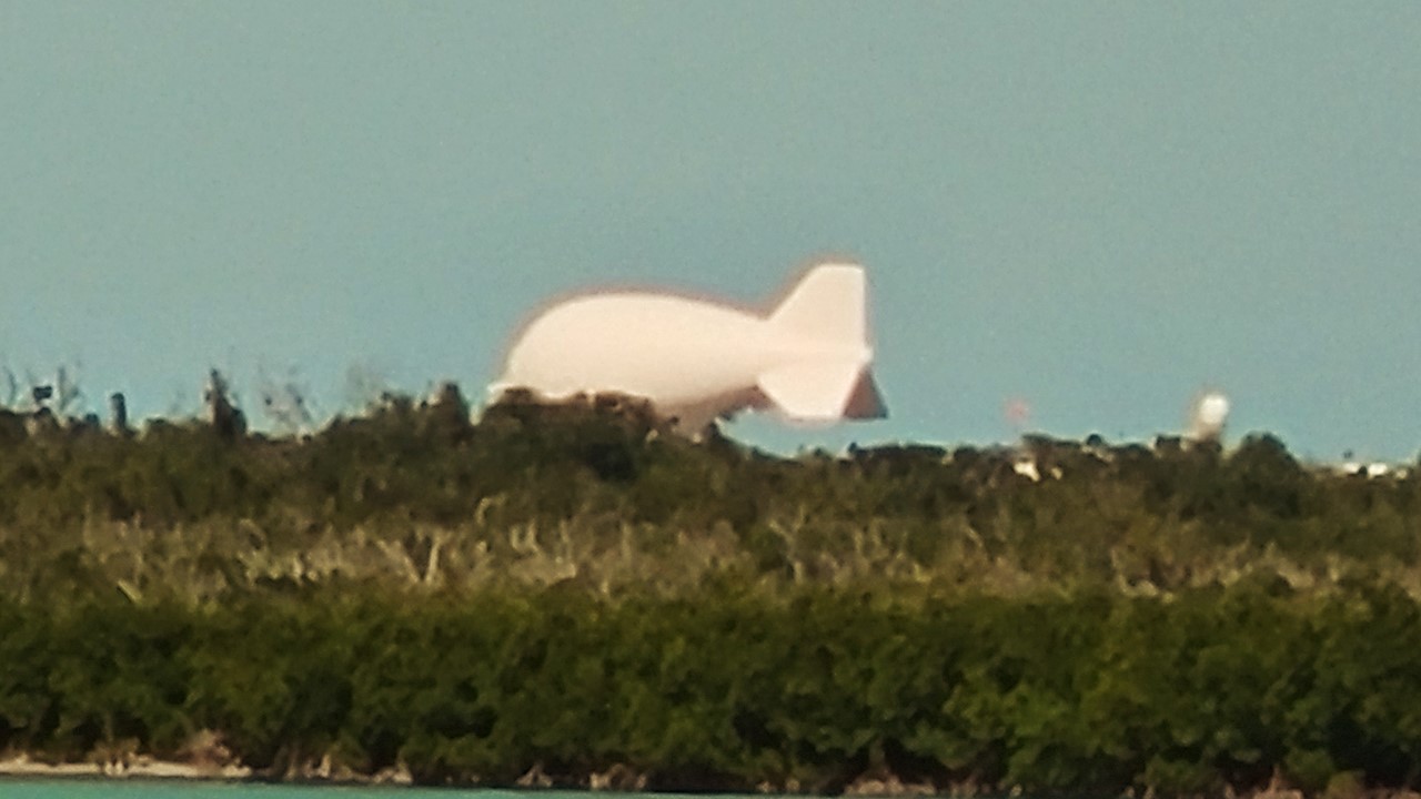
This part of the bike path was excellent, quiet, and picturesque, and at the end of Summerland Key, it crossed over onto a dedicated bridge to Cudjoe Key, where it then crossed back to another excellent section of SR 4A. At the western end of Cudjoe Key one could see the blimp, “Fat Albert”, still tethered off to the north. “Fat Albert” was supposed to be ending its 33-year flight history recently but appears to still be stationed there by popular demand. The blimp is a Tethered Aerostat Radar System, (TARS, in military-speak), and was part of an Air Force’s Drug-interdiction program that monitored the Mexico/U.S. border as well as the Florida Straits. The various “Fat Alberts” have been the subject of many stories in the Florida Keys, including numerous crashes in 1989, 1993 and 1994, and breaking free of its tether, drifting over the Everglades, and crashing there, as well. However, the most incredulous story was in 1991 when the blimp broke free and a fisherman connected the loose end of the tether to his fishing boat thinking he would tow it back to shore. Instead, he and his mates were taken airborne and dumped into water uninjured near Mud Key. Only when an Air Force F-4 Fighter shot down the blimp with an air-to-air missile did the boat settle back to the water’s surface, little worse-for-wear, leaving the boat’s captain happy to have gotten it back in one-piece.
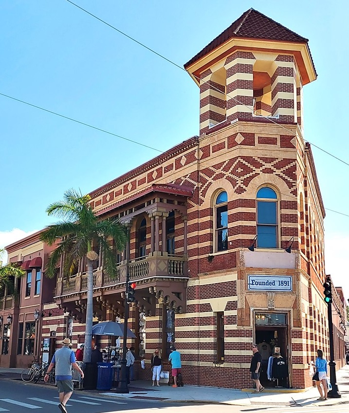
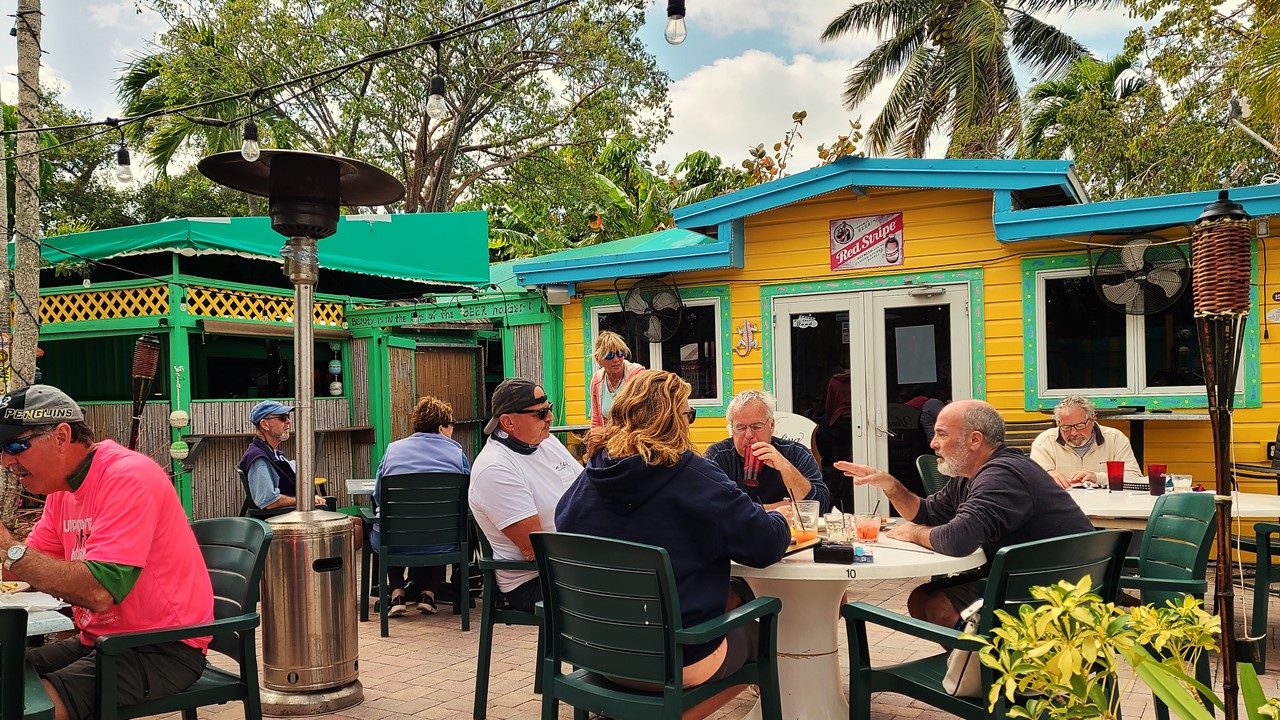
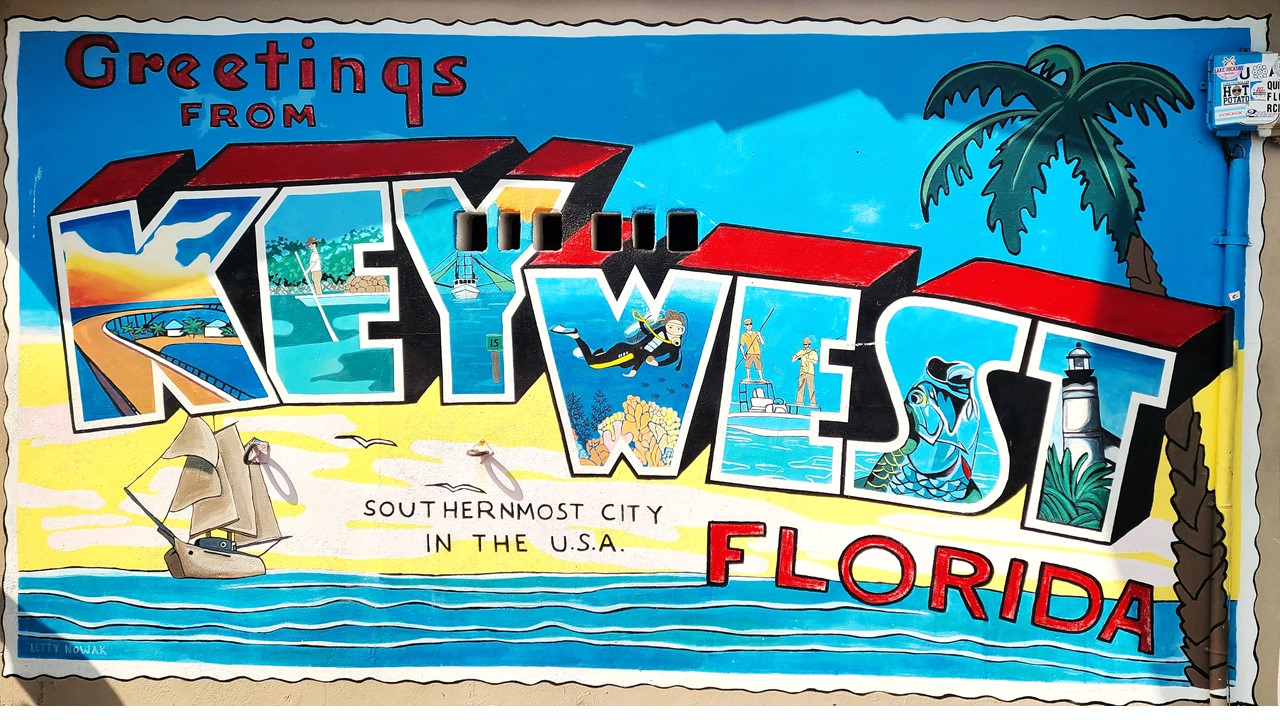
West of Cudjoe Key, a dedicated bridge takes us onto Sugarloaf Key and along to Mile Marker 20 where we stopped for lunch at Mangrove Mama’s – a quaint and kitschy mom-and-pop restaurant with an outdoor patio. After lunch, we began the 15-mile ride back to the car, but this time with a tailwind making the ride much shorter. When we got back to the cars, we loaded up the bike and made the drive to our hotel in Key West – The Hilton Garden Inn (Mile Marker 4) – located at the east end of Key West island, 4-miles from downtown. After checking-in, we caught the hotel shuttle downtown to the front of the Waterfront Brewery and explored downtown and parts of Duval Street. The day’s 36-mile bike ride and the enduring wind chill was rapidly wearing us down, so we ducked onto a restaurant patio with heaters where we had a meal of shrimp and conch fritters and salads. After eating, we strolled through the shops before returning to the hotel for a well-deserved night’s rest.
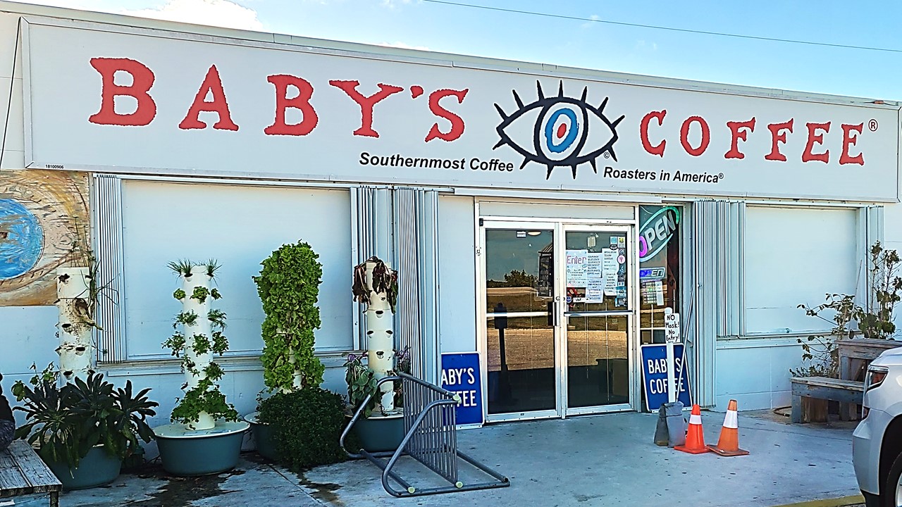
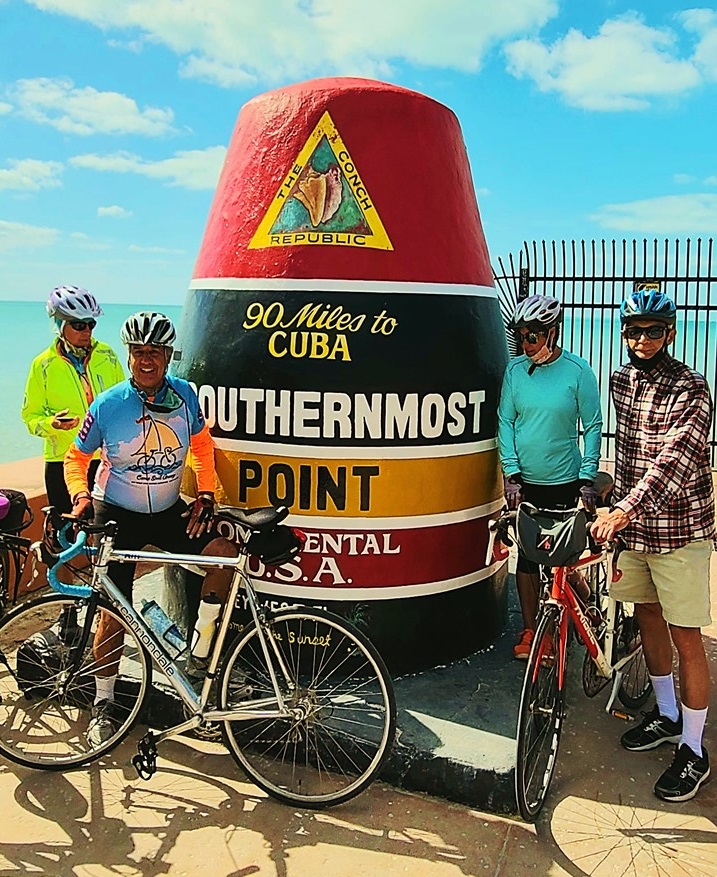
Wednesday morning, we rose early and set off east from the hotel on our bikes onto the most completed section of the Florida Keys Overseas Heritage Trail. The weather was beautiful and along the way we were “buzzed” by military jets doing “touch-and-go’s” at the adjacent Naval base (Boca Chita Field), and passed many people out for a jog, waiting for the bus, or riding their bikes to work. We rode to Sugarloaf Key at Mile Marker 15 where “Baby’s Coffee Shop” is located. This was obviously an immensely popular spot with commuters, and the “socially distanced” ordering line filled the small store. After getting coffee and bagel meals, we ate outside on picnic tables before beginning our journey back. When we arrived back in Key West, we continued riding our bikes along the southern route around the island next to Roosevelt Boulevard (A1A) and continued along the seawall and historic streets until we came to The Southernmost Point in the United States, which is marked by a large red buoy. Here we joined a short queue to get our pictures taken, and then rode the rest of the way around the northern side of the island until we arrived back at the hotel. We cleaned-up from the day’s 30-mile bike ride and caught the hotel shuttle downtown where we walked the waterfront marinas and shops, stopped for drinks and appetizers, and explored the busy Mallory Square tourists’ area. That evening, after returning to the hotel by shuttle, we drove to the store for next-day supplies and to pick-up sandwiches for dinner before returning to the hotel bar for drinks and a few games of cards. Today ended of trip’s bicycling part with a total of over 180 miles over 5-days, covering most of the Florida Keys Heritage Trail by bicycle, traveling both north and south!