September 2020
Bicycling & Exploring Florida’s Everglades National Park
The year 2020 was one where the international travel limitations imposed by the Covid-19 Pandemic refocused our adventurous glances to domestic locations that we had not yet explored. Only hours away from our Florida home is the Everglades National Park – a place that neither of us had visited or ventured into previously. And so, after a bit of hurried planning, we decided to load our bicycles and head for the Park’s Eastern Entrances to learn what we could and to explore this national wonder.
The Park’s history extends back to the 1800’s and early 1900’s when the only human residents of the region were local Native Tribes. The early European settlers viewed the region as a wasteland full of mosquitoes and useless for development. Most of the area is characterized by an immense, flat, limestone plateau with less than a few feet elevation variation, populated by extensive grasses, sparse hammocks of trees and bushes, and covered by ~1-4 feet of water. The water is really a 100-mile wide river that slowly flows south into Florida Bay, providing the habitat for various species of birds, reptiles, fish and amphibians, and providing the source of fresh water for both the recharging of Florida’s aquifers and for Florida Bay. As Florida’s population grew and development capabilities progressed, the water supply to the Everglades was diverted via irrigation and canals to the ocean to create more farmable land. In 1945, the problem had gotten so bad that the dry, central Everglades’ grasses caught fire and destroyed a large part of the ecosystem. In response, the Everglades National Park was created in 1947, and since then, a comprehensive restoration project has been underway to restore the historic natural flow of water to the region, and to remove non-native and invasive species. Today, it is encouraging to see the return of nesting birds and wildlife to the region.
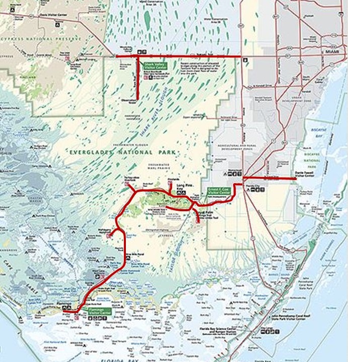
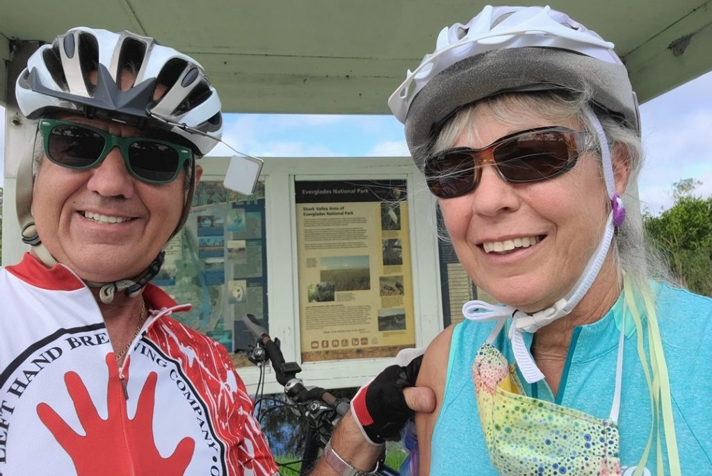
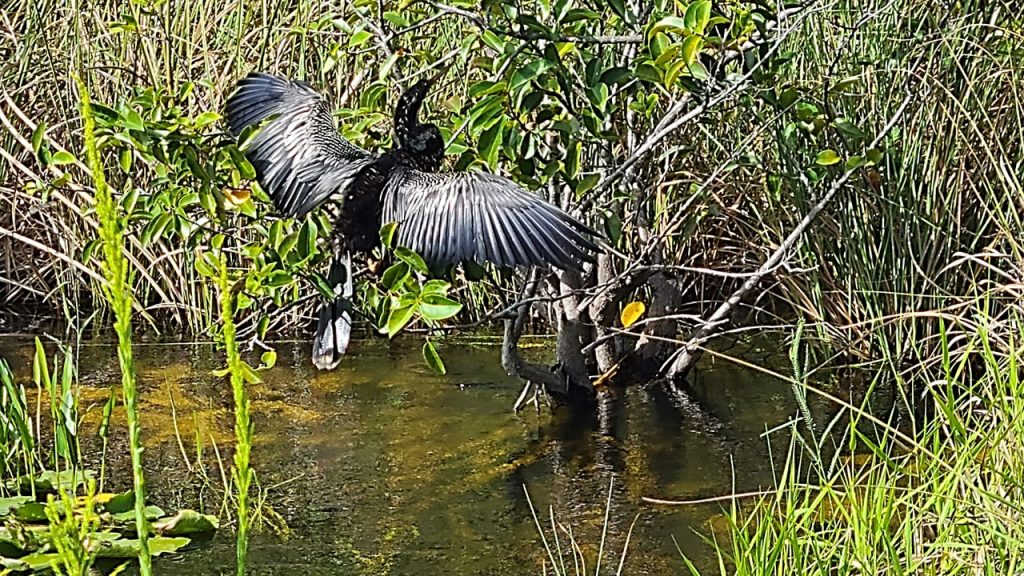
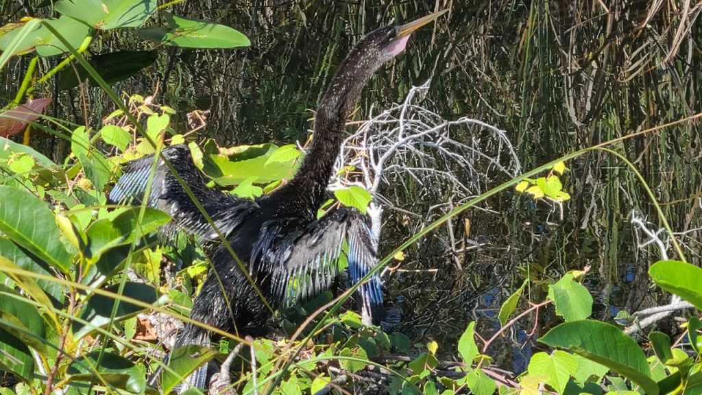
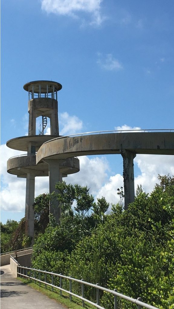
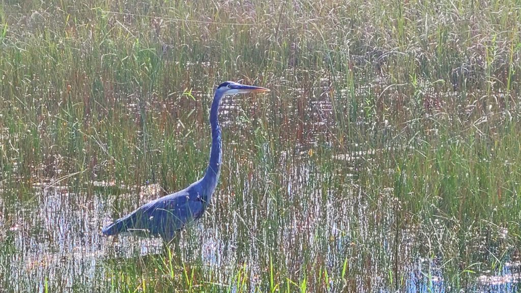
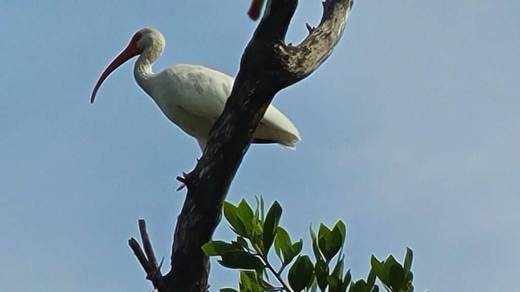
Sunday morning, we rose early and headed in the car to the Park’s most northeastern entrance at “Shark Valley”. Shark Valley is actually a long, wide, shallow valley, only a few feet deep, that extends from northeast to southwest across the Park, and that empties into Florida Bay. The Shark Valley Visitor’s Center is located 30 miles west of the Florida Turnpike, and we parked and unloaded our bicycles when we arrived. Here is located a 15-mile-long loop on paved road through the “fresh-water prairie”, with an observation tower at halfway point. The route is shared by a tour-tram that circles the same loop every hour. As we rode, we observed birds (cormorants, ibis, anhingas and blue herons), turtles and a few small snakes, but no alligators. At the Tower, we climbed to the Observation Deck to look out over a vast vista of sawgrasses as far as the eye could see. The ride was hot and steamy in the mid-day Florida sun, and at the end we visited the Visitor’s Center there for a cold drink and to learn more about the area’s history. After inspecting the area’s other trails the (Bobcat Boardwalk and the Otter Cave Hammock Trail – which was under water), we headed east out of the park through the water Control District to a local Pit Bar-B-Q outdoor place where a cold beer and local pulled pork made for an excellent lunch.
After lunch, we headed south to the Park’s most southeast entrance at the Ernest E. Coe Visitor’s Center located 11 miles from Homestead – an area that was devastated during Category-5 Hurricane Andrew in 1992. The Visitor’s Center has a gift shop and excellent displays, but its Parking Lot is under renovation getting ready for the “winter rush” of visitors and the hourly free tram that they run from there to The Royal Palm Visitor Center located ~8 miles away. After our visit, we headed towards the Royal Palm Center and were intrigued by a sign to the “Nike Missile Center”! We headed down an old, small paved road past denuded limestone covered with ~1-foot of water with a mound of dirt in the distance. Apparently, the area had been used for growing the non-native Brazilian Pepper Plant which has been nearly impossible to eradicate. Therefore, they removed everything above the limestone and secluded it for some number of years in a last effort to eliminate it from the area. Someday, the thin soil layer will be returned to the carbonate plateau.
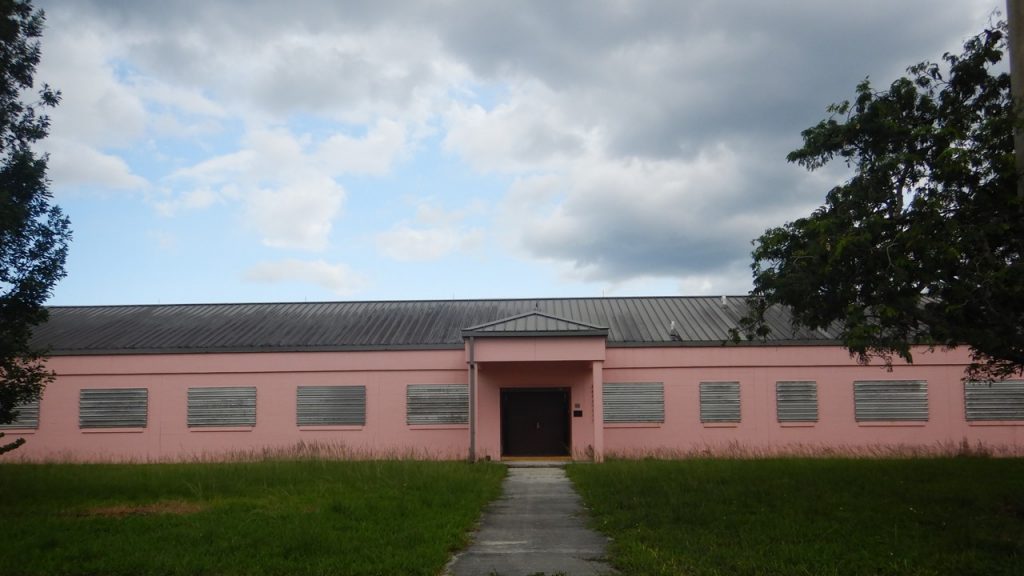
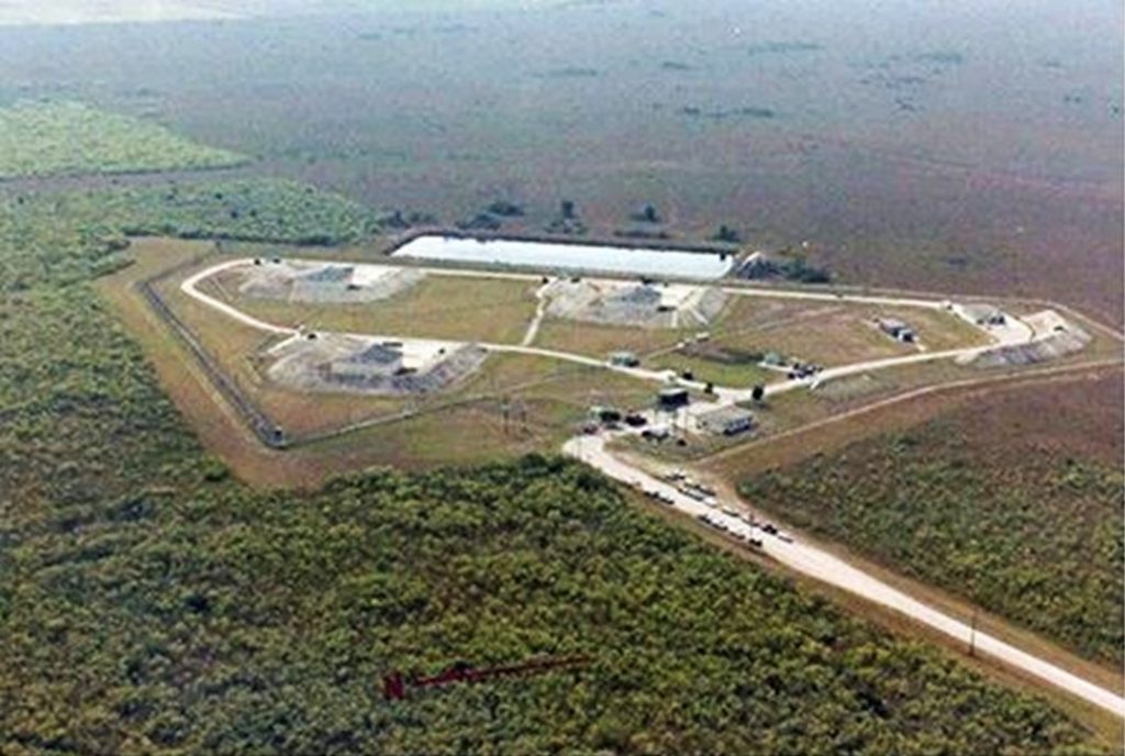
After traveling ~10-miles down this road and passing a South Florida Boy Scout Camp, we came upon a set of pink buildings that were locked up with a dozen Government vehicles parked outside. It turns out that these Administration Buildings were the entrance to the site of the HM69 Nike Hercules Missile Center that once housed nuclear warhead surface-to-air missiles. The warheads are gone, but the barns used to hide them are still there, as is a fully restored Nike Surface-to-Air Missile. Because of the shallow water table and limestone base, the idea of silos was replaced with 3 barns, including 4 bunkers of 6 missiles each, as well as dormitories and guard dog kennels – and, of course, many, many alligators! Although the site was closed the day we were there, it is opened for public viewing with a ranger in the late Fall and early winter. For more information, visit the site: https://www.nps.gov/ever/learn/historyculture/hm69.htm
Excerpts from their site:
HM69 Nike Missile Base – A Relic of The Cold War
Everglades National Park houses one of the best-preserved relics of the Cold War in Florida, a historic Nike Hercules missile site called “Alpha Battery” or “HM69”.
The site remains virtually the same as it was when official use of the site ended in 1979. Construction of the site by the U.S. Army Corps of Engineers was completed in 1965, just after the Cuban Missile Crisis of October 1962. At the time, the nation’s air defenses were positioned to protect against a possible Soviet air attack over the North Pole and thus, this and other anti-aircraft missile sites were established to protect against a possible air attack from the south. The Nike Hercules missile site was listed on the U.S. Department of the Interior Register of Historic Places on July 27, 2004 as a Historic District.
The area includes 3 missile barns, a missile assembly building, a guard dog kennel, barracks, 2 Nike Hercules missiles, and various support elements. HM69 was also significant because of the technology employed. The South Florida Nike Hercules sites were integrated with Hawk missile sites to provide an all altitude defensive capability around South Florida. Approximately 140 soldiers staffed the 3 above-ground missile barns of HM69 to protect against an air attack from Cuba. The personnel of HM69, along with the members of other South Florida unites, received the Army Meritorious Unit Commendation which was one of the few times that it was awarded for deterrence rather than engagement with the enemy.
Visitors may visit the site most days between early December and late March. There is an open house program, as well as Ranger-guided tours. Our visitor programs fluctuate due to seasonal changes and staffing capability. Please check with the Ernest F. Coe Visitor Center or view the park’s calendar for scheduled programs at the site.
After sidetracking to explore the Nike Missile Site, we completed our journey to the Royal Palm Visitor’s Center to check out the trails there. The Center was closed, but we made note of the local trails that were located there in preparation for our return visit the next day. We then drove to scout out the area and trails at Long Pine Key. The Camping Area there was also closed, but the region looked to be a good place to explore by bicycle when we returned.
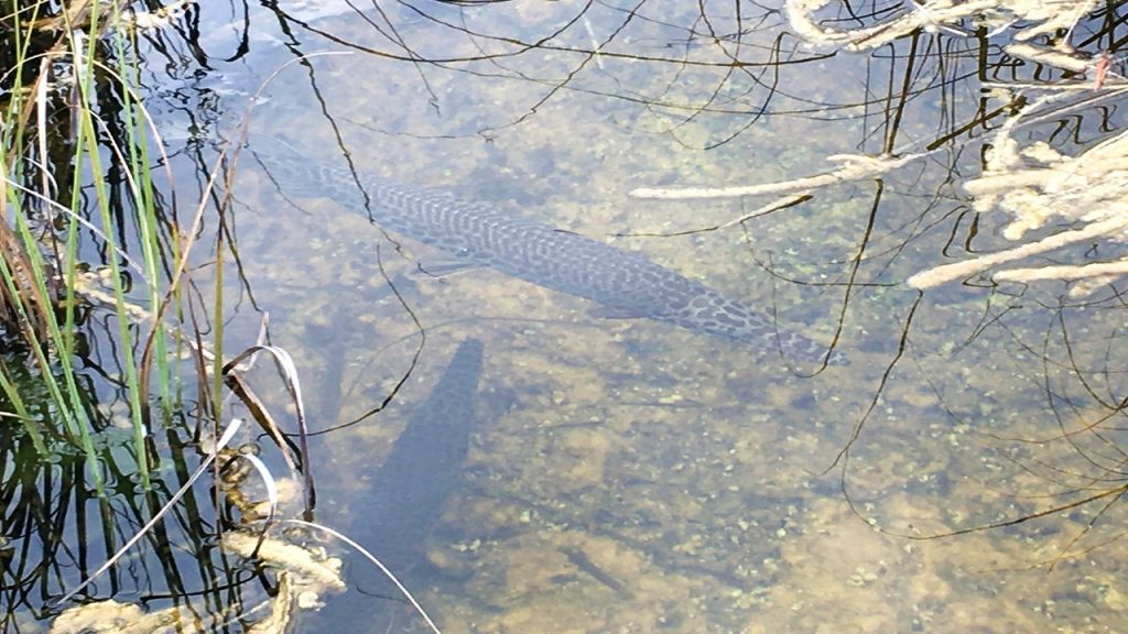
From there, we traveled west on the Main Park Road to a short boardwalk at Rock Reef Pass – one on the highest elevations in the Park – 3-4 feet above sea level! Here we could observe the ibis’ hunting in the grasses and the Florida Garfish swimming in the shallow water. Then, we traveled to the Pa-hay-okee Overlook which provided a boardwalk to a raised platform that overlooked the extensive freshwater Marl Prairie.
After that, we headed back east out of the park just in time to meet a storm that brought wind and heavy rain to our drive. We arrived at our hotel – the Hampton Inn in Homestead at about 5:30pm, where we enjoyed a hot shower, a lite dinner, and a bottle of red wine.
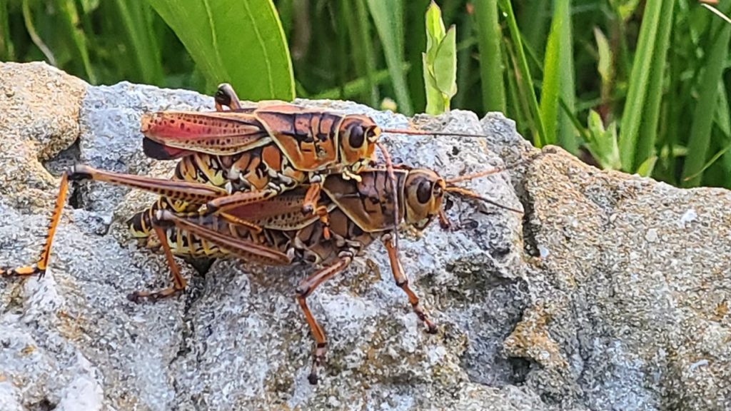
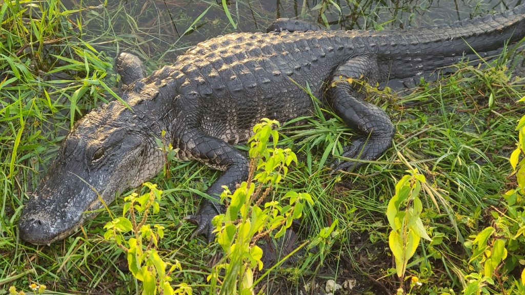
Monday morning, after an early hot breakfast, we headed back to the Royal Palm Visitor’s Center to watch the sun rise and look for wildlife. The Royal Palm Visitor’s Center was originally located among a grove of royal palm trees, but they were wiped out with Hurricane Andrew in 1992. We walked the Anhinga Trail – a wonderful boardwalk loop that winds out over the hammocks and sawgrass prairie. Immediately we came upon several enormous grasshoppers that were mating, and along the side of the trail we saw three different 5-7’ alligators resting warily. The sawgrass marsh was full of birds and small fish peacefully hunting as the sun rose over the horizon.
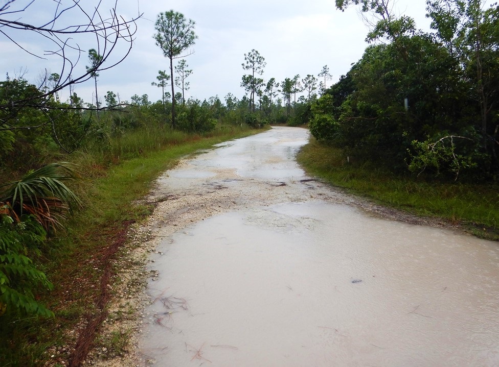
Next, we headed back to Long Pine Key – a two lane limestone track that winds through the pinewood forest for a few miles on some of the higher and dryer land. We unloaded our bicycles and entered at Gate #4 and rode for some distance, but it soon became apparent that the prior evening’s rains had flooded sections of the trail and that the mosquitos were in full attack mode. When the trail became almost impassable, we finally turned around and decided to look for other adventures. After returning to the car, we decided to explore the deserted campgrounds on bike, checking out the lake, the campsites and the new outdoor theater awaiting their eventual re-opening for campers. Then, after loading up our bikes, we drove to the boardwalk at Mahogany Hammock – an area that is still home to a giant Mahogany tree and a tangle of Strangler Fig trees and pairs of nesting owls.
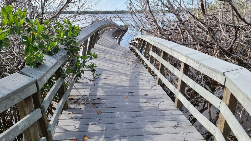
Our next stop was West Lake which was said to have a lovely looped boardwalk through the mangroves and out over the lake. The area was renown to be popular with boaters and picnickers, but we had yet to see another person all day. We set off one direction on the loop marveling at the boardwalk built through the nearly impenetrable mangrove forest and listening to the frogs and fish startled by our presence. However, just before reaching the lake, the boardwalk was closed, and we could see that it was heavily damaged up ahead. We circled back and took the other direction around the loop which went all the way out onto the lake before it was also closed, but it did provide an excellent view of the twisted, broken and contorted remains of the lake portion of the boardwalk. Apparently, Hurricane Irma in 2017 drove huge waves in the small lake that destroyed anything built over the open water.
After West Lake, we continued southwest on the Main Park Road until we arrived at the entrance of the Snake Bight Trail which would take us to a scenic Florida Bay viewpoint. We parked on the roadside, unloaded our bikes and began to ride down the trail. However, it soon became apparent that this trail had not been maintained as we had to fight encroaching bushes, downed trees, and the ever-present mud and mosquitos. Apparently, this end of the park is only principally visited by campers, boaters and hikers in Florida’s winter months of December-February, and the Park does not dedicate many resources to it out-of-season. Therefore, we again decided that discretion was the better choice, turned around and went in search of other areas to explore. Along our journey traveling southwest, we had hoped to explore a paved road and trail to Bear Lake, but this lane was clearly so overgrown that we did not even attempt to enter it.
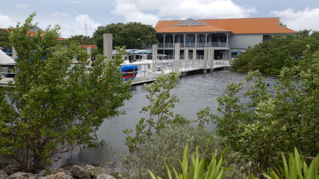
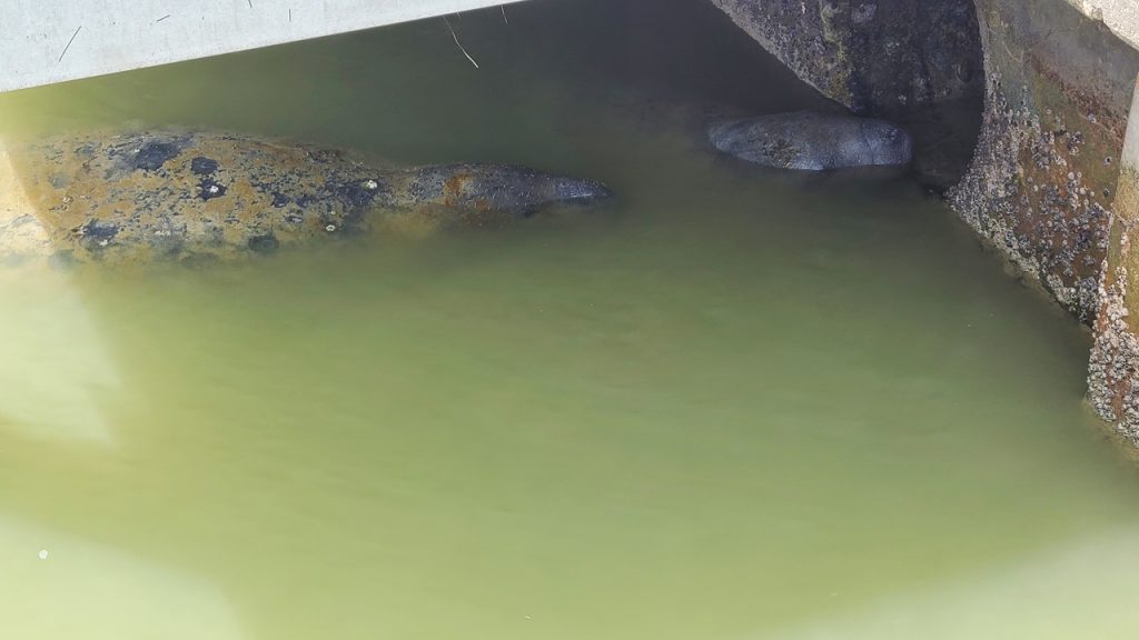
Finally, we reached the end of the Main Park Road at the Flamingo Visitor’s Center located on the shores of Florida Bay. This Visitor’s Center was also destroyed by Hurricane Irma in 2017 and it is currently being rebuilt and is scheduled to reopen in 2021. The construction workers were the first people we had seen all day. In the parking lot, we unloaded our bikes and rode the lovey Guy Bradley trail along Florida Bay’s shore until we reached the Eco-Center Campgrounds. Here there were mowed camping pads, an amphitheater, restrooms, and a series of Eco-Tents – all set-up and waiting for visitors – of which there were none! We rode back to the Visitor’s Center and checked out the adjacent marina and store where we stopped for a snack. The Marina was open and provides fuel, supplies, rentals, and boat tours to visitors. In one section of the marina were a half-dozen manatees snuggling up near a water runoff outlet and we watched them for awhile before biking back to the car, loading up, and beginning the trip back through the park.
Upon exiting the park, it was still early afternoon, and we decided to head east 18-miles to Biscayne National Park, located on Florida’s East Coast between Key Biscayne and Key Largo. The Park encompasses a mainland mangrove shoreline, the shallow Biscayne Bay, the surrounding islands, living coral reefs and a large number of shipwrecks. It was established as a National Monument in 1968 and became a National Park in 1980. It was designated a park to protect both the terrestrial and undersea life in the region. The Park was open, but Hurricane Teddy located offshore had brought huge tides and waves to the region flooding most of the shoreline and boardwalks. We walked the fishing pier and explored the Park’s store before leaving for dinner carry-out from Chili’s, a hot shower and packing for our return trip home in the morning.