June 25, 2015
Ascending Mt. St. Helens
As a matter of fact, we had not planned to climb Mt. St. Helens in late June of 2015. However, because of a fortunate confluence of circumstances, our good friends, Peter & Nikki, had already committed for an addition spot that suddenly came available, and they were kind enough to invite me (Rocky) along. The trip was planned by another good friend, Cliff, a seasoned geologist and volcanic hobbyist, who had already climbed Mt. St. Helens five previous times over the past 20 years, all since the catastrophic eruption of the mountain that took numerous lives in 1980. Since Julie was committed to family obligation, Rocky took them up on the offer with only a couple weeks of notice, having most of what would be needed already stored in the closet.
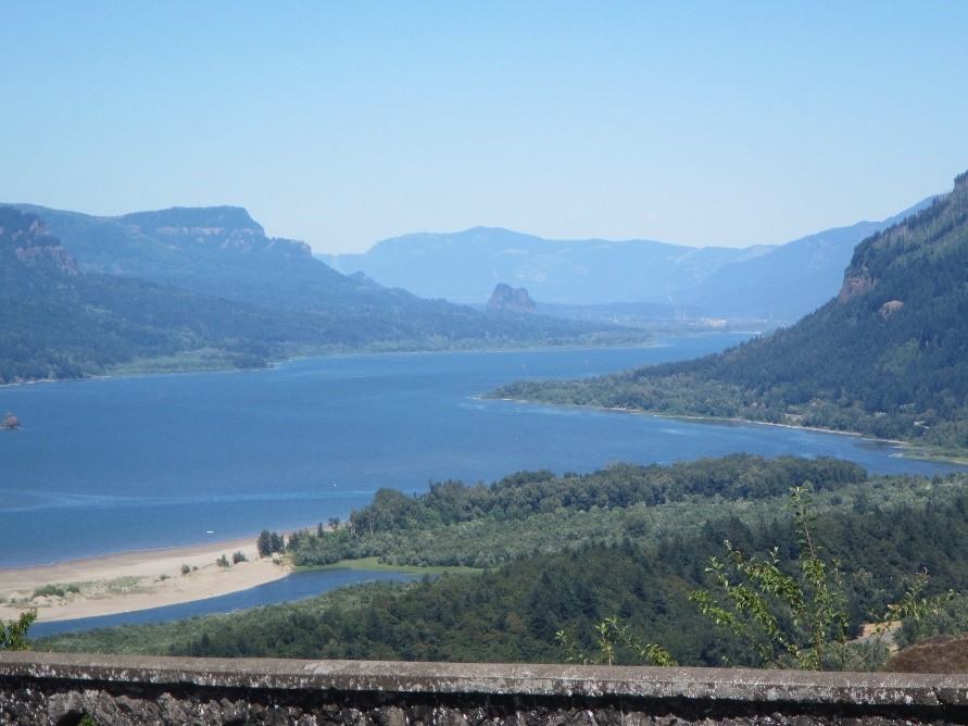
The trip would begin with air flights from Orlando to Portland, where the “Team of Ten” would assemble over Thursday and Friday. After collecting rental cars, the earliest arrivals on Thursday would briefly sightsee in Oregon along the Columbia River before heading to our assembly point at a quaint motel in Woodland, Washington.
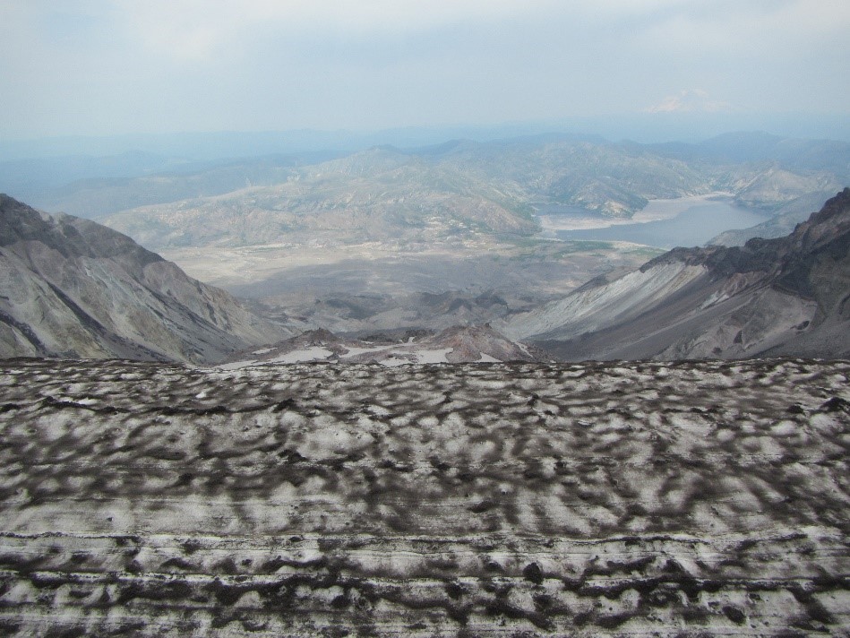
Friday, as we continued to assemble, we traveled north to the side of Mt. St. Helens which collapsed in 1980. Although authorities were wary of the grumbling volcano that year, and had evacuated much of the immediate area, no one expected what actually happened. An earthquake destabilized the entire north face of the mountain which slid down the valley uncovering the weight which held the volcanic forces in place directing a massive eruption sideways destroying everything within may miles of that north face. Today, the first beginnings of plants and animals are showing life among the desolate landscape.

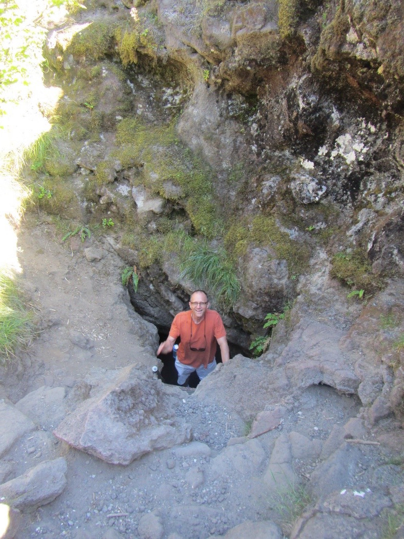
Having time left in the day, we re-circumnavigated the mountain and went to the south face near where we would ascend from tomorrow (Saturday). In that area are remnant “Lava Tubes” – geologic features remaining from streams of lava where the ceiling solidifies while molten rock continues to flows in an “underground river.” Sometimes, the molten rock empties the underground channel leaving a “hollow tube” of igneous walls, floor and ceiling. Peter, Buddy and I decided to “hike” the 1 ¼ mile-long “Upper Tube” at Ape Caves, requiring headlamps and sturdy footwear to navigate the treacherous ripple and pock-marked wet floors and numerous ceiling cave-ins in pitch-darkness. The “hike” took us 2-hours, and although the surface temperature was 95 degrees, it was 42 degrees in the cave. Unfortunately, the ankle-busting terrain took one casualty as Buddy twisted his ankle and would be unable to ascend the mountain the next day.
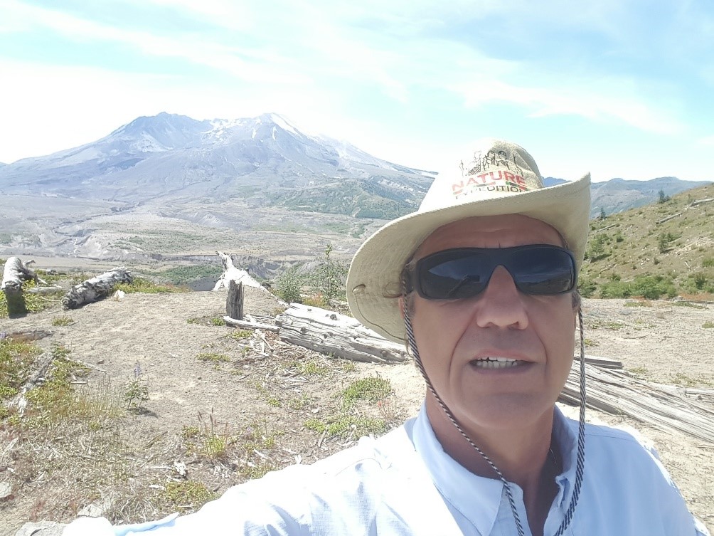
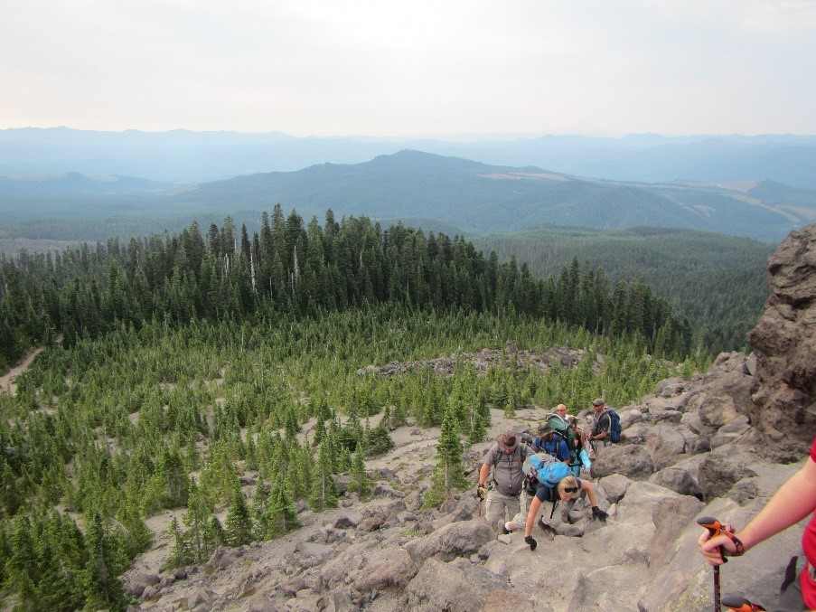
Saturday required waking at 3am, gathering our 9 remaining climbers and making the 90 minute drive to “Climbers Bivouac” at elevation ~3800’ to start at ~4500’ ascent to the crater’s rim at 8365’. We signed in at left for the first part of our journey through 100 year-old forest for the first 2 hours until we emerged from the tree-line at ~4800’ elevation. Beyond this point, our assigned-day climbing permits were required. These are scarce items as only 100-per-day are made available, and they are grabbed-up almost immediately. Graciously, Cliff had done this for the group and we set off now scrambling over boulders and rocks for the next 3 1/5 hours. Our choice of days aligned with record high temperatures for the area, and as the thermometer exceeded 95 degrees, our climb became that much more difficult. Unfortunately, the grueling, strenuous and dangerous climb took its toll and 3 more of our party stopped before reaching the top of the boulder fields and began their descent down.
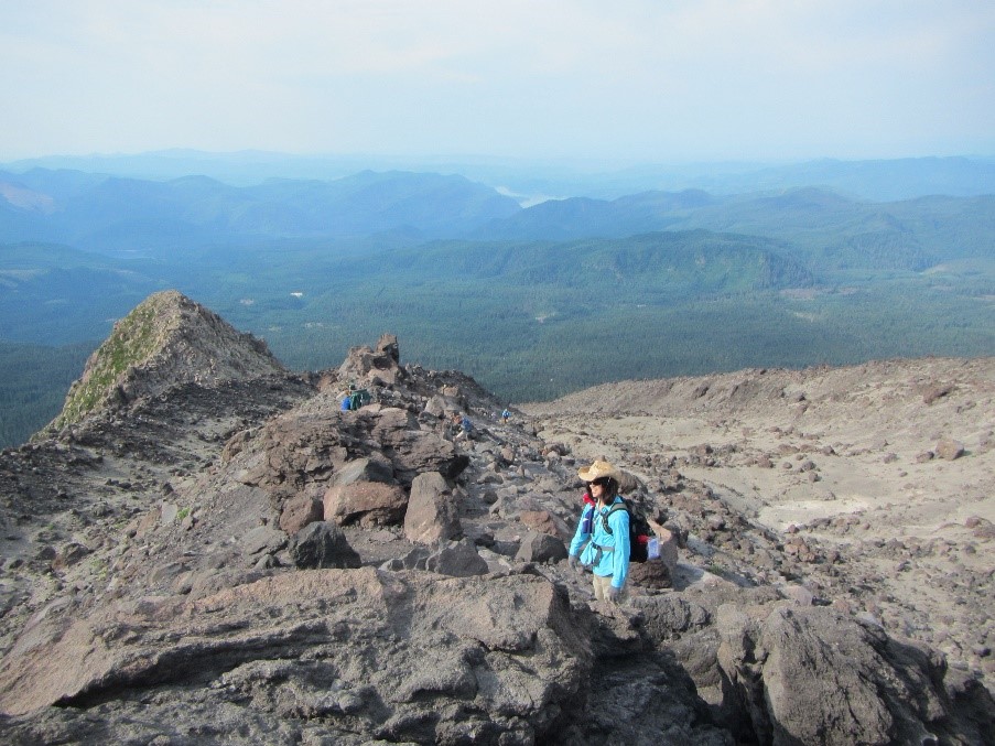
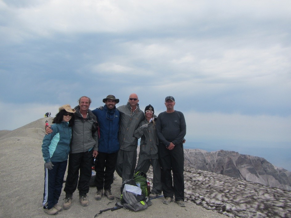
With our remaining group of six, we continued our ascent, eventually leaving the boulder fields and beginning the final 1000’ ascent on steep-faced “ash” – which was actually an assortment of unstable pea-gravel and unrooted boulders that slid-down 1 step for every 2 taken. Finally, after another 1 ½ hours of struggle, we reached the summit!
Once there, after 7 hours of climbing, we relaxed, caught our breaths, ate lunch and toasted each other with champagne. The view was spectacular as the haze cleared, and slowly, a cold front came in causing us to don our coats.
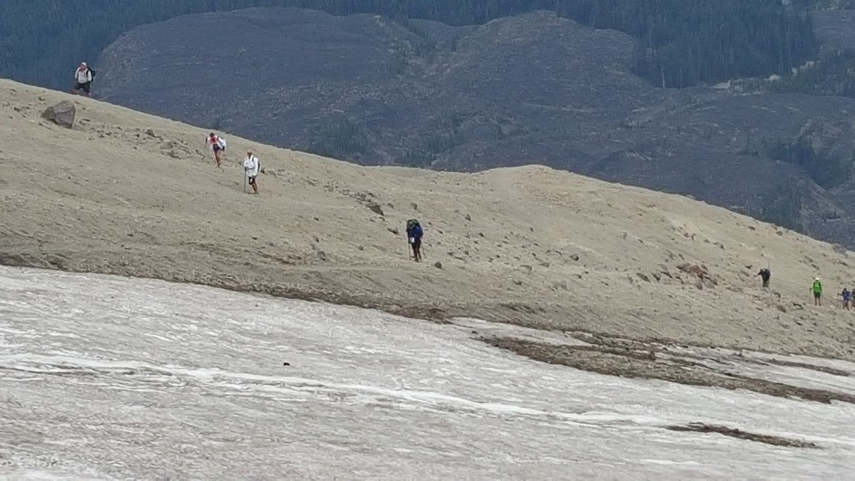

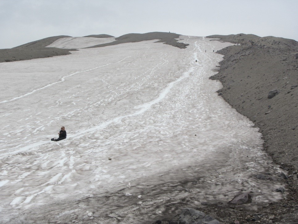
But now, it was time to consider our way down, and, although the snow-pack and glaciers were small, there was still some opportunity to “glissade” down the top part of the mountain. Some of us chose the “sitting method, (those with “tough” butts), sliding down over 500’ in elevation. But, this enjoyment was short-lived, as we needed to spend the next 4 ½ hours making our way back down. It was a long and trying journey, but definitely one of great accomplishment and personal satisfaction.