Visit west to the Snaefellsnes Peninsula and the Town of Stykkisholmur
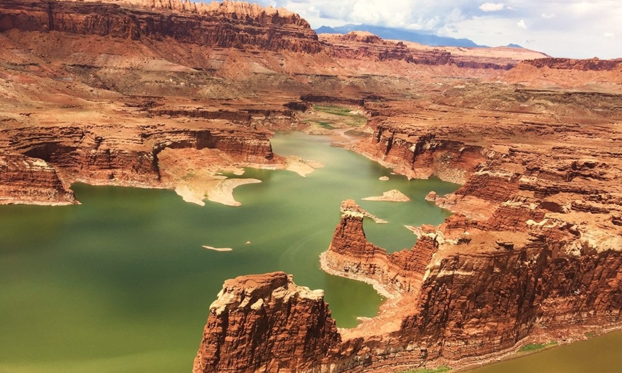
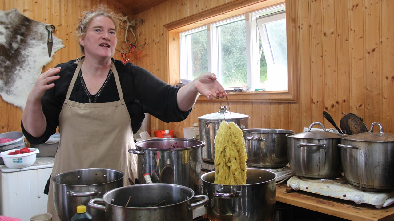
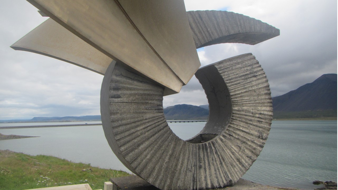
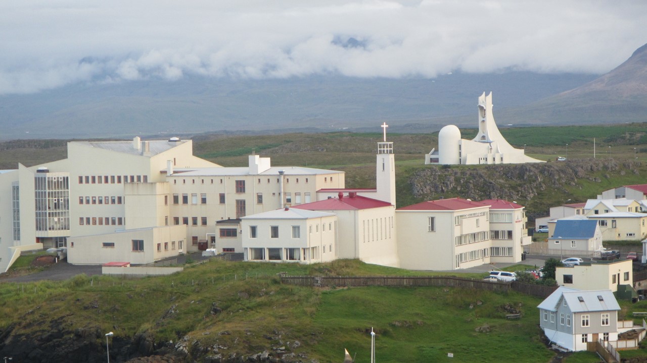
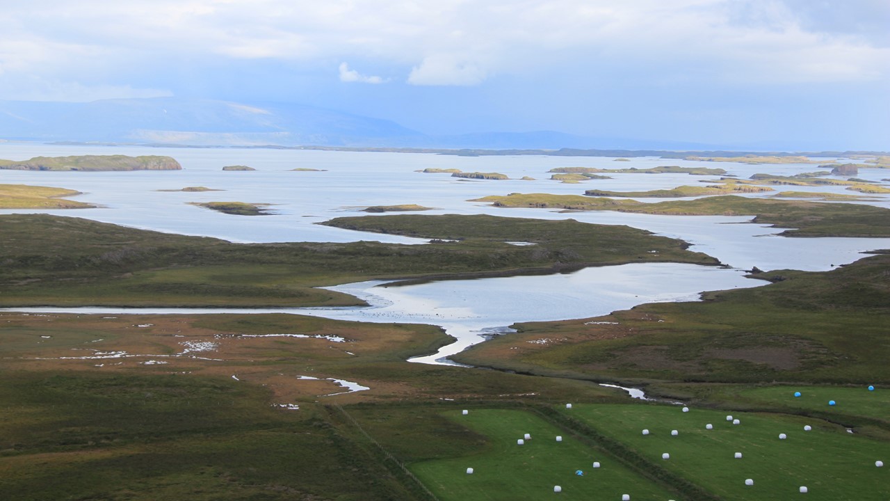
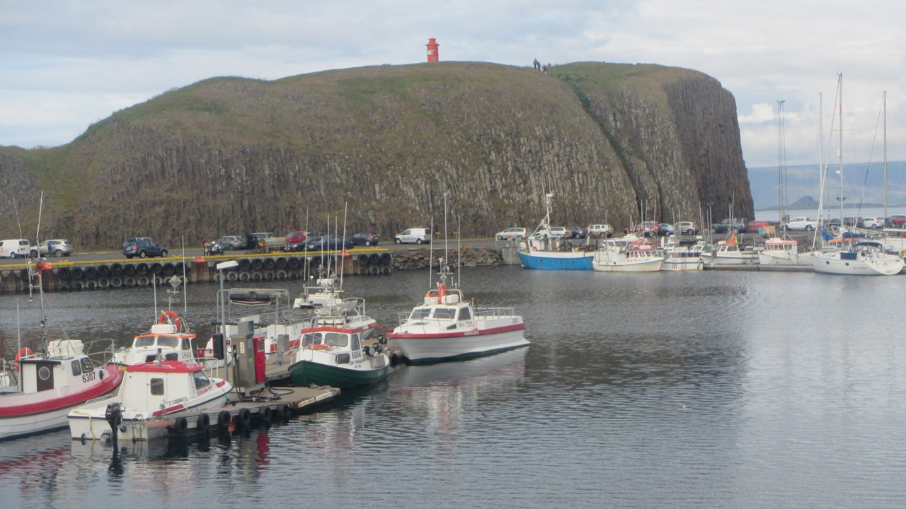
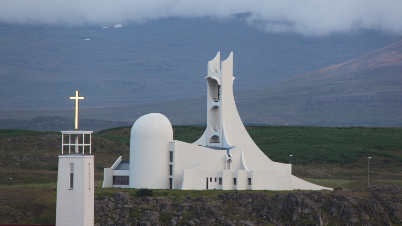
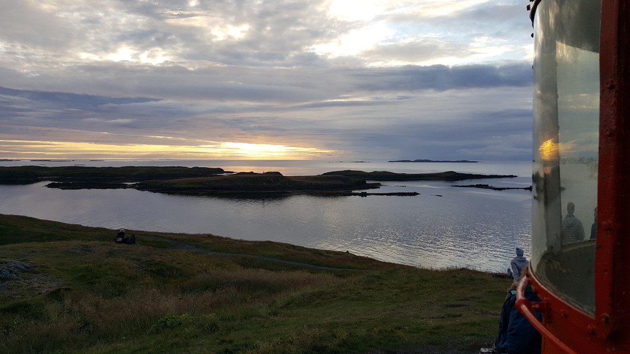
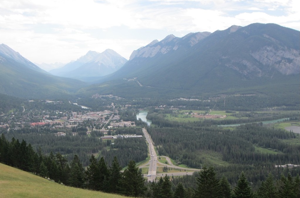
This day, after our breakfast buffet, we drove west out of the city of Reykjavik through the sparely settled countryside. The Icelanders have lots of sheep, and lots of smaller Icelandic horses (NOT ponies)! The average farm size in Iceland is ~2600 acres, and the dominant crop is grain and hay for the animals in the winter, followed by root vegetables (potatoes, turnips, and beets). Most of their other vegetable are actually grown in geothermal heated greenhouses.The average family has ~1.9 children, and after the country’s bankruptcy about a decade ago, it has grown to be one of the wealthiest countries in Europe.The coast is a series of deep fiords, making road travel difficult.However, the country does have a well maintained “Ring Road” that circumnavigates the country. Along the way, we traveled a 2-mile tunnel under one of these fiords to travel alongside the Borgarfjordur fjord, named for the stories of the large whale that lived in the fiord who was known for sinking ships and terrorizing early settlers.We also used the occasion to learn a little Icelandic, such as Godan daginn (good day). Finally, we arrived at the workshop of Gudrun – a University Professor and wool dyer that only uses traditional historic materials. We watched as she dyed her Icelandic wool with local herbs and plants. After looking at a small local hydroelectric plant nearby, we traveled to visit to the Settlement Center of Borgarfjord and toured an exhibit that described the turbulent period of the Vikings. After lunch there, we walked to the local monument and took pictures, before re-boarding the bus and traveling to the holy mountain, Helgafell, where we climbed to the top, picked crowberries, faced east and made our wishes. From here, we traveled to our hotel in harbor city of Stykkisholmur (pronounced “Sticky – sholmer).This town is the largest on the peninsula, and after checking-in, we walked through the town to identify landmarks, stores and restaurants. and then dined on a lamb-starter, lightly salted cod (bacalá) and ice-cream for dinner.After dinner, the extra light allowed us to walk back to the town’s harbor where we climbed to the lighthouse for a 360-degree view of the setting sun, before returning to the hotel for a night’s sleep.
Gudrun Demonstrating the Dying of Wool
Monument at Settlement Center of Borgarfjord
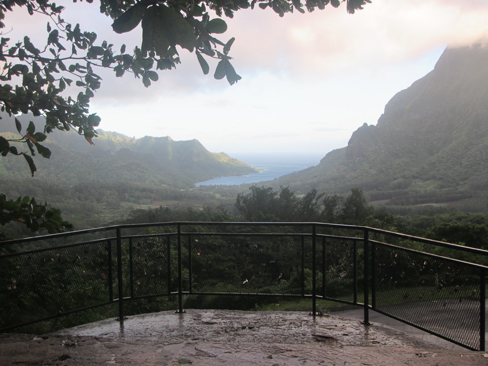
Overview of the Town of Stykkisholmur
Facing East from the Holy Mountain of Helgafell
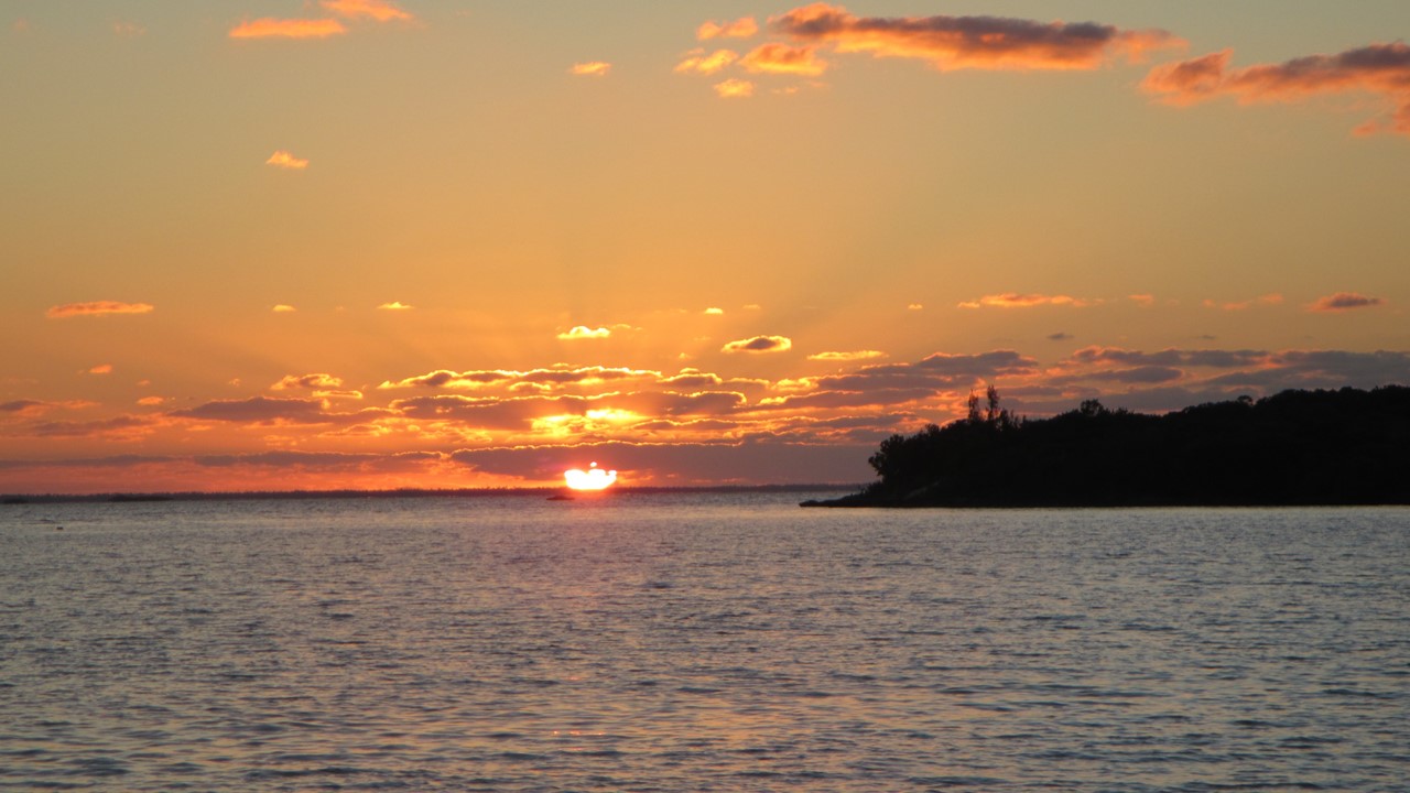
The Harbor & Lighthouse at Stykkisholmur
The Church at Sunset in Stykkisholmur
Sunset from the Lighthouse at Stykkisholmur
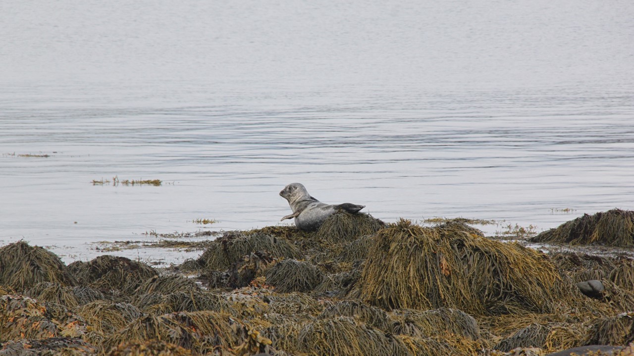
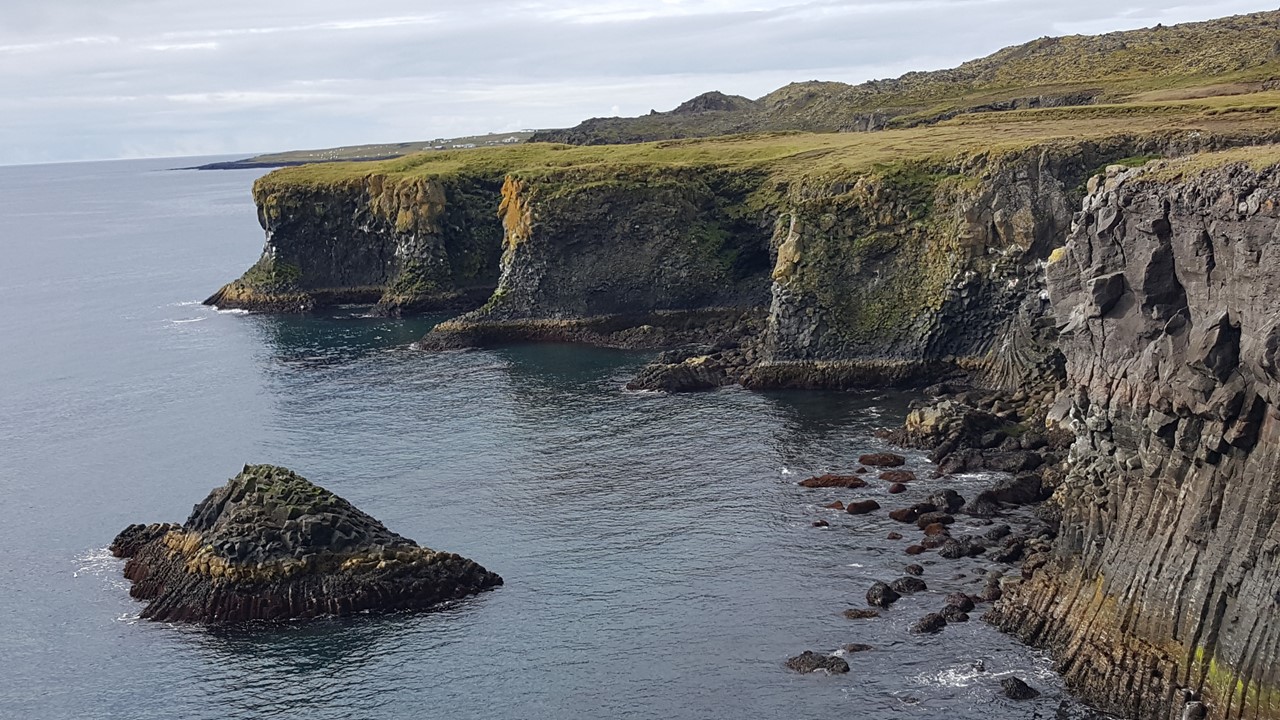
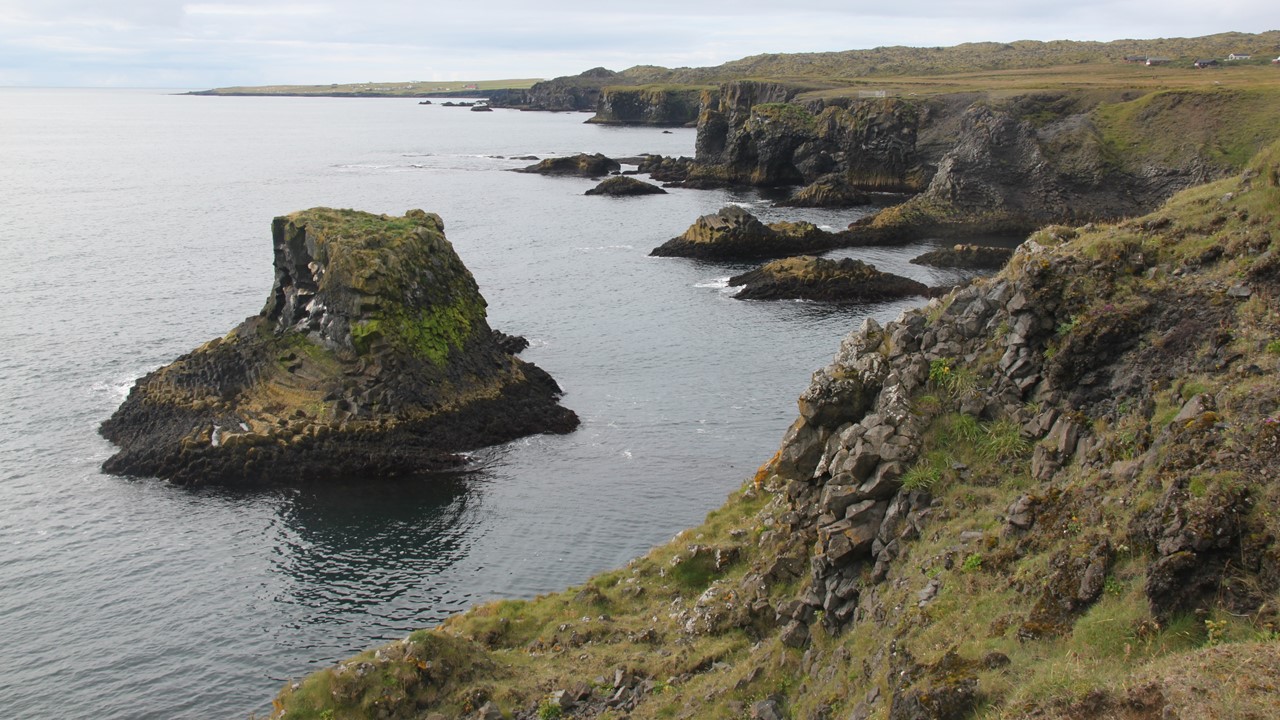
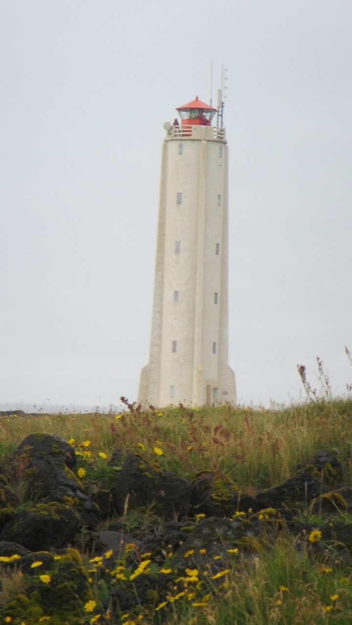
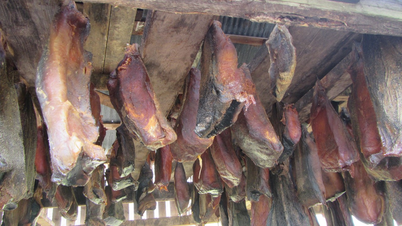
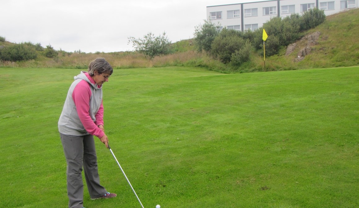
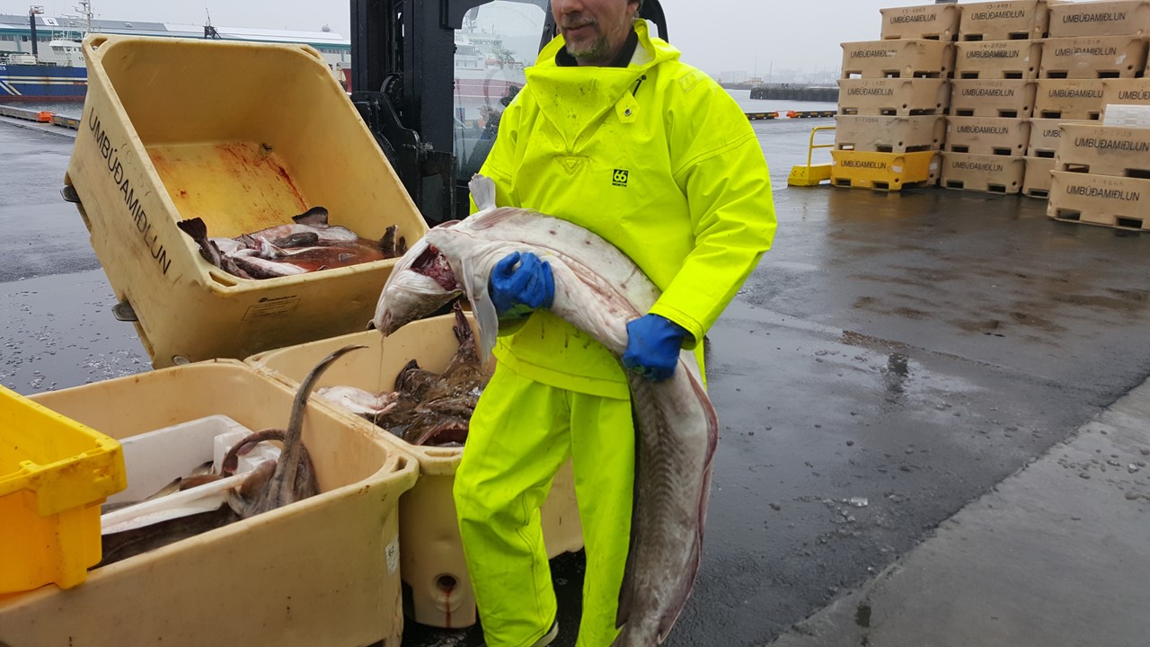
The next morning, we ate an early breakfast, and boarded the bus for a trip around the Snaefellsnes peninsula, home of Snaefellsjokull glacier from where the adventure of Jules Vernes’ “Journey to the Center of the Earth” was inspired. From there, we stopped for a visit on the coast at Ytri-Tunga, where we observed both Harbor and Grey Seals sunning themselves on the rocks.After a quick coffee stop, we went to the town on Arnarstapi to hike along the coastal cliffs of the peninsula observing the blowholes and lava basalt pillars and the numerous Kittiwake seabirds nesting there.Then, it was on to Hellnar for lunch at the smallest, quaint seaside café in the region – “Kaffihus Hellnum Fjoruhusid”.Lunch was a shrimp & fish soup with delicious homemade bread and Skyr yogurt cream for dessert. We then continued our journey around the peninsula, stopping at various places to take pictures and enjoy the views, including the sighting of a 50-60 ft whale making his way west along the coast. At Malarrif, we climbed up a local lighthouse that happened to be open with a local artist’ – Jonina Gudnadottir – display inside and took in the spectacular views of the Snaefellsjokull glacier the top.The Lighthouse was built in 1917 and was 24 meters high with 100 steps up to the light.Scattered around the lighthouse’s base were a plethora of whale bones gathered from the local area, reminding us of the life led by the locals.From here, we visited an ancient volcano crater that was capable of being driven into, and which is typical of the landscape that would surround us the rest of the day.From Malarrif, we traveled to a local ice cream shop, then into the Bjarnahofn area where we visited the Bjarnarfoss waterfall, before traveling further to visit the home and shop of the local harvester of Greenland shark and their Shark Museum.The Greenland sharks are a protected species but are sometimes caught as a by-product of cod fishing, and when available, are brought here for processing and utilization. These sharks have inedible flesh due to the high concentrations of urea, so it is hung-up and dried for 3 months that allows the meat to become edible and is considered a national delicacy.We tasted the dried shark meat – “hakarl”, which carries a very strong taste, and is best enjoyed with a shot of schnapps!After this, we traveled back to our hotel, and headed into town on a “free night” for dinner.Dinner was at Restaurant Narfeyrarstofa where we had salads and scallops, followed by a shortened round of golf play at the course behind the hotel, and packing for the next day.
Grey Seal on the Rocks at Ytri-Tunga
Coastal Cliffs at Arnarstapi
Coastal View at Hellnar
The Lighthouse at Malarrif
Drying Shark Meat at Bjarnahofn
Playing a Hole of Golf behind the Hotel
The next morning, we were packed and ready to depart from Stykkisholmur and continue our journey northeast towards the Arctic Circle.
A summary of our 2018 Visit to England, Iceland and Greenland
Two of the places that we’ve never been are Iceland and Greenland.Anyone that we’ve talked with whose been to Iceland has had nothing but very nice memories of soaring landscapes, sea mammals and northern lights. We figured that if we were going to Iceland, that we might as well check out Greenland, and also use the occasion to visit good friends in England.
A Visit to Reykjavik, Iceland
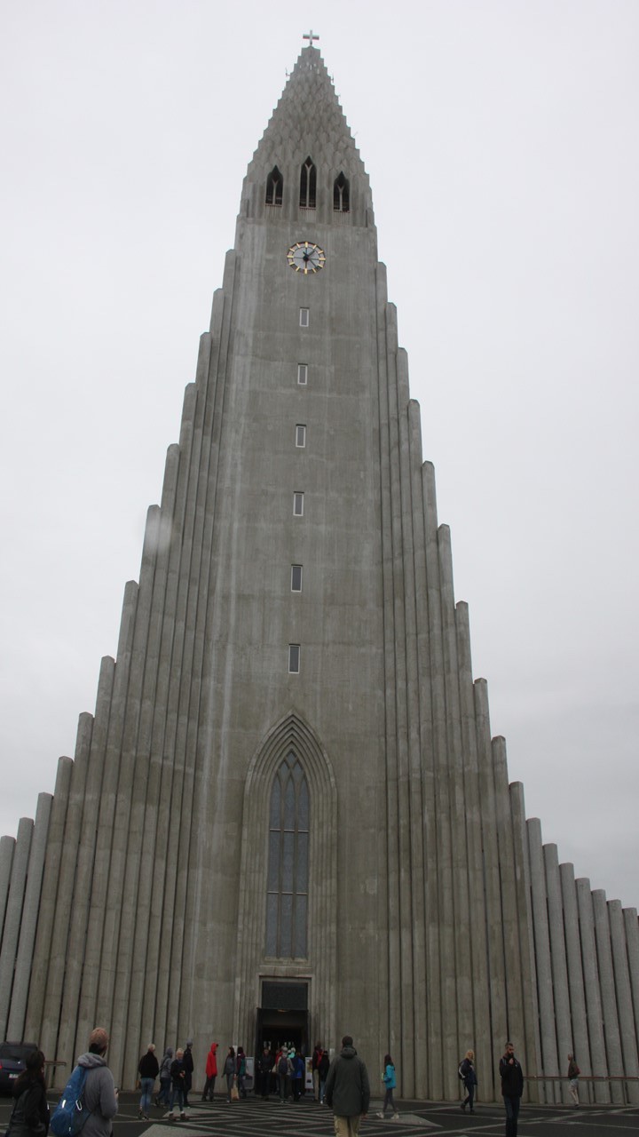
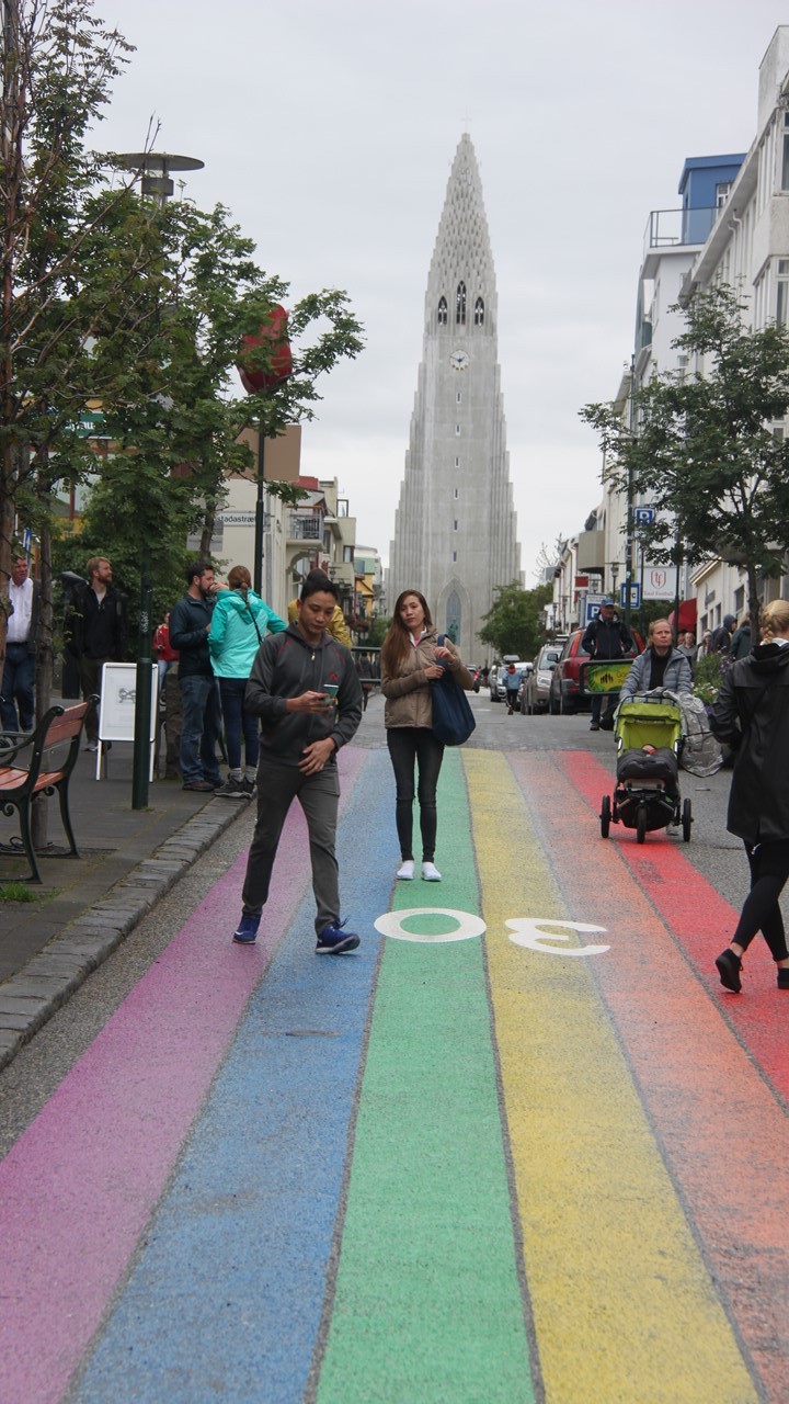
After our visit with them, we took a 4-hour direct flight from Heathrow, London to Reykjavik, Iceland, and were met at the airport by our taxi driver who took us the 45-minute drive to our hotel located on the outskirts of town.Here, we met our tour guide, Heiddis (pronounced Hath-deese), a middle-aged single mom of one teenage son, who has been working in the tourism industry for a long time.After checking-in, we took a private walk to the shore located a few blocks away.The name of the city “Reykjavik” means “Bay of Smoke” and describes the city’s location and weather perfectly.The day was cloudy and drizzling, but the cool air felt crisp and refreshing.After returning to the hotel, Heiddis took our group into downtown via the city bus, for an orientation walk through town.After a wander past the popular “Penis Museum”, we walked to Langordatur – Iceland’s first indoor swimming pool built in 1937.From there, it was on to the impressive largest church in Iceland, Hallgrimskirkja, then to the Parliament building, and the City Hall by the Pond of Reykjavik. After a quick bakery stop, we walked on to a monument to Iceland’s first settler before bussing back to the hotel for “Happy Hour” and our Welcome Orientation and a dinner of Arctic Char.
View over Reykjavik
Largest Church in Iceland, Hallgrimskirkja
The Rainbow Road in Reykjavik
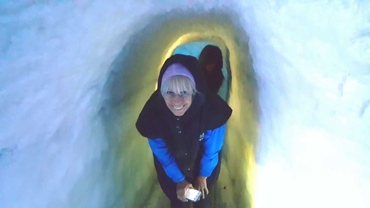
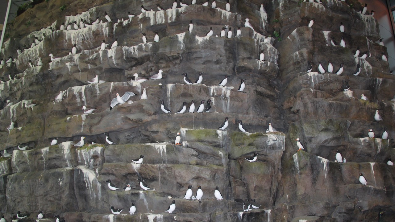
Monday morning started with the hotel’s breakfast buffet before we city-bussed back into town to the Ocean Cluster House located in the city’s old harbor area, for an interesting presentation with Villi about the fishing industry in Iceland. While waiting to meet with him, we were lucky enough to meet with a local fisherman who was unloading his weekend’s catch of monkfish, cobia and cod.Villi spoke of improved sustainability and utilization of their fishing industry’s cod catch, and we observed a range of products, such as design lamps and leather jackets, not to mention getting a chance to taste dried fish, cod liver oil, pensyme and canned cod liver.While there, we had a lively discussion about Iceland’s whaling industry.After this, we visited the National Museum to learn about the history of Iceland from 850 AD to the present.This was followed by a lunch of fish & chips, and then a small group of us went by bus to the Perlan Museum for “The Wonders of Iceland” display. The museum had a number of interactive displays that highlighted the forces of nature (volcanos, earthquakes and geothermal energy) and included a walk through a full-size, real ice cave and a life-scale seabird cliffside.From there, we caught the bus back to the Harpa (Reykjavik’s Concert Hall), whose glass wall is made from a series of concentric hexagons, representing the basalt columns that characterize the island.From here, it was back to the hotel for a Happy Hour social, dinner and packing for tomorrow’s journey west.
Unloading Fish in Harbor
Julie in the Ice Cave
Seabirds on the Cliffside in The Perlan
Artistic Window Architecture of the Harpa Concert Hall
A summary of our 2018 Visit to England, Iceland and Greenland
Two of the places that we’ve never been are Iceland and Greenland.Anyone that we’ve talked with whose been to Iceland has had nothing but very nice memories of soaring landscapes, sea mammals and northern lights. We figured that if we were going to Iceland, that we might as well check out Greenland, and also use the occasion to visit good friends in England.
Visit to England
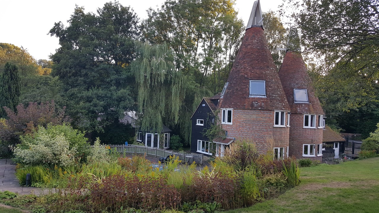
Our trip started with a flight from Washington Dulles Airport to London Heathrow via British Airways.We were met at the airport by our friend, Guy, whom we had met and spent a good deal of time with when we lived in Nigeria.After a brutal commute from London Heathrow to South Essex to the southeast of London, we finally arrived at Guy and Sue’s home – an old Oast nestled into the rolling fields of the countryside.Their Oast consists of twin 3-story cylinders that were historically used to dry hops to make beer.The hops were grown locally, dried in the Oasts, and then bundled and baled in the attached “barn”, (which now serves as a 2-story attachment.)The collection has been renovated to include ~5 bedrooms, 3-baths, a kitchen, living room, den and laundry room. When we arrived, they were just seeing off previous guests and family who had attended a weekend birthday gathering.Here we also met Guy and Sue’s first grandson, (only 3-months old), and his parents.It was exciting to see our friends’ daughters all grown up and starting families of their own, as we had known them when they were children. For lunch we went to a little restaurant called “The Vineyard” where all the ingredients are sourced locally.Here we ate pork terrine, a Pimm’s cup, and fish wraps.That afternoon, we sat in the garden drinking wine and chatting about what’s happened in the 3 years since we were last together.
The Oast
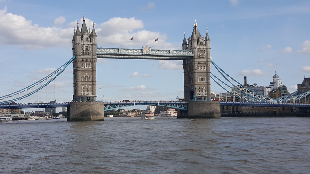
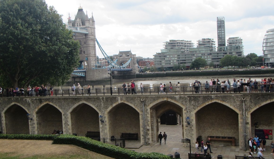
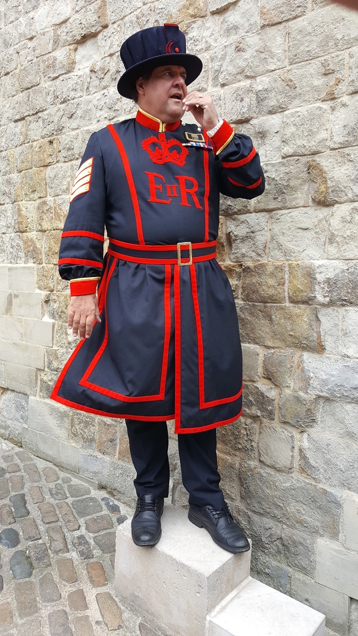
Tuesday morning, Rocky and Julie got an early start on the 1-hour train ride from the town of Stonegate to London where we walked across London Bridge to The Tower of London.At the Tower, we took the tour with a Beefeater guide learning about the 900 years of history of The Tower complex.We skipped the Crown Jewels tour because of long lines, but we visited the museum looking at centuries of armor and weapons. After visiting The Tower, we walked to Katherine’s Wharf to meet Guy and Sue for drinks and lunch at “The Dicken’s Inn”, after which we made a long walk along the river past The Tower, through the Cheap Side, through the Financial District and past the Bank of England to St. Paul’s Cathedral where Diane and Charles were married.From there, we walked over the Millennial Bridge (the wiggly-wobbly bridge, as it is locally known), to the other side of the Thames, where we stopped for tea and coffee before heading past Shakespeare’s Globe to Borough’s Market – a series of shops selling cheese, fish, spices, teas, oil, vinegar, etc.Here, we stopped for drinks and dinner at Q-Fish – a restaurant near where “Bridget Jones” movies were filmed, after which we walked back to London Bridge Station to take the train back to Stonegate, where their daughter picked us up and brought us home to the Oast.
Tower Bridge
Inside the Tower of London
Our Beefeater Guide
The next morning, we awoke to a country breakfast, and spent the morning helping pack away the kitchen in readiness for an upcoming kitchen remodel.After lunch, we went for a walk along the area’s country lanes to a pub called “The Bull”, a favorite of ours from last time we visited. Here we enjoyed the beautiful afternoon before heading back to the Oast for dinner and a quiet evening.
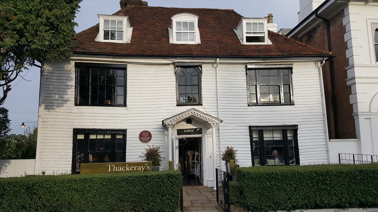
The next morning was Julie’s birthday, and after seeing deer in the garden, we enjoyed breakfast before Julie and Sue set off to visit Sue’s elderly relatives, and to run errands.Meanwhile, Rocky and Guy nearly finished packing the kitchen, before it was time for a late lunch, followed by an afternoon of birthday bubbly.For dinner, we dressed up and went out to eat at “Thackerays”.This restaurant was located in a lovely old building build in 1640 and was renown for its world-class chef and tasting menu.For her birthday, Julie had duck with foie gras, cod with ratatouille cannelloni, and white chocolate souffle with raspberry sorbet. Rocky had a crab tartlet, halibut and cheesecake.All finished with chocolate birthday cake!A fantastic meal polished off at home with a nightcap and a good night’s rest.
Thackeray’s for Dinner
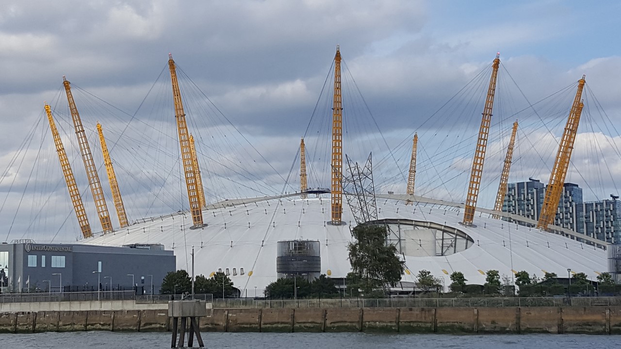
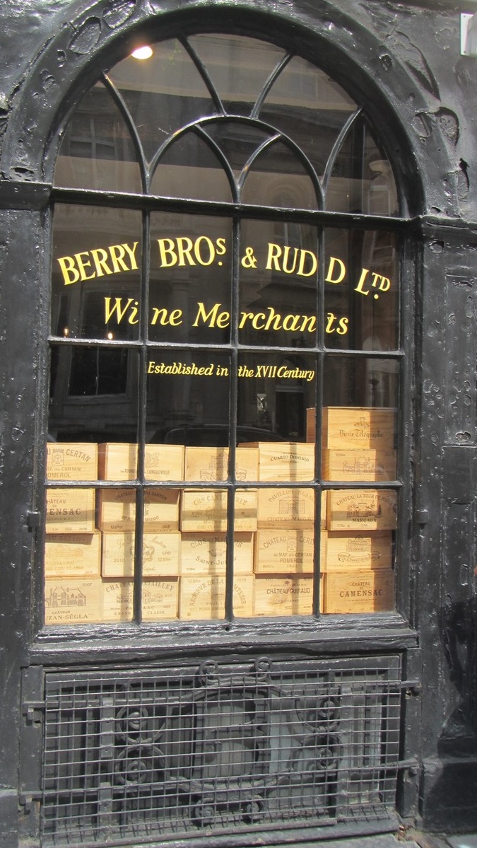
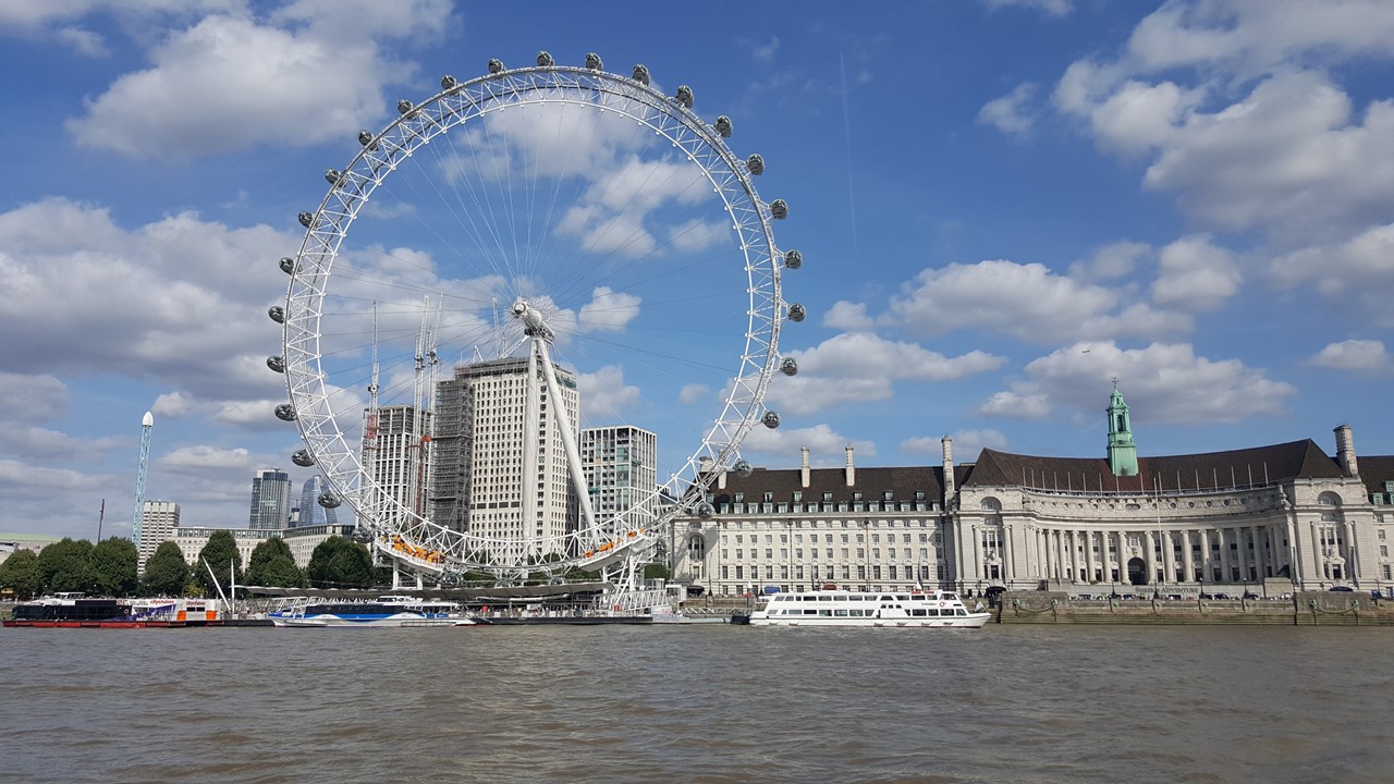
The next day, we drove to Bexley to visit Guy’s mother who had recently bought a new house.After tea and pleasantries, we drove to the O2 where we boarded the Thames Clipper, (a boat bus), for a trip into London by boat past Greenwich, Masthouse, the Canary Wharf, and the Tower of London to The Embankment, where we disembarked and found a local pub, “The Coal Hole” for sandwiches. After lunch, we walked to St. James Palace and took a 45-minute tour of Clarence House – the official London residence of Prince Charles and Duchess of Cornwall, Camilla.The grounds boasted a beautiful front garden, a portico and a portico that was being renovated.After the tour, we walked through St. James Park, stopping to visit “The Kingsman” clothing store (yes – the one in the movie).From there, we went to “Berry Brothers and Rudd” (Britain’s oldest wine & spirits store) operating for over 3 centuries!Their cellars stretch over 2-acres underground where they house the world’s best selection of “investment” wines. From there, we walked to Horseguard Square where the mounted Cavalry is housed, and then to Westminster Pier where we boarded a Clipper ship back to the O2. We spent the evening with nibbles watching “The Blues Brothers” movie before calling the day’s end.
The O2 Concert Stadium
The Millenium Bridge & The Shard
Berry Brothers & Rudd Cellars
The Eye
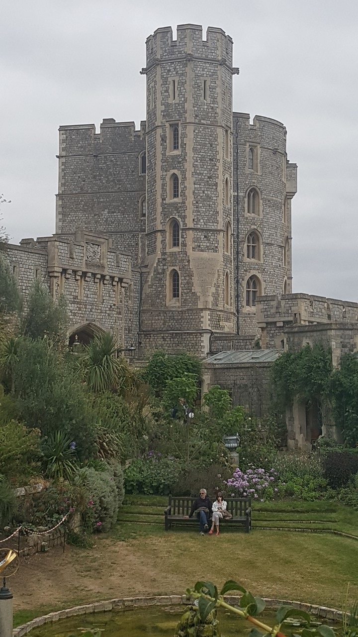
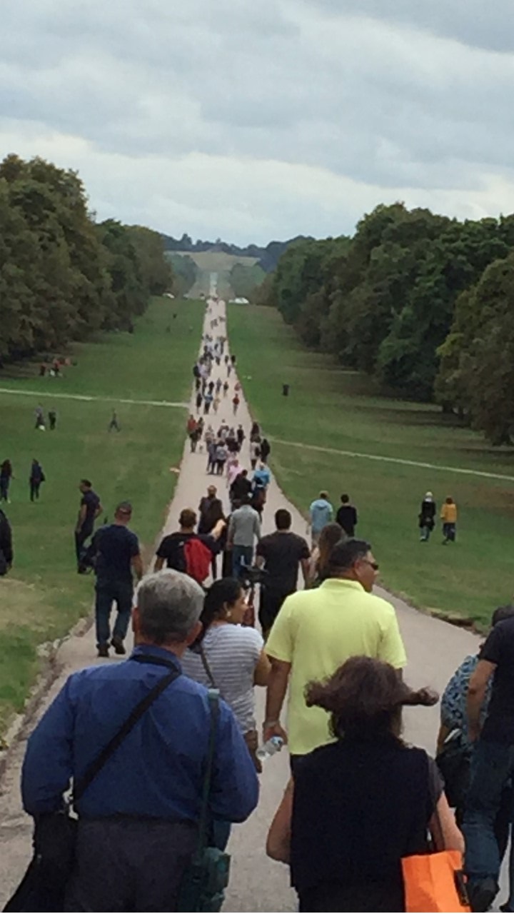
On Saturday, we drove to the town of Windsor to see the town and tour the castle while Guy and Sue visited their daughter, son-in-law and grandson.Since we had pre-bought tickets, we avoided the long lines and walked in just in time to be the last to tour St. George’s Chapel, followed by wandering the terraces and grounds, and touring the State Apartments, (including the Drawing Room, the Waterloo Room, the King’s Chamber, and the Queen’s Chamber.We then walked part of “The Long Walk” – a 2 miles straight path leading to the Castle’s Gates, before meeting Guy and Sue for drinks, and then having dinner at “The Giggling Squid” restaurant.We then met up with their kids and grandkids picnicking locally.That was our occasion to say our goodbyes, before being dropped off at the Heathrow Airport Hilton for our flight to Iceland the next morning.
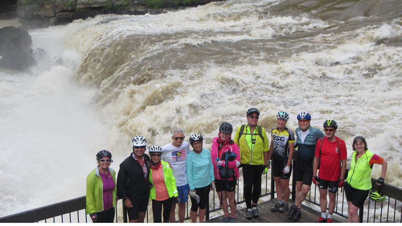
The 2018 Father’s Day Weekend brought the running of the 30th Anniversary of the Great Ohio Bicycle Adventure, and our brother-in-law’s 30th participation in it.A.J. is one of only a couple of dozen people who have ridden every running of this event, and this year we were lucky enough to be able to join him in this celebration.The 2018 GOBA began and ended at the Delaware County Fairgrounds, north of Columbus, Ohio, and circles Columbus counterclockwise for a week of bicycling and camping.
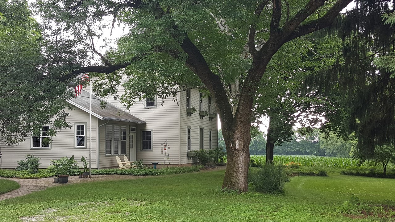
A.J. & Pam’s Farm House in Dayton, Ohio
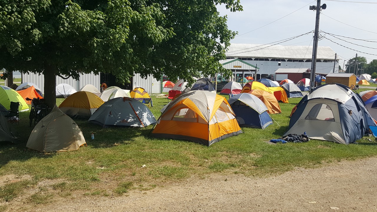
On Sunday, June 17th, we rose early at Pam and A.J. house in Dayton, and arrived at the Fairgrounds at 6:45AM, where we registered, loaded our luggage into the Luggage Travel Vans, and parked our cars.By 7:20AM, we were cycling on the road through pastoral settings past large farms and fields of corn and soybeans.Today’s terrain was reasonably flat with only 250ft of elevation change.The Breakfast stop was at the 13-mile mark, where locals sold PB&J sandwiches, fruit and breakfast burritos.Lunch was provided by Subway at the 31-mile mark, but 1-mile before then, A.J. suffered a catastrophic tire blow-out requiring a temporary tire patch and new tube.With appreciated, friendly help from recreational cyclists from the Trek Bike Shop in Dublin, Ohio, we limped into the lunch stop where A.J. had new tires and tubes installed.After repairs, we resumed our ride to the afternoon water stop at the 40-mile mark.However, this stop was not set-up, and by now, the temperature had reached a humid 92 degrees F, and many participants were stopping to rest and struggling with the heat.Luckily, 2 young ladies from Phat Daddy’s Pizza were at the 45-mile mark giving away much-appreciated bottled water.After 57 miles, we arrived at the London, Ohio Fairgrounds where we located our luggage, set up our tents and were off to the well-needed shower trucks.After showers, we all walked the one mile into downtown looking for a cold beer.However, today being Sunday, we could only find one local bar, “Jim’s”, where the beer was cold, and we were the only customers that were not local.After getting refreshed, we walked to Phat’s Pizza to “thank” them and to enjoy a gyro pizza snack.We returned to the Fairgrounds for a spirited came of cards and a quiet afternoon.That evening, we enjoyed pulled pork sandwiches from the “Buckeye BBQ Truck” before settling in for an early night’s sleep.
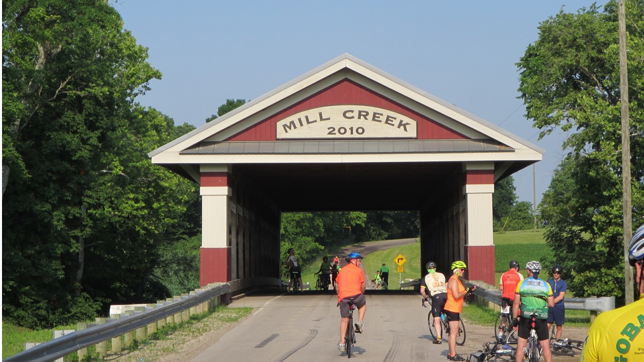
Famous Mill Creek Covered Bridge outside of Columbus, Ohio
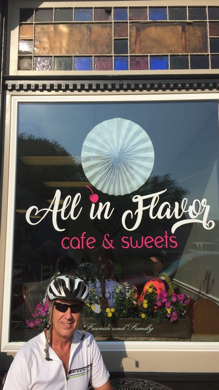
On Monday morning, we awoke ~6:15AM and set off on our bikes to the nearby town of South Charleston, 13 miles away along the paved National Bike Rail Path.In town, we located a small Coffee Shop called “All in Flavor Café & Sweets Shop” where we enjoyed breakfast burritos, bagels and coffee.From there, we rode leisurely back to the Fairgrounds for showers, and then shuttled back into London to visit the public Library – one of the nearly 2500 Carnegie Libraries originally built in 1905 by philanthropist Andrew Carnegie.Although added-on-to in 1989, the original plasterwork, molding and tall ceilings remain.Here we caught up on world news, charged our cell phones and relaxed in air-conditioning.Afterwards, we returned to the camp at the Fairgrounds for a round of cards, before shuttling to a Mexican Restaurant for chili rellenos, fajitas and quesadillas. After dinner, we returned to camp to relax and settle-in for the night.
Breakfast at All in Flavor in South Charleston, OhioRocky putting up the tent at the CampsiteGOBA-town at the London, Ohio Fairgrounds
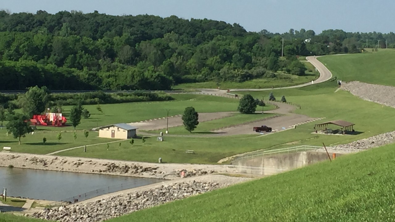
Tuesday morning, we were up at 5:00AM to pack, take down our tent, and load up our luggage into the luggage vans.We were on our bikes by 6:00AM for the day’s 54-mile ride south on the west side of Columbus.The route included passing through Madison Lake State Park, and into Deer Creek State Park where a massive dam creates a beautiful lake surrounded by wildflowers, a marina, beach and lodge.Today’s ride was hot again, and water stops were welcomed along our way to the town Circleville.A.J. and Rocky made the complete ride in 3 ½ hours with all stops and average a surprising 18 mph!At Circleville, we stayed on the school grounds where all three schools (Elementary, Middle, and High School), are located.Here, we initially set up our tents, but on hearing of the strong likelihood of evening storms, we took advantage of the opportunity to stay in the gymnasium for the night.Therefore, after repacking our tents, we set up our bedrolls indoors before we traveled into town for huge, late lunch at Buffalo Wild Wings followed by a visit to the Circleville Library, where a series of special programs for GOBA riders was made available.They provided drinks, snacks, popcorn, games, puzzles, movies and charging stations in an amazing show of hospitality and graciousness.After enjoying ourselves for a couple of hours, we headed back to the camp where we strolled about before settling in for the night.
Deer Creek State Park looking over the Route
The next morning, the gym lights went on at 5:00AM, and we were up, packed and ready to get the day started.After dropping our bags at the luggage vans and grabbing a quick cup of coffee, we set off in the beginning light only to be met with a thick fog that soaked our clothes and covered our bikes and glasses. Today’s 53-mile route travels up and down in hilly countryside, challenging our climbing ability, and reaching downhill speeds approaching 40 mph!Our breakfast stop was in 16 miles, at a local Methodist Church.However, they had only just found out about hosting it, and were scrambling to meet the hungry and thirsty hoard of riders.Lunch stop was another 12 miles away at a local family’s produce farm where the whole family was on-hand to help and to sell fruit, sandwiches, snacks and drinks.After lunch, the fog cleared, and we made our way into the city of Lancaster where the route went through the center of town into the front gates of the Lancaster Fairgrounds.Here, Rocky and A.J. set up the tents and everyone took a well-deserved shower before heading across the street to a local pub that had opened the day Prohibition ended.Here we had some cold drinks and snacks before catching the shuttle back to downtown, which was in full celebration.Lancaster had arranged a city celebration for the cyclists including a city-center stage and band, stilt-walkers, cotton candy, etc.From here we went to the library to catch up on the news of the day, and to charge our electronics, until they closed at 5:00PM.After they closed, we went to the town square to enjoy the festivities and play a few hands of cards, until A.J. had to attend his “Golden GOBA Dinner” – honoring those who had ridden so many years.During A.J.’s dinner, the rest of us headed to O’Houl’s – an authentic English Pub where we had fish & chips, mushy peas and nachos.During dinner, a huge rainstorm hit, but it had subsided by the time we met to walk back to camp.That night, the rains came and went, but we were cozy in our tents and sleeping bags.
A J and Rocky ready to set off on their bikes
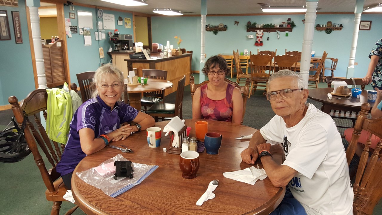
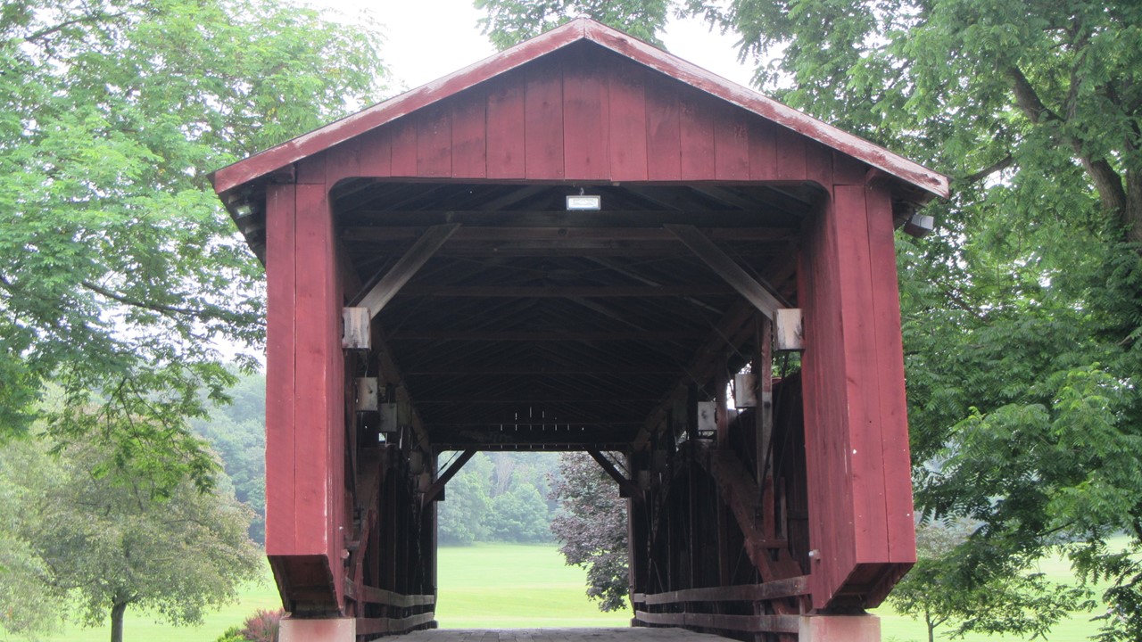
Thursday morning was overcast but dry and was the day of the Summer Solstice!We “slept in” until 6:15AM, when we got up and decided to ride the 15-miles from Lancaster to Pleasantville for breakfast.The ride was beautiful and cool – passing 3 old covered bridges and a few gentle hills.Unfortunately, the restaurant that we were looking for wasn’t in Pleasantville but was another 5-miles down the road in the town of New Salem.After some confusing directions from locals, we finally found “The Old Town Diner” – a quaint “one woman” establishment that was the favorite hangout of the locals.The owner was a pleasant woman who greeted, served, cooked, bussed and washed dishes, all the while cheerful and attentive to a not-full coffee cup or water glass.The food was excellent, and we conversed with the local customers before setting off for the return bike trip back to camp.
At breakfast at the Old Town Diner in New Salem, OhioOld Covered Bridge in Lancaster, Ohio
At camp, we showered and then looked at the impending weather forecast.That evening and the entire next day called for torrential thunderstorms, and so we made the decision to “bail”!We called for an Uber to take the girls the 60 miles back to the cars in Delaware, and meanwhile Rocky and A.J. packed up the gear and the tents, and moved everything, including the bikes, under cover in the “Goat Building”.Since it would take the girls 2 ½ hours to get to the cars and return to Lancaster with them, Rocky and A.J. revisited the local bar to replenish their fluids while waiting.The girls arrived with the vehicles ~ 2:40pm, and after loading gear and bikes into the vehicles, we made the 1 ½ drive back to the farmhouse in Dayton. Another GOBA – albeit shortened – under our belts!
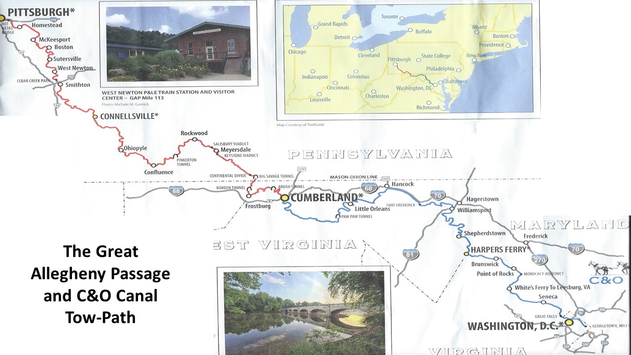
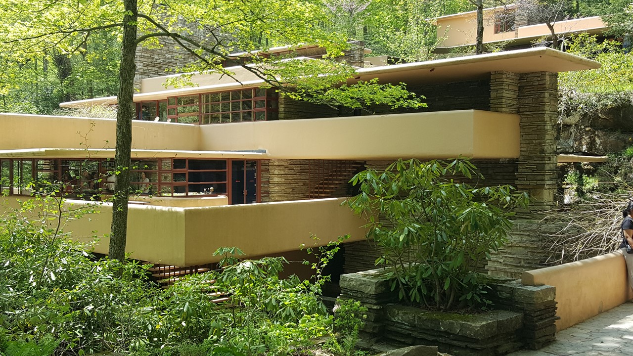
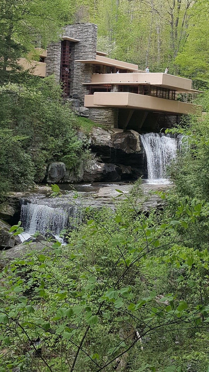
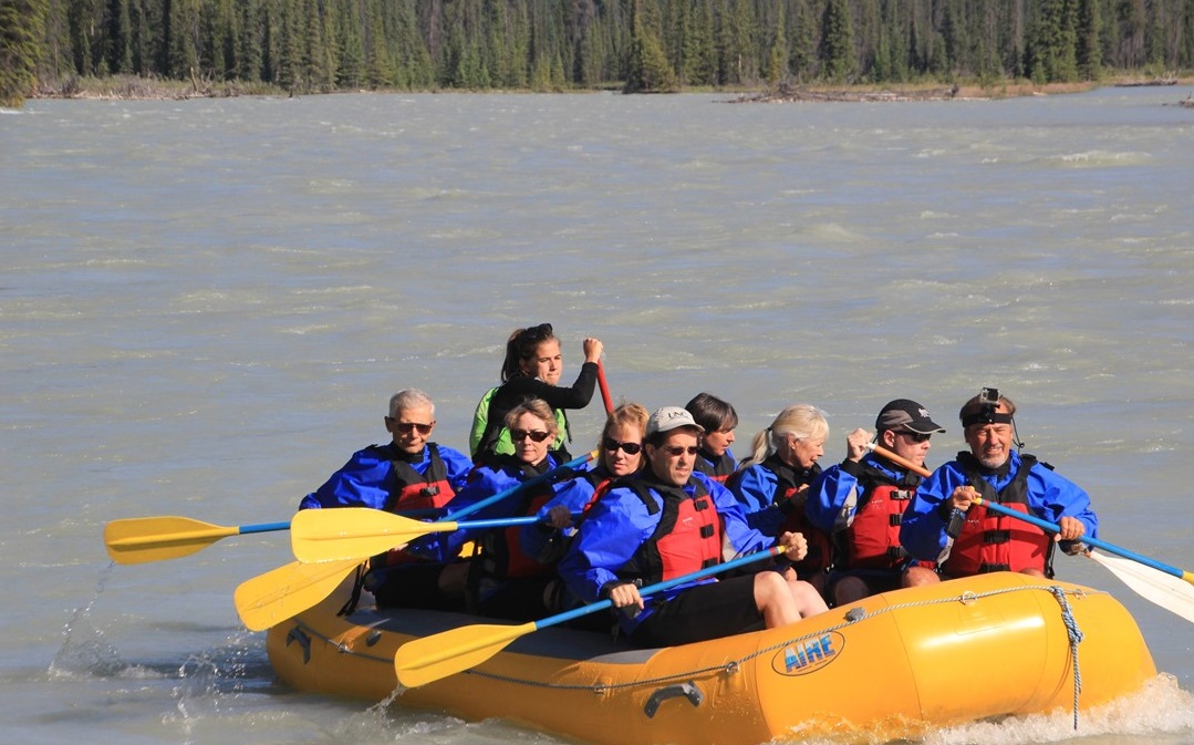
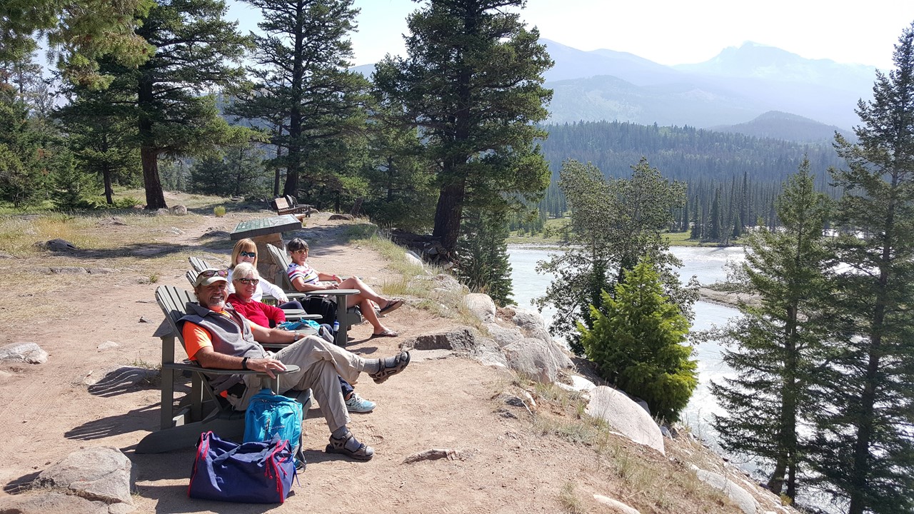
Given our previous bicycling adventures in New Zealand and Canada, we decided we should see some of the great bicycling adventures closer to home, and one of the most talked about routes is the Great Allegheny Passage and C&O Canal Towpath from Pittsburg to Washington, D.C.We decided to arrange this trip with a locally favorite company – Wilderness Adventure Travel, who is actually located along the trail in Ohiopyle, Pennsylvania.Our trip started by meeting Julie’s sister and brother-in-law at our home in Alexandria, Virginia where we loaded-up our luggage and drove the 4 hours to Uniontown, PA from which we could visit the National Historic Landmark of Fallingwater – the home designed by Frank Lloyd Wright for the Department Store mogul-family, The Kaufmanns.This famous home is set over the falls and running river of Bear Run and has hosted over 5-million visitors since it opened for the public in 1964.The next morning, Sunday, we met our adventure companions at Ohiopyle, and the 11 of us, along with our two Wilderness Adventure Travel guides, Montana & Chris, fitted our bikes and traveled to the Boston, PA. trailhead where our adventure began.
Our Route along the Greater Allegheny Passage Rail-Trail and the C&O Canal Tow-Path
Frank Lloyd Wright’s FallingwaterFallingwater’s iconic view
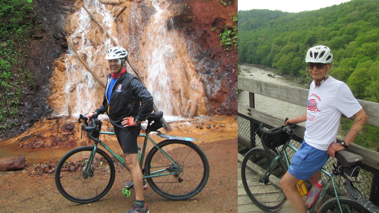
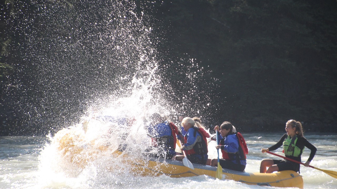
Our first day of biking was traveling 57 miles upstream along the Great Allegheny Passage – a converted rail-trail beside the Youghiogheny River.This route was used by the railroad to transport coal and other raw materials over the Appalachian Divide to the East Coast.Along the way we saw deer, turkeys, geese and an abundance of flowers.The wildlife was complemented by spectacular views as we crossed deep gorges, visited trail centers and rode through old coal-mining towns, until we arrived back at Ohiopyle.After a short visit to the pub for beer and ice, we headed to our first night’s stay and dinner at a mountain-top private lodge – The Trillium.Showers, drinks and a dinner of BBQ brisket & pork with chocolate cake completed our first day.
Rocky and A.J. on Greater Allegnehy Passage
After a “cowboy breakfast” we re-engaged the trail and continued our climb along the Great Allegheny Passage, 48 miles to the Eastern Continental Divide – the point at which eastern USA waters divide between flowing to the Gulf of Mexico or to the Atlantic Ocean.Along the way, we crossed some long viaducts and passed windmill farms until we finally started our additional 24-mile descent into Maryland through the Mason-Dixon line to the town of Cumberland. Those at the head-of-the-pack were met with downed-trees from the previous night’s storms which required carrying bikes over them, and those still riding later in the afternoon were met with a new round of thunderstorms.We checked into our hotel rooms at the Fairfield Inn, and after showers and snacks, went to the Crabby Pig for dinner, before retiring for the night.
Our Wilderness Adventure Bicycling GroupRocky at the Eastern Continental Divide
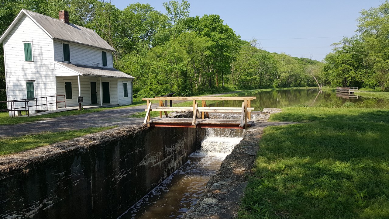
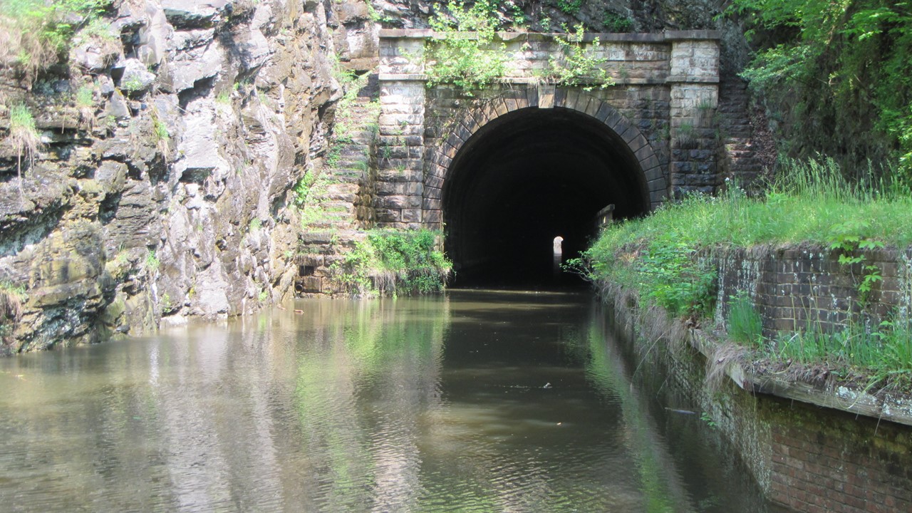
The next morning, we awoke to news that yesterday’s storms had brought some severe weather and flooding to Eastern Maryland and some of our 54-mile future route.Today, we would switch from the Great Allegheny Passage rail-trail to the C&O Canal Tow-path which starts at the historic Western Maryland Train Station.The C&O Canal was built in the 19th century along the Potomac River and allowed barge traffic to move both ways from Cumberland to the Eastern Seaboard.The C&O Canal took 35,000 laborers and 22-years to construct and consists of a series of locks, with water fed from the Potomac upstream, and a tow-path beside it that allowed men, donkeys and horses to navigate their way upstream. After a humid and muddy morning, we stopped for lunch, before continuing to the Paw Paw Tunnel.The Paw Paw Tunnel is an underground 3118’ canal and tow-path tunnel that started construction in 1836 and took 14 years to complete.It bypasses a 6-mile stretch of the Potomac that contains 5 horseshoe bends and takes its name from the pawpaw trees that grow nearby. The darkness inside requires walking our bikes with care and with a light, but the traverse was incredible, and not much different than that over 100-years ago.After reaching the town of Old Orleans, we biked the nicest 16-miles of the day along the C&O and detours onto the Maryland rail-trail.Last nights storms had washed out parts of the Tow-path, but we eventually arrived covered in mud in the town of Hancock, from which we shuttled to the nearby West Virginia town of Berkley Springs for hot showers and a rustic dinner in the Morgan Tavern located within the 1930’s historic Country Inn.
Canal House along the historic C&O CanalAt the entrance of the Paw Paw Tunnel
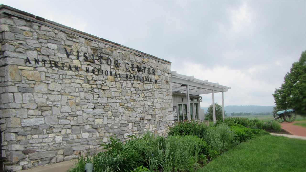
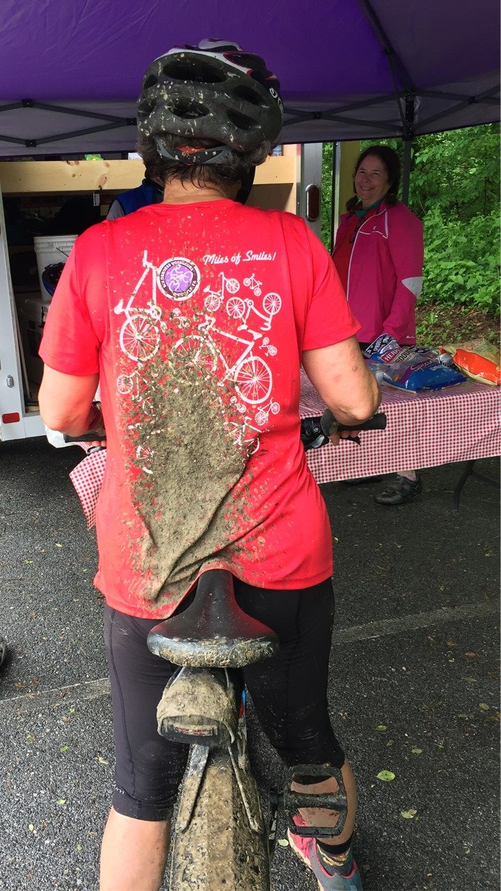
Wednesday morning started off dreary as we rode 12-miles to the historic Fort Frederick, built in 1756 in support of the French & Indian War.Then we rode on to Williamsport, MD where we had lunch, before resuming our ride on the C&O tow-path in the pouring rain. From here, we were heading to the Antietam National Battlefield when we encountered an area of the tow-path that had been covered by the rising waters of the Potomac River.While most of our riders searched for a detour, a few, including Rocky, waded the waters around a bend for ~150’ before the path re-emerged from the flood and the trip could be continued.Unfortunately, this unexpected hazard scattered our group, and Julie’s brother-in-law, A.J., needed a friendly lift before getting back on route.From here, part of the group headed to the Civil War Battlefield, and part headed via van directly to the hotel.After the Battlefield visit, and fixing Rocky’s flat tire, the sightseeing group biked to Shepherdstown, WV., where everyone met up at the Bavarian Inn hotel, and where A.J. also successfully found his way to.Dinner that evening was in the Rathskeller where we feasted on German beer, sausages and veal schnitzel!
Fort Fredrick build in 1756 to support the English in The French & Indian WarVisitors Center at Antietam Civil War Battlefield
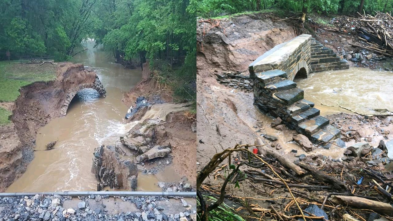
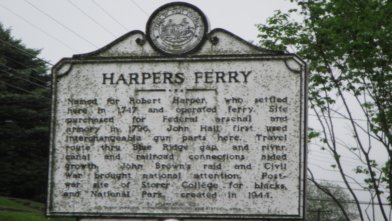
By Thursday morning, the continued heavy rains had closed much of the next part of the C&O tow-path, requiring us to detour onto the Western Maryland rail-trail – a beautifully paved trail that was welcomed with the continued bad weather.Despite the rain, we saw an abundance of wildlife along the way, including deer, turkeys, rabbits and birds.After biking to Harper’s Ferry, we explored the historic town, checked out the still-operating old train station and enjoyed lunch.From here, we shuttled to the Washington & Old Dominion (W&OD) trail, passing beautiful wildflowers and scenic views, until we reached the Homewood Suites in Leesburg, Virginia.Here we enjoyed Happy Hour while playing cards, before leaving for our final trip dinner, consisting of wood-fired pizza at Fireworks Pizza Restaurant.
Examples of the Washed-out Tow-path TrailThe Historic Town of Harpers FerryMemorium for Hapers FerryFinal group dinner at Fireworks Pizza
Friday morning, we awoke to heavily overcast skies, and after a quick breakfast, we departed in hopes of avoiding the impending storm – unsuccessfully.The rain fell in buckets as we rode the complex, increasingly urbanized W&OD trail.Today’s journey would only be 37 miles, and after a brief lunch stop at the Herndon, VA golf course, we switched to the Custis Trail to navigate our way to Georgetown in Washington, D.C.Today was National “Ride Your Bike to Work” Day, and all along the way were corporate sponsors and encouragement groups.We arrived in D.C., and after crossing the Potomac River to Georgetown, sought out our final meeting place at the Thompson Boathouse.The weather had gridlocked the Friday automobile traffic exiting town, and our bicycles were a welcomed way to navigate the city’s complicated network of routes.Upon meeting at the Thompson Boathouse, we took showers, dressed and said our goodbyes to our trip-mates.From here, Julie and her sister Metro-ed to our Alexandria home, while Rocky and A.J. shuttled with Wilderness Adventures Travel back to Ohiopyle to collect the car.
Julies sister covered with mud
Altogether, we had cycled the ~320 miles from the outskirts of Pittsburg to Washington, D.C. in 6 days under trying conditions of rain, floods, and detours!Even so, everyone had had a great time, and vowed to start planning our next great bicycling adventure!
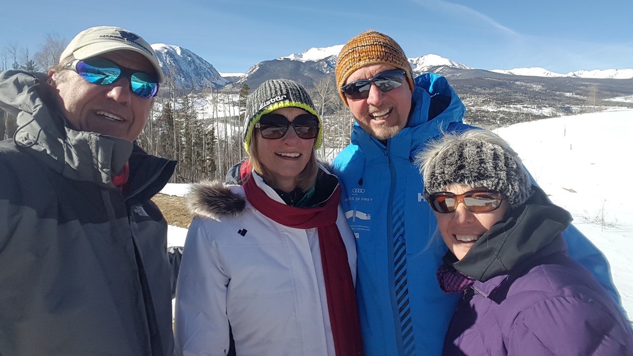
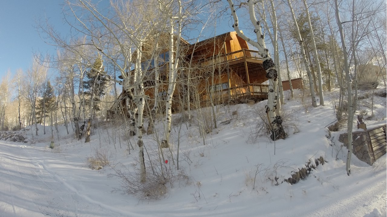
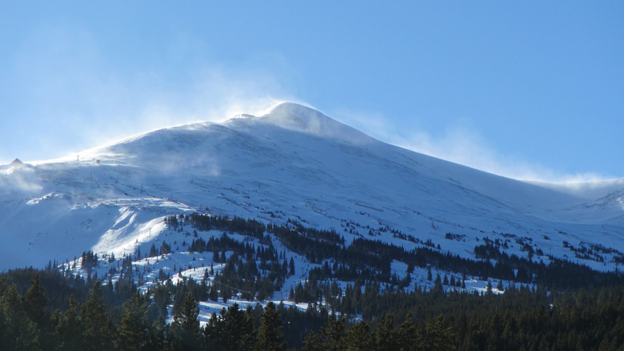
During previous “Out West” adventures, (Grand Canyon and Mt. St. Helens), we connected-up with another couple Scott and Mary, who happen to live in Silverthorne, Colorado. Under the philosophy that “no authentic invite shall go unfilled”, we arranged a week trip to visit them during the Colorado winter! On Thursday, January 11th, we flew to Denver, where we rented a car and drove the 90 minutes up the mountains, through the Eisenhower Tunnel, to their house in Silverthorne. Scott and Mary have a beautiful 3-story log cabin, at 9000’ altitude, high on the side of a mountain in the Williams Fork Range, overlooking the Blue River Valley and the town of Silverthorne. The house is built on the 1.7 billion-year-old, thrusted Dakota meta-sediments, and we spent the first afternoon marveling at the views from their house of the Gore Range, with stands of Lodgepole Pine trees visited by ospreys, bald eagles, ravens, magpies and red-tailed hawks. Scott and Mary told us about their personal sightings and local encounters with foxes, brown bears, elk, deer and mountain lions! That night, we watched the sun set behind the mountains across the valley while we ate lasagna & salad and sipped nightcaps in front of the stone fireplace.
Rocky-Mary-Scott-JulieScott & Marys House from Road Below
Thursday night, a light snow fell, and we awoke Friday morning to continued flurries and a new, white blanket covering the hillsides. After a leisurely breakfast, we set off on a gentle hike 800ft up to the top of Scott and Mary’s community, admiring the views and uniquely-constructed houses along the way. That afternoon, we headed into Frisco where we had appetizers and drinks at the Outer Range Brewing Company – a busy local brewery frequented by locals and their families, which had a style reminiscent of old English Pubs. From there, we went to the Pioneer Ski Shop to pick up Roc’s ski equipment for Saturday, and then went to the Red Mountain Grill in Silverthorne for dinner. It was then, while observing the crowd that we had realized that we had forgotten that this was a Holiday Weekend, since Monday would be MLK Day! After an excellent salmon dinner, we headed back to welcome Bill and Sandy, friends of Scott and Mary from Denver, who came up for the night to ski with us on Saturday. We all drank wine, and then socialized until we finally called it a night and went to bed content.
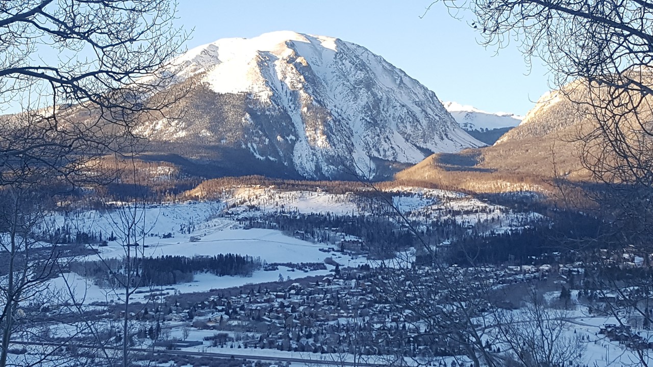
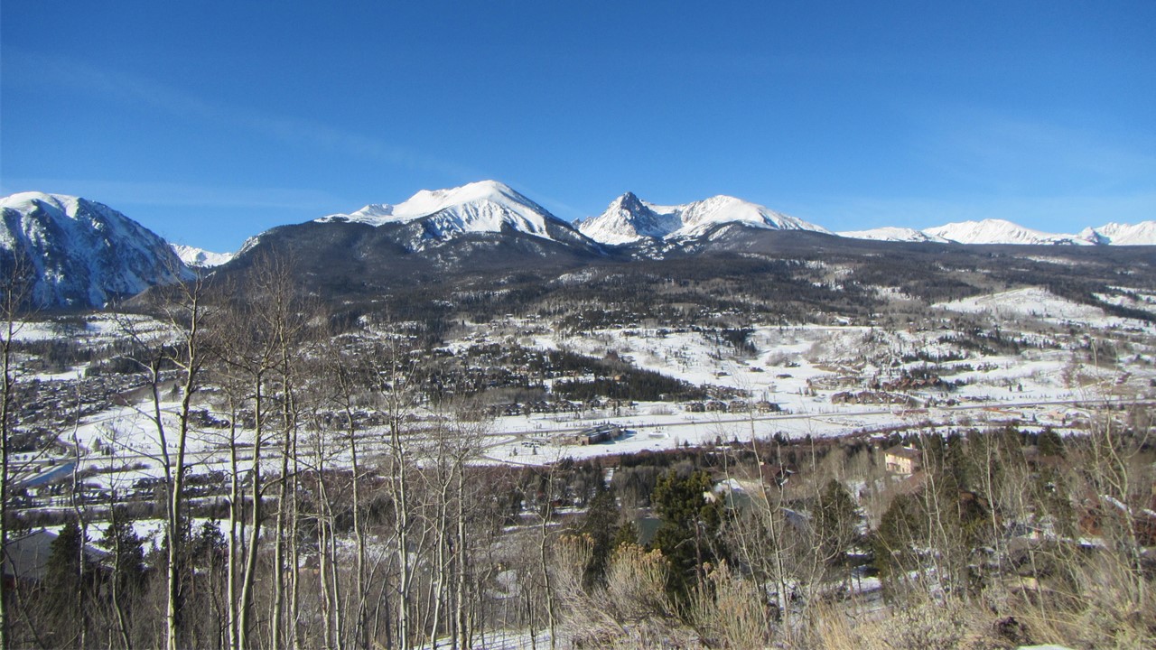
View of Buffalo Mountain from the DeckMountain Range View from across the Valley
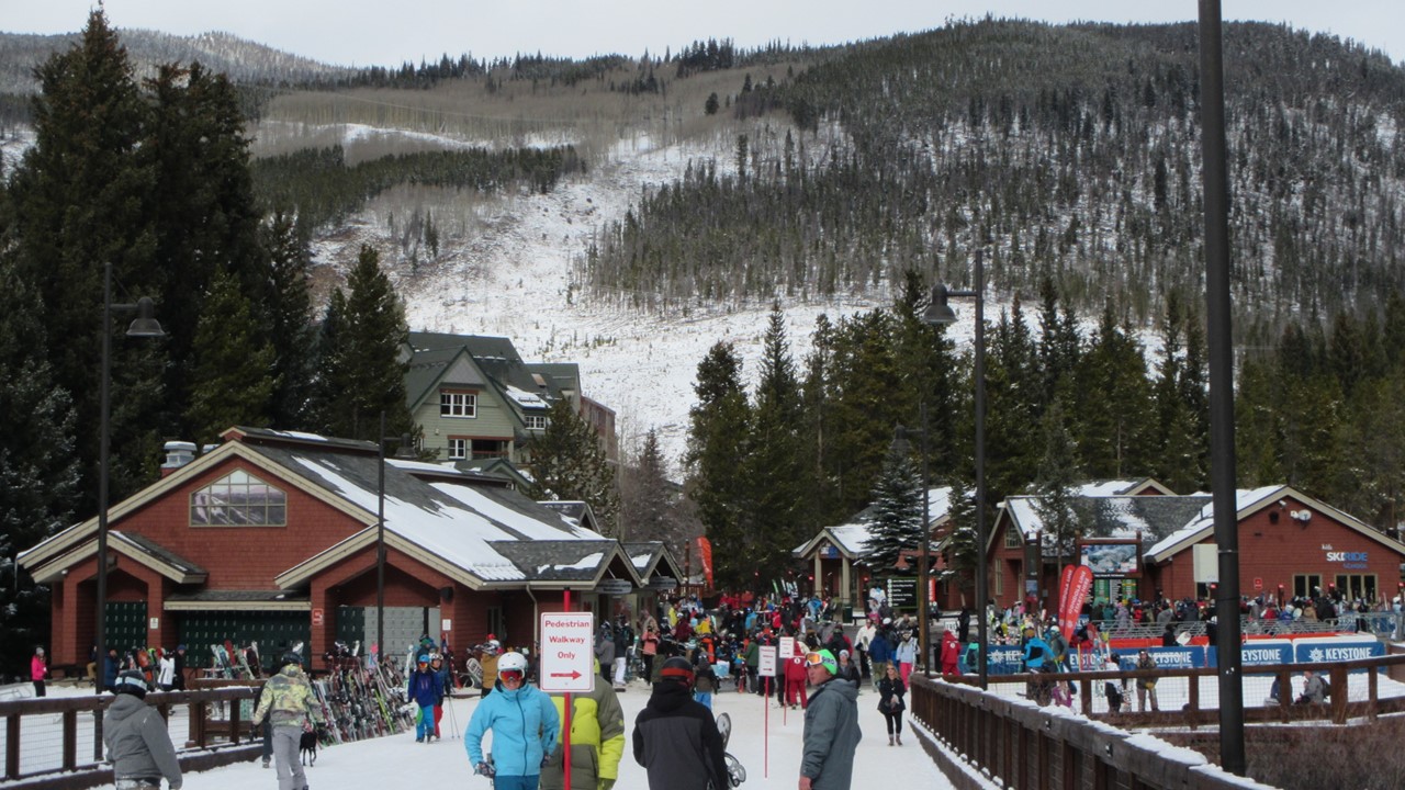
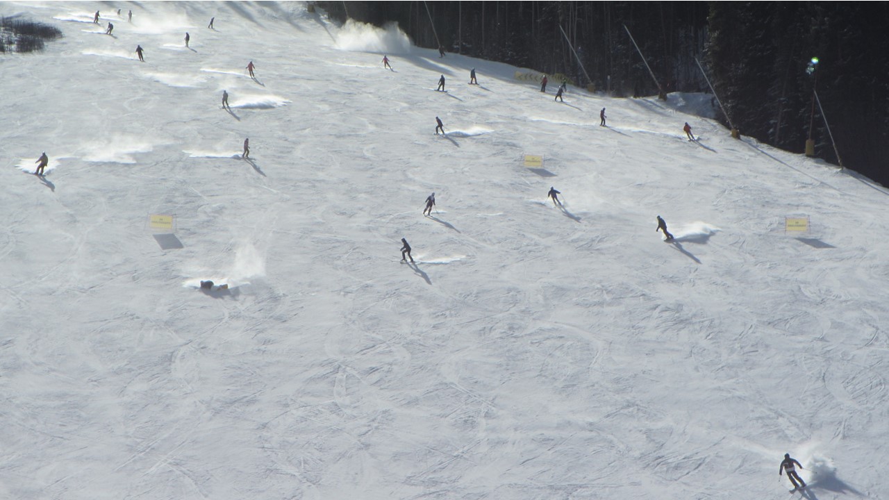
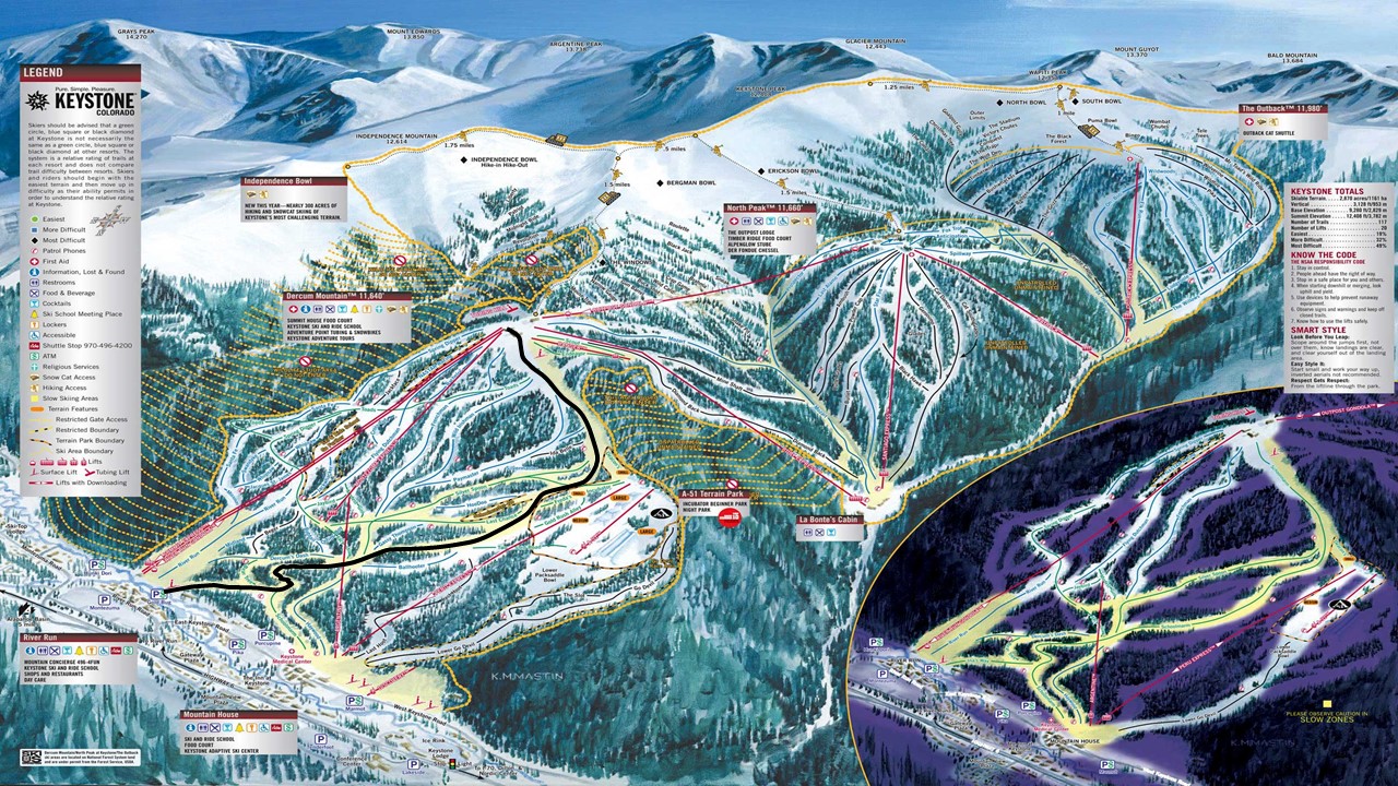
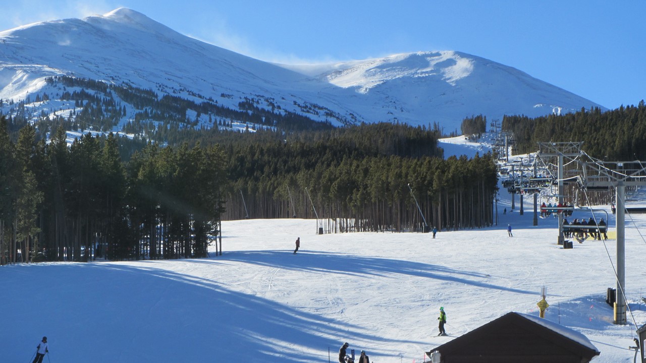
Saturday morning, we were up, had breakfast and coffee, and then the “boys” set off for Keystone Ski Resort “Foursquare” area, for a day of downhill skiing. Scott and Mary also own a rental condo across from the lifts at Keystone and can therefore use their condo’s parking garage to stage for skiing. After dressing, we three headed to the lift-ticket office so that Rocky could get a “Buddy Pass” lift ticket, (which, unfortunately took almost an hour), and then proceeded together to the “River Run Gondola” up to the start of “School Marm Run” – a 3.5-mile long “green” run, 2040’ down from the 11.640’ start. Since Rocky had not been skiing for nearly 40 years, Scott and Bill kept a watchful eye on him, but the old skills slowly returned, and Rocky executed a careful, but successful, run down the mountain. While the boys were skiing, the women made their way to the ski route’s finish and greeted the boys when they arrived from their first run. After that, the women, Mary, Sandy and Julie, checked out the Keystone villages and shops, of which Julie particularly liked the Gorsuch Shop which had unique gifts and interesting lines of clothing. After shopping, the girls headed to the bar for drinks and snacks, and to wait for the boys. Meanwhile, Scott, Bill and Rocky made there way back up the hill on the “Summit Express Chair Lift” to the top again, where they stopped for a quick beer at the Summit House Food Court, before again skiing “School Marm Run” – this time much faster and with fewer rest stops along the way. With 2 runs under his wings, Rocky called the day “finished” while Bill and Scott headed up for one final run of the day. All finally assembled with the girls for final drinks, before we headed back to Frisco to drop off Rocky’s skis, and then back to Scott and Mary’s for a few rounds of cosmopolitans, and a fantastic dinner of grilled steak and buffet potatoes, with rum cake for dessert. After dinner, Bill and Sandy needed to head back to Denver, and so, after goodbyes, the rest of us collected our wineglasses, and moved out onto the patio in 15-degree weather for a soak in the hot tub, while looking for satellites and watching the stars above. Once completely relaxed, we exited the tub, gathered in front of the fireplace before finally heading off to bed.
The Village Shops at KeystoneSkiiers at KeystoneSki Routes at Keystone (SchoolMarm in Black)
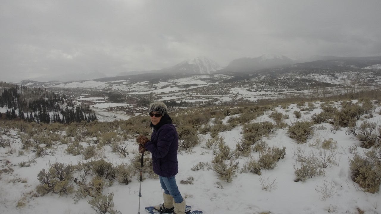
Sunday, after breakfast, we headed out to the Breckenridge Nordic Center. It was a beautiful sunny day, and for very little cost, we equipped ourselves with snowshoes and boots, and began our “hike” along the “Red Trail”. The snowshoeing trail wound its way through the valley floor and up into the mountain-side’s trees, before we veered-off onto the “Yellow Trail” that took us up and under Breckenridge’s gondola. From there, we headed back down through the snow-strewn trees and beside moose meadow before returning to the Nordic Center – a fun-filled, 2-hour hiking adventure! From there, we headed to the gondola to ride up and visit Breckenridge’s Peaks 7 & 8, where the Holiday Weekend and recent snow had generated considerable crowds. We stopped for drinks and appetizers in a local restaurant, before heading back to the car, and back to Scott and Mary’s to get ready to go out to dinner. Tonight, we had planned to meet and have dinner with Nancy, the acting Society of Exploration Geophysicists President, who was planning to drive down from Denver. We met at Uptown’s in Frisco, where Nancy’s daughter, Haley, also joined us. Dinner was spent with excellent food and lively discussions of nursing and geophysics.
Showshoeing View at BreckenridgeSuper-Chair Lift at BreckenridgeBlowing Snow at Breckenridge Mountain Tops
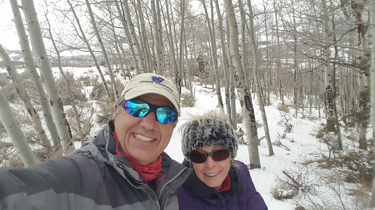
Monday morning, we took a leisurely approach to breakfast, before Julie and Rocky bundled up and put on Scott and Mary’s snowshoes, and went out for a hike around their countryside. We hiked through the adjacent woods down to near the valley floor, before returning in a roundabout way over an hour later. After a quick warm-me-up, we took out our rental car for a bit of a drive-about, and to give it a “warm up.” We drove through some of the local neighborhoods and around the growing condominium and townhouse communities. The rest of that afternoon was spent lazily before a dinner of grilled salmon and veggies. Again, we spent part of the cold, crisp evening in the hot tub with our wine, and searching for satellites in the heavens above – (Julie says she saw one!)
Julie Snowshoeing near Scott’sRock and Julie out Snowshoeing
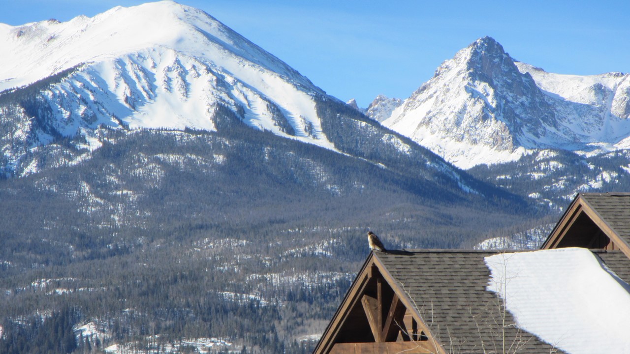
Tuesday morning was spent packing our belongings, before the 4 of us went outside for a 2-hr. walk along the roads, into some of the newly developing communities nearby – Hamilton Creek & Angler Mountain Subdivisions! Along the way, in addition to the majestic views, we sighted a falcon, and 3 deer! After saying our heartfelt “Thank You’s” and goodbyes, we headed off to get a hotel in Denver for one night, to be better prepared for our very early morning flight back to Florida. Along the way, we passed the ever-present Buffalo Herd – our classic reminder of the whirlwind adventure we just had.
It’s wonderful how life delivers a cascade of friendships that take you to unexpected places! Our friends in West Palm Beach, Peter & Nikki, connected with their friend Alex who used to be a Charter Captain in Grand Abaco Island in The Bahamas. Alex and his girlfriend, Heather, were chartering a sloop over New Year’s and needed 2 other couples to round out their crew, and so the six of us came together in West Palm Beach Airport on the morning of Thursday, December 28th, 2017 to fly to Marsh Harbor on Grand Abaco Island to pick up our 45ft Jeanneau named “Aequanimitas” – meaning “Equanimity” or “demonstrating a state of psychological stability and composure which is undisturbed”! I’m not sure it was appropriate for the 6 of us!
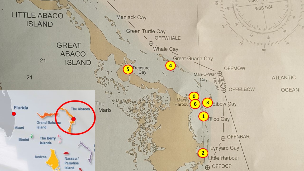
Abaco Map
The trip began as these trips usually do with lunch at the marina followed by the guys checking out the boat and its equipment, and the girls gathering supplies at the nearest grocery and liquor stores! We did have time to take the boat out of the marina, get underway and travel south to Tilloo Cay, where we set anchor and ate a light dinner of freshly prepared conch salad.
The Aequanimitas
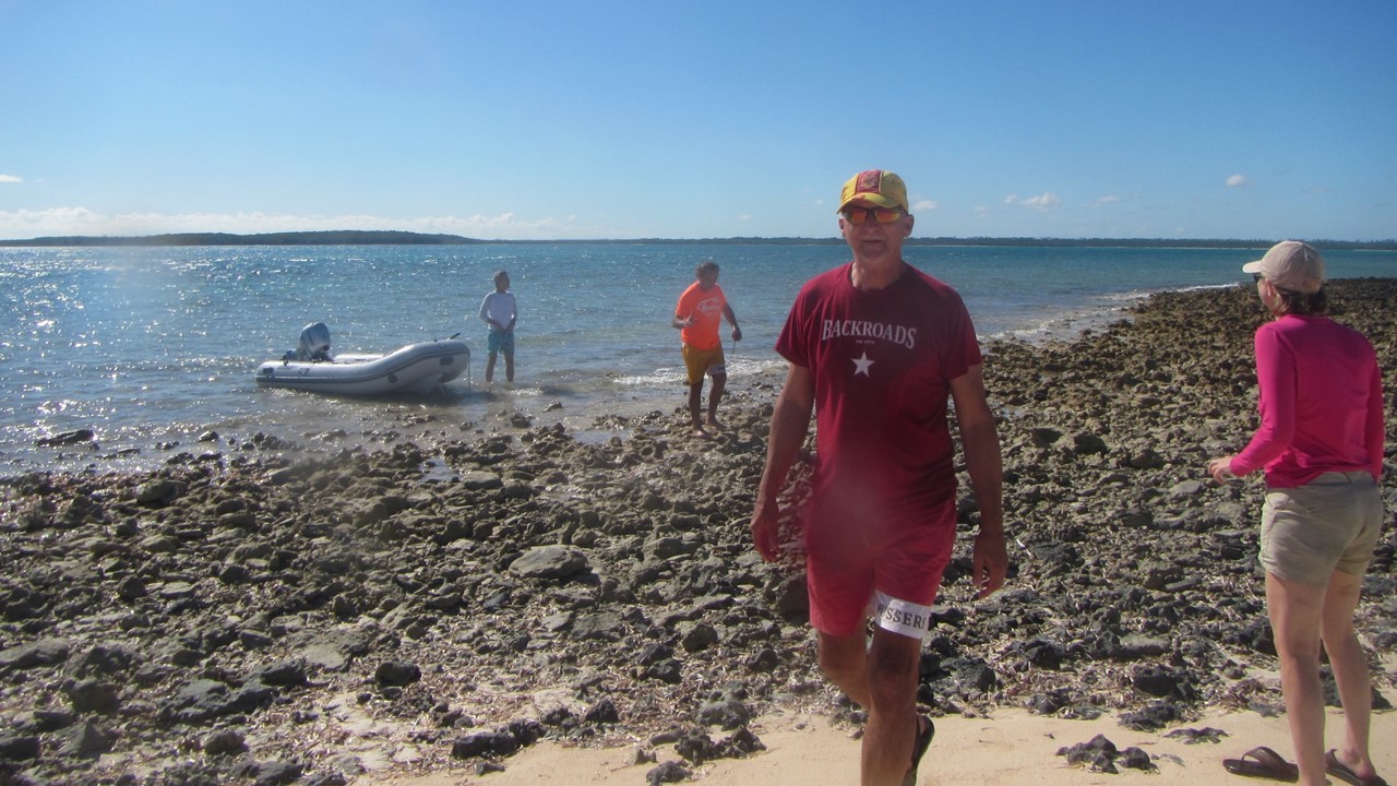
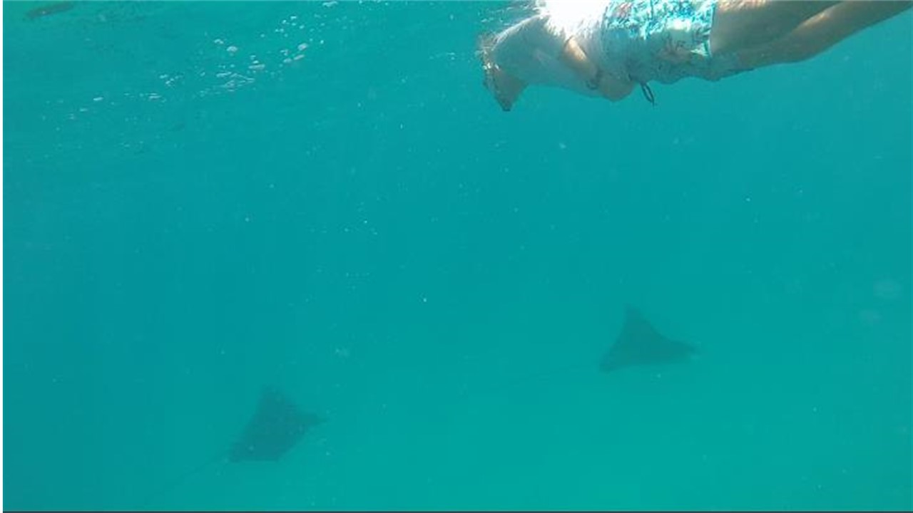
The next morning, after a breakfast onboard of coffee, eggs, bacon, potatoes and toast, we set sail south to Sandy Cay, an uninhabited spit of sand and rocks that hosts a spectacular offshore reef teeming with fish. After anchoring, we took the dingy and looked for a shore access where we all disembarked and explored the beach for sea biscuits, shells and sea fans that had washed-up. While the girls continued beach-combing, the guys took the dingy to the diving mooring balls where we tied-up and snorkeled a wall of coral. Among the multitude of fish, we came upon a couple of Sea Eagle Sting Rays with a wing-span of 3-4 ft., and a tail extending 15-20 ft. behind! After our fill of snorkeling, we went back to shore to pick up the girls, ate lunch on the boat, and then continued our sail south to Little Harbor, where we picked up a mooring ball and took the dingy over to Pete’s Pub and Gallery. Here, the water was crystal clear, the seafloor was sandy, and the harbor was filled with sea turtles and smaller sting rays. At Pete’s Pub, we had drinks and fish dinners, including trigger fish, wahoo and grouper, and we took the occasion to make the 200-ft. short walk over the dune to view the Atlantic Ocean.
Beachcombing Sandy CaySwimming with the Rays
On Saturday morning, we motored north early to Lynyard Cay to take advantage of the higher tides, where we set anchor and ate a leisurely breakfast on the boat! After cleaning-up, we set sail north to Elbow Cay where we would have to slowly motor through a very shallow passage. Along our sail, the bottom was clear to view, and we saw numerous sharks ranging 3 – 6 ½ ft. in length, a school of small tuna, sea cucumbers, and sea turtles. We even saw a small group of 6 dolphins leisurely exploring our boat. However, with the tide too low, we could not successfully cross the shallows on our way to Elbow Cay, and so, having to wait for the tide to come in, we anchored nearby at south of Lubbers at Tavern Cay for snorkeling and lunch. At Tavern Cay, a series of small rock outcrops, “Fish Hotel Rocks”, serve as home to small corals, sting rays, conchs, and bigeye fish. After snorkeling and having lunch on-board, we slowly motored on the higher tide to Hope Town on Elbow Cay. The harbor of Hope Town is a beautiful and quaint area, and after picking up our designated Abaco Charter mooring ball, we restocked groceries and liquor, before returning to shore for drinks, conch fritters and wings on the dock at “The Harbour’s Edge”, and then eating dinner aboard.
Diving for Coral
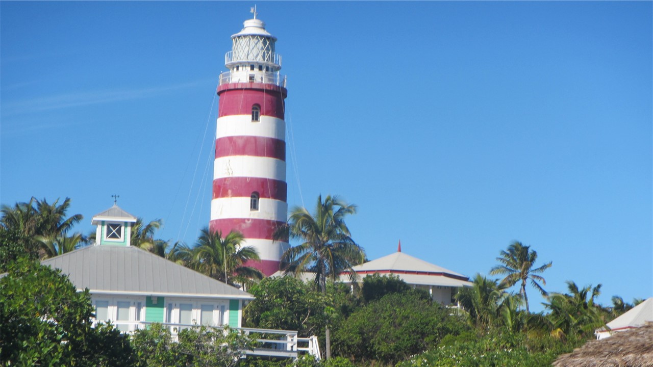
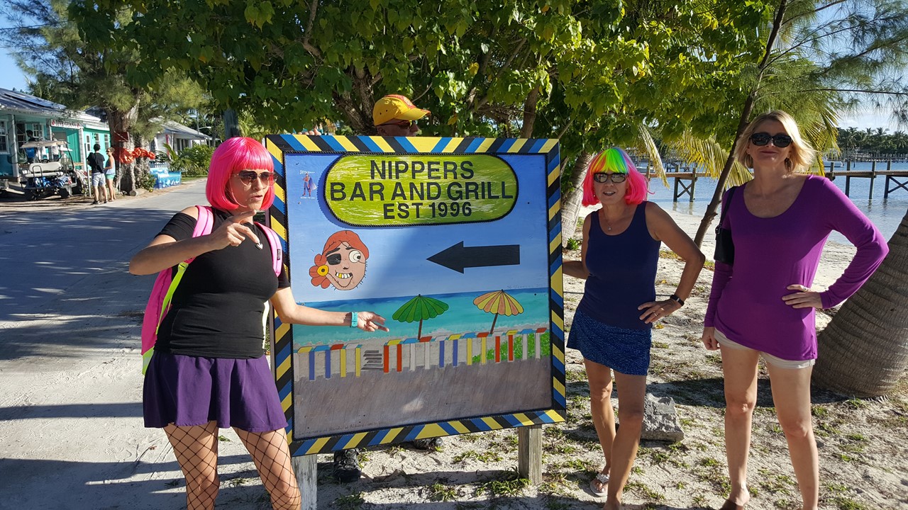
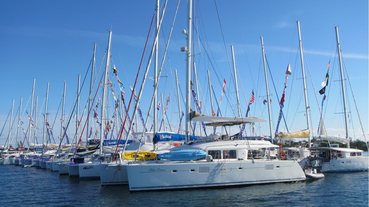
Sunday was New Year’s Eve, and most stores and shops were closed. However, after a light breakfast on-board, we all went to the Elbow Reef Lighthouse. This lighthouse was erected in 1864 and is the world’s last working kerosene lighthouse of its kind! With its octagonal mirror structure, it gives a group of 5 white flashes every 15 seconds. We climbed the 101 steps to the observation deck and took in the beautiful panoramic view of the area, before descending and leaving Hope Town to sail north to Guana Cay – home to both “Nippers Beach Bar & Grill” and “Grabbers Bed, Bar and Grille”. After setting anchor at the outer edge of the harbor, we took the dingy to the City Dock and took a golf cart across the narrow island to Nippers – a multilevel deck bar overlooking the famous “Seven-Mile Beach” on the Atlantic Ocean with loud music and 100’s of young adults drinking and dancing! After sampling the famous “Nipper’s Juice Cocktail” and joining in the party, we were getting ready to leave when two girls sitting on the railing, tumbled-over from 8 ft. up and were seriously injured. While medical attended to them, we walked back across the island to “Grabbers at Sunset Beach” where we sampled a frozen drink called the “Guana Grabber”, ate pizza, chicken tender and fish finger appetizers, and marveled at the largest catamaran “Raft-Up” any of us had ever seen – 36 catamarans in two rows of 18 – all anchored and roped together! After a bit of shopping, we returned to the boat where we enjoyed a late, light diner, and enjoyed music and cards until 11:00pm, when the first round of fireworks over the island were set off. Then, at midnight, we popped-open our champagne, enjoyed the next round of fireworks and celebrated the beginning of 2018!
Elbow Reef LighthouseView of Hope TownParty at NippersNew Years Eve FireworksMassive Catamaran Raft
Monday morning and a Happy New Year to everyone! After a light breakfast, we continued to motor-sail north, past the huge raft-up, to Treasure Cay. Unfortunately, a low-pressure front was moving in making for a very light wind day! But, that would be reversed with the storm that was forecast for tomorrow. Since today was a holiday, we picked up a mooring ball and went ashore to the “Coco Beach Bar at Treasure Bay Beach Resort” where we ate a lunch of mahi- and cheese-burgers, drank Gin & Tonics, rented beach lounges and an umbrella, and spent the afternoon enjoying the surf, sand, and sun. While beach-combing, we saw starfish, sting rays, sand dollars and delicate, fragile shells. We returned late in the afternoon for showers and a boat-cooked meal of chicken, potatoes, corn and beans before settling in for an early night.
The night brought the expected storm, and Tuesday we awoke to 30 mph winds out of the north, with gusts to 35 mph, and a driving rainstorm. Even though we had one day on the charter remaining, in respect for the predicted bad weather getting worse, we charted a course back south for Marsh Harbor to the south. We raised the main to before its first reefing point, and put the genoa out to its first reefing point, which is all the sail we were willing to expose, giving us a speed of over 7 knots over land! However, the mast-self-furling main jammed and the shackle holding the furling line broke off leaving the self-furling jammed and disabled! This was not too much problem while sailing and tacking towards the harbor in the south, but had to be resolved before we could enter the marina in those conditions! Finally, when we approached the harbor, we furled the genoa, and motored into the lee of an island where we set anchor, and, in a driving rainstorm, the boys wrestled the exposed mainsail to wrap it around the mast, and secure it with a maypole of the spinnaker halyard. This allowed us to motor into the Boat Harbor Marina where we docked at the T-dock and battened down for the storm. That evening, we hunkered down for the storm in the boat, cooking the foodstuff that we had left for dinner, and having a nightcap of Grand Marnier at the Marina’s Poolside Bar.
Securing the Sail in a Storm
The storm howled all night, but showed signs of let-up the next morning, allowing us to all walk to a local restaurant called “Jamie’s”, where all we had a hot breakfast. After breakfast, Alex and Heather took the ferry to visit with old friend back on Elbow Cay, and the rest of us played cards and enjoyed the facilities offered by the Boat Harbor Marina. The winds remained in the 30-40 mph range until late that evening, and with the occasional rain shower, kept us close to the boat until a break later that evening, when we walked to a local restaurant called “Snappa’s”. There we ate salads and drank wine and beer before returning to the boat. We “camped” that night on the boat, enduring the rest of the storm by playing cards and preparing to leave the next day by starting our packing.
Sunset at Abaco
Thursday morning, Alex and Heather rejoined us, and we all went to “Jamie’s” again for brunch before catching a cab to the airport and our flight back to West Palm Beach. From there, it was a short, 2-hour drive north back to our home in Indialantic. Another fantastic trip with high adventure, good close friends and new friends – what could be better!
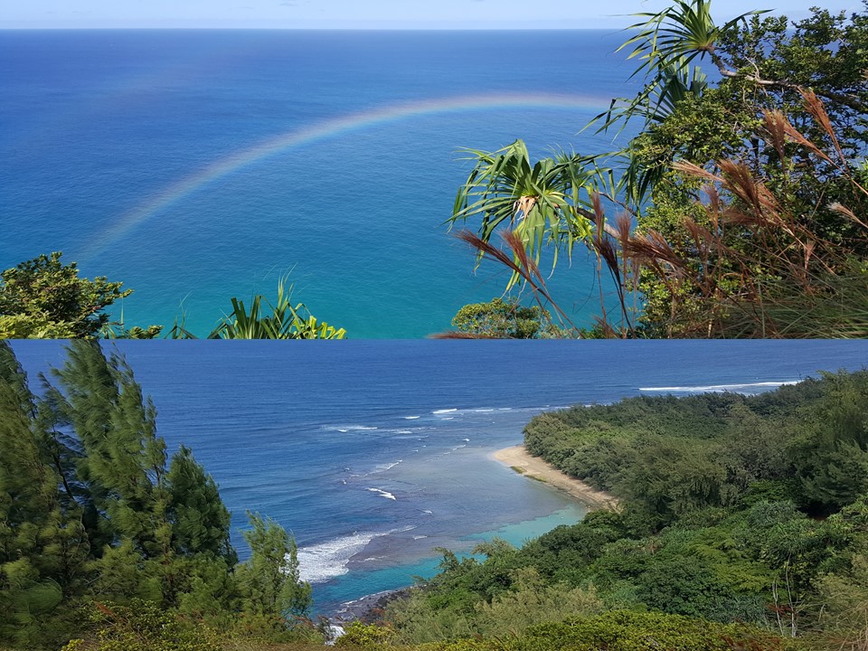
We are fortunate to have good friends who kindly invited us to spend the week of November 4-11, 2017 with them at their timeshare resort in Kauai – the “Garden Island”. Bob and Diana allowed us to share a 2-bedroom/2-bath unit in Poipu that was on the water’s edge and that overlooked the beautiful southern volcanic coast, (“R” on map). The view allowed us to daily watch the many large sea turtles which came into the numerous craggy coves to feed.
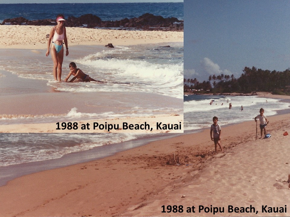
The last time we were in Hawaii was in 1988, also in Poipu, when we took our young boys on their first adventure vacation. Back then, we hiked the Na Pali coast, viewed the Waimea Canyon, swam at Poipu Beach and enjoyed the quiet, sparely populated island that was still-off-the-beaten-trail. This time would be quite different.
Map of Kauai showing key places referenced in the web log
After a direct flight on Saturday from Atlanta to Honolulu and a short air-flight to Kauai, we were greeted at the airport by our friends and settled into our “home” for the next week. After the long trip, a night out to dinner at Keoki’s for fresh fish and calamari was finished off with a huge piece of Hula Cake completed the evening.
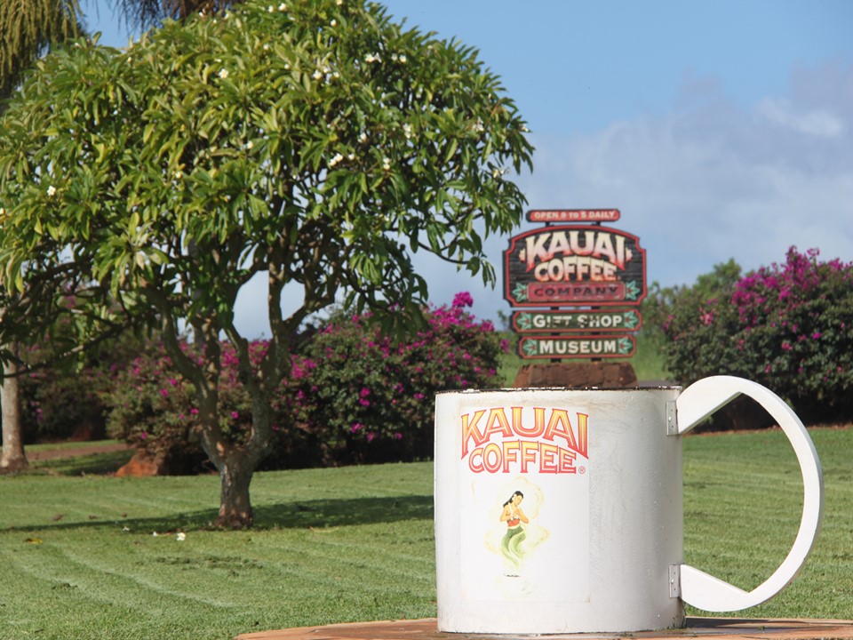
Sunday, after a brief stop at Brennaki’s of Poipu, (“1” on map), we ate breakfast at Kalapaki Joe’s – the most western-located sports bar in the United States – where the two of us split a Loco Kalua – a breakfast of rice overlain by sautéed onions, pulled pork and covered in brown gravy and finished with a fried egg! After washing it all down with coffee and mimosas, we headed west on highway 540 to Kalaheo where we toured the Kauai Coffee Company, (“3” on map). Coffee is now the key cash crop of Kauai since the exodus of pineapples and sugar cane years ago from the islands. After walking the fields, touring the gift shop and drinking our fill of free coffee, we headed back on the road west through Hanapepe to Port Allen where we stopped and explored Salt Pond Beach, named for the nearby commercial salt pond business. Then, we stopped in the town of Port Allen for lunch and beer at the Kauai Island Brewery, (“3” on map). After lunch, we shopped at the famous “Red Dirt” store, well known from a “Dirtiest Job” episode, and where the shirts and clothes have been permanently stained by the islands red soil. From here, we headed back to the town of Koloa where we grocery shopped for steaks that we grilled poolside that evening, accompanied by shrimp, mushrooms salad! The night was finished off with wine while resting in the resort’s spa before our pillows finally called our name.
Pictures taken in 1988 during family vacation on Poipu Beach
View of resort’s pool
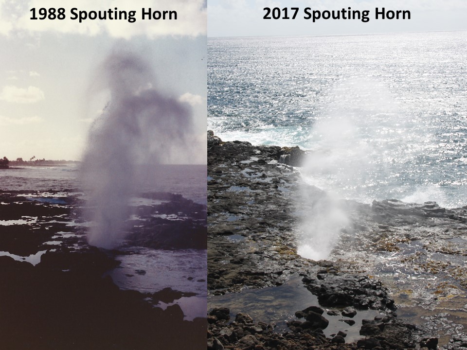
On Monday, we awoke to sip our coffee while watching the sunrise and sea turtles coming to feed. When the local fish market opened, we bought fresh fish for dinner, and then drove the coastal road to its end at Spouting Horn Beach Park, (“2” on map), a place we had visited 29 years earlier. Today, the hole in the lava rock still spouted the ocean swells, but the park was now encircled with vendors and typical tourist venues. From here, we went onto the island’s Kaumualii Highway, past Hanapepe to the coastal town of Waimea where we stopped for lunch at “The Shrimp Station”, (“5” on map), a little drive-up that serves the very best shrimp tacos any of us have ever had! After lunch, we turned north onto the Waimea Canyon Drive, where we drove up the scenic west side of the spectacular Waimea Canyon, the largest canyon outside of The Grand Canyon in the United States, and commonly known as “The Grand Canyon of the Pacific”. Waimea Canyon is 15 miles long, about 1 mile wide and up to 3000’ deep, and offers challenging hikes as well as unmatched views, (“6” on map). We were lucky to have great weather and perfect visibility during most of our ascent through viewpoints and overlooks. However, by the time we arrived at the summit, fog rolled in from the north spoiling our view of the Na Pali Coast. There are no roads in the northwest corner of the island as the rugged topography has made the area accessible only by hiking treacherous trails or by boat. We called it a day, drove back to our resort, and grilled our fish for the evening’s dinner, and prepared for a day at the beach tomorrow.
Sunrise and daytime view from below our resort balconyEntrance to Kauai Coffee CompanyTwo views of Spouting Horn from 1988 & from 2017A view of Waimea Canyon from Overlook
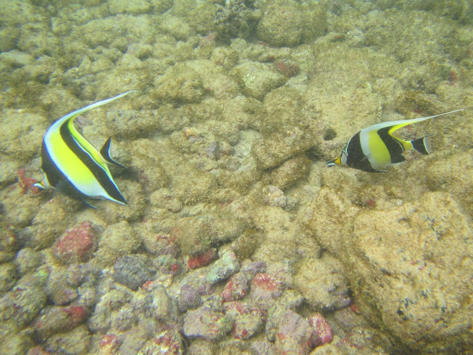
Tuesday, we woke, had coffee and breakfast, and then headed a short walking distance to Poipu Beach, (“1” on map), where we swam, snorkeled and laid on the sand. The water visibility was excellent, and all sizes and colors of fish ventured into the shallows to visit the reefs. After such a relaxing morning, we returned to the resort for a refreshing fish salad late lunch and began to get ready for our evening entertainment – a Luau Kalamaku at historic Kilohana Plantation! This Luau presents like a musical play that pays homage to the earliest discovery and settlement of the Hawaiian Islands by Polynesians from Tahiti. Since the Luau includes an open bar, we all took a charter bus to the event located east on Highway 50 just before the city of Lihue. While bussing there, it began to rain, making us more thankful for the arranged transportation. We arrived at the Kilohana Plantation, (“7” on map), and were greeted with a ranch-type complex including a real train & depot, craft fair, restaurant and Event Main Stage Pavillion. After sightseeing and enjoying the open bar, Rocky was convinced to join the stage group and learn the Luau. We sat with some young people from Portland, and had a buffet dinner of salads, rice, poi, sweet potatoes, fish, pork, chicken and desserts. Dinner was followed by the show that included dramatic re-enactments, traditional music and fire dances. It was late when we left, and we were grateful for the bus ride home to complete our day.
Colorful Angelfish at Poipu BeachLuau Kalamaku at Kilohana Plantation
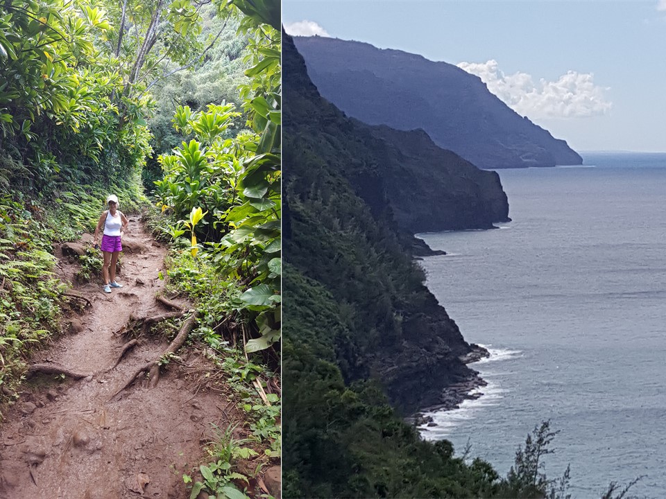
On Wednesday, Julie and I decided to “recreate” our hike along the Na Pali Coast that we did 29 years ago! The trip begins with a 2-hour car ride counterclockwise around the island past the towns of Lihue, Wailua, Anahola, Kilauea and Hanalei, (the home of Puff, The Magic Dragon!) At the end of the road, at the trail head, the Park Ranger checked our plans and reminded us that it was a 2-hour, 2.5 -mile-one-way hike to the “hidden beach” – Hanakapiai Beach – located in the Kalalau Valley and only accessible by hiking the ancient trail, or by boat. If we wanted to additionally hike to the Hanakapiai Water Fall, it would be another 2-hour-one-way hike up an even more challenging trail. Since it had rained the night before, the trail was slippery and muddy, so we took our time and decided that we would not try to go to the Falls. The trail wanders up and down clay-covered, slippery rocks, around a series of ravines and ridges, (each with a unique view of the coast), and across two running streams over which we tip-toed on the tops of boulders. In 105 minutes, we arrived at the beach, “10” on map), which was much smaller and rock-strewn than it was 29 years ago. We were greeted by a park ranger at this end, as well, along with more people than we might have expected. We had packed a lunch of salami and crackers, chips and water, which we enjoyed, while wading in the surf and exploring the coastal caves. Finally, the time came to begin the hike back, which started with a stream crossing and a ½ mile climb up from the shore, before walking the way out in time to meet Bob and Diana who had agreed to pick us up at a set time. Upon return at the trail-head, we washed the mud off our shoes and ourselves, and had a chance to get cleaned up before joining our friends for the ride back. After returning to the resort, we showered, and all went to dinner at Brennecke’s Restaurant – the same place we took our two boys to eat 29 years ago!
View of the Na Pali Coast Trail and the coastal hike aheadViews of the rainbow and Kee BeachBrenneke’s Grill still sitting in the same spot 30+ years
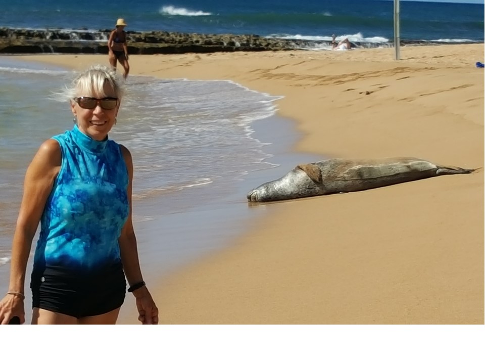
On Thursday, November 9th, after breakfast, we returned to the Koloa Fish Market to purchase dinner, before driving back to Salt Pond Bay for another day at the beach, swimming and snorkeling, (“4” on map). After picking out a nice spot under the local palm trees, we spied a rare Monk Seal resting on the beach. The Monk Seal is endangered with only 1300 of them left in the islands, and the beachgoers a seal respectfully tolerated each other’s space. Meanwhile, we snorkeled behind a lava rock breakwater where reef fish abounded, although the visibility was reduced by the water breaking over the rocks. After exploring the beach for sea-glass and taking in the views of the Salt Pond and Southern Shore, we returned to the resort for a late snack and drinks in the hot tub spa before cooking fish dinner on the grill, and enjoying an evening of good friends and wine.
Julie and Monk seal on the beach at Salt Pond
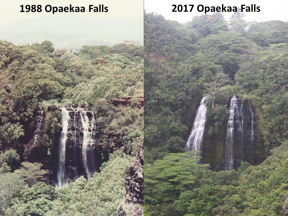
Friday would be our last full day in Kauai, and we decided to go somewhere none of us had ever been! A friend recommended that we visit a Hindi Temple located in Kapaa just north of Wailua. On the way there, we stopped to view Opaekaa Falls, (“8” on map), and river just outside of Wailua, when the mist started to roll in. At Kauai’s Hindu Monastery, (“9” on map), we all put on sarongs and explored the grounds. The Monastery was founded in 1970 by a monk named Gurudeva, who raised funds to purchase the grounds and grew the complex to include an Indian Banyan Tree, Temple, Library, Meditation Center and Visitor’s Gift Shop. In the Temple is located one of the largest single-crystal quartz stones in the world, “The Earthkeeper” that stands 39” high and weighs 500 lbs! After exploring the Temple grounds, we headed back to the Kilohana Plantation for the free rum tasting at the Koloa Rum Company’s store. Today’s special was “coffee rum”, and after tasting it, along with 4 other rums, we shopped before having lunch of fish tacos and shrimp spring-rolls at Gaylord’s Restaurant, located next door. After finishing with Mai Tai’s, we shopped the shops there before returning to our resort to enjoy the hot tub spa and starting to pack. Bob and Rocky went to the Koloa grocery for shrimp and wine, and after a fine dinner, we finished our packing for our trip tomorrow.
Pictures of the Opaekaa Water Falls from 1988 & today
November 11th would be our day to leave and head home. After completing our packing, we all went back to Kalapaki Joe’s for breakfast and our last taste of a Loco Kalua. From there, we checked out of the Resort and started heading to the airport located at Lihue. However, since we had plenty of time, we decided to stop one more time at The Koloa Rum Company’s Tasting Room for a round of dark, spice, coconut and passion fruit rum. From there, it was on to the airport to catch a flight to Honolulu, and a subsequent flight back to Atlanta and onto Florida. A great holiday in Paradise!
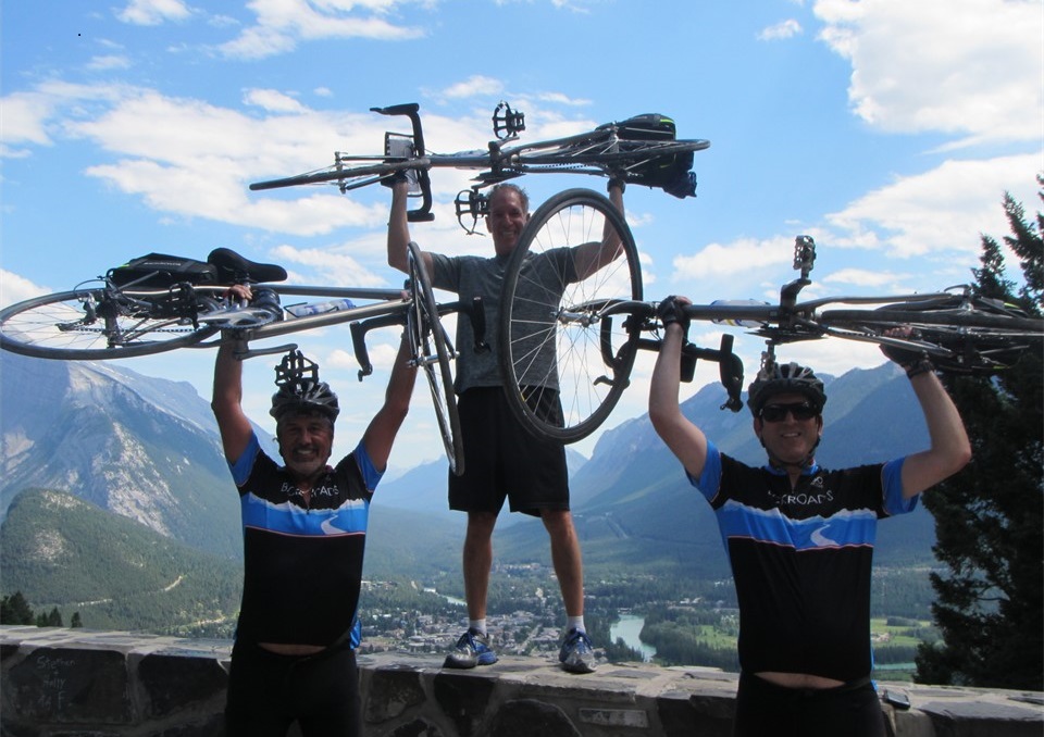
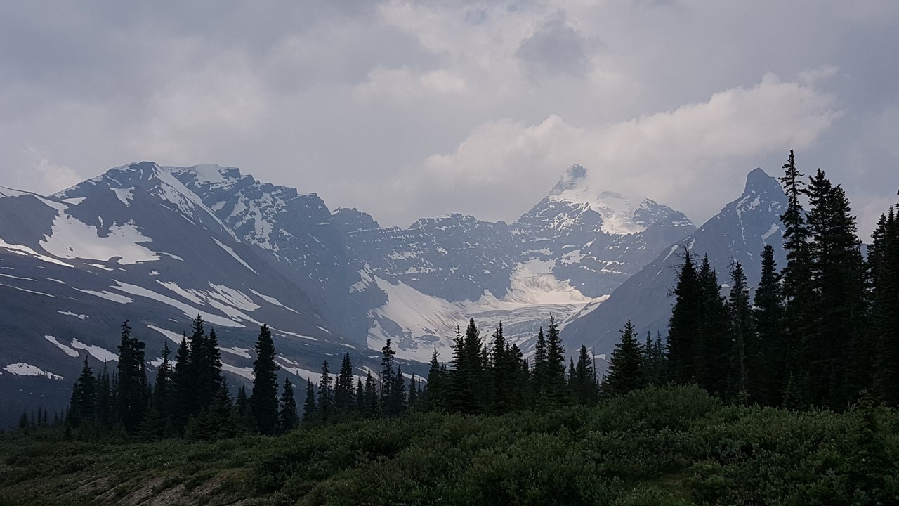
Julie’s sister and brother-in-law invited us to join them on a Backroads cycling trip in the Canadian Rockies. The trip would be 7 days from Banff to Jasper with some side-trips and other activities. On Saturday, July 8th, we flew from Orlando to Calgary via Houston, where we caught a 90-minute shuttle to The Buffalo Mountain Lodge in Banff. There, we met up with Julie’s sister, Pam, and her husband, AJ., for a walk through town and a light shawarma dinner. After dinner, we took advantage of the late setting sun and the free bus service to visit Lake Minnewanka. Many things in Canada were free or reduced this year since it was Canada’s 150th anniversary! At the Lake, we saw deer and a mountain goat, and enjoyed a brief walk, although many trails were closed due to the extensive bear activity in the area.
Sunday morning, after breakfast, we met our Backroads guides, a Canadian named Cameron and the leader, a woman from California named Hannah. They would work the week with us, along with logistics support from Samantha. After a brief safety talk and overview, it was off to fit our bikes and to start our first trip. As always, the Backroads bikes are excellent, custom titanium frames with carbon-fiber forks and Garmin GPS route electronics. The 4 of us were joined by 9 others – 3 couples and 3 singles. Julie and Pam, and another guest, Kathy, rode e-bikes – bikes with a battery-powered “assist” that is applied to each pedaled stroke. We then rode a route of 22km out of Banff, past Two Jacks and MInnewanka Lakes, to a picnic spot for lunch. After lunch, we rode another 25km up a 1300’ climb up Mount Norquay, a popular winter ski resort, before heading back to the Buffalo Mountain Lodge. Rocky actually rode an extra 12km, having returned to the hotel first before following the correct course. On Julie’s the way down Mount Norquay, a downhill skateboarder crashed, was bleeding from his head and needed medical attention. But our group all did well, and then met later for an excellent “Welcome Dinner”. (59km daily, 59km total)
Ascent of Mount Norquay
View of Banff from Mount Norquay
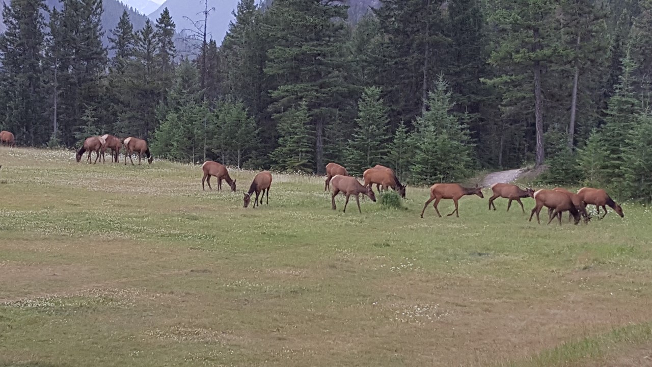
July 10th would start early with breakfast and picture-taking of a herd of elk grazing behind our room while we were prepping for the day’s ride.
Roaming Banff Elk Herd
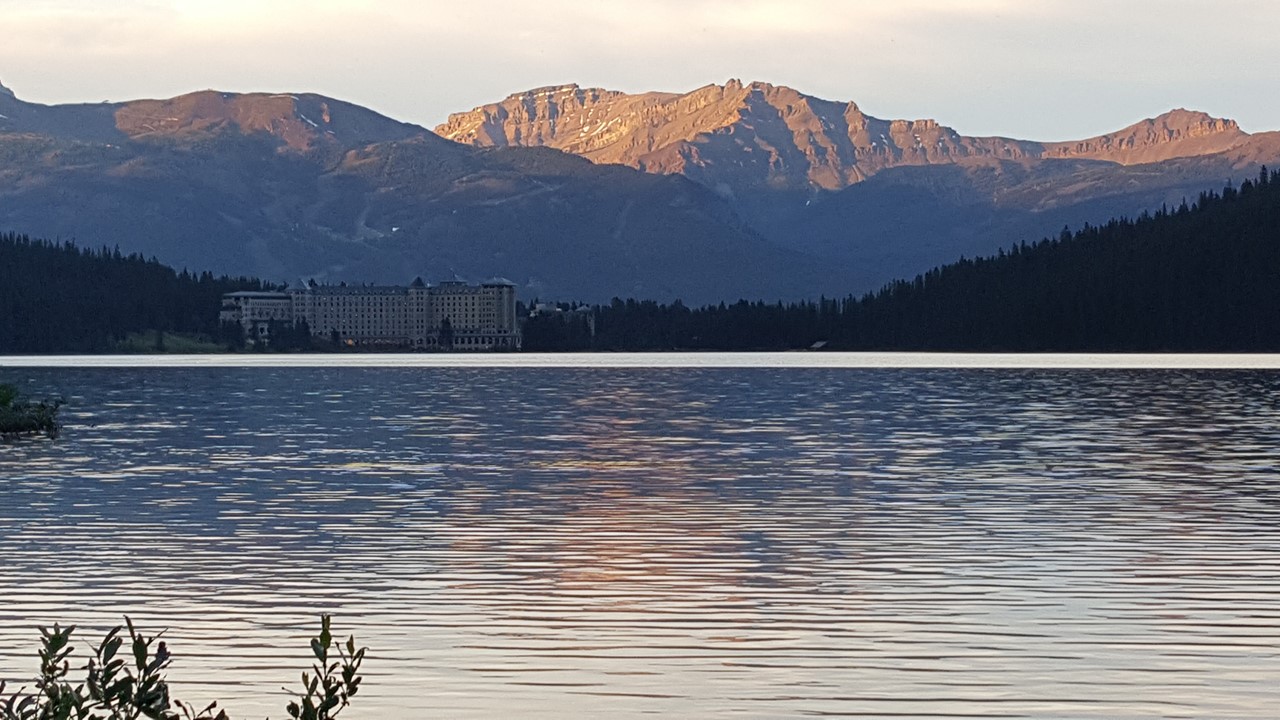
We started riding in a light rainfall, as we left Banff, circled the golf course and then passed Vermillion Lakes, before heading north on Highway 1A through beautiful forested hills and valleys. On the way out of town, we passed a large bull elk with a full rack. After cycling 36km, we stopped for lunch at Johnston Campgrounds, where we ate and also took a short 2-mile hike to Johnston Falls, a popular tourist attraction along a narrow, suspended walkway through the canyon. The afternoon we rode another 37km to Deer Lodge at Lake Louise. Along the way, we saw another bull elk, and watched helicopters longline-ferrying supplies over the rough terrain. After checking in to Deer Lodge, we explored the Fairmont Chateau Lake Louise, a famous original hotel located next door. Then, after a fine dinner of Walleye Pike and Bison steak, we walked halfway around the north side of the lake before returning to our rooms after 10pm. (73km daily, 132km total)
Lake Louise
View Back of Lake Louise & Chateau Fairmont
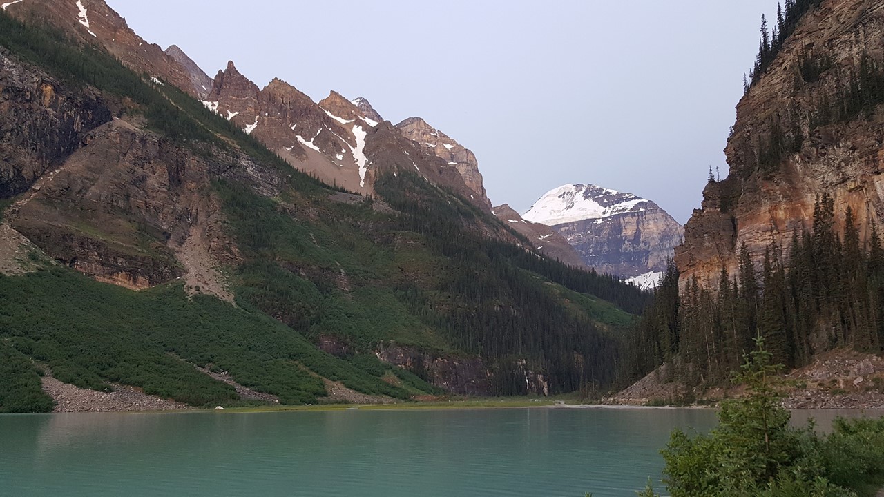
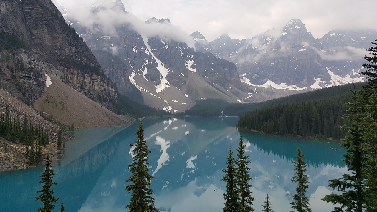
Tuesday, after breakfast, we rode the challenging 14km up to Moraine Lake and the Valley of Ten Peaks. From here, one gets the spectacular view recreated on the former Canadian $20 bill.
Picturesque Moraine Lake
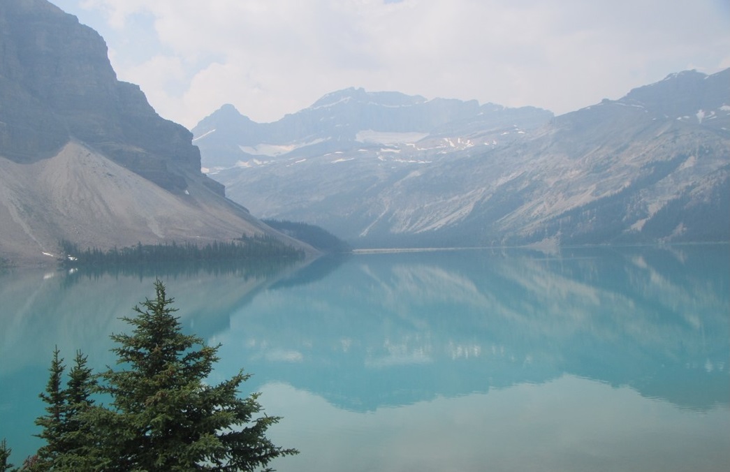
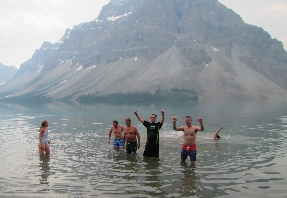
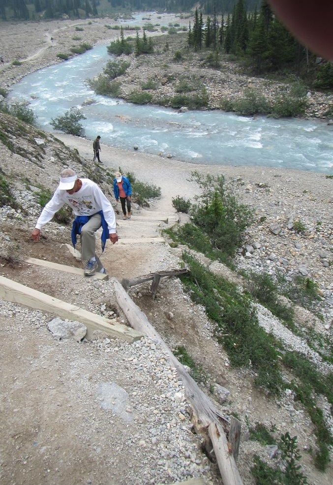
From there, we descended and rode another 20km, entering the Icefields Parkway (93N), to our original planned lunch stop at Herbert Lake. However, since our group was relatively fast and it was so early, we continued another 21km to Mosquito Creek Campground. After lunch, it was a short 12km ride past the Crowfoot and Bow Lake Glaciers to the Num Ti Jah Lodge, located on the shores of Bow Lake, and the headwaters of the south-flowing Bow River. This Lodge is an original log cabin building with many stuffed animal heads and a long, colorful history. After checking-in, a group of us assembled at the lake’s edge for a polar plunge into the 40-degree water. Since we arrived early, there was still time for the 5-mile hike around the lake to the Bow Falls overlook. The hike took 2-hours and took us over braided stream moraines and up a cliff bluff via a ridiculous set of “stairs”! After fighting off the hordes of mosquitoes, we arrived back in time to clean-up and enjoy an excellent dinner of mushroom soup, venison and lentil loaf. (67km daily, 199km total)
Bow Lake
Polar Swim in Bow Lake
Climbing the stairs to Bow Falls
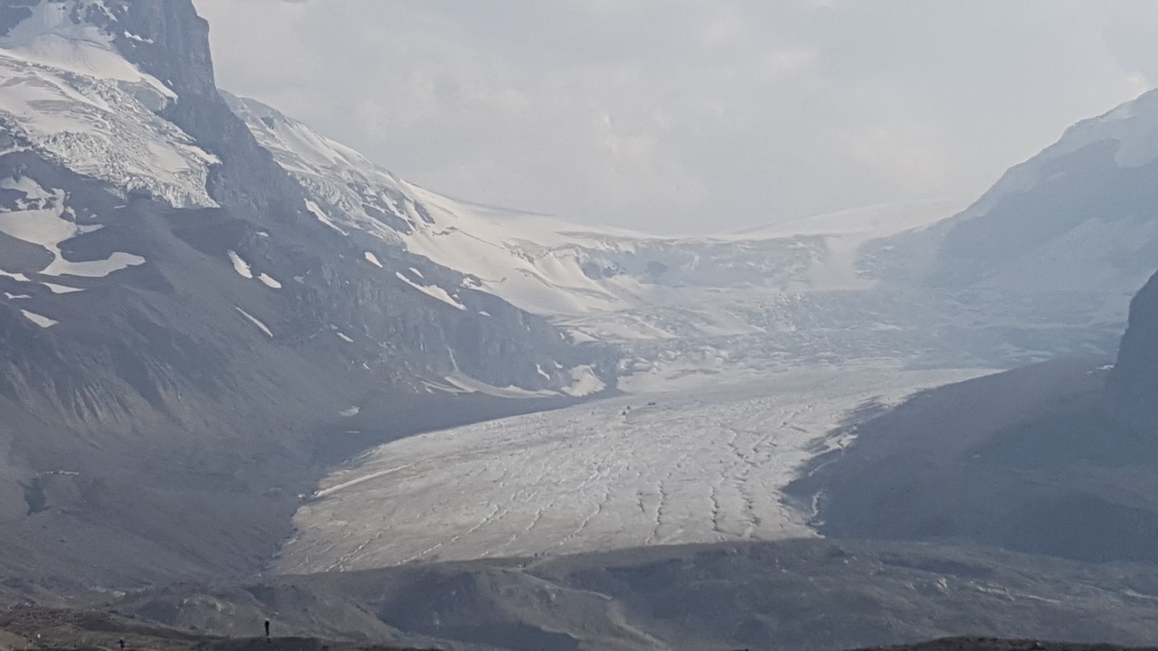
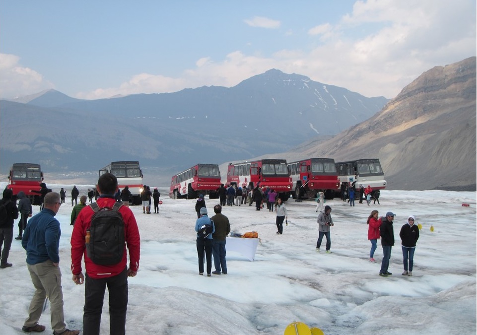
Wednesday, July 12th started with a 4am fire alarm and evacuation from the hotel! Apparently, someone left a pot and burner on in the kitchen, creating smoke that set off the alarm. After 30-minutes, we returned to our rooms, cold and groggy. With breakfast at 7am, we got ready for the longest day, yet. Today’s route would take us further along 93N Icefields Parkway, but started with a 5km climb to the Peyto Lake viewpoint. Including another brief stop at Saskatchewan Crossing for hot coffees, we rode the next 59km to our lunch stop at Coleman Creek. Along the way, riders saw bears, deer, elk and goats, as this remote area is home to a variety of wildlife. After lunch, there was a brutal 2000’ ascent of Sunwapta Pass, (a 7-9% grade), at an elevation of 6675ft. After completing the 37km after-lunch ride through weather ranging from 90-degree heat to near-freezing rain, we arrived at the Glacier View Lodge, at the base of the Athabasca Glacier. At 5pm, our group met for our tour and walk on the Athabasca Glacier. Buses took us from the hotel to the “Glacier Entry” Center, where we transferred onto special “ice crawlers” – 6-wheel drive vehicles specially made for ascending and descending the lateral moraines, and for transporting over ice. We traveled out onto the Glacier, where we had ½-hour to walk around and take pictures. Since we were here 13 months ago, the Glacier has receded nearly another 60ft, causing the visiting area to be moved, and giving estimates are that these types of tours have only 10-15 years left available. That night, we had dinner at the hotel’s “Altitude” restaurant while watching the sun set on the Glacier. (90km daily, 289km total)
View of Athabasca Glacier
Athabasca Glacier Up Close
Walking on Athabasca Glacier
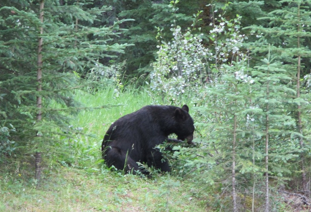
Thursday morning, we left the hotel soon after breakfast, and began the 52km ride to Honeymoon Lake for lunch. This route gave views to the most wildlife, yet, with roadside viewings of bears, elk, deer and goats. After a picnic lunch, we began the afternoon 53km ride by leaving the newer Highway 93 for the original Highway 93A, a bumpy, isolated ride with very little traffic. However, this road also gave access to quite a bit of wildlife viewing. Along the way, we stopped at the Athabasca Falls where we walked to the scenic bridges and overviews, and had a quick snack. At the end of the route, we entered the town of Jasper, we cruised past quaint stores and country-style shops. After leaving town, we rode to the Tekarra Lodge, overlooking the Athabasca River. After checking in, we walked to mile back into town to explore further and to shop. That evening we ate Boar Belly and Bison short-ribs followed by specialty coffees. Our rooms were small efficiencies with stove, refrigerator and microwave and fireplaces for the chilly evenings. (105km daily, 394km total)
Roadside Black Bear
Friday, we had the option to take a short bike ride, or to raft the Class 2 Rapids of the Athabasca River. Eight people chose the rafting trip, while three chose to ride bicycles, two went exploring/hiking. The rafting trip was a great experience, with our guide, a young woman named Emma from Adelaide, Australia. The trip took about 1-hour and journeyed us past the Tekarra Lodge. After returning to the hotel, everyone assembled for the journey via vans back to Banff. The four of us were dropped off at the Fox Hotel for the night, where we shopped the stores of Banff, and ate a dinner of pizza and beer!
Rafting in the Athabasca River
Taking a Wave while Rafting on the Athabasca RiverRelaxing by the Athabasca River
Saturday started with an early shuttle back to the airport in Calgary, and flights back to Houston and Orlando. After arriving home at 1am Sunday morning, we settled in for a well-deserved good-night’s sleep in our own bed.
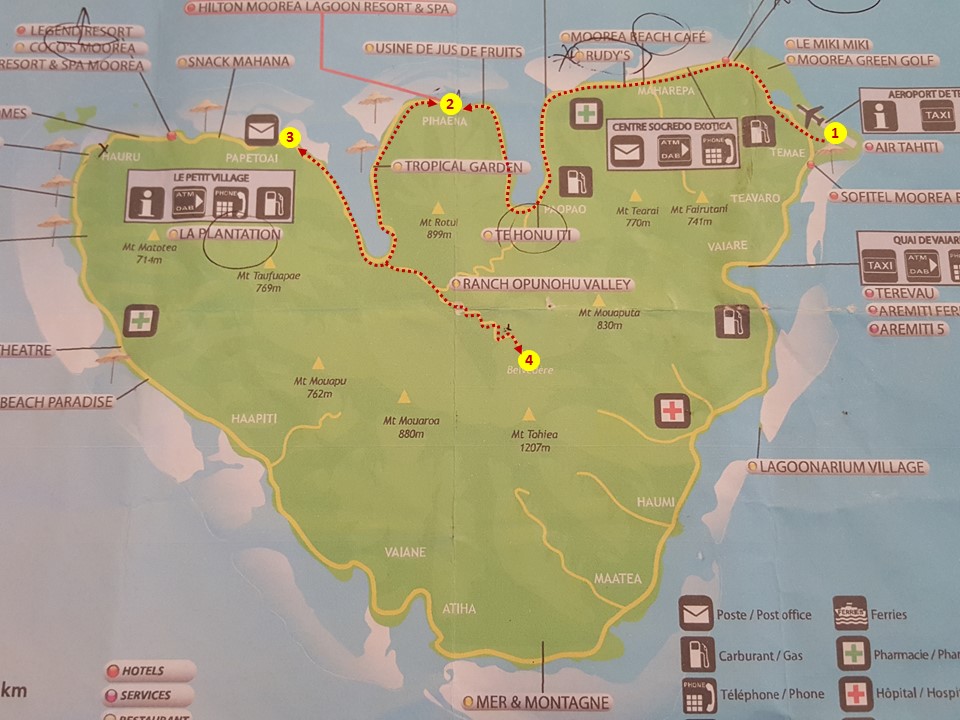
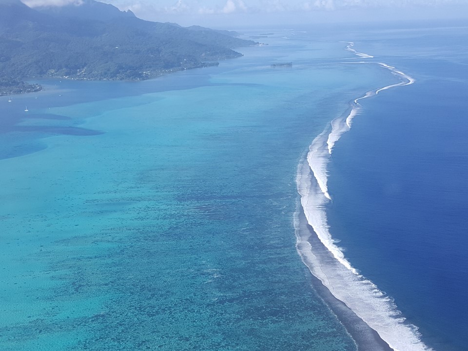
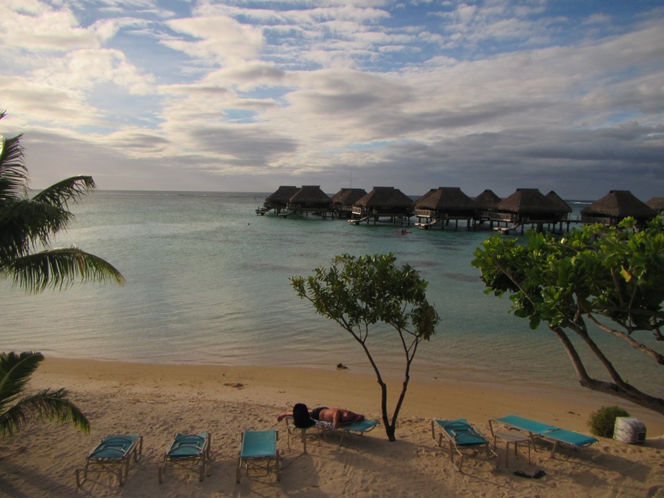
The island of Moorea has a much less extensive and mature reef system than many of The Society Islands, and there are only a few motu’s around this island. The airport is located on the northeast corner of the island’s mainland, and, after collecting our luggage, we took a 30-minute bus ride from the airport, west, to the central north coast of the island where the Hilton Moorea Lagoon Resort is located, and where we would spend the next 3 nights in onshore bungalows. Here, each bungalow has its own secluded patio area with a private plunge-pool! The resort’s restaurant bar overlooks the ocean, with Bora Bora in the background, providing a great sunset view at evening Happy Hour. After unpacking, we met for drinks and dinner of shrimp, swordfish and tuna, before taking a leisurely stroll and calling it a night.
Coast Line of the Island from the Air
The Hilton Resort Pool
The Hilton Koi Pond
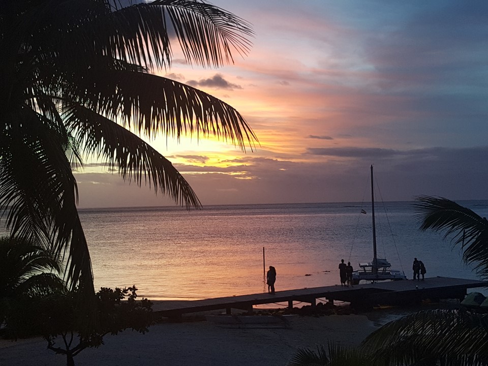
Sunset from The Hilton Bar Restaurant
Wednesday morning, we were awakened at daybreak by a local, roaming rooster. It turns out that roosters roaming loose on the island are the norm, as they are protected by law and are a growing nuisance. After taking a tremendous buffet breakfast on the restaurant’s balcony, we took up lounges under a beach hut and snorkeled off the beach to the resort’s mini “coral gardens”. The coral here is much more mature and readily accessible that at our Bora Bora Resort, and the sea life is very abundant.
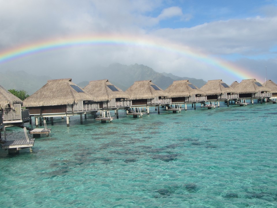
Bungalows with Rainbow
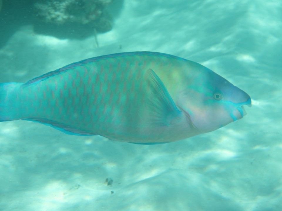
Reef Parrot Fish
Reef Trigger Fish
Reef Coral
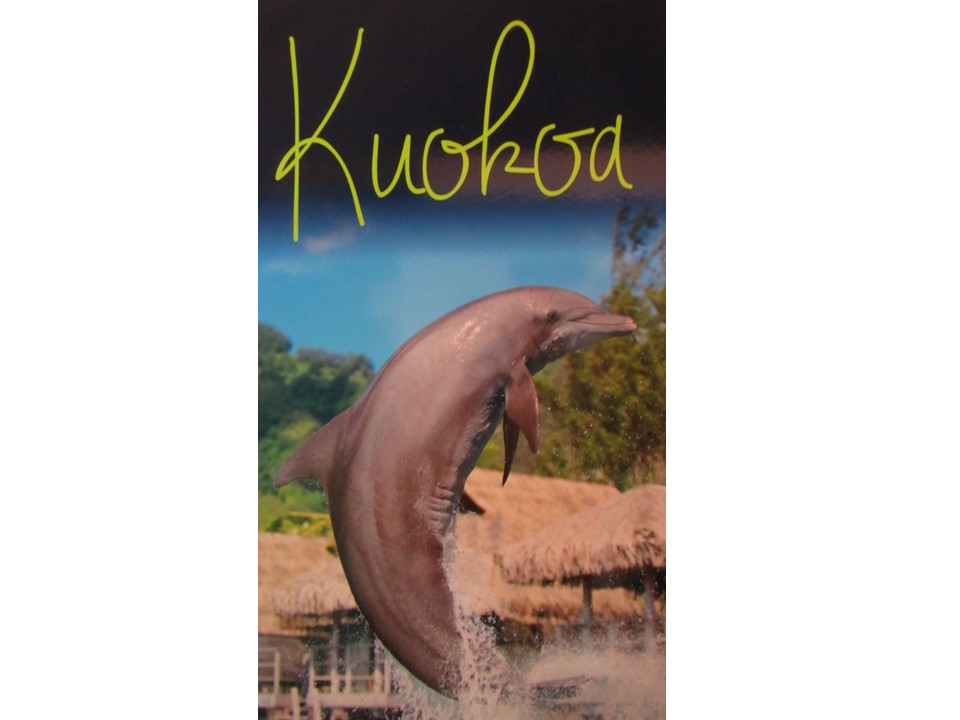
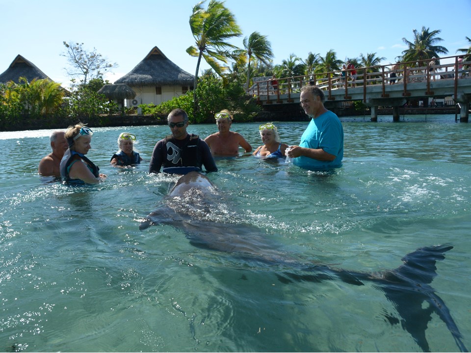
Later in the morning, a mist flowed down over the mountains from the south, and we took a modest lunch and got ready for our afternoon adventure. After lunch, we took a transport around the bay to the west to The Hotel Intercontinental Resort, where there is located both a Turtle Preserve, and a Bottlenose Dolphin Center. The afternoon would be spent with a Trainer and Bottlenose Dolphin named “Kuohoa”, a 19-year-old male that was rescued from the U.S. Navy. Kuokoa was ~8 ft. long and weighed ~210 lbs., but was gentle interacting with us, allowing us to pet and kiss him, and playfully interacting with us in the water for over ½ hour. After our “Dolphin Adventure” we returned to the Hilton for a Polynesian Buffer Dinner accompanied with Polynesian dancing and a fire-dancing on the beach.
Bungalows with Rainbow
Bottlenose Dolphin Kuokoa
Kuokoa Grees the Group
Julie with Kuokoa
On Thursday, May 11th, Rocky got up early and hike 90 minutes up the Opunoho Valley into the island’s center to the archeological ruins of Marae Ahu a Mahine, and on to a lookout at over 800 meter high. Nowadays, most inhabitants of the island live along the coast, but the ancient Tahitians populated many inland parts of the island.
View from Overlook in Moorea
After returning to the resort, Rocky met the others for breakfast, and then took up on the beach under the shady beach hut before snorkeling out to the very outer edges of the reef. In these deeper waters, the mature and beautiful assortment of coral was extensive and populated with some of the most diverse and larger fish that we had seen on the trip. After lunch at our lounges on the beach, we took a kayak out to the same outer reef location before ending the afternoon in the swimming pool.
View from the Hilton Pool
After a quick plunge at our bungalow and a leisurely shower, we me for drinks and dinner at the Crepes Restaurant located out over the water in the lagoon on the dock near the overwater bungalows. The crepes were enormous and worth sharing, and after meeting the Chef, we all shared a dessert crepe of bananas, chocolate and coconut ice cream. At the end of dinner, we spent time observing the 4-5 ft. bull sharks that were exploring the area underneath us.
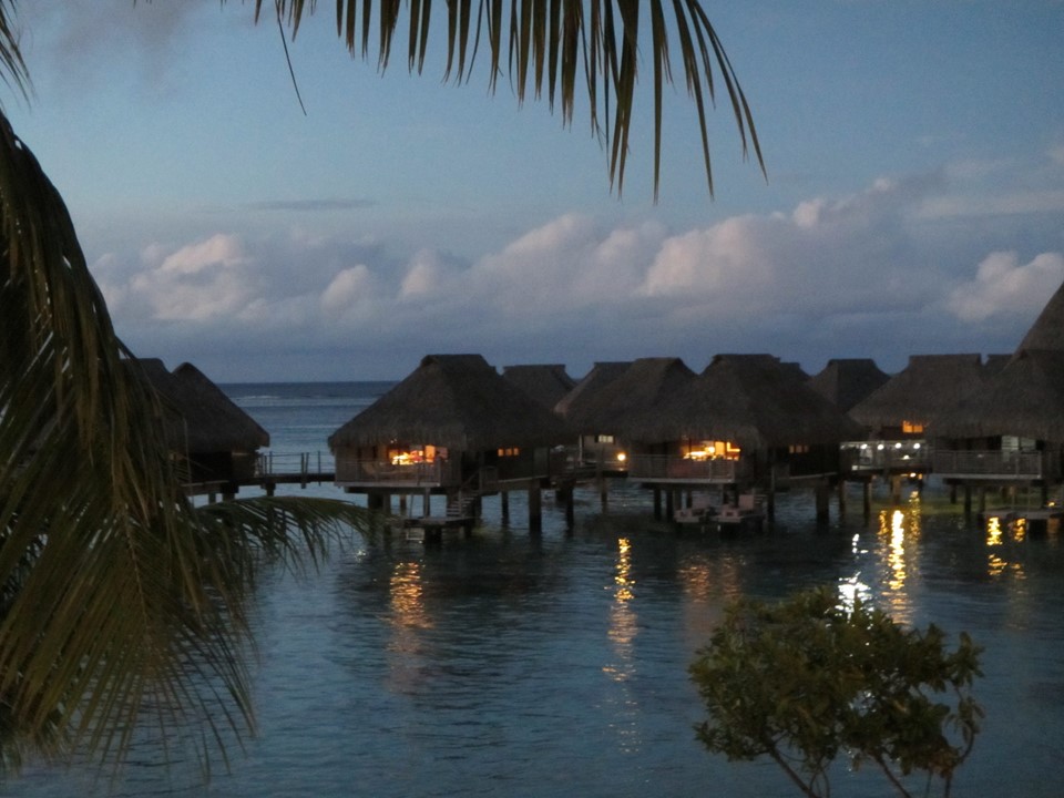
Hilton Overwater Bungalows at Sunset
Friday morning, it was time to pack and end our adventure. After meeting in the lobby and checking out, we bused back to the airport for the very short (15 minute) flight back to Papeete, Tahiti, where our international flight back to the U.S. would leave that evening. Since we had several hours before check-in in Papeete, Jeff, Debbie, Rocky and Julie put their luggage in storage and took a taxi into town to sample the local food, brew, and deserts. After short visits at several bars and restaurants, and having lunch, we returned to the airport to check in for our flight, and spent the last few hours in the Priority Lounge. The flight back to Los Angeles was only 8 hours, but was followed by layovers and a stop in Houston, before returning to Orlando for the hour’s drive home.