Eastern Australia and Tasmania

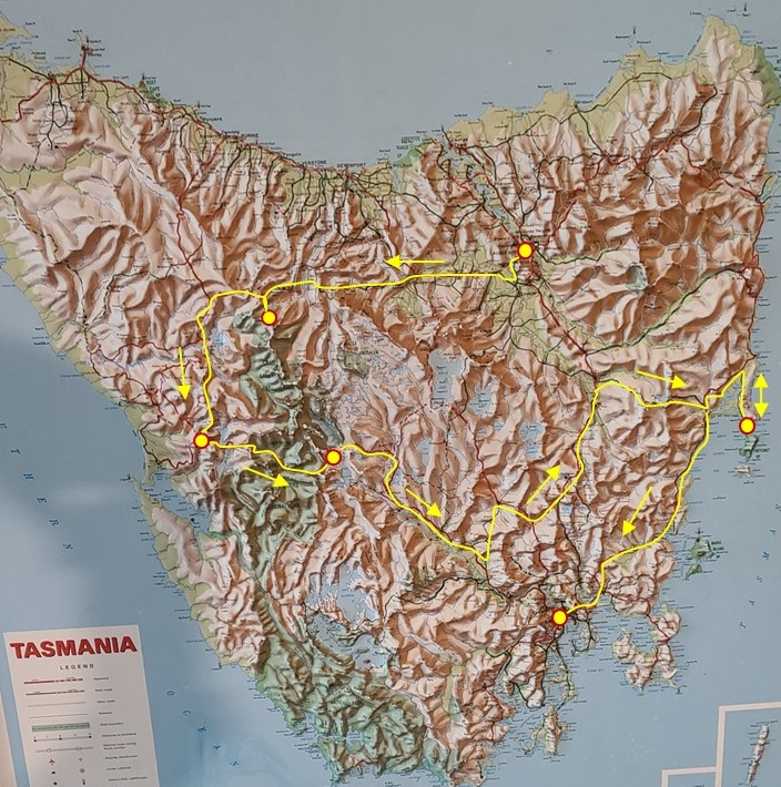
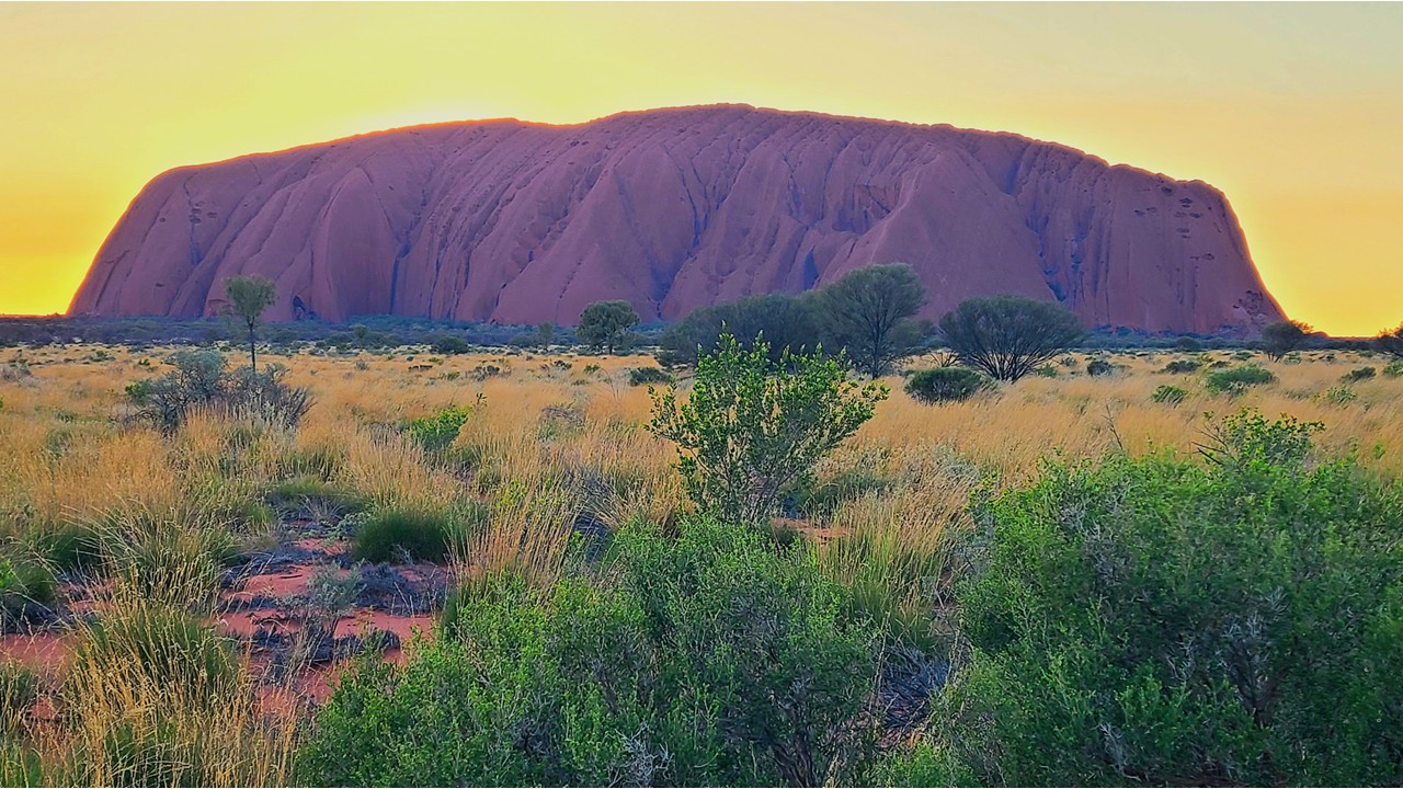
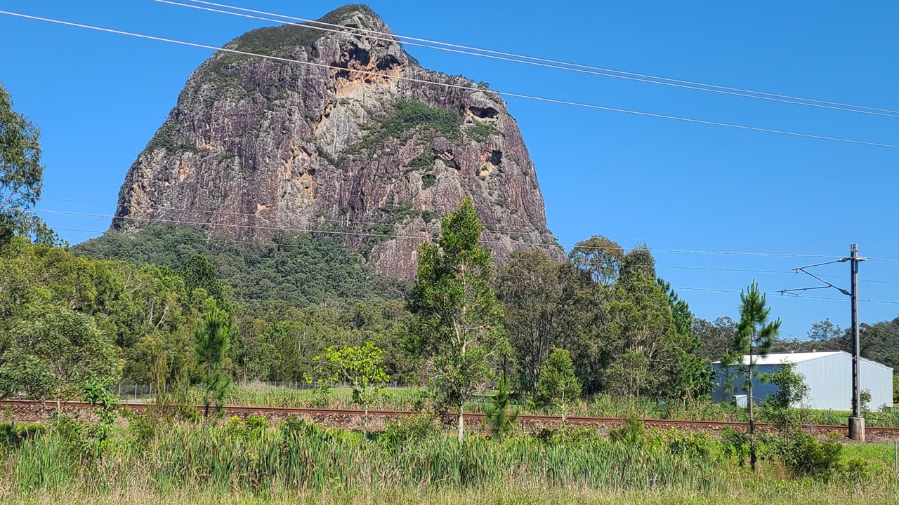
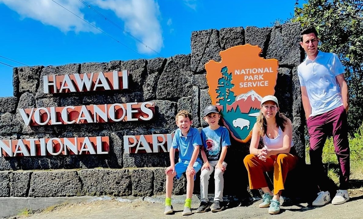
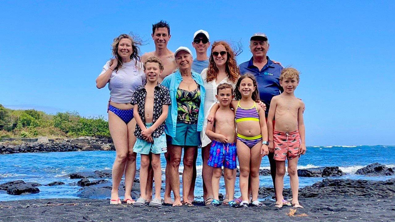
Part 4: Tasmania – from West to East & Hobart

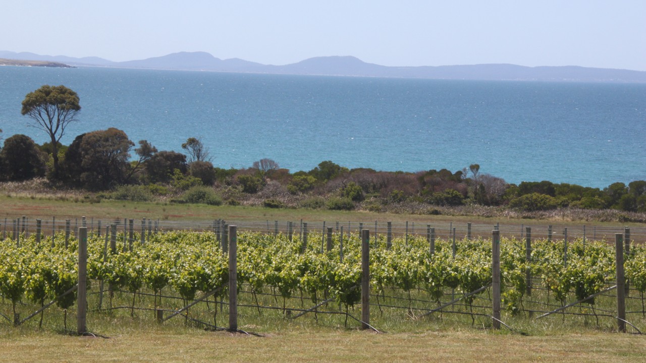
The next morning we had an early breakfast so that we could begin our long van ride back to the east coast of Tasmania. The morning was characterized by raining buckets, and all of the luggage had to be moved from our rooms on the pier to the vans via covered golf carts. We departed Pumphouse Point and drove 1-hour before stopping at a fuel station for a bathroom break. Then, 2-hours later we stopped again – this time in the town of Campbell – the cross roads of Tasmanian highways, and a place where the convicts were originally sent to work in the Australian penal colony. Those that were interred and that died here are memorialized by bricks with their names, crimes and sentences etched in the sidewalks located around the town. After a quick local coffee, we are back in the vans until we stop at the Craigie Knowe Vineyard in Cranbrook for a delicious lunch and a wine tasting. Craigie Knowe is the oldest vineyard ion the East Coast of Tasmania, and was started in 1979 by John Austwick, a dentist. In 2013, father and son Glenn & Alex Travers were in the area and decided to bring new life to this now broken-down vineyard. It took 3 years to produce the first grapes – 12 tons but they were on their way and, in 2016, they produced 22 tons of grapes and 25 tons the year after. Next they bought the vineyard next door and today they operate the restaurant, Flora’s, which was where we were having lunch and tasting wine. For lunch, we ate scallops and calamari followed by duck and flat iron steak, all while tasting 6 different wines and then taking a walking tour of the 12-acre vineyard.

Sisters at Craigie Knowe Vineyards
Cgaigie Knowe vines in Eastern Tasmania
Hiking Cole’s Bay beach to Freycinet Lodge

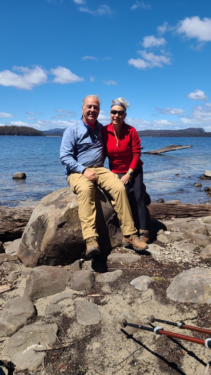
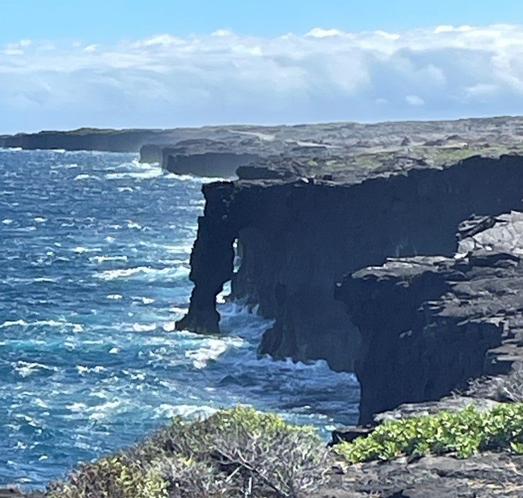
After lunch, we boarded the vans for a 45-minute drive Cole’s Bay at Freycinet National Park. After arriving at the Bay, we hiked a mile on the beach to the spectacular Freycinet Lodge overlooking the bay where we would stay for the next 2 days. After showering we headed to The Bay Restaurant for a family style meal of pork and fish. Tomorrow will be a hiking day.

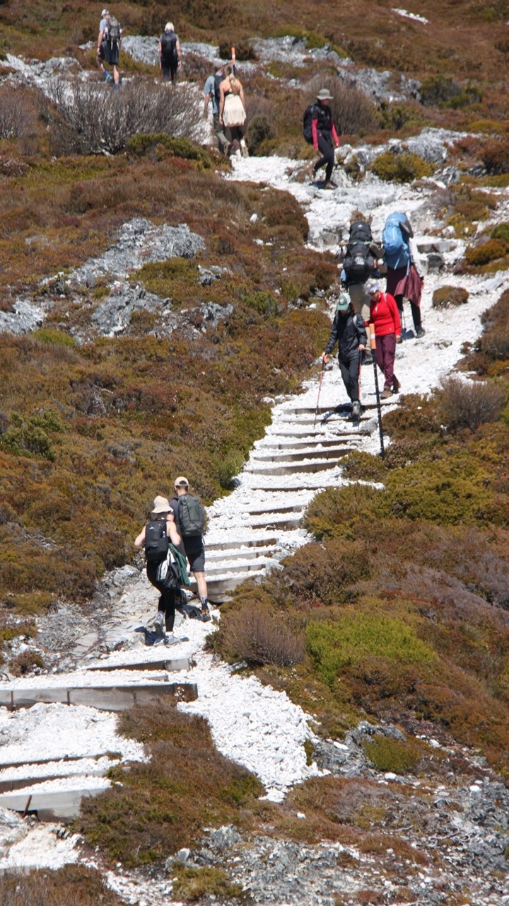
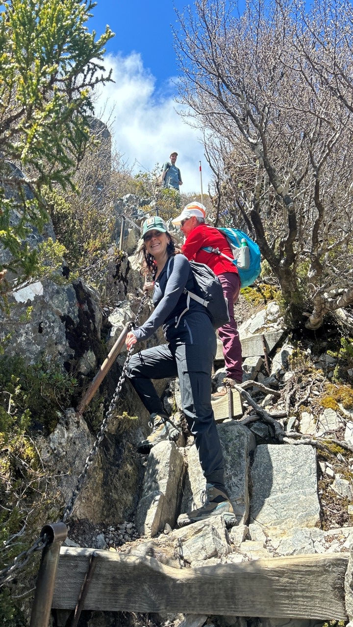
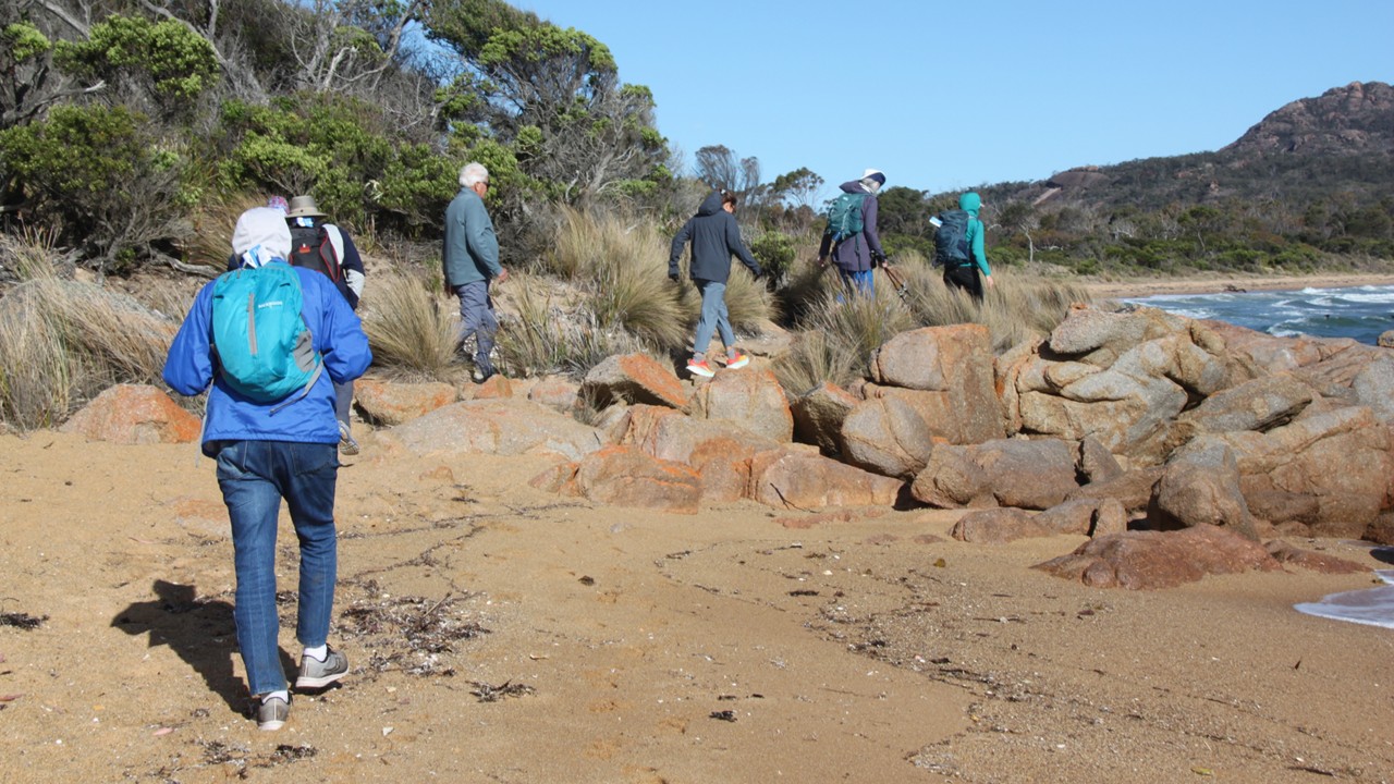
We began Saturday morning with a leisurely breakfast before receiving a talk about the day’s activities and options, and each receiving a box lunch. The day’s plan is to hike to Coles Bay Lookout and the on to the Wine Glass Bay Lookout in the very popular Freycinet National Park. The hike begins at the hotel where we leave on the trail at 8:30am. The 4 of us leave before the rest of the group to beat the heat of the day, leaving our boxed lunches in our room as we should be back before noon.

The trail to Wineglass Bay and Lookout
A view of Wineglass Bay

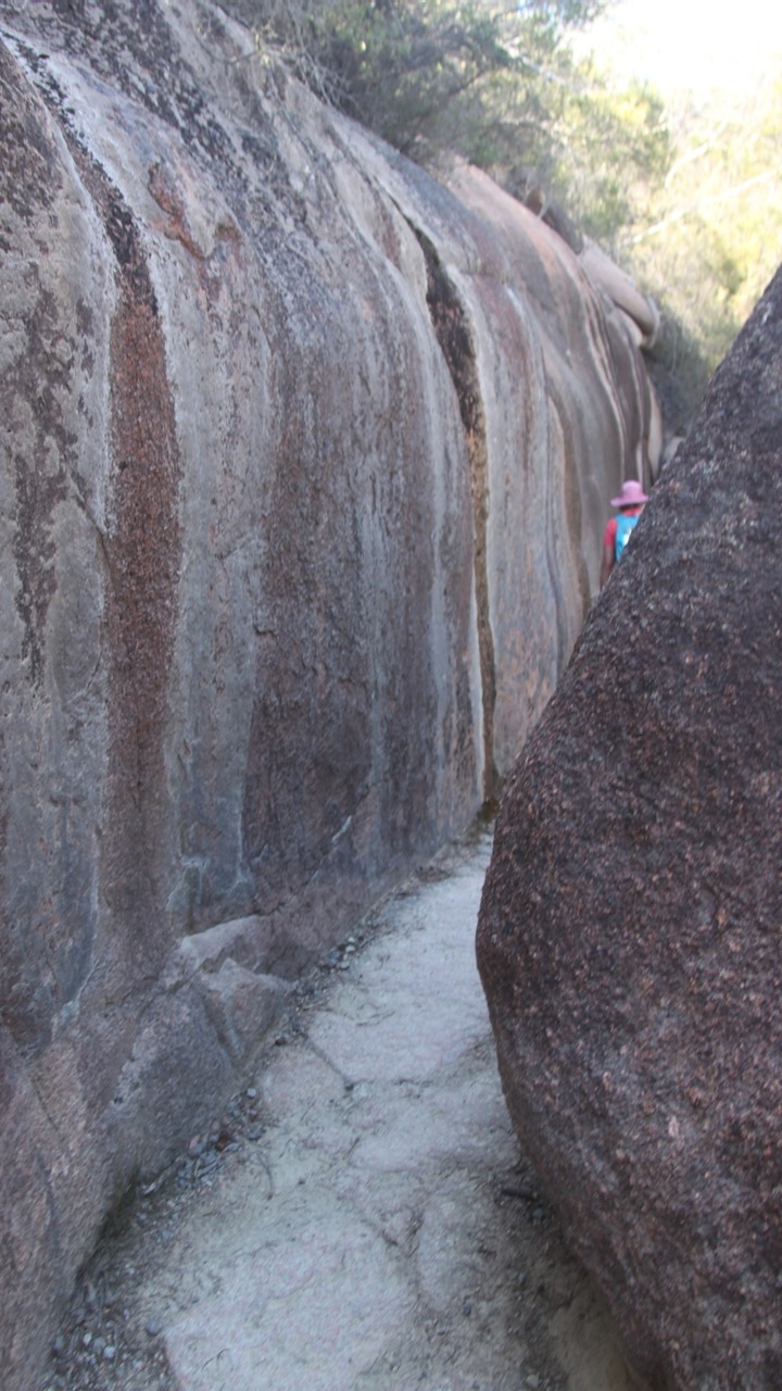
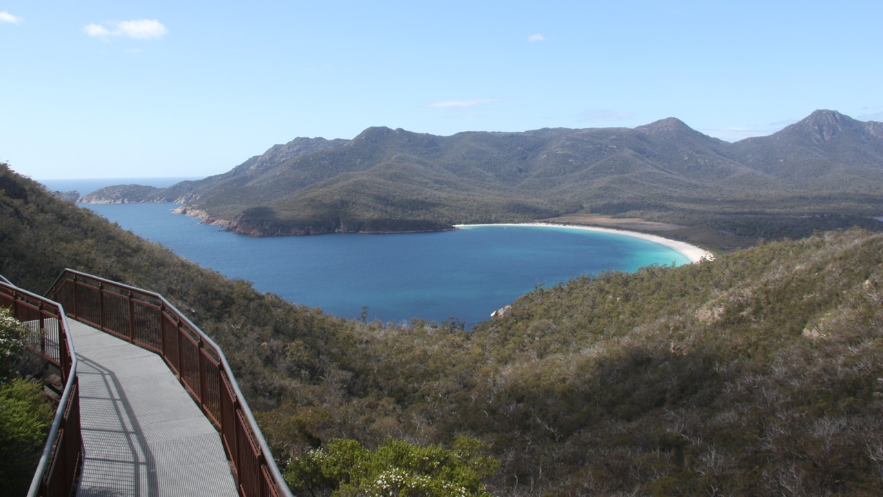
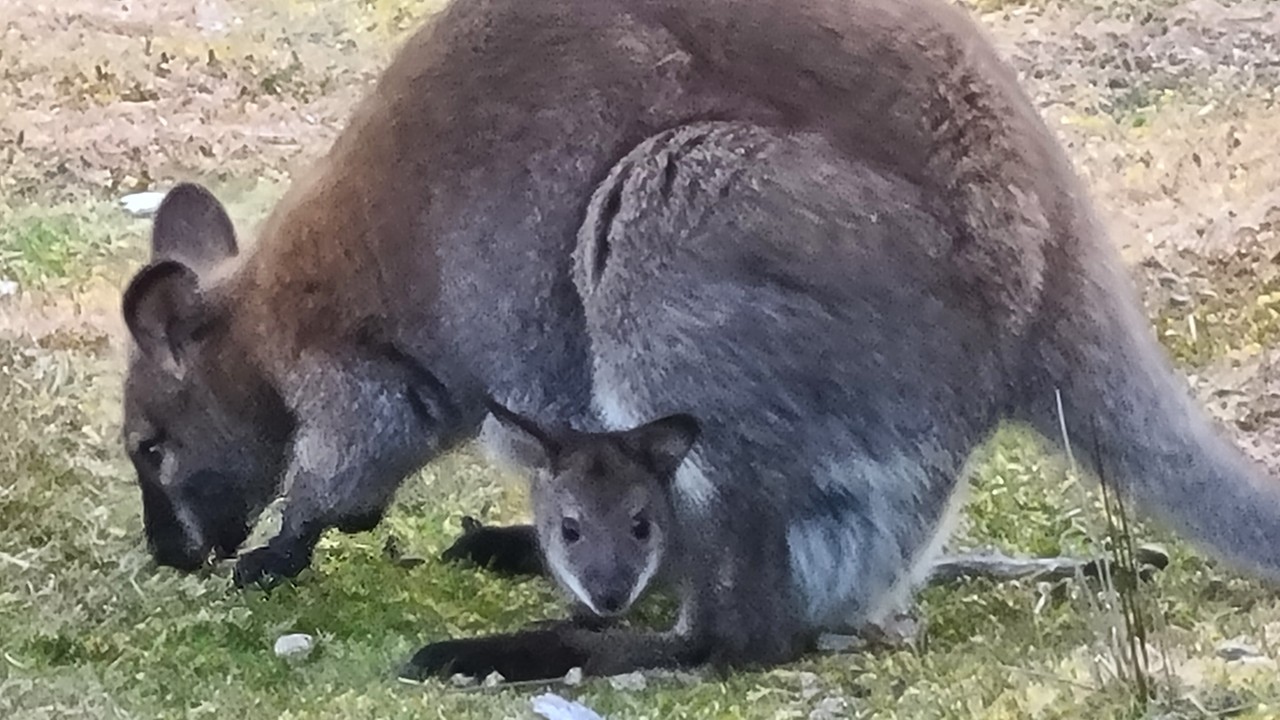
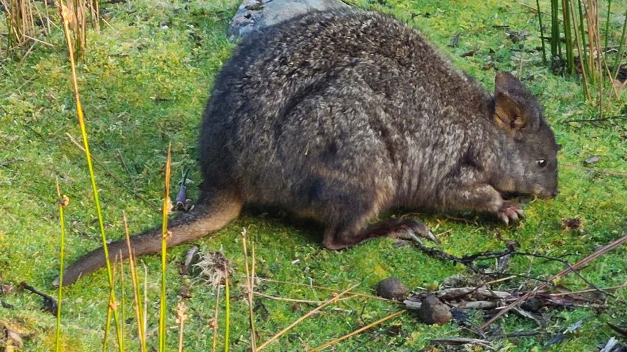
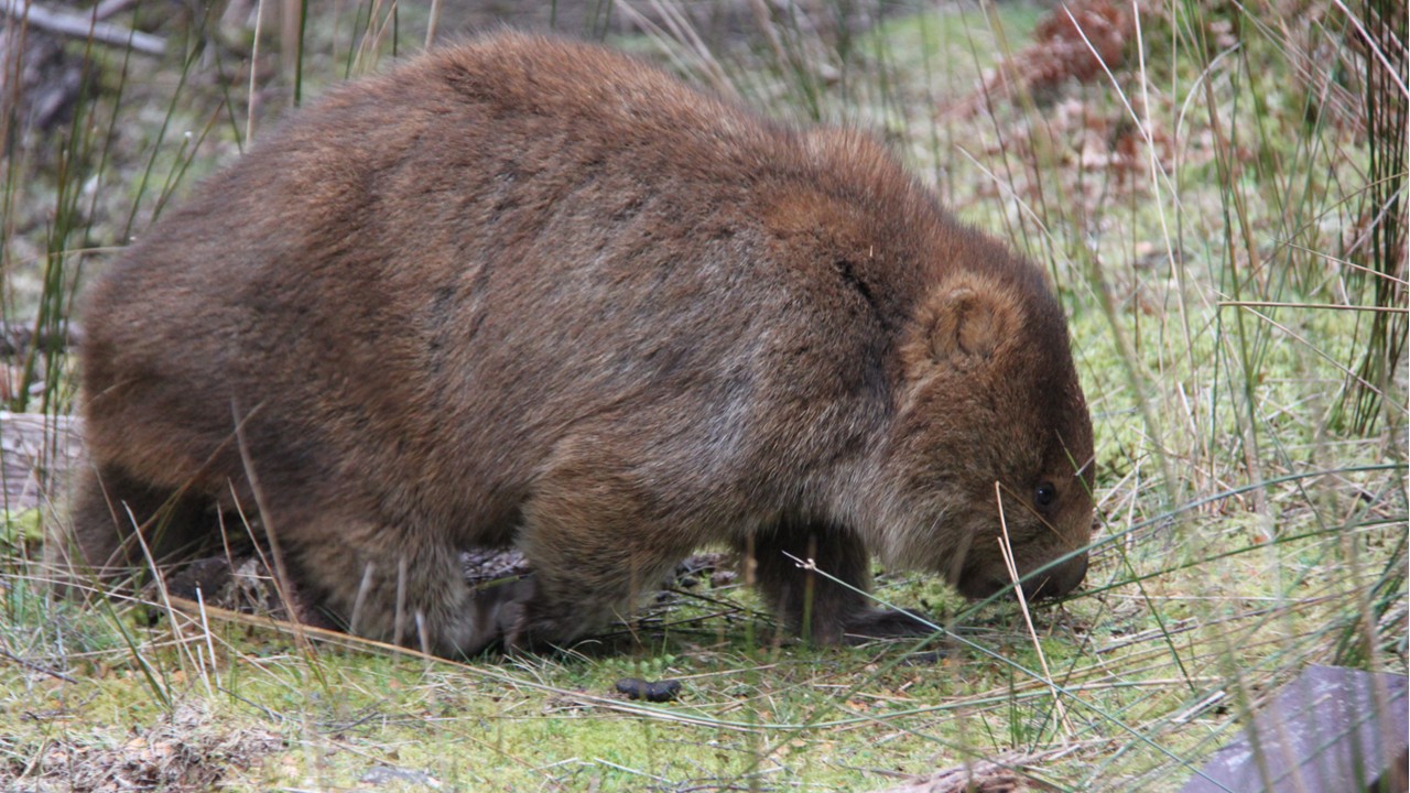
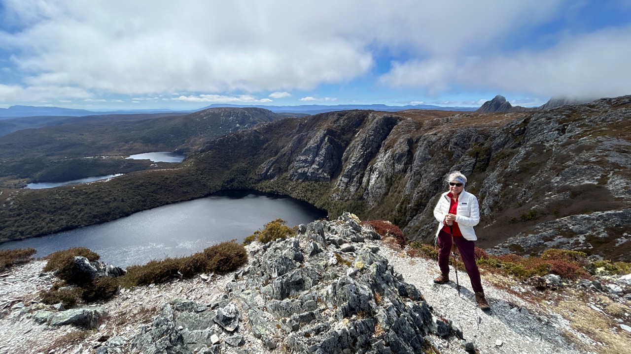
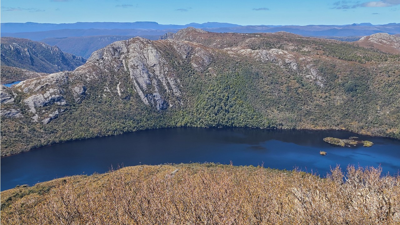
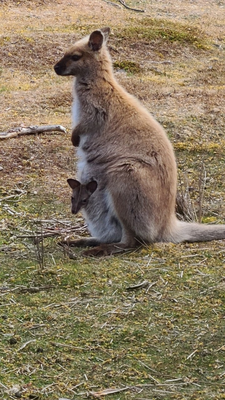
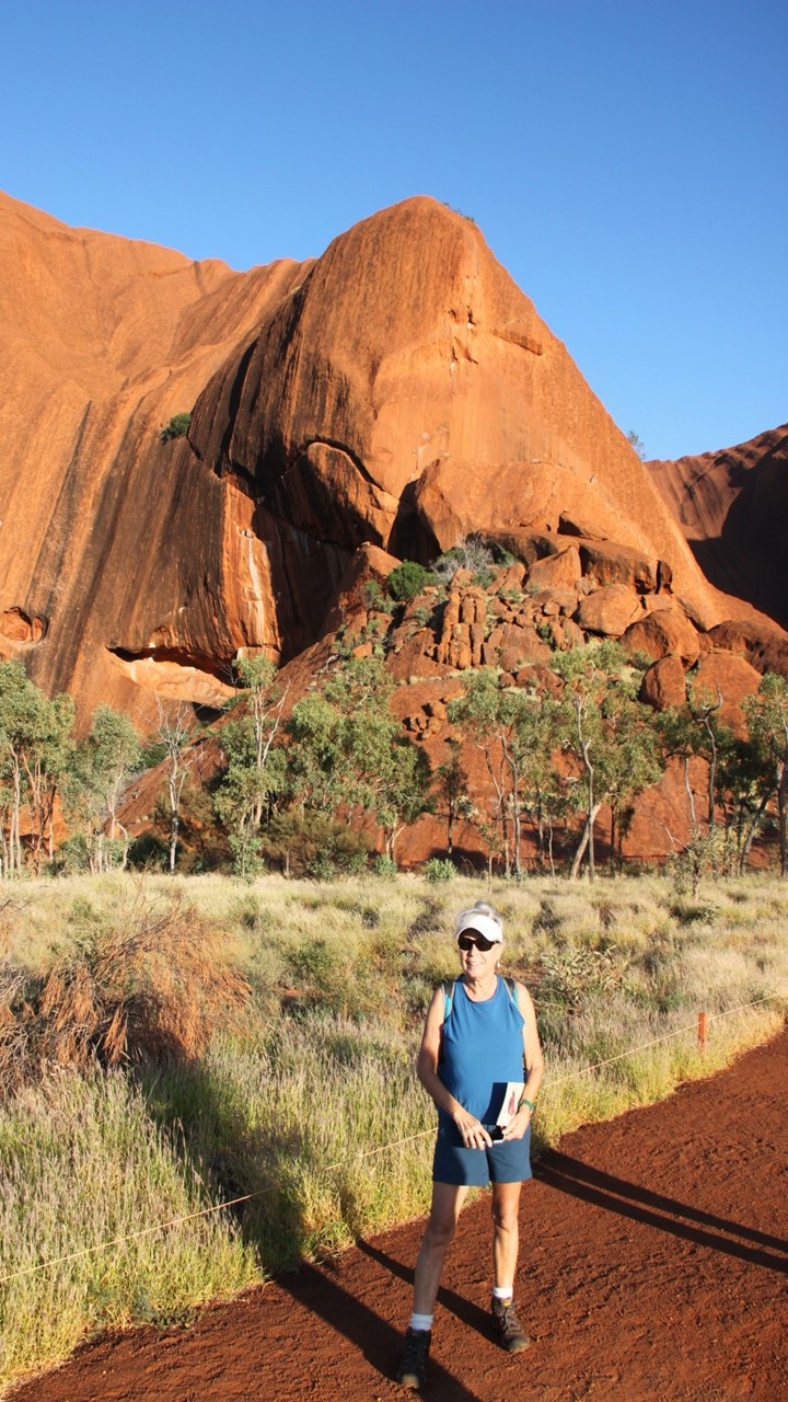
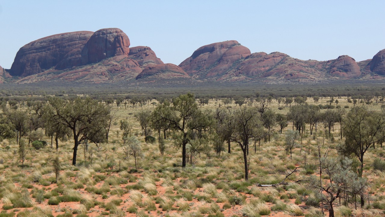
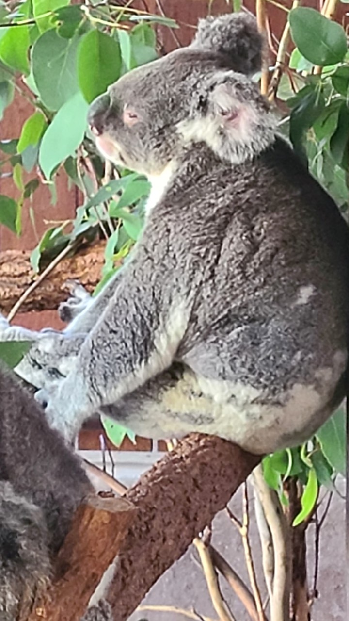
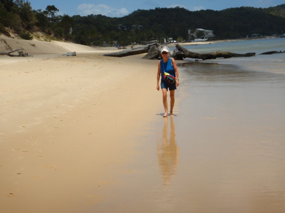
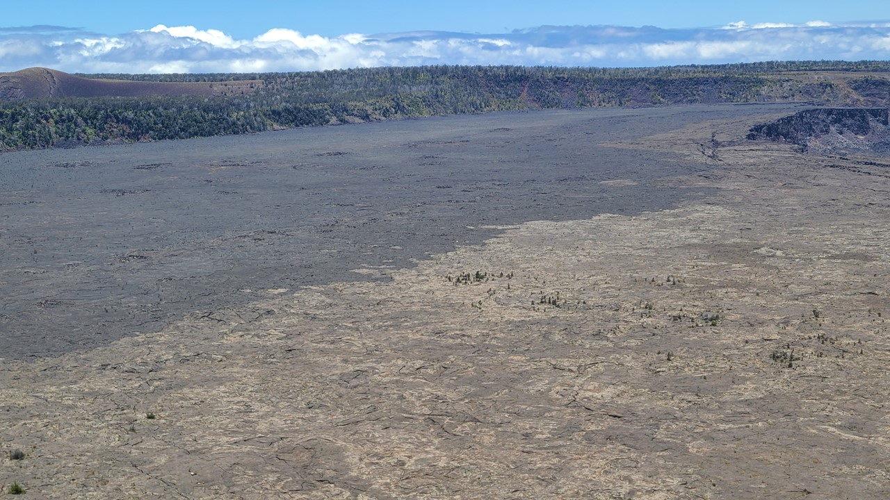
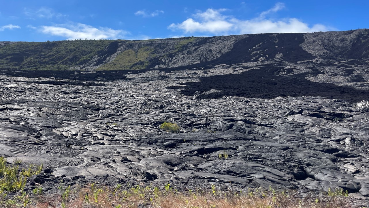
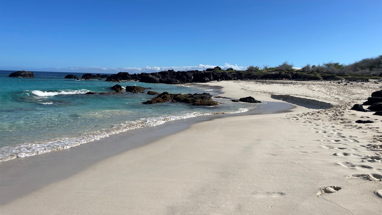
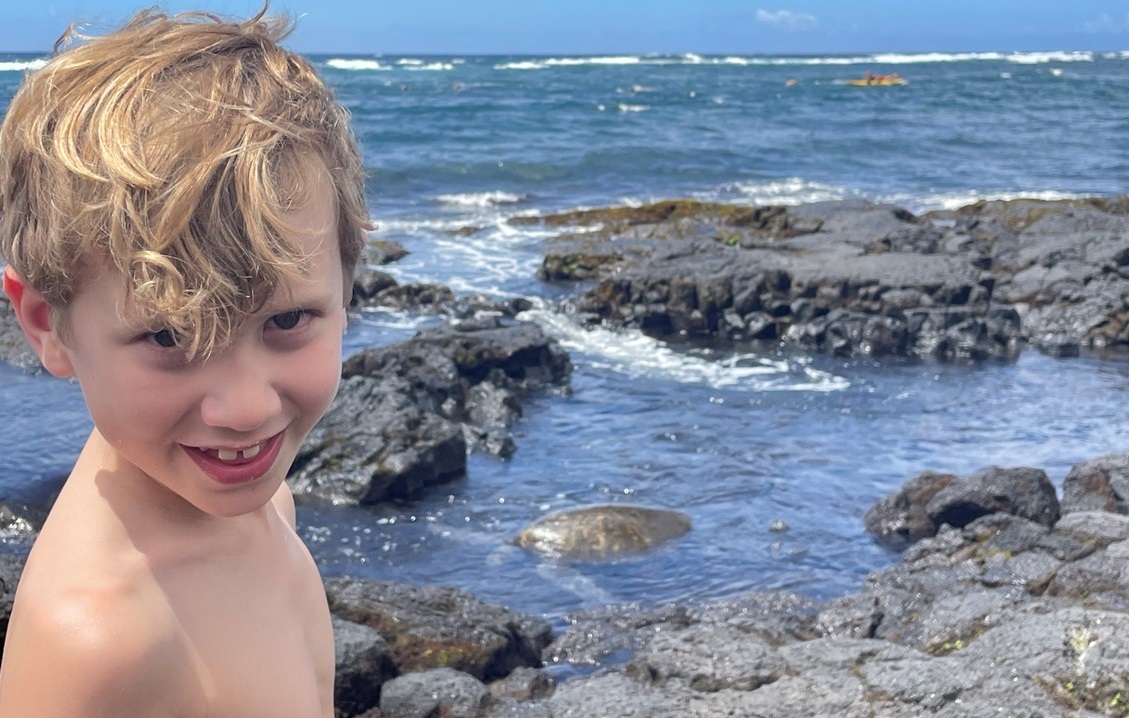
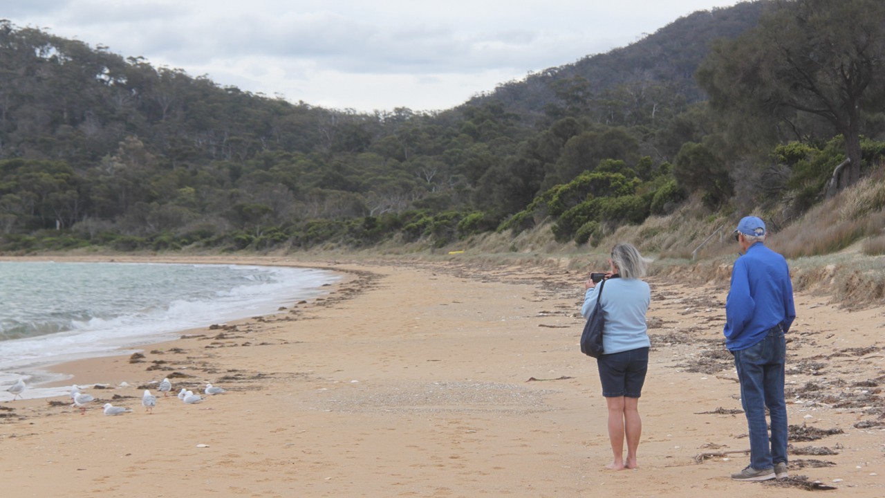
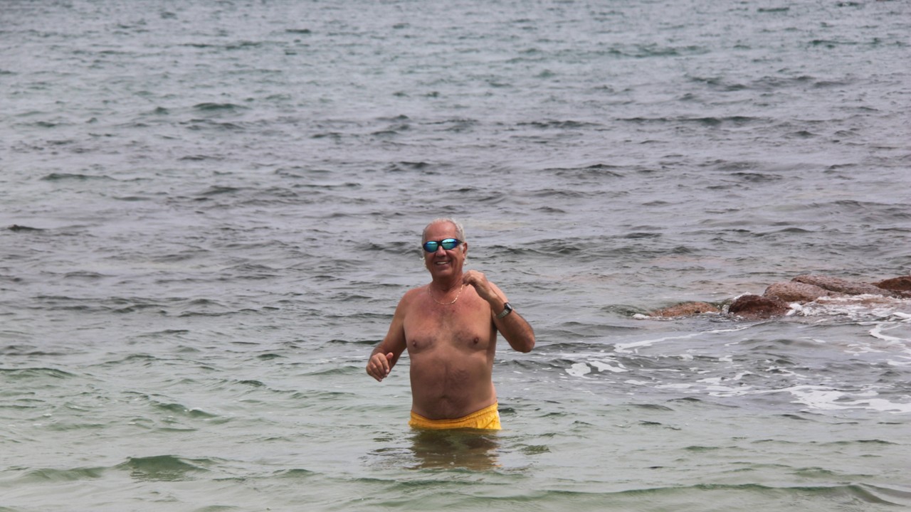
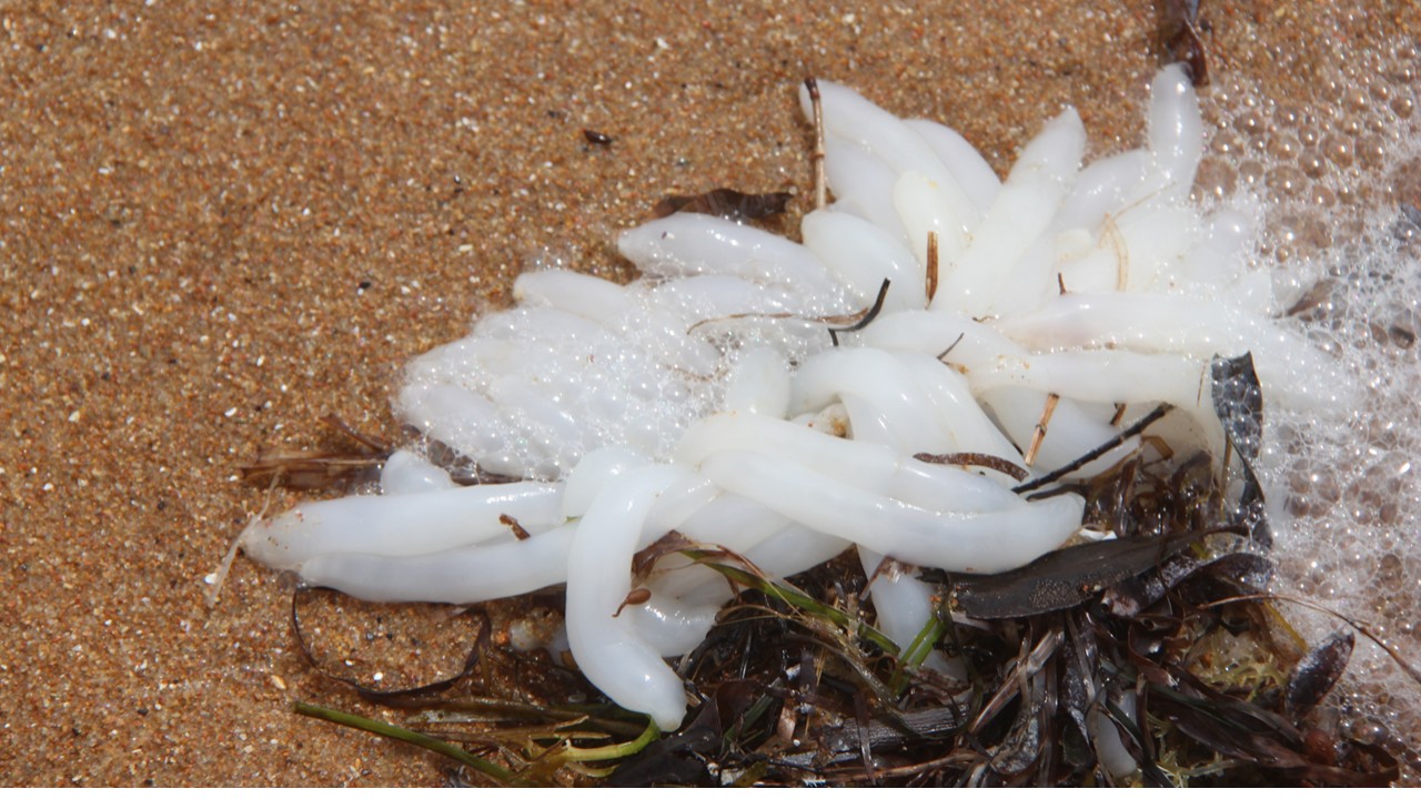
The hike is a five-mile round-trip walk along trails and boardwalks to and from the lookouts. Along the way, we saw a wallaby and a few geckos. It was a sunny and breezy morning, and the hike was uneventful, although there were a lot of steps to climb, (700 ft climb in altitude). The scenic overlooks were fantastic with views of beautiful blue water harbors and extensive beaches. After returning and eating our lunches, we played a few rounds of the card game “Euchre”, before heading back down to Coles Bay Beach to look for sea glass and shells. Rocky jumped in the water and found it was not as cold as it looked. Then we returned to the hotel for snacks, wine, and cards. Dinner that night was at Richardson’s Bistro and consisted of oysters and grilled mushroom appetizers with salmon and pumpkin ravioli. 

Exploring Cole’s Bay Beach
Rocky swimming in the cold waters of Cole’s Bay
A Sea Anemonae on the Beach at Cole’s Bay

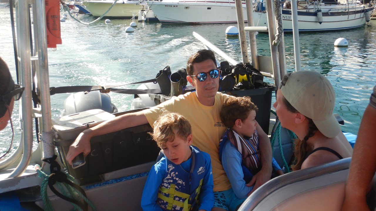
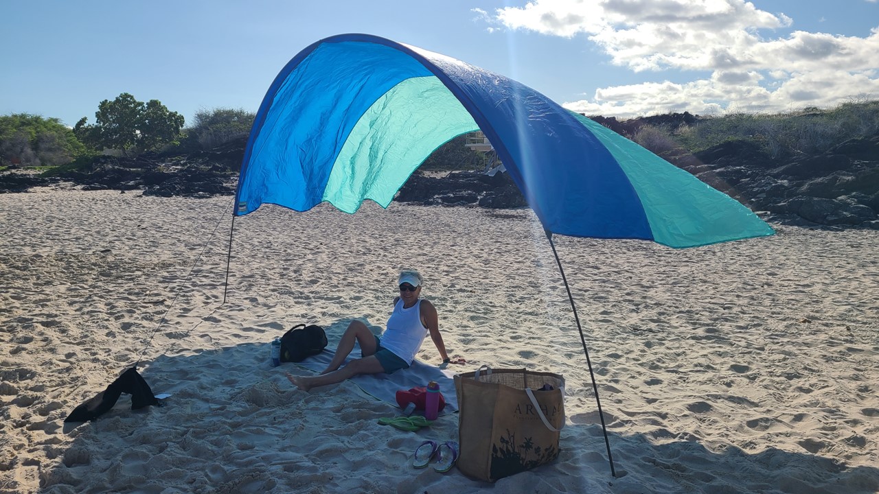
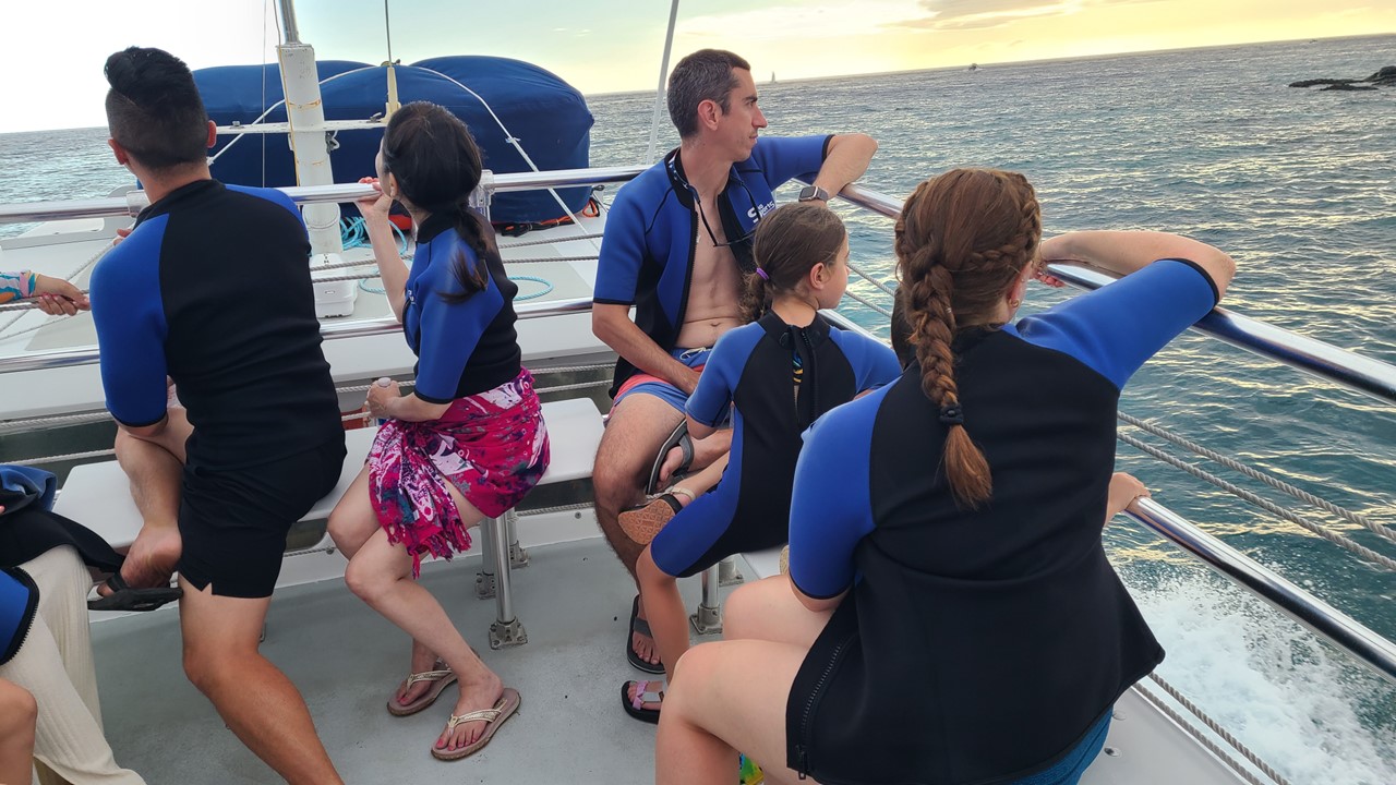
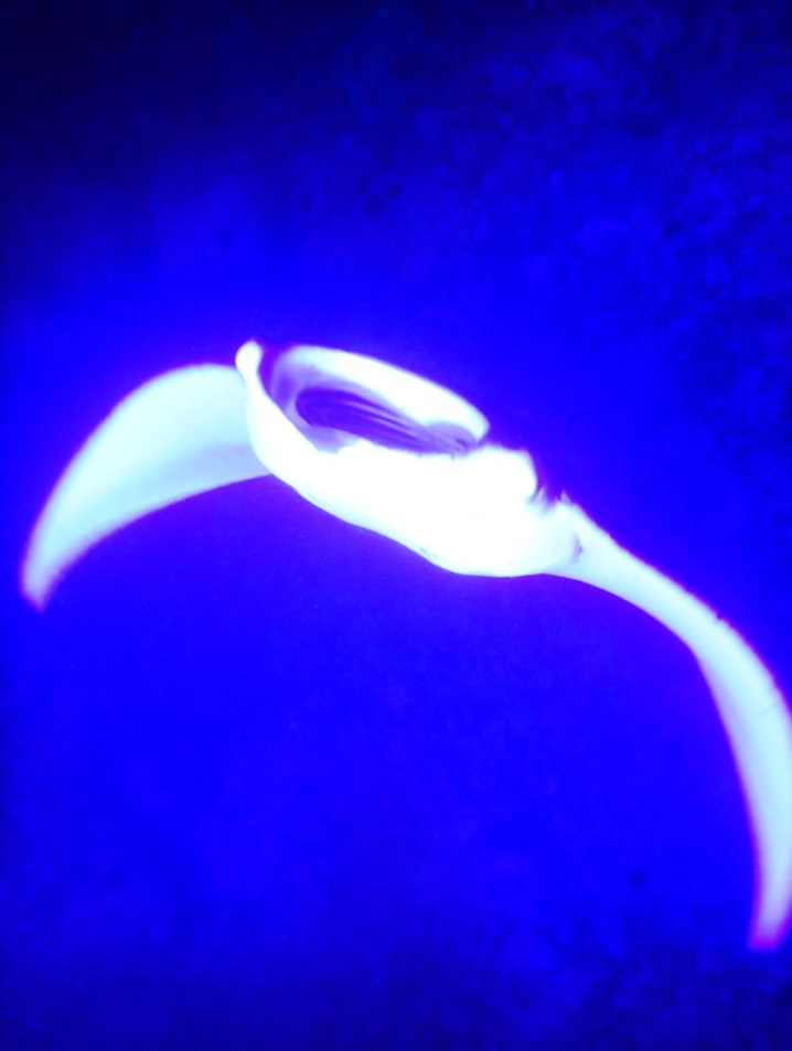
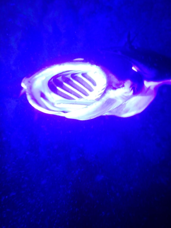
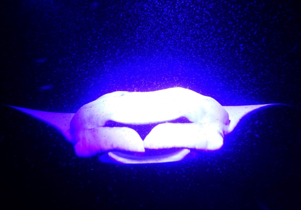
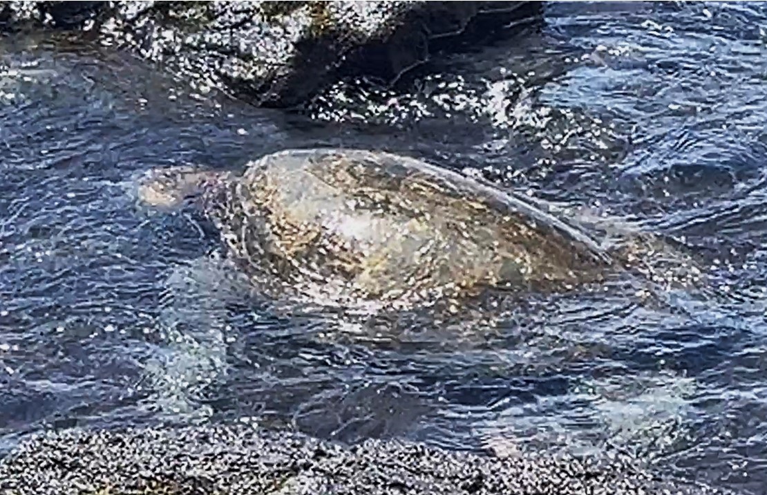
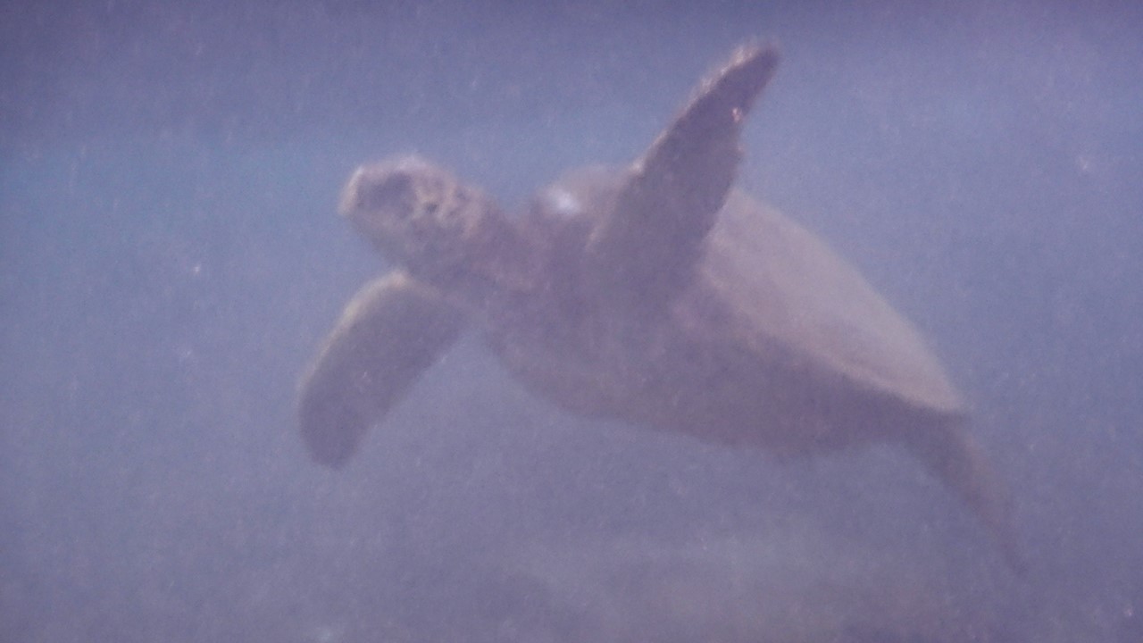
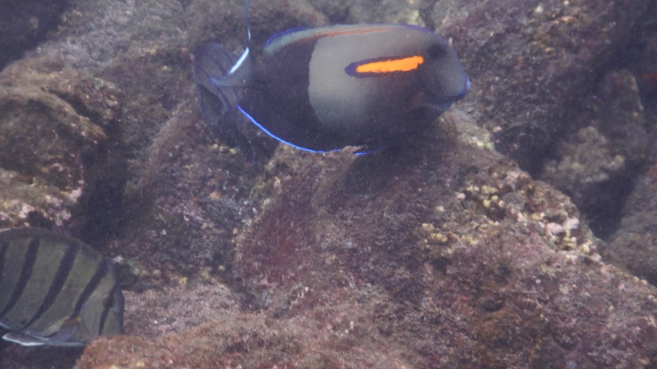
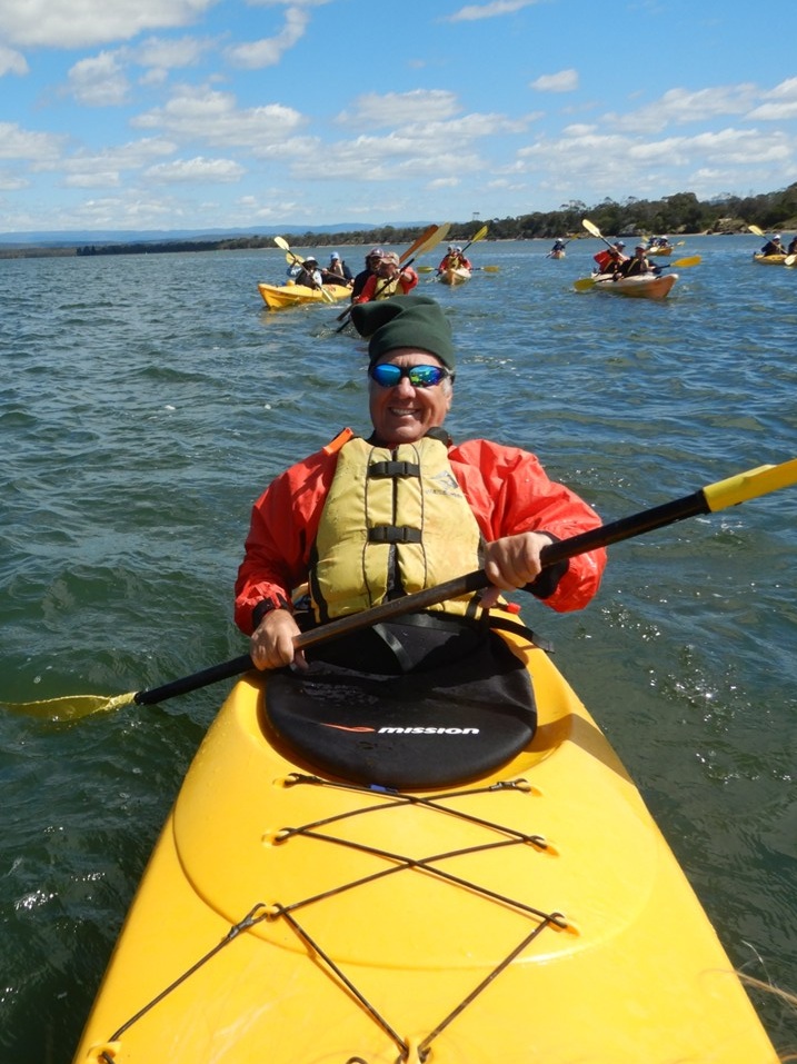
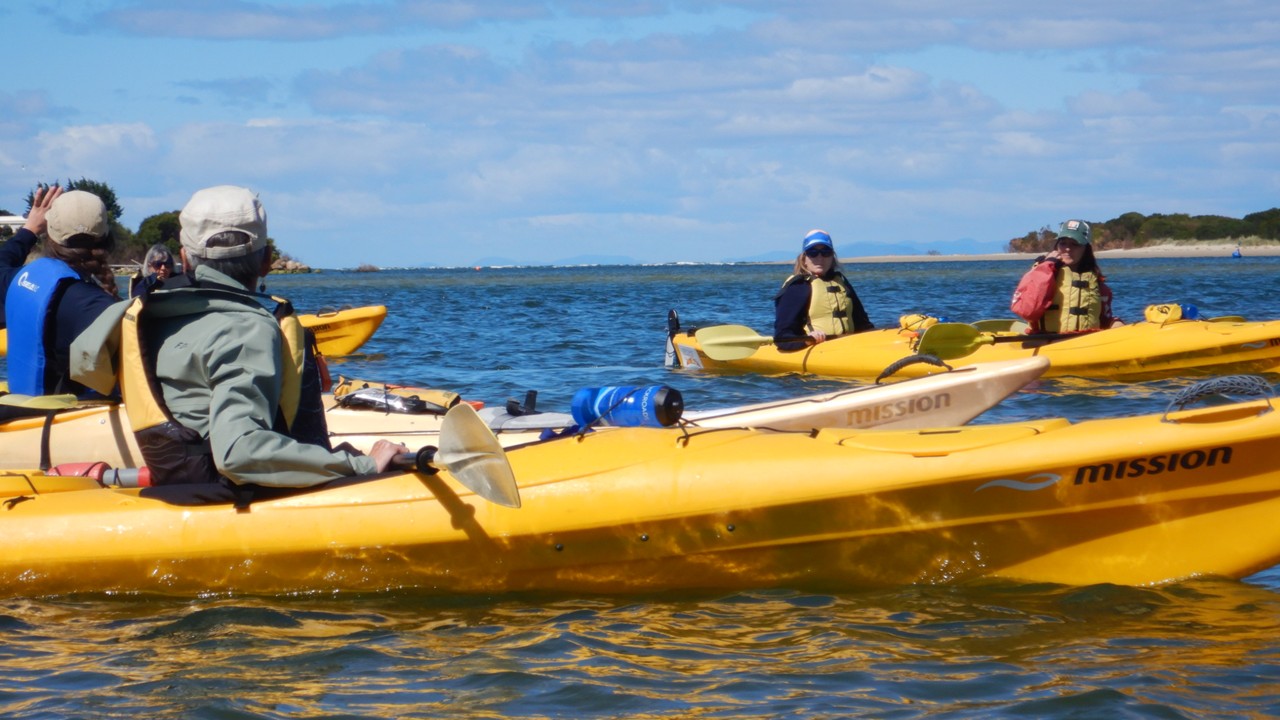
Sunday morning was met with a leisurely breakfast and packing. Today, we dressed in swimsuits under our clothes with a change of dry clothes carried in our backpacks. After a short 10-minute drive to Swan River, we were instructed in how to put on our fleece and foul-weather tops and our kayak skirts, before we moved our 2-person kayaks into the water and set off up-river. The tide was out so we had to avoid running aground in the shallows. Once on the water, we observed manta rays, eagle rays, egrets, pelicans, and numerous other birds in the river channel. Further up the river was a large oyster farm from which the oysters we ate yesterday had sourced from. After paddling up-river near the right bank, we turned the kayaks and paddled across the channel’s rising tide towards the opposite bank. Once we were again in the shallows, we took a break to enjoy the view and munch on some chocolate chip cookies. We then made a large circle around and returned to the dock with no mishaps. When we had dried off we were treated to hot tea and hot chocolate. 

Rocky in a two man kayak
Kayaking at the mouth of Swan River

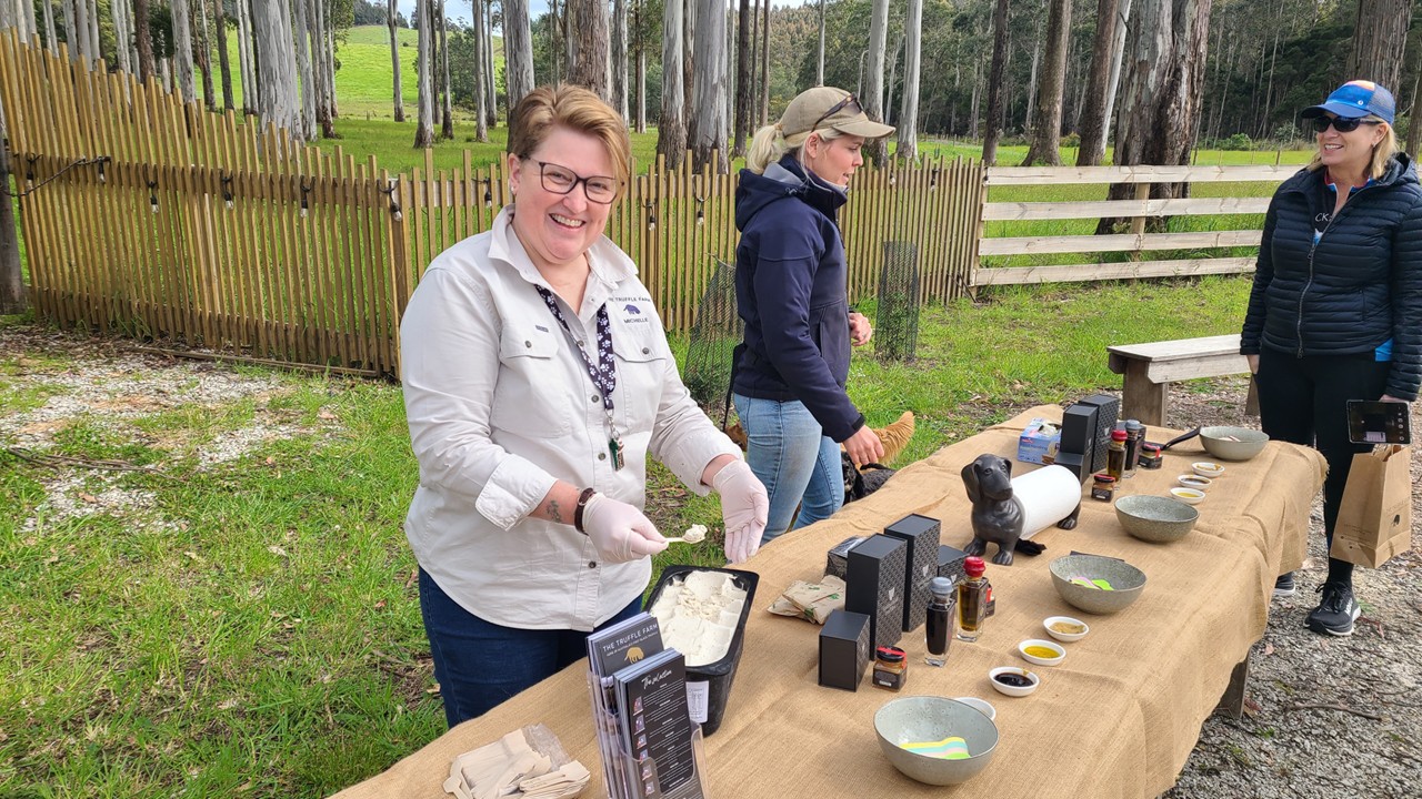
After reboarding the van, we traveled a short distance before stopping at the community garden for a bathroom break and to dress in our street clothes for the 1-hour trip to Mayfield Estate Wine Cellar and Tasman Sea Salt producers for lunch. Two brothers there farmed sheep until a drought came and nearly decimated the estate from 10,000 sheep to only 2,000 sheep. In response, the brothers set about growing grapes in 2010. Now they send the grapes to local wineries and their brands of wine are returned to their restaurant/estate, which is located on a wonderful hilltop venue overlooking the scenery around it. All of their grapes are hand-picked. While we each ordered a pizza from their stone oven, we enjoyed a wine tasting consisting of a sparkling wine, a Chardonnay, a Pinot Gris, a Rose, and a Pinot Noir. The brothers have also continued to raise sheep for their Merino wool, of which 80% is exported to China. 

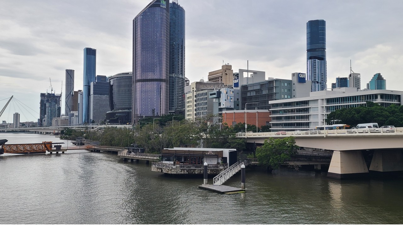
We then shuttled 1.5-hours to Hobart to famous “MACq 01 Hotel” located on the Harbor Waterfront. Our room has a beautiful view overlooking the harbor with a brand new tug boat parked just outside of our balcony. The MACq 01 is a “Story Hotel” with every room and lounge dedicated to the personal story of a Tasmanian individual: see the link: https://www.macq01.com.au/our-story/ . Cocktails that evening were in the “Story Bar” with a selection of hors d’oeuvres, and followed by a 3-course meal in the Old Wharf Restaurant. This was the last dinner we had as a group.

Statues & View of MACq 01 Hotel in Hobart

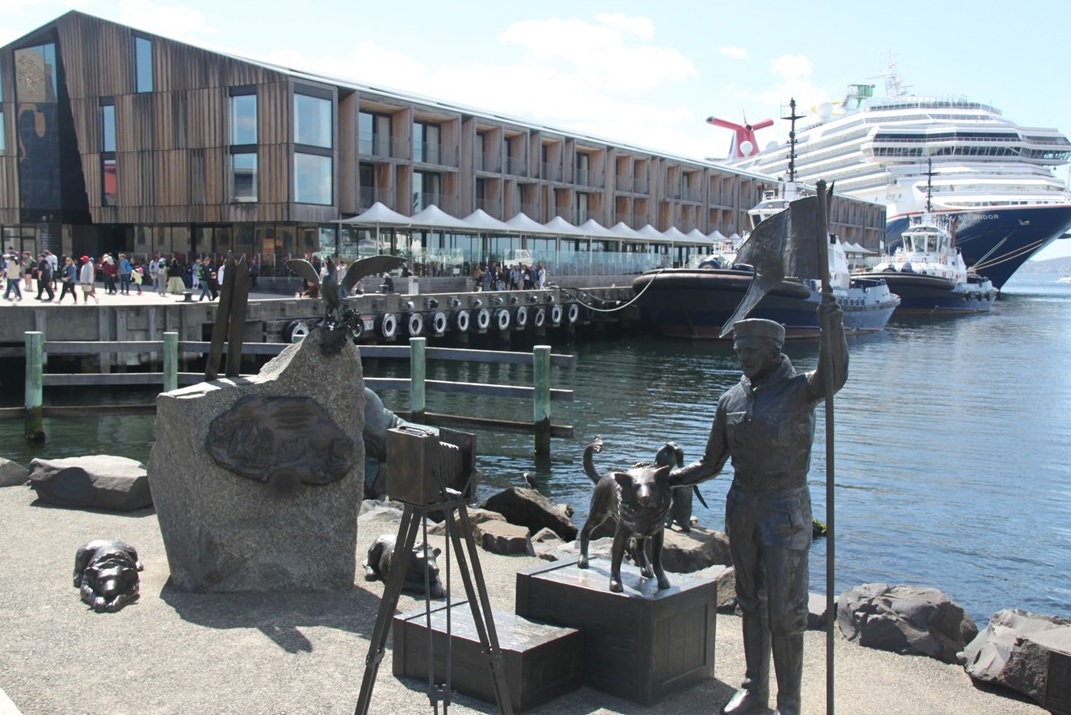
Monday morning we were up for breakfast with Julie’s sister and brother-in-law, as they were departing early to return to the U.S. After breakfast, we met with the remainder of our group for a “story telling” walking tour of the area beginning in the “Evolve Bar.” The “Evolve Bar” is decorated with a unique and valuable collection of fossils that is the private collection of the hotel owner. Once the introduction ended, we took an initial walk around the square surrounding the hotel, learning the history of various buildings and parks and how they became part of Tasmania’ history. 

In 1642, the first white man who came to Tasmania was Abel Tasmania, the captain of a Dutch ship working under the sponsorship of Anthony van Diemen, the Governor-General of the Dutch East Indies. Later, 150 visitors and scientists came from France to study the strange and previously unknown animals and flora. When the British established a settlement there in 1803, they retained the name, “van Diemen’s Land”. Then, in 1825 it became a separate penal colony when John Bowman brought 50 convicts there. It soon became notorious for its harsh treatment of prisoners and for its reputation for being inescapable. Then, in 1856, the name was changed from Van Damien’s Land to Tasmania to distance it from its brutal reputation.

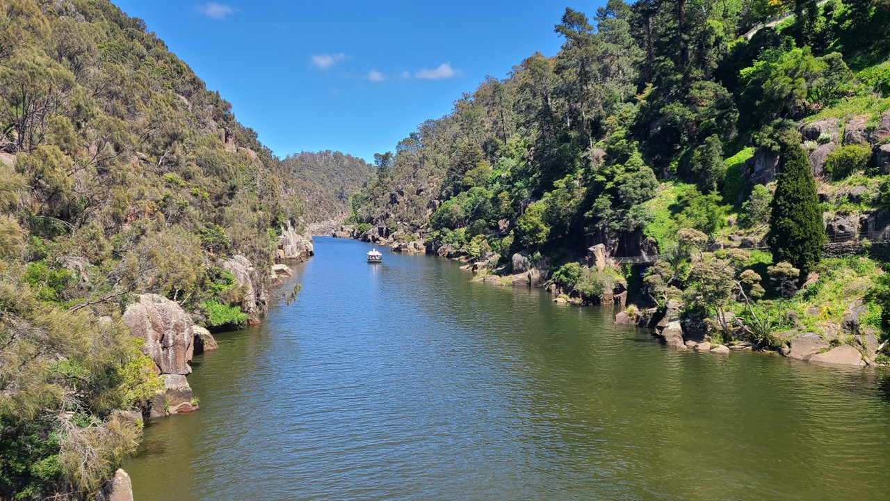
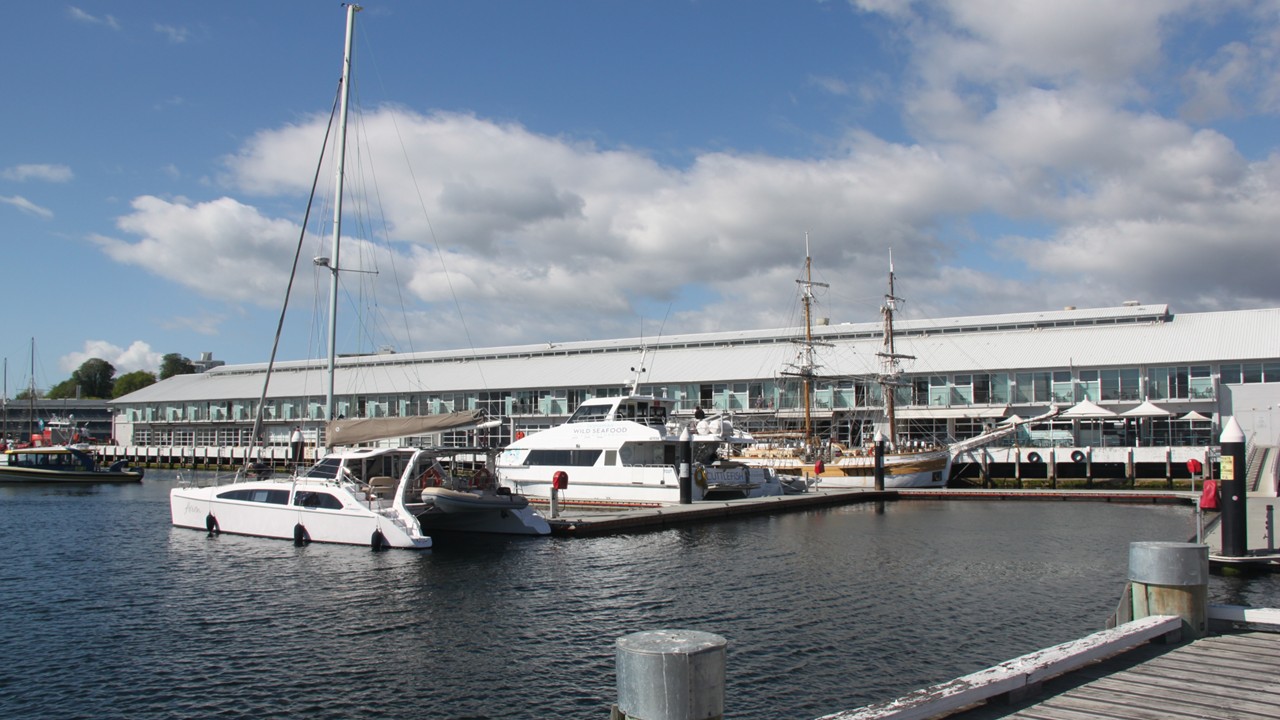
Today, Hobart is the second deepest port in the world and has traditionally been a breeding ground for Southern Right Whales, (so called because during the whaling industry times, they were the “right” whales to hunt!)  It was said that at one time, there were so many whales in Hobart’s harbor that you could walk on their backs across the water. Today, there are few whales left that visit the harbor as most are up closer to Melbourne. We walked to Battery point – the oldest residential neighborhood in Tasmania where today over 60% of its citizens have convict heritage. Much of the port today is surrounded by reclaimed land that once held valuable warehouses and factories. We walked by the Henry James IXL Building – a company established in 1891 as a manufacturer of jams, conserves. However, by the 1970-1980’s the port area had become an area of slums and poverty. Then, in 1990, the  area was restored and is a bustling shopping area today. The population of Hobart is only ~250,000 people – nearly half the population of Tasmania.

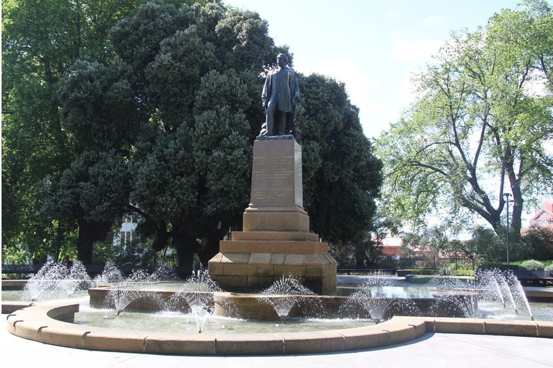
We then visited Franklin Square named for British explorer Sir John Franklin; a British Royal Navy officer, explorer and colonial administrator who was knighted in 1829 and who served as governor of Van Diemen’s Land from 1836 to 1843. He later took 128 men in 1845 to search for the North West passage. However, his ships got stuck in the ice and their fate was never discovered for 12 more years when a written account in a diary was discovered detailing their journey, starvation, and deaths. Their ships were never found until 2014 & 2016.

We then toured St. David’s Park – the largest park in Hobart and one that was once a cemetery. After the cemetery fell into disrepair, it was redesigned in 1925 as a classic Victorian garden, with lawns, flower beds, and a variety of native and exotic trees. The gravestones and burials of the cemetery’s inhabitants are still there.

Hobart Harbor
Franklin Square and Cemetery in Hobart
Tasmanian Navy in the port of Hobart

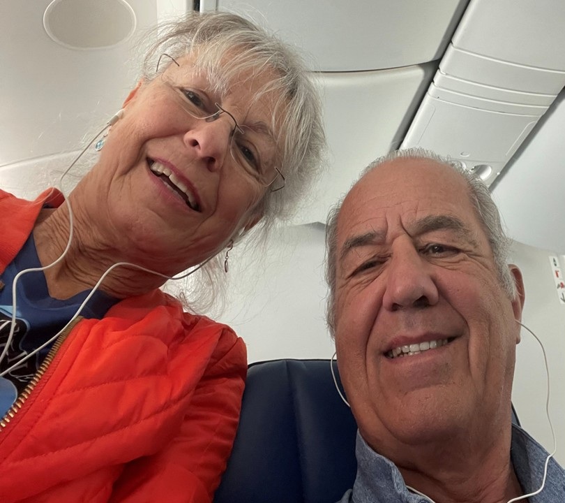
After the tour and back at the hotel we checked out and left our bags in storage there while we did some shopping. We bought souvenirs and stopped at Mures for a lunch or fish and chips with a beer. Then, it was time to leave Tasmania and we returned to our hotel, picked up our luggage, and took an Uber to the airport  for our 2-hour flight to Sydney, Australia where we stayed overnight in the airport hotel. The next morning we boarded a 16-hour flight back to Houston and connected to a 2.5 hour flight back home to Florida. A wonderfully adventurous trip, indeed.

Julie and Rocky on flight home

Eastern Australia and Tasmania

Part 3: Launceston & Western Tasmania

Sunday morning we were up and checked-out of the airport hotel by 7am. After walking across the sky-bridge to the Check-in Counters, we checked our bags, got breakfast at McDonald’s, and then window shopped until boarding time. It was an hour flight from Melbourne south to Launceston, Tasmania. Launceston is the second largest city in Tasmania, (Hobart is the largest), and it was the first Australian city to have underground sewers and to be illuminated by hydro-electric power. Launceston is also known for its vibrant food culture and has been made a UNESCO city of gastronomy, one of only 49 in the world. From the airport, we caught a taxi to Peppers Silo Hotel, where we would meet our Backroads group to begin bicycling the next morning. Peppers Silo is a hotel made out of old grain silos and is very unique. We dropped our bags there and walked to Cataract Gorge, a National Reserve site. The site has been a Reserve since the 1800’s, and is characterized by a “hanging walkway” along its side that was built in the 1890’s and which is still used today. The walk starts in King’s Park across King’s Bridge and then down the path along the gorge.  We saw numerous birds, massive Sequoyah trees (planted in 1894), and a number of peacocks. After sightseeing, we returned to the waterfront near the hotel to eat lunch at “The Rupert & Hound.”  We then walked into the downtown area looking for some pastries for tomorrow’s breakfast, and for a bottle of wine for the evening. On return to our hotel we checked into our rooms and then played cards in the lobby. We had a light snack at the bar before calling it a day.

Map of Tasmania and the route taken
Cataract Canyon in Launceston

On Monday morning, we met our Backroads group, turned over our luggage, and loaded up into their vans for a short trip to The Truffle Farm – Australia’s First Black Truffle Farm. There the family run business showed us how they “pollinate” spores on fledgling tree roots and wait over 10-years to speculatively gather truffles with the help of their truffle-sniffing dogs. We sampled a variety of truffle products before getting fit for our bicycles and heading off for an 18-mile ride across the pastoral countryside. 

Tasting table at The Truffle Farm

At the end of the 18-miles, we stopped at Sherlock Farms where we had lunch at a local farm run by Bob &Sally Sherlock. We dined family style on quinoa salad, tofu salad, edamame salad, topped with fresh beef from their ranch. 

After lunch, we shuttled to Cradle Mountain Lodge located on the border of Cradle Mountain National Park. Along the way we saw echidnas foraging along the side of the road. On  arrival at the Lodge, we saw pademelons, wallabies, and wombats. Our accommodation was in a private cabin a good walk out in the bush. Once we settled in and unpacked our luggage, we walked back to the lodge for dinner, seeing a wallaby with a Joey in her pouch and a platypus swimming in the pond along the way. In the lodge, we had a private dinner with wine and hors d’oeuvres of salmon ceviche, pork belly, and tortellini. The main course of lamb and beef, with desserts of lemon sorbet , chocolate raspberry compote, and vanilla almond ice cream with short breads. After dinner, we returned to our room to prepare for tomorrow’s hike.

Wallaby with joey in her pouch
Padymelon foraging
Wombat grazing in camp

The next morning, we were up at the lodge for a quick breakfast at 7am so that we could leave for Cradle Mountain National Park for a day of hiking. It was 37F degrees this morning and somewhat windy. The park is biodiverse with ancient rainforest, alpine heaths, and grasslands. We drove to the Ronny Circle parking lot before dividing into groups that would take the shorter, easier route or the longer, challenging route. We decided to do the challenging route, and after crossing the road, we started our hike on part of the Overland Track Trail (a 65 kilometer long trail) until we reached the Scout Hut, and then we joined the Horse Track Trail which would take us around Crater Lake. We climbed up 1621 ft in altitude over wet boggy land and large granite boulders until we reached the Kitchen Hut. Here we broke for snacks and hot chocolate. We then walked on to Marion’s Lookout before rejoining the Overland Track via a path of steep downhill boulders while holding onto a chain rope. We continued on until we reached Crater Lake lookout then moved onto the Wombat Pool Track. Finally, the hike took us toward Lila Lake and the Park’s boathouse, ending at the shuttle bus stop. We rode the park shuttle bus to the Park’s Interpretive Center which was very near the Park’s entrance and our hotel. We strolled back to the hotel.

Hiking the Overland Track trail in Cradle Mountain National Park
The Kitchen Hut along the Overland Track trail
Rocky at Marion’s Lookout over Dove Lake
Julie at Marion’s Lookout over Dove Lake
A view of Crater Lake
Scramble down the Rocks

Exhausted we hit the showers before joining friends in the lodge lobby for celebratory drinks and game of cards. At 6pm we had reservations in the Highland Restaurant for a 2-course dinner. Roc had smoked salmon and lamb rump roast and Julie had Tasmanian oysters and duck confit. Desert was vanilla ice cream with mango sauce and meringue. We watched the platypus frolic in the lake from our dining table. Then, it was back to our cabin to pack for our morning check-out.

Wallaby with joey

Breakfast the next morning was followed by a 1-mile hike to King Billie overlook to see The King Billie – a 1000+ year old pine tree. The morning was cool but the hike was warming and the wombats were out and about. We checked out of the lodge and drove 1.5-hours to Queenstown. The town of Queenstown is an old gold and copper mining town. Unfortunately, after no longer economic, the old mining companies left the town decimated and polluted with a sulfuric acid creek running through the middle. However, the surrounding mountains are now a popular mountain biking area which accounts for the meager income that supports the town beyond government assistance. We had a private lunch at the historic Paragon Theater while watching a movie about the theater’s history. After lunch, we changed into biking gear, drove 30 minutes to Burberry Lake Campground, and began our bike ride on the Lile Highway riding 25 miles while climbing 1/2 mile in altitude. When we arrived at the Lake St. Clair Ranger’s Headquarters, we took a short shuttle to a thoroughly unique hotel at Pumphouse Point. Our room was in the original planned hydroelectric dam’s pumphouse at the end of a long pier that extended out into Lake St. Clair. The pumphouse was deserted when the project to divert water and generate hydroelectric power was cancelled. We checked in, showered and changed, and then joined the other guests for a complementary cocktail hour and a convivial meal.

Our rooms out at the Pier at Pumphouse Point

Thursday morning we were up early for breakfast, after which we received a loaf of bread to use with the larder of food that was in our room to prepare ourselves a lunch to take with us while we hike the Lake St, Clair National Park. We drove back to the Park’s Headquarters and walked to the Ferry terminal and took the ferry across the lake to Echo Point. Here we rejoin the Overland Track Trail and hiked through the forest alongside the lake for the next 11 kilometers. The ground is wet, soft, and mossy, and is covered with large tree roots and the occasional babbling brook. The footing is challenging as we ford creeks, climb over logs and branches, and avoid the mud. Three-quarters way through the hike we stopped and made our way to the lake’s edge to eat our packed lunches, utilizing the larger trees and rocks as benches and tables. When we finished the hike back at the headquarters/Visitors center, we celebrated with drinks and a beer.

Boar across Lake St Clair to the Overland Track trail
Julie and Rocky lakeside at lunch

Once back at the hotel, we decided to take a hike along the nearby beach looking for signs of platypus and any available beach glass. After collecting a bit of beach glass, we hiked over to the local weir bridge, and looked for wildlife. However, all we found was a sign warning of deadly snakes! Back at our hotel rooms, we took showers and prepared for dinner. Cocktails were again at 6pm and the night was a sloe gin special. Dinner was parsnip soup or pumpkin burratina (baby burrata), followed by lamb or chicken, and finished with a faux rock chocolate coffee desert. That night, we walked back to our room down the pier to see a stunning sunset.

View across Lake St. Clair with the Pumphouse in the circle

Eastern Australia and Tasmania

Part 2: Uluru – Ayer’s Rock

Thursday morning we were up early to train back to the airport to catch our flights – first to Sydney, and then onto Ayer’s Rock. We enjoyed a breakfast of corn fritters on board the first flight, and then samosas for a second breakfast on second leg of flight. We arrived at Ayer’s Rock at noon, picked up our rental SUV, and drove to our hotel – “The Lost Camel.” We checked-in and picked-up our welcome bag before visiting the local (only) grocery store to get some breakfast muffins for sunrise tomorrow. We then drove to Ayer’s Rock for pictures and a visit to the cultural center to understand the stories of the Indigenous tribes and see them actively painting their unique art designs. Then we drove around the entire rock, marveling at our closeup views of the erosional holes in the rock and the striation of the layering – all while noting that it was a dry 98-degrees outside. We then returned to the resort for much needed cold beers & ciders and began planning the rest of our day. We did some shopping at the Town Square waiting for the temperature to drop before stopping to pick up some pizzas and drinks and heading to the Sunset Overlook to watch the sunset on the rock. This time our foray into the park was a line of cars, all with the same idea- sunset at Uluru Rock. Once we assumed a prime spot, we met strangers, did selfies, ate pizza, and awaited the sunset  And – when sunset did come – it was beautiful. A perfect ending to a long day.

Welcome to Uluru – Ayers Rock
Daytime view of Uluru – Ayers Rock from Pard Road

Uluru – Ayers Rock At Dusk
Uluru – Ayers Rock at Sunset

On Friday, we were up early to head back to Uluru to do the base walk. We started walking the 10 kilometer trail the goes all the way around the rock at 6:45 am hoping to avoid the hottest part of the day. We started at Kuniya car park where we were still in shade and with a nice breeze. By the time we were a quarter of the way along the trail, it had moved away from the base and the breeze lessened. The trail is composed of red dirt & grit with only occasional restrooms, water, and first aid at the 1/4 and 3/4 way stopping points, and with only first aid stations at the 1/2 and end stopping points. Over half the route is considered sacred grounds which means no picture-taking is allowed. No climbing of any of the rocks is allowed any longer since the rock is sacred, but in the past this was not true. At the 3/4 point of the walk is the Kantju Gorge which contains precious water, but can catastrophically flood. We finished the walk in 2 ½ hours.

Overhang cave hiking around Uluru – Ayers Rock
Kantju Gorge and watering hole
Erosional holes in the clay rich sandstone rock

Aboriginal wall paintings in Uluru cave
Spectacular Erion features on Uluru – Ayers Rock
Julie on the 11kilometer Uluru base hike
Uluru – Ayers Rock at dusk
Uluru – Ayers Rock at Sunset

We then drove to Kata Tjuṯa Dune for a view of the Kata Tjuṯa rocks which are not at high as Uluru. This formation is not one rock but many rocks, and of a different composition. Along the way, we also saw a herd of wild camels.

The Kata Tjula Rocks
Wild camel herds wandering the desert

Next we returned to the resort for a late breakfast but as it was already 11am, we settled for an early lunch followed by showers and some swimming pool time. Later in the day, we played cards in the hotel lobby, as it was another 98-degree day. For dinner, we walked to nearby Desert Garden Hotel and enjoyed their service at the Managua Bistro and Bar. Dinner consisted of kangaroo kebabs, pumpkin salad, mushroom rigatoni, and chicken wings. After walking back to our hotel, we called it early night as we are planning to rise early and see Uluru at the Sunrise Overlook.

Hotel center at Uluru – Ayers Rock

Saturday morning we were up very early to arrive before sunrise at Uluru at the Talinguru Nyakunytjaku, a series of boardwalks and platforms built to view the rock at sunrise. It was a quiet beautiful sight. Afterwards we drove back to the Sunset viewing area for a different morning view.

Uluru – Ayers Rock at dawn

Uluru – Ayers Rock at sunrise

When we returned to the resort, we had breakfast at the Academy Cafe, a training facility for the local tribes-people to be trained in the hospitality industry. After packing, we played a quick round of cards prior to checking out of the hotel. On the way to the airport, we drove to the local camel farm and self-toured their farm and small museum. Here, we learned that the Afghan people brought the camels to Australia in the 1800’s. At that time, this was the only way that people were able to traverse the desert and move supplies and mail about. Eventually, trains, and then roads took over the transport system, and by the 1950s the camels were too expensive to keep and no longer of any use, and so, were abandoned to roam free. About 10 years ago after the camel population had ballooned to over a million camels, a desert catastrophe was in the making as the wild camel herds were consuming huge amounts of the scarce desert water, depriving native animals of water to survive. In response, the government began annual culling of the wild camels. Today the camels are only used for desert tourism. The camel farm museum had lots of old pictures, saddles and carts, a gift shop, a children’s petting area, cows, and water buffalo.

Camel caravan at camel farm

After that, it was on to the petrol station, car return, and the airport. There, we checked-in for flights to Melbourne where we spent the night at the airport hotel.

Eastern Australia and Tasmania

Part 1: Brisbane

We had been to Eastern Australia once before, after we had experienced our first Backroads trips to the northern and southern islands of New Zealand, 8 years ago in 2016. Then, we had taken advantage of being halfway around the world to self-plan 3 days in Melbourne and 3 days in Sydney to explore and sightsee. This time, Backroads offered a first-time ever multi-adventure trip to Tasmania, and again we self-planned visits to places we had yet to see.

On Saturday, October 26th we flew to San Francisco where we met up with Julie’s sister and brother-in-law and caught a 14-hour flight to Brisbane, Australia. Not only had we never been to Brisbane before, but it had been a desire to visit the “The Crocodile Hunter’s” Wildlife Center also known s the Australia Zoo, (Steve Irwin), and see his family (Terri, Robert, Bindi, Chandler, Grace, etc.) and marvel at the variety of strange and wonderful animals. 

Part 1: Brisbane

We arrived in Brisbane on Monday at 6am and took the train into the city where we left our bags at our hotel which was across the street from the Botanical Gardens and proceeded to explore them on our way to a small café – “The Garden Club.” The gardens were beautiful and housed massive trees and lots of different large birds. We then crossed the Goodwill Bridge to use a pedestrian walkway along the Brisbane River towards Story Bridge. We passed the Maritime Museum which had many boats in dry dock and an old lighthouse. We continued along the river to the Kangaroo Point Cliffs which actively allow people to practice their rock climbing. The flowers and scenery along the way were lovely. Once we arrived at Story Bridge we received a notice that our hotel room was ready, so we caught the ferry at Holman Street to cross the river, and walked back to our hotel. After setting out things in our rooms, we headed back out for a local beer, and a walk to Queen Street Mall, before finally stopping for a late lunch at Mr. Edward’s. After returning to the hotel, we played cards poolside until a rain storm interrupted us and sent us inside for the evening 

Brisbane Skyline
Walking across a Brisbane bridge.

On Tuesday we were up early to prepare for a day visiting the Australian zoo. We hired a car for the 90-minute drive north of Brisbane. Nearing the Wildlife Park, we passed the famous “Glass Mountains” – steep peaks of volcanic intrusion jutting up out of the landscape. We arrived just before the park opened, and began our visitation by viewing the Tasmanian devils, dingoes, cassowaries, and some koalas, crocodiles, alligators, and tortoises. We then walked to see wombats, various birds, and the red kangaroos, which we petted and fed, before visiting more koalas, which we could pet. Then we strolled among the grey kangaroos, which loved being petted, and went on to see 2 large birds we never heard of before – the Jabirus, and the Brolgas. Then we explored the Asian section of the zoo where there were Sumatran elephants and tigers, and red pandas. We decided to head for a lunch break past Bindi’s island to the “Grasslands Café” to enjoy a Moroccan meal. After lunch, we visited the cheetahs before catching the park’s local train to go see the crocodile show. Since the “Crocoseum” was being rehabbed, we sat in the show stands as the Irwin Family, (Terri, Bindi, and Chandler), introduced themselves before Robert Irwin worked with and fed the 3 largest crocodiles – “Bosco”, “Occy”, and “Acco.” Robert would swish a chicken carcass in the water while stomping the ground to get the crocs to move out of the water toward him. He would then drop the chicken as the crocs would leap and lunge for him., After the show, we visited the gift shop and then, the famous wildlife hospital. There were multiple animals being treated: several birds, turtles, snakes, and multiple koalas. It was fascinating to observe the vets at work. To return to Brisbane, we walked to shuttle stop to get free bus transport to the train. Due to some local dispute, the train back to Brisbane only cost $.50 cents Australian per person – basically “free”!

The Australian Glass Mountains
Entrance to Australia Zoo
Tasmanian Devil Asleep
Australian Wombat
Indian Ocean Aldabra Tortise

Australian Koala
Julie petting a Koala
The Irwin Family for Showtime
Robert Irwin feeding the Crocs
Bindi Irwin’s Treehouse

Back at the hotel we arranged the next day’s travel & adventure theme before heading off to dinner – beers and ciders with nachos, chicken, and ribs. We ended the night enjoying the hot tub with a glass of wine.

Wednesday morning, we took a taxi to the Tangalooma Ferry Port of Brisbane.  There, we purchased tickets for a Day Cruise to Tangalooma Island Resort via 75-minute ferry down Brisbane river to Moreton Bay to Moretan Island, where the resort is located. While on this protected sand island, which serves as protection for the entrance to the bay, one can experience whale watching, dolphin feeding , pelican feeding, snorkeling the Tangalooma wrecks, paddle-boarding, fishing, dune surfing, and a multitude of beaches, all while enjoying drinks and food from the resort. We walked the beach to the site of the intentional ship wrecks, where the water is crystal clear. The first wrecks were sunk in 1975, followed by more which were added in 1980 and again in 1995 specifically to attract sea life. 98% of the island is protected as a National Park, but there are a few permanent residents. Moreton island is the 3rd largest sand island in the world. In the past, the island had 5 lighthouses and a whaling station. All of the roads on the island are sand and only a few 4-wheel drive vehicles are located on the island.

Julie walking the beach at Tangalooma

While walking the beach to the wrecks, it was low tide and we saw a number of white starfish and a multi-legged (8 legs) starfish. We found live shells and live scallops at the water’s edge. The sea was a beautiful blue azure with a variety of fish of all sizes swimming lazily close to us and dolphins playing nearby. After a brief swim near the wrecks, we returned to the resort for drinks and lunch, After lunch, we had a few minutes to shop and to play a few hands of cards before catching the ferry back to Brisbane. Once onshore, we called an Uber to return to the hotel, where we got a snack at the bar before going off to bed.

The wrecks at Tangalooma
Giant 8-legged Starfish at Tangalooma Beach
Julie with beach treasure at Tangalooma

Ohio to Erie Bike Ride 2024

Day 1 Sunday September 29 – 54.5 miles

We drove to Cincinnati in the early morning and met at the Little Miami Golf Center where we left our car for the duration of the bike ride. There, we met our guides, Heidi and TJ, and our fellow riders (2 guides and 12 of us riders in all). The journey will require riding our bicycles 40 – 61 miles every day. Each day’s breakfast will be followed with a brief ride description, and they guided using the “Ride with GPS” on our cell phones to follow the routes to each of the indicated rest stops, lunch, and evening hotel stops. One guide rides at the end of the group (sweeper) and the other goes ahead in the vehicle and is ready for us at intermediate snack and meal stops.

Day 1 starts with the Little Miami Scenic Trail, a tree-lined paved rail trail from Cincinnati to Xenia, Ohio – 54.5 miles. However, the remnants of Hurricane Helene has made its way into Ohio and the day’s ride is in the rain. Our first support stop is the Little Miami Riverview Park (12 mile mark) where there are chipmunks everywhere. Our second support stop is in South Lebanon (at 20.8 miles) which we arrived at by avoiding downed trees, and where we saw our first “albino” squirrel. Lunch is at the “Little River Bar” (at 35.9 miles) where hot pizzas and salad were much needed to warm us up from the chilly rain. After lunch, we rode to the first day’s end in Xenia, where there is an option to either shuttle 10 miles to the hotel in Yellow Springs or bike your way there. Some shuttled and some biked. The lodging for the night was in the very accommodating Mills Park Hotel. It is actually built in 2015, but is designed to look older, and is quaint with a lovely gift shop. After cleaning up, we met in the lobby and walked a short distance to Ye Old Tavern for German bar food and traditional entrees – all treated by the tour guides.

Rain start to Ohio Erie biking trip.

Day 2 Monday September 30 – 56.7 miles

Today’s ride from Xenia to Columbus is on a combination of trails: the Little Miami Scenic Trail, the Camp Chase Trail, and the Lower Scioto Greenway. Most of the trails are slightly downhill and we end in the center of downtown Columbus, the capital of Ohio.

A quick stop in London, Ohio

Breakfast is provided at the hotel restaurant and consists of country eggs, meats, fruits, and bread. Our first Support Stop is at the Charleston Train Station (at 18.5 miles) with a lunch stop of salad and wraps in the town of London (at 28.8 miles). After lunch, we rode to a support stop at Camp Chase (at 42.3 miles), and then finished downtown at Hotel Leveque (which is very glamorous) (at 56.7 miles) and is one of the tallest buildings in Columbus – once the tallest building in Ohio. Our bikes are housed for the night in an empty second floor room. Tonight, dinner is on our own. At 6pm, we planned to walk to the nearest Subway but it was closed, as were 2 others near us, despite the signs on each saying that they were open until 7pm. Instead, we ate at O-H Pizza and Brew which is principally a carryout business. However, their hot pepperoni rolls and sub sandwiches are delightful. Back in our room at the hotel, there is a projector that beams the night sky of stars and constellations onto the ceiling for the night. In our dark room preparing to sleep, the stars look like glittering diamonds.

Old railway cars preserved along the route.
Historic Columbus Hotel Leveque
Downtown Columbus at night.

Day 3 Tuesday October 1 – 52.1 miles

After breakfast at the hotel restaurant, we climbed on our bicycles and rode through some of Columbus’ historic neighborhoods and various parks to the Genoa Multi-Use Trail passing through the Char-Mar Ridge Preserve. After a support stop at Cast Park (13.8 mile mark) we continued along the trail avoiding and climbing over downed trees, to lunch outside of the Big Walnut apparel shop (28.1 mile mark). Here we shop for Ohio-to-Erie Trail merchandise before continuing to our final support stop for the day at Memorial Park (38.7 mile mark). After a quick snack, we proceed to Mt. Vernon via the Ariel Foundation Park. At the park, a short distance outside of town, we climbed the Rastin Observation Tower which is 240 rotating steps around an old Pittsburgh Plate Glass factory smokestack to a wonderful view of the surrounding 250 acre park and lakes. There are views of scalped terraces, a glass river, the clock room and museum, and a tree of life reflection area. 

Storm blockages on the trail.
The Rastin Observation Trail

After returning to ground level, we ride the final mile to the town of Mt. Vernon and The Grand Hotel. We parked the bikes in a meeting room and, since it was somewhat early, we took the time to stroll around town visiting the candy shop, and the City Dog Fountain. For dinner, we walked to Bickerdyke Table & Tap located on the bottom floor of the old Woodward Opera House.

The dog fountain on downtown Mt. Vernon.

Day 4 Wednesday October 2

After a breakfast buffet at the hotel, we are set to ride north to Millersburg and travel into Amish Country. The route begins on the Kokosing trail with gently rolling hills, and then continues to the Mohican Valley Trail which crosses the Mohican River via the famous wooden “Bridge of Dreams.” At 370 feet, it is the second longest covered bridge in Ohio  (after the Smolen-Gulf Bridge) and the third longest covered bridge in the United States. Our first support stop is at Rotary Park (10.4 mile mark) where we see deer snacking along the trail. This is followed by lunch at Glenmont Park (27.2 mile mark) and an ice cream treat at the Killbuck Sweet Shop (35.7mile mark). We then join the Holmes County Trail and travel some quiet country roads that take us into Millersburg (42.5 mile mark) where we check into the Millersburg Hotel whose hallway walls are covered with antique quilts.

The Bridge of Dreams covered bridge.

We parked bikes in the hotel quilting retreat room for the night and then strolled around the quiet and little town, visiting the local bookstore. Dinner tonight was on our own and we drank beer and ate brisket at the Millersburg Brewing Company.

Day 5 Thursday October 3

After a quick continental breakfast in the hotel’s parlor, we began the longest daily ride of the trip – 60.7 miles traveling through Amish country to Akron. Our first support stop is in Fredericksburg (11.0 mile mark) and it is an uphill climb to get there. From there, we travel through Amish Country to Jake’s Amish Furniture shop (22.3 mile mark) riding up and down the rolling hills that has us speeding to the lunch stop at Helena’s park (39.9 mile mark) where we all pitched-in to help with preparations. From lunch, we travel roads and trails, including the Holmes County Trail, Sippo Valley Trail, the Congressman Ralph Regula Towpath Trail, and the Ohio & Erie Towpath Trail. We take a quick water at the 49.7 mile mark before passing the Akron Rubbernecks Stadium, and finish the day at the Akron Courtyard Marriott, again parking our bikes in a hotel conference room. The downhills of the last half of the day’s ride made the route fast and enjoyable. 

The Detomos and the Murns on the Ohio to Erie trail.

For dinner tonight, we walked to Lock-15 Brewing for our choice of food and our last dinner together. The highlight for many of us there at the Brewery is the famous “leg lamp” from the movie “A Christmas Story”. 

Day 6 Friday October 4

Our last day of the ride starts with a breakfast buffet in the hotel conference room before riding through a chain of Metro Parks and the Cuyahoga Valley National Park past old canal locks, lockhouses, and aqueducts. Today’s route is mostly downhill to flat and the ride is relatively easy. We make quick stops at the Hunt Farm (10.6 mile mark) and the Ohio Erie Trailhead (25.3 mile mark), and then ride through some beautiful old neighborhoods and past the house where “A Christmas Story” was filmed before winding our way through Edgewater Park to the famed script “Cleveland” located on the waterfront of Lake Erie (41.9 mile mark).

“It’s a major award!”

Once there, we celebrated our accomplishment with numerous pictures and lunch before loading all the bikes on top the van.  We dropped some people off at the airport and at a downtown hotel before the rest of us rode in the van back to Cincinnati to pick up our cars and travel home.

The finish line at Waterfront Park in Cleveland.

Exploring the Big Island of Hawaii

Part 5: Kilauea/Volcanos National Park & Hawaiian Vanilla

Monday would be our last full day in Hawaii and we decided to spend it exploring Volcanos National Park. We drove south along the coast for about an hour before stopping again at “ “Coffee Grinds” for ice coffee and bagels, (our past experience here was so good we wanted to come here again). After another hour’s drive, we arrived at the Park’s Visitor Center at the Kīlauea Crater where there were a large crowd of visitors and many Rangers to ask questions to. While we were in the park, there were no active eruptions taking place or any visible flowing lava. We quickly walked to The Volcano House, which has a view of the Kīlauea Caldera . The Caldera changes regularly and one could clearly see old roads and structures that had been consumed by the growing crater. We then drove down Crater Rim Drive West to Uēkahuna which overlooks the Halema’uma’u crater. There we met a Ranger getting ready for a 20-minute talk and a walk to the Kilauea Overlook of the Kilauea Caldera. The center located there was condemned due to the caldera’s growth, and was being dismantled. From the Ranger, we learned about the native Ohi’a bush, (a red bottle brush looking flower), and its importance in breaking down recent lava flows. We also learned of more recent eruptions and the continuously , and sometimes rapidly, changing floor of the caldera and magma moves in and out of the magma chamber located beneath it. 

At Hawaii Volcanos National Park Entrance
The Kilauea Volcano Cauldron
A Fiddlehead Fern along the Volcano Rim

From there we went to the Kūkamāhuākea, (steam vents), which were very active. After hiking along the crater rim and exploring the vents and views, we drove the cars to the Nāhuku Lava tube. Once there, we walked one-way about 1/4 -mile through the dimly lit, and very damp, tube. From there, we drove to Devastation and hiked to an area it aptly describes – nothing but ash flow and not a single living thing! This area was in such contrast to most of the Park which was lush and treed. At this point, while the rest of the family went back to the house to swim, we decided to drive to the end of the road on the east coast, 19 miles ahead, The drive took us through areas covered with lava eruptions that are recent enough that the road ends because it was buried beneath a recent lava flow. There we walked in 30-mile hour winds and 90 degree heat to an outlook to see the Hōlei Sea Arch. After that, we drove the ~3-hours back to the house for a dip in the pool and hot tub. That night, we had dinner at the house of sandwiches from the “Poi Dog Deli” which were a fusion of New Orleans and Hawaiian flavors. Then, everyone began packing for returning home tomorrow.

Steam Vent along Volcano Crater Rim
Kilauea Cauldron Floor
National Park Nāhuku Lava Tube
The Devastation Area Covered by Ask Flows
The Eastern Coast Covered by Recent Lava Flows
Julie in the Desolate Lava Covered Landscape
The Hōlei Sea Arch on the Eastern Shore
Target Practice in The Big House Pool

Tuesday morning we ate whatever leftovers and breakfast items that were left at the house, did a bit of cleaning, and said our “goodbyes” to everyone at the house. Both boys and their families had mid-morning departures for heading back to their homes on the East Coast. After everyone was gone, we did a final load of towels/ laundry before departing for a tour of a vanilla farm. The Vanillerie was once a tree farm in the 1990-2000’s, before it transitioned to a vanilla farm. Vanilla is actually a type of Orchid, and it is grown in 4 Quonset huts to provide them the shade that they need. They opened their Vanilla Farm in 2017 with one hut and a series of cuttings. They attach the cuttings to a tower with twist ties and add bark, rock, and drip water. The hut also has overhead sprinklers to wash off the vanilla in case of “VOG” – Volcanic Fog – during or after an eruption. 

Visiting The Vanillerie

Vanilla was first cultivated in Mexico in 1100’s, and there are 3-types of vanilla from 3 different areas of the world: Mexican, Tahitian, and Madagascarian. All of these taste slightly different, and the Vanillin that gives vanilla its taste can also be found in other plants (spruce trees), and animals (the beaver). It is from these other sources that imitation vanilla is made from. The U.S. uses the most vanilla in the world and it has upwards of 250 different flavor profiles. At the Vanillerie, Hut #1 has vines that are 22-years old and are at its “end of life.” The old vines will be chopped up into 24” pieces to start and propagate new vines. In Huts #2 and #3 are younger plants that produce most of the vanilla beans. In Hut #4 are the newest vines which will have to grow and mature 3-5-years before producing flowers in March-May that can be pollinated. Vanilla loves the tropics, but it can get sunburnt.

When their flowers open, there is only 4-6-hours available for them to be pollinated before the blooms begin to close. Vanilla is hermaphrodite and both the pollen and stamen are within the same flower. Natural pollination is very inefficient (only 2-4% of the flowers), so the plants are pollinated manually, where each flower is manipulated with a small instrument by hand. Good pollinators can approach a 90% success rate this way, but the time window is short and the work exhausting. If pollination is successful, the flower will stay on the shaft then eventually, over several days, a bean will begin to grow. It then takes ~9 months to grow the bean which is harvested when the bean begins to get a yellow tip. The beans are clipped and are dropped in hot water to blanche them. They are then wrapped in packs and placed in a hot box. This process is repeated until the beans weight drops to about half the weight it started with. The beans are then unwrapped and put in a humidifier at 70-80 degrees until their weight drops by half again and they begin to get shiny and pliable. They are then vacuum sealed and sold. Because the process is so tedious and done by hand, the beans are expensive.

Vanilla Beans on the Vine

They also explained the making of vanilla extract and suggested that a single bean can be used to make extract over and over again for years. 

To make vanilla extract, open 1 vanilla bean, chop it into half-inch pieces, then add vodka or bourbon, (high-quality alcohol is better), hide it in the dark turning it upside down monthly for at least 6-months. Then pour the extract into a small bottle, and repeat the process. They suggested that ingesting vanilla is good for depression and for improved immunity.

After visiting the Vanillerie, we did some last minute shopping before stopping at The Harbor House at the Marina on Honokōhau Bay for a late lunch. Then we returned our rental car, checked in, and boarded our plane at 8:30pm for our 9:30 pm flight to Seattle. We arrived in Seattle at ~6:00am, found some breakfast, and boarded our plane to Orlando at ~8:00am. However, once we got near Orlando, we were informed of bad storms near the airport, and so we spent an extra hour circling the airport until we were allowed to land the plane. Once landed, we learned that there was still a ground-stoppage in-place for weather and that the gates were all closed. Therefore, we sat parked on the tarmac for another 2-hours until the weather cleared and the ground stoppage ended. We finally arrived home at 9pm.

Waiting to Board the Airplane to Return Home

Exploring the Big Island of Hawaii

Part 4: Captain Cook’s Bay

Sunday morning, we were up early so that we could catch another boat back at the Marina at Honokohau Bay with a small company called “Coral Reef Snorkel Adventures” who would take us on a 45 minute boat ride south along the coast for a morning snorkeling adventure at the bay where Captain Cook’s Memorial stands. This is a protected, no-fishing, secluded bay with minimal wave action and practical access only by boat. Along the way to get there, we saw some cardboard, a hubcap, plastic bottles and bags floating in the ocean and circled the boat to collect and remove them from the water. At Captain Cook’s Bay, we saw a huge number of coral reefs and reef fish, as well as a barracuda, a sea cucumber, and an octopus. There were lots of different types of butterfly fish, parrot fish, tangs, and triggerfish. We also saw Moorish Idols, Yellow-Stripe Goatfish, Hawaiian Sergeants, Black Dorgans and the easily recognizable Glasseye. After an hour and a half of the whole family snorkeling, (all 10 of us), we started our voyage back to harbor, stopping to check out a lighthouse, a golf course owned by Tiger Woods, and some lava caves opening into the ocean. We also watched some cliff divers, looked at coastal VIP homes, (including one owned by Oprah Winfrey), and saw the place of the last Hawaiian battle, as well as a rock weighing 10 tons that had be thrown 20ft up the cliffside by a huge wave.

On the Boat to Captain Cooks Bay
A Tourist Sight-seeing Glass Bottom Submarine being Towed out to Sea
Fish Aggregating Devide (FAD)
Rocky Ready to Snorkel
A Saddleback Butterfly Fish at Captain Cooks Bay
A School of Yellow Tangs
More Yellow Tangs
A Lonely Orange Tang

After returning to the Marina, we went to shop at Ali’i Gardens Market and went to “Shaka Tacoz” for a lunch of Ono tacos (fish) which was delicious! After walking around the market, we returned to the house and sat in the hot tub to relax. We then walked to Magic Sands Beach which had a local volleyball game going on and lots of surfing with building waves. We stopped at the nearby Beach Shack for a beer while watching the boogey-boarders and the ocean. Then it was back home for a quick dip in the pool before getting ready for a family dinner in town at Kai’s Restaurant, where we all had pizza, fish, ribs, and coconut shrimp. The night finished with a silly game of cards and a relaxing nightcap.

Building Waves at Magic Beach
Intensely Waiting for Dinner
Family Dinner at a Kai’s – a Kona Seaside Restaurant
Family Picture on Kona Beach Hawaii

Exploring the Big Island of Hawaii

Part 3: Hilo and the East Coast

The next morning, we were up early for breakfast, and then made a short drive to Maniniowale Beach in Kona Coast State Park, just north of the airport, for snorkeling and swimming and the building of sandcastles. The waters here were a beautiful blue with few people and minimal waves until midday when the beach became crowded and the wind picked up. While snorkeling there, we saw plenty of reef fish and a swimming green turtle. The sand was white and perfect for sandcastle building and we built an array of them.

Maniniowale Beach in Kona Coast State Park before Crowds
Julie under our Shibumi
Sea Life among the Rocks
Sea Turtle swimming in the Surf
Building Sandcastles
Sand Cstle Collaboration

We left the park for a late lunch of burgers and then headed back to the house where we swam in the pool and got ready for a big family dinner reserved that night at the original Merriman’s Farm-to-Table Hawaiian Restaurant near Waimea. In order to get there, we had to drive inland across the island 90-minutes to Kamuela in the north. Along the drive we saw a royal blue peacock perched on a fencepost, and numerous wild goats and deer. We had a delightful meal with quality food and quality service, complete with desserts and after dinner drinks. We returned along the western coastal route where we stopped to watch the sunset before returning home for drinks to belatedly celebrate Tony’s 40th birthday.

Merriman’s Restaurant in Waimea
Family Dinner at Merriman’s
Two Grandkids Toasting their Virgin Mai Tais
Dinner rates a Solids Thumbs Up
Family Dinner at Merriman’s

On Saturday, we decided to cross the Island and explore the east coast of Hawaii, including the town and area of Hilo. We drove back through the coastal road to Waimea where we stopped for a “second breakfast” and coffee at “Waimea Coffee” and shopped at the local Saturday Morning Market where we bought a sampling of delicious, traditional Hawaiian donuts! Then we drove southeast to the famous Akaka Falls, located about 11-miles north of Hilo, and where we climbed and hiked to both overlooks. Akaka Falls is located in a state park and displays a spectacular 442-foot tall drop. “Akaka” is named after a Hawaiian Chief. 

A Bucket of Legos at Coffee Shop in Waimea
420ft tall Akaka Falls near Hilo

Then we drove to Hilo for lunch waterside at the HBC (Hilo Bay Cafe). Here we had unusual cocktails and lunch while we watched an outrigger regatta taking place in the bay. We also saw a mongoose crossing the lawn. Mongooses are an invasive species on the island brought there by sugarcane plantation owners to control rats, but now they are a serious problem. Their favorite meals are small birds and their eggs, but they are also known to eat plants, fruits, and insects. The mongoose also eats sea turtle eggs, damaging that population, and is responsible for the deaths of at least eight species of birds that are native to Hawaii and that are on the endangered species list. After lunch, we traveled to the Lava tube/caves in Kanamu state park. The footing was wet and treacherous, but it was adventurous and a good time. Lastly, we decided to visit Rainbow Falls where there are two view points of the 80ft tall and almost 100ft wide Falls, before we traveling in the car back across the center of the island to our house for some relaxing pool and hot tub time!

Lunch Overlooking the Bay at Hilo
Inside a Lava Tube Near Hilo
Rainbow Falls with its Two Feeders
The Grove above Rainbow Falls

Exploring the Big Island of Hawaii

Part 2: Coffee and Manta Rays

After breakfast on Thursday morning, it was time for a swim and play at Magic Sands Beach and then a drive up the side of the old Hualalai Volcano, to 3200 feet of elevation, to Mountain Thunder Coffee Plantation. Here we tasted their different coffees, took a tour of the processing area, and learned about their coffee making. It takes about two years for their coffee to get to market, including Co-Operative growing of the year’s crop, harvesting the beans, then sorting, roasting, and packaging of the coffee. The company harvests about 60,000 pounds of coffee per year, with only 60% of the beans ever making it into their coffee products. Their coffee has a shelf life of about one year and their blonde coffee is the strongest of their coffees. We then walked their nature trail in the cloud forest ecosystem, seeing rows of coffee trees with beans in various stages of growth. Mixed into the foliage was the Hawaiian Ti plant, (the “Good Luck” plant), with its colorful leaves that were used by the Hawaiian Chiefs and worn around their neck during rituals. The large leaves are also used to thatch roofs. Only 2.5% of the world’s forests are similar to this Cloud Forest. The Cloud Forest is characterized by persistent, low-level cloud cover, and abundant moss-covered ground and vegetation. At the Mountain Thunder Coffee Farms, the current annual rainfall exceeds 100 inches a year, and that amount of moisture gives rise to huge Hawaiian ferns. Among the branches were chameleons, cockatoos, and apapanes (bright red birds also known as “the Hawaiian Honeycreeper”), Ōhi‘a lehua trees, (the dominant tree above 1,300 ft. and principal colonizer of recent lava flows), and a local lava tube which is 40 feet deep and 60 feet wide.

Exploring the Morning Beach Sealife
Signpost at the Coffee Farm

At the end of the trail, we reached an observation deck overlooking the 7-acre farm of all organic coffee and a small amount of tea. Hawaii is the only U.S. state to commercially grow and harvest coffee. Although coffee is grown on several Hawaii Islands, Kona Coffee is the most-sought after and highly prized. All of their coffee is grown in the cloud forest and is picked by hand. After leaving, we stopped in town at the Kona Farmers market and looked at all the produce, crafts, and wares. Then we returned to the house for lunch and swim time. 

Coffee Beans not yet Ripe
Exploring the Trinkets at the Market
Quiet Time in the Boys Bunkbed Room

After a restful afternoon and a snack, early that evening we set off for our evening snorkel with the Manta Rays! We drove a short ways north of town to the Marina at Honokohau Bay where we met the “Bite Me Sport Fishing Company” for their sunset Manta Ray viewing. Everyone put on wetsuits, climbed onto their boat, and took a 25-minutes ride north until we were just offshore of the airport and in shallow water (20 ft.) We entered the water with snorkels and masks, and the crew deployed 3 surfboards, each equipped with batteries, downward facing floodlights, and hold-on loops. The lights attract plankton which attracts the Manta Rays. In the growing darkness, one holds onto the rope loop on the surf board and uses a floatation “noodle” to  keep your legs at or near the surface. Then we wait and watch with our face masks in the water. Soon, the Manta Rays came and they began to slowly cruise beneath us. Once they were used to us the manta started swimming somersaults, turning over, swallowing plankton, and showing off all their beauty. There were males and females of various sizes, but most were between 6-10 ft. wide. The longer we stayed the more Manta Rays came with some mirroring each other in a spontaneous, elegant dance. It was truly fantastic! After an hour more of viewing, we got back on the boat for warm showers and snacks and then returned to marina. Then it was back to the house to shower, grab a snack, and relax.

The Boys with Wetsuits Ready for Adventure
Riding the Boat to See the Mantas
Manta Rays coming up from Below
Manta with Mouth Open catching Krill
Manta on his Back performing a Loop to Maximize Food Intake
Manta Ray with Gills Showing
The Manta Ray Adventure Crew

Exploring the Big Island of Hawaii

 Part 1: Magic Sands & Black Sands Beaches

We have been to the islands of Hawaii numerous times, but always to Oahu or Kauai. In fact, our first time to Oahu and Kauai was in 1988 when our family vacation included only ourselves and our two sons who were 7- and 4-years old. This adventure included exploring Waikiki, Diamond Head, visiting the Dole Pineapple Factory, hiking the Na Pali Coast and Waimea Canyon, and snorkeling the shallow reefs at Poipu. However, our 4-year old, (who is 40-years old now), has little memory of the trip and we decided it was time to revisit, but this time with both of our sons’ families including our 4 grandchildren. In order to make the adventure new and fresh, we decided to visit the “Big Island” of Hawaii, and rented a 7-bedroom house in Kona, Hawaii known locally as “The Big House” near Magic Sands Beach.

We embarked on our trip from our home in Florida on Monday morning with a 6-hour flight from Orlando to Seattle, followed by another 5-hour plus flight from Seattle directly to Kona. From there, we rented a car and checked into the Holiday Inn Express for one night in downtown Kona near the shore. After settling in, we walked down towards the water, had dinner & drinks at a second story restaurant named “Poncho and Lefty’s,” and watched the sun set over the ocean before exploring the waterfront beach and returning to the hotel.

Hawaii Map with Key Locations

On Tuesday, after a hotel breakfast, we explored the local Kona area by car, identifying interesting shops & locations, visiting Magic Sands, Keauhou, and Maniniowale beaches, and locating “The Big House” where we would all spend the next week. Our younger son, Tony, and his wife and two children, (9- and almost 6-years old) arrived from a 3-day holiday in San Francisco at noon, followed by our older son, Mike, his wife and two boys, (9- and 7-years old) who arrived from a 4-day holiday visiting friends in Los Angeles. We greeted both families with flower leis before everyone grabbed a quick lunch and then settling into “The Big House”, choosing bedrooms, and jumping into the swimming pool. It was then time for gathering supplies, ordering pizza for dinner, and walking the unique and lovely decorated footpath to Magic Sands Beach for watching the sunset. Then it was baths and bedtime for the kids and nightcaps for the adults on the patio terrace deck, before bringing the long day to its end.

Grandkids Geeted with Leis
Swimming in the Big House Pool
Dinner on the Big House Deck
The Decorated Path to Magic Sands Beach
Sunset ay Magic Sands Beach

On Wednesday, the grandkids were up at 6:15am and ready for breakfast and an early swim in the pool, before we set off on the first day’s adventure. This morning we would make the 90-minute drive south to Punalu’u Black Sand Beach that is known for its encounters with sea turtles. We took 3-cars and drove south along the coast, heading first to the top of a volcanic plateau where we stopped and took a break at “Coffee Grinds” for coffee and smoothies. We then continued our drive around the most southern point of U.S. land in the world and headed east to the black sand beach, parking on the far-side of the parking lot. There are less than 25 black sand beaches in the world, and when we arrived this one had one large loggerhead turtle nesting in an area restricted for turtles, and another turtle eating moss in a nearby tidal pool. Eventually everyone began snorkeling seeing a large variety of reef fish of all colors, as well as sea cucumbers, eels, and more turtles! The kids built sand castles and explored for hours. After 3-+ hours, we packed-up and began driving back. Along the way, we stopped for lunch in the little town of Naalehu, where there was a local market taking place with food trucks. After lunch, we continued back to the house and took the occasion for more pool time. For dinner, we drove into downtown Kona at “Papa Kona’s” where we were seated on the deck looking over the ocean and watched the sunset. After dinner, we strolled along the many shops, getting ice cream and watching locals play volleyball before returning home for bedtime.

Turtle on Black Sands Beach
Watching Turtle in Estuary at Black Sands Beach
Turtle Making Way onto Beach at Black Sands Beach
Sea Turtle underwater while Snorkeling
Reef Fish while Snorkeling at Black Sands Beach
The Whole Family at Black Sands Beach