Cape Town – Nature’s Portrait

We had often heard from our traveling friends that Cape Town, South Africa was on of the most beautiful places that they had been, but we have traveled to many beautiful places from the coast of Brazil, to the plains of East Africa, from the valleys of Yellowstone to the shore of the Caribbean, from the roof of Hawaii to the islands of the Eastern Mediterranean, so we were a bit skeptical.  However, after our first visit there, we are convinced that the juxtaposition of the area’s natural beauty with quality lifestyle and entertainment is clearly world-class!

 SA2334 Lily

When one talks of the natural beauty of Cape Town, it falls into two regions – the meandering coastline with its beautiful beaches, quaint villages and historic points; and the soaring mountains which rise from the sea and provide a crown of weather, views and adventure for those who reside below them.  We started our journey along the western coast of the peninsula which forms the east side of False Bay.  This area is ringed with quaint, sleepy villages, (Fish Hoek, Glen Cairn & Simonstown), home to sailing, art and antiques. 

SA2346 Fish Hoek Town Fish Hoek town center

As one travels south to Cape Point, there are an abundance of isolated coves, offshore rocks and scenic overlook restaurants where one can sample local seafood.  The coastal road eventually gives way to an ascent to the Cape of Good Hope Nature Reserve, and eventually Cape Point.  This is the southern-most point in Africa, where the Atlantic and Indian Oceans meet, and an area of numerous sailor’s tales and lost ships. 

SA2418 Two Oceans 1

Two oceans (Indian & Atlantic) meet at Cape Point South Africa

A hike to the lighthouse provides a spectacular view of the area and a chronology of ships that continue to be lost in this area, as they choose to hug the African coastline to avoid waves and weather, but risk the submerged rocks lurking below.

SA2420 Atlantic at Point

 Cliffs at Cape Point & Atalantic Ocean

We turn our travel north on the western-side of the peninsula, finding many of the beaches where surfers build their skills.  On this coast, the sleepy villages are replaced with the tuna boats and shrimp trawlers of fishing towns, such as Hout Bay, and finally we arrive at the city outskirts at the picturesque Camps Bay.  Passing this point and coming into view of Cape Town, the shadow of Table Mountain towering over the city dominates every landscape view.

 SA2440 Whitsand Bay


Whitsand Bay

SA2450 Camps Bay from Room

Camps Bay from our room at Primi Sea Castle

Table Mountain is a spectacularly “flat” mountain at ~1050 meters high, which rises nearly straight up from the coast.  To go up to the top, we took the Cable Car to the summit of the Western Table, from which numerous hiking trails emanate.  A 2 ½ hour hike took us across Platteklip’s Gorge to the Eastern Table and the mountain’s highest point, MacLears Beacon, at 1088 meters.  We were lucky with the clarity of the day, as the mountain creates it’s own weather, and can often by restricted by dense fog and high winds.  The trail is a combination of rock steppers, alpine meadow boardwalks, and cliff-edge trails with spectacular views of the coast and city below. From our residence at Camps Bay, we could daily see clouds roll in from over the mountain, drop down over us, and promptly lower our coastal temperature 10 degrees Centigrade. To the north of Table Mountain are Lions Head Mountain, and Signal Hill, both popular and challenging outdoor adventures to hike up.  One can drive up to the top of Signal Hill where there are unparalleled views of Table Mountain and the local Coast.  Every day at noon, they still fire a single cannon from the mount, a signal and tribute to the city’s colorful past.  At the northern base of these mountains is Cape Bay, with its bustling and renovated Victoria & Albert Waterfront shopping, Green’s Point Soccer Stadium and gateway to the Atlantic Seaboard.

SA2659 Cable Car and Town

Cable car to Table Mountain high above Cape Town

SA2806 Julie & Table Mountain Best

Table Mountain from Signal Hill

SA2649 West Table from East Table

Table Mountain – West Table as viewed from the East Table

SA2445 Signal Hill from Camps Bay

Signal Hill from Camps Bay

SA2452 Waterfront in Morning

V & A Waterfront, Cape Town

The Voice of Freedom in Cape Town, South Africa

On our brief but first visit to South Africa, we were impressed with the passion of its residents.  Everywhere, there was a huge pride that bound the country together in their commitment to bring the World to their shores for Africa’s first World Cup in 2010.  It was especially impressive to see a country where apartheid ruled only 20 years ago, lift itself to new levels of cooperation, trust and respect.  The spectacular Green’s Point Soccer Stadium rises on the shores of Cape Town as a local symbol of this commitment to demonstrate to the world that their country is ready to take a respected seat among the leaders of the world.

SA2811 Green Point Stadium from Signal Hill

 Green Point Stadium

Although Progress has been made, the country preserves its painful history, so elegantly reminded through the World Heritage Site at Robben Island.  Robben Island is a low limestone island in the bay off Cape Town that was originally named for the seals that inhabited the island, and is a half-hour’s boat ride from Cape Town waterfront.  In the 1800’s and early 1900’s, it was used to isolate international lepers in a colony and later as a criminal prison, and political holding area for enemies of the state.  Today, the only marked graves remaining on the island are a small plot from groups of these diseased souls who not only lived out their lives in the small space, but married and had children who were taken from then since they did not have the disease.


SA2460 Robbin Island from Ferry

Robben Island from the ferry

Also remaining on the island are the prisons and supporting structures for what grew to be a political prisoner holding area during the latter 20th century.  Housed on the island was the State internment area for Robert Sobukwe.  Mr. Sobukwe was a black leader during the apartheid years who was arrested and had served his full prison term sentence.  However, instead of being released, the government wrote a specific constitutional phase in that allowed them to hold him here in an isolated room-building among only dog kennels for the rest of his life to prevent him from influencing others in the country or any of those also imprisoned on the island.  For years, he was never allowed to talk with another person.

SA2466 Robert Sobukwe House & Don Kennels

Robert Sobukwe House (single concrete room on the left) and dog kennels (middle and right).

During the growing anti-apartheid movement of the 1970’s and 1980’s, many political activists were jailed here, although the cell blocks were limited to only male persons of color only. 

SA2463 Robbin Island Prison

Most famous of these was Nelson Mandella, who was interned here for 17 years in the highest security area – Cell Block “B”.  He later was held on the mainland for another 7 years for refusing to renounce violence as a means for ending apartheid, until his release and pardon in the 1990’s.  Our tour through the prison was especially poignant given that it was led and described by Mr. Itumeleng Makwela, himself a prisoner in cell blocks “A” and “F” for 10 years, and one of the prison’s cooks. 

SA2478 Ifumeleug Makwela guide

In 1980 he was arrested for distributing weapons to the dissidents and served his sentence while Mr. Mandella was there.  He talked of sleeping on a floor mat in the early days before beds were finally allowed. 

SA2482 Cell with Mats before 1985

And he talked of long evenings as the inmates would hide near the only light in the bathrooms, teaching and educated each other to read and write, and to learn of the value and of the price of freedom for which they struggled.  Their days were spend at the island’s limestone quarry, where they broke rocks by hand, initially to provide road material for the country,

SA2468 Quarry, Teaching Cave and Rock Memorial

but later to simply provide a hard toil for them  At the time Makwela was released in 1990, was being paid 5 rand per month for being a cook.  He is one of the dwindling survivors of this place who still have a personal story to tell, and we felt honored to have had the chance to listen to him.  No one ever escaped from Robbin Island, and it was closed in the early 1990’s, and eventually turned into a memorial and Heritage Site.  Today, approximately 127 people still live on the island, many of them families of both the guards and the inmates who spent much of their life in this place.


Back on shore, one marvels at how far the country and its people have come in such a short time.  South Africans of all races freely demonstrate their native cultures and peacefully discuss their differences and their joint aspirations.  We met a number of visitors from Australia, England and New Zealand who were former residents of South Africa, and who left the country during its violent period 20-plus years ago.  They were coming back to revisit and reassess their country, as will the world next year.  The wounds of the past are healing, and the country is an exciting place to visit as the voice of recent freedom still echoes clearly in the air here.

SA2598 Capetown from Bay

Capetown and Table Mountain from the bay

Roaming the Beach

dscn6214

 This weekend as we traveled through the port of Lagos on the way to the beach we encountered a “RO-RO”  Roll On – Roll Off – in otherwords a ship full of new vehicles.  It is like a large floating rectangle with a window.  There is an ramp elevator on the side and one at the rear.  We were like a micro-machine next to it.

dscn6219


 We found a washed up bouy – massive!

dscn6221


dscn6222

 Here is what is left of a dead palm tree.

dscn6226

 It was windy and the salt spray obscured the view, but a very comfortable day for a beach walk.  After 40 minutes we had 3 dogs that found us.  As we walked they chased the hermit crabs on the beach – a game for them.


dscn6234

Lastly, the gentlemen and their boats (which are loaded with Sand [that they have dredged up]) are tethered together and being driven by one moter – slow going.  It’s difficult to tell but there are 14 boats here. 


dscn21001

Train Trip Down the Line

            It was Thursday and the weekend was rapidly approaching.  With rainy season upon us and a free Saturday coming up we decided to join up with a Nigerian Field Society, (NFS), for a local excursion to the Nigerian Railway Corporation, (NRC).

dscn6100


            The trip was jointly sponsored by NFS and a group called “Legacy” which focuses on maintaining historical infrastructure.  We followed directions to the Ebutte-Metta Junction Station in Lagos where we met ~ 70 other people to take a train trip “Down the Line” to Ikojo, a town located 40 kilometers away.  The trip was scheduled to depart at 9am, but, as is common in Nigeria, we didn’t have a diesel locomotive until ~9:45am and thus left late.

dscn6101 Our train

            This route services over 7,000 commuters each week as 3 trains of 9 coaches each travel it 5 days a week.  For our excursion, on Saturday, the NRC brought out its special coaches, including a Barcar, an air-conditioned 60 passenger sitting car, a 25 passenger recreational car and NRC’s lone dignitary salon car, complete with black leather sofas, lush red velvet drapes and climate control system.  In order to power this extravagance, a diesel generator car was also attached.

dscn6108  The Bar Car

dscn6109 Passenger Car

dscn6111 Salon car


            With everybody on board, we began the hour-long journey out of Lagos.  One is immediately surprised at how Nigerian life has moved right up to, and in some cases over the train’s tracks.  We traveled through busy markets, squatters villages and along a corridor showing a cross section of typical life in Nigeria –   many poor people marginally making a living on the edge of disease and ruin.  But most Nigerians are hard workers and they move on, building a life for themselves and their families the best that they can.  Venders who are set up on the tracks move to the side as the train passes.  Market stalls and umbrellas are only inches from the train as it passes by at ~40-50 km/hour.  Walls that were built to protect residents from the train’s route have simply fallen down and serve as hills on which children play and business takes place.

dscn6172 

On the tracks

dscn6116

dscn6140


            We arrive in Ikojo at ~11am and are greeted by a town delegation of immaculately dressed men and women in Nigerian Finery and are serenaded by a loud local drum corps.  The train stops, we disembark and are escorted through town to greet the Oba, the town’s equivalent of a Mayor, Chief of Police and Judge all rolled into one person.  After pleasantries are exchanged, gifts are given, and many handshakes and photographs are taken, we walked back to the train for the trip back.

dscn6154 Greeting at station

dscn6170 Drum corps

dscn2048 

Oba

dscn2053


            On the train we talk to one of the Conductors, Augustine, and to the NRC’s Chief Engineer, Abdul Sanni.  Abdul explains that the weekly commuter trains are blue and that the coaches in which we are traveling are green, and that everyone on the ground knows that the green train is special.  This is why so many of the locals are taking notice of us as we pass through their communities.  We are also told that this train line goes all the way to Kano in the North of Nigeria, a 2-3 day journey.  However, service is currently suspended because the number of reliable locomotives that NRC has available today does not allow for it.  Like much of the infrastructure in Nigeria, maintenance has been ignored and the consequences are now undependable service.


dscn6102 The station

We arrive back at Ebutte-Metta Junction at 1:00pm, as promised, and complete the morning’s journey/adventure.  Today was just a small glimpse of the country from inside of an iron horse left here by the British before independence was given.


Member Election – Ikoyi Club 1938

            As we documented earlier, we joined a local sports club in Nigeria located on the island of Ikoyi, only a short distance from our residence.  It is a comprehensive club with 18 bars and restaurants and facilities for 12 major sports.  Our prime focus there has been the 18-hole golf course, which is currently closed for 3 weeks while the rainy season runs its course.


And so, for the past year, we were “Junior Members”, meaning we had membership use of the facilities, but were on “probation” until such a time as the Club’s Committee decided to invite us to become full members.  Last week, we were finally invited to the Official Member Election event, a formal throwback to British Colonial ceremonies that are part of the Club’s founding heritage and traditions.


The Ceremony Event begins with a check-in queue requiring both us and our Member Sponsor to be present and to be appropriately dressed:  Matching suit and tie for men and cocktail dress for women – no blazers, no jeans and no casual wear.  Once presented and introduced by our sponsor, we proceeded to a receiving line of the entire Executive Committee of the Club including the Director, Functional Chairmen and each Sport’s Director.  After we greeted and conversed with each representative, we proceeded to pick up our gift, and then moved to the drinks and hors d’oeuvres, while under strict instruction that leaving the room early or having one’s cell phone go off would disqualify us from membership!  We met some new people and participated in “small talk” until the last member had been received by the Committee – over 2 hours later!  Then the Director addressed us and inducted us into the Club as full members, and we were finally free to leave.  We found the attention to such antiquated customs both curious and refreshing.  It demonstrated clearly how historic customs and traditions are adapted locally, although they are culturally curious and serve only to preserve a comfortable familiarity with the past.

Wednesday Night Football

           No, Monday Night Football has not moved nights, we have simply begun a local version of our own entertainment here at Queen’s Drive in Lagos, Nigeria.


            Months ago, Rocky built two small soccer goals, (40 inches tall x 55 inches wide and 55 inches deep), out of PVC pipe and old soccer nets we brought from the USA.  We placed these on our apartment’s outdoor basketball court in hopes that the local residents and their children would begin to use them.  Instead, we sparked interest in the complex’s guards and staff, which motivated Rocky to organize what has now turned into a regular Wednesday Night Football Match, mixing Nigerians and Expats, drivers, guards, staff and residents’ and creating an event which has taken over the complex’s tennis courts every week on Wednesday evening.


            The matches are played 5 on 5, with usually about 12-18 people participating, including an average of about 2-5 “Oyibo’s”.  Most of the Nigerian players are in the 25-35 age range, and all are technically skilled with a soccer ball at their feet.


            Some of the more amazing aspects of the game are the fact that some players play barefoot, and some play in flip-flop sandals!  How they run and control the ball with this lack of footwear is  truly amazing.  Every game ends with a quick beer or water for the players and the session’s group photo – a pictorial record of an event that has no social, political or economic overtures.  The world’s sport!

dscn6066 Notice the bare feet

dscn6084 Even the guard who was on duty wanted in the picture!

dscn6093

Overnight at the Beach

dscn1749

Rocky and I had a long weekend at the end of May and were able to spend the night at the beach.  We recently have purchased the beach house that we have been escaping to on weekends for the last several months.  So an overnighter was perfect to get a good feel of how well everything works.  And all worked wonderfully well.  The ocean lights up at night with lights of hundreds of ships heading in and out of the Lagos Harbor and the sunset was spectacular.

dscn1730 Sunset

dscn1726  Reflections

dscn1724 Julie at sunset

 Sunset

Egypt – The Ancient / Modern Civilization

Our Royal Caribbean Western Mediterranean cruise took us to the country of Egypt for a day, and we decided to make the most of it.  Our ship docked at 6:30am in Alexandria, an ancient port city remade in recent history.  With our limited time available, we decided to make the 2 ½ bus journey into Cairo to see the ancient wonders of the Giza Plateau.  We met our bus and departed at 7:10am with a wonderful guide, an Egyptian named Mohamed Mandour, an inherited owner of a family Mango Orchard business with a worldly appreciation, a fine sense of humor, and a classical Egyptian lack of shyness in giving you his opinion on any topic you might inquire about. The route south from the harbor took us progressively on causeways through the Nile delta, past refineries, through grape-palm-mango-strawberry farms, into new, desert, housing developments, and finally into the city.

dscn5860

The cones are pigeon houses.  Note the sand – it is everywhere.


After reaching Giza on the west bank of the Nile, (Cairo city center occupies the east bank), one could not miss the Great Pyramid of Cheops rising above the skyline, viewable from almost anywhere in town.  The Pharaohs would build their early monuments up outside of the fertile Nile River valley where floods were common, onto the higher ground at the edges of the great desert.  Today, the city of greater Cairo, designed to support about 5 million people, is home to nearly 20 million individuals, and has pushed its expansion far into the desert – almost to the foot of the pyramids.


dscn1357


We went to a nearby Overlook on the Western Plateau, where Cheops and its sister-pyramids could be viewed, and where local vendors can be engaged for trinkets or a camel ride.  The locals have a classic “tourist fleecing” business plan that gets you engaged for little-to-nothing, and then forces you to pay to disengage.  An example of this is demonstrated by the local camel owners who will allow you onto their camel for $5-$10, but will then take you on a trek away from the Overlook, and charge you $20-$50 to bring you back or allow the camel to kneel to let you off.  Even the government security guards will encourage you to cross the “no admittance” security ropes that surround the pyramids, only to subsequently demand payment to keep them from arresting you for the violation.  It is the entrepreneurial system at work with a large posting of “Buyer Beware”. 

 dscn1378

dscn1361

From the Overlook, we went back to the foot of the Pyramid of Chephren where we walked among the 4500 year-old ruins of adjoining temples and courtyards and went inside the display of the recovered “Pharaoh’s Boat”.

dscn5916

(A 43-meter cypress wood boat, buried for the pharaoh’s trip in the afterlife).  From the Pyramids, it’s a short walk downhill to the Sphinx, the famous half-man/half-lion monument whose nose was shot-off for soldiers’ amusement during the World War.  It is carved from a single, huge piece of limestone, and the bottom-half, which had been buried for centuries in the sand, is in remarkably good shape.

 dscn1391

After leaving the pyramids of the Giza Plateau, we traveled into town for lunchdscn1395 at a hotel/resort called the Mena House. 

The Mena House was founded in 1869 as the Egyptian Royal Family’s Hunting Lodge.  It is ornate and lavish, and the staff met us with an amusing musical welcome of European & American National anthems played on an unlikely assortment of musical instruments, including bagpipes, trombone, ukulele and violin. 

dscn5937

Lunch was an elegant buffet of typical Egyptian fare, and the desert table presented options we had never before tasted.


When lunch was over, we traveled southward to Memphis, Egypt’s first capital, to an open air museum at the ruins of the temple of Ptah that houses the Alabaster Sphinx and the recovered Statue of Ramses, along with an impressive collection of sarcophaguses, carvings, busts and artifacts.

dscn1420

dscn1418

All around this particular area are locals with houses and dirt floors, who dig in secrecy at night under their dwellings.  They do this to recover artifacts which they sell on the illegal, antiquities market.  The government has tried to move them out, but with little success.  When they have exhausted investigating their dwelling’s footprint, they move their house to more opportunistic ground.  And so, the dismantling of the country’s physical heritage continues. Today, over 4000 years of Egyptian history are spread among the world’s museums, and a substantial part of the rest is hidden from view in private, illegal collections, assembled over hundreds’ of years.


From here, we traveled to Sakkara, the location of the oldest ancient cemetery in the world, where is located the world’s first monumental stone building, the Step Pyramid of King Zoser and a complex of Mastabas, (funeral chambers), built nearby, (~4700 years old).  We took time to enter one of the best preserved Mastabas’, where the hand carved and brilliantly colored paneled 33 rooms are relatively intact depicting scenes of everyday life in the Nile Valley.  We then traveled to the entrance to the courtyard and the excavation of the Step Pyramid, wandering among the unearthed columns and ruins of the surrounding temples and vaults.

dscn5976

dscn1431 

dscn1423

dscn1439

From here, we concluded our trip with a visit to the Papyrus Institute where the creation of papyrus “paper” from the natural papyrus reed was demonstrated.  The Institute also houses some beautiful painted papyrus scenes which can be purchased, along with an attached jewelry and souvenir shop.  It is here that one can get a customized “khartoush”, one’s name in hieroglyphics represented on a piece of jewelry that captures and protects the spirit, (I got a set of silver cufflinks, and Julie got a silver bracelet).

dscn1445


As the sun began to set, we headed back for the 2 ½ hour trip back to the Port of Alexandria, arriving at the Ship at nearly 9:00pm – a long but wondrous day!


Unusual Pictures from Benin Republic

dscn07151

Car load of fabric on its way to market.

dscn0862

Termite hill in Pendjari National Park.

dscn0982

Pinapples in the baskets and  in the bags; pinapples everywhere!

dscn0707Local fuel depot. The glass jars contain various amounts of fuel: 1 liter. liters and the large glass bottles 25 liters.

dscn0928A large truckload of charcoal.

dscn5684Elegantly dressed ladies.

dscn0948One way to transport a bag of grain.

dscn0979

Bags of mangos headed to market.

dscn1042

Please note the sign says “Buses Welcome”.  This is the stilt village; all trasport is by boat.

dscn0950

This motorbike is carrying a bed (headboard, footboard and rails, 4 chairs and a table!

“Go West Young Man” – Exploring the Benin Republic

We rise at 5am on Good Friday to meet our group of 8 and to drive west from Nigeria to the Benin border, an early start to avoid the Easter Holiday traffic.  We were up and ready to go, and so were 5 others, but one member never showed.  We waited until 6:15am and finally drove to his apartment and banged on his door.  Apparently a late night of imbibing had him a bit unprepared for the trip.  With our best-laid plans already in shambles, we dragged him out of bed and designated him as our trip’s “whipping boy”. Two hours later we made it to the border in the midst of heavy traffic and a very large crowd.  At the Nigerian-Benin border there are a series of stations, (tables), that you walk through outside, while carrying your bags with you.  Each station does one small part of the process, and then directs you to queue up for the next.  There were so many people that the noise level is quite high, the heat of the day beats down on you, the street hawkers/vendors are in your face, and chaos is everywhere. It took 1½ hours to get everyone through, with a small dash (tip) at the appropriate places to speed up the process.  We are a diverse group: Italian, American, Trinidadian, and British, 3 women and 5 men. After successfully negotiating the border, we met Grace, our Benin-native tour leader.  While in Benin, we would call a small 12-person van our “wheels”, and our trip started well enough on a modern toll road.  As we drove west into the large city of Cotonou, (named for “near the lagoon of death”, it was believed that it was here that dead souls traveled to the sea), we enter the land of round-a-abouts (traffic circles).  Your cruise along and then must slow down for a crowded, congested round-a-about.  Cotonou is the largest city in Benin and very similar to Lagos: crowded, noisy, lots of cars and motorbikes, and dusty, with plain concrete buildings.  Benin, as a country, only has a population of ~6 million people, and most of them are in the south near the coast. While Grace exchanged money at a bank, (unit of currency is the CFA – the Benin Franc.  ~450 francs = $1), we headed to a local bar and had our first beer – Flag Beer – cold and local. 

dscn0702

Barbara, Scott, Rocky, Jonathan, Antonio, Jill & Darren

Then we began the long journey north in Benin, losing traffic and any decent roadways as we went.  We traveled through many local villages stopping to stretch our legs and ended up eating lunch at a local ostrich farm in the town of Dassa. 

dscn0742

This time of year, in southern Benin, is the beginning of the rainy season, but we saw little evidence of anything but “dry”.  As we continued north through the villages in the early evening we saw several pilgrimages of men and women, (in the middle of the highway), celebrating the holidays with a person carrying a cross.  We eventually arrived in the north of the country at our “hotel” in the town of Tanguita, in the dark at ~10pm.  Hotel Baobob is a series of round one-room huts with an outdoor reception and dining area. 

dscn5576

We were welcomed and commenced to drink all the beer and gin that the bar had stocked, while eating a locally prepared chicken dinner. The rooms that night were hot, stark and spartan – but we slept like babies in our mosquito-netted, floor-fanned comfort. 


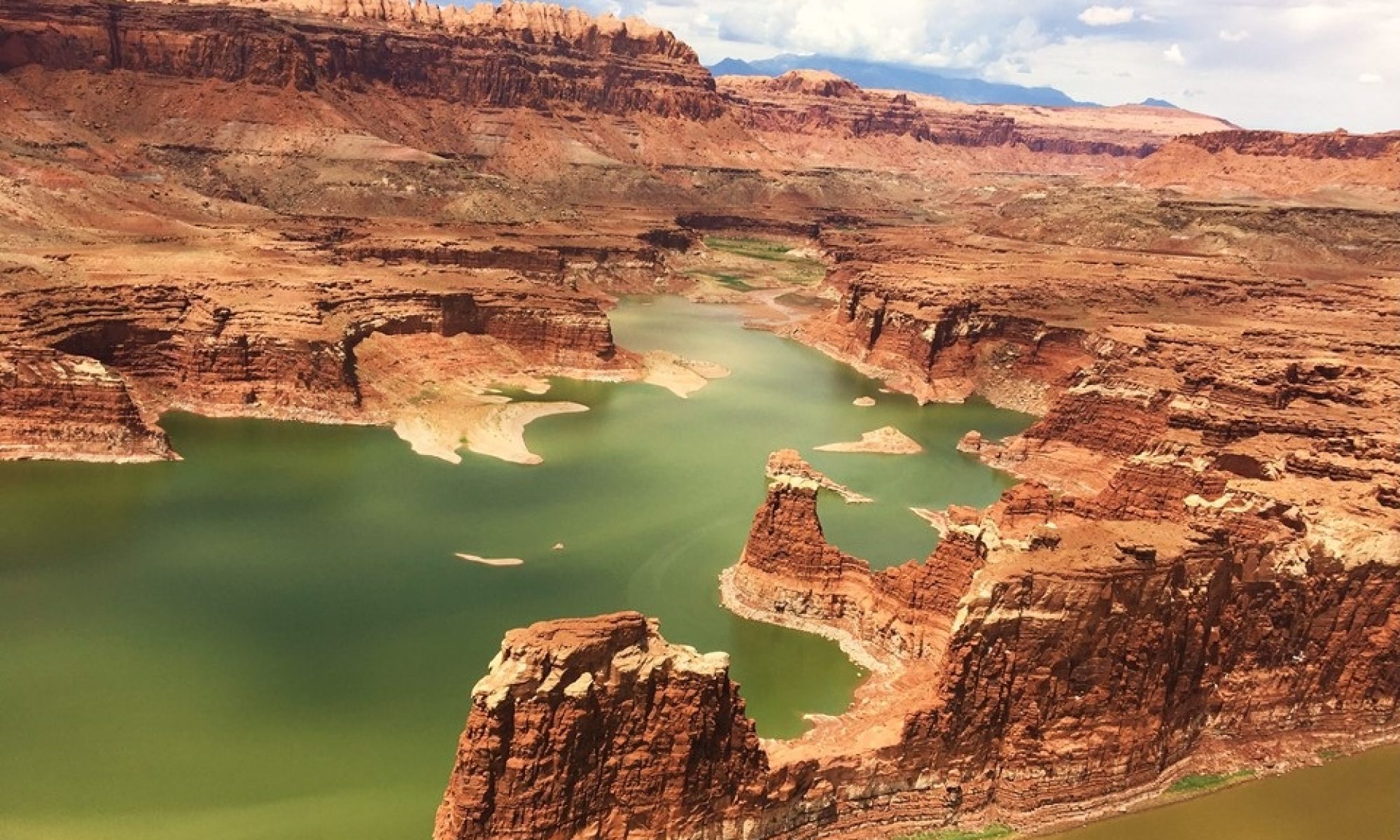
We were up early for breakfast at 5:00am to continue north into Pendjari National Park, a nature reserve on the border of the countries of Togo and Burkina Faso. 

dscn5619

It encompasses plains, savanna, mountains, lakes, the Pendjari River and a forest, and is home to the largest variety of wildlife in West Africa, including lions, elephants, cheetahs and hippos.  We drove on red dirt roads the whole way, rarely seeing any other vehicle.  Our trip now was with 3 people, plus a driver, each in one of 3 land-rover jeeps, equipped with an additional bench seat on the roof! 

dscn5573

Rocky and Jill riding topside!

All locals travel here by foot, or the occasional motorbike or bicycle.   It was blistering hot ~40 degrees C or 104F, as the rainy season comes much later to the area in northern Benin.  However, even with the heat we saw an African elephant, lots of birds, baboons, chevalier and roan antelope, kobe, hippos, waterbuck, deer, stork and crocodiles.  We all took turns riding on the roof seats, (a great viewing area), and red dust accumulated everywhere! 

dscn0804

dscn0853

dscn5535

We returned to our hotel for dinner and entertainment by some of the local women.  They performed native dances and sang for us, making us participate with them and feel very welcomed.

 dscn5583

Our original plans had us visiting a local village the next day, but we enjoyed Pendjari Park so much, we rehired the jeeps and drivers, and we were up early to go back and see some more animals.  This morning when we entered the park we saw a herd of forest elephants.  They are darker gray and smaller in size than the African elephant.  They also have a longer trunk and straighter tusks.  We saw fervet monkeys, buffalo, deer, small monkeys, baboons, antelopes, and birds. 

dscn5568

dscn0865

A buffalo herd.

We watched as the Park Patrol began the burning of the bush, to control the forest’s growth. 

dscn5540

We walked across the river border into Burkina Faso, which has an adjoining animal nature park bordering the Pendjari Park to the north. 

dscn0860

At the Benin/Burkina Faso border.

After lunch, we started our journey back south and stopped just outside of the park at a local village, Tanougou, where there was a wonderful natural spring waterfall.  We hiked to the end of the road where there was a small pool, but our guide said not to swim here, and we were directed to hike up more rocky terrain to the upper waterfall where there was a big, beautiful pool.  It was a cool and refreshing swim.

dscn0885

After a bit of shopping with the village locals, we traveled further south until we stopped for the evening in Natitingou, at the Tata Somba Hotel.  After removing layers of red dirt, we headed to a small, local restaurant that Grace had reserved for us, where we had local kabobs, rice, the world’s best fries, veggies, wine, beer and water.  The women all wore local dress and some even had their babies on their backs as they cooked and served us.  We danced to local music videos, avoided a few raindrops, and had a most wonderful evening.


The next morning we continued our journey south on to the town of Abomey.  Here we visited the region’s museum and learned the history of the 12 kings of Benin and their kingdoms, which spanned from the early 1600’s until 1900. 

dscn0976

The 12 kings geneology.

We were able to tour 2 of the king’s original palaces that are still remarkably preserved. Each king was represented by a set of symbols, and each had his own custom ceremonial throne, (one was built on the skulls of his enemies).  These kingdoms conquered much of this area of West Africa, and flourished by capturing their enemies and selling them to European Slave Traders in exchange for weapons and cannons.  This is also the origin of the original Amazon Women Warriors, which was an innovation of one of the kings to conquer a larger region.  It was a series of brutal and bloodthirsty reigns, which propagated the kingdom until the arrival of French Commander Dodd, who conquered the kingdom in 1900, and banished the last king to Libya.  At the historical site, we saw native blacksmiths and weavers at work and shopped the Benin traditional appliqué art.

dscn5632

The 12 kings thrones and alters.


We then headed to our hotel, Auberge de Abomey, where our group had booked all of the hotel’s rooms – 6 of them.  We had a splendid French dinner out on the porch, hooked up one member’s iPod to some speakers and had an evening of music, dance and conversation.


In the morning, we were up, (not so early this day), and continued our journey south towards the border.  Along the way we began to run into traffic again and were delayed when a tanker jack-knifed across the road.  This appears to be a very common occurrence in Africa where there are hills, as many of the large trucks’ brakes do not work going backwards. If the truck loses power going up a hill and then begins to roll backwards, they lose all control and jackknife onto the side of the road.  Nigeria, Kenya and Benin roads on hills are littered with the skeletal wrecks of these occurrences.  Luckily for us, in this case, the Belgian Army was on maneuvers here and quickly built a dirt road around the vehicle allowing us to continue or trip while only losing 45 minutes. 

dscn5575

These trees with red flowers were just beautiful!

On the outskirts of Cotonou we turned east to Lake Ganvie where we boarded a boat and started a 30-minute journey to the middle of the lake to the Ganvie stilt village. 

dscn1039

This village was founded during the slave trading days when the local fisherman were seeking refuge from the Abomey rulers and the European slave traders.  It is a fishing village today of 30,000 people, built on stilts in the shallows of the middle of this large lake.  We ate at a local stilted restaurant “Hotel Germain”, (buses welcomed?), having smoked fish and salads.  The locals here stick branches into the waters creating local habitats for fish, (each “plot is typically 5,000-10,000 sq yards).  After a period of time, they surround the habitat with nets, trapping the larger fish inside.  They then wait, allowing the fish to grow within this habitat before climbing inside and manually removing all of the habitat sticks.  This then allows them to close the area’s nets and capture all the fish that were inside. 

dscn0990

dscn5693

After a boat ride back to solid ground it was then back to the Nigerian border.  The noise and traffic congestion was a reminder that we were heading back to Lagos.  After going through the now-familiar series of border stations, we walked across the border and we were met by our auto drivers and our mopo, (motorized patrol), security escort.  Mopo took the lead with sirens blaring and lights flashing to escort our little convoy through the twenty-plus Nigerian checkpoint stops as you navigate the Nigerian countryside.  It was nice to whiz right on by these stops, and 2 hours later we were home.  


Additional Pictures:

dscn0901

Black Market Petrol.  When the electrical power goes out  these little road side shops are where you buy your fuel. It is double what the gas stations charge, however, you really have no choice.

dscn0908

We bought petrol twice this way; 25 liters the first time and 15 liters the second.  Your engine does backfire once in a while with this fuel.

dscn1050

A boat full of empty 50 liter petrol cans headed to Nigeria to get petrol on the black market.