Tuesday, January 9th, 2019, and today we paused our exploration of Santiago, Chili to head to one of the furthest outposts of mankind – Easter Island! Easter Island is the most isolated, inhabited place in the world – many thousands of miles from any other inhabited place, and a long 5 ½ hour plane ride from Santiago. European’s named the island because it was discovered on Easter Sunday.
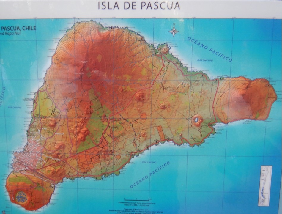
Easter Island, (“Isla de Pascua” in Spanish), or Rapa Nui as it is known by the native Polynesian ancestors of its first inhabitants is also known as “the naval of the world” harkening back to local beliefs that all spirits’ power originated there. The island is formed from 3 ancient volcanos, (Rano Kau, Poike, and Maunga Terevaka) forming the apexes of a triangle, with the southwestern one providing the peninsula for the airport and the island’s only town – Hariga Roa. The airport is quite modern, and the runway is the longest in the southern hemisphere, as it was built by NASA as an alternative landing site for the US Space Shuttle. Our “hotel” is a lovely but quaint “mom and pop” establishment with beautiful gardens of fruit trees and flowers, located in town just up the beach from the island’s principal harbor, beach and port. From here one could watch the bevy of local surfers, eat at a range of the town’s restaurants, or observe the Oceana Cruise ship “Marina” (1275 passenger & 800 crew) sitting in the harbor. For our stay, we had a local Rapa Nui descendent, Noi, who would serve as our guide, and who, along with our trip leader, Meche, and our dedicated driver, Jose, would be sure we got to see and understand the island’s history and sights.
Rapa Nui was likely settled in the 13th or 14th century by Polynesians sailing from Tahiti. They brought with them all that they thought that they would need, but the island offered no mammals, sparse fishing, little fresh water and a lack of resources with which they could build boats to ever leave In spite of the hardships, the original few hundred Rapa Nui grew into a civilization numbering over 10,000, before civil unrest, starvation and fighting shrunk their numbers considerably. When Europeans landed there in the 1600’s, the introduction of disease and foreign species reduced the Rapa Nui to only a few hundred from which their descendants today are derived.
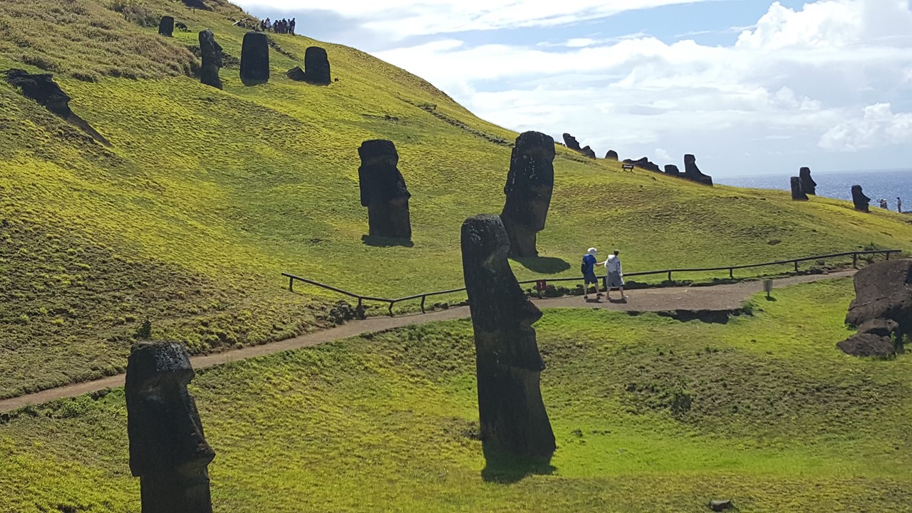
Soon after we check-in, we set out into town to visit a local grocery/bakery, where we stock-up on water & wine, and get to sample the largest empanadas we have ever seen, (~10 inches long filled with creamy cheese and tuna). Then we headed north to Ahu Akivi – the only group of Moai not along the coast and whose platform was erected during the 14th century facing the water. These seven Moai statues were toppled around the 15th century but were restored to upright status in 1961. They are set to align with the winter solstice.
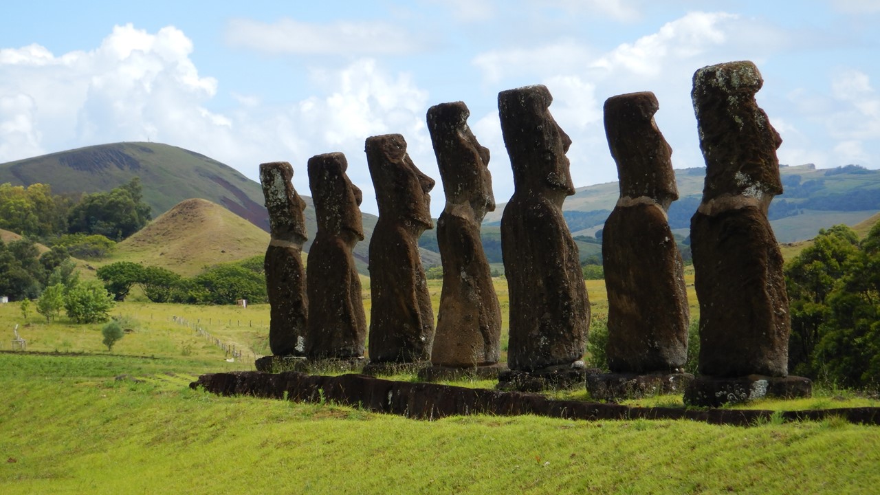
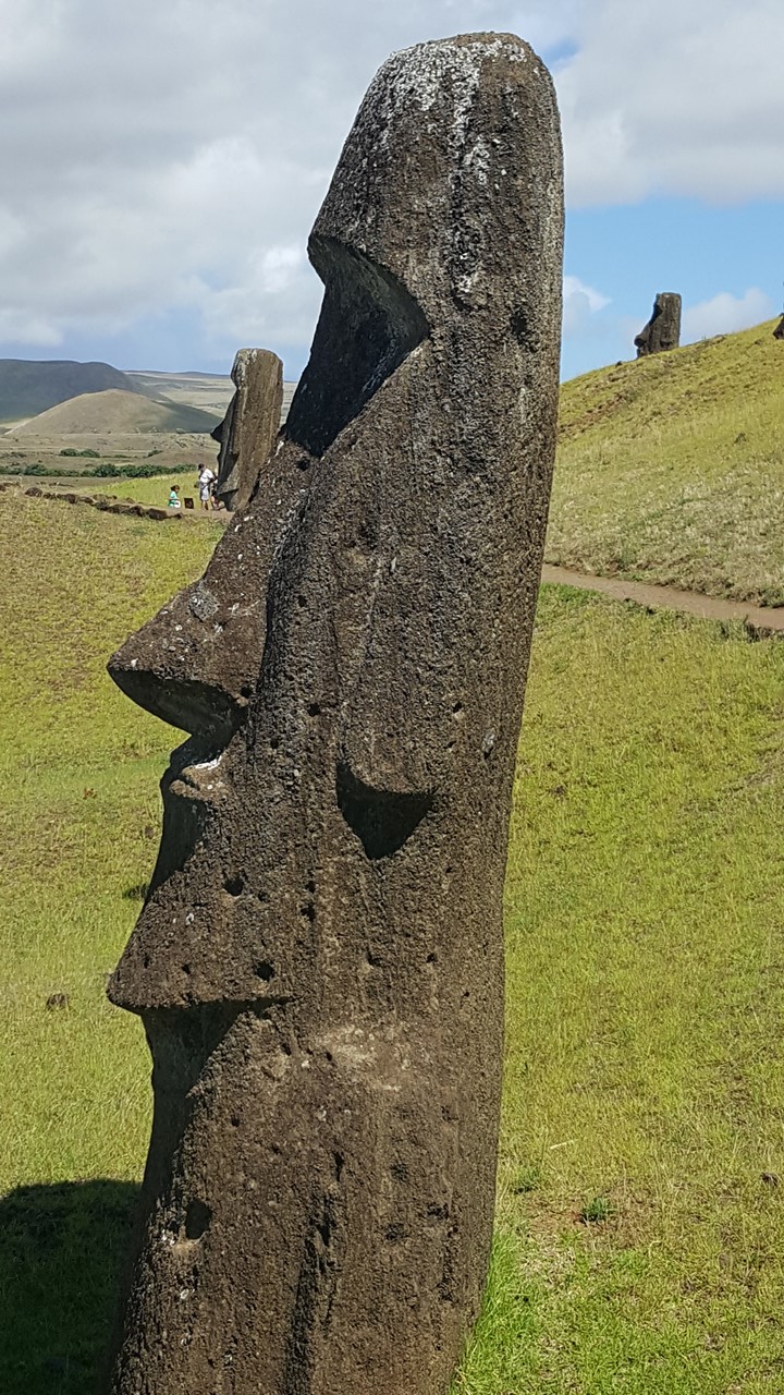
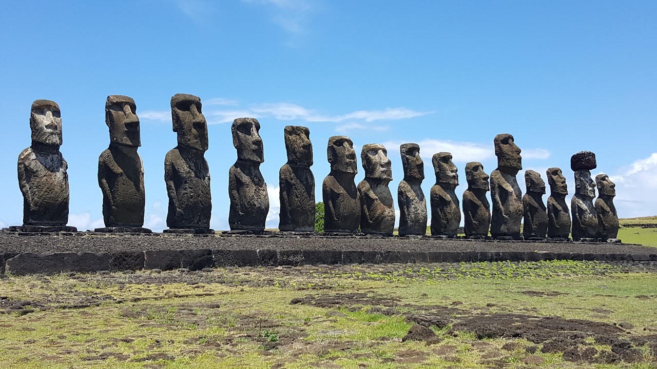
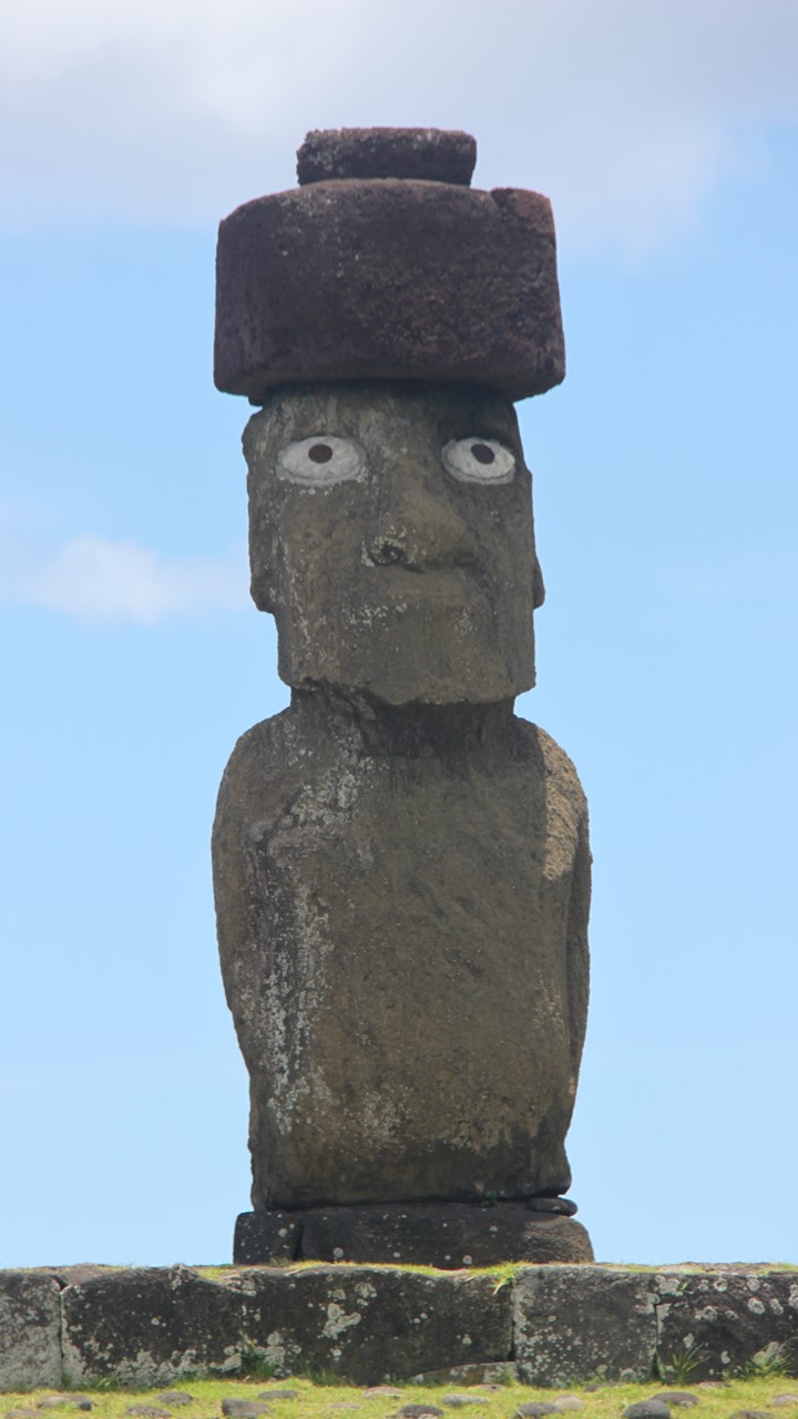
The Rapa Nui society was initially ruled through lineage to one of the 12 “clans” that had divided the island, and a single king. The King was thought to be Godlike, and the Moai were erected by families as a way of collecting the power of their souls – their “manna”. The Moai were only represented from pelvis to head with no limbs and sculpted androgynously. There are 1045 known Moai’s worldwide, however, only 1020 are still on the island and many of these are still in the in the local quarry at various stages of completion. Once their sculpting is complete, the Moai were then moved to the sites where they will stand. Today, there are still 400 statues at the quarry. Important members of the “clan” are buried in the platforms surrounding the Moai, so all platforms are sacred. The eyes of the Moai are open mean the manna is alive in the Moai. Nearly all Moai face inland from the shores, facing the people. These Moai at Ahu Akivi are rare as they are facing ocean. The eyes of the Moai were painted or decorated with shells or coral, as the Rapa Nui believed that if there were no eye socket, then the Moai had no manna. The first restoration of Moai took place on the island in 1951. During the fall of the Rapa Nui civilization, the Moai were all pulled down with their faces facing down to destroy the manna of the rulers, so many Moai were re-raised in recent times, although many remain damaged from their fall. In addition, many of the later Moai that were erected were fitted with “top knots”, or “tocow”, on their heads. These were circular crowns carved from a specific reddish pumice stone that is lighter in weight so that it could be raised to the top of the Moai. It would take 8 months to 2 years to carve a Moai, but no one is sure how they were moved to their platforms.
After visiting Ahu Akivi, we were supposed to travel to Puna Pau – the quarry where the top-knots were carved. Unfortunately, the quarry and the road were closed for maintenance. Therefore, we traveled to Aruenga – a private property with a single Moa located on it. It also faces east aligned with the summer solstice, but this Moai actually has 4 hands engraved upon the stone – the only one on island like this and one of the few on lands not specifically controlled by the military during the times when the island was ruled by the Chilean Navy.
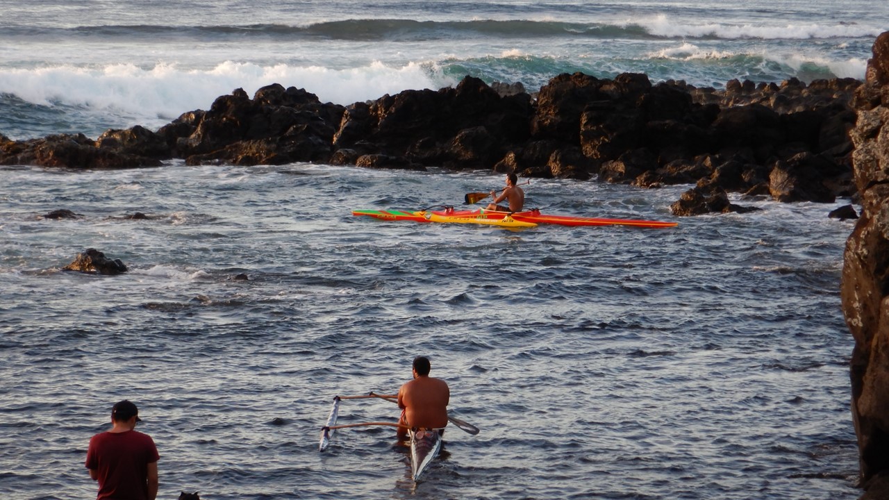
We then returned to our hotel for a quick freshen-up, and a brief 10-15-minute walk to a waterfront restaurant for dinner on the outdoor second floor balcony overlooking the oceanfront. Dinner was a salad followed by a tuna fillet with smashed sweet potatoes and strawberry passion fruit ice cream. As the sun set on the horizon, we watched the sailboats at anchor and the long boats, kayaks and surfers enjoy the last light.
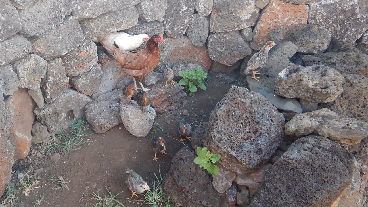
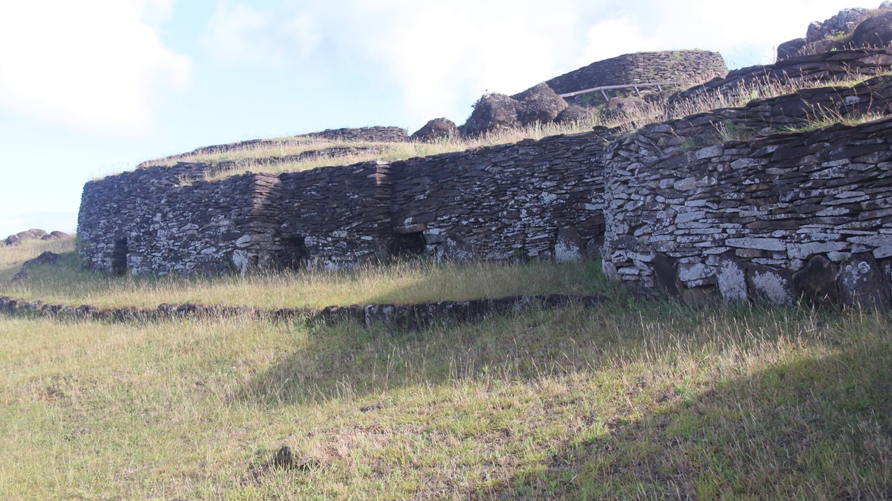
The next morning, we traveled east to the coastal area of Vaihu, where a typical “family center” of life of the Rapa Nui has been recreated. All structures are made of stone stacked up in creative ways. We were surprised to see long stone piles resembling upside down boats that serve as chicken houses known as “hare moai”. Our guide, Noi, removed a stone from the wall, and out came a steady stream of adult and baby chicks.
The rocks are also used to make circular gardens whose tall walls protect plants from animals and winds and yet keep moisture inside. Grasses were used to make similar boat-shaped houses, “hare vaka “, including a stone porch for more wealthy. The houses were only used for sleeping, as everything else was done outside. Each family group would have 4-5 houses at their center.
Next, we continued east down the coast to Akahanga where we encounter a series of Moai facing inland, but still toppled and with their topknots removed. With the eyes facing the ground, the belief is that the manna is gone. Here we found at least 27 Moai in three platforms of 9 each and with a crematory on the point of land located behind one. These crematories are still used and revered, and we were careful to respect the area. Above the Moai was a large cave believed to have been used by workers and serving as the source of stones used in the “Ahu” (platform) construction below.
We then continued our journey east to the famous quarry of Rano Raraku, where ~400 Moai remain in various stages of sculpting and movement. All Moai are carved at top of mountain while still attached to the earth along their back. The Moai is then cut out at last and gently moved down hill into a staging hole where it was slid into an upright position and sculpting was completed. Moai’s left in this position have had their holes filled over the years, but 33 years ago one was dug out and exposed and demonstrated that it now extends 75 feet underground. After walking around the quarry and looking at the many Moai abandoned there, we came upon the most unusual Moai on the island, a sculpted man with a goatee in a kneeling position.
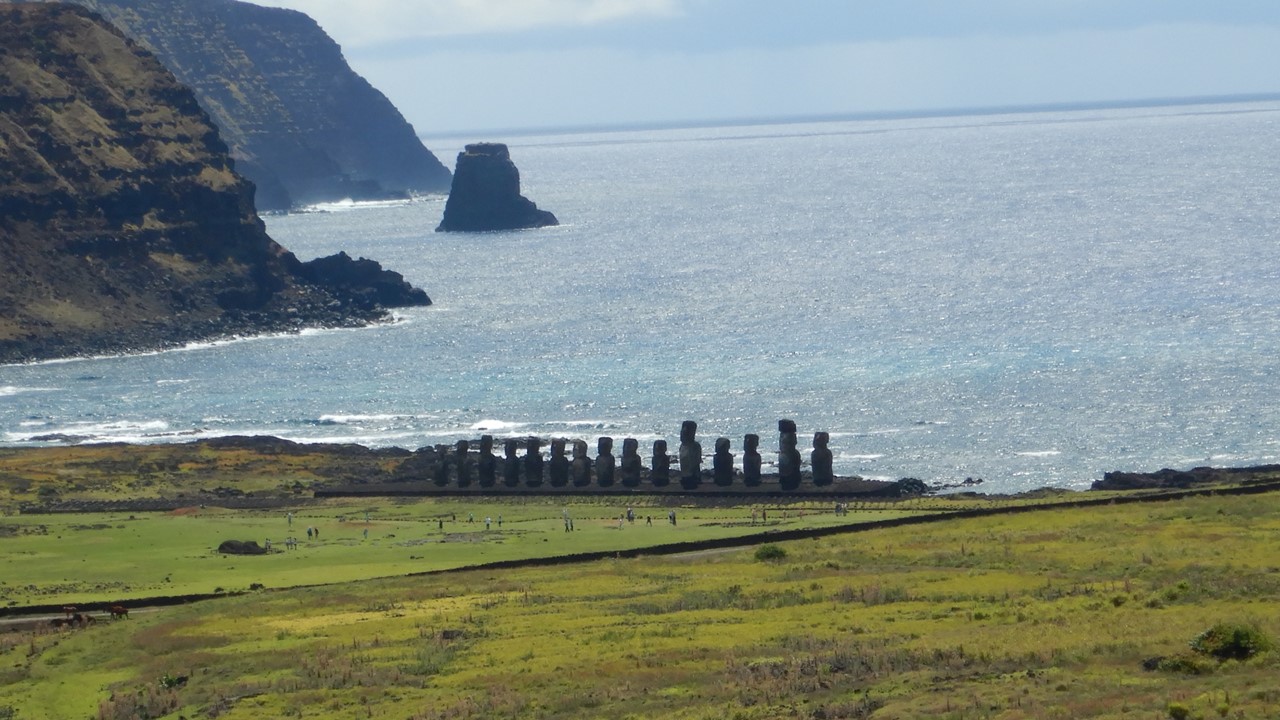
Next, we continued our travels east along the coast to one of the more famous settings at Tongariki. This large platform located on the southeastern coast was the setting for 17 Moai by the quarry’s owners, demonstrating their great wealth and strong manna. In 1960, an offshore Chilean earthquake generated a tsunami which came ashore and toppled and scattered the Moai over a large area. After this, one Moai was taken on world tour to raise funds to restore them, and today, 15 Moai stand back at the site, (2 Moai were too damaged to re-raise them, and they still sit in the field nearby. Originally, all these Moai had topknots, but today, only a single Moai could be restored with this component.
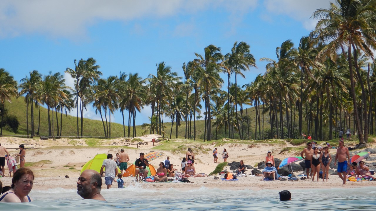
From here, we drove north across the island to the northeast shore to Anakena, the site of a platform with restored Moai, and the islands only swimming, white and pink sand beach. Here we changed into our bathing suits and swam between the black lava rocks in the gentle surf of the Pacific and sunned ourselves on the beach. In ancient times, an offshore carbonate reef provided the materials for the sandy beach here. After a refreshing break, we returned to the hotel for dinner on our own.
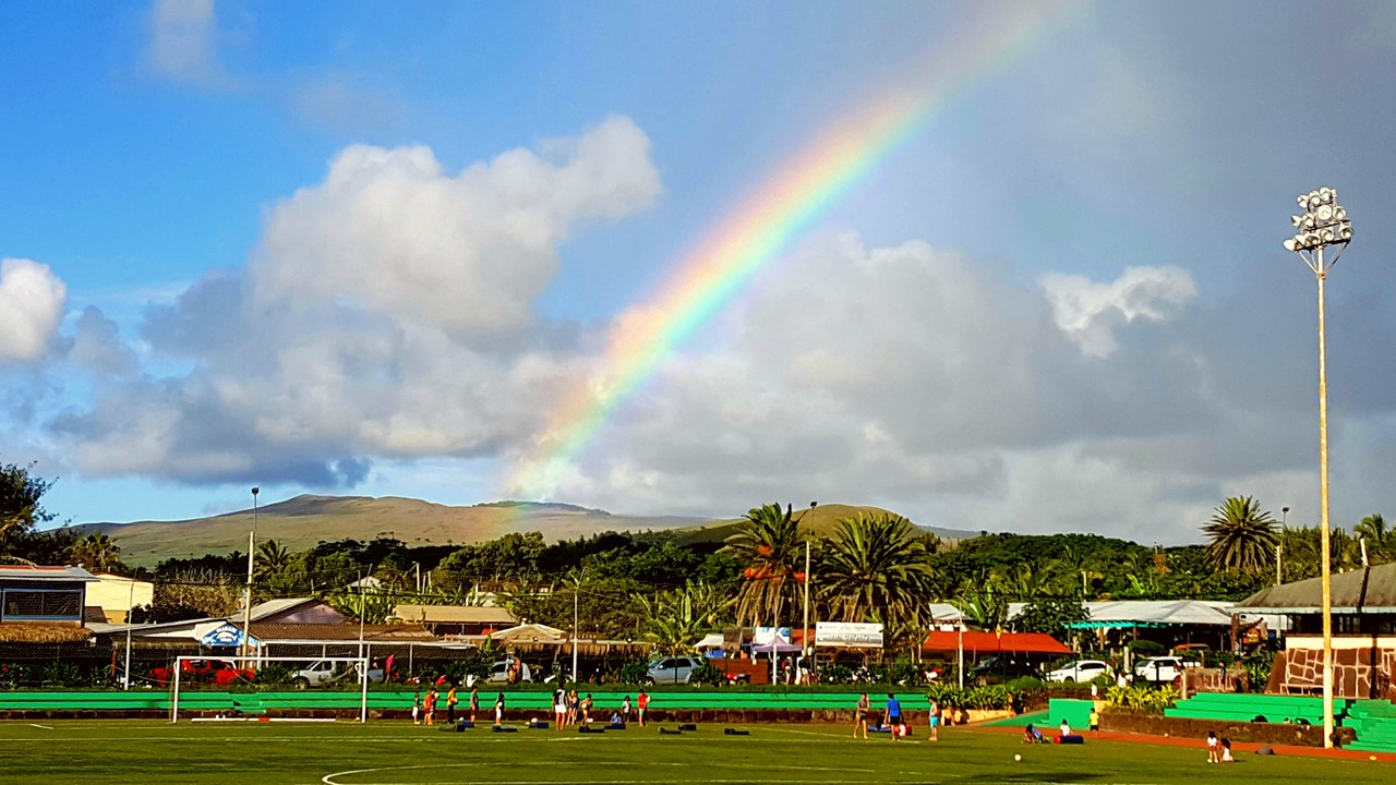
For dinner, we strolled south along the waterfront of the surfing bay and checked the menus at several places before settling on Haku Hanu. Here we sat on the patio watching the surfers and enjoying our Pisco Sour and jumbo shrimp meal. After dinner, we walked to a small restaurant behind the town’s soccer field to meet up with our fellow travelers and enjoyed another round of Pisco Sours. On our way back to the hotel, we passed the local gym where, hearing music, we stopped in to see the local townsfolk practicing native dances in preparation for the local festival next month. It was very interesting as there were over 100 women there dancing along with a few men. January and February are the summer months in Rapa Nui, and the schools are out of session, and the island’s festivals are in full swing. We then strolled along the main commercial street looking for souvenirs before returning to the hotel and calling it a day.
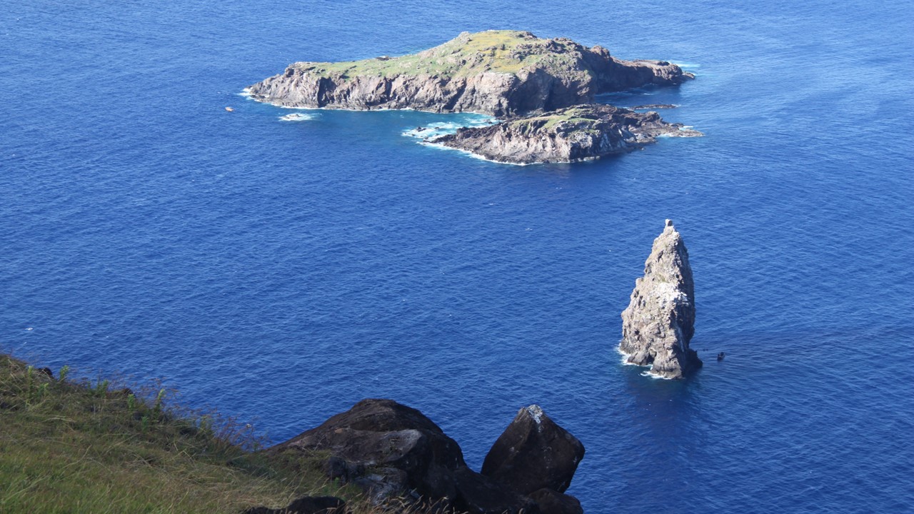
We started Thursday with breakfast before driving south to Vaiatare and up to the top of the Rano Kao volcano crater’s rim. In the later stages of the Rapa Nui civilization, this site known as Orongo, was sacred, and was where the King lived and where sweet potatoes were first grown. In ancient times, Manutara migratory birds would come to the offshore islands during September and the Rapa Nui families would send a representative to compete in the Bird Man Competition to decide the next year’s King and ruler. The Bird Man Competition consisted on being the first man to bring an unbroken egg from the Manutara bird’s nest, which entailed climbing down the rocky cliffs, swimming the frigid, dangerous Pacific waters to the offshore island, scaling the cliff faces to get to a nest and returning with the egg intact being the first of the year. The last of these competitions took place in 1886, but no birds come there any longer.
In the early years, Peru took thousands of Islanders as slaves and Jesuits brought European diseases leaving less than 200 native survivors. Today there are around 4000 natives recognized as descendants. 54 of the local houses used by the competitors are still there, although many drawings and petrographs had been stolen by foreigners. This spot is the coldest and windiest place on island, so people lived elsewhere most of the rest of year. The Rano Kau crater is protected and only native Rapa Nui people are allowed to hike into it for spiritual reasons. The crater contains plants not found elsewhere in the world, although the water in it is only 8-10 meters deep. For the ancient Rapa Nui, this was one of the few sources of fresh water on the island.
On the other side of the volcano, we visited the Vinapu site where there were two platforms: Vinapu and Taheda. The platform at Vinapu was constructed with a different style using large rectangular blocks mixed with large squares, carved to fit together perfectly and without small stones – more like Inca culture used. These platforms were constructed at the beginning of Modern Era late in the Rapa Nui civilization. The second platform was destroyed when European explorers went looking for gold, noting the similarities to Inca architecture. At Taheda, an unusual Moai was found consisting of a female with breasts and arms and 2 heads. This Moai was recorded by earlier sketches but is missing its heads today.
We then traveled back to the north side of town where we visited the Island’s Museum that told the story of an early German explorer who took many pictures of the island and later published a book on Rapa Nui when he returned to Germany. This Museum’s exhibition told the story of the native people and the Moai and is free to all.
Below the Museum towards the coast, we walked to lunch with a local Rapa Nuian (Uri) who can trace her ancestry back to the original Rapa Nui founders. She still lives on her family land where she inherited her house, and now works on solving the issue of trash and recycling, since the island has grown population-wise. Her family served us a lunch of rum guava aperitif with an empanada starter followed by tuna ceviche w/ rice and salad. She served a Chilean wine “Akenna”. The salad was grown in the Music School’s organic garden. The Music School was built out of recycled plastics and aluminum. She let us ask questions and then she asked us questions. The meal was outside in a tent with every table set with a vase of flowers. Her property encompasses the land all the way to the ocean, including her family’s Moai with brings manna to her family. From here, we walked back to our hotel for a “free” afternoon.
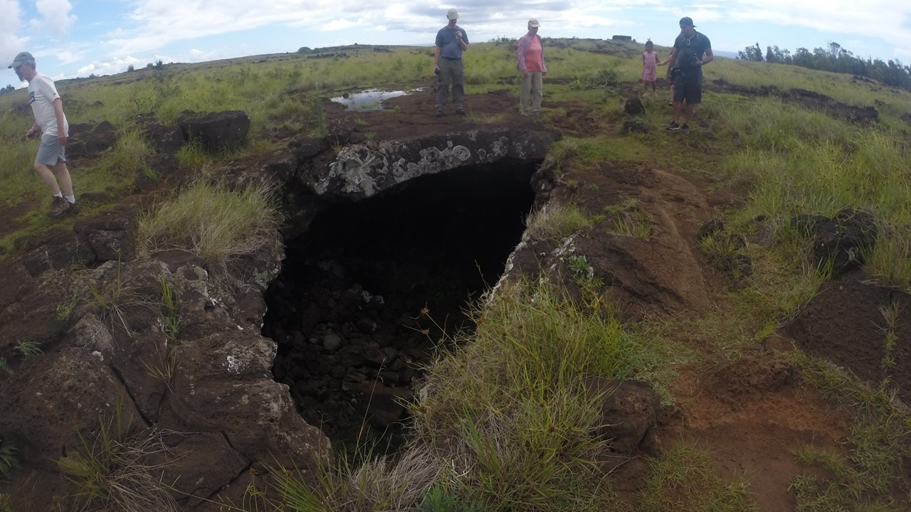
In the afternoon, Rocky and three others decided to arrange a trip to explore one of the island’s lava tubes. Lava tubes are horizontal caves formed when molten lava flows over the ground and the top solidifies in the air creating a tube that the hotter molten rock keeps flowing inside of. Once the molten rock all runs out, a long tubular cavern with a thin roof is left. The Rapa Nui would use these caves as a source of fresh water, a safe place to defend themselves, and as natural protection from wind and weather. We hired our driver, Jose, to take us to the Ana Te Pahu lava tube. It is located inside the National Park, and about a mile hike from the Park’s entrance. We enter through a hole in the lava tube’s roof where a collapse has occurred and are greeted by a multitude of banana trees and tropical plants that thrive in the sunlight with access to water and protected from the surface wind. After exploring a short dead-end direction, we begin the 1/3-mile hike within the tube, climbing over small roof collapses, circumnavigating pools of water, and avoiding knocking our heads on the low-hanging rocks that occasionally greet us in the darkness of the cave. We meet a British group who are also exploring the lava tube and assist them until they exit through a large “window” in the tube’s roof. We explore on until we can go no further, and back-track to exit at the British route to arrive on the surface in a mist of light rain. We begin our trek back to Jose excited by a unique adventure that was well worth our time.
That evening, we return to our luncheon site for sunset viewing over the Moai at Tahai Beach – 3 platforms all connected by a single rock berm. Here, one of the Moai still has its eyes in place – eyes that are made from white coral) and has its red top-knot. This site also houses some original Rapa Nui rock houses, and many people are out on the hillside doing the same. Here, our guides treated us to a beautiful sunset celebration complete with champagne and nibbles, while meeting some local children and dogs, and watching a new bride who was having her wedding photos shot.

The next morning, Saturday, we were up very early to travel back to Tongariki to see the sunrise over the ocean behind the 14 Moai statues. The gates open at 6:00am, as a small crowd gathers to look at the beautiful stars. However, as the sun rose, the clouds came blocking the orange and pink colors of the sunrise making it less spectacular than we had hoped. From here, we traveled back to hotel for breakfast, showers and a final packing. Once ready, we had time for a leisurely walk around town, stopping on the waterfront for coffee and to watch youngsters taking surfing lessons. As it was Saturday morning, the town was sleepy, and few people were out before 9:00am. Before departing, we stopped in the post office to get our passports stamped for Easter Island, and then traveled to the airport for our trip back to Santiago, Chile. What a great adventure!