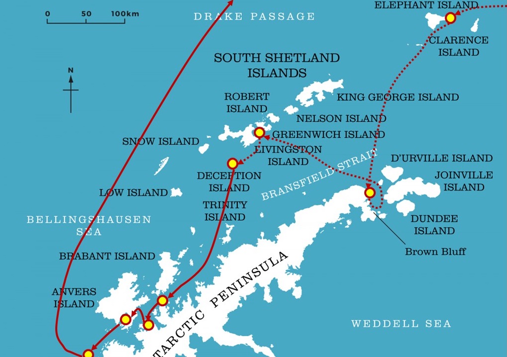
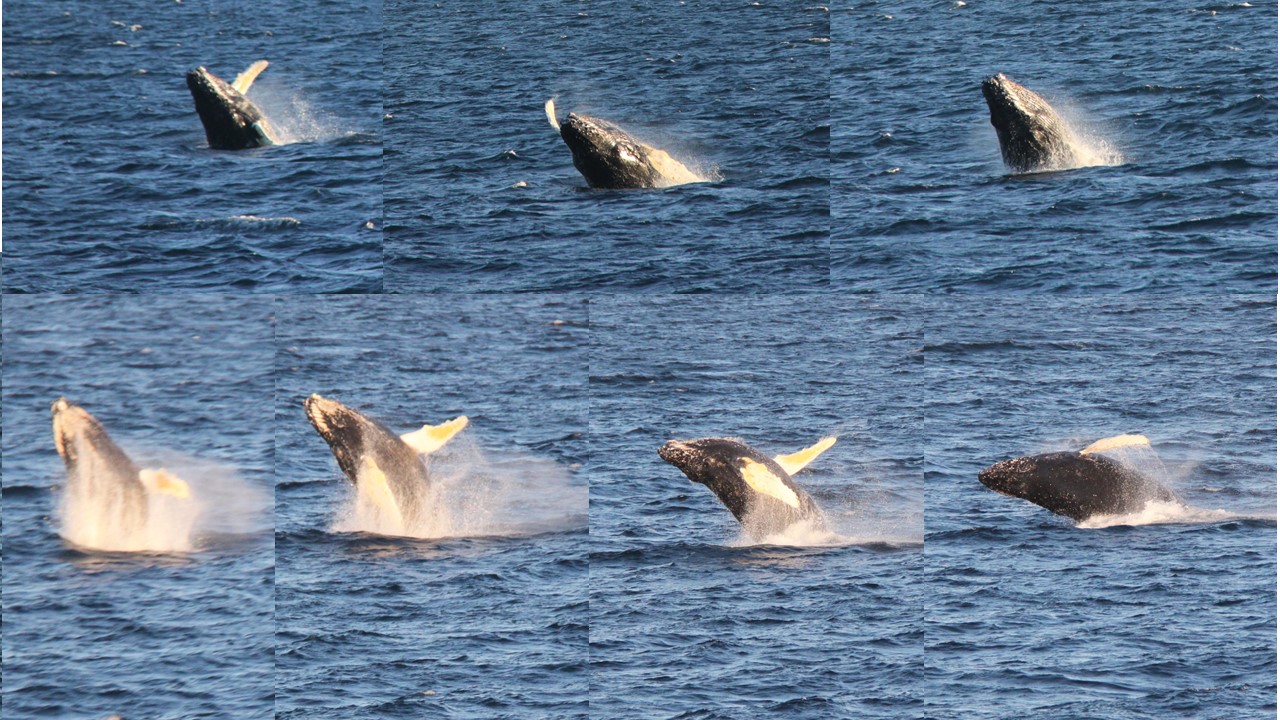
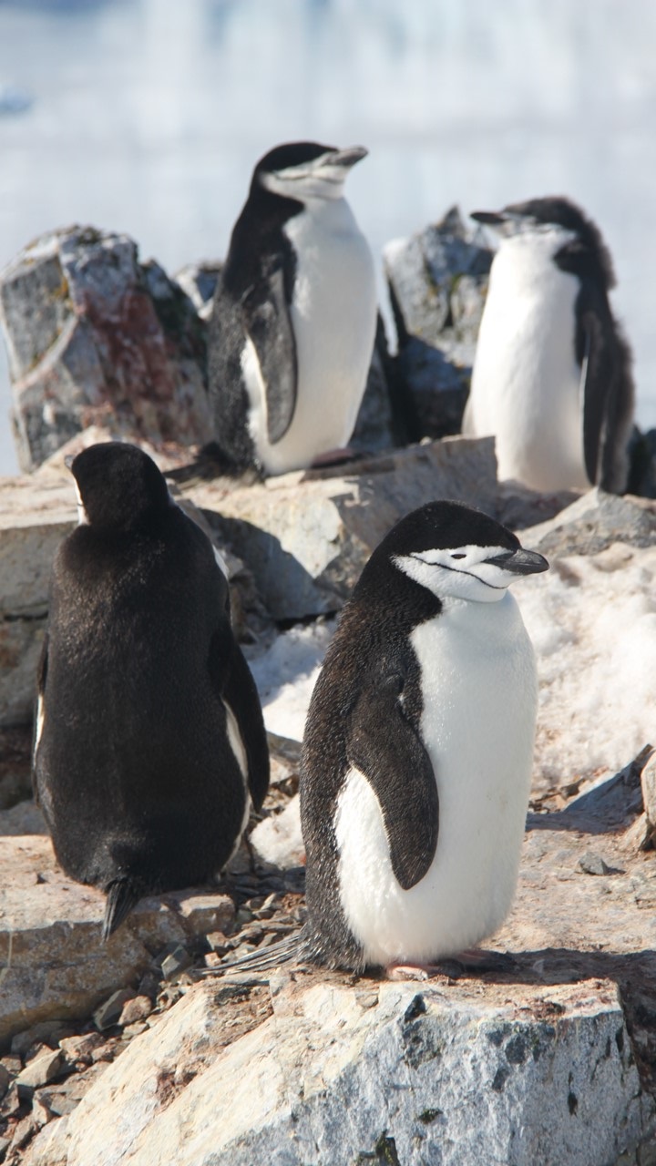
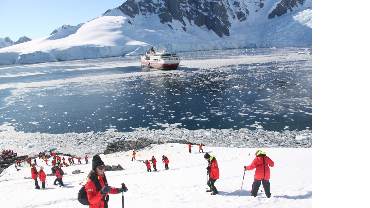
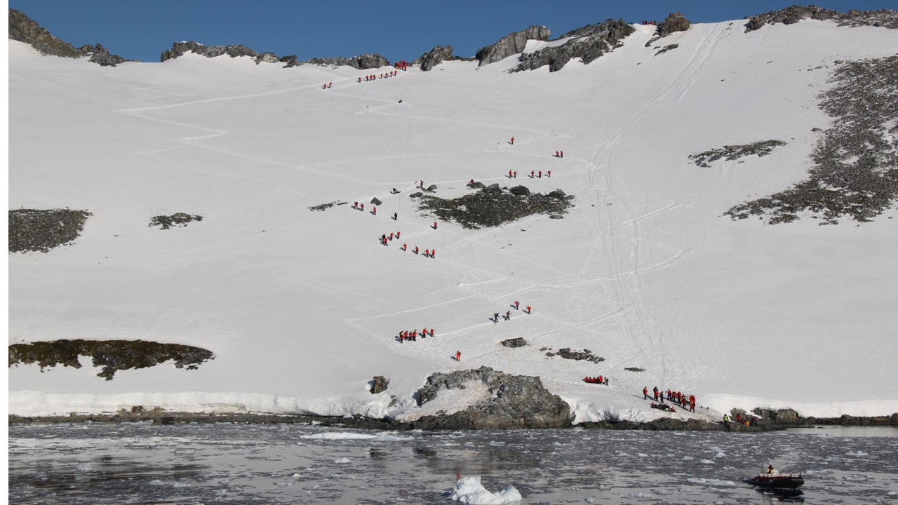
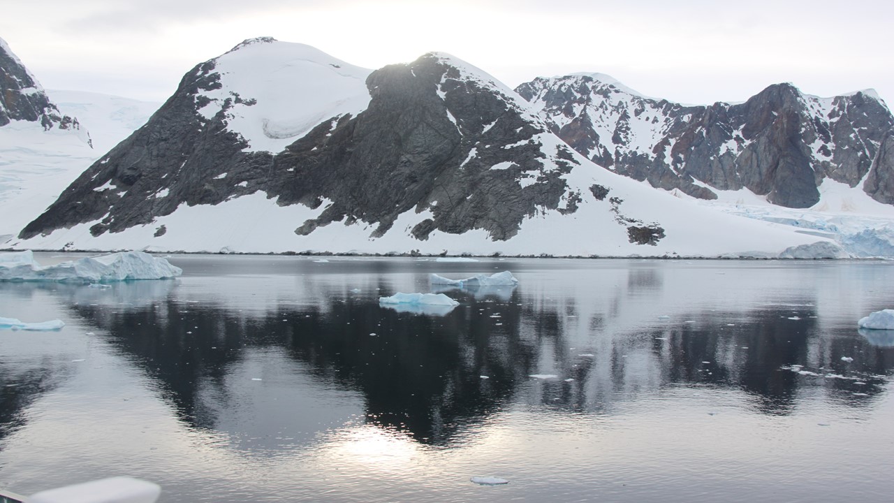
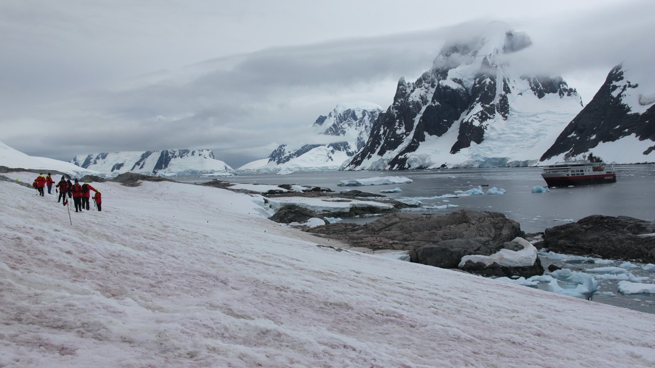
We rose early on Sunday morning, February 24th to view our voyage to t Harbour. To get there, we will sail back across the Bransfield Strait and return to the Antarctica Peninsula. Along the way, we saw several humpback whales giving us an early morning show of breeching, fin slapping and tail slapping. The whales could be viewed in front of us, and on the side of us, and behind us, giving us an incredible show! Once we were in Orne Harbour (which is on the Arctowski Peninsula) the Expedition Crew went ashore to mark a trail. Here, the landing site is very small, and we will then hike directly ~300’ up the steep, snow-covered hill in a zigzag manner. The hill/mountain is covered in snow and ice and we can see the “paths” where other groups have made the hike. There are some sea lions sunning themselves on the rocks and on the top of the mountain one can see silhouettes of chinstrap penguins looking down at us. Several birds live in the area, but so far this morning it is very quiet. As we hike up the snow, some of the Expedition Crew cut crude steps into the snow to make it easier to climb. Once we arrive at the top, the view is exquisite. We could see Humpback Whales in the next cove and there was a Chinstrap Penguin colony as high as us in the surrounding rocks! It is amazing that these ungainly little penguins can make their way up these steep, rugged slopes to colonies so far from their home in the water. From our viewpoint, we could see the “penguin highway” paths that they travel, which came from the next cove. We could also see that it is truly the tourist season in Antarctica as, in the distance, we could see the National Geographic Explorer ship, and an Expedition Ship we saw in Ushuaia, the Marco Polo. The season is at the summer’s end and many of the summer bases are already fully closed. As we’ve gone south, the weather has gotten steadily colder and we are seeing much more ice. The hike down from the ice-covered ridge was a little more treacherous as the top layer of snow was melting and the downhill view was steep and scary.

Once back on board and during our buffet lunch, we start sailing to Errera Channel.
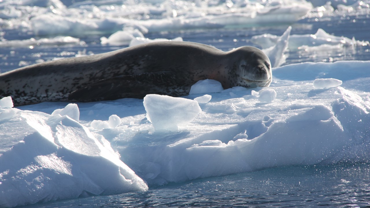
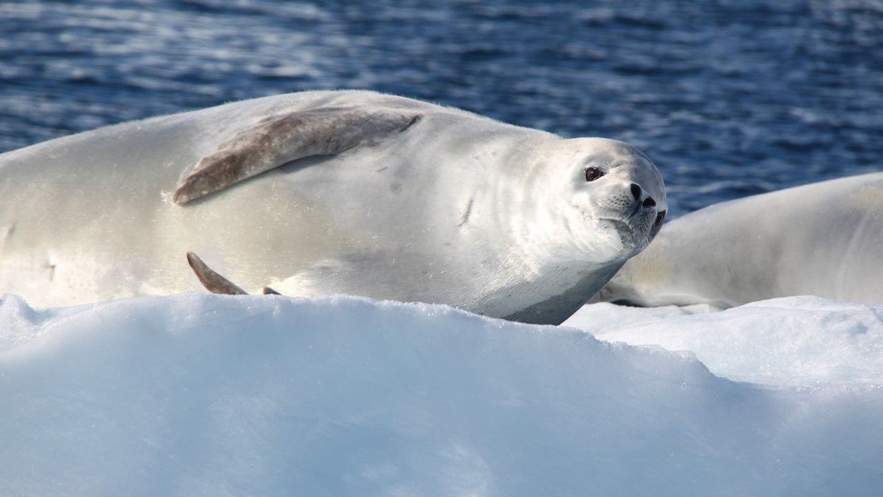
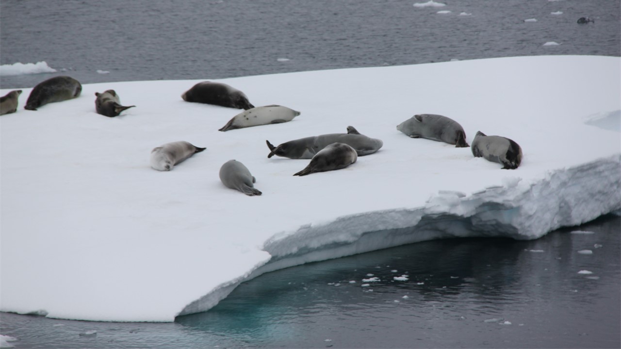
Errera Channel is home to a great many leopard seals and the crab-eater seals. While the second group of kayakers took off for a tour, the rest of us to rides in the zodiacs (polar crikel boats) around the channel to see the wildlife. Because it was so sunny, there were seals on all the small icebergs. The leopard seals are spotted with a long nose and sharp teeth for catching and eating penguins and are ~500 pounds in weight. They are so mellow when they are sun-bathing and did not pay us much attention. The crab-eater seals only eat krill and have shorted muzzles and are a beautiful silver in color.
During a buffet dinner, the Captain moved the ship further down the channel to Danco Island where there is a beach area and a flattish-area for putting up 15 tents for those who have chosen to camp tonight in Antarctica. The camping rules dictate no food can be taken ashore and there should be no impact to the environment. Therefore, the campers will camp in tents on snow, and they will go to shore around 8pm and return by 6am. Once ashore, they will set up their own 2-person tents with only mattress pads, sleeping bags and a bottle of water. That evening, there was a beautifully colorful sunset followed by an evening briefing.
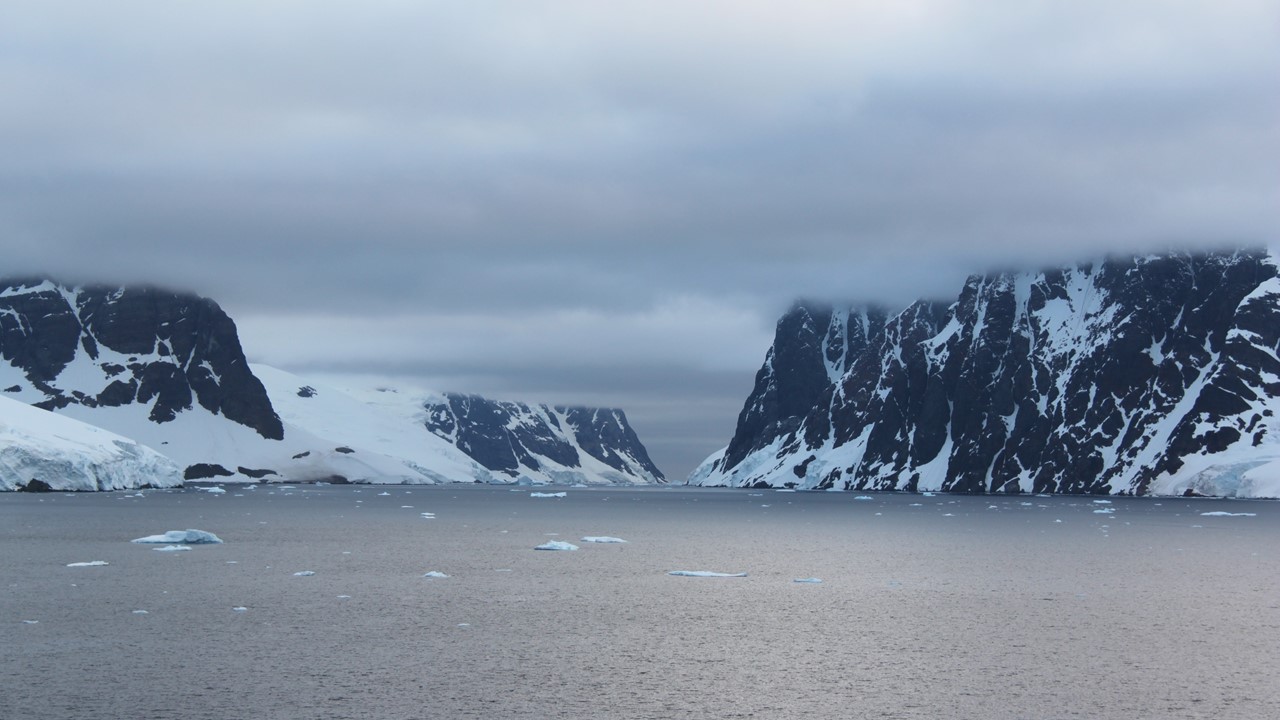
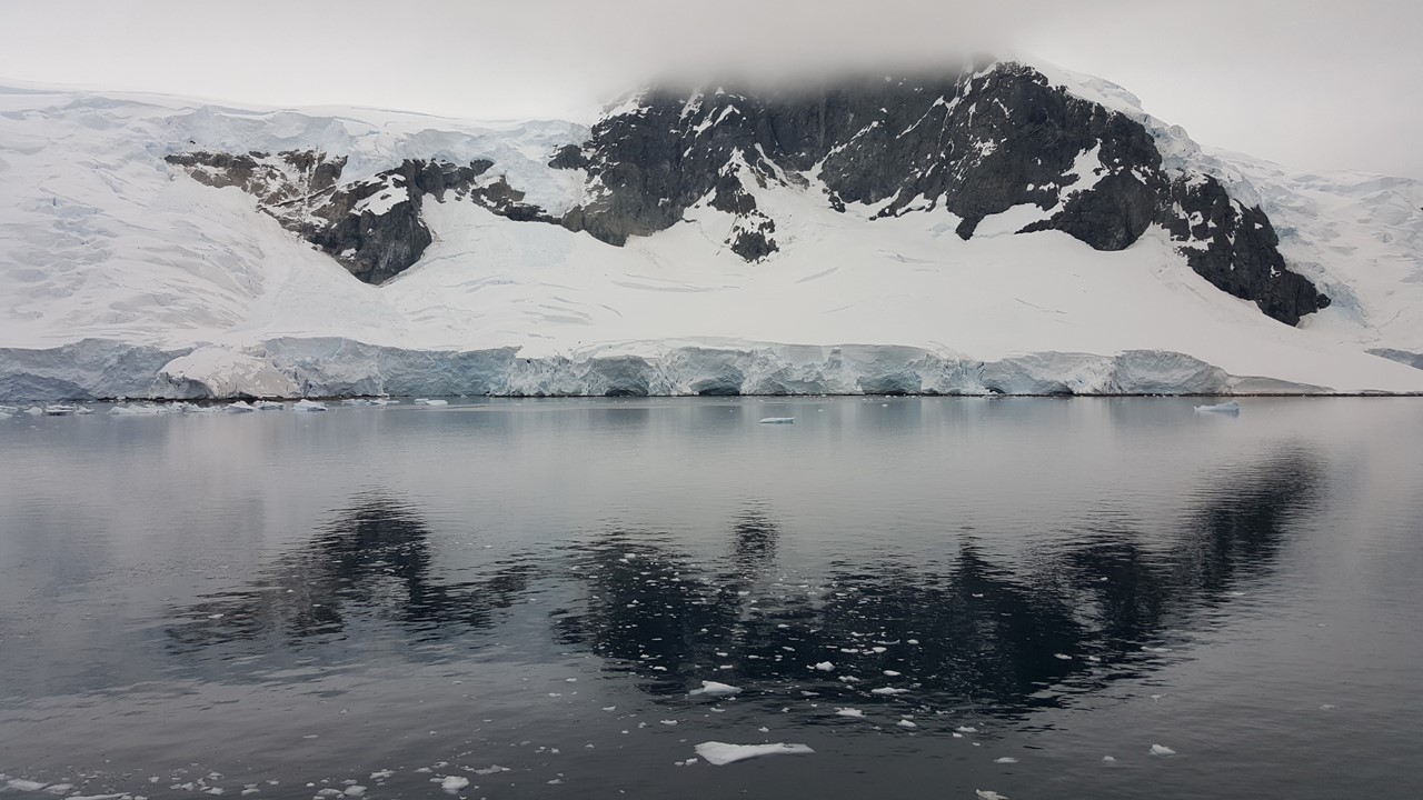
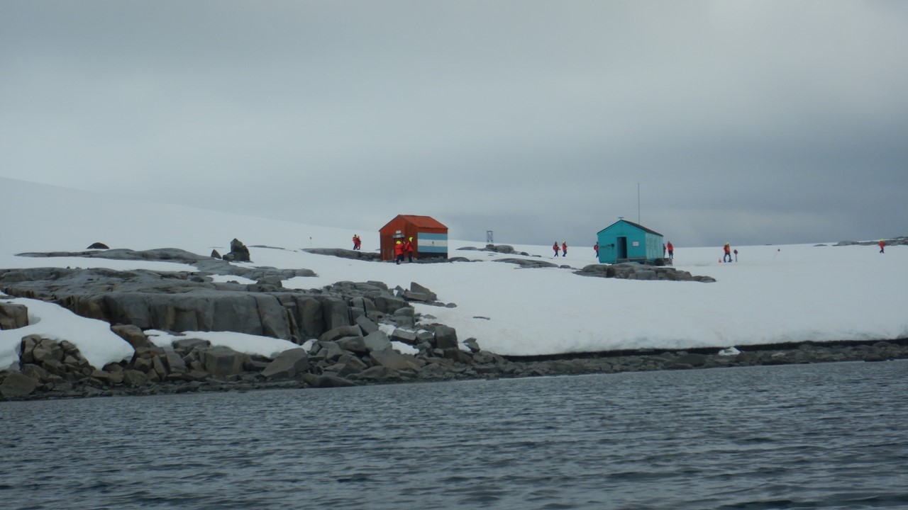
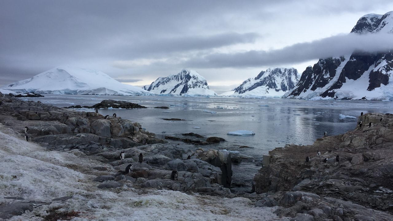
Monday morning, with the campers back on board, we begin a beautiful slow cruise to Paradise Bay, which was named by the whalers because it was so beautiful. There are 2 bases in the bay. The first of these is a Chilean Base, “Gonzales”, a summer base only and the 12 staff stationed there left 2 weeks ago. There is a huge Chilean flag painted on one of the buildings. Their focus has been the study the local penguin colonies. Further along is the Argentinean Base, “Brown Base”, still staffed with its icebreaker ship stationed out front. They also study penguins in the area by motoring around with a smaller water boat. Next, we turned into the Ferguson Channel, where we are met with some huge icebergs. All along the way we see Humpback Whales just floating on the surface, barely moving. Lucy, our whale expert guesses that they are already gorged and are taking a brief rest before beginning their migration north out of Antarctic waters. From here we turn right into Gerlache Strait and head northwest to enter the famous and scenic Neumayer Channel. Neumayer Channel is often not passible due to extensive ice, however, recent word from other ships is that we may be able to travel along it. All along the way, the sky remains overcast with clouds blocking the view of the tops of the mountain peaks. However, at 10:30am the weather and the view allow us to assemble all the passengers on the bow of Deck 5 for a group picture. The Captain was in the windows of the bridge waving to everyone. This was an ideal place for the picture since Neumayer Channel is shaped like an ’S’ and is 15 miles long. Belgian explorer Adrian de Gerlache named Neumayer Channel after German explorer and scientist Georg von Neumayer, who sailed it during his Antarctic Expedition of 1897-1899. It is surrounded by high mountains, ice-covered cliffs and steep glaciers. As we head for Damoy Point, we pass Vinca Island which is named for a sailor who was washed overboard on Gerlache’ Expedition while he was cleaning out a ship’s scuppers.
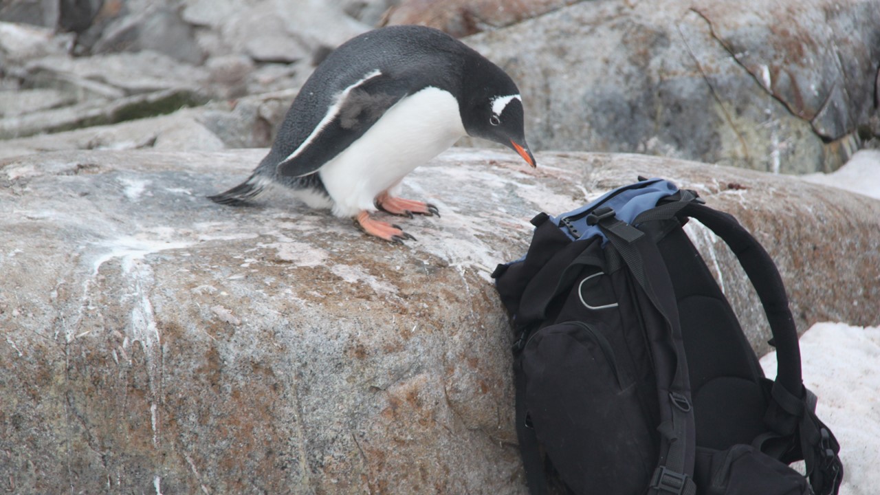
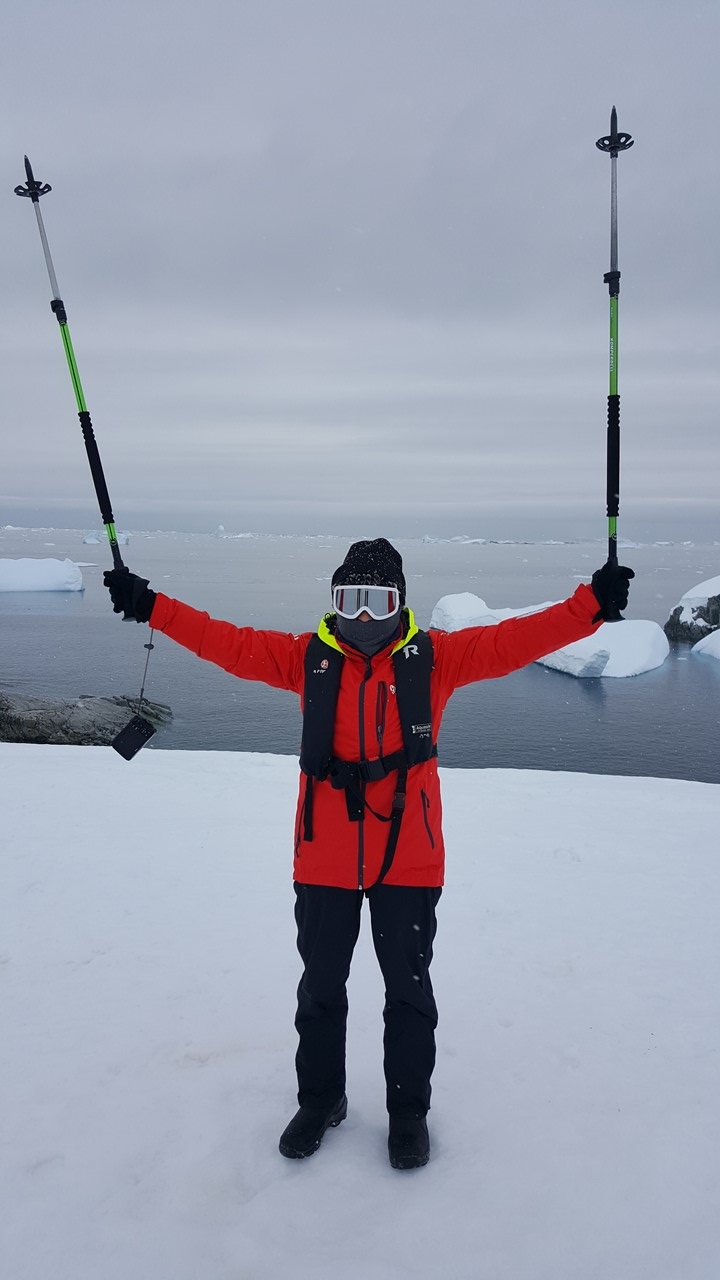
We did an early lunch in preparation of our landing at Damoy Point as the two of us will be kayaking today. We arrived at at Damoy Point ~12:30pm, and in the interim, we changed into our long underwear and 2-pairs of socks, and then head to deck 2 to put on polar fleece jumpsuits and neoprene dry suits. We then added neoprene boots and neoprene mittens that connect directly around the kayak paddles. Finally, with hats, scarves, neck buffs, lifejackets and cameras, we board the zodiacs for a short ride to a rocky beach on Damoy Point in Dorian Bay where our kayaks are waiting. Damoy Point was originally discovered by the French Antarctica Expedition of 1903-1905 under Jean-Baptiste Charcot. While we kayak, the rest of the passengers will explore scientific huts and the hill’s viewpoints. There are Gentoo penguins here and blue-eyed cormorants. The one hut was built by the British in 1973 and was used for several years as a summer aircraft landing facility. The landing strip was on thick, blue-ice that has since melted away and was used for planes to bring supplies to Port Lockroy. Since this area stayed frozen so much of the year due to its southernly latitude, the runway had allowed researchers in Port Lockroy and Rothera Bases to get an early start on their research without having to depend on ships. It was last occupied in 1993 and has been designated as a Historic Site. Today, Rothera Base has its own runway. There is also a hut here built by the Argentinians and kept supplied by the nearby Uruguayan Base. Once we approach the beach in our zodiacs, we unloaded into cold waters of the bay to walk ashore since the area was very rocky. We adjusted our kayak pedals and paddles, climbed in, and then were gently pushed into the frigid waters. There are 14 of us in seven double kayaks and 2 guides in single kayaks. The water, while extremely cold, is very clear and it is very quiet out there. There are penguins in the waters around us and the current quickly moves us out of the bay toward the ship. Once everyone is accustomed to paddling, we explore the area around the bay, stopping for a group photo. After ~3 hours, it was time to return to the beach and return to the ship.
Despite all the clothes our feet and hands were quite chilled, so, after arriving, we head straight to the hot tubs for a warmup and watch the remaining passengers hike back to the zodiacs to return to the ship.
Dinner was an “Arctic & Antarctic” buffet. The Captain then took us on a slow, leisurely cruise in the Lemaire Channel past “Eunice’ Tits” Peaks and Booth Island. The channel is 5 miles long and at its maximum, is only 1600 meters wide. It is very much a picturesque moment. However, tonight the clouds are low, and one cannot see the tops of the peaks. We sail slowly, dodging the icebergs of varying sizes. In a small bay, we spot a small polar ship but, since there is no base nearby, it is probably doing some sort of research. Eventually, we exit Lemaire Channel and enter into French Passage and are in front of Pleneau Island and Petermann Island that we will visit the next day. However, there are a large number of moving icebergs here, so the Captain backtracks up the Lemaire Channel to wait until morning, when we will again sail to Petermann Island for a landing. Then, later in the Panorama Lounge, four of the Expedition Staff did a talk show based on the research of Rob with birds, Sam with plankton, Beluga with whales/dolphins, moderated by Monica, who was also a bird researcher.
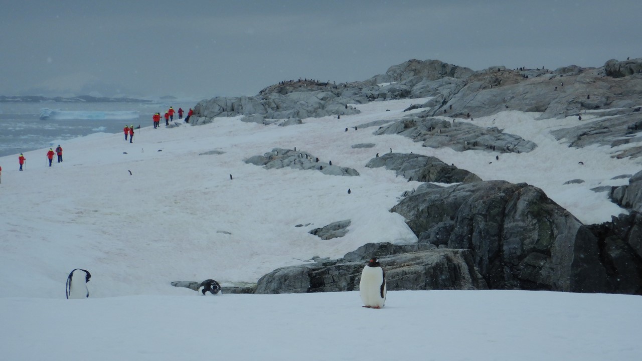
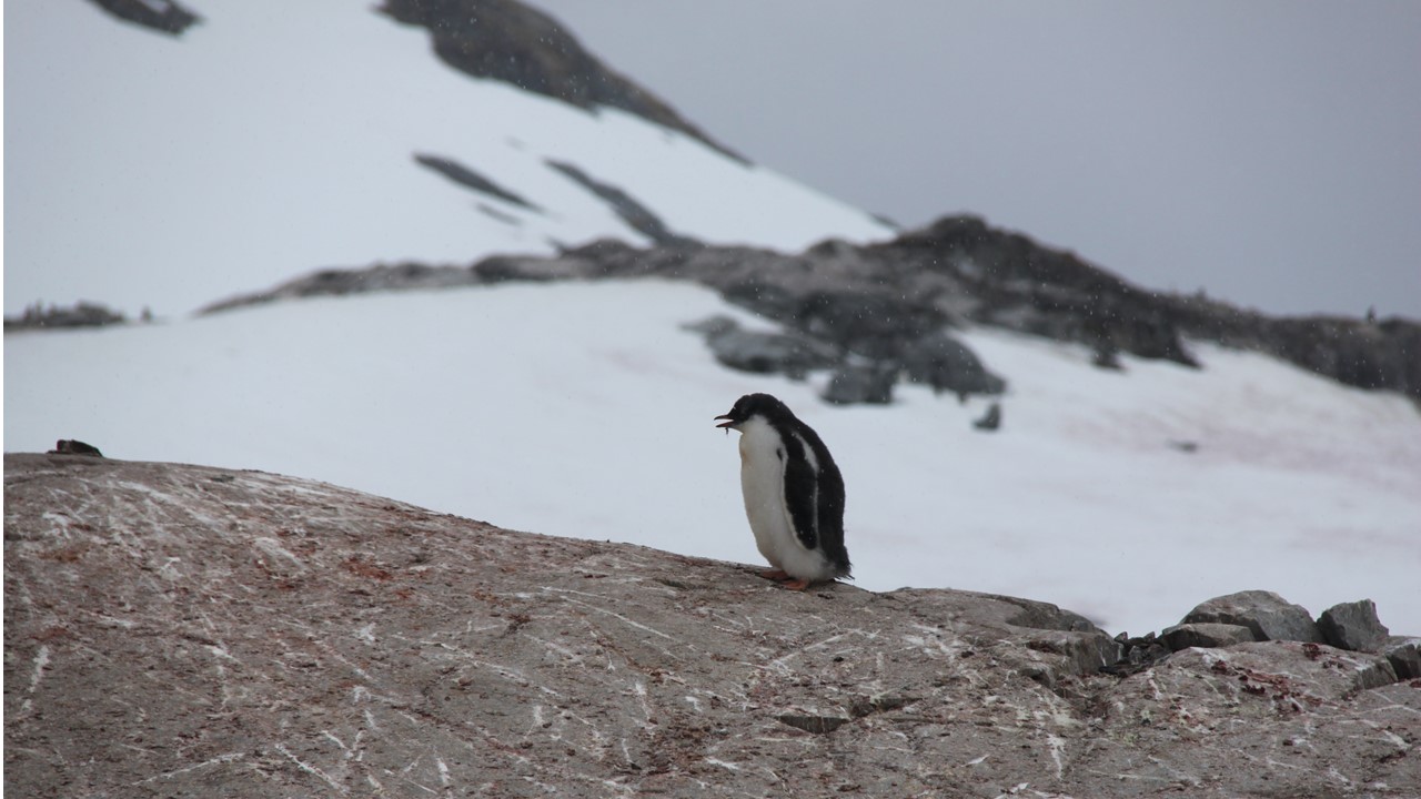
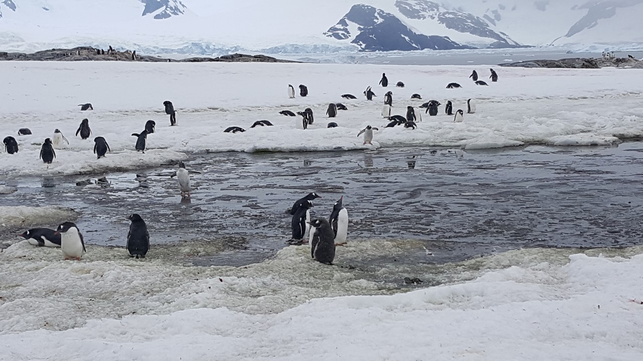
The next morning is Tuesday, February 26th, and our last day in Antarctica! The ship was moving early this morning back down Lemarie Channel to Petermann Island. In order to enjoy the view, we were up early, ready for breakfast, and prepared to be the first passengers ashore for an early landing on Petermann Island (latitude – 65 degrees 10 minutes south). Petermann Island is small and close enough to the mainland to see Mount Shackleton and Mount Perry. Petermann Island was originally discovered by a German whaler Eduard Dallman and named for German geographer August Petermann. It is most famous for its 1909 resident, Jean-Baptiste Charcot was forced to winter here in his ship in a tiny cove of Petermann Island which he named Port Circumcision (and which is now our landing location). There is a cairn and plaque from his expedition on a hill near the ship’s old anchorage. Today, there is an Argentinean Refuge hut located here, along with a commemorative cross, and it has also been designated as a historic site. The 1950’s era Refuge hut is also now kept up and regularly visited by Ukrainian staff from the Vernadsky Station, which is a little further south of us. Today, the penguins (Gentoo’s and Adelie’s), the blue-eyed cormorants, the storm petrels and the polar skuas rule this island. This island is ~1km long, rises 150 meters above sea level, and is mostly ice covered with small, rock-cobbled bays near the shore. We hiked to the southern-most point on the island for a view of the Archipelago and then to a point just north of the landing site for a view of a few Adelie penguins. Adelie penguins are very shy and are moving further south away from visitors, and to places where there is less habitat competition with Gentoo’s. In contrast, the gentoo’s are curious and will walk right up to you to see what’s going on. This island has so many penguins there are penguin highways worn into the ice and snow, and there are large areas that are pink with penguin-poo. When we leave the island, we have potentially set our last step on the continent of Antarctica.


After everyone returns to the ship, the Captain starts a slow cruise south in the Penola Strait looking for wildlife and we see a variety of leopard, crab-eater, and Weddell seals lying about on the ice flows. The crab-eater seals are particularly numerous and are the largest seal population in the area, spending a great deal of their time on the ice. The leopard seals feed on the local penguins, and the Orcas feed on the seals when they carelessly venture off the ice. As we sail around avoiding the ice, we can see the Vernadsky Station, the Ukrainian base that maintains different Refuge huts in the area. It can be easily spotted by the several high antennas they have erected. This base was originally operated by the British and is the site credited with discovering the Antarctic ozone hole.
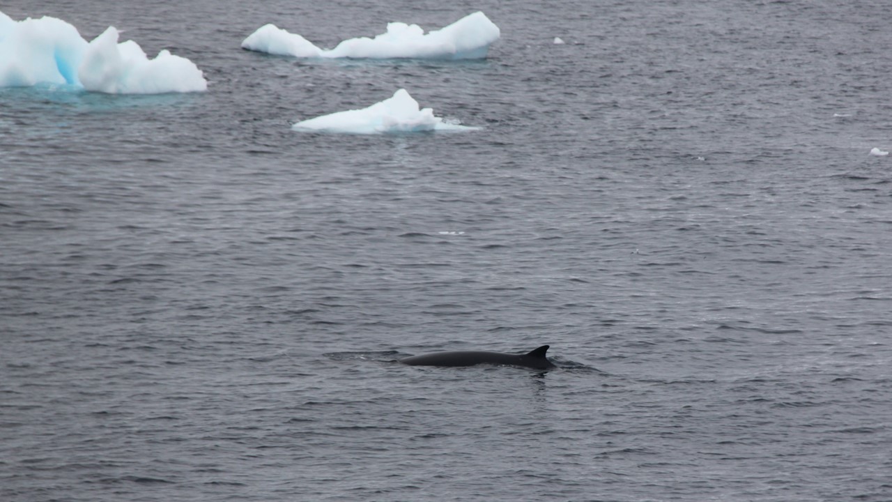
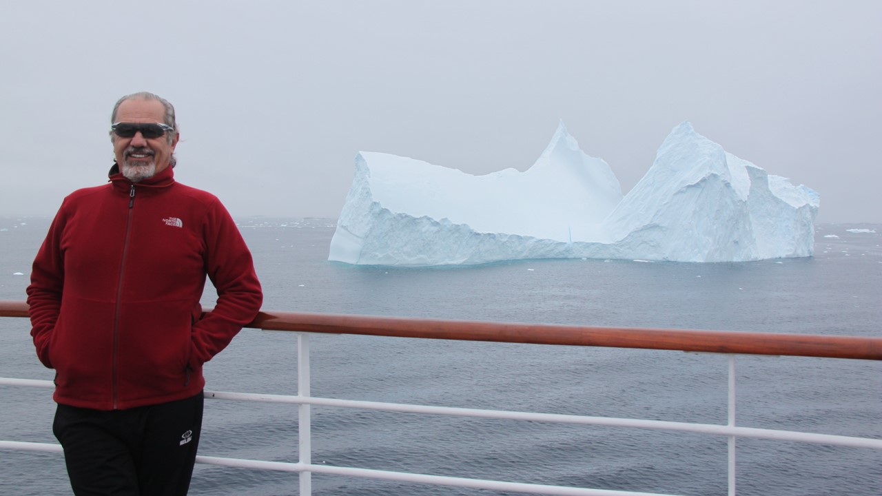
We have sailed as far south as we can go due to ice (65 degrees 40 minutes south) and we are less than 100 miles from the Antarctic Circle. but now we turned north into the French Passage and then head west out into the sea. This is a slow and tedious journey due the amount of ice, and every little ice flow seems to have a crab-eater seal on it. We also come upon a couple of really massive icebergs, one of which was grounded in 120 meters of water with another 40 meters above the water-line. The next large iceberg was tabular and 840 meters long, 81 meters high, clouded in mist and towering over our ship. Our Safety Officer has been measuring the visible part of the icebergs with his sextant! The Captain has been measuring the underwater part of the iceberg with sonar and this one is 185 meters deep! We have also seen several whales: Humpback, Fin, Minke, and even a couple of Orcas.
After exiting the French Passage, we enter the beginning of the Drake Passage. We are still ~650 miles from where we will pick-up the Channel Pilot to enter the Beagle Channel, and we will have 2 full days at sea to get there. Tonight, the waves are building to 3-4 meters, and people are already seeking their cabins.
Wednesday is a sea day, and many people have sleep-in. The waves have already dropped to less than 3 meters and the air temperature outside is noticeably warmer.
In the morning, we take a tour of the bridge of the ship. The Fram has 4 diesel-electric engines and two propellers that can be independently rotated 360 degrees. Currently we are only running two of the diesels, and the propellers are set to be “pulling” us through the water. The Captain related that as we traversed from South Georgia to Antarctica and the seas were so rough, we needed the electric power of 3 diesels to make acceptable headway. The bridge is totally electronic – there are no paper plots or charts. The sonar and radar are such that the smallest items on the surface can be seen, and the base of submerged icebergs can be accurately determined. We were running via computer automatic pilot at a speed of 10 -12 knots. Later that day, we began to prepare to end our trip by returning our muck boots to the Expedition Crew, gathering up our stuff, and spending time in the Panorama Lounge watching the waves and calming seas. That night we dine on fish & chips and finish the evening with a Late Night “Talent Show” and party hosted by the crew.
Thursday is also a sea day and is spent packing, checking the billings, validating flight information and getting ready to disembark the ship early the next morning. In the afternoon, our Whale Expert from the Orca Foundation, Lucy, gave us a summary of what we have recorded on the trip – 7 species of Cetaceans, 6 other species of marine mammals, and ~1644 individually counted animals. The count looks like this:
- Commerson’s dolphins – 38 (black and white with gray babies)
- Peale’s Dolphins – 16
- Orca (Killer) Whales – 10 – of the 4 ecotypes, we saw 9 type-C, and 1 type-A
A) Largest, prefer open sea & they hunt Minke’s whales
B) Sub-Antarctica
C) Brown Yellow coloration, largest eye patch, hunt seals
D) Sub-Antarctica
- Minke whales – 46
- Sei whales – 38
- Fin whales – 126 (they appear to look like logs in the water and were the largest whales we have seen
- Humpback whale – 301 (exhibiting lots of different behaviors, breeching, slapping the fins, slapping the tails, and in an icy area blowing bubbles to clear the ice before surfacing)
We also saw 206 “whale blows” where no whale surfaced, thus there was no identification. The best whale display was near Shag rock where you had 4-types of whales and hundreds of blows with whales, seals, and birds all coming out of the water.
In the afternoon, we pass Cape Horn, which we visited with a landing on another trip last month. The evening has us take aboard a Channel Pilot and bring us into the Ushuaia Harbour in the early morning daylight, finishing the Antarctica Expedition part of our trip and 3768 nautical miles traveled by ship. Now, it is off to Buenos Aires for a night of dinner and Tango, before our flights back to Atlanta and New Orleans to begin our next adventure – Mardi Gras 2019!