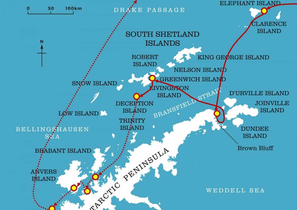
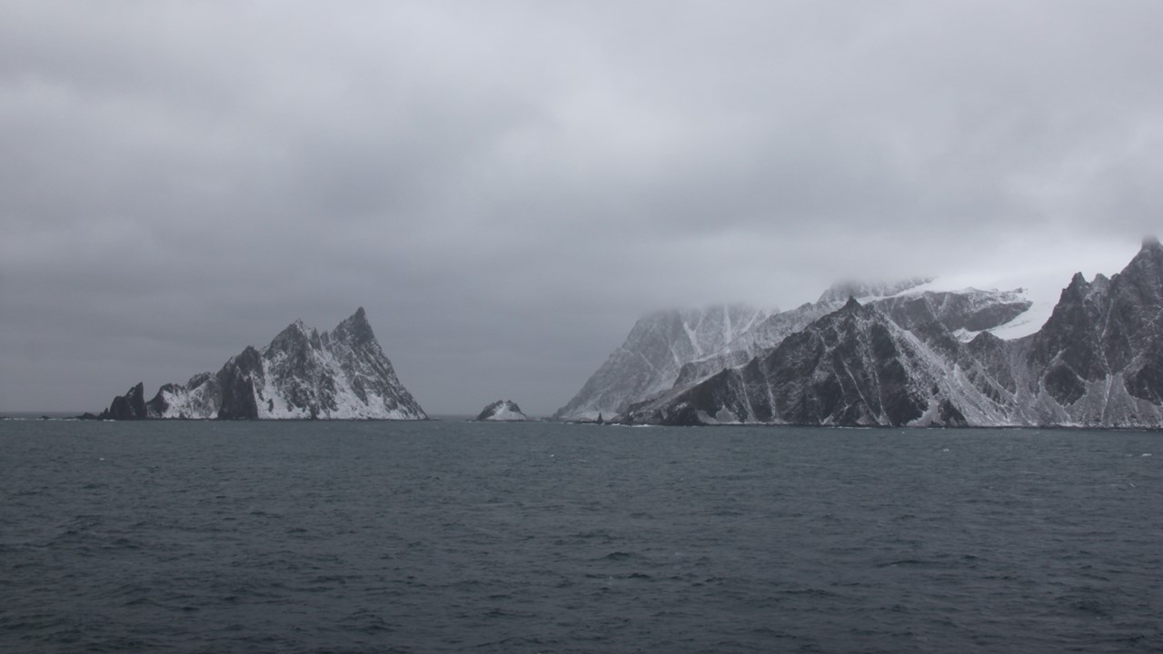
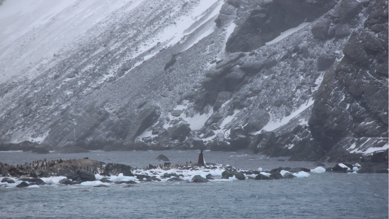
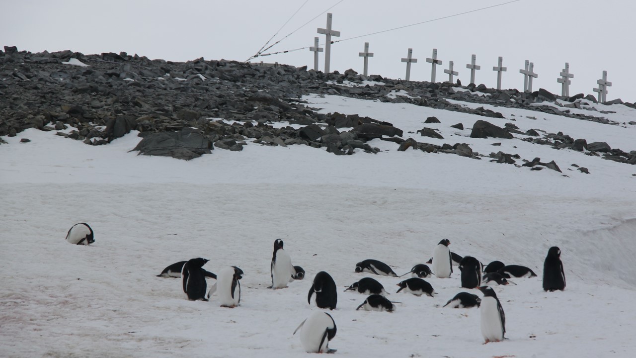
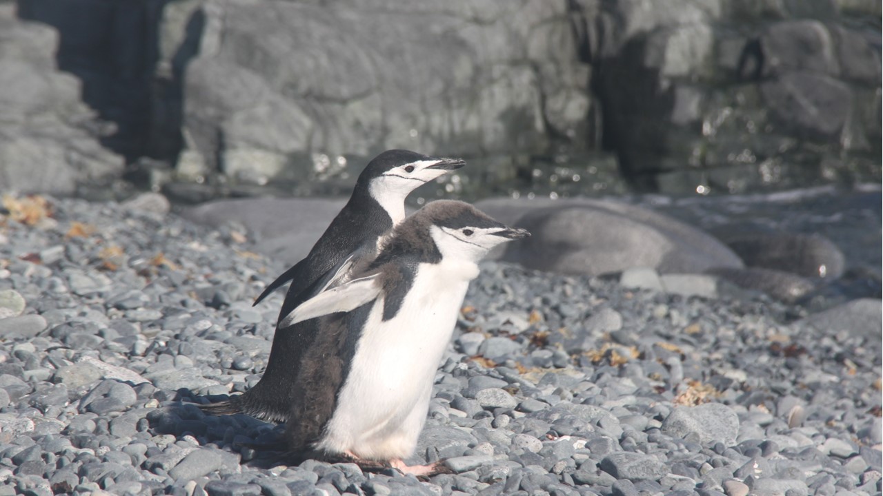
We have been sailing from South Georgia Island to Antarctica, and it is now Thursday morning, February 21st. It is a very overcast day, but the conditions are tolerable, and we are excited to awaken to whale blows quite near the ship. It is quite cold outside, (28 degrees) and still a bit windy (25 mph winds with gusts up to 60 mph), and we are now observing icebergs in every direction one looks. Soon, we can see Elephant Island in the distance covered by mist/clouds. Elephant Island is 25miles long by 7 miles wide and has the crude shape of an elephant’s head with a long, extended trunk. As we approach the island, we get a good view of a series of jagged peaks composed of metamorphic rocks, the tallest of which is 2500 feet. Point Wild is ahead and is where Shackleton left his men while he and a small crew went to the South Georgian Islands looking for help to rescue them. The area of Point Wild is all mountainous with a very small beach in a tiny protected cove where the men lived for 4 1/2 months. They lived under what was left of their lifeboat turned upside-down and were led by Frank Wild. There were no penguins here in 1914 only sea lions which is all there was to eat for those many months. Today, the beach is smaller than 1914 and the adjacent glacier has receded some, but there now is a colony of Chinstrap penguins in the area who are the only regular visitors to a single bronze bust of Captain Pardo erected there by the Chilean Government.
Our Captain held our ship in the bay for us to take photos for nearly 30-minutes, despite the katabatic wind gusts coming down the glacier. The ship’s deck-5 observation area developed frozen patches of ice due to the extreme wind chill. The glacier in that bay is massive and its colors are amazing, but it brings with it its own weather conditions.
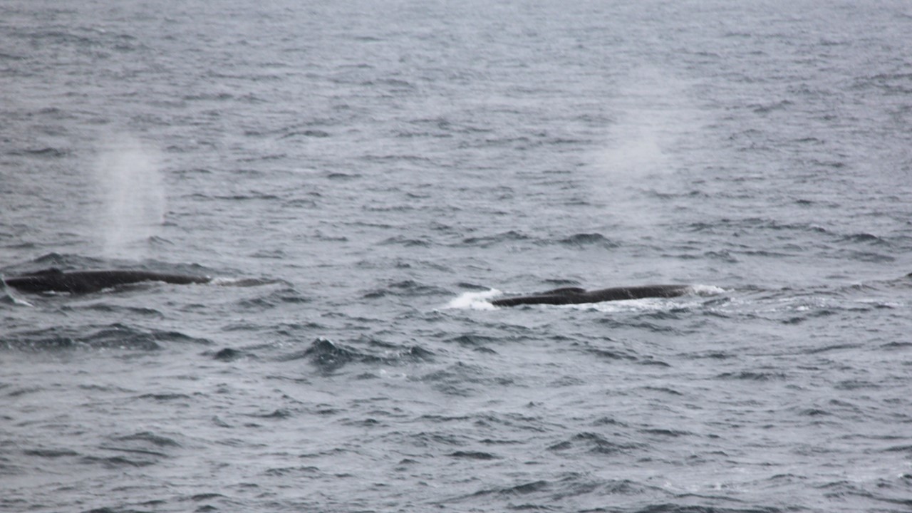
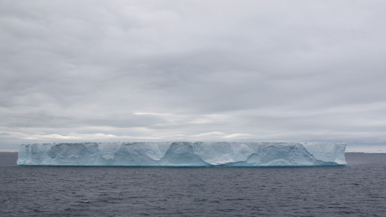
We continue to sail around the east end of Elephant Island to a place called “Cape Valentine” where Shackleton’s party originally landed on Valentine’s Day but were forced to then move on to Point Wild. As we sailed west past Cape Valentine, it began to snow heavily, and the wind howled. We continued south west down the Bransfield Strait towards the west-end of Elephant Island to Lookout Point or Cape Lookout, pass Rowett Island which is now all covered in new snow. Cape Lookout was discovered in the 1820’s by Captain George Powell. Today, there are ~10,000 Chinstrap penguins living in the waters between these 2 points. Here we saw many penguins in the waters all around us, as well as a few fur sea lions. Also, along this route we have seen a number of Sei- and Fin- whales. After Elephant Island, we turn south again and cross open water towards the Antarctic Peninsula. In a couple of hours, we pass Gibbs Islands – small, barren, ice-covered set of rocks in the middle of nowhere. When we approached Gibbs Island, we come close to a massive tabular ice sheet and are hit with hurricane-force katabatic winds yet again, preventing us from going any closer. Therefore, the Captain turned the ship and we are head straight towards the Antarctic Sound, which was discovered in 1825 by Captain Wendell.
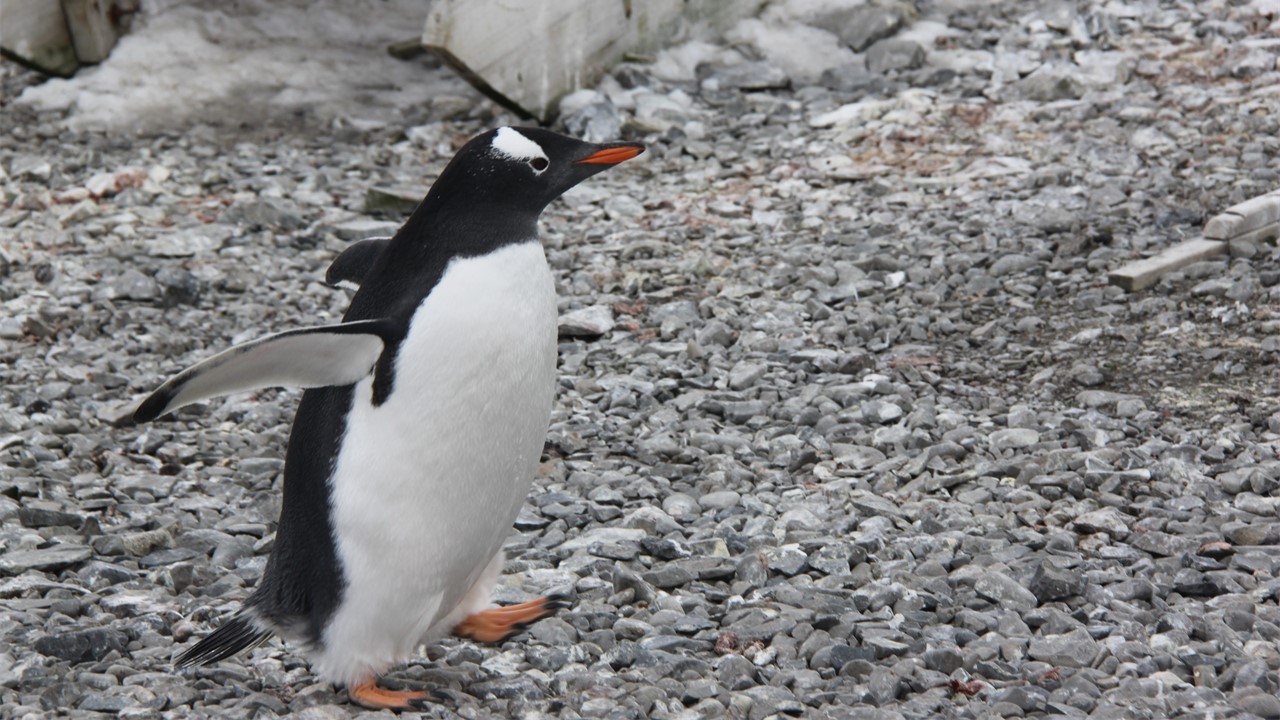
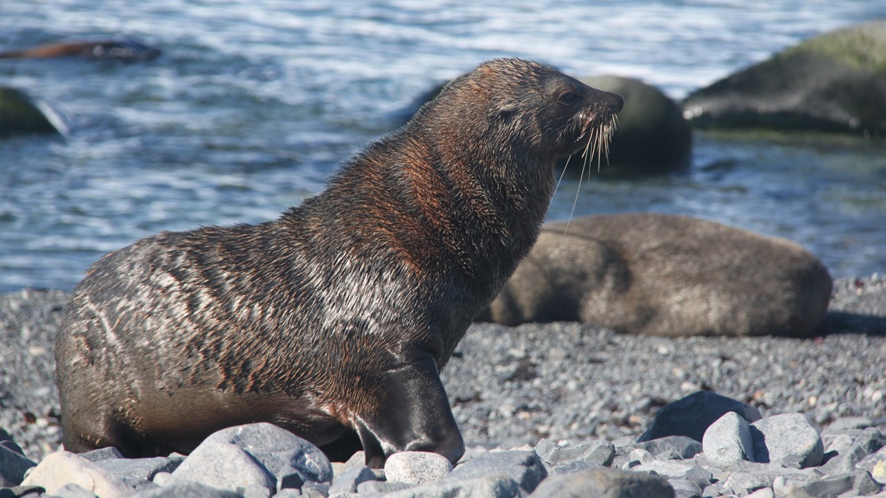
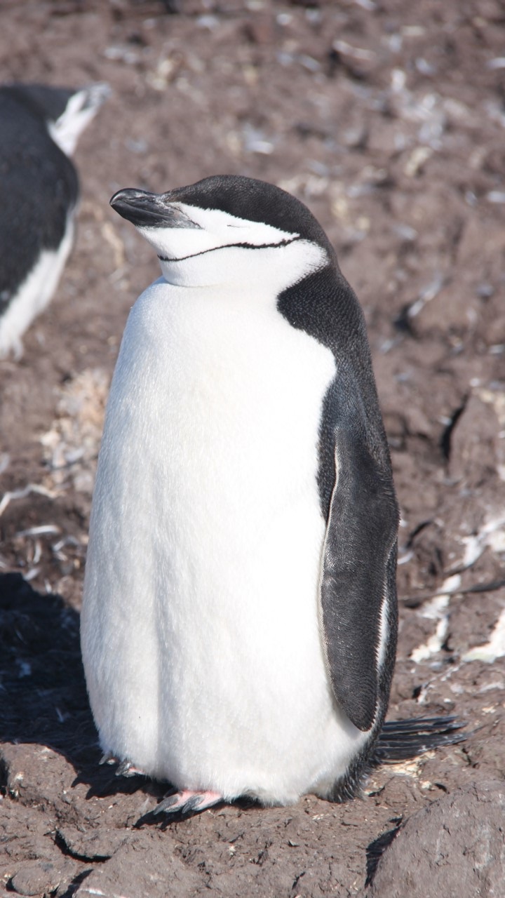
The afternoon lecture that day was given by Lucy from the “Orca” Foundation. “Orca” is a British-based non-profit organization that was founded in 2001 for long-term studies of whales and dolphins. It is now a global organization with 6 full-time employees who encourage everyday “citizen-scientists” to help with the monitoring of the whales and dolphins. Lucy talked about the scientific order of Cetaceans, how to identify them and their differences. She also reviewed the mammals we have seen on this trip: Commerson’s dolphins, Peale’s dolphins, Minke whales (most common to Antarctica), Humpback whales, Sei Whales, Fin whales, fur seals, elephant seals, crab eater seals, leopard seals, wendell seals and penguins (chinstrap, rockhoppers, king, gentoo, macaroni, and adelie).
That night, after our buffet dinner, it was time for another night in the hot tub. Although the seas were calmer, the air was extremely cold, and our hair began to freeze. Later that evening, there was a presentation review of our time in the South Georgia Islands. The review reminded us how the weather had driven the ship to sail up and down the northeast coast of South Georgia 4-times in search of safe locations for landings. One of our expedition staff, Tom, reviewed for us the extent of emergency gear that needs to be taken ashore prior to every time we land. Emergency gear for 100 people for 24-hours of survival is placed onshore for every landing in case of changes in the winds or weather that prevent us from getting everyone back to the ship. This gear includes blankets and pads to sit on, tents for shelter, and water & basic food. In the 9-years that the senior Expedition Staff have being doing these trips – the emergency equipment has only been used once! The review then featured Bob, who explained that katabatic winds are a result of cold air from top the mountains and above the glaciers rushing downhill because of its higher density. These cold winds then ride under the warmer air creating very strong gusts. Finally, the passengers played another game of “Antarctic Jeopardy” with 2– categories Penguins and Non-penguins. The guests were divided up into two-teams – Port and Starboard. We were part of the Starboard Group and we won – yea! Then, it was off to bed.
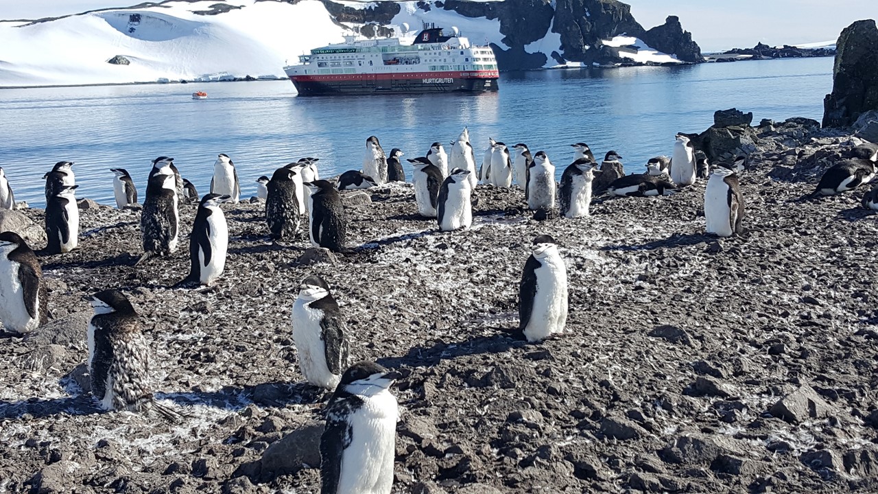
The ship sailed all Thursday night and Friday morning through the Antarctic Sound heading toward the Argentinian base “Esperanza”. Along the way, we are surrounded by icebergs of many sizes and shapes, and the Captain expertly avoids the largest ones. As we sail into sight of the base, we see many humpback whales and other types of whale blows. “Esperanza” is a permanent research station open year-round, on Cape Hope. The base’ motto is “Permanence, an act of sacrifice.” Built in 1953, the base houses 55 inhabitants in the winter, including 10 families and 2 school teachers. The base has a civil registry office where births and weddings are recorded. The first child ever born on the Antarctic Continent was born here in 1978. The base also has some minimal “tourists’ facilities” and hosts about 1,100 tourist a year who stop to visit. The 43-buildings of the base have a combined space of 3,744 square meters (~40,300 sq. ft covered). The base uses 18,000 liters, (4,800 gallons), of fuel annually by its 4 generators to produce the electricity for the station. Research Projects include glaciology, seismology, oceanography, coastal ecology, biology, geology and limnology.

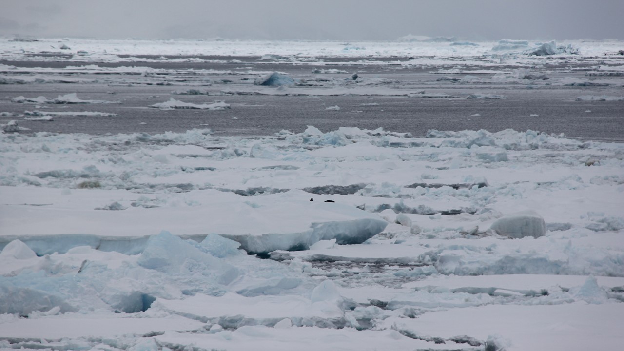
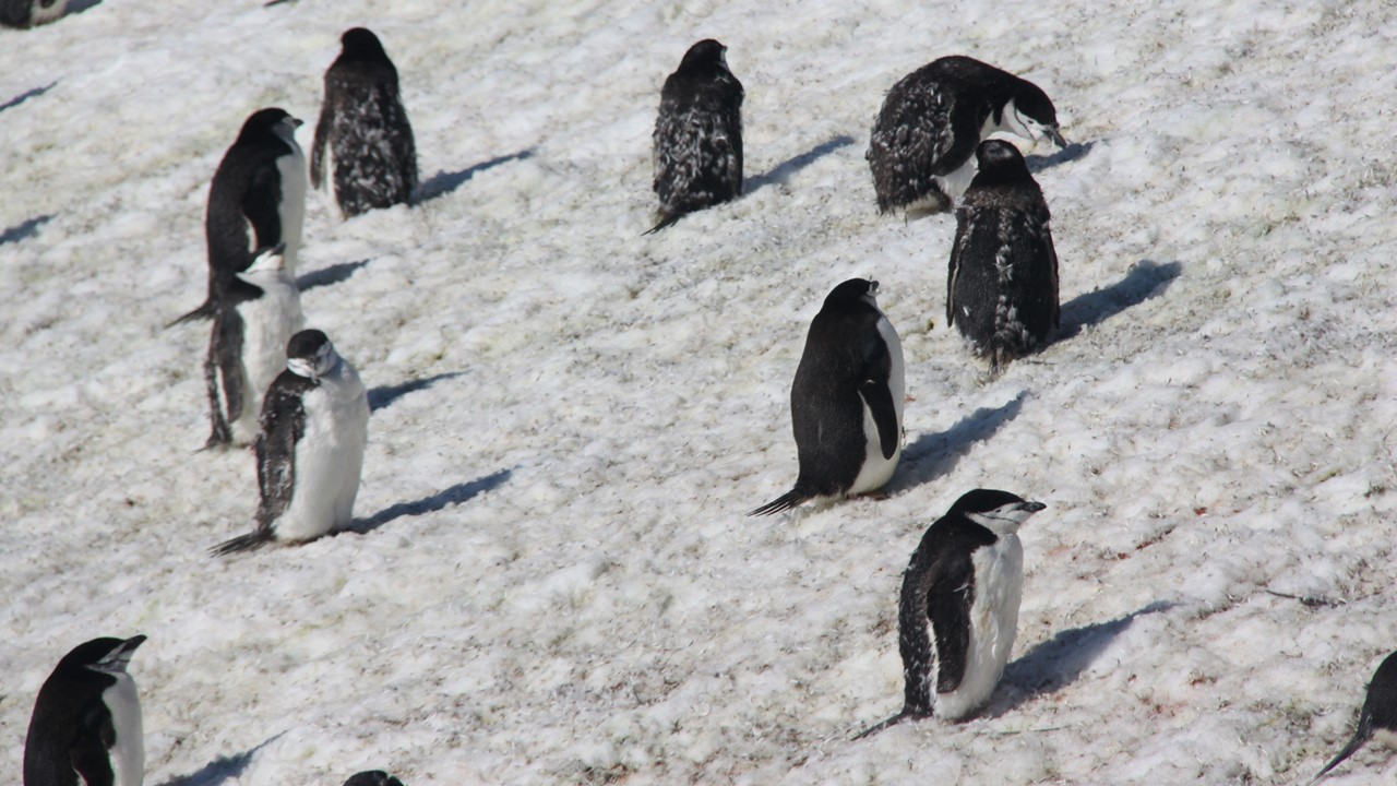
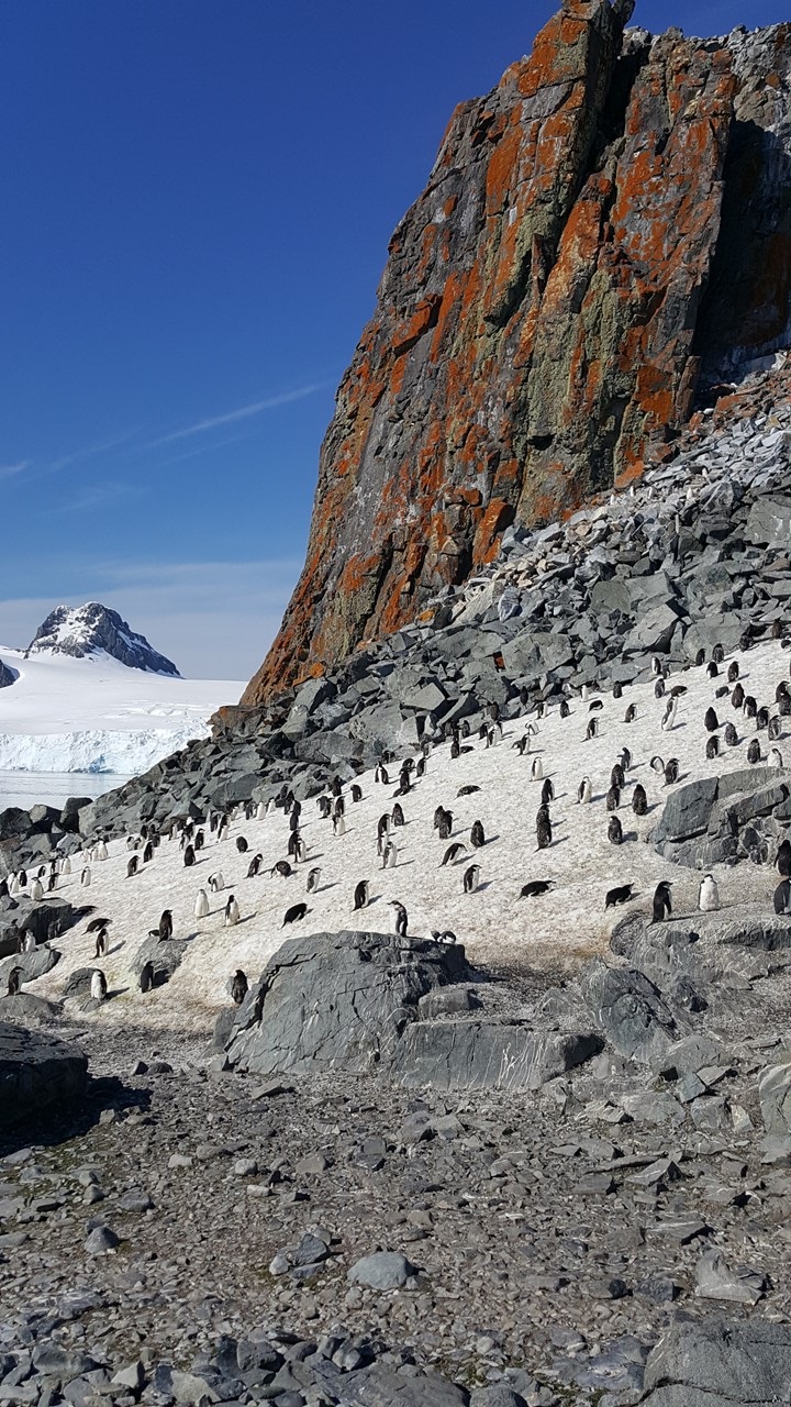
The Antarctic Sound lies between the very tip of the Antarctica Peninsula and D’Urville, Joinville, and the Dundee Islands. It was named for the ship “Antarctica” in 1903 when the Swedish South Polar Expedition Captained by Carl Larsen explored the area. This area is known as “Iceberg Alley” due to the astonishing assortment of floating ice, both large and small. The Sound is 30-miles long and is often difficult to navigate due to the amount of ice. This area has a high concentration of Adelie penguins, (~500,000 nesting pairs).
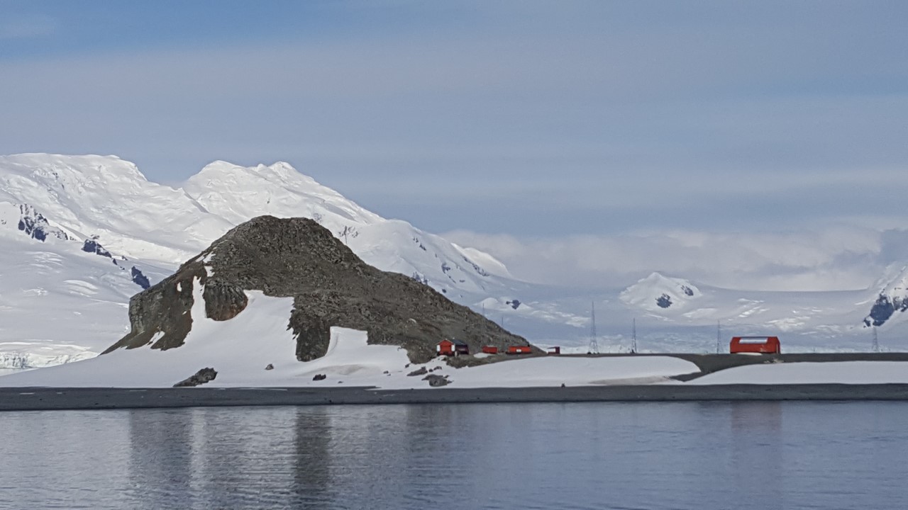
As we approach the base, all the buildings are painted orange and one of the larger buildings has an Argentina flag painted on its roof. This color-scheme is the norm for any Argentine Base in the Antarctic. There is very little snow here, but it is very cold and windy, and the base is built on a cobble beach, surrounded by glacial ice and mountains. Also located at this Base is a historic, large rock-hut that was built by a shipwrecked 1903 Expedition Team for survival through the winter – the first people to successfully winter in Antarctica. We arrived at the “Esperanza” Base at ~9am and Expedition Team goes ashore first. The Base Commander has offered to receive tours of the Base in groups of 20-25. We learned they have a small gift shop and are encouraged to bring money with us. The Expedition Team has us broken into 8 groups and today our group goes last.

We loaded into the zodiacs at around noon and, as we pulled away from the ship, are surprised by a huge humpback whale surface right behind us, showing us his backside before diving. We arrived at a little dock but leave the zodiac in the shallow water on a rocky slope. We were greeted by a large contingent of gentoo penguins before the Captain of the Base comes to welcome us and take us on a tour. Not only are the buildings painted orange, but all of the Argentinean Antarctic gear is orange, as well. which makes this base different from everyone else. As we walked up the hill to the base, there were an old set of railroad tracks, old sleds and vehicles from years ago that were used to move supplies up from the coast. This equipment is now considered part of the museum. The indoor part of their museum has fossils with leaves imbedded in them, stuffed penguins, equipment from their first hospital in the 60’s-70’s. It has pictures of other explorers that have made it to this point in Antarctica, including a picture of the 3 Swedes who built and survived in the rock hut in 1903. Argentina had founded Esperanza as a Base in 1903 and have just celebrated 115 years at this location. There is a small chapel on the Base that has a donated cap from the current Pope. The Base has its own accredited residential Primary and Secondary school which will begin in March and will have 17 students from the 8 families that will be on base for the winter. There are 2 teachers – a husband wife team. They will teach the Elementary students and then facilitate the Secondary students with classwork delivered online. They have 3 physical classrooms, a chemistry lab, and an indoor gymnasium. These students will get the same curriculum as all other Argentinian students. It is the only school in all of the Antarctic Continent. We then visited the Cafeteria Building where we were served sweet coffee, signed the guest book, and visited the gift shop, (t-shirts, polo shirts, hats, patches and post cards with the seal of the base). At the conclusion of the tour, we returned to ship for a late lunch. Then, the Captain took us for a sail around Antarctica Sound, which was loaded with a tremendous amount of ice debris in the water, and numerous icebergs. We soon came across another massive tabular iceberg, bigger than the ship, which has broken off the Weddell ice shelf.
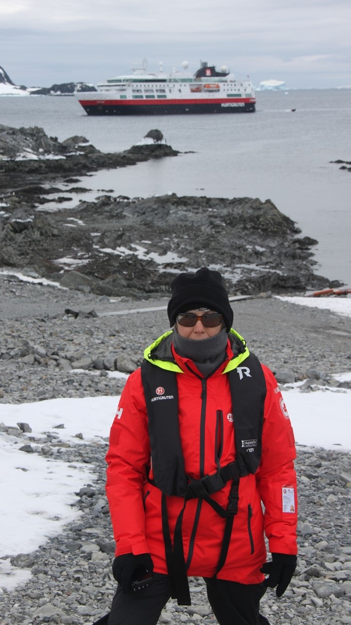

Antarctica is the 5th largest continent on Earth, with a total area of 5.5 million square miles. During the winter Antarctica “doubles” in size, due to the large amount of sea ice that forms at its periphery. Antarctica is more than 95% ice-covered and contains about 90% of the world’s fresh water. Antarctica has no native human population. Even today, its only residents are scientific teams and their support staff that stay no more than one-year at-a-time. (This is also true at Esperanza. However, we learned that once someone spends a year on the Base here, they often apply again to return. This is true of the teachers who met here year’s earlier.) Antarctica is the coldest (record -126.9F in 1960) and the driest continent (less than 2-inches of rain per year in the interior) and is therefore actually considered to be a desert. The Antarctica coast line, however, receives about 15 inches of rain a year. While we were visiting ashore, we saw another cruise ship, the National Geographic Explorer, for the first time since we left Ushuaia.
That evening, after receiving our “evening briefing”, we went to the panorama lounge to witness the “lottery” for those wishing to camp one night on the ice in Antarctica. There were 30 spaces in the tents for camping and 50 people wanted to camp, thus a lottery was drawn to see who received the 30 slots. After the lottery the kitchen crew provided us with entertainment in the form of fruit carving, cake decorating, napkin folding and ice carving. The fruit was carved into fishes with seaweed and flowers by the cold food chef. The sheet cake was decorated in a “Fram” theme with handmade flowers by the crew chef who doubles as a pastry chef. The napkins were folded by our dining room waiter who made swans, peacocks, flowers, ships, hats, and people. The ice carver took a large block of 2ft x 3ft x6in ice and carved a beautiful fish. Each piece of art was created skillfully by beautiful and talented people.
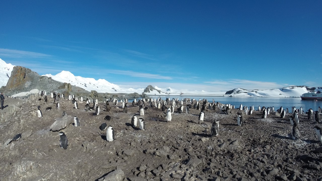
Saturday morning is crisp and clear, and we have traveled west to arrive in the South Shetland Islands at Half Moon Island, which is a small island between Greenwich Island and Livingston Island. Here, there is summer-only Argentinian Research Center with 5 buildings. Currently, their shutters are down, and they are already closed-up and gone for the winter. This island has many chinstrap penguins, terns and gull nests. Some areas are closed to us because of their environmental sensitivity and to be sure we don’t disturb the wildlife. Onshore, there is an old shipwreck from the 1900’s which is both historic, and in unsafe condition, and so we stay clear of it. The water is calm and glassy, and the sun is shining brightly which makes for good kayaking and comfortable adventures onshore. The South Shetland Islands are a string of islands running parallel to the Northwest coast of the Antarctica peninsula with snow & ice covering ~98% of the islands. There are bases of 12 different nations on these islands – eight of which are permanently manned and 4 of which are manned in the summer only.


After our shore excursion and lunch, we sail south to Deception Island which is currently a dormant volcano with part of its ancient caldera wall collapsed, forming an enclosed bay that is now flooded by seawater. One can only enter the caldera through a narrow gap named “Neptune’s Bellows”. We sailed through the Bellows and into a small internal cove to the right called “Whalers Bay”, which was already occupied by a ~50’ sailing Ketch and a large Chilean navy ship. All the Chileans came out on deck to welcome us with waving and cheers. Although Deception Island is dormant now, it did last erupt in 1970 and destroyed the Chilean base that was on the island. The black volcanic sand is still warm and steaming reminding us that the magma is not far beneath the surface. Whaling took place here in Whalers Bay from 1912-1930’s and the remnants of the old whaling station are still here, but not safe to approach too close.
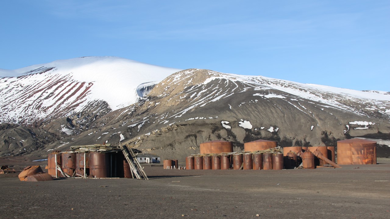
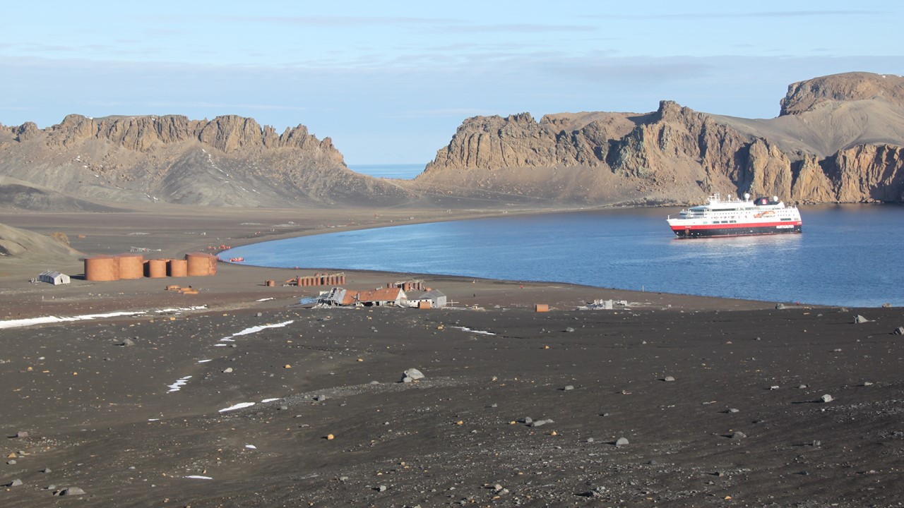
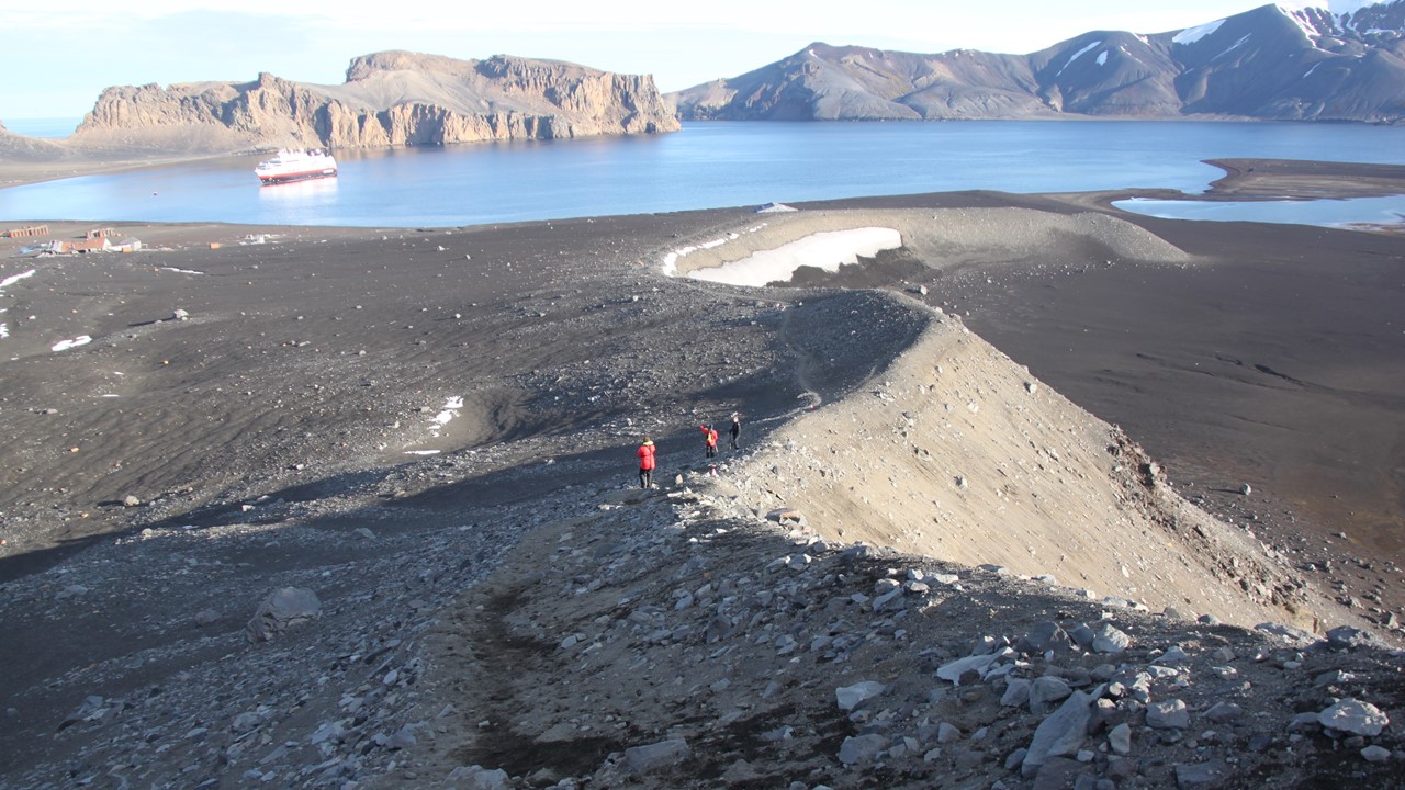
Today, there are two bases still located in Deception Island – Argentinean and Spanish – both located within the caldera around the larger bay, which is named “Port Foster”. There is a small abandoned airport with runways and hangers near the far end of the whaling station which used to be part of an old British Base that is also now abandoned. Since there was an eruption in 1970, there are buildings broken and buried in the lava sands and huge 90-year-old whale bones lying about. We walked from the landing site past the old fuel tanks and tanks used to recover the whale and seal oil, past a huge British “manor” to the abandoned Aircraft Hangar. After looking over the dilapidated Hanger, we begin to climb Ronald Hill to the “lookout”. We climbed 350 feet steeply-up, to the top of the hill and the location of a magnificent viewing point. Here we look over the caldera and take pictures before beginning our climb back down. Once down, we retrace our steps back towards the landing point and then head the other way walking to viewpoint “cut” in the volcanic crater wall called “the Window”, which gives one a view of the entrance outside of Neptune’s Bellows of the Bransfield Strait approach and all the way across to the Antarctica Peninsula. While we were busy hiking, another Expedition Ship made its way in, sailed round Port Foster, and then left. We then again returned to the landing site, it was time for Rocky to do the “Polar Plunge”. There was an old piece of iron whale equipment that made a nice “changing room”. As the temperature was 28 degrees, he ran across the rocky black sand and into the water which is at 32 degrees. Thankfully, the ship had towels ready and recorded everyone brave enough to take the plunge, (they also had the doctor standing by for safety). After a quick swim, it was a rush to shore to dry and dress, and to catch a quick trip on the zodiac back to the ship.
Once everyone was back on board, the Captain elected to cruise around Port Foster so that we could see the ice-sheets covered in black ash, as well get a quick view of the Argentinean and Spanish bases, located opposite of Whalers Bay. After a dip to warm up in the hot tub and then dinner, we had our evening briefing describing the plan for the next day, and then a talk show exploring the intricacies of the “de Gerlache’s 1897” Expedition to Antarctic. Gerlache was a Belgium Explorer who took the first team of scientists to explore Antarctica. However, they unexpectedly got frozen into the ice and drifted for over a year before finally getting free and making it back to safety. Many of the places that we will pass were named by this Expedition, and it set the precedent for scientific research in Antarctica.