August 2018
Selfoss & Iceland’s “Golden Circle”
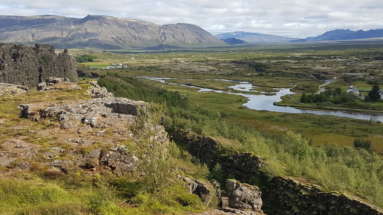
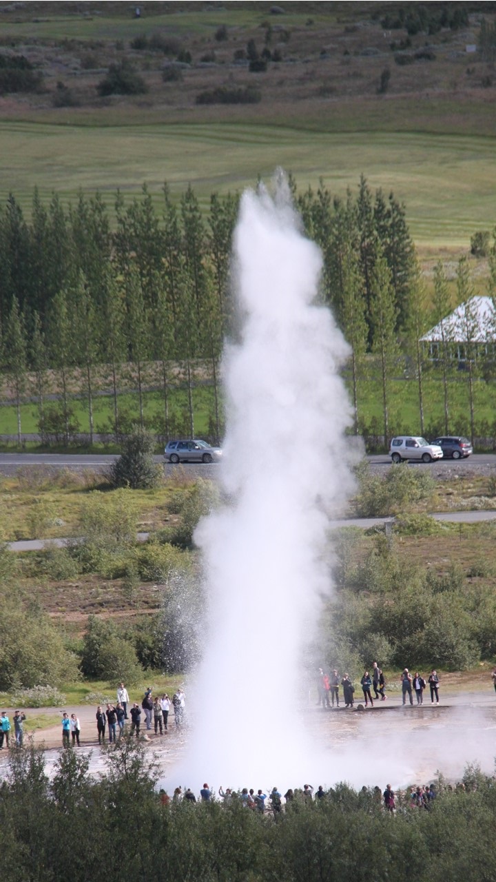
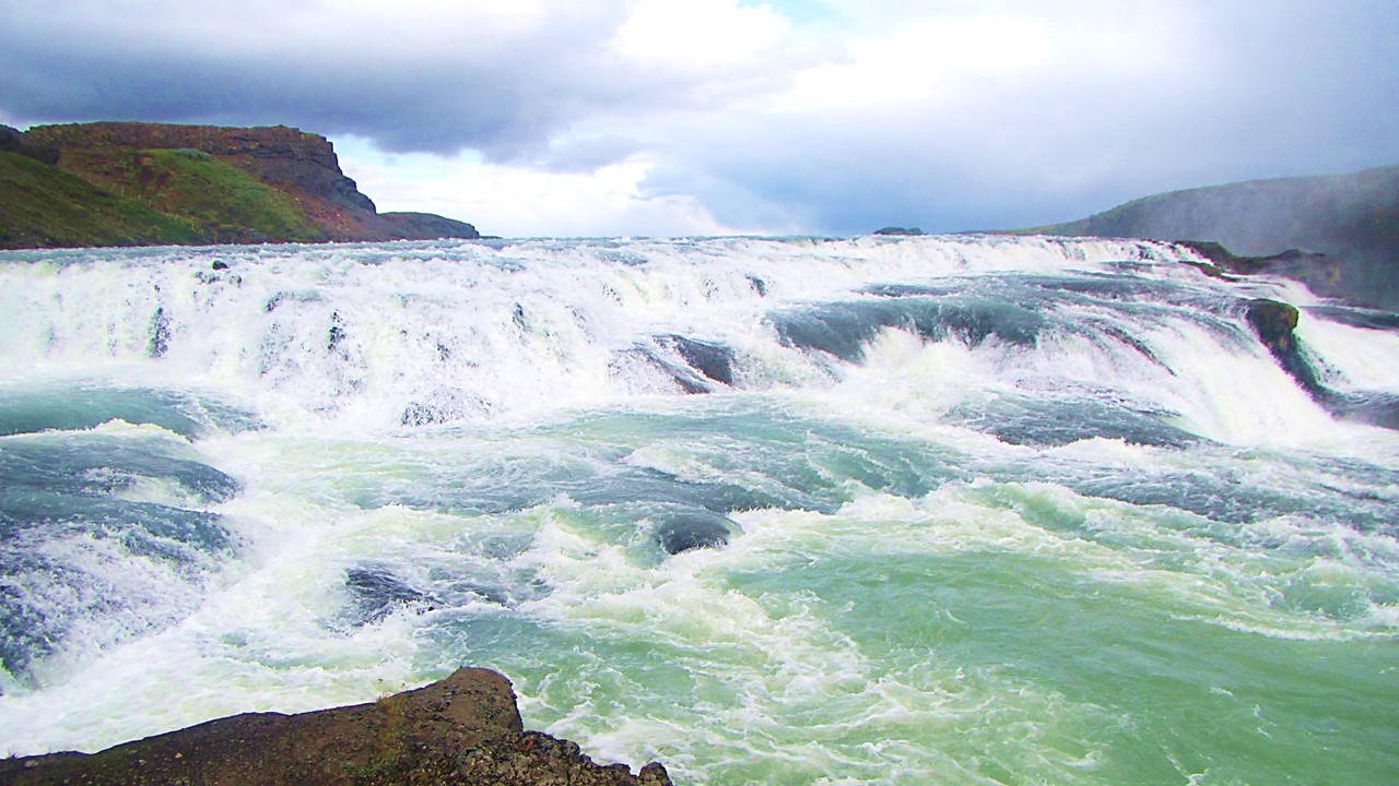
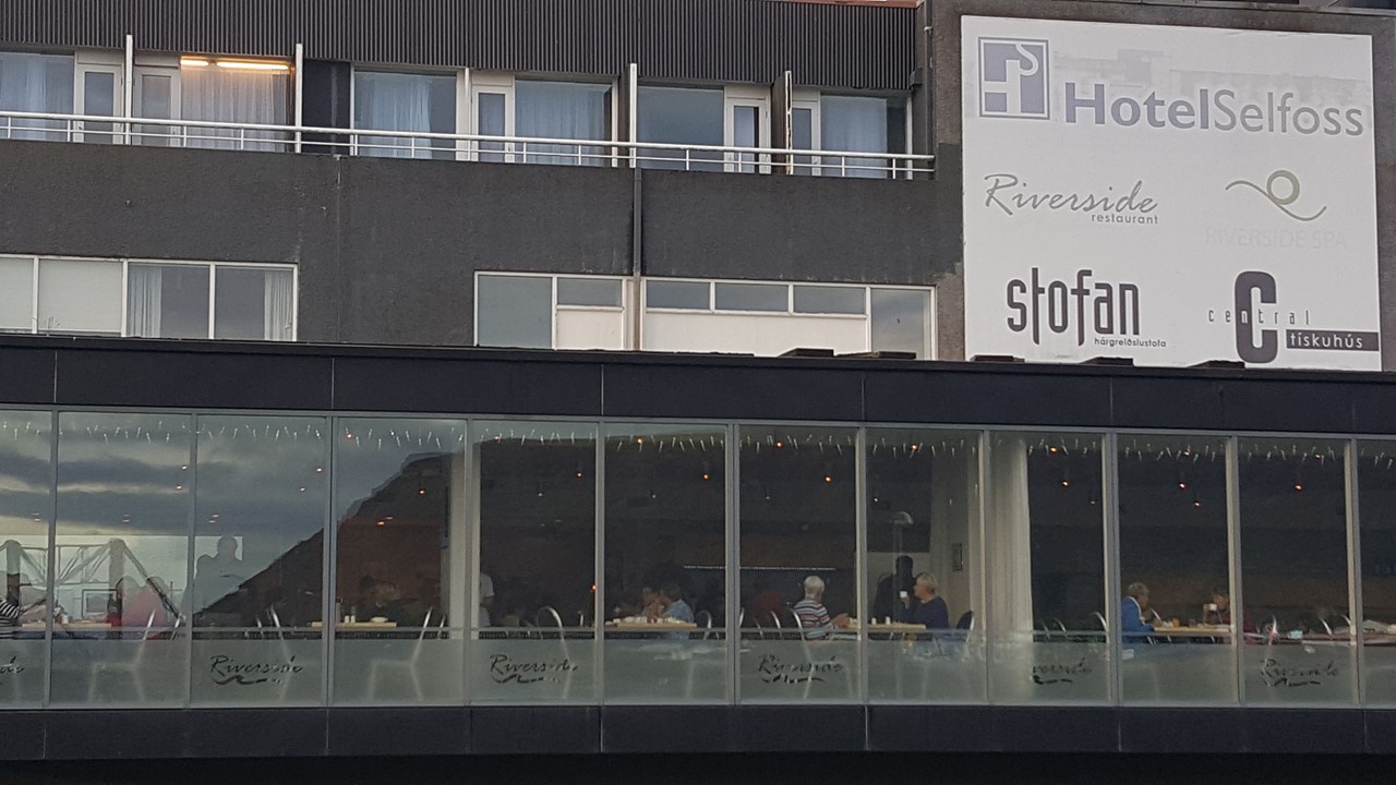
On Sunday morning, we departed from the northern town of Akureyri with a 35-minute Icelandic Air domestic flight back to Reykjavik. From here, we met back up with our bus driver, Guestor, and headed east to the “Golden Circle”. First, we visited Thingvellir National Park to take a walk into the famous rift valley between the tectonic plates of North-America and Euro-Asia. The two plates area about 7 km apart today, and still moving at over 1 inch per year, creating the space for Lake Pingvallavatn, Iceland’s largest lake. The area also served as the historic meeting place of Icelandic Elders from 980 until 1262, when all the local tribes and families would be represented annually for law setting and dispute resolution. Followed this visit, we traveled to Geysir, the area from which all geysers get their name, and watched as Iceland’s most active hot spring geyser, Strokkur, erupts 60 ft. into the sky about every 5-7 minutes. While there, we ate lunch, and then climbed the local hill to get a great view of the surrounding Haukadalur valley. From here, we traveled a short distance to Gullfoss (“Golden”) Waterfall – a waterfall with 3-tiers of rushing white-water into a 100 foot deep crevasse. Then, it was on to a small waterfall at Mane, (the Faxi Waterfall), before heading into the town of Selfoss, the largest town in southern Iceland, (7000 people), other that Reykjavik. The town is located on the Olfusa River and was the home and final resting place of the famous Chess-Master, Bobby Fisher. Here, we checked into our hotel on the river, and enjoyed a restful happy hour and extensive buffet dinner.


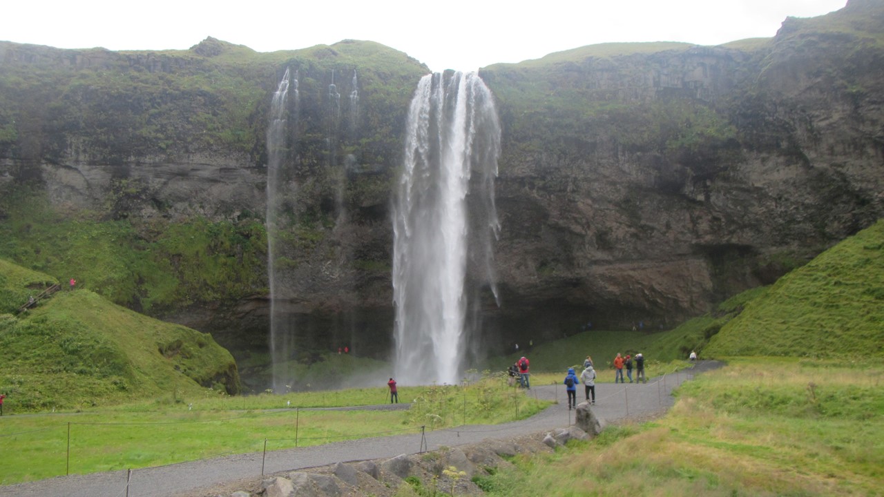
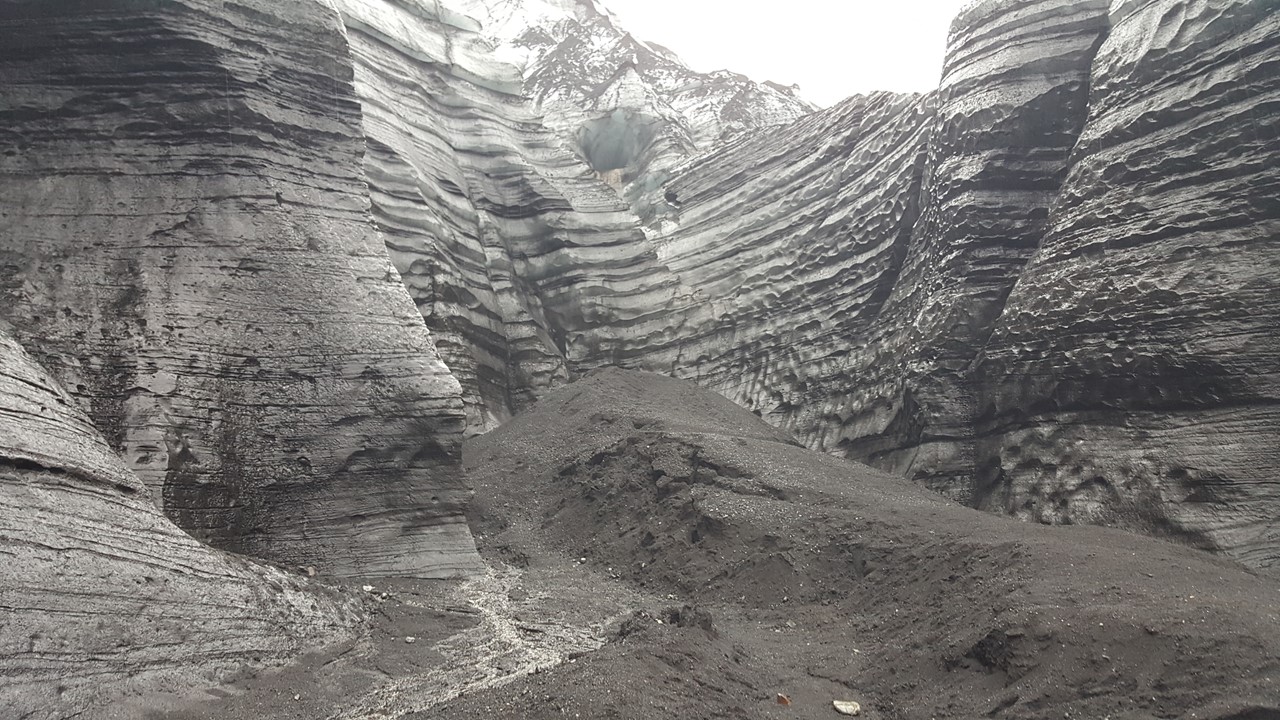
The next morning, we traveled along Iceland’s south coast – a lowland area of large 10,000-acre farms leading up to numerous volcanic slopes. Our first stop of the day was at Seljalandsfoss – a large waterfall that one can walk underneath via the cavern that extends behind the falls. After visiting the smaller Skogar waterfall, we headed to the south coast to the Dyrholaey peninsula at Reynisfjara where steep cliffs are bound by black sand beaches, and the small, soil ledges are great locations for the Puffin nests that are located in holes into the ground. Here we saw hundreds of orange-beaked Puffins coming and going, which was unusual this late in the year, as they typically spend all of their time at sea except for when their nesting. From here, we went to the most southern village of Vik (~200 people) where the tourists outnumbered the locals, and had a lunch of arctic char, veggies and spice cake at “The Volcano Hotel”. After lunch, we gathered for a Super-Jeep tour across a “moon-like” volcanic landscape past the Mydrals jokull up to the Kötlu jokull glacier in the Katla volcano. Here we hiked onto the face of the glacier recognizing the layers of ash and summer dirt layered with the winters’ snow. After our super-jeep tour, we returned to Vik for a bit of quick shopping before heading to the Skogafoss (“jewel of the family”) waterfall. Skogafoss is a 197’ high and is the largest waterfall in Iceland with a drop into a canyon of 25 meters wide. As we walked by on the trail, we were drenched by the micro-climate spray that hovers continuously beside it. From here, we traveled back to Selfoss to our hotel for dinner where we tested our first taste on Icelandic “pylsa” – a hotdog with all the fixings, including a few that that would surprise most Americans!


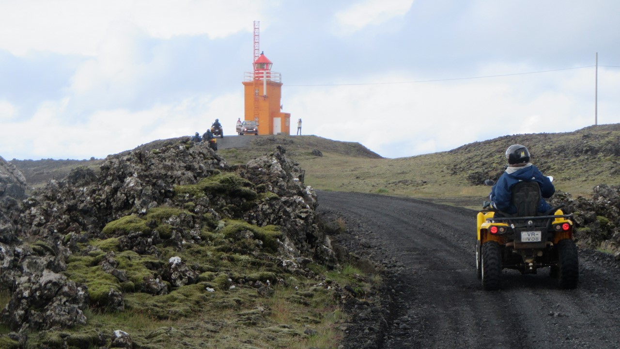
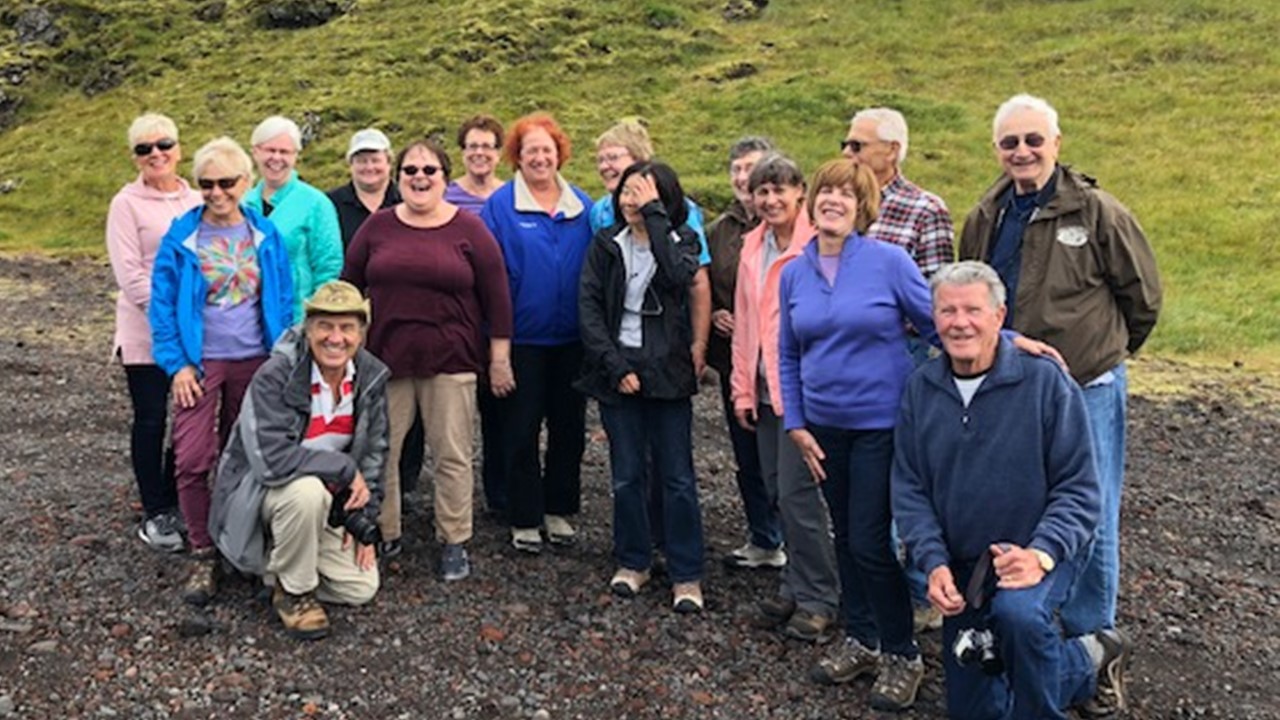
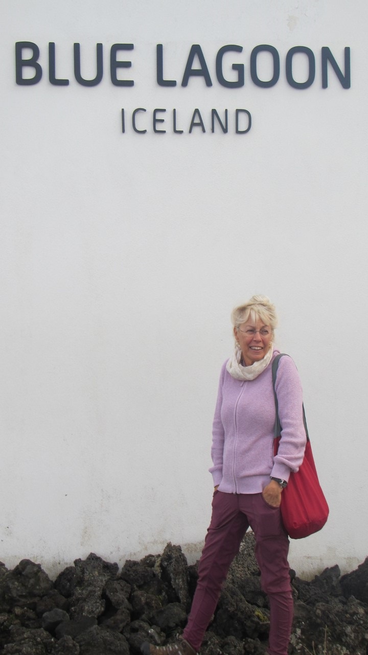
The next morning, we departed from Selfoss and drove to the hot spring town of Hveragerdi to the Almar Bakery where we enjoyed chocolate cake while admiring it bakery’s building which is split in two, built over an active fault that last moved in 2010. We then traveled along the Reykjanes peninsula to Strandatkirkja to visit a small, local church located on a sparsely populated coast. Here we saw more puffins and a lone seal playing in the surf. From here, we moved onto Grindavik, one of the wealthier municipalities due to their successfully fisheries and high allowed quota. In Grindavik, we met with the local First Responders, part of a national all-volunteer force. Iceland has no army or navy, so the Coast Guard and First Responder Force are responsible for all rescues. After learning the history of their historic rescues, we dressed in jumpsuits and helmets up for a drive on 4×4 ATVs around the peninsula’s coast, observing a series of shipwrecks that still litter the coast. When we returned, we had a short picnic of Icelandic flatbread, smoked lamb and cheese, with an orange-shanty drink. After lunch, we began our trip to the Blue Lagoon, with a stop at an US B-24 Memorial from WWII – a story of triumph and tragedy. Finally, we reached the Blue Lagoon, a commercialized natural hot spring with its milky blue color. It holds 1.9 million gallons of water which is renewed every 40 hours and includes steam rooms, saunas and silica masks. After spending the afternoon there relaxing, we headed back to our starting point at the Hilton Reykjavik hotel, where we had our “farewell dinner” and prepared to travel to Greenland the next day.