January 2016
After spending 10 days ushering in the New Year, 2016, in the North Island of New Zealand with our Backroads Multisport Adventure, we headed to New Zealand’s South Island where we would begin Part 2 of our adventure, with a challenging cycling trip along the island.
Part-2: Backroad’s Cycling Trip in New Zealand’s South Island
We arrived in Christchurch at the airport fresh from our North Island adventure on Monday, January 4th, and immediately took taxi’s to our hotels near the train station. We gathered up at Speight’s Ale House for dinner and made our plans for meeting everyone for the first day of our new trip the next morning. It had been a long day, and we called an early night after a dinner of burgers, beer, fries and wine.
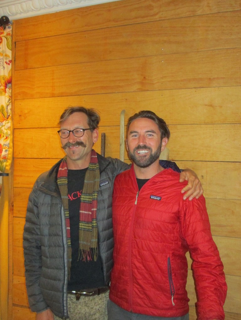
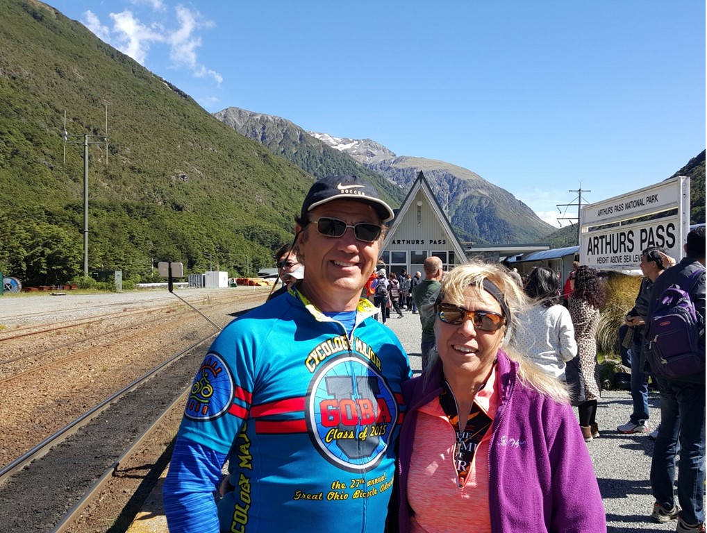
The next morning, we gathered with all of our gear at the train station, fully dressed ready to ride bikes. The six of us were joined by 16 other people this time, and they came from Brazil to Canada. Our guides, Bradley and Darren, would be supported by two other staff, Grant and Sophia. After loading up all of our gear into luggage vehicles that Grant, Darren and Sophia would drive, Bradley joined the rest of us on the train for a cross-country scenic tour through the Southern Alps, from the east coast to the west. Along the way, the scenery was gorgeous, and, in addition to a dining car, there was an “open air” car without windows where one could take pictures. As we climbed into the snow covered passes, however, most people stayed to the inside cars. Near the midway point, the train stopped at Arthur’s Pass, allowing us to stretch our legs outdoors and view the local flora.
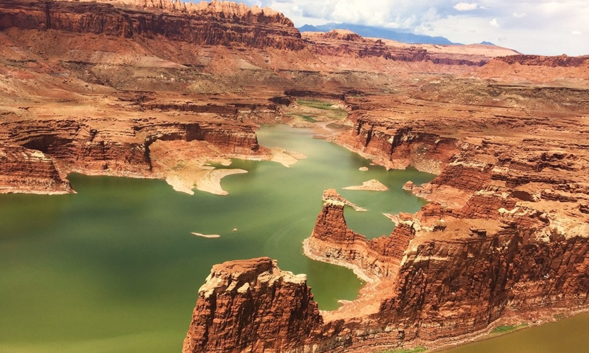
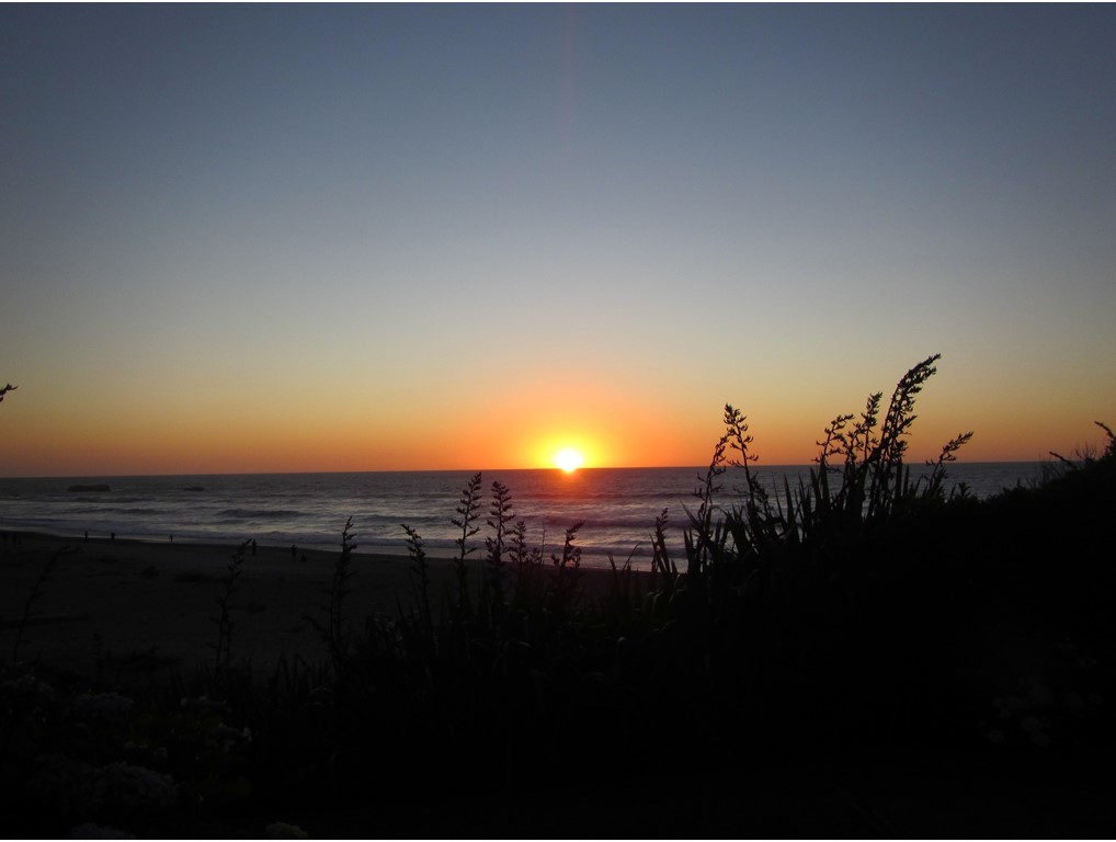
We finally disembarked before the coast in a small town of Moana on the shores of Lake Brunner for lunch at the Station House Café. After lunch, we fitted out our bikes and then began our first ride – 26.5 miles from Moana to the coast. We followed the Arnold River down from the hillsides, crossed the Grey River and passed the mining town of Rununga, to end up at a “beach pub” in Rapahoe. There, we gathered for a quick drink while others made their way in, before taking the van a short way north, up the coast, to the Punakaiki Resort, located on the beach. After cleaning up and a relaxing stroll down the beach, we met up with others for drinks and dinner at the hotel and discussed the upcoming day.
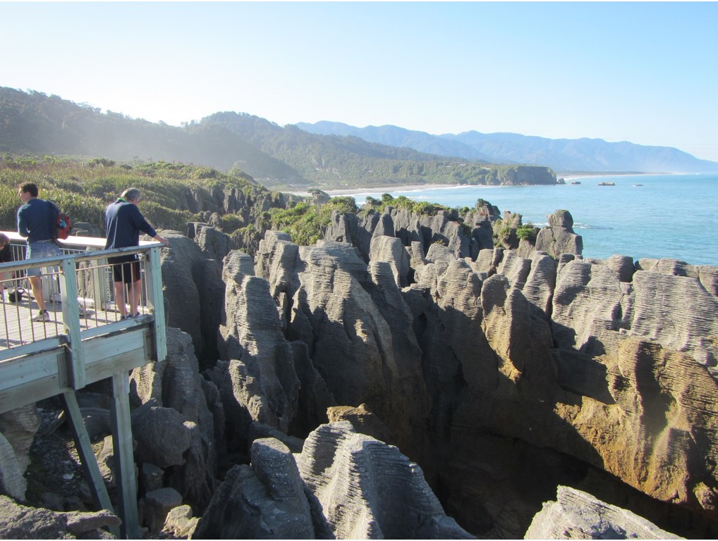
The next morning, after breakfast, we took a brisk walk up the coast on the side of Highway 6 to the “Pancake Rocks” – stacks of limestone layered into amazing formations, eroded by the runoff from the mountains and the pounding surf.
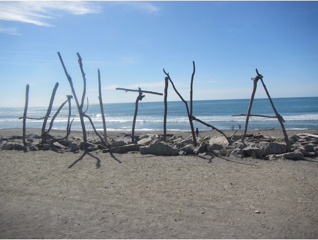
From there, we boarded our bikes to begin a 27-mile ride south along the Coastal Highway and then to the city of Greymouth. After crossing the Grey River bridge, we all met up at another Speight’s Ale House where we were free to order whatever we wanted for lunch. After lunch, we rode another 12 miles to the coastal town of Hokitika – an historic gold mining town that morphed into a quiet resort community. The town is also known for it “driftwood art” that springs up along the beachfront on unexpended occasions. Once we were checked into our hotel, we met a local historian for a walk-about around the historic buildings of the town. That night we traveled to a local working farm restaurant called The Stations Inn for wine and dinner, before settling in for the night.
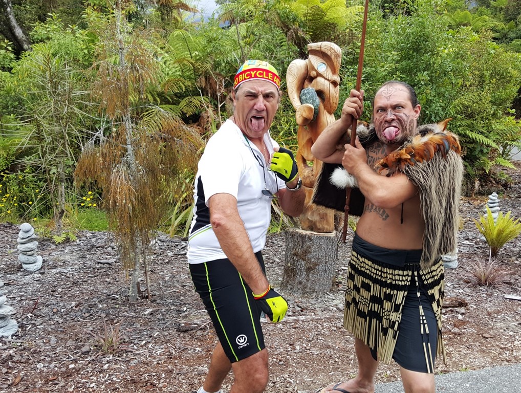
The next morning, we were up for breakfast early before shuttling a short distance to the town of Ross, where we boarded our bikes for the most challenging day yet – a morning 30-mile ride along the Kakapotahi River and through the Waitaha Reserve to the town of Hari Hari to take lunch at the Pukeko Tearoom. After lunch, it was another 37 miles, but this time with over 2000’ of elevation change making our way over Mt. Hercules and through the Whataroa Reserve to the Te Waonui Forest Retreat in the town of Franz Josef. It was a grueling but rewarding ride, and we were met with a fierce but friendly Maori warrior, and guided to the nearby geothermal pools to soak and recover. It was a long but adventurous day, and we all gathered for dinner at the hotel restaurant and made plans for the next day’s exploration.
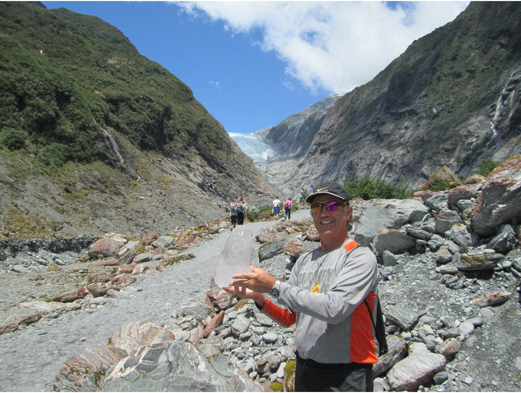
It was now, Friday, January 9th, and we were free to explore the local area and town on this day. After breakfast, we traveled a short distance to the entrance to the Franz Josef Glacier terminal moraine. There, we hiked through the temperate rainforest to the river where one had the option to hike up to the Franz Josef Glacier’s retreating ice-face. Unfortunately, it was raining and chilly, but Rocky hiked in to check it out, while the rest of the group headed back to the hotel. Thankfully, the weather cleared enough to make a great hike, but not enough to allow us to take a helicopter to the top of the glacier. Therefore, after walking 3 miles back to the hotel, Julie, Pam and A.J. joined Rocky in returning to explore the glacier’s retreating moraines and ice-face once more. The glacier has retreated over 2 miles since it was discovered in the 1800’s, but it is still an impressive, massive ice sheet, hundreds of meters thick. This time, on return to the town, we explored the local shops and made reservations for dinner in town – again at a Speight’s Ale House! After over 15 miles of hiking that day, a few drinks, and some steaks, we called it a night.
Today we would cycle further into the South Westland National Parklands and along the wild and sparsely populated New Zealand’s West Coast. However, before leaving, we were again treated to training in learning a Haka from the local tribesmen. It was great fun, and will certainly be the source of numerous pictures and movies. Then we boarded our bikes and began our 38.5-mile morning ride from Franz Josef through rolling fields to the Salmon Farm Café for lunch. The Café is surrounded by pools of salmon in various stages of maturity. After a light lunch of chowder and salads with a coffee boost, we took off again for another 17-mile long ride to the Lake Moeraki Wilderness Lodge – a quaint retreat on the shores of a small lake, in the middle of a Reserve, only a few miles from the coast. It turns out that it was originally a Worker’s Camp during the construction of the Western Coastal Highway in the 1960’s that was rescued and improved by Dr. Gerry and Anne McSweeney. They then petitioned and actioned to get the surrounding area protected and preserved from development. The area now serves as a home for many native species of temperate rainforest trees and flowers, and is home on the coast to colonies of New Zealand’s “little penguins” and fur seals. Before dinner, Dr. Gerry gave us a brief walk through the rainforest, pointing out the native species, including the massive trees that served as inspiration for the movie “Avatar”. After returning, cleaning up and having dinner, we again followed Gerry, this time into the night in the search of “glow worms”. These are centimeters long worms that glow with a fluorescence, and that are usually found making webs in areas located in overhung embankments. In the dark, the banks along the road looked like a million stars, glowing and twinkling as the breeze rustled the foliage around them.
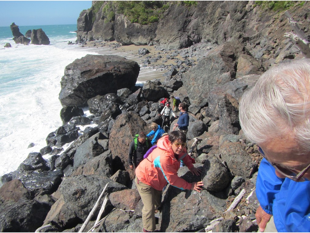
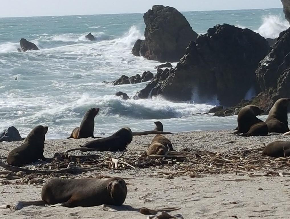
The next day, we skipped a short morning bike ride to explore the area on our own. We hiked down to nearby Munro Beach through rainforest trails to check out the nesting site of local penguin colonies, but we were too late in the season to see any remaining penguins. We wandered upstream along the glacial Moeraki River to look for the large native eels that populate these waters, and where we have the option to feed them. Finally, we returned to the lodge where there are kayaks available to go further upstream into Moeraki Lake. After lunch, Dr. Gerry took a group of us on a challenging hike through a more secluded part of the rainforest to a deserted portion of the beach, where we clambered along surf pounded rocks and avoided large waves to make our way south to a fur seal colony hanging out at a point on the shore. The seals were numerous and wary of us, but we did not get between them and the water, and so it went well. Along the way, we stopped to pick up sea urchins and to sample them raw straight from the shell and to take an afternoon coffee. The way back involved pulling ourselves 500’ vertically up with an extended rope and crude steps carved into the cliff face. It was the most physically challenging part of the entire trip, but everyone who went made it, with a little help. It was then back to the hotel for showers and dinner and the sharing of excited stories.
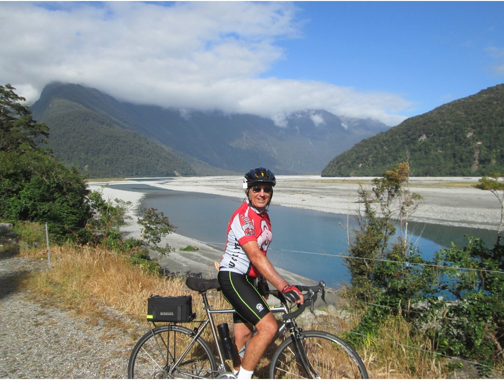
In the morning, we left the Lake Moeraki lodge early, knowing that this would be the most challenging day of the trip. Today, we would ride our bicycles from the coast, inland and uphill through the Mt. Aspiring National Park, past a series of scenic lakes, and over the Continental Divide of the Southern Alps, to the scenic town of Lake Wanaka. Our morning portion of the ride consist of 48.5 miles, with over 5000’ of elevation climbing, including a steep ascent over Haast Pass. Today, A.J., Peter and Rocky decided to tackle the challenge together. It then became clear that both Peter and A.J., and especially A.J. are “hill animals” when it comes to ascents. We all made it, however, to our lunch stop at the Makarora Café. Then, after a quick and light lunch, we took off again for the afternoon challenge of another 60 grueling miles! This time, Peter and Rocky supported each other and rode together past the pristine lakes, stopping to briefly enjoy the scenic overlooks and to keep hydrated. After replenishing their water supply, Peter and Rocky rode into the vacation town of Wanaka, and to the Edgewater Resort Hotel with their odometers reading over 110 miles of travel that day each! Of the only 6 individuals that completed the whole challenge that day, they arrived first! Meanwhile, while the boys were finishing their ride, the girls cut their ride short, and had explored the local area around the hotel, including a nearby winery. However, such an accomplishment by everyone called for drinks at the bar before our celebration dinner.

The next day was Tuesday, January 12th, and we were free to explore town or take a plane ride over the Southern Alps to Milford Sound. Again, the weather’s high winds did not permit the flying option, and we chose to spend our morning with Julie and Pam bike riding and Rocky, A.J., Peter and Nikki hiking. The bike ride was a short, but challenging 24 miles out to Treble Cone ski area and back, and the hike was a 5 mile climb up Iron Mountain with a hike back down and into town. We all met up at the hotel and walked up to Rippon Winery for a scenic lunch overview of Lake Wanaka. That night, we went back to town to have dinner at a local pub where we watched the NCAA Division 1 National Championship Game on TV. After strolling 2 miles back to the hotel, we all met up in Nikki and Peter’s room for nightcaps and camaraderie.
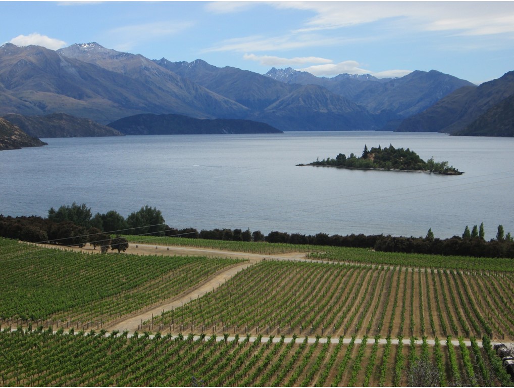
Wednesday would be our last day on bikes in New Zealand – The “Final Ride!” It would encompass a challenging morning ride of 37 miles along the Clutha River to Bannockburn and the Otago wine region. Along the way, we coasted through “Old Town” Cromwell historic district, before heading out along country roads lined with vineyards. Our destination for lunch was Wild Earth Wines, a restaurant across the Kawarau Gorge ravine, with a small suspension bridge leading to it. The restaurant is built upon the ruins of an old mining village where cables, buckets, and wash-nozzles are scattered about. Here, we loaded our bikes up onto the vans for the last time, and proceeded to enjoy a great lunch of wine-barrel BBQ and local vino, before loading ourselves into the vans for the hour-trip to Queenstown. Upon arriving in Queenstown, we checked into the Sofitel Hotel in the center of town. Queenstown is located on the waters of a large lake, and is one of the recreation capitals of the country. After checking in, one could explore the upscale shops in town, walk the picturesque waterfront, explore the local Arboretum, or take on bungee jumping from the original bungee jumping venue in the world. New Zealanders A.J. Hackett and Henry van Asch built the sport here in Queenstown from observing vine-jumpers in Vanuatu, opening this first venue in 1988. That evening we gathered in the hotel bar for a group cocktail hour, and then walked next door for a “last meal”. Everyone had been challenged and had a great time.
The next morning, some of us met Bradley for a final walk and tour through the local Arboretum and lawn bowling club. Many of the trees there were hundreds of years old, and the flowering shrubbery was fully in bloom. Then it was back to the hotel for shuttles to the Queenstown airport for our flight to Australia, and the third-leg of our adventure. As we climbed away from the runway, we said “good-bye” to the country that had hosted us for the past 3 weeks with adventure, beauty and hospitality. We will miss it!