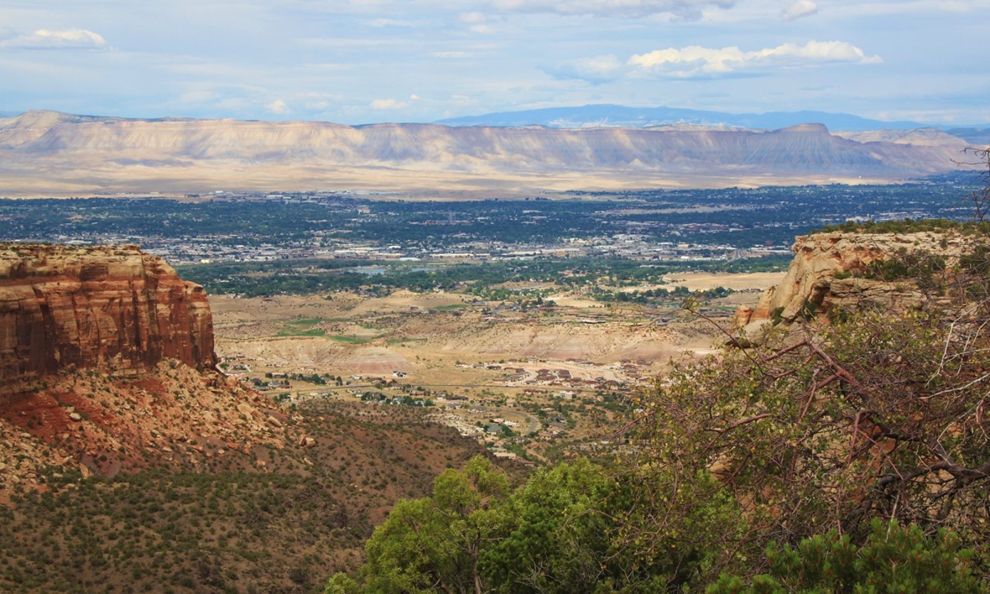
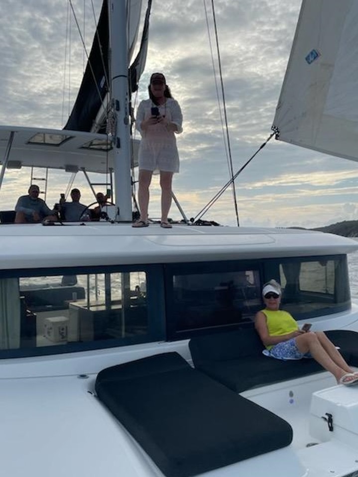
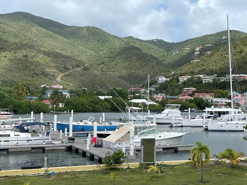
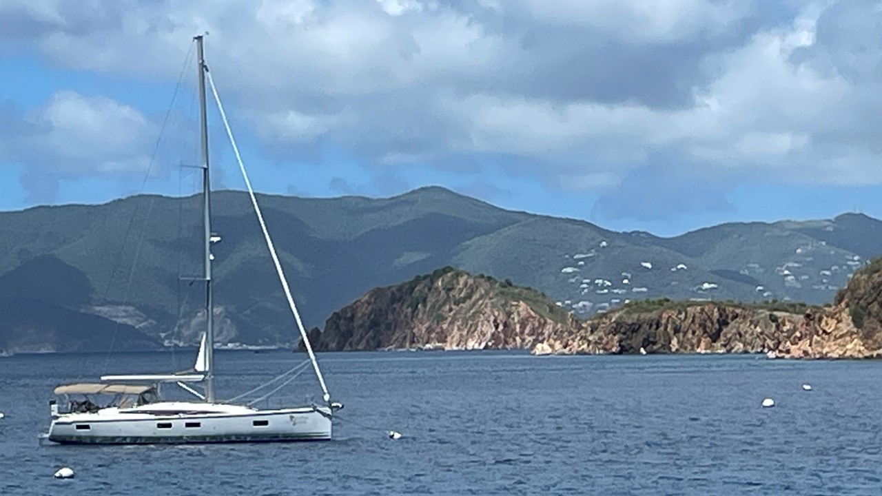
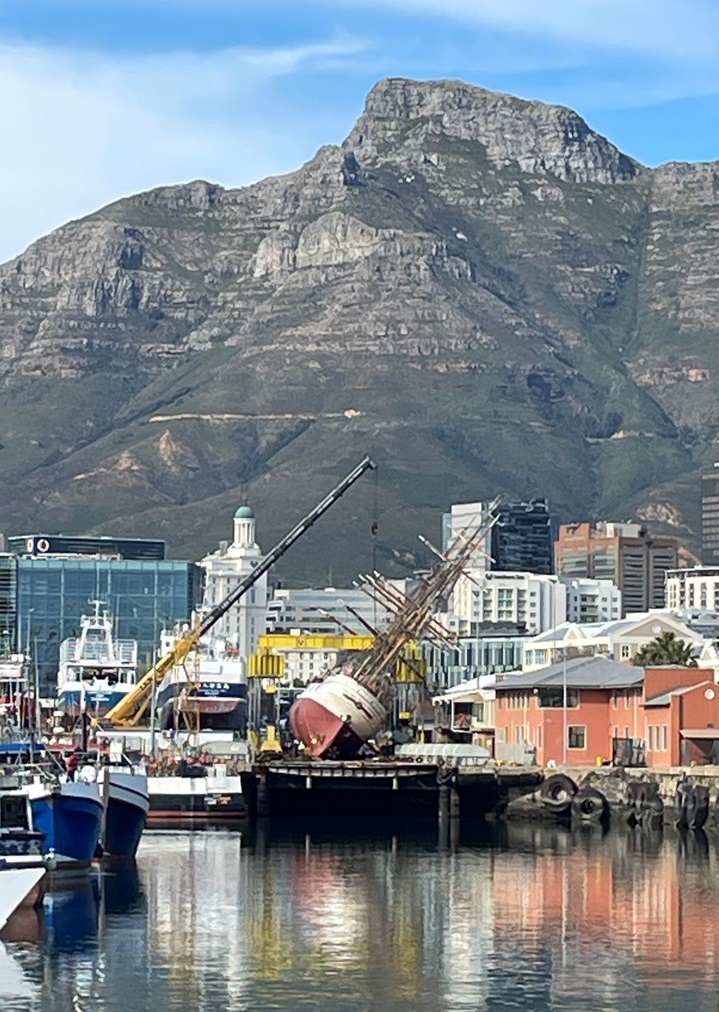
Thursday morning we enjoyed a lovely homemade feast for breakfast before a diesel motor expert arrived to fix our engine. However, after a few hours of no success, the decision was made to offer us an alternative yacht – a 46’ Lagoon Catamaran “As You Wish”. Although never having captained a catamaran before, Rocky and the crew accepted the offer and frantic packing/unpacking and movement across boats ensued. In less than two hours, and with minimal preparation, we had left the harbor, had the sails up, and were headed towards the harbor of The Bitter End.
Leaving “Paradise Found” Sailboat for the “As You Wish” Catamaran
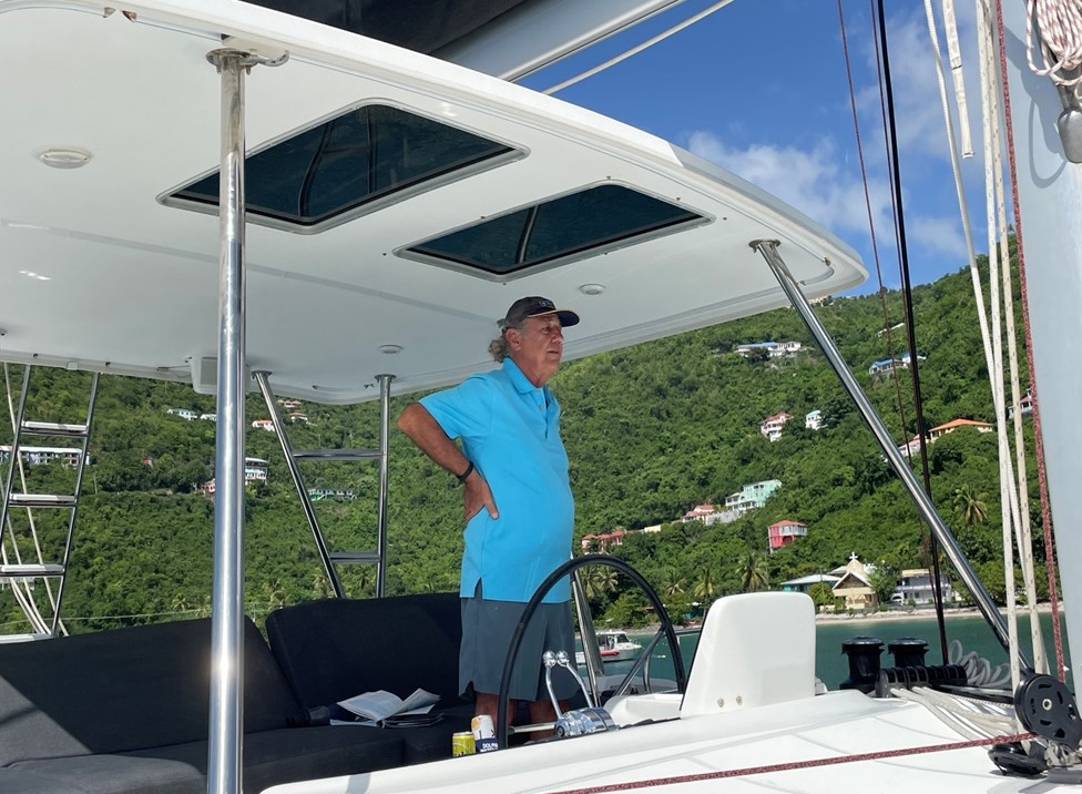
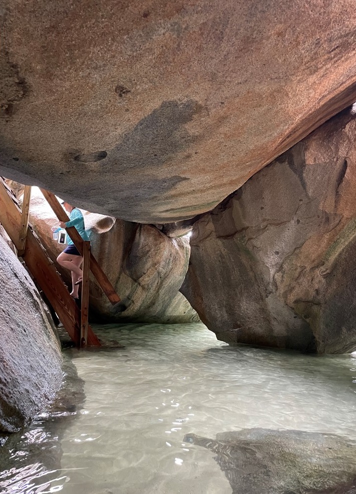
Once there, we picked up a mooring ball off the coastline of Saba Rock, a group of adventurers took the dingy to the old Saba Rock restaurant, formerly the home a fantastic place before being wiped of the map by Hurricane Irma. However, in spite of its all new construction, and the ever-present enormous tarpon jumping around, it was scheduled to open October 13th for the season, which was still a week away. Instead, the proprietor gave us a grand tour before we returned to our boat for dinner outside on our back deck, and a rousing game of cards called “Phase 10”.
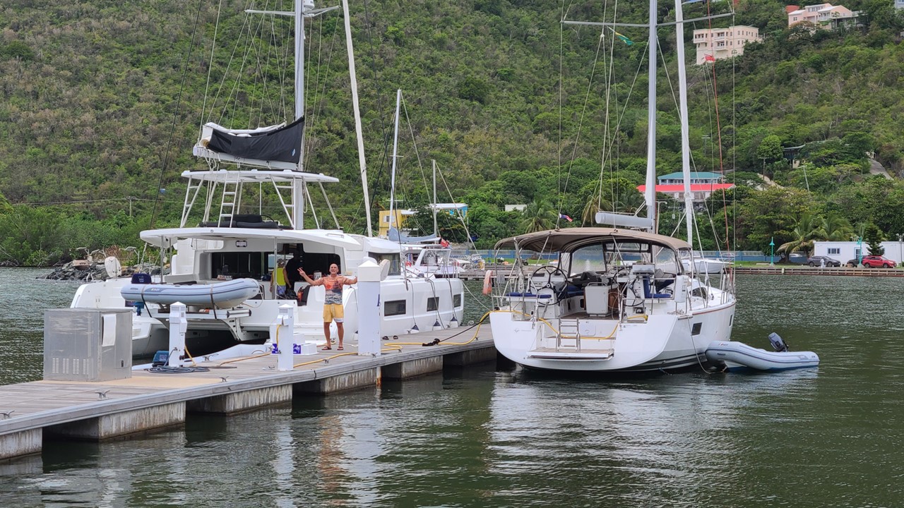
Captain Rocky at the Helm of the 46 foot “As You Wish” CatamaranThe Restaurant at Saba Rock near The Bitter End
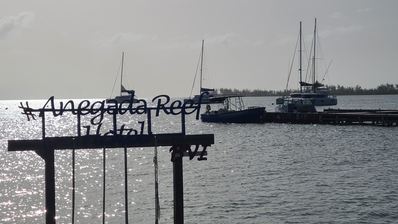
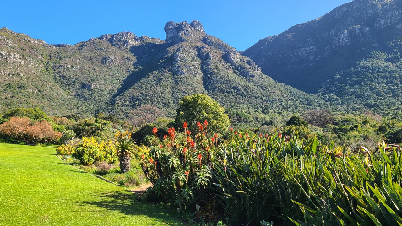
Friday morning, we were up for a lazy breakfast and then decided to explore The Bitter End Marina and town on Virgin Gorda. We took our dinghy to the Bitter End which was under massive reconstruction and also not yet open. Here too, all new construction is underway. Once upon a time, the Bitter End marina and resort town was a very “happening” place. However, it was completely destroyed on September 6th, 2017 by Hurricane Irma. Today, it was still in the process of rebuilding and is targeting a reopening soon. When getting ready to leave our mooring ball, we suffered another setback as the starboard catamaran engine would not start. We notified the Manager on Duty at the Charter Marina and they sent a local engineer by boat out to take a look. A wiry old mechanic named “Polo” showed up and resolved the problem quickly by overriding the automatic primer allowing the engine to start and filling the self-primer. While waiting on the fix, we were blessed to see a jumping, twirling manta ray. Once repairs we complete, we set sail north, setting a course for the BVI’s northern most island, Anegada, the home of some of the largest lobsters we have ever seen. The Island of Anegada is the only inhabited British Virgin Island formed from coral and limestone rather than being of volcanic origin. While the other BVI islands are mountainous, Anegada is flat and low and its highest point is only about 28 feet above sea level, earning it its name, which is the Spanish term for the flooded land, “tierra anegada”.
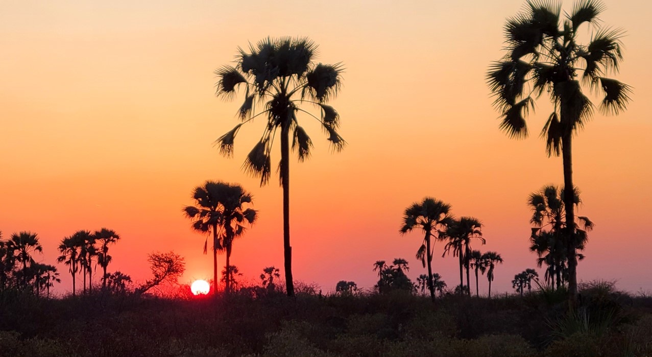
Sailing the Catamaran to Anegada
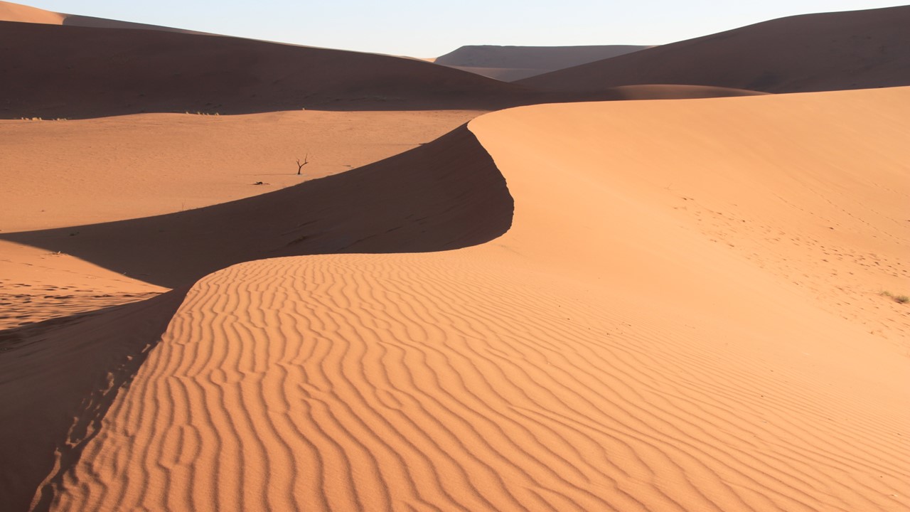
At about 15 square miles (38 square kilometers), Anegada is the second largest of the British Virgin Islands, but it is also the most sparsely populated of the main islands, with a population of 285 as at the 2010 Census.[4] Most of the population on Anegada live in the only village, The Settlement. Anegada is known for miles of white sand beaches and the 18-mile (29 km)-long Horseshoe Reef, one of the largest barrier coral reefs in the Caribbean. The reef makes navigation to Anegada by sailing ships complex. While we can freely sail among most of the other Virgin Islands, sailing to Anegada is discouraged by the Charter Companies because of the risk of running aground or scuttling on the reef. To date, the reef has caused hundreds of shipwrecks, including the large ships HMS Astraea in 1808, the Donna Paula in 1819, and the MS Rocus in 1929. Anegada is also known for the large salt ponds that cover much of the west end of the island, These ponds, which support unique fauna, were designated a protected site in 1999. In the 1830s, thousands of Caribbean flamingos lived in these ponds, but they were hunted for food and feathers throughout the 19th and early 20th centuries and disappeared by 1950. They have now been reestablished and the flamingo flock numbers are in the hundreds today.
Enjoying the Deck Space on the “As You Wish” CatamaranThe Harbor at Anegada
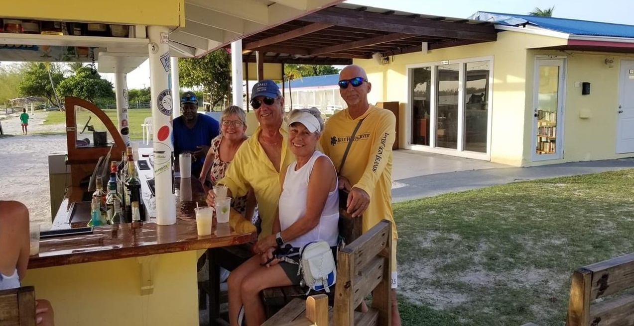
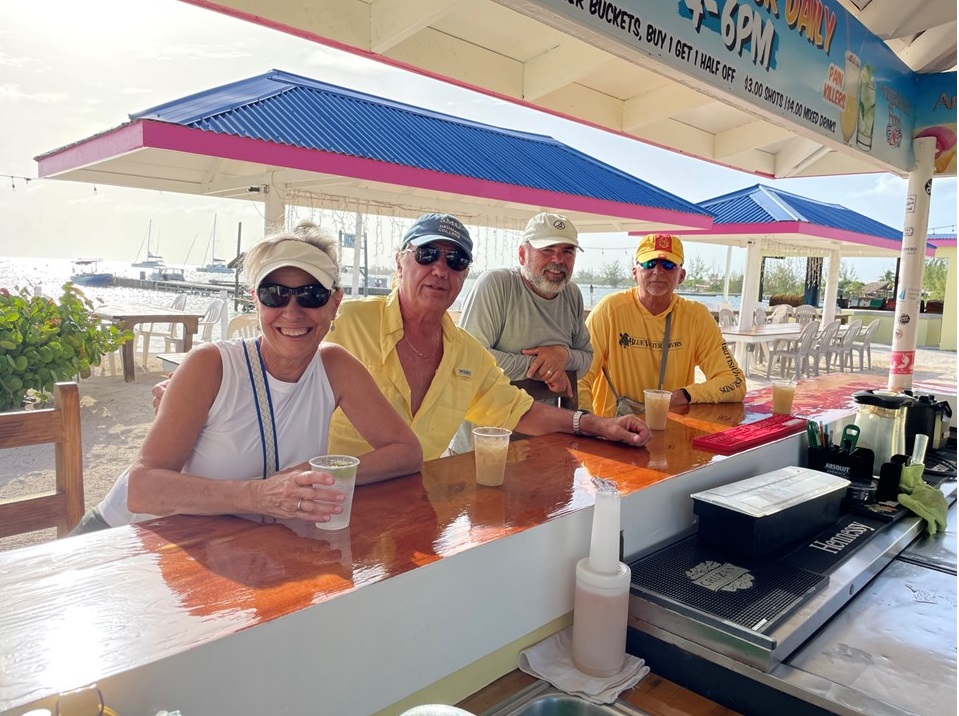
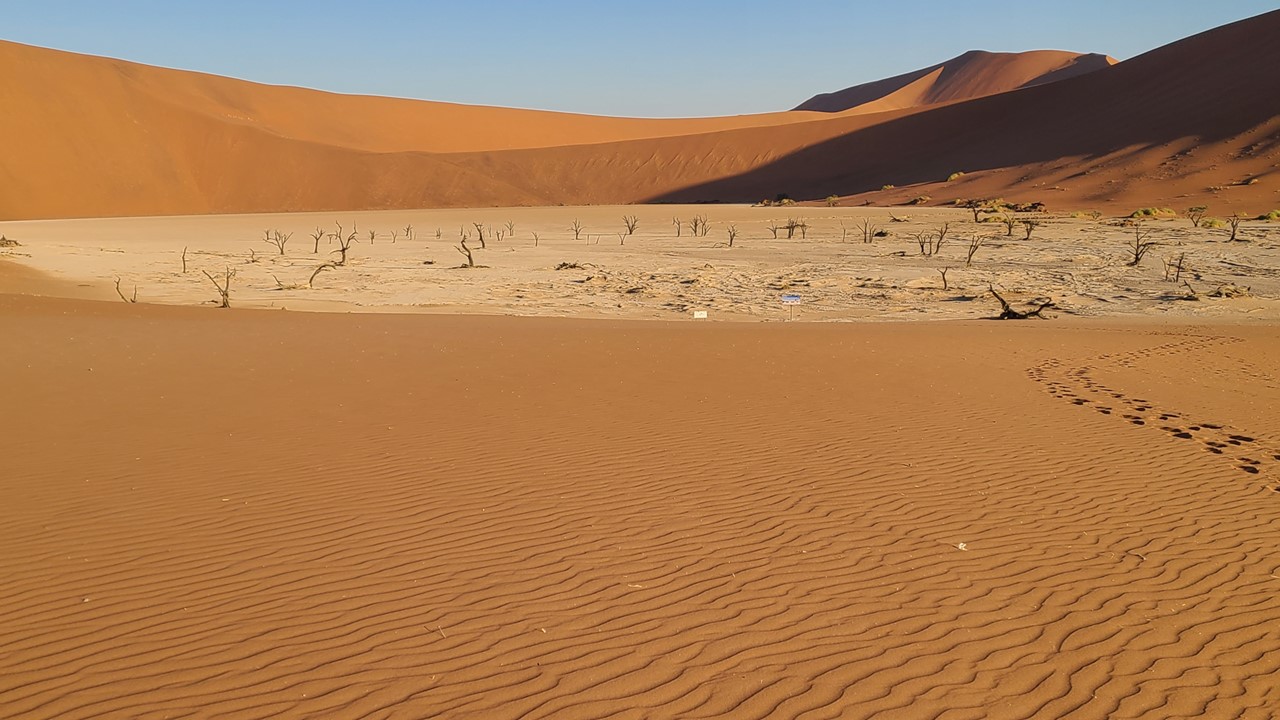
On the sail to Anegada, we tried to avoid the sargassum (seaweed), but made good time at about 8 knots. The entry to the Anegada Harbor is very shallow (8’-10’) and the only other sailing vessels that were there were six other catamarans. Once we picked-up a mooring ball, we sent a contingent to shore to explore the possibilities of getting lobsters for dinner. Unfortunately, lobsters were “out-of-season”, but the local hotel beach bar was open for painkillers and drinks for all. Juju and Craig arranged for a tour of the flamingo salt ponds, while the rest of us socialized with the locals until we returned to our catamaran for a dinner of homemade bacon-wrapped grilled shrimp and sausage, and a lively card game.
Drinking with the Locals at Anegada Beach BarJulie, Rocky, Craig and Peter at the BarVisiting the Flamingo Salt Ponds in AnegadaSunset at Anegada
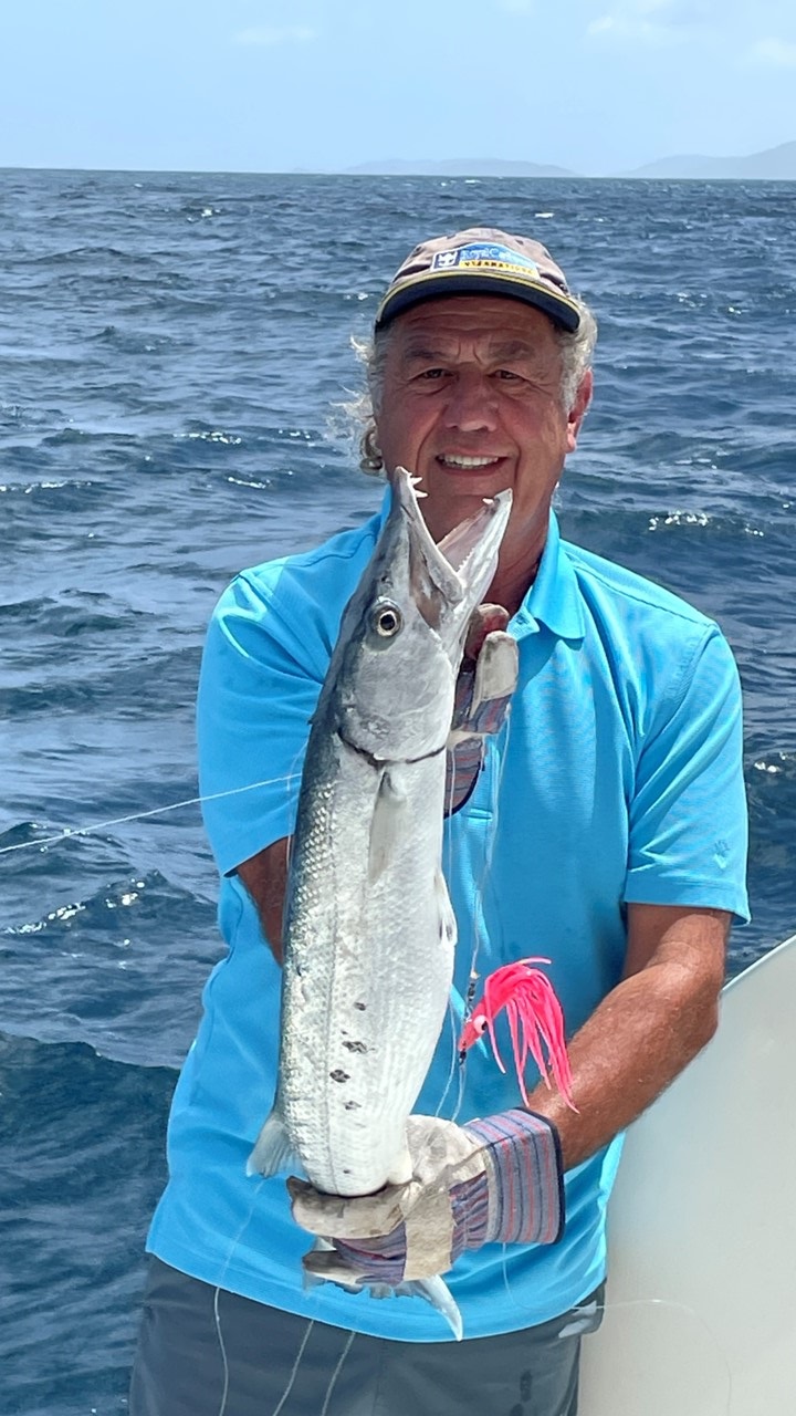
Saturday morning, we made breakfast burritos onboard before setting off to sail south-by-southeast to Cane Garden Bay located on the eastern end of Tortola. Along the way, we successfully caught a 4’ barracuda, which we cleaned, skinned, breaded, and ate, as “barracuda bites” – delicious. We arrived by mid-afternoon and after picking-up a mooring ball, headed to the local beach bar and store to purchase ice and water, a few supplies, and to have drinks with the locals. After a long day, we took it easy that evening and enjoyed the view of the setting sun.
Baracuda that becomes LunchRelaxing on the long sail back from Anegada
Part 1 – Getting settled on the monohull, “Paradise Found”
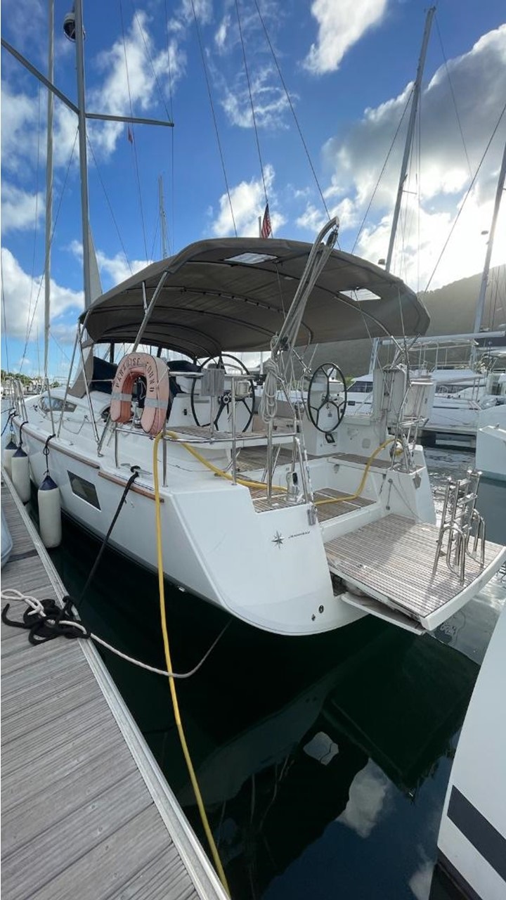
After a long break from sailing due the pandemic, (last captained out of Naples in 2019), it was time to get back to the beautiful British Virgin Islands and charter a bareboat yacht for us and friends. We decided to go for adventure and comfort, and chartered a 54’ Jeanneau monohull with 3 large cabins, (each with their own head with walk-in shower), generator, and air-conditioning, for a 10-day adventure. Our friends, Nikki & Peter, and Juju & Craig were excited to sail with us. We arrived on Saturday, a day early, with Peter & Nikki at the local Nanny Cay Resort on the BVI island of Tortola to settle in, collect provisions, inspect the boat, and meet with locals at the bar.
Nanny Cay Marina & Resort in Tortola
On Sunday, we enjoyed breakfast at the Island Root Café before completing paperwork and boarding our yacht, the “Paradise Found”. We checked all systems, unpacked, loaded provisions, and welcomed aboard Juju and Craig before heading to the famous “Pusser’s” restaurant located In Road Town. That night we had drinks, caught-up with each other, and slept aboard in harbor ready to disembark the next morning.
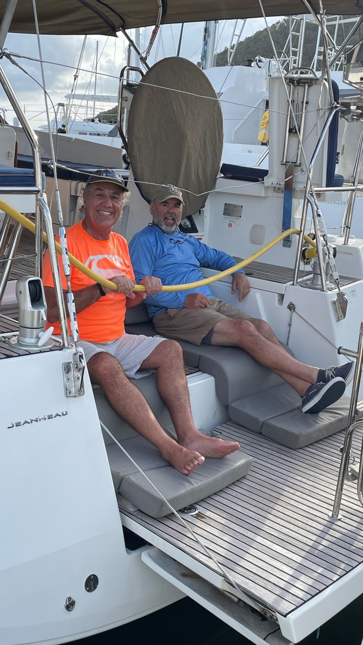
The 54 foot Jeanneau “Paradise Found”Rocky and Craig on the rear Swim Deck
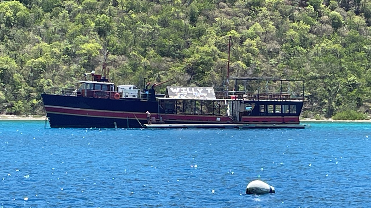
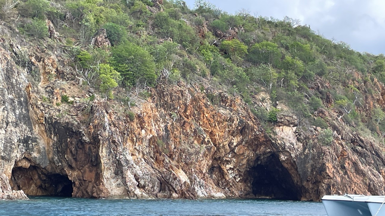
Monday morning, after a quick breakfast at the Island Root Café, we left port and sailed across the Drake Passage to The Bight, a protected harbor at Norman Island and the home of a floating restaurant, bar, and club known as “Willy-T’s”. After hitching-up to a mooring ball, we took the dingy over to Willy-T’s for lunch and drinks, We then motored around the corner of The Bight to The Caves where we picked-up another mooring ball with the intent of snorkel-exploring the caves. Unfortunately, the ocean current and wind directions and the size of our vessel made this untenable, and we soon left for other harbors.
Willy-Ts Bar & Grill at Norman IslandParadise Found on a Mooring Ball near Willy-TsThe Famous Caves where Treasure was once Found
Norman Island also has a history of pirate booty being stowed upon the island. In 1750, part of the treasure from the Spanish treasure galleon named Nuestra Señora de Guadalupe was buried on the island by mutineer Owen Lloyd. Lloyd was later arrested, but word of the treasure spread, and residents of Tortola went to Norman Island and dug it up for themselves. Part of the booty was later recovered by authorities, but much of it was not. Since then, rumors or local treasure discoveries in and around Norman Island’s caves have persisted.
After leaving Norman Island, we sailed to Little Harbor at nearby Peter Island, a private island with a distant small resort and little development. Here we anchored and enjoyed a quiet night with no other boats or people visible until morning. Several of us went snorkeling near a broken-down dock where rays, turtles, and fish congregated. That night, we grilled shrimp, salmon, and veggies on the barbecue and enjoyed each other’s company before calling it a night in our air-conditioned cabins.
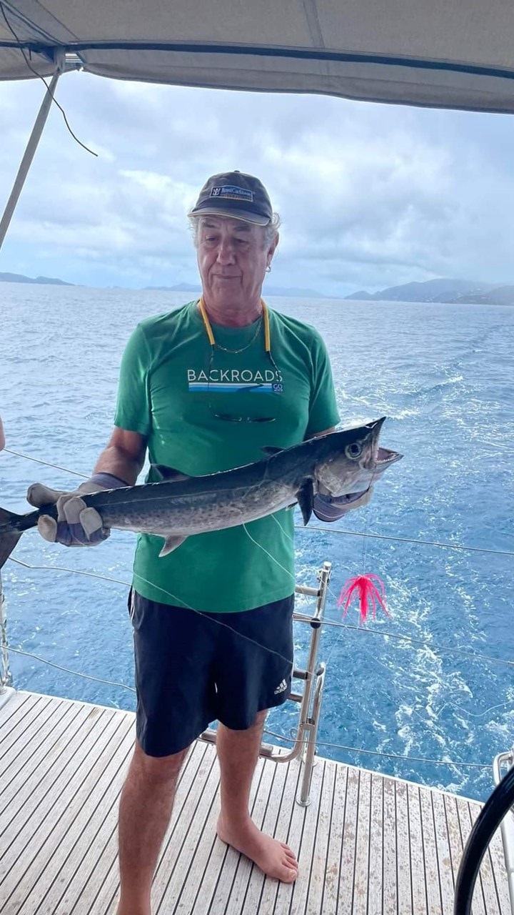
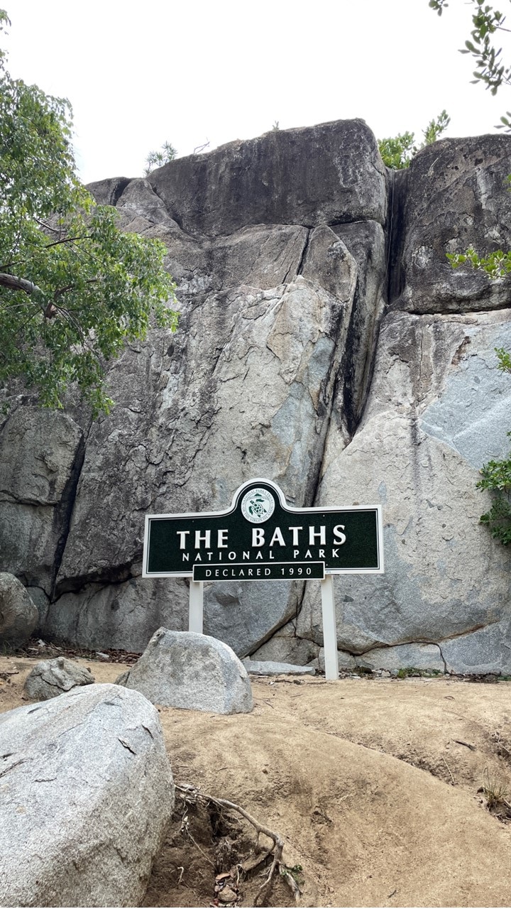
Tuesday morning, we kept an eye on the weather, and hurricane Philippe as it was skirting past us 200 miles away. After breakfast on the boat, we pulled anchor and set sail along the Drake Passage towards the island of Virgin Gorda, so named by Christopher Columbus because the island’s profile on the horizon looks like a fat woman lying on her side. Along the way, Rocky caught a 4’ King Mackerel while trolling behind the boat, which we let go. Virgin Gorda contains two of the best harbors in the BVI, and the city of Spanish Town was once the capitol of the BVI. Of particular interest is the unusual geologic formation known as “the Baths” located on the southern end of the island. At the Baths, huge granite boulders lie in piles on the beach, forming isolated grottoes that are open to the ocean’s waves. This landmark is a popular tourist attraction as well as a National Park and offers an adventurous hike/scramble through them to a trail leading up the hillside to the Top of the Baths. In order to access these from our boat, we picked-up a National Park mooring ball offshore, then took everyone via dingy to the beach’s swim limits roped-off area, and let them swim to shore. The dingy must be tethered to a mooring ball outside of the swimming area as this is the only method of access from the sea. Once ashore, we hiked to the restaurant at the Top of the Baths where we had lunch and enjoyed the view. Soon, an enormous influx of tourists showed up by bus having arrived on an excursion from the Disney ship in harbor in Road Town. After lunch, we hiked back down to the Baths and explored the trail through the granite boulders before arriving at the final beach, and swimming back to our dingy. From there, we returned to our boat and sailed to the protected harbor of Marina Cay, where we picked up a mooring ball anticipating a night of degrading weather from Philippe. Through intermittent rains, we enjoyed a dinner of salad and pasta with meatballs before our generator suddenly stopped working and would not restart. We contacted our Charter Company’s Manager on Duty, but with the winds reaching 30-knots and driving rain, it was not possible for them to come to us that evening. That night we endured high winds and torrential rains from Hurricane Philippe with no air conditioning before awakening to slowly improving conditions in the morning.
Rocky with a King Mackerel caught in the Drake ChannelThe Granite Batholiths at Virgin GordaA View from inside the Baths TrailThe Group at the Top of the Baths Restaurant
Wednesday morning it was still raining and the generator was still down. We had breakfast on-board and called back to the Charter Operator at the marina at Nanny Cay. After much discussion, we finally decided it would be best to return the boat to the marina where personnel and parts to potentially fix the generator could be readily available. In 30-knot winds, we left the safety of our mooring ball and proceeded to motor our way back to Tortola. Unfortunately, halfway there, our diesel engine displayed a sensor error, and once it was turned off would not restart. We raised the jib and continue to sail towards Nanny Cay without any power, while talking with the marina on a plan to get the yacht safely into harbor.
When just outside the harbor, the marina captain, Henry, and the Charter Company owner came to meet us and we onboarded Henry. Captain Henry sailed us into marina and landed us at the fuel dock with assistance from the support boat that pushed “Paradise Found” into position. Once safely docked, an engineer boarded to fix the engine. Since we connected to shore power, we again had air-conditioning and electrical systems. While in harbor, Nikki and Julie bought additional groceries for the boat and then went to Captain Mulligan’s restaurant for drinks and a snack. As the weather slowly improved, and since the engine had not yet been repaired, we all went to Peg Leg’s Beach Bar for drinks before returning to the boat for a dinner of spaghetti and meatballs, and a quiet night’s sleep.
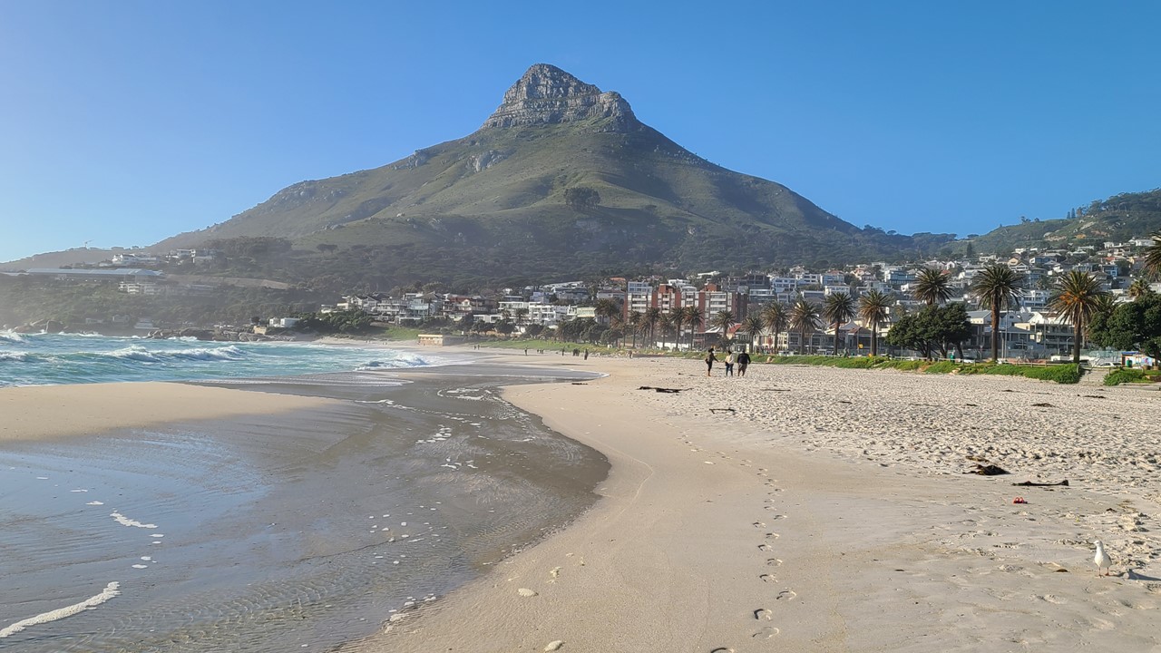
Tuesday morning, we awoke to a dreary view as it had rained during the night. Lucky for us, we have a fully stocked kitchen for breakfast and got familiar with what would be “our space” for the next week. The management restocks basics daily, (including eggs, bacon, and all condiments), and also delivers fresh baguettes and croissants to our door promptly at 7:30am. After breakfast, we did a load of laundry, made a meager grocery list, and walked to the local grocery to plan a lamb chop dinner, before exploring the nearby beach, all in spite of the rain. That afternoon, we drove to the nearest liquor/wine store to top-off our stock, (Camp’s Bay does not allow packaged alcohol sales, so we needed to head along the beach to the next town, Sea Point).
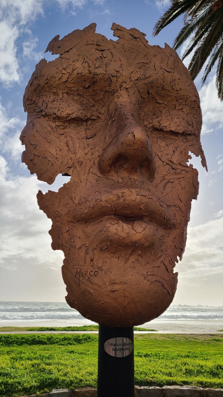
View northwest along Camps Bay Beach in Cape Town South AfricaBeach Sculpture at Camps Bay
The next morning, after breakfast, we drove to Stellenbosch – wine country – as we hoped to visit a few wineries that day. We started with Warwick Estates – set in a group of old, white-washed buildings. This is an historic farm with a coffee house and restaurant, as well as daily wine tastings. There are no crowds, as it is winter in the southern hemisphere. Here we decided to taste the “First Lady” line of wines. We started with a sparkling rose, (the “Cape Classic”), which was very nice, then a dry Rose wine, a Sauvignon Blanc, a Chardonnay, and a Pintotage (developed from hybrid grafting a Pinot Noir vine with a Hermitage vine). Pintotage wines are now a preferred blend from this area of South Africa and it was very nice. Finally, we finished with a Cabernet Sauvignon. As were tasting we were told the legend of “The Wedding Cup” which revolves around the beautiful princess, Kunigunde. She was the daughter of the King and Queen of old Nuremberg, whose hand was promised in marriage to a prince from a faraway kingdom. However, the princess wanted to marry a local, so he was challenged to build a wedding cup for her that they could both drink from at the same time. He successfully constructed one thus winning her father over and allowing her to marry her love. As we were leaving we met two women who were in the wine courier business, and who recommended we next go the Muratie Wine Estate and try their port.
So, based upon their recommendation, we visited the Muratie Wine Estate next and ordered a cheese plate. Soon, the 2 women who recommended we come here for the port showed up and joined us. However, the port had apparently become so popular that it had been removed from the tasting list. But, because these women were wine couriers, we were all promised a tasting. Muratie Wine Estate is a very old winery which has windows full of ancient, preserved cobwebs, which have been there for years. Even with the generational change in owners, the spider webs and old calendars on the wall have been left “as is”. Finally, we decided on the Premium Tasting options that included the “Lady Alice” (a sparkling Pinot Noir which was very nice), the “Lauren’s Camphor” (a white blend), the “Isabella” (a Chardonnay), the Mr. May (a Grenache Noir), the “Martin Merck” (a Cabernet Sauvignon), and lastly the port which we were promised, and which was quite lovely.
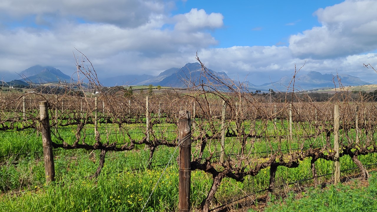
After this lunch, we drove to Beyerskloof which is considered “the home” of Pinotage wines. It is a young winery (only about 30 years old) and was not far from Muratie. After a tasting of a few Pinotage, including the Pinotage Rose, Pinotage 2021, Cabernet Sauvignon, and a Reserve Pinotage, we chose our favorite and carried on to the next vineyard. Next, we went to Simonsig – the home of sparkling wines. Rocky tasted several whites (Chenin Blanc, Sauvignon Blanc, and a Chardonnay), and a couple of reds (a Pinotage, and Cabernet Sauvignon), while Julie tasted several sparkling wines (a Cuvée, a Vonkel Brut, a Brut Rose, a Satin Néctar and a Satin Néctar Rose). After Simonsig, it was late afternoon and we moved on to Rust en Vrede Vineyards, which was recommended to us by some other travelers. It was a very old vineyard that had been modernized in the 1970’s with white washed buildings and a wonderful view. Here we did a tasting of the Estate Syrah, the Estate Cabernet Sauvignon, and the Estate 2020. This vineyard actually has solar panels on their roofs which supply 40% of their power, which is useful in a country that has rolling power rationing. Upon returning to Camps Bay it was time for a light dinner and a relaxing evening.
Stellenbosch Vineyard
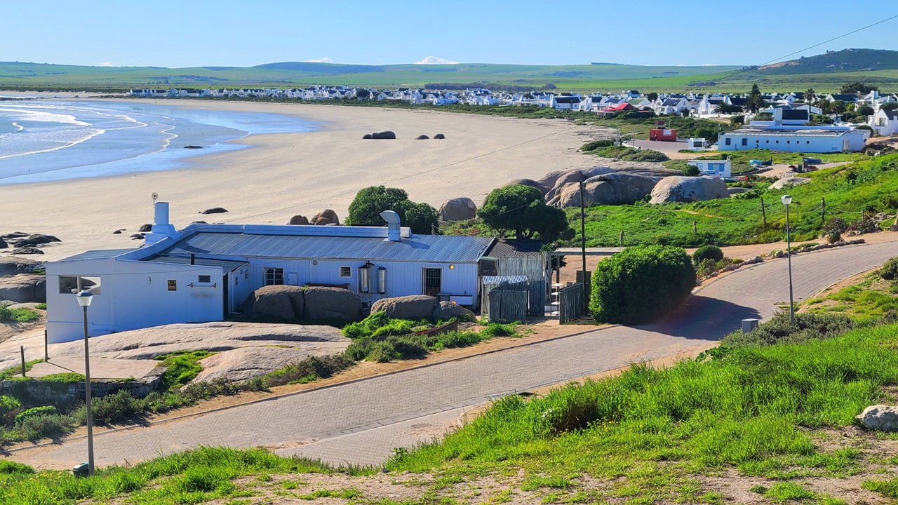
The next morning, we had breakfast before setting off northwest along the coastal road 2-hours to the village of Paternoster. Along the route, as we left the city behind, we saw farms and several nature reserves as well as the West Coast National Park. Across the landscape, we saw impalas, dik-diks, ostriches, and a few zebras. There was also an Air Force Base, sheep and cattle farms, and a massive windmill farm. Here, the landscape was green, with only a few sandy-colored dunes. Paternoster is on the ocean on a large, secluded bay, and consists of a small village of white washed cottages with blue shutters and roofs. It is often described as South Africa’s most beautiful village. It has a long wide isolated beach with large rocks at each end for protection from the surf. Paternoster means “Our Father” and was named such by shipwrecked Portuguese sailors. Hundreds of ships have shipwrecked in South Africa’s dangerous West Coast coastline over the years.
When we arrived at the beach, we were greeted by boys trying to sell us fresh mussels. We walked the long, secluded, pristine beach, past mussel-covered rocks and enjoyed the quiet and peacefulness. There was no trash and only a few mussel shells on the shore. As it was winter, there were very few people out and about. However, there was a red-roofed building on the beach, which you could see from everywhere. It is the Voorstrand Restaurant. There we met a man throwing his dog a ball and as we spent time talking, the dog kept bringing Rocky his ball to throw. He told us that the restaurant would be open later for lunch. We returned to our car and drove around the village. As it was winter-time, a lot of businesses were closed or renovating, or were on holiday. It was chilly out, but the sun was shining and the people were friendly and hospitable. We checked the local hotel to see its famous “panty bar”, but the bar was not open. The local art galleries were also closed but a few souvenir shops were open and we visited and shopped. The town started to come to life around 2pm, and we went back to the Voorstrand Restaurant for lunch. It was not a big place but they have a large, covered patio on the beach with a great view, so we ordered gumbo, a hake fish plate, and a snack plate with mussels, prawns, samosas, calamari, and oysters. It was a feast, the food was delicious, and the atmosphere was the best. By the time we left, the restaurant was full of guests – a very enjoyable lunch. Eventually, we headed back to Camps Bay.
Beach at PaternosterTable Mountain above Cape Town
Once back to Camps Bay we walked along the beach and then enjoyed sundowners at the hotel’s pool deck. The night’s special drink was a “Plumosa” (tequila, grapefruit/lemon juice and sparkly wine) which was very refreshing. The pool was heated but since it was winter, no one was swimming.
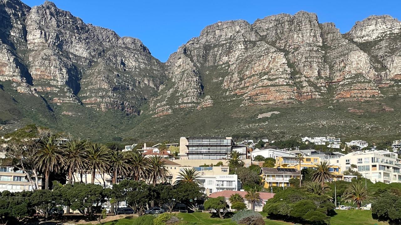
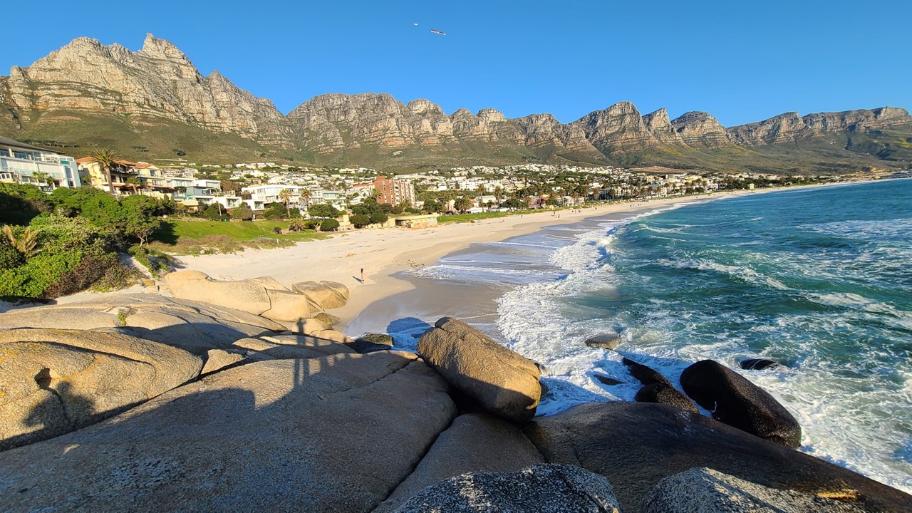
Camps Bay beach and 12 Apostles (mountain peaks) looking southeast
The next day we drove the Beach Road to The Victoria and Albert Waterfront, specifically to the V&A Wharf Shopping Center. It is a three-story mall with parking underground, with a major grocery store on the ground level, and retail stores above. We window-shopped for a while before heading out onto the wharf. Along the wharf, we walked among old warehouses that had been converted to shops. There were also sightseeing boats that one could book, and lots of restaurants. But this is also a working wharf with drydocks and marine yards scattered among the tourists, with boats going to Robbin Island, boats being repaired, and with wharf improvements all taking place. We went to the clock tower, and saw seals swimming in the dock area near the ferries. We finally stopped at Quay 4 for lunch having gumbo and the best fish and chips ever! Rocky ordered a Castle beer and received the beer with a scratch off card for a “beer lottery” chance! However, his card said “Sorry”! We eventually found some souvenirs before heading back along the Beach Road to our place at Camps Bay. Later that afternoon, we took a walk on the beach looking for beach glass and watching the local youth team practice their rugby skills.
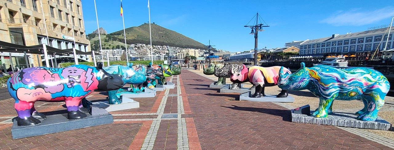
Working shipyard at the Victoria and Albert WaterfrontPainted Rhino art for sale
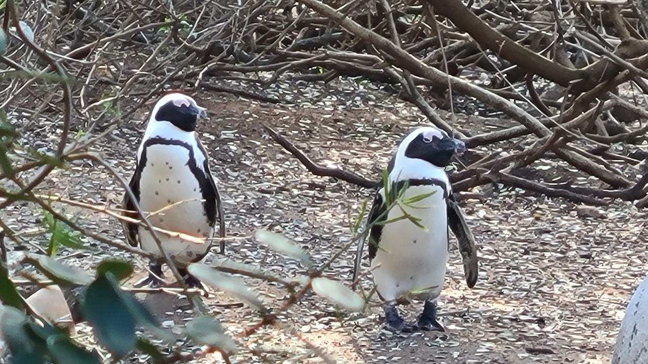
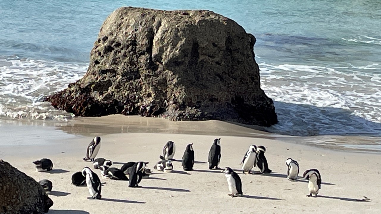
Saturday morning, after breakfast, we decided to drive around Table Mountain to the Boulders Penguin Colony located about an hour away on the East Coast of South Africa. This colony of African Penguins live in a sheltered cove of massive boulders and within a dense thicket of mangroves in a residential area south of Simon’s Town. The African Penguin once numbered 1.5 million (in 1910) but was down to just 2-breeding pairs by 1982. The uncontrolled harvesting of penguin eggs and commercial fishing nearly drove them to extinction. However, once pelagic trawling was eliminated in False Bay, an increase in the pilchards (herring) and anchovies supply helped the penguin population recover. The penguins are now part of Table Mountain National Park and the area is full of thick brush for nesting and recent estimates put the population of penguins at 2200-2500 – significantly larger than our during our last visit here 13-years ago. We saw penguins nesting in holes and under bushes, sheltering their downy newborns. There were also young juveniles – the “blue” baby blues – so named because when they lose their baby down, it is replaced with an initial waterproof, dark blue-grey plumage. There were large groups of penguins on the dunes and other groups in and out of the water. There were many swimming to a large flat top rock offshore and then hopping to the top of the rock for a little sun before coming back to shore. One of their biggest enemies is the Kelp Gull, which likes to steal the eggs and attack very young chicks. We walked the boardwalks at Foxy Beach watching enjoying the penguins’ antics. We also climbed some of the large Boulders at Boulders Beach. Afterwards, we drove the beach road south to Miller’s Point where we spotted a whale out in the surf, occasionally surfacing – just like we had seen during our visit here 13 years ago. Our drive back to Camps Bay took us along the beach road through Simone’s Town then Houk Bay before crossing over and around the edge of Table Mountain. Once in Camps Bay we headed to a restaurant named “Primi” for a late lunch of zucchini sticks, pizza, and wine.
African penguins at The Boulders ColonyThe Boulders Penguin Colony near Simons Town
Sunday morning after breakfast, we decided to take a leisurely drive and head to a very historic area called “Constantia”, where there were lots of older residences with a bit of land, as well as a few local wineries. We went to see the “Groot Constantia Wine Estate” which was founded in 1685 by Jan van Riebeeck who had been sent here to establish a “replenishment station” for ships heading to the Far East. Instead, he started a vineyard. Fast forward to 1792 when the first restoration took place, and then to 1885 when the estate was sold in public auction to the government. In 1925 there was another major restoration due to a fire, and this time it was meticulously restored. Finally, the government turned over the farm/estate (~170 hectares) to a private trust in 1993. Since then it has been run as a profit-making business with the grounds open to the public. As we entered the gates we saw people walking and jogging among the vineyard groves, as well as numerous people heading to the two different restaurants on the grounds for Sunday coffee, hot chocolate, donuts, or a full breakfast. There were children in the yards playing ball and families feeding the ducks in the ponds. The buildings (the Manor House, the Vineyards, the Cellars, and Gift Shop) were all open and busy. We heading to the tasting room, which was very quiet at this early hour, and settled on a 5 wine tasting, including a Sauvignon Blanc, a Rose, and several reds. We really enjoyed the Cabernet Sauvignon 2020, and the Gouverneur’s Reserve (red) 2019. We had an excellent wine guide, Abram, who was a delight to converse with and very knowledgeable and curious. We also had the opportunity to taste the Grand Constance 2018, a lovely sweet but smooth desert wine. We finished the morning purchasing the desert wine and parting with 2 wine glasses as a gift and memory of the day.
Monday would be our last day in South Africa and we started with a leisurely breakfast. Our suite has a 2-burner stove, an oven/microwave, a fridge, and freezer, with the fridge being fully stocked daily, (eggs, bacon, salmon, cheese, fruits, OJ, almond milk, yogurt, granola, etc.), plus fresh croissants and baguettes. We have gotten very spoiled. We completed our final packing and loaded the luggage into the car’s boot. We checked out of our accommodations and said “goodbye” to Camps Bay – still one of our most favorite places to visit. We have a few hours, so we head to the world-renown “Kirstenbosch National Botanical Gardens”. It is probably one of the most spacious and beautiful gardens we have visited as it encompasses many different types of gardens, many of which are built into the eastern slopes of Table Mountain. They even boast a yellow version of the “bird-of-paradise” plant that was developed in honor of Nelson Mandela. After 2 1/2 hours visiting the conservatory, many, many gardens, and even an elevated canopy tree walk, it was time to head to the airport where we turned in the car and ran into teams of rugby players, teams of net ball players (as the Netball World Cup is going on in Cape Town), and other foreign travelers from England, Saudi Arabia, and the USA.
The Kirstenbosch National Botanical GardensThe yellow bird-of-paradise hybrid in honor of Nelson Mandella
Our long flight home is uneventful as we return from another great African adventure..
We were welcomed at the Gröotberg Lodge and were shown to our stone cabin located on the hillside. Unfortunately, the cabins had no way to be heated or had any electricity, phone, or Wi-Fi. After returning to the reception area, we found a “charging room” near the dining hall where we could charge our devices and where limited Wi-Fi was operating. There were sofas, chairs, and blankets since this area was also not heated and it really was the only place to gather and relax. We drank hot tea, charged our electronics, and ordered a bottle of red Shiraz for warmth and for dinner. Dinner was eaten while we were bundled in our coats, but consisted of an excellent steak with yams, rice, and peach gingerbread pudding. The chef came and talked to everyone and then we went off to bed for a well-deserved rest while the winds continued to howl!
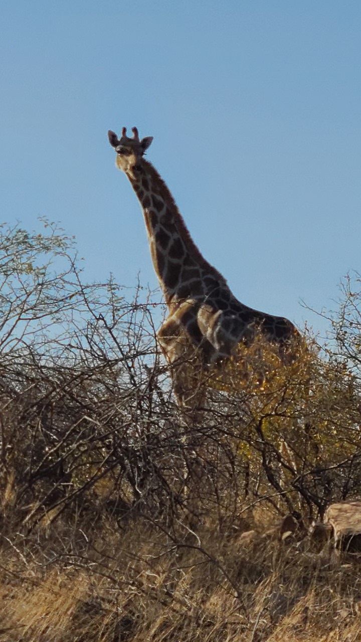
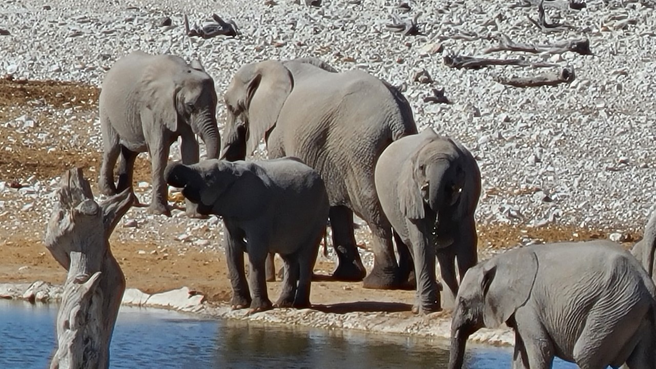
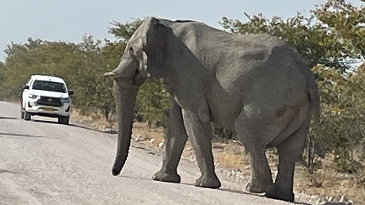
After snuggling under the covers in our warm beds all night to hold off the cold on the mountain, we were up early breakfast, and then we started down the mountain to go to Etosha National Park. The roads remained gravel for a ways, but travel was easy. Along the way, we saw giraffes and springboks, and since we arrived early, we decided to drive past our lodge and travel straight into the southern entrance of the National Park at the Anderson Gate. Soon we were among herds of giraffes, blue wildebeests, springboks, zebras, ostriches, oryx, and elephants. We found ourselves having to stop often for animals crossing the road. At the Aus waterhole, we saw 12 elephants, red hartebeests, black-faced impala, zebra, and a dik-dik. Then, along came another herd of elephants and some kudu at Oilfantsbad water hole. Lastly we stopped at the Gemsbokvlakte water hole to see more black-faced impalas, springboks, ostriches, and blue wildebeests. Throughout the day, the weather improved considerably, and by afternoon it had warmed up to nearly 70 degrees F.
Lone giraffe near Anderson Gate entering Etosha National ParkElephant family getting water at Etosha National Park
Finally, at 3pm we made our way back to the Anderson Gate park entrance. To exit we had to show our day’s pass and allow our vehicle to be inspected for any contraband or smuggling! While in the Park, no one is permitted to exit their vehicle except in very controlled, designated spots. We later learned that one of the items that the park is searching for is red meat and that no one is allowed to leave the park with such items.
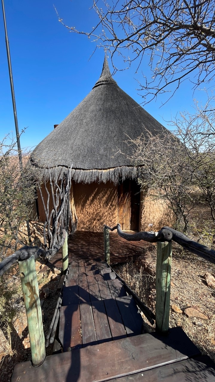
We went to our lodge where we would be staying for the next 2 nights – the Etosha Oberland – located a short ways outside of the southern park gate. The drive through the property’s entrance gate and through its reserve included 22 speed bumps created by placing 4-inch thick ship rope across the ground. The lodge was comprised of 20 chalets each with its own view of the reserve and totally private. Our chalet was spectacular and consisted of 3 large rooms: a bedroom, a sitting room/bar area, and a bathroom, all overlooking the game reserve with sliding glass doors in every room. Since strict privacy is ensured, there is also an outdoor shower for those who wish to shower with nature. After settling in and unpacking, we went to the lodge for sunset drinks, taking our binoculars to watch the springboks, the blue wildebeests, the birds, and the kudos all coming to enjoy the local watering hole. The lodge/reserve reports that they have 6 rhinos on the property and we hope to eventually see one. Then, it was time for dinner, nightcaps, and a comfortable bed.
Our tented chalet at the Etosha Oberland Lodge
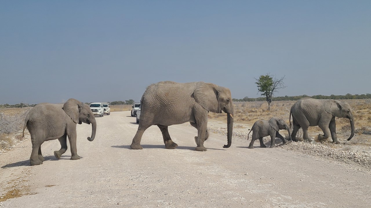
Thursday morning started with a lovely made-to-order breakfast while overlooking the lodge’s two watering holes. After breakfast, we drove ourselves back to Etosha Park’s entrance to explore areas further east in the park. Once back into the park, we saw zebras, springboks, ostriches, and several giraffe before reaching the Homob waterhole. Here we saw large herds of springboks, wildebeest, and zebra. We then drove along Rhino Drive, but saw no wildlife there. Once back to the main road, we continued east to the Noniams waterhole, but again saw no animals. However, this part of the park was much hillier and boasted many more trees. Adventure awaits those who seek it and we proceeded to the Goas waterhole. Here there were herds of black-faced impala, springboks, zebras, & oryx. Since we were driving a large loop we eventually turned back toward the park entrance and stopped at the Nuamses water hole to observe 2 lonely impala. Then, while heading towards the Etosha Lookout we saw a Honey Badger digging under a tree looking for insects to eat. At the Etosha Lookout the road runs out into an enormous pan where one has a 270-degree view across the pan. From here, one can see animal tracks along a vista that goes on as far as one can see. Once we returned to the main road, we came across a cheetah stalking something from under a tree. There were very large herds of zebras, wildebeests, and springboks in this area. Then, along the side of the road, we came across two zebra fighting and a couple of dozen ostriches. At the Rieffontein waterhole, there were more zebra herds, impala, and oryx hanging out. We proceeded to the Salvadoran waterhole where there were more springboks and lots of birds, including the bronze wing courser. The following 2 waterholes that we visited, (Charitsaub and Sueda), were filled with springboks. Back on the main road we saw ostriches and then several Kori Bustards – a very large brown bird. Then, a family of elephants appeared and we stopped to watch as they crossed the road right in front of us. It was getting late, and we headed back to Anderson Gate, where we had a final sighting of another oryx before reaching the lodge.
Elephant herd crossing the road at Etosha National Park
Back at the lodge, we enjoyed sundowners, watched animals visit the watering hole, and left to return to our room to shower for dinner. On the way back to our room, we startled a group of wildebeest who were grazing near the walkway. Their snorting told us that they were not happy we were there. The night we enjoyed a lamb dinner while watching kudu and springboks visit the waterhole before heading off to bed.
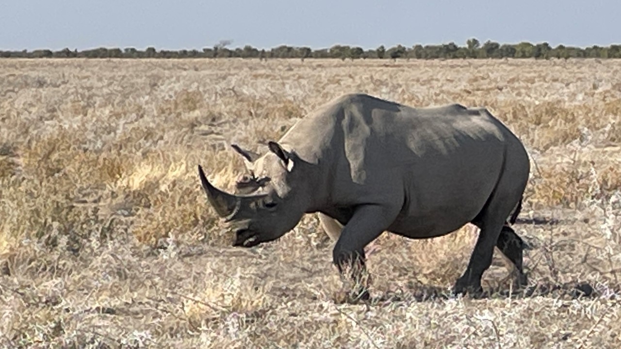
The next morning, we checked out of Oberland Lodge after a lovely breakfast while over-looking the water hole. The drive to our next lodge will take us east from Etosha’s Anderson Gate across the park to the Namutoni Gate located at the far eastern end of the park. As we start our drive springboks and kudos run in front of our car, and then, as we travel across the park we see more springboks, giraffes, zebras, wildebeest herds, ostriches, and an eagle in the tree. A short distance later, we came upon a huge Black Rhino grazing off on the side of the road. As we stopped and watched, he made his way close to our vehicle, until he crossed in front of us and continued on his way. The drive this morning is an endless parade of animals with more black-faced antelopes, wildebeest herds, and red hartebeest herds. Then, we spot 3 large bull elephants on the move, eating grass along the way when they too decide to cross the road in front of us. Next, giraffes and Kori Bustards are sighted. We route ourselves to the Springbokfontein, Batia, Ngobib, and Kawkheuwel watering holes and see plenty of wildebeests, springboks, zebras, black-faced impalas, and a Southern Yellow-billed hornbill. Driving on we saw a Southern Pale Chanting Goshawk, several families of giraffe, and at the Chudop watering hole, we saw kudus and warthogs.
Black Rhino at Etosha National ParkElephant matron crossing the road in Etosha National Park
At the park’s eastern gate is located Fort Namutoni, now a national monument that was originally built in 1896 as a German Police Post and a veterinary control point. Later, the fort was used by the Germans to hold English prisoners during World War 1. Leaving Namutoni Gate, we head to the Klein Namutoni waterhole where we see kudu, impala, wildebeest, zebra, red hartebeest, and guinea fowl being stalked by a jackal.On final road to Onguma Camp we see wildebeest and zebra and a Bradfield Hornbill.
Upon arriving at our next lodge/reserve – the Onguma Lodge – located immediately adjacent to the park, we received a welcome drink and orientation talk. We are assigned tent #1 with a great view of the watering hole which is only a few yards away. We can even observe the watering hole from our bed. The Onguma Tented Camp was originally built in 2006, and includes 5 other camps on the reserve of ~32,000 hectares of land and desert. There are only 7 tents in this camp. “Onguma” in the local Herero language means “the place you don’t want to leave”. The reserve’s 36,000 hectares were purchased in 1994 and has several accommodation locations on the reserve, each with their own waterhole. In 2001, 6 rhinos (white & black) were gifted to the reserve. There are also elephants and lions, at least one leopard, and herds of common impala on the reserve. Being located next to the park, it is impossible to constrain many animals, including rhinos, elephants, lions, and leopards, to stay within their designated areas. There are also palm trees on the property, although they are not indigenous. It is likely that the seeds were carried by animals from Angola located to the north. Palm trees are popular for vulture nests, (they lay only 1 egg which then the parents incubates for 48 days).
In the late afternoon we headed out for a game drive with the lodge’s guide. Yesterday, there had been a lion kill of a baby giraffe and now the lions (a pride of 9) are laying under a tree resting and protecting their kill laying nearby. We watch the lions which include one large male, 5 females, and 3 younger male siblings. Eventually, they stretch and start strolling around. However, it is getting dark and near time for sundowners, and it is not safe to be out among the pride at night. We need to find a place away from the lions before watching the sunset and enjoying our gin & tonics, but first we must encourage the lions laying in front of our vehicle to get up and move.
Young male lion at Onguma Reserve
Due to the camp’s remoteness and the proximity to dangerous animals, everyone is required to have an escort after sundown to and from their tents, and we gladly are escorted from our tent to the lobby/dining area. After a 4-course dinner we had a nightcap at the camp fire site with the camp photographers (who were from the Netherlands). Then, it was to bed to be ready for an early morning Etosha game drive. That night, we were kept awake for hours by lions located nearby roaring and calling each other – seemingly very close.
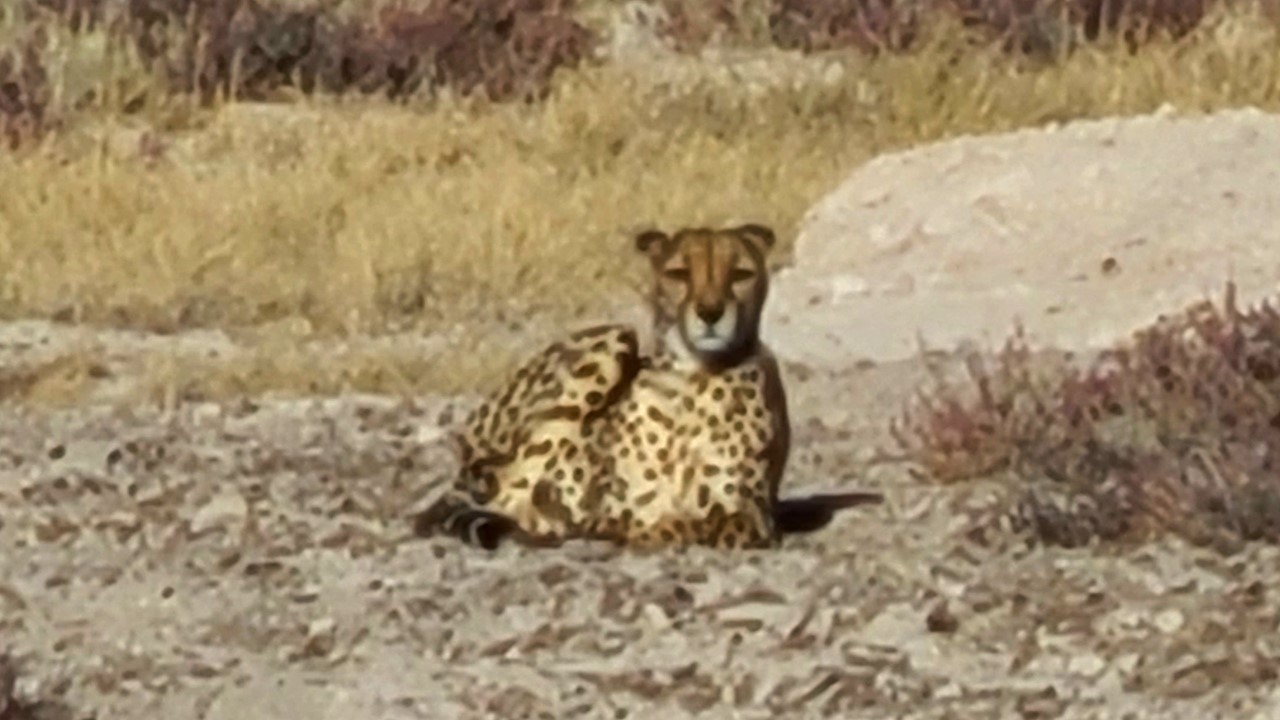
Saturday morning was a quick and early breakfast so we could leave for an early morning game drive. We started on the Onguma Reserve, spotting 3 lions hunting wildebeest – however, they were somewhat lazy and were not close to success. Then the young male lions decided to stalk a springbok – also without success. We then drove into Etosha Park, where giraffes had taken over the road. After they moved on, we saw a cheetah sunning herself on the warm gravel limestone. We then observed a lion alone at a waterhole. Further along, we spotted a brown hyena limping across the pan with a family of 3 giraffe watching warily. Finally off in the distance, we spotted a White Rhino crossing the pan towards a brushy “island” outcrop. While driving to the opposite side of the pan to see the rhino, we came across a brindled gnu and a banded mongoose. We also saw a dik-dik, numerous giraffes, zebras, springboks, impalas, and wildebeest in abundance.
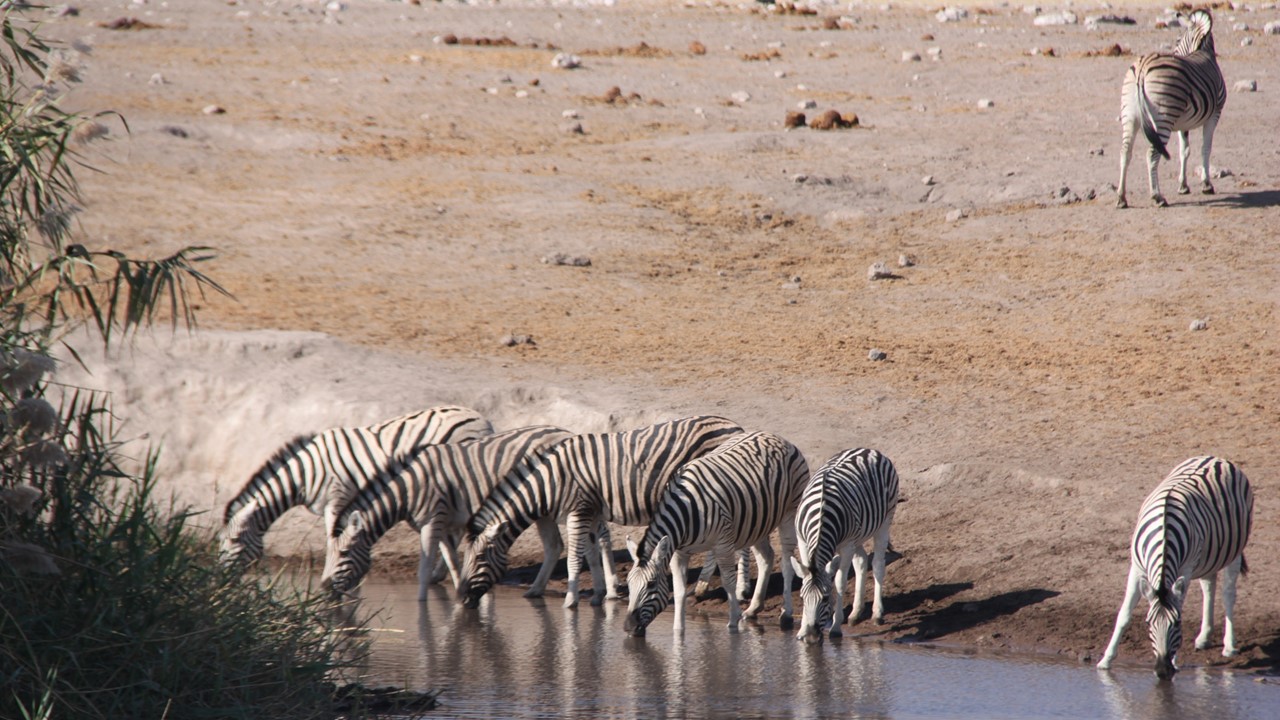
Lone lion stops for a drink or water near the Fort Namutoni GateYoung Cheetah at the eastern end of Etosha National ParkHerd of zebra at the watering hole in Etosha National Park
After the game drive, we returned to camp to enjoy the view over the waterhole from our deck and to relax. The impala and warthogs made their appearances there before we went to the restaurant and had a light lunch. After lunch, we relaxed for a short time until it was time for a sunset game drive through the Onguma Reserve. There we spot a bull elephant wandering along and then 2 lions (a male and female) laying under a tree napping. After watching them slumber, we came across kudus, oryx, warthogs, dik-diks, a Kori Bustard, and a grey heron all at different watering holes. We then saw a vulture nest in a palm tree (with a vulture feeding a baby in it), an owl (juvenile and then his mother) in another palm tree. He was pale and light colored while she was big and powerful. Then, it was time to find our sundowner spot for drinks and nibbles before heading back to camp for a delicious dinner overlooking the waterhole which was calm and quiet. Once we were in bed, the lion’s roars began again, but this night, they were far away.
Warthogs at our camp at Onguma Tented Camp watering holeSunset at Onguma Reserve
Sunday, we were packed and ready to drive the 6 hours south, back to Windhoek. But, before leaving, we enjoyed a dish of Royal Eggs Benedict for breakfast. Once leaving the reserve and getting back to the highway, the rest of the journey was on paved asphalt roads and we made good progress, only stopping twice for diesel fuel. Our GPS was working and we had written instructions that got us to the car depot around 2pm where we met by Marc who took possession of the vehicle and drove us to the Omaanda Lodge for our last night in Namibia. Omaanda Lodge is located on top of a hill outside of Windhoek, in an animal reserve of 9000 hectares, with no other ranches or houses in sight, and fairly close to the Windhoek airport. Our hut is a concrete round massive bedroom with a balcony overlooking the reserve where we can see a water hole in the distance that has impala surrounding it. Our room has a large bath with a fireplace between the bedroom and the tub. We watched the sun set from the pool bar, before having a dinner of Oryx steak with a delicious jus, grilled vegetables, and potato cake – absolutely the best oryx dish we have ever had! Then we returned to our toasty-warm room, where a fire in the fireplace had been lit, and relaxed for the night.
Our cabin at the Omaanda Lodge in Windhoek
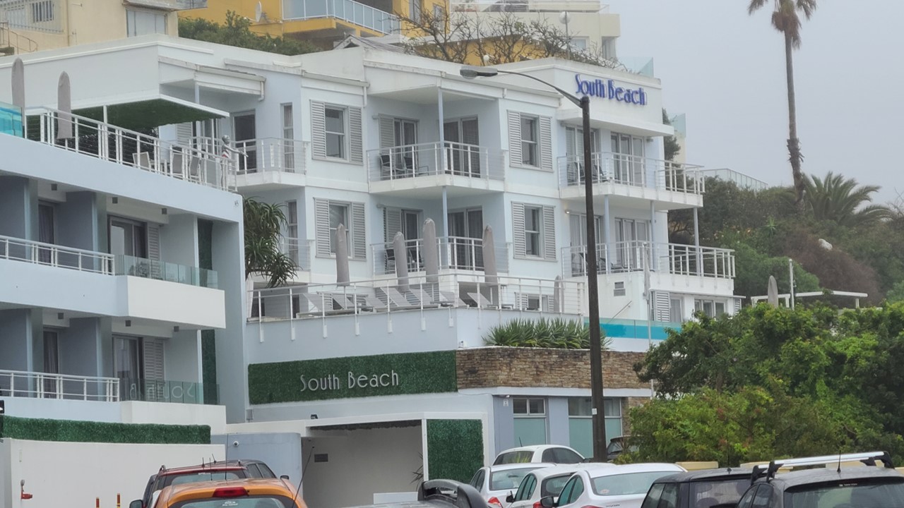
Monday morning, we had a poached egg breakfast, checked out of the lodge, and were transported to the airport where we caught a plane to Cape Town, South Africa. We had lunch aboard the plane before arriving in Cape Town in the late afternoon, where we picked up another rental car and made our way to Camps Bay South Beach – the location of our hotel. The traffic was terrible and we arrived at the hotel, which was located across the street from the beach, after dark. After checking into our lovely apartment with a view of the beach, we cooked a light snack and relaxed for the rest of the evening.
Our beachside accomodations at South Beach, Camps Bay, South Africa
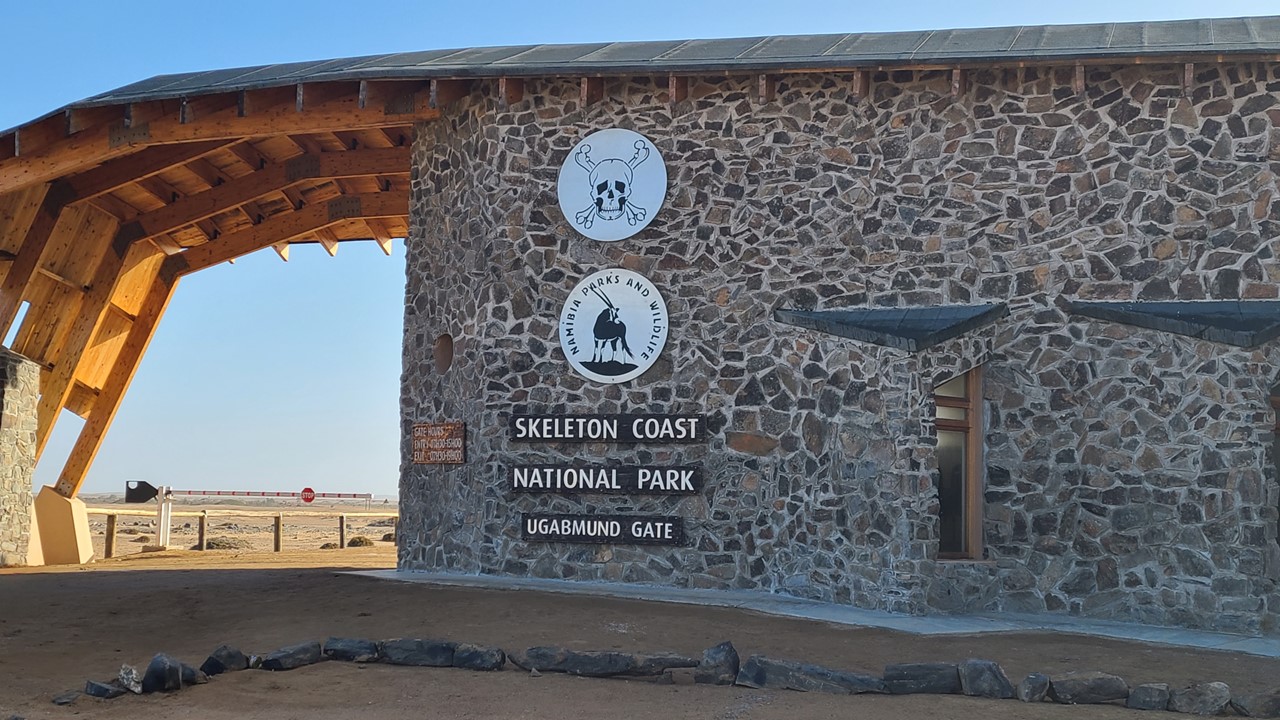
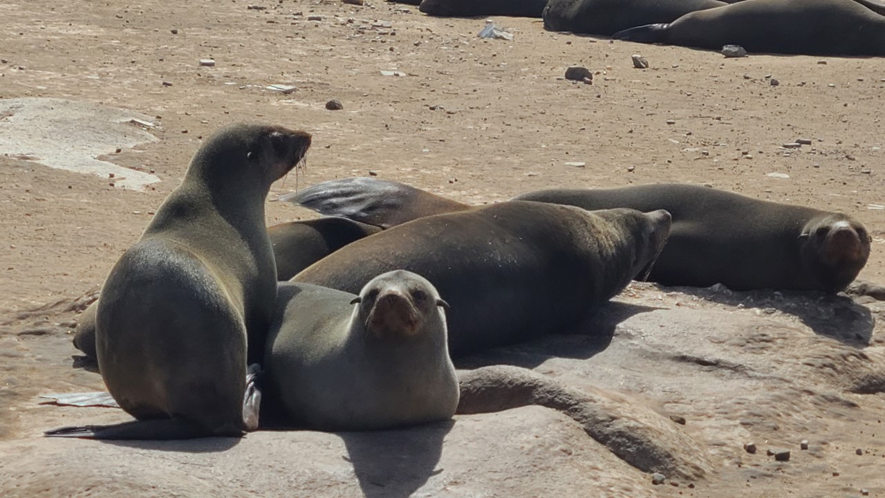
On Sunday, July 9th, we left Swakopmund early and began our trip north along the Skeleton Coast. The first ~250km through the Durob National Park were on relatively good gravel roads. Along the way, there were numerous shipwrecks and salt and diamond mining operations. One large ship, the Zeila, was wrecked on the shore of Henties Bay as recently as in 2008. We saw an old, rusty, derelict oil rig, and many abandoned operations. Halfway along, we officially entered the Skeleton Coast National Park at Ugab River Gate, where, according to the log book, the last road traveler to enter this way had been over a week before! Once we made it to the final town of Torra Bay, the roads deteriorated significantly and we left all vestiges of civilization – no cell phone service, no towns, no homes, no other roads, and no people! Meanwhile, the wind was still fierce, but blowing from the east off of the Atlantic Ocean. The temperature was in the mid 40’s Fahrenheit, and once we passed Terrace Bay (where we filled up with diesel), we never saw another vehicle for the last ~100km. The road is rarely traveled as most people traveling to this region opt to fly-in on small planes. However, today’s weather would have made flying impossible. When we reached the “end of the road”, at Möwe Bay, there was an abandoned gate, a small block-house, and a colony of over 500,000 seals. We parked to await the arrival of our transport to the lodge and used the time to explore the beach. When our guide/driver arrived, we shared drinks and nibbles while making introductions and getting oriented. Before continuing our drive with 4-wheel drive the additional 45 km north to Shipwreck Lodge, we visited the seal colony and were lucky enough to meet and visit with Dr. Philip Stander, an eco-biologist studying the desert lions of the Skeleton Coast. He has been tracking and studying over 80 desert lions for over 20-years using GPS collars and game cameras. By the 1990’s, the Skeleton Coast’s desert lions had almost been eliminated from the area, but they have returned and are re-adapting to the extreme environment, including hunting seals. Dr. Stander let us know that a female had recently returned to the area near the lodge, but the lodge area covers over 145,000 hectares. Dr. Stander then gave us a DVD documentary of the chronology of one of the desert lion prides.
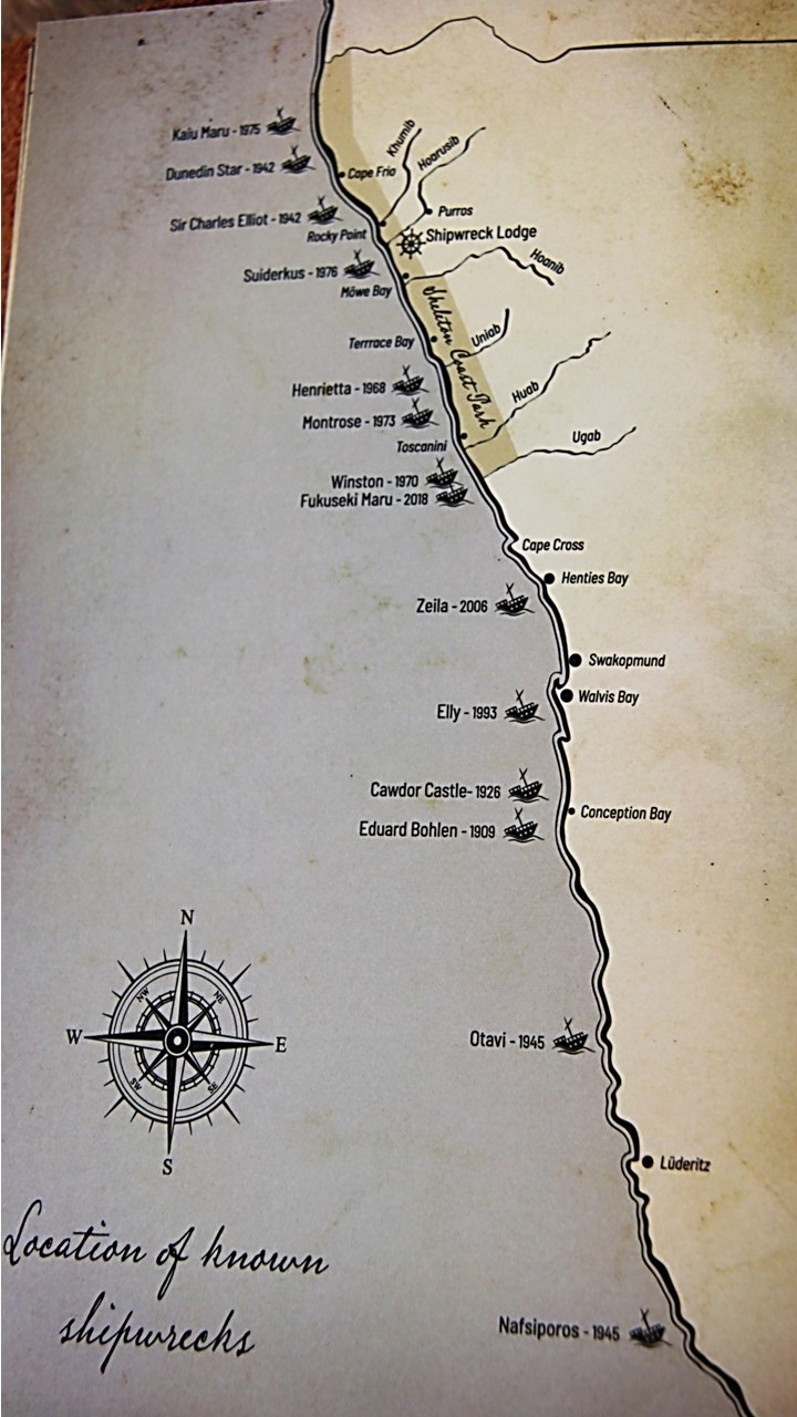
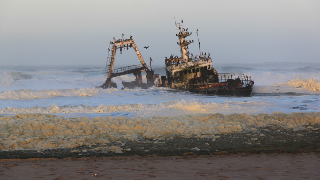
Map of Namibia’s shipwrecks along the Skeleton CoastThe ship Zeila, lies wrecked on the shore of Henties Bay from 2008The Skeleton Coast National Parks southern entrance at Ugab GateThe Möwe Bay seal colony
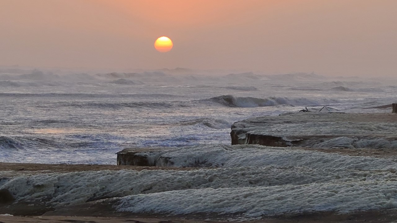
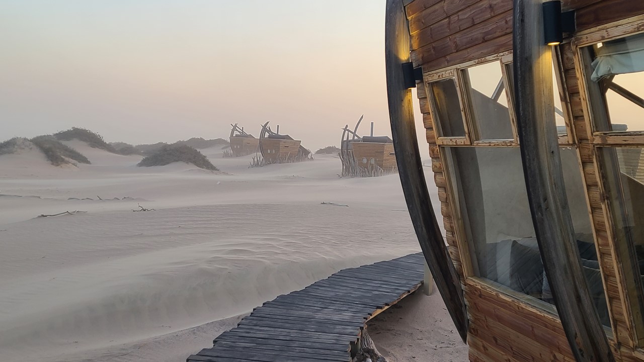
Driving north to Shipwreck Lodge, we encountered numerous whale bones along the beach. It was low tide, so we could navigate partly on the beach and partly on the dunes to get to the lodge. The lodge is located near the mouth of the Hoarusib River and has a 25-year lease with the government, including a clause to eventually return the land as if no lodge was ever there. It opened in 2018, relies completely on solar power with a small backup generator. It is built into sand dunes, and there is no noise pollution. The view is stunning with breathtaking vistas of desert, sky, and ocean for as far as one can see. After arrival and orientation, we settled in our room and then did a sundowner drive to the beach for drinks. This area of the beach had lots of drift wood and high winds that were now coming from out of the south with 24-foot waves. Because of the high winds and salt mist and sand in the air, the sunset was unusual. We actually had to back the vehicle off the sand ridge as the tides were coming in and almost washed away our drink table. That evening, we had a lovely oryx steak and fish dinner and a great conversation with the other 12 guest that were there. Later that night, we returned to our room where a fire had been lit for us in our cast iron stove, warming the room.
Shipwreck Lodge cabin nestled amond the sand dunesSunset on Namibia’s Skeleton Coast
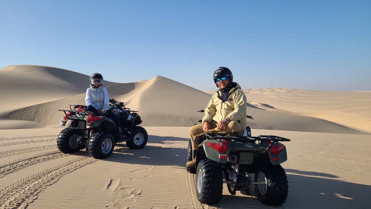
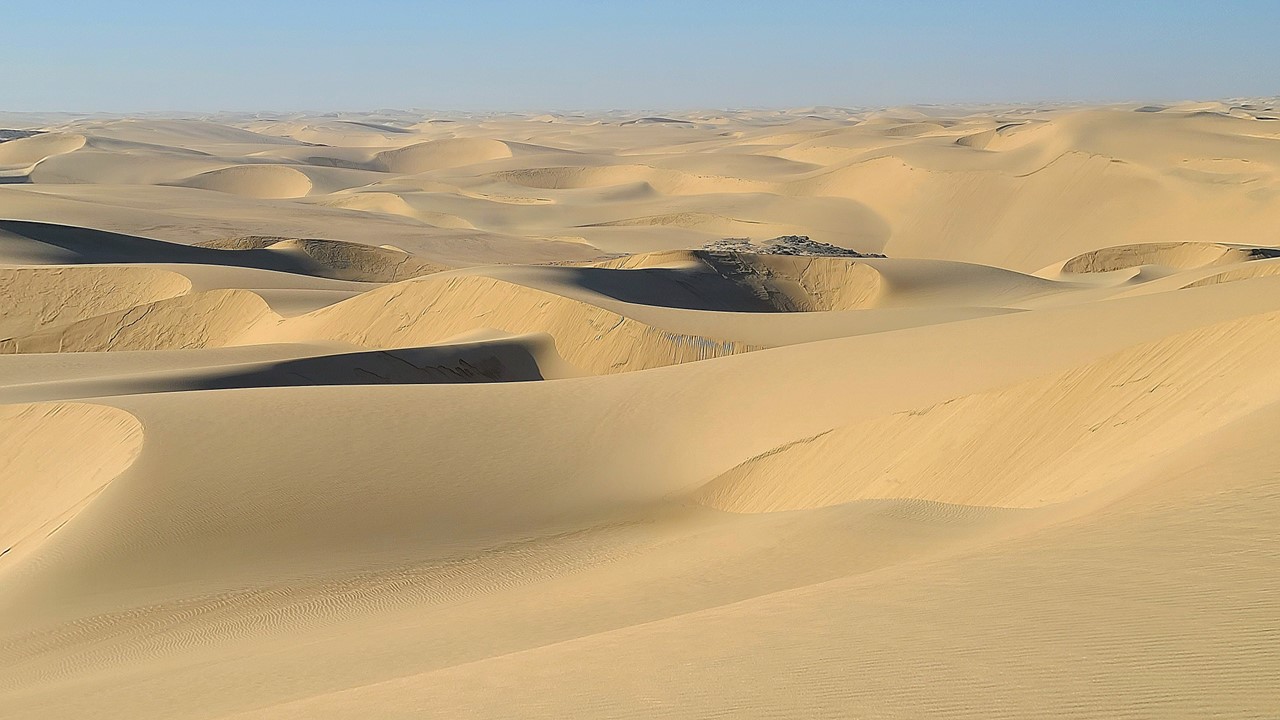
Monday morning, we were up for coffee and a leisurely breakfast. The weather had improved significantly as the front had passed and the wind had died. However, some of the camp’s raised wooden walkways had become buried by the night’s moving sands and, reminiscent of analog snowstorms in the northern USA, staff were busy shoveling them out. After breakfast, we met our guide for riding 4×4’s over the sand dunes, exploring the area, and looking for signs of local animals. We were out among the dunes for about 2-hours – spotting oryx and springboks, finding hyena tracks, and trekking across an other-worldly landscape more akin to the moon or a distant planet. We even learned to “walk” our 4×4’s down the steepest face of the dunes, surfing downhill on a controlled landslide.
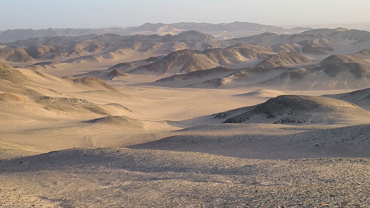
Four-wheeling over the Skeleton Coast sand dunesNamibia’s Skeleton Coast sand dunes as far as the eye can see
After returning to the lodge for a hot tea, we decided to take advantage of the good weather and embarked on a ~1-mile, one-way, self-hike from the lodge to the ocean over a series of small dunes. Along the way, we saw springboks, picked up a jaw bone of a zebra, and unsuccessfully looked for diamonds on the beach. There were lots of animal tracks on the dunes (brown hyaena, oryx, springbok, jackal, rabbit, and lots of birds). Nearer the ocean, we encountered reeds and succulents and lots of drift wood from the ocean, which was much calmer than it had been the day before. We then had to hike back to the lodge, as our walkie-talkie radio did not work, and our “Uber” pick-up never arrived!
A lunch of stuffed mushrooms and lamb chops was lovely, and after a refreshing shower, we relaxed in the lounge for a few hours before meeting our guide again for a scenic drive up the Hoarusib River Valley, which was dry for the first few miles from the coast. Eventually, small signs of groundwater started to appear with greenery that attracted wildlife. Small herds of Springboks and Oryx appeared and elephant dung and baboon tracks were prevalent. The river valley deepened into small canyons which had green reeds and other greenery and, eventually, some small watering holes, We headed up the sides of the river canyon to rejoin the dunes and mountains and to climb to the top of a series of granite boulders at the top. From this vantage point, the view was one of sand, rocks, and desolation – like a moonscapes with massive canyons, Two hours later we’re heading back where we encountered a large, single male oryx in the lodge’s parking lot. We enjoyed our afternoon sundowners and met the new arrivals (4 who flew in from London). Dinner was mussels and fish with eclairs for desert. After dinner we sat and talked with Ozzie, the camp’s contracted engineer, who had assembled a collection of quartzite and calcite, which he insisted on sharing a few pieces from with us. Then, it was back to our room for a fire, night-cap and packing.
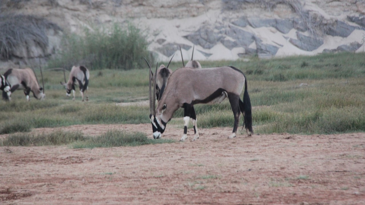
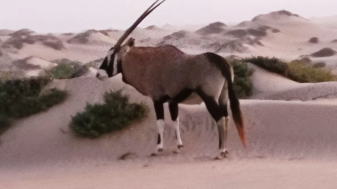
The dry Hoarusib River Valley near the seashore The inland Hoarusib River Valley where some greenery existsA lonely Oryx among the Skeleton Coast dunes
Tuesday morning we awoke to a howling sandstorm. The wind was now at 45-60 mph blowing the sands east from the dunes out towards the ocean. We fought our way from our cabin to the lodge where we had breakfast, and then were to be ferried back to our vehicle, Pauline. Unfortunately, the visibility was so low that the landmarks that the driver would have used to guide him back to our vehicle were not visible, and he got lost amongst the dunes and blowing sand. After backtracking numerous times and climbing down some impressive descents, we finally made it back to Pauline having turned a 45-minute trip into one of over 90-minutes.
The Shipwreck Lodge cabins in a vicious sandstorm
As we began our journey south down the Skeleton Coast, the winds increased and the visibility decreased. The wind pelted the left side of the truck with sand and rocks and the dust was so thick it hurt your throat. One could not see the hood of the vehicle, but, traveling at less than 10-mph with Julie looking down at the ground on the left side, and with Rocky looking down at the ground on the right side, the gravel road’s berms could barely be identified and slow progress could be made. Luckly, no other vehicles we encountered, but a breakdown could have stranded us for days. After over 3-hours of intense operating in this manner, we finally reached Terrance Bay hoping to stop for relief and diesel, but the petrol station was deserted and locked up tight. We continued our journey to the town of Torra Bay where we would find a paved road that would take us east into the sand storm. Although we now turned into the storm, we soon left the sand dunes of the west coast and the visibility improved significantly. After traveling ~30km we came to the Skeleton Coast National Park’s Springbok (East) Gate, which had been blown down and was blocking the road and our exit from the park. After showing our Park Permit papers, and complementing the Park’s Ranger, Rocky & 4 others lifted and moved the iron gate out of the way (to the cheering of other waiting vehicles). From the park, we continued east towards the Damaraland area and to our accommodation for the night at Gröotberg Lodge. Visibility had improved, but our left-side window were left pitted and barely transparent, and a smog-like haze of fine dust continued to hang over everything.
The Skeleton Coast National Park’s Springbok (East) Iron Gate blown down by the sandstorm
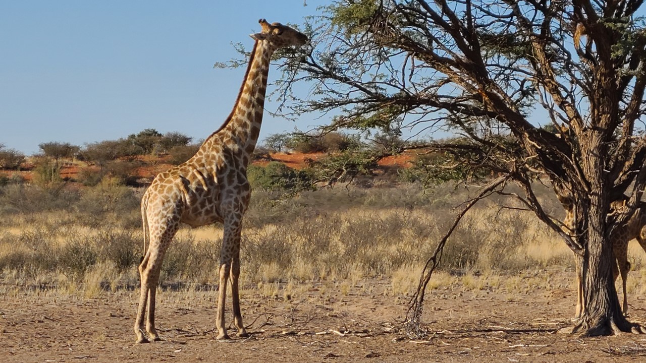
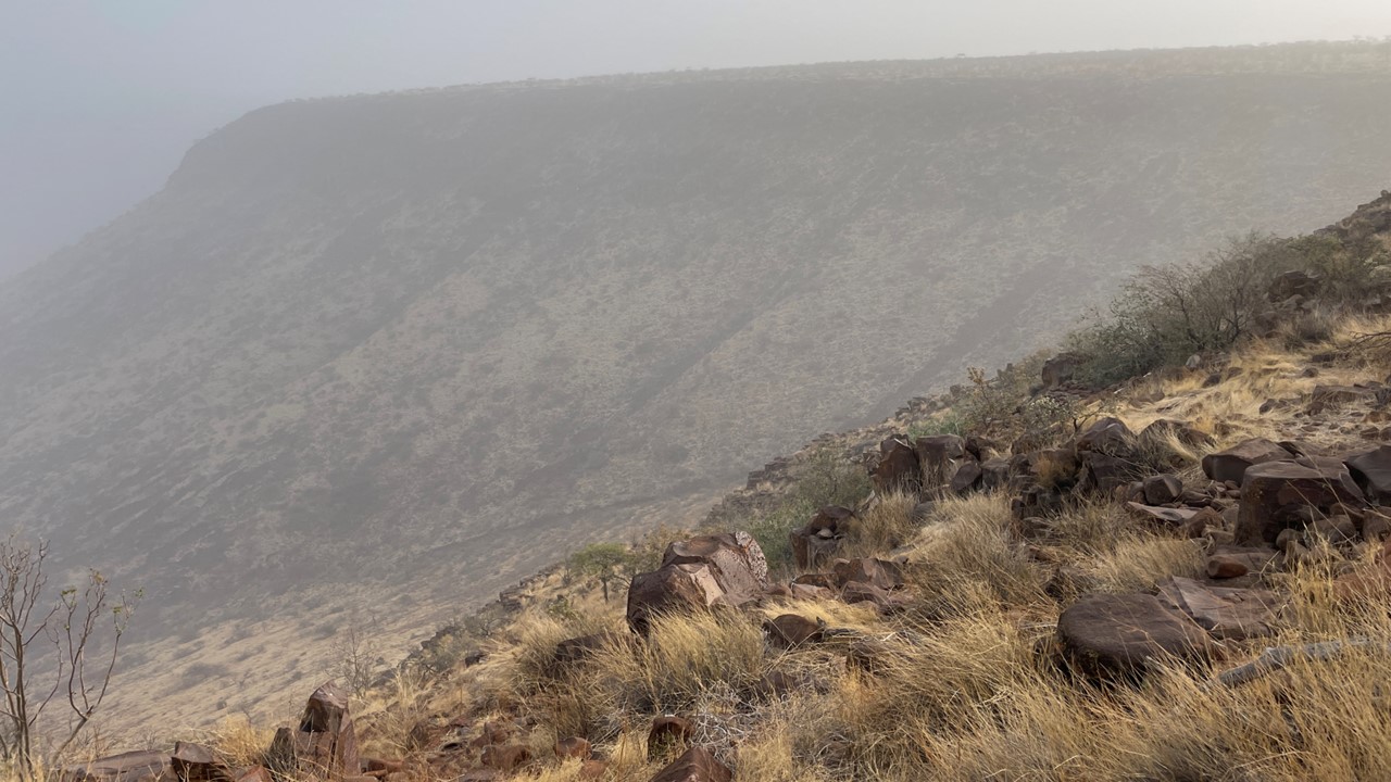
Finally in the countryside cloud, we see a giraffe, and then a 2nd one. We continued driving until, in the middle of nowhere, we spotted the sign for the lodge and started a treacherous climb up a narrow one car track that is so steep that one cannot see the road in front of the vehicle. When we finally reach the top of Gröotberg mountain, we are at a lodge built out over a steep ravine for a spectacular view of the valley below. Unfortunately, the air is so full of dust that we cannot see more than 100 feet. It has taken us 8 grueling hours to get here and the winds are still howling at hurricane force, and the temperatures are very cold – a few degrees above freezing.
Giraffes eating at Acacia TreeGröotberg Lodge on the top of Gröotberg mountain embedded in dust and sand
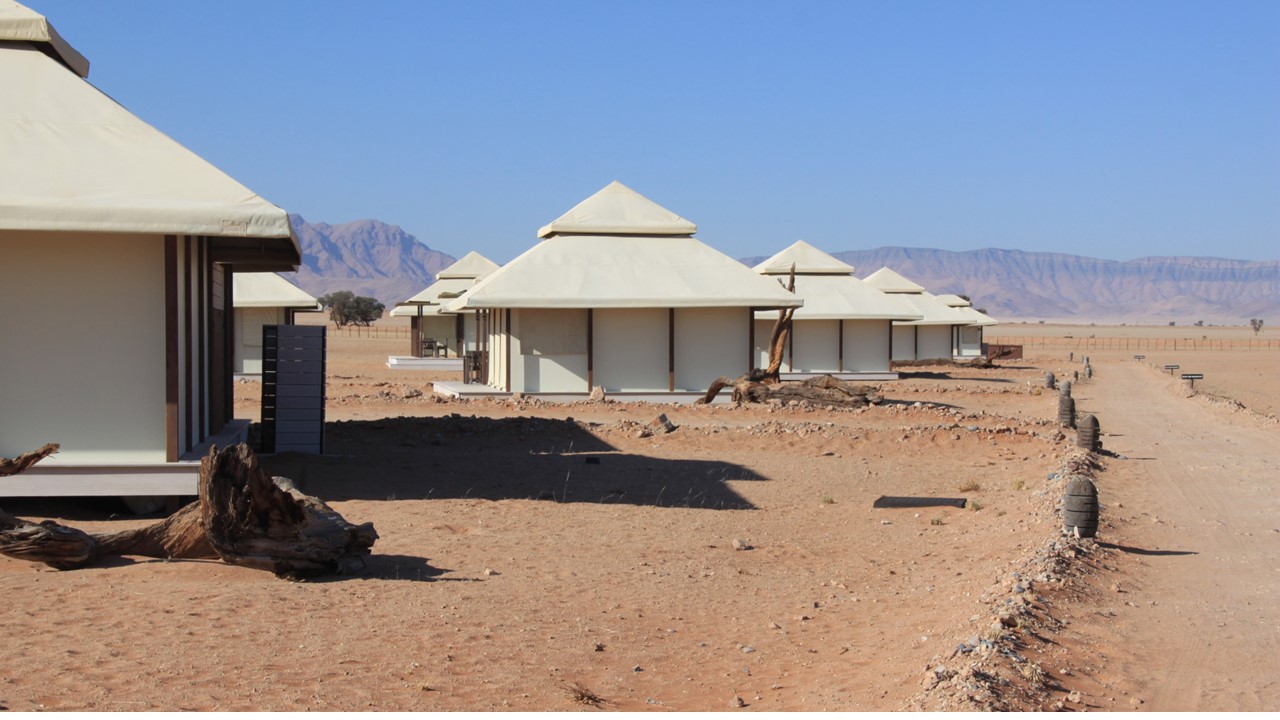
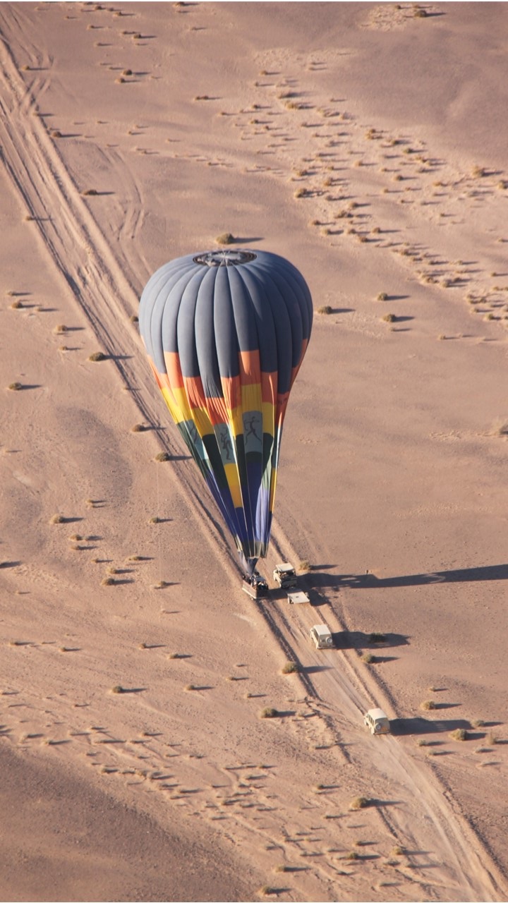
After filling our vehicle with diesel at Bette, we headed north to the Serium Gate of the Namib Taukluft National Park. Soon after, we arrived at the park’s Dead Valley Lodge just in time for lunch. At the park, we have reserved a tented chalet for one night. After settling in, we headed for an afternoon scenic drive to the Sossusvlei Pan and the Namib Desert’s red dunes. The Namib Desert is the oldest desert in the world, and this area of it is a UNESCO world heritage site with a dedication monument in the park. We drove 50-plus kilometers passing hundreds of enormous sand dunes that are named and numbered. On the west side of the valley, the dunes were yellow-gray, but on the east side they were red! We stopped at Dune 45 for pictures and then climbed the dune at Deadlvei claypan. Here, 900-years ago, the dunes migrated across the local river and cut off its flow, leaving a small pan of forested ground to dry up. The areas of dead forests remain there, frozen in time. In order to see the “Dead Valley”, we walked over a mile before climbing a large red dune. The dunes here are over 125 meters tall. After returning to the vehicle, we then drove to the Sossusvlei area of the desert among the giant red dunes to watch the sunset and enjoy gin and tonics and nibbles. Jonas was our guide and on the return to the hotel we saw an oryx, springbok, and a jackal, entering the park just as the Park’s gates closed for the night. Back at the lodge, we had grilled eland and grilled lamb ribs for dinner. Then we went to our tented chalet to prepare for our 5am hot air balloon ride in the morning.
Dead Valley Lodge in Namib Taukluft National ParkSome of the hundreds of dunes in the Namib Taukluft National ParkA dead river valley where sand dunes cut-off a river routeSundowners at Dead Valley in Namib Taukluft National Park
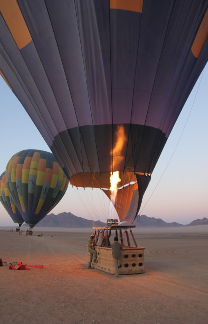
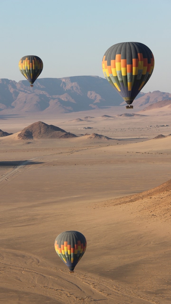
Saturday morning we rose at 4:00am to pack and travel 35km to the site for our hot air balloon launch. Unfortunately, the camp had suffered a power failure during the night and we accomplished this in the dark with only cell phone lighting. We left our luggage there since we would be returning later to check-out, and we then drove to exit the park. However, the park’s gates were closed until 6:00am, and we needed to honk our horn to wake the guard to be able to leave. We traveled in the dark to a sign by the roadside that indicated where to turn, and we arrived at Namib Sky Balloon Safaris, where 56 of us gathered to ride on 4 balloons set to take-off at sunrise. We were ferried to a flat, open field where the balloons were assembled and inflated, before boarding the basket and rising above the earth. It was a quiet, gentle ride where the topography looked other-worldly. Below, we could see ostriches and springboks. Our pilot would adjust our direction by changing the height of the balloon and entering different air currents that move in different directions as a function of altitude. The ballooning company owns considerable areas adjoining the park, but the intent is always to land the balloon on or near a road to make recovery earlier and to minimize offroad vehicular travel. Our pilot, Paul, does one better and lands the balloon’s basket on the trailer of the balloon recovery vehicle. Simply amazing. Our balloon ride is followed by a champagne breakfast in the desert, including: coffee, tea, and champagne, home-made breads ,jams, muffins , and croissants, eggs, yogurt, and even zebra meat and game sausage. While eating breakfast, a curious jackal, and even a few springboks, came to see what was going on.
Filling the balloon with hot airHot air balloon ride over the Sossusvlei Pan with Namib Sky Balloon SafarisHot air balloon landing near road and recovery crew
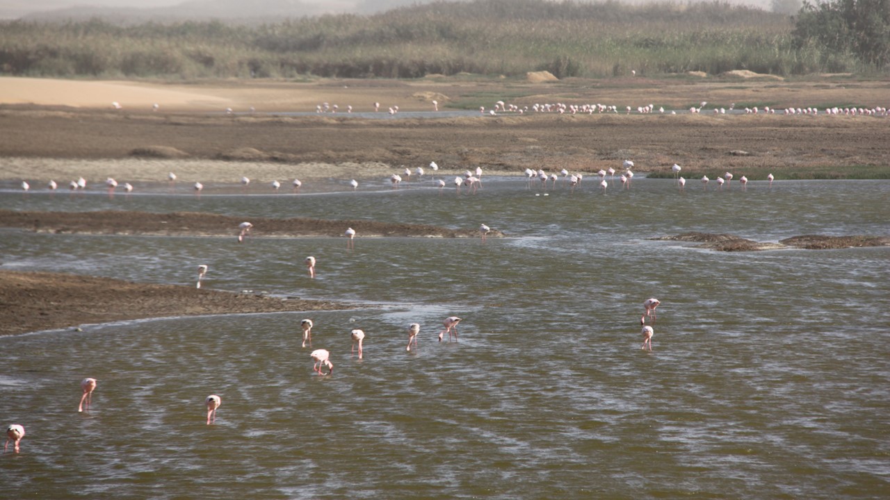
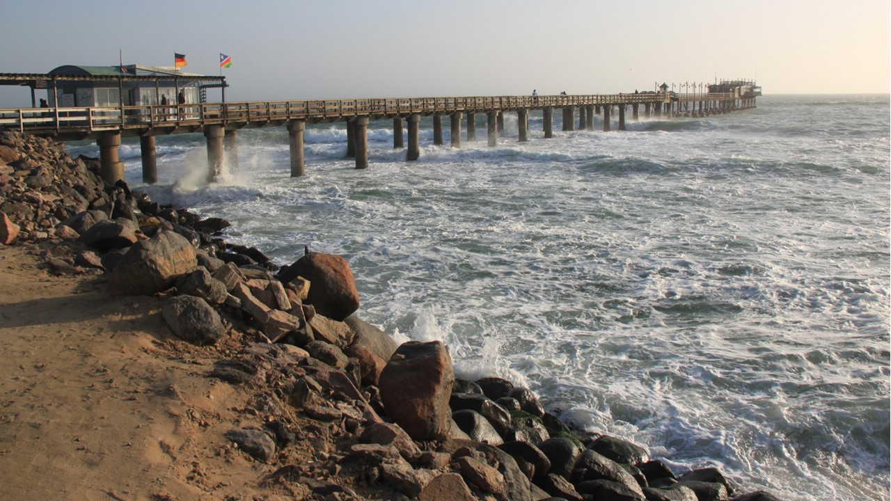
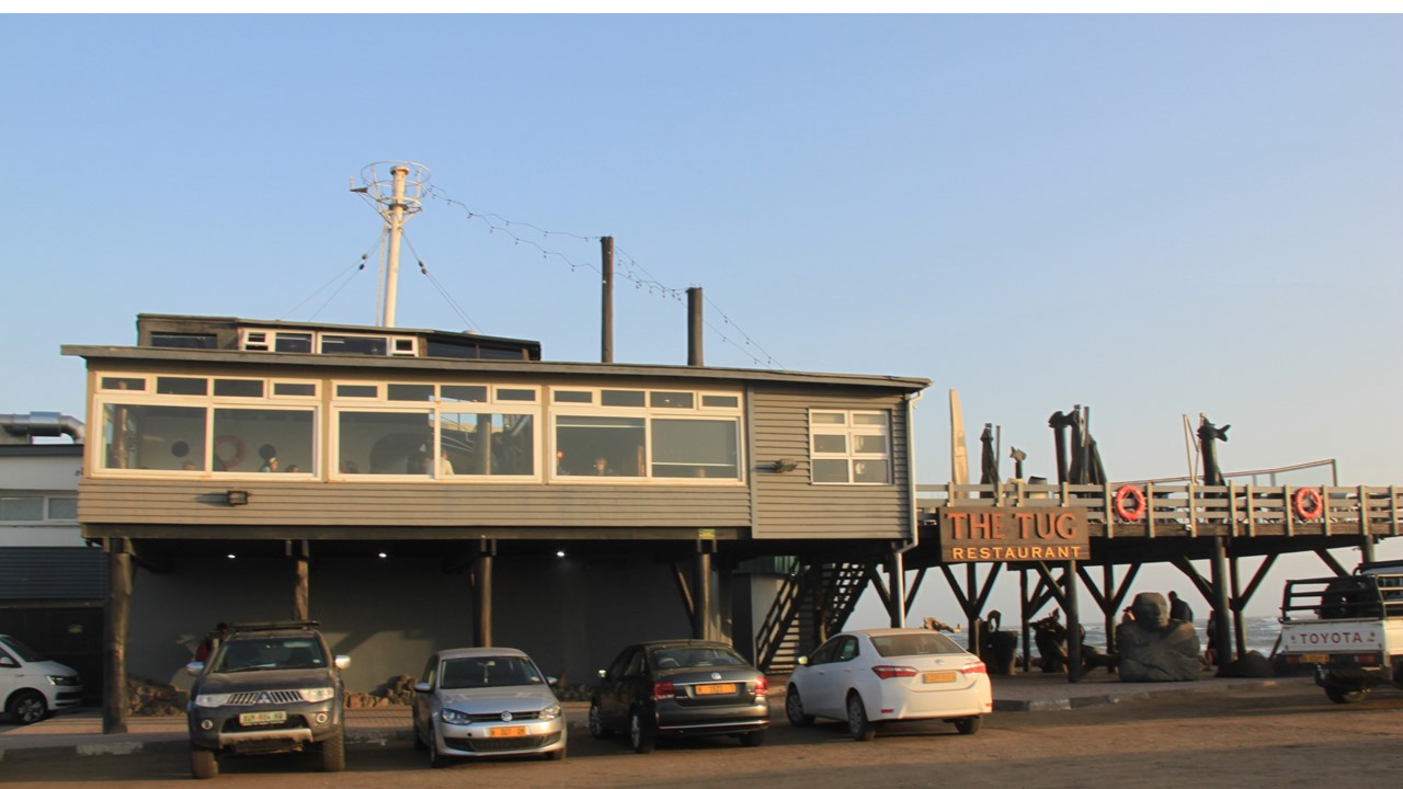
We returned to our car, headed to the park gate to pay our park fees, and check out of the hotel before we start 360+ kilometers on gravel roads, (some good and some very, very bad), through the National park to the coastal town of Swakopmund, a small, old German fishing town. Just before Swakopmund at the town of Walvis, we passed some local brine estuaries that were filled with pink flamingoes. But, on the way there, a weather front came through and a driving sand-storm impacted the last 30km of our trip. Finally, we checked into a small guesthouse located just 2-blocks from downtown and from the ocean. From there, we bundled-up and walked downtown to do some window shopping. We then walked to the beach, where it was high tide with high waves and high winds. The temperature was rapidly dropping as we stopped at “The Tug” for dinner. The Tug is an old tug boat that has been turned into a bar and restaurant at the beach-end of the town’s pier. The bar had personality and the food was delicious. After dinner, we headed back to the guesthouse to get ready for tomorrow’s 400+km drive to the remotest destination on the Skeleton Coast – Shipwreck Lodge in the Skeleton Coast National Park.
Pink Flamingos at the town on WalvisThe pier at the coastal town of SwakopmundTug’s Restaurant at the base of Swakopmund’s pier
Over a decade earlier, we had completed almost 5-years of living in Africa, and had had the wonderful opportunity to participate in over a dozen safari’s within 9 different sub-Sahara countries. However, Namibia had been one of those countries that we had never made it to, although plans had been made in 2011 that were subsequently cancelled for severe flooding. Now, after a dozen years of relative drought conditions there, we finally made the commitment to see this beautiful country. We planned our trip through our historic Africa planners (Go2Africa), and decided to rent a car and move from one game lodge to another that were all reserved in advance. Our intent was to experience different parts of the country and have the flexibility to explore along the way. Namibia is a safe country to travel in, and with a population of only ~2.5 million, is the 2nd least population dense country in the world!
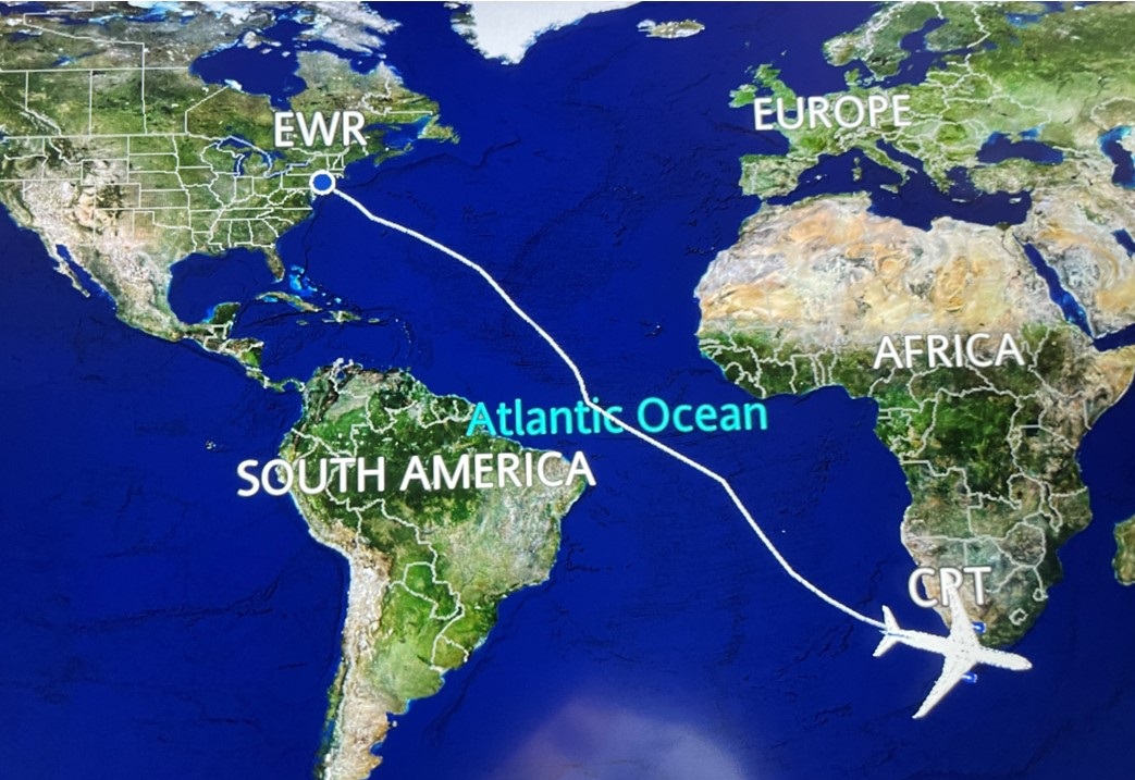
When planning a safari with a desire to see animals, it is best to travel in the winter (dry season) as the animals will group-up near the isolated watering holes, making finding them much easier. Therefore, we planned to leave Washington, D.C. in early July (winter in the southern hemisphere) to spend two weeks traveling around Namibia. And, since we were already close-by, we tacked-on an additional week in one of our favorite places on the globe – Cape Town, South Africa – at the end of our trip.
Air flight path – 15 hours
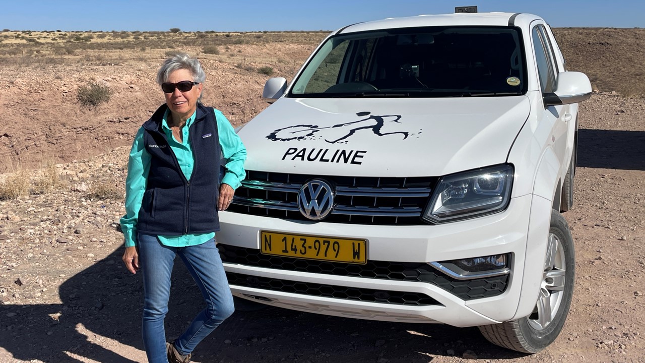
From Washington, Dulles, we took a short flight to Newark to board our 15-hour-plus flight directly to Cape Town. After a plane “cargo balancing” delay, we finally left Newark and arrived in Cape Town in the evening only 1-hour late. That night, we stayed in a near-by airport hotel, (Hotel Verde), before resuming our journey to Windhoek, Namibia with a short flight the next morning. We were met at the airport by our car-rental company, oriented to the area, and given our vehicle – “Pauline” – a 4 door pickup with a covered back to hold our luggage and 2 spare tires. With the help of GPS we headed to our first game-park lodging, having to stop along the way for a herd of baboons, a flock of Guinea fowl, and herds of sheep and goats crossing the road. Along the way, we passed Namibia’s Hero Monument build to recognize the countries historic heroes, and then passed south of the Tropic of Capricorn.
Julie with our vehicle – Pauline
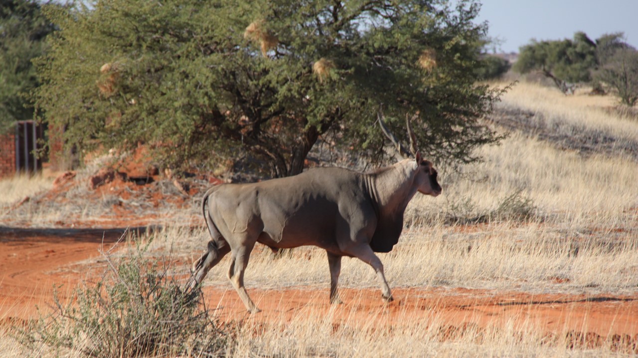
283 kilometers later we arrived at the Kalahari Anib Lodge, where we unpacked before taking a short walk on a desert trail. That afternoon, we took a guided game drive where we saw eland, the largest antelope (males can up to 2000 pounds), guinea fowl, red hartebeest, ground squirrels, and ostriches. Ostriches can lay 10-18 eggs each at one time, and they can also join their nests into a communal nesting area that can hold upwards of 60 eggs that are jointly cared for. This helps to protect against the jackals that like to scavenge their eggs. As darkness approached, we stopped to watch the sun set and enjoyed sundowner drinks and nibbles before returning to our room.
Eland in the Kalahari Desert
Back at the hotel we were moved to another room due to lack of hot water, and after dinner we celebrated the 4th of July with champagne around the campfire.
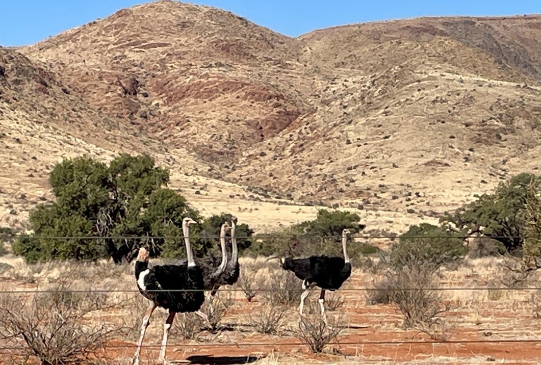
The next morning after breakfast, we began the 3-hour drive from the Kalahari Anib to the Zannier Hotel Sonop, on the edge of the Namib Desert in Sonop, Namibia. Along the way, we stopped to explore the Duwisib Castle – a grand medieval looking building atop the hills in the Southern Namib region. It was built in 1909 as the residence of Hans Heinrich von Wolf, a German military officer. It was built so that could withstand a siege, as was taught in Von Wolf’s military training. After the German wars in the south Africa region, Von Wolf and his American bride settled there on over 55,000 hectares. They operated the property as a stud farm for English and Australian thoroughbred horses. However, when World War I broke out in 1914, they returned to Germany where Van Wolf was killed in battle and his wife gave-up the castle. After that, it changed hands many times until the Namibian Government took ownership in 1979 and refurbished it in 1991. Today it operates as a resort and still serves as home to wild horses that descended from the Von Wolf herd.
Ostriches on the side of the road near Duwisib Castle
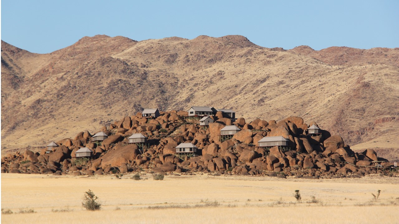
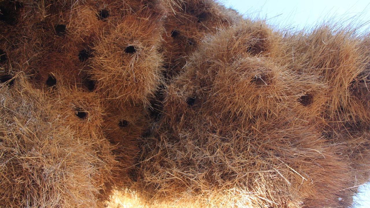
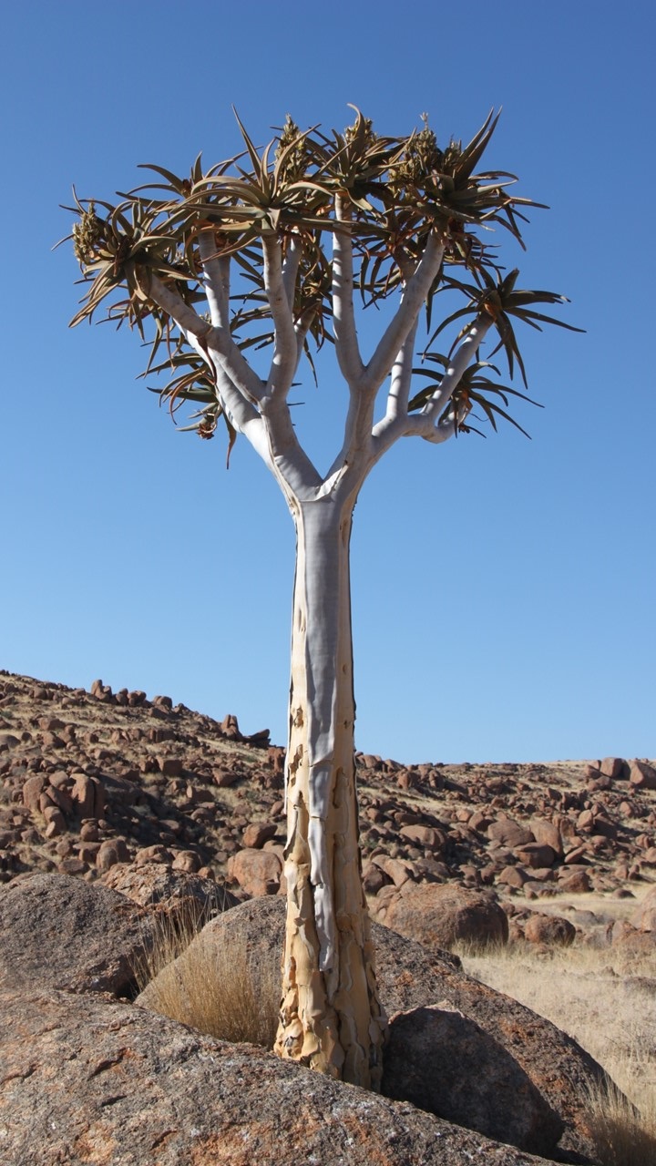
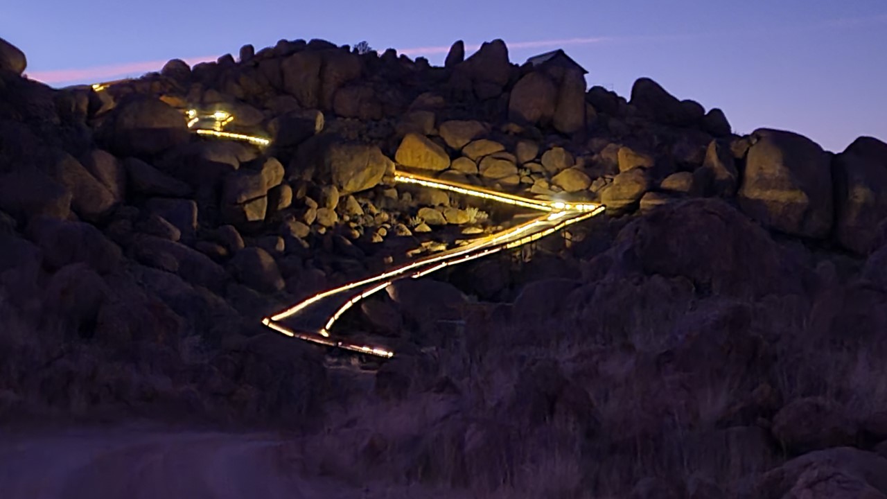
After passing flocks of ostriches beside the road, we entered a large valley and traveled a series of dirt and gravel roads before arrival at the entry headquarters of the lodge. We were transported another few miles with our luggage to a large outcrop of boulders where the resort sits atop. It consists of 10 cabin tents with a dining area, pool, and gym – all mounted upon giant boulders with panoramic views of the surrounding pan and the Tiras mountains. After a 2-year drought, few animals remain in the area with the exception of oryx – the national animal of Namibia. That evening, we took a scenic drive with Floyd – a local renown guide that was spectacular. His knowledge of the area and animals was exceptional and we started by visiting a colony of weaver birds who make giant communal nests holding 400-600 hundred birds. These nests can become so big that they can eventually topple the tree. Small single weaver nests could also be observed. We inspected a Quiver Tree, which is a type of Aloe Vera tree with beautiful yellow flowers on the top and the bark was used by local tribes to make quivers for their arrows. All of the trees have medicinal properties. Floyd also showed us the African Moringa tree, it too is medicinal. We ended the drive at the top of the large dune where we had drinks and watched the sunset. This magic moment led to discussions of family aspirations and of life growing up in Namibia. Floyd demonstrated the iron richness of the dunes by extracting iron from the sand magnetically. Time ran away, and on the way back in the dark we encountered an oryx crossing the road. Then, it was into a golf cart for the climb to the top of the boulder pile and for an eland steak dinner before retiring for the night.
The Zannier Sonop Lodge located ontop of boulder fieldUnderside of Community Weaver bird nest with nest entriesA flowering Quiver TreeThe night time ramp to the top of the Zannier Sonop Lodge
Thursday morning we watched the sunrise from our tent’s balcony before an early coffee and meeting Floyd for a 3-mile ride on electric fat tire bikes to the horse stables. There, we met Austin to go horseback riding on 2 beautiful horses – Angie and Jessica. We rode for about 2-hours towards the mountains, then to the entrance gate, and finally back to the stables, taking lots of pictures. Una then drove us back to the lodge for a late breakfast of omelet and Eggs Benedict. Then, we went to the pool for a cool, relaxing late morning. After floating around, having lunch and a bottle of champagne, we returned to our room for showers before heading to the lobby for afternoon drinks and meeting another guide, Lazarus, for a hike to the Bushman’s cave that was historically used as temporary lodging by local tribe members when they were away from their village out on a hunt. While hiking, we stopped to examine various cactuses and plants, and came upon springboks and eland grazing about. At the Bushman’s communal cave, we saw the remnants of ostrich egg shell pieces that had been fashioned into jewelry, stone implements for grinding, pottery shards, and drawing on stones and the cave walls.
Horseback riding in the Namib Desert
We then celebrated with gin and tonics while having a conversation about cultures and family before returning to camp in time for dinner. That night we dined on pork medallions while having conversations with the day’s newly arrived guests, before heading off to bed.
Sunset from Zannier Sonop Lodge
Friday morning, we were up at sunrise to take the fat tire e-bikes for a spin around Zannier Hotel Sonop 5000 hectares by ourselves. Shortly after leaving the lodge and heading towards the mountains we saw a large male oryx, then a pair of oryx, then 7 oryx, then 9 oryx, and then 3 different herds of 20-40 oryx each. We rode the bikes for 90-minutes, enjoying the peace and quiet of the area and going where we wanted. We returned in time for breakfast, after which we checked out and started our drive to the “town” of Bette to fill our vehicle with fresh diesel, and continue our journey.
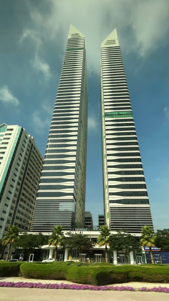
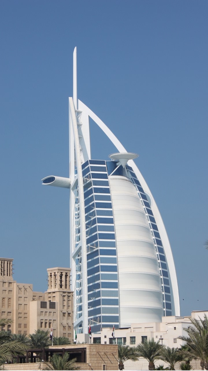
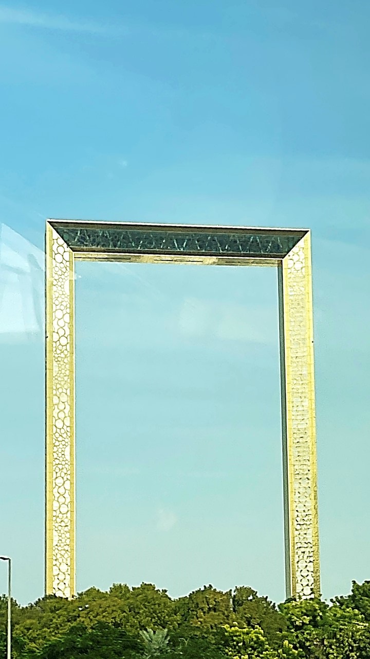
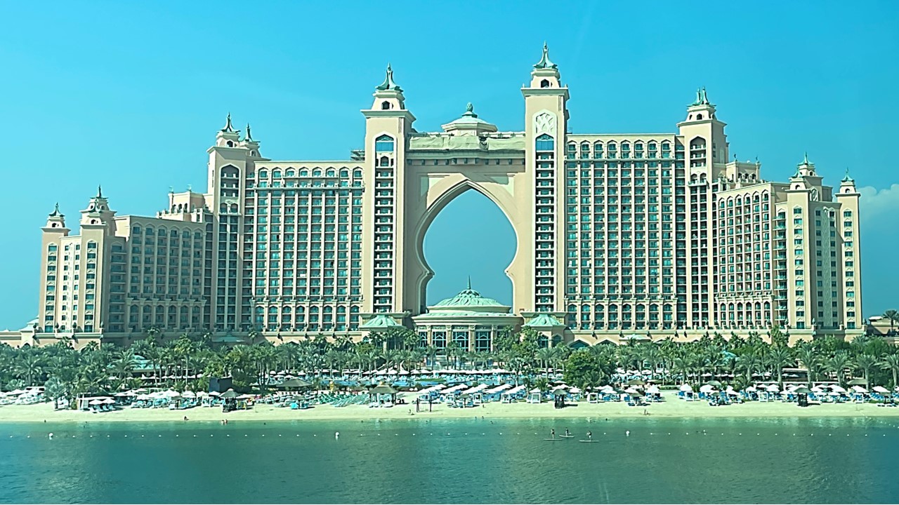
In the morning, we arrive in Dubai. After breakfast, we turn in our room keys, pick up our passports, and disembark the ship to pass through immigration and board a bus for a city tour. The United Arab Emirates are made up of 7 Emirates that joined together in 1971. Before that, the area was a British Protectorate. (The country’s 51st birthday was yesterday!) Dubai is ruled by Sheikh Mohammed bin Rashid Al Maktoum (Sheik Mohammed) and he also serves as the Vice-President of the UAE. (Sheikh Mohammed bin Zayed Al Nahyan, the Crown Prince of Abu Dhabi, is, in fact, the emir of Abu Dhabi, and the president of the UAE.) The country of UAE is only ~84,000 sq. Kilometers and its population is ~9.6 million with only 11% being native, and ~89% being Indian, Pakistani, Bangladeshis, Iranian, and Philippine. The country’s economy does not run on oil, but runs instead on direct foreign investment. Dubai is made up on ~40 “investment cities” that each depend on one particular business: the Internet City, the Health City, etc. Most government jobs are reserved for native citizens, but the entire government is paperless. The government provides school, health, housing, and a marriage fund. Nearly all government employees and expats have servants. The city has an extensive monorail system and a series of spectacular architecturally wonderful buildings, (e.g., “The Frame” – a building that looks like a picture frame but is an observation deck with a glass floor; and the “Burj al Arab” – a sailboat-shaped hotel more than a 1,000 feet tall). We pass walled areas that are Royal Family Palaces before we head to the “Palm Island” or “Palm Jumeirah”, as it is called. This entire island looks like palms from the air and was artificially build into the sea. Over 100,000 people live here and the island host the “Atlantis Resort” – a near duplicate to the one in Nassau, Bahamas. The Palm Island #2 is under construction, but has no homes there, yet. Construction on the Palm Island #3 was stopped because of the recent downturn I the economy, and is planned to be re-branded as “Dubai island”. The islands are connected via tunnels – the longest of which is 750 meters in length. The city of Dubai is very “high tech”, and there are too many skyscrapers to count.
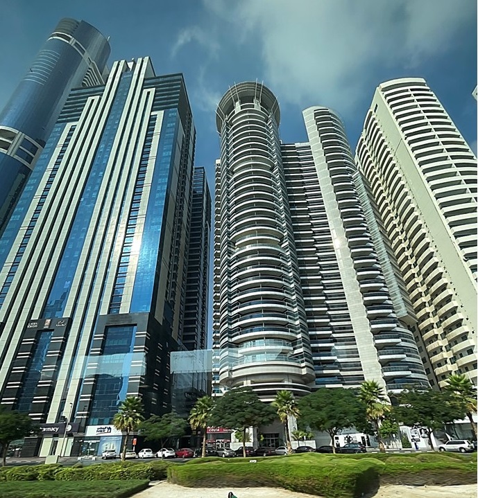
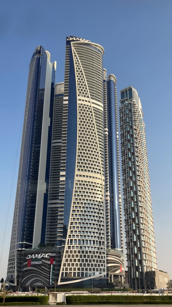
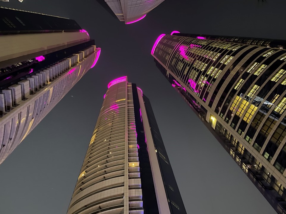
Cayan Tower in Dubai – Eye-catching Helical ShapeThe Jumeirah Emirates Towers in DubaiUnique Residential Towers in DubaiCommercial – Residential Tower Complex in DubaiThe Sail – The Burj Al Arab Building in DubaiDamac Towers in DubaiThe Dubai Frame – Largest Frame in the World – an Observatory & Museum
After, the quick bus tour, we exited and climbed aboard the monorail for a ride from the Palm Island entrance to Atlantis and enjoyed the view along the way. Then we traveled to Souk Madinat Jumeirah for lunch on our own and a great view of Burj Khalifa – the tallest building in the world. We ate salads at a restaurant called “Ushna – The Dancing Elephant” before shopping for souvenirs. We then rode the bus back to our hotel – “The Paramount” – whose entire theme is inspired by the rich history of the Paramount movie studio with Hollywood-themed rooms and modern California cuisine. Our room is very high tech with all electronic controls located at bedside, and the television located inside the mirror opposite the bed. The hotel is part of a 4-tower complex of residential condos, each 25 floors high, with a grocery store on site as well as 2 pools and spa and is located 10 miles from the airport.
Atlantis at Palm Island
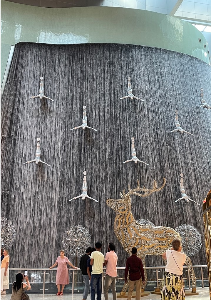
Dinner that night was at a restaurant in the Souk Al Bahar where we enjoyed Lebanese food at “Abd El Wahab“, consisting of many small plates of appetizers and salads, followed with meats & BBQ, and then fruit and rice panna cotta desert. Every 30-minutes, the Dubai Mall fountains (which are between the Souk and the Mall) dance to music like a smaller version of the fountains at the Bellagio in Las Vegas. The area also offers boat rides in the fountain’s waters, as the fountain pool is 900 feet long with 6,600 lights and 50 color projectors. Water shoots up 150 feet to contemporary Arabic music, and the Burj al Khalifa in the background, (the world’s tallest building at a height of 2,722 feet – just over a half mile tall), is lit-up with dancing lights all along its side. After dinner, we returned by bus back to the Paramount Hotel.
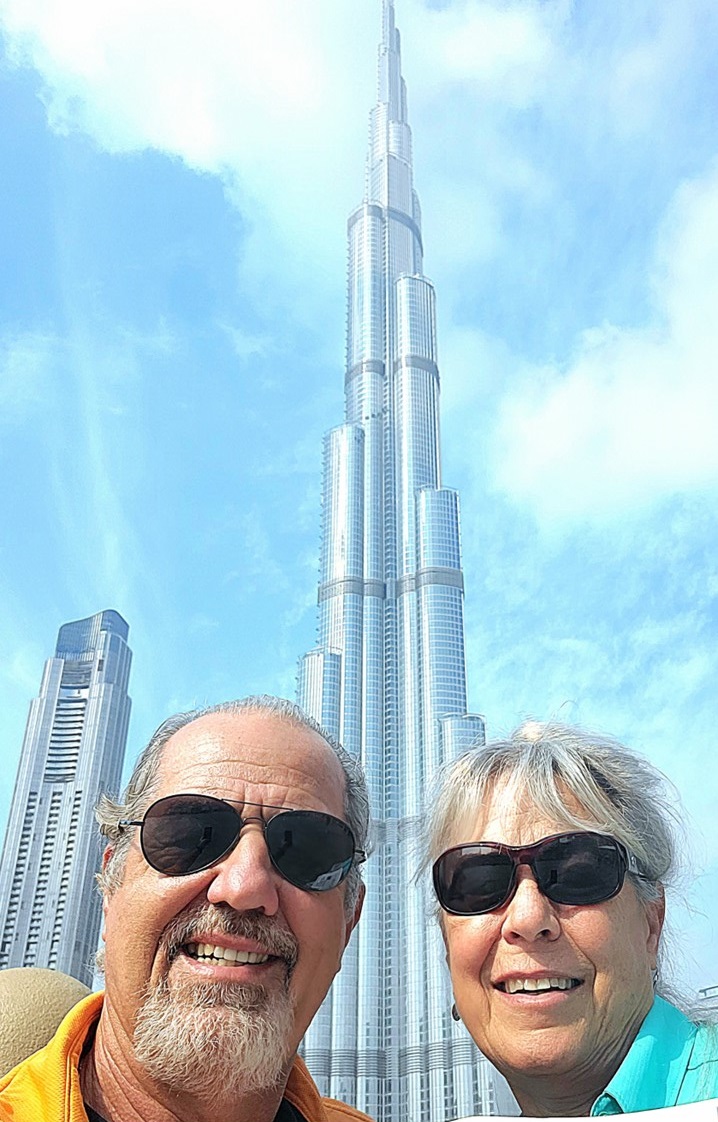
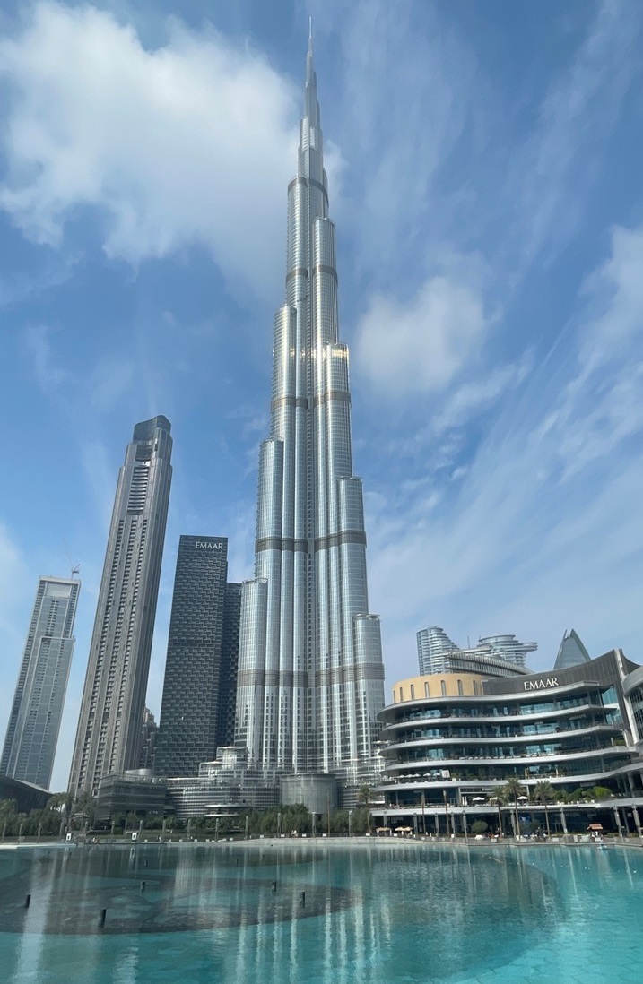
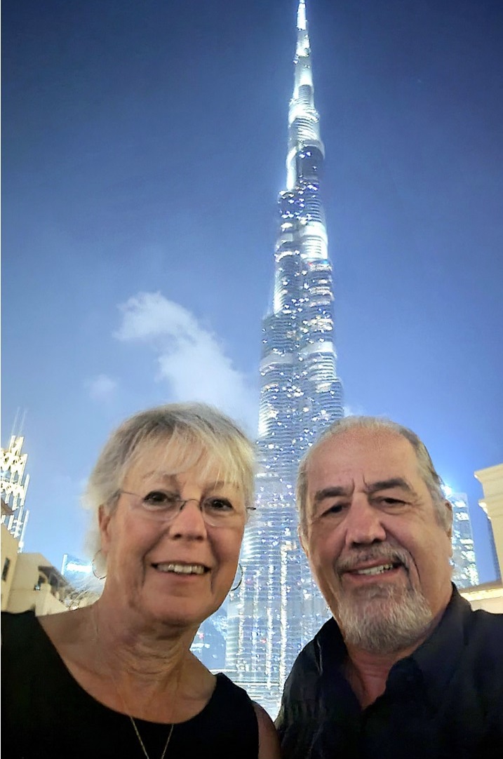
The next morning, we enjoyed breakfast at the hotel before traveling by bus to the Burj Khalifa Tower. There is an underground walk to get to the entrance and the building’s security. The tower contains 154-floor with 9-floors dedicated strictly for infrastructure and building maintenance. The rest of the floors are offices, residences, restaurants, lobbies, and a hotel. There are 2 subterranean floors for parking and mechanical systems. Every 30 floors is a floor dedicated to building services. The tower has 57 elevators, is 829 meters (2722 feet) high – over twice the height of the Empire State Building. Its construction was began in 2004 and completed in 2009. The building opened in 2010. We rode the high-speed elevator to the 124 floor observation deck and then walked to 125th floor taking lots of pictures. There is a Sky-level bar and observation deck at the 148th floor which charges a hefty fee to enter. On a clear day at low tide you can see all the way to Iran, located 95 miles away. Unfortunately, today is not that clear. After completing our tour of the building, we have time to visit Dubai Mall where there are over 1200 shops, the Dubai Aquarium & Underwater Zoo (33,000 aquatic animals), the Dancing Fountains, (which we saw the previous night), the Dubai Ice Rink, The Waterfall Wall, the Star Atrium, and Burg Khalifa, We explore nearly all of it before we head back to the hotel at ~4:00pm.
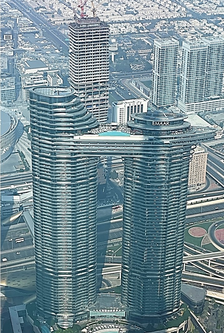
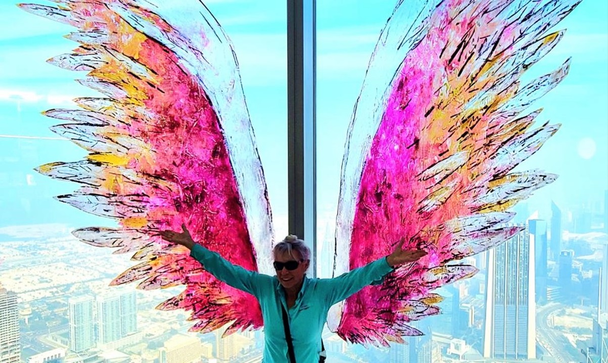
The Emaar Building from atop the Burj KhalifaJulie with Wings atop Burj KhalifaSharks and Rays at the Dubai MallThe Wall of Water & Sculptures at Dubai Mall
That night, we have dinner on our own, and since this will be our last night on the trip, we head out to the pool-deck bar afterwards to watch World Cup soccer live. We have great seats, a lite dinner and drinks in the cool evening air while enjoying the games taking place only a short distance away in Qatar. At 10:30pm we board a shuttle to the airport as our plane is scheduled to depart at 1:50am to Frankfurt, before we connect back to Washington, Dulles. A great trip!
Thursday morning we enjoy breakfast as we begin to make our way into port. Making it into port and clearing everyone’s entry will take all morning, so we enjoy a lecture about the region’s history with oil “Black Gold”! After fieldwork and drilling wells in the Zagros regions in western Iran, George Bernard Reynolds discovered the first oil in the Middle East in 1908. The British Petroleum Company then began to operate in the region. Then, in 1938, an American-owned oil well in Dhahran, Saudi Arabia, drilled into what would become the largest source of petroleum in the world. The discovery radically changed the physical, human, and political geography of Saudi Arabia, the Middle East, and the world. Before the discovery (made by the company that would eventually become Chevron), Saudi Arabians were largely nomadic. The country’s economy was based on tourism revenue from observant Muslims’ pilgrimages to the holy city of Mecca. After the discovery, Saudis established strong infrastructure dotted with wells, pipelines, refineries, and ports. Today, oil accounts for roughly 92% of the Saudi budget. In 1941, during World War II, Britain and the USSR invaded countries in the Middle East to preserve their oil supply. After WWII, many of the countries nationalized all or parts of their oil industry beginning a long series of conflicts and political meddling in the region. Commercial oil was discovered in Oman in 1964 and was first exported in 1967. Subsequently the production and export of petroleum rapidly came to dominate the country’s economy. Today, Oman’s oil economy is rapidly shrinking, and the economy is focused on improving other sectors.
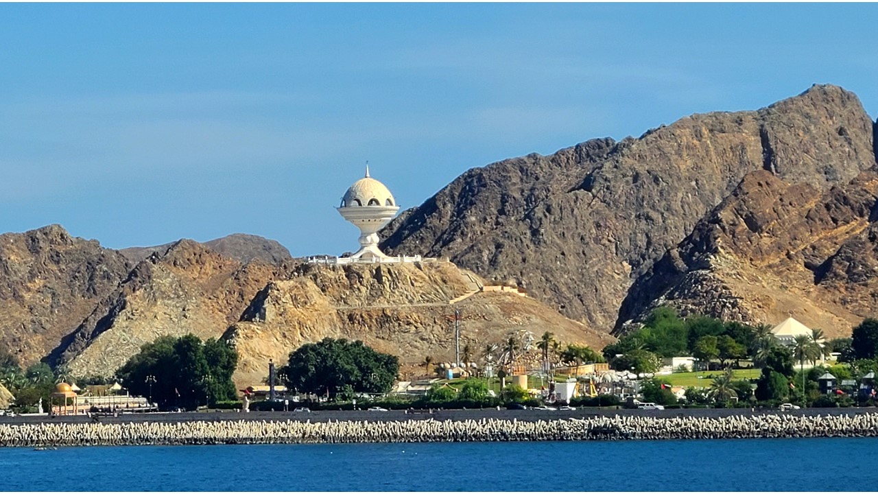
Entrance to Muscat HarbourThe Sultanate of Oman
After lunch we were finally able to disembark the ship in Port Sultan Qaboos in Muscat Oman. Here, we met our local guide, Akmed, who took us on a quick tour of the city. Today, Oman is one of only two countries in the world with a Sultan, the other being Brunei. It is a country of 4.8 million people with approximately half of them being expatriates. Oman has 11 regions with 63 cities and speaks fluent Arabic and English.
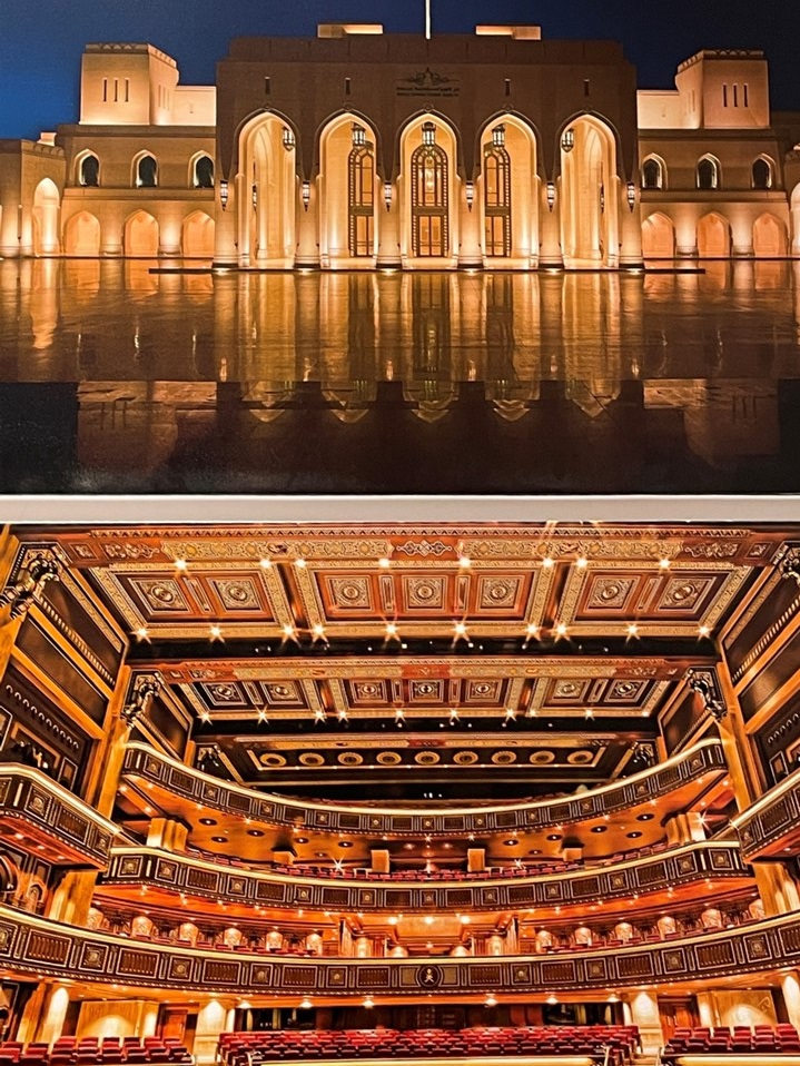
Outside & Inside of the Royal Opera House Muscat
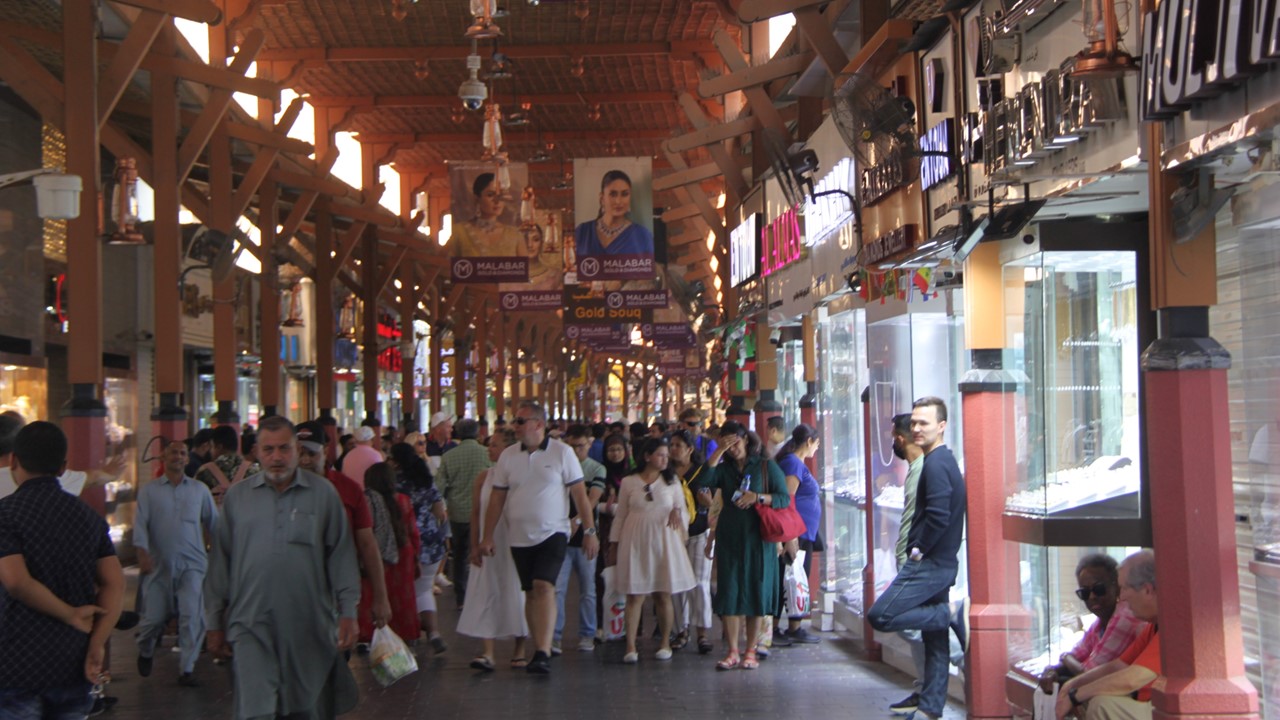
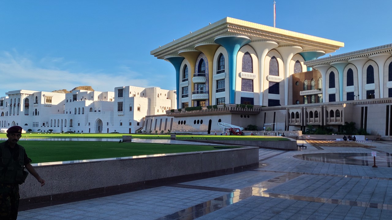
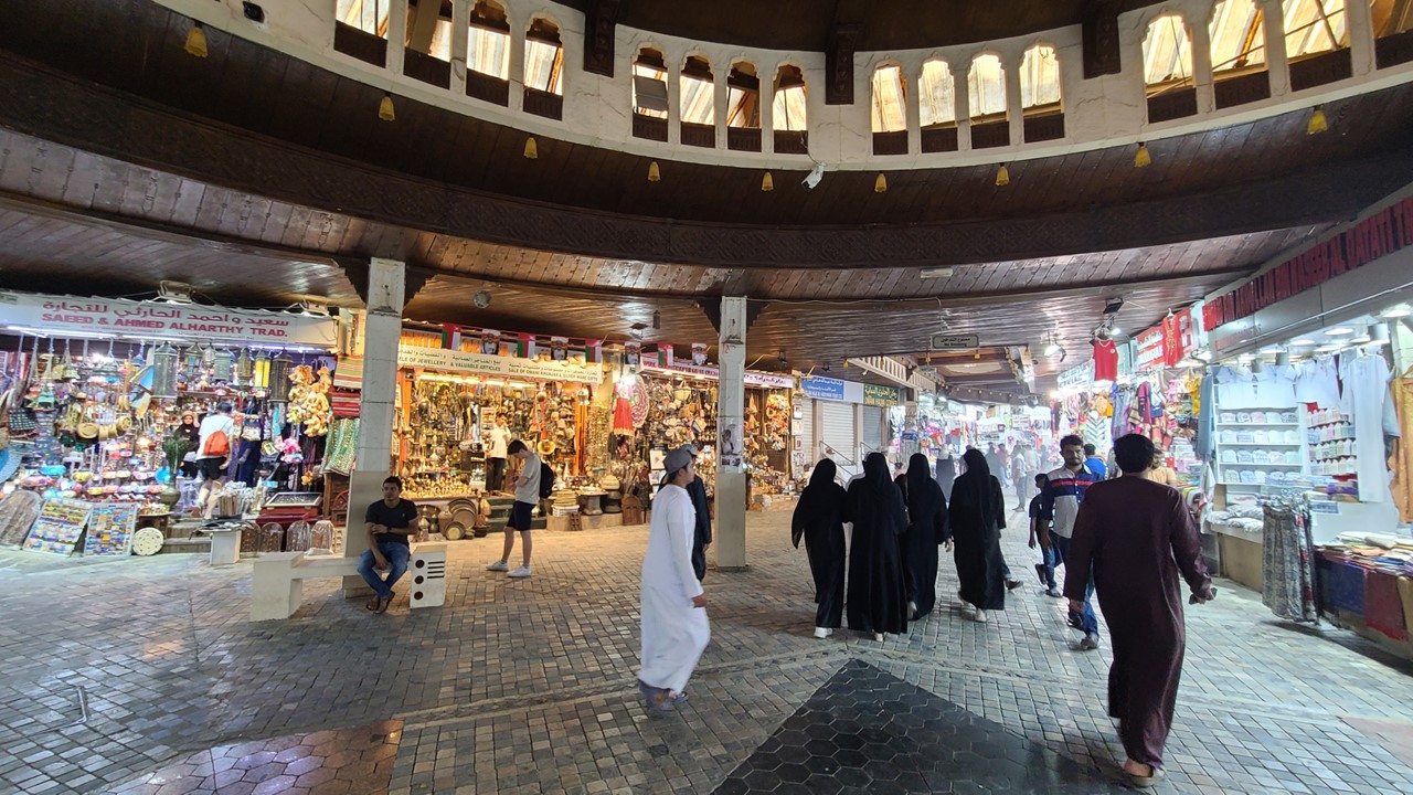
Its land are is only 309,000 sq. kilometers with most of it mountainous desert. We first visit the Bait Al Zubair Museum and gift shop which chronicles the history and customs of Omani clothing, jewelry, and weapons, and outlines the linage of its sultans. We then stop for photos at the Qasr Al Alam Royal Palace, which is located beachside in the city. There are two palaces in Muscat and four additional ones in the rest of country. The giant “ball” dominating the city’s skyline is for burning incense, principally frankincense. Then we head to the souk for a bit of shopping, where we find deals on frankincense, myrrh, pashminas, and other things. After an hour of shopping, we return to the ship for dinner. Tonight is our new friends’ 50th wedding anniversary and we celebrate at the Captain’s Table with them.
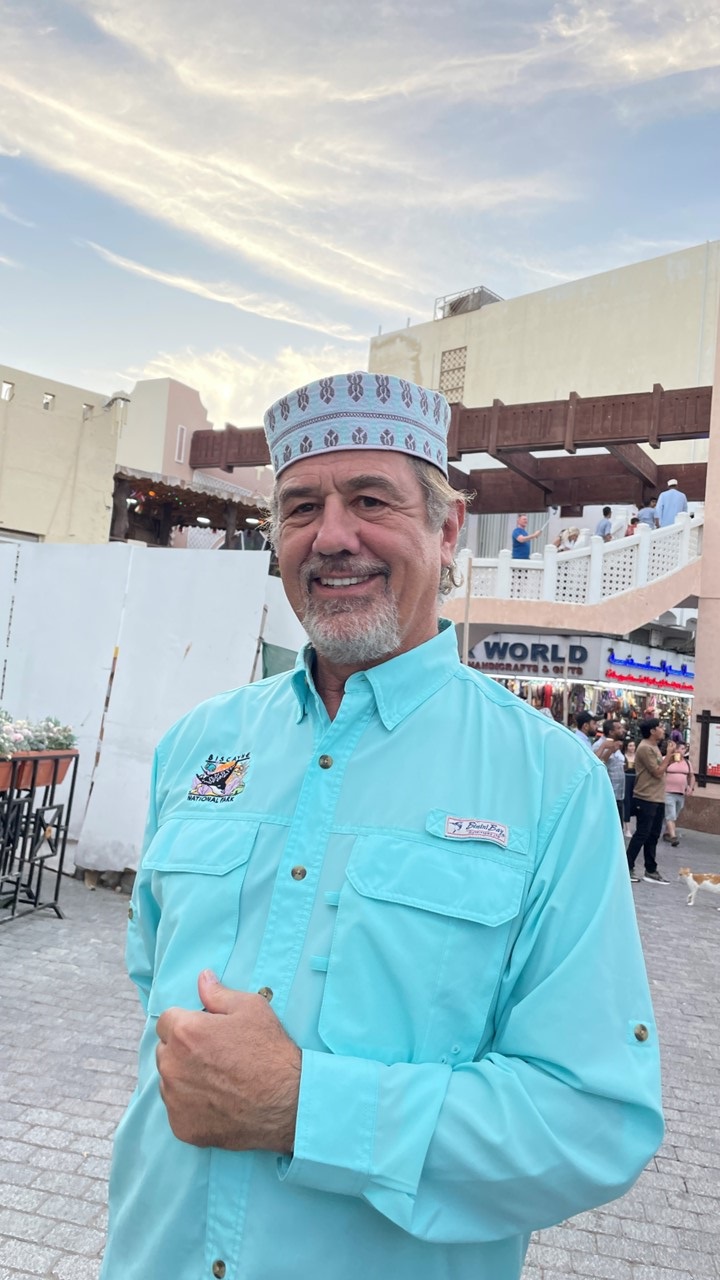
The Qasr Al Alam Royal PalaceShopping at the Muscat SoukRocky as an Omani Local
That evening, there is a short talk about the next day’s activities where we will visit an Omani city located just on the border with the United Arab Emirates (UAE).
Khasab
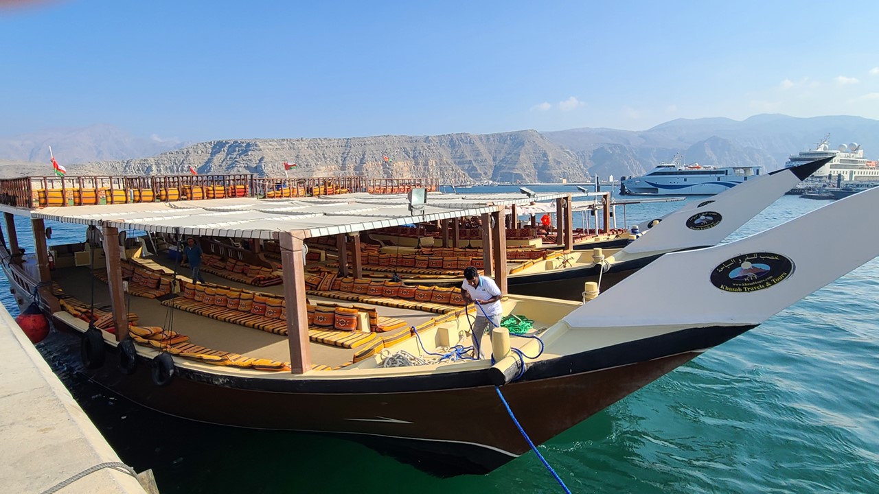
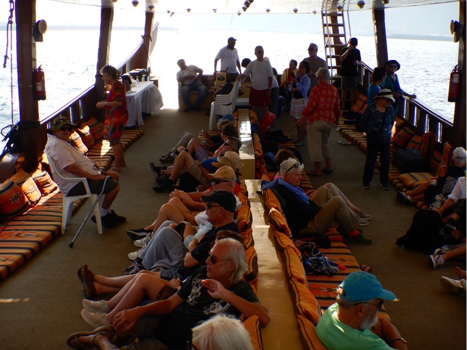
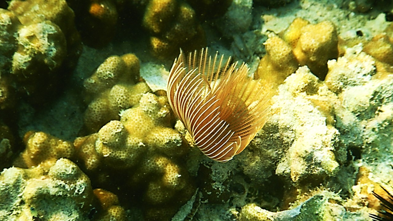
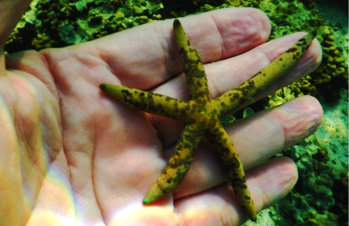
After breakfast, we head into the port city of Khasab. Khasab is on northern Oman’s Musandam Peninsula. Khasab Fort has crenellated stone turrets, model wooden boats and a museum with handicrafts and archaeological finds. From Khasab Harbor, we board wooden boats to cruise some of the Strait of Hormuz’ fjords, which offering rugged coastal views and an opportunity for dolphin sightings. Our wooden boat travels south, past small mountain villages and modestly green valleys, past Jabal Hareem peak which is known as a rich source of marine fossils. There are ~30,000 people living in the area, mostly fishermen and wealthy individuals. There is no reportable crime in the area although Iran is only located ~65 kilometers away. The port boast the fastest ferry in the world requiring only ~3.5 hours to get to Muscat. Since Iran is so close, their shepherds and herders bring their goats and sheep to the docks here in Oman so they get taken to market. They then take their money back to Iran. The first 30 minutes of our cruise to takes us past 5 small villages of 45 to 100 people each. Most people here have 5-10 goats living in the house with them, as is tradition. We head to Telegraph Island which is where the British had once set up telegraph wires, but is now deserted. Along the way, we spot a pair of humpback dolphins. We set anchor on the far side of Telegraph Island and jump into the water to snorkel the local coral. While Rocky was snorkeling, another boat cut our boat’s anchor line and we drifted away to the middle f the channel, stranding him for a short while. After returning and picking up Rocky and the other snorkelers, we sailed in and out of the many fjords before heading back to the dock as the sun was setting.
Our Boats for Local Cruise in KhasabRelaxing on the Boat’s Lower Deck in KhasabCorals While Snorkling in Fiords of KhasabKhasab Starfish among the Seafloor Creatures & Corals
From there, we reboard our ship, prepared for dinner, and headed back into the Arab Gulf to pass through the Straights of Hormuz and into the Persian Gulf.
Our journey to Oman will begin by heading south in the Red Sea past Sudan, Saudi Arabia and Eritrea. The ship has opened the pool and the hot tubs, and the sauna and exercise machines are all now up and working. That afternoon we have our first at-sea talk by our Cruise Director, Amani, reviewing our upcoming itinerary, while appetizers and wine are served. Dinner was at 7pm and, because today is Thanksgiving, a turkey, chicken, and duck feast is served. That night, they show the movie “Death on the Nile” in the lounge along with free popcorn, and that evening, we check out the hot tubs on deck with a well-deserved nightcap.
The next morning, we rise early for a quick workout in the gym. Despite the rocking of the boat, the treadmills are all working fine. After a quick visit to the sauna and it’s showers, we head for coffee, and a light breakfast before a morning talk by our sociologist/historian, David, who talks about “How a Humble Canal Sunk an Empire!”.
The Suez Canal
The 19th century was the “age of the canal”, with the building of the Erie Canal, the Panama Canal, and the Suez Canal. The Suez Canal was originally conceived and began by the Frenchman, de Lesseps, and it was anticipated to be economically transformative, as it would save 5,000 miles of shipping travel between Asia and Europe. Early in its history, the British tried to sabotage its construction by the French, but the French persevered. The canal was built principally by slave labor and Egyptian peasants and it opened in 1869. At the time, it was seen as an equivalent of placing a man on the moon today. The opening was marked by a grand procession of boat parades through the canal. However, the canal did not bring riches to the area and, instead, the Egyptian economy failed, leading to unrest and protests. Eventually, in order to preserve its use, the canal area was declared a neutral zone by the British, which soon led to the British to build settlements in Africa and then in the Middle East. At one time, Winston Churchill even sent tanks to the area to protect the Canal. Eventually, Egypt’s leader, Nasser, nationalized the canal and declared it the property of Egypt. This led to the1956 crisis where the British and the French bomb the canal fighting for control it. Finally, the British backed-down and control of the canal went to the Egyptians. This was a massive geopolitical moment as the humiliation to the Western European powers likely encouraged the Soviet Union to invade Hungary that same year. Today, there are two 2 parallel canal sets of locks and the canal has ~$9Billion impact daily.
After the morning lecture, we had a light lunch before taking a tour of the ship’s bridge. The ship is driven by diesel generators powering electric motors. Steering is all controlled by hi- tech toggles and joysticks with no traditional wheel. The ship was received from China on Oct 21, 2022 and was brought straight to our group after a quick stop in the Philippines to board staff. The bridge keeps two people on watch at all times; and while we were there, it was Ronald, the safety officer, and Dan, the watch officer, who were on duty.
Bridge Crew on Watch
After the Bridge Tour, we took the occasion to go relax in the hot tub, as the pool was closed due to the dangerous “sloshing” of the water. At 4pm, we went to the ship’s Library for the daily high tea which included cakes, sandwiches, nibbles and bits, served with a variety of teas.
Daily Tea Time – Sweets & Cakes
At 5:30pm, we headed to the Lounge for cocktail hour and our 6:30pm talk which reminded us of the need to change the time on our clocks tonight, We were also informed that 2+ guests had tested positive for Covid and would be quarantined in isolation in their cabin for the next 5-days. We were also told that before we exit the Red Sea, pass Djibouti, and enter the Gulf of Aden, we would come alongside of a floating “Security Station” where we would pick-up 4 Security Guards for the ship to travel the “pirate area in the seas between Somalia and Yemen. This has now become an insurance requirement for shipping in the region. These Security Guards will stay aboard until we leave the coast of Yemen and enter Omani waters and the Arabian Sea.
Saturday morning, we have breakfast and relax before meeting in the lounge for our morning lecture with David. Today’s topic is “Difficult Erections: The Curious Case of the Moving Obelisks.” Many of the world’s famous obelisks were “appropriated” from Egypt, and few people are fully aware of how their movement came to be.
Egyptian Obelisks
In Paris, at the Place de La Concorde where once a statue of their king stood, and which was replaced by a guillotine for public executions, stands an obelisk today. This particular obelisk is the right-hand-side one of the pair of Luxor Obelisks which were carved from a single piece of red granite in dedication to Ramses II to stand on either side of the portal of the Luxor Temple. It is 75 ft. high and was taken from Egypt in the 1830’s as a gift/reward to the French in recognition of Napoleon’s successful war with Egypt. It weighs 230 tons and took 7 years to move there. The “gift” originally included both obelisks, however, in 1981, President Mitterrand renounced possession of the second obelisk which remains at Luxor.
England had originally been promised the Luxor Obelisks but accepted the offer instead of one of Cleopatra’s Needles. These obelisks were made in Heliopolis (Cairo) during the 18th and 19th Dynasties, from the time of Ramses II and stood in Alexandria until one was toppled in ~1303AD. The toppled Needle was alternatively offered as a gift to the British in 1819 in commemoration of Lord Nelson in the Battle of the Nile. However, the British would not pay for its shipping until 1877, nearly 60 years later, when Sir William James Erasmus paid for its transportation to London from its space in the sand in Alexandria. It was erected on the Victoria Embankment which had just been built in 1870. Today, the obelisk is flanked by 2 fake sphinx which are facing the wrong direction. The site had been bombed during WW2, but the needle survived.
At the opening of the Suez Canal in 1869, Egypt’s ruler, Isma’il Pasha, gifted the USA the second of Cleopatra’s Needle obelisk from Alexandra in appreciation of the USA having remained neutral during the French-British conflicts there, and as their commemorative gift from the opening the Suez Canal. The Needle was moved to New York City by the US Navy and was erected in 1881 in Central Park just west of the Metropolitan Museum of Art.
All Egyptian obelisks are four-sided stone pillars with a pyramid-shaped top, carved from a single piece of stone, usually red granite. The obelisk symbolizes rebirth and was believed to attract the rays of the sun. They were commonly placed at sun temples in commemoration of the gods and to mark the entrance to the temple. There are 29 ancient Egyptian obelisks left in the world today. Nine are in Egypt, and eleven in Italy (eight of which are in Rome, having been pilfered by the Romans after Augustus defeated Antony and Cleopatra in 31 BCE, thereby conquering Egypt). Others are scattered around the world, often gifted to countries, including Lebanon, Turkey, and Poland. The largest obelisk outside of Egypt is in Rome at Piazza San Giovanni from the Temple of Karnak, and the Vatican Obelisk taken by the Romans from Heliopolis at St. Peter’s Square is the second largest.
After the lecture, we laid out on deck and enjoyed the sunny day. After lunch, the Security Force of 4-men came onboard. They brought with them many large cases of weapons and military gear, which they are not allowed to have in any Middle Eastern country, but which they can possess at their floating base in international waters located on the high sea.
That afternoon, we took a Cooking Class and learned from Chef Indra how to make “Mandy Chicken” – a light chicken curry, and from Chef Richard how to make “Tabouli“. Both dishes were quick and tasty! Then, it was “Hot tub time” again before showering and heading off to daily tea-time.
Before dinner, we all met with our new Security Force for a “Security Briefing”. The Security Team, part of “Ambrey Maritime Security” are all ex-military with multiple years of training and fighting experience. They reported that there had been no attacks on passengers ships this year, and that they stay on watch 24-hours a day with ship officers on the bridge. They will let us know if we need to raise the alarm. If an alarm is raised, there will be an announcement – “Pirate Attack, Pirate Attack, Pirate Attack.“ If such an alarm occurs, we were instructed to walk out of our cabins into the corridor, and to sit down with one’s back to the bulkhead, and not near the door, (for maximum protection from bullets). We are to move quickly and not pause to brush one’s hair or teeth. This Team usually works protecting commercial vessels and not passengers vessels, but the highest risk area has recently changed from the previous Egypt to India routes, to the Yemen to Oman routes, principally due to Somalia pirates.
Captain with Anti-Pirate Security Force Team
Tonight, we are in the southern area of the Red Sea. In the Red Sea there are two routes for shipping referred to as the International Recommended Transit Corridors (IRTC). For security, the Japanese do flyovers all day long looking for small vessels that are out of ordinary. The last attack in this area was in December 2021 on a vessel with Rocket Propelled Grenades (RPGs). However, no attack has ever succeeded with Ambrey Security aboard. They will stay aboard for ~4-days until we are past Yemen and off the coast of Oman.
After dinner, we played a game of “Liar, Liar” with staff members Steve, Thyss, and David. It was Hilarious!! The night was concluded with dancing and great socializing.
The Story of Cleopatra
Sunday morning was quiet with a lecture after breakfast about “Making Egypt Great – Again”.” This was “Part 1” of the story of the real Cleopatra – Cleopatra VII, the last pharaoh of Egypt and a great historical and political figure of glamour and myth. Cleopatra was from Alexandria and was well educated and spoke 9 languages. She grew up in a time when Alexandria was home to many Greek elite, and it was common among her culture to marry siblings and children. At this time, the Roman Republic was the great power in the land and Egypt was a heavily taxed region. Cleopatra sought an alliance with Rome and an audience with Caesar, and when she was 21-years-old, she had herself wrapped in a rug and smuggled into his presence in Rome. At 57-years-old, Caesar was smitten by her boldness and beauty and began a romantic relationship with her that lasted many years. Meanwhile, Cleopatra returns to Egypt with promises and concessions, marries her 12-year-old brother and successfully rules Egypt with him. She maintains her relationship with Caesar for many years.
The story takes a break for lunch and an afternoon of swimming, hot tubs, and high tea. Dinner is followed by the movie “Top Gun Maverick” with drinks and popcorn.
The next morning after breakfast, everyone assembles for the rest of the story of Cleopatra – “Making Egypt Great – Again! – Part 2.” Her story resumes with Cleopatra killing her brother/mate and ruling Egypt as the sole pharaoh. During her reign, she builds up Alexandria and begins a new relationship and alliance with Marc Anthony by meeting with him in Taurus, and plotting against their other Roman foes, including Octavia. Marc Anthony returns to Egypt with Cleopatra where she gives birth to twins, Cleopatra Selene and Alexander Helios. She and Marc plot to take over the world, but their forces lose at the Battle of Actium, and Cleopatra returns to Egypt and barricades herself in her mausoleum. In defeat, Marc Anthony kills himself, and upon hearing the news, Cleopatra also kills herself. Octavia thus becomes the ruler of the Roman Empire including all of Egypt. Cleopatra’s children were taken to Rome where her son, the heir to the throne of Egypt, died and her lineage disappeared. Today, Cleopatra’s tomb may have been recently discovered outside of Alexandria.
Our morning story was followed by wine-tasting, and, by lunch time, we had each had 6 glasses of wine! After lunch, it was back to the hot tubs for conversations with fellow travelers before showers, high tea, and a competition with a battery of “tricky questions.” The winning team was rewarded with sparkling wine. This was followed by what was supposed to be a “port talk”, but we were informed instead that the ship was not traveling as fast as been predicted, and that we would not reach our planned Port of Salalah in Oman tomorrow, as the itinerary had indicated. Designated transit corridors, winds, and current were all put to blame, plus, we still needed to drop off our Security Force. A change in plans were proposed and effort began to arrange an additional port stop in the Omani city of Muscat, after our stop in Sur.
At dinner, the conversation focused on the uncertainty of where would next make land and what changes to plans would have to be made. This was especially true for some of the ship’s staff who had made arrangements for embarking and/or disembarking in Salalah.
The British East India Company
Tuesday morning we were still at sea and, after a stint in the gym, we went to breakfast late. Today’s morning lecture was by David Kampfer Part 1 about “Pirates or Gentleman – the strange tale of the British East India Company” The British had been in India for over 92 years. In fact, the Powis Castle in Wales has one of the largest collection of Indian artifacts and relics – larger than in the Delhi Museum in India.
The British East India Company had begun with a small office and 35 employees in the 1590’s as a company given permission by the British Government to loot and pirate passing ships of foreign countries. Up until then, the Spanish and Portuguese had a monopoly on the spice trade to Europe. The East Indies, (Indonesia today), was the source of spices and riches to Europe, and the BEIC could plunder competitors at will, to the British Crown’s benefit. The company met with opposition from the Dutch in the Dutch East Indies (now Indonesia) and the Portuguese. The Dutch virtually excluded company members from the East Indies after the Amboyna Massacre in 1623 (an incident in which English, Japanese, and Portuguese traders were executed by Dutch authorities), but the BEIT Company’s defeat of the Portuguese in India (1612) by Lord Clive won them trading concessions from the Mughal Emperor Shah Alam. The company settled down to a trade in cotton and silk piece goods, indigo, and saltpeter, with spices from South India. It extended its activities to the Persian Gulf, Southeast Asia, and East Asia. Soon, the British East India Company (BEIC) was given permission to take tax control of the 3 richest regions of India, and subsequently, the British took control of the highly profitable cotton mills and began to move them to Manchester – soon known as “Cottonopolis“. Manchester remained the textile capitol of the world until America took over that role many years later.
Lunch was followed by the showing of the original movie of “Cleopatra”, daily tea time, and an update concerning our extended time at sea. We would not only miss stopping at Salalah, but we might miss our stop at Sur, as well. The growing disappointment and frustration was softened by an accompanying open bar declaration with free drinks and appetizers. This was followed by a surprising change that came as a result of our suggestion a few days earlier – the crew has arranged an open-deck evening BBQ for us for dinner! Deck 8 at sunset was the site of the food – a suckling pig, burgers, and ribs, with all of the associated salads and side-dishes, and a pastry assortment of pies and cakes. Because of the darkness, the crew and chefs used their phone flashlights to highlight the food and help the guests to their deck-side tables. This was all accompanied by a DJ and followed by on-deck dancing. A truly great evening!
On-deck BBQ with Suckling Pig
Than evening, after dark, we pulled-up near the floating Ambrey ship-base where we were met by a large zodiac that the Ambrey Security Forces exited our ship onto. From here, they plan to board a cargo ship heading in the opposite direction.
Security Force Disembarking our Ship
That night, my cell phone livestream coverage provided a play-by-play for the World Cup match of USA vs Iran, a 1-0 USA win. Our ship still does not have satellite access, and the World Cup is only shown on pay-per-view in this part of the world anyways, so we considered ourselves lucky to have gotten even this coverage.
The next morning, still at-sea, breakfast is followed by part 2 of our lecture on “Pirates or Gentleman – the strange tale of the British East India Company.” With the endorsement of the British government, the BEIT began using slave labor and transporting enslaved people to its facilities in Southeast Asia and India. Although some of those enslaved by the company came from Indonesia and West Africa, the majority came from East Africa—from Mozambique or especially from Madagascar—and were primarily transported to the company’s holdings in India and Indonesia. Large-scale transportation of slaves by the company was prevalent from the 1730s to the early 1750s and ended in the 1770s. Beginning in the early 19th century, the company financed the tea trade with illegal opium exports to China. Chinese opposition to that trade precipitated the first Opium War (1839–42), which resulted in a Chinese defeat and the expansion of British trading privileges. The company gradually lost both commercial and political control, and its commercial monopoly was broken in 1813. After 1834 it was merely a managing agency for the British government of India, and it was removed from that role after the Indian Mutiny (1857), and it ceased to exist as a legal entity in 1873. During its run, other trading companies for investors were set up, including the Royal Africa Trading Company, the Hudson Bay Trading Company, and the Muscovy Russia Trading Company.
After our lecture, the ship’s chefs gave another cooking lesson in the lounge making Caesar Salad with homemade dressing and Shrimp Fried rice. After lunch, deck time and tea time, we finally had a Port talk indicating that we would definitely not be able to go to Sur, Oman due to lack of tenders to ferry us to shore. However, the crew had successfully arranged for us to go to port in Muscat tomorrow, instead. Muscat is known for its good beaches, with no high-rises; and good schools – often referred to as “the Switzerland of the Middle East”. Sultan Haitham bin Tariq rules the country, which was founded 900 years ago, and is an oasis of greenery, cleanliness, and order. It is characterized by a modern road network and advanced organized services, with a very high standard of living. We are told about the excellent shopping there and the basics of “haggling”. Frankincense is a popular item for tourists and should cost in the $5-10 range for a packet. At dinner, everyone is excited to have a chance to exit the ship tomorrow, and the evening is uneventful.